Google Map |
Rockies :: Kananaskis :: Wasootch Peak |
GPS Track |
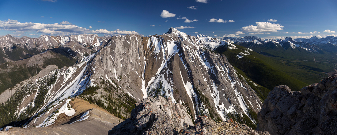 
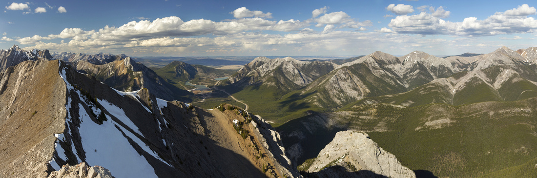
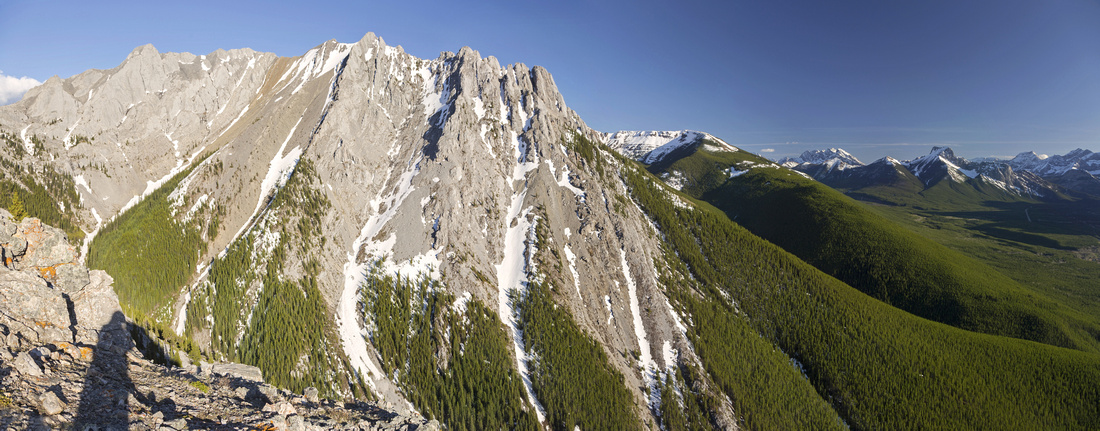
Panoramic View south from Wasootch Summit. Kananaskis Peak upper center. Mackay Hills between Wedge and Fisher Peak upper right |
|||
| Trip Summary | |||
May 9, 2018Wasootch Peak is first highpoint of long ridge that curls on east side of Kananaskis Village and continues further south over Kananaskis Peak, Old Baldy and McDougall before dropping to Evan Thomas creek. Outing is quite popular and excellent trail exists all the way to the summit. I don't scramble much anymore but was looking for something I'd be able to do without snow. Initial plan was Wasootch Ridge I've done several times before, but driving in it still appeared snowbound. To the contrary, Wasootch Peak was entirely dry -- SW ridge receives lots of warm afternoon sunshine.
Parking is opposite (just north) of Nakiska turnoff on east side of the road. There will usually be several cars parked, even on weekday so you can't go wrong. It is right by large drainage that has been ravaged in 2013 floods. Initial part of the trail has been washed out so just walk in the drainage staying on left (north) side for 10 minutes or so and watch for the cairn indicating start of Wasootch summit trail. From there trail rises fairly steeply with some open areas that offer nice views of Kananaskis Valley. Most pleasant part is after you break treeline -- series of rock ribs that are great fun if scrambled directly, although trail skirts on the side. Final slope is your standard Talus with multitude of trails made on descent; going up stay close to ridge crest on climber right for best footing. Final obstacle is 3-4 meter high angle rock wall, with somewhat skimpy but solid holds. It is great fun if tackled directly. Bypass exists on both sides and is just hiking; most people seem to prefer north side as good sized cairn indicates. Wall is class 3, and easier than step on Heart Mountain for comparison; I downclimbed facing out on descent. Finish is very brief ridgewalk that has few semi-exposed steps to large rock pile that had register but little paper in.
From the summit connecting ridge north to Kananaskis peak, and ultimate 5 peak traverse is sometimes attempted by urban knuckleheads bragging for social media likes - don't do it. On the opposite side lower north summit would be relatively easy ridgewalk, but I didn't bother. I believe it might be possible to do "Wasootch Traverse" by starting somewhere in vicinity of Lorette ponds, but ascent via NW ridge would probably be couple of grades more difficult than gentle SW ridge. I returned the same way, with one extended break just before treeline -- where accidentally I picked up couple of ticks I discovered at home later on; check yourself well! |
|
Gallery |
|||
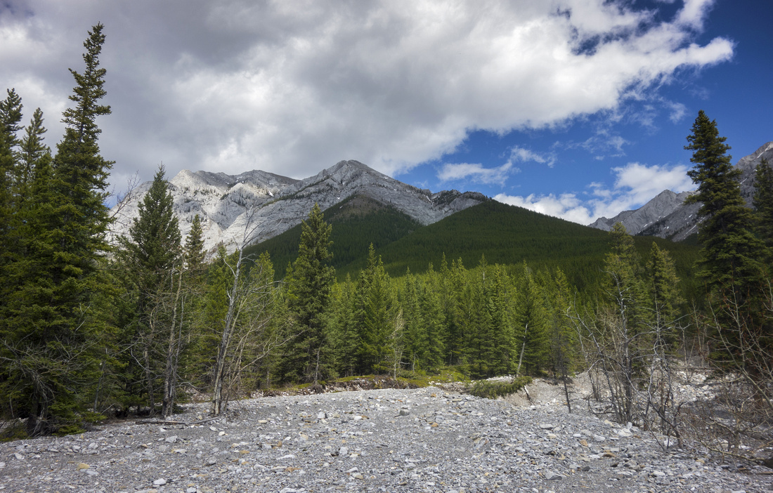 Starting up the drainage. Wasootch Peak directly above. Watch for trail on the left side. It will reach treeline at that green cone just right of center, then follow skyline ridge left to the summit
 |
|||
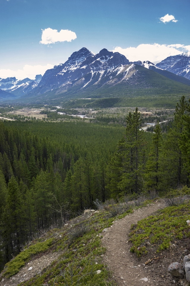 Looking back towards Kananaskis Valley as trail rises above the drainage. Mt. Kidd behind
 |
|||
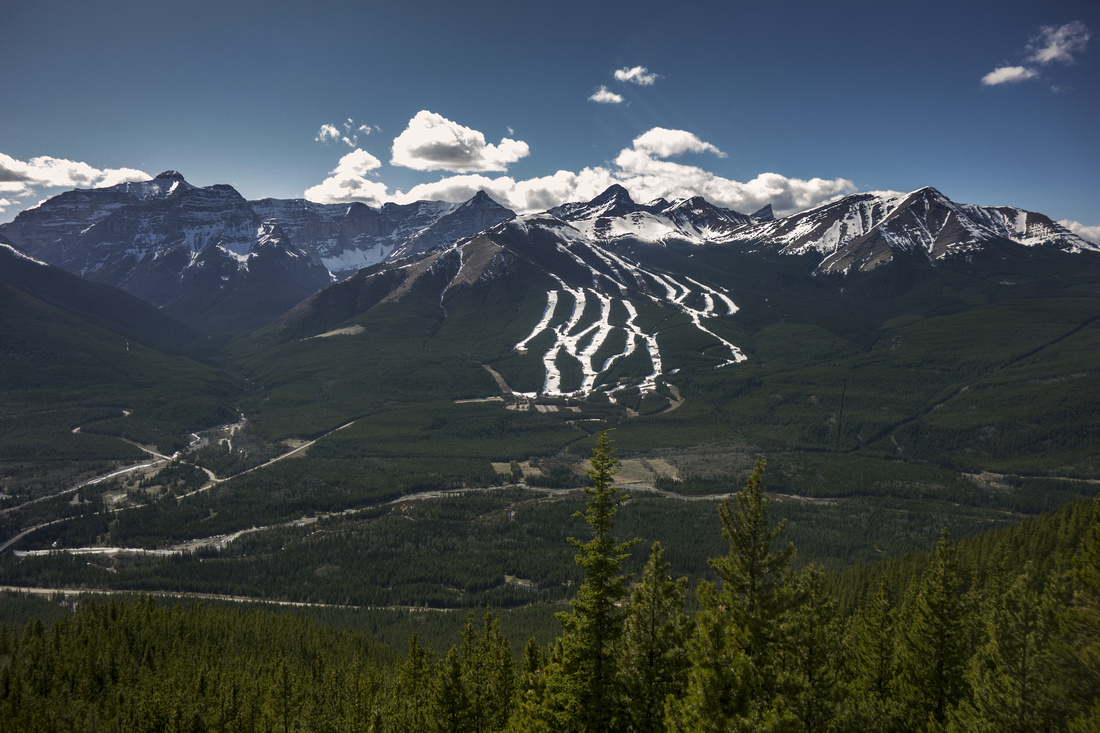
View back towards Nakiska Ski area. Centennial Ridge and Mt. Allan center right |
|||
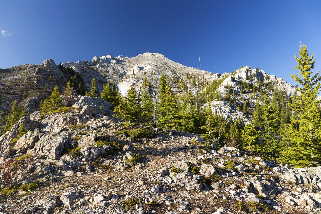 Remainder of ascent just after treeline. Route follows rock rib on the right and was in retrospect most enjoyable part of the day
 |
|||
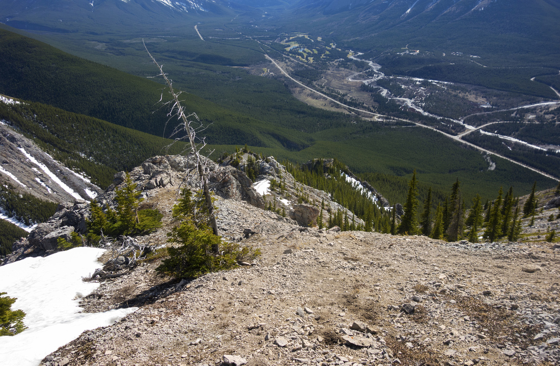 Looking back at ascent route from mid-point of final talus slope
 |
|||
 Panoramic view north from the summit. Barrier Lake and McConnel Ridge in the distance, then Baldy, Midnight/Midday peaks as well as Porcupine and Wasootch ridge
 |
|||
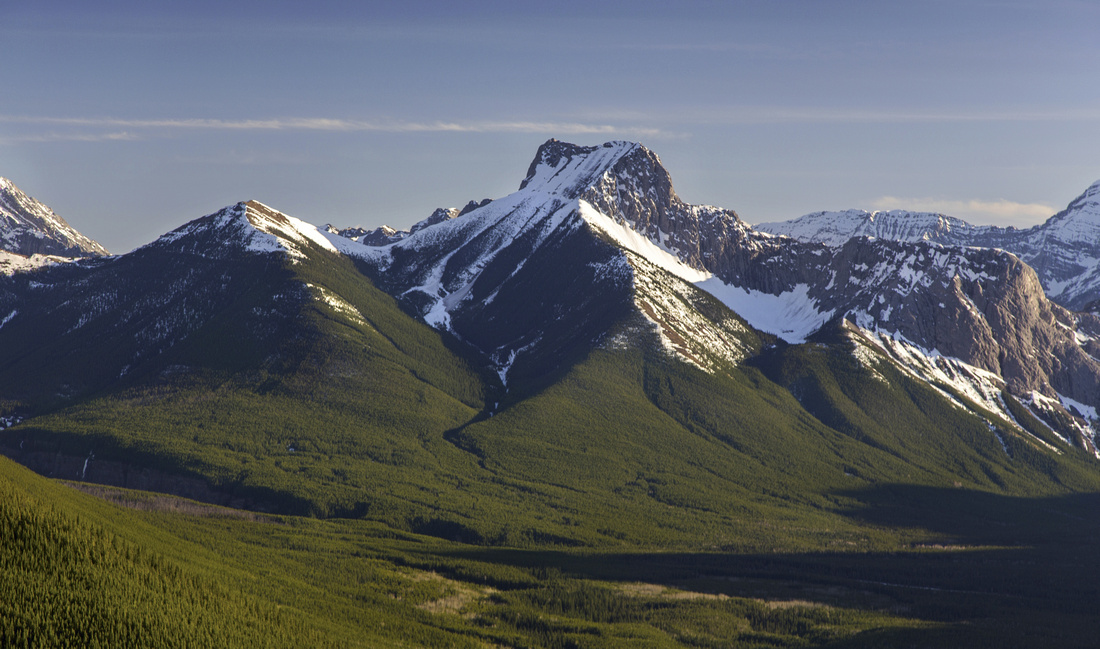
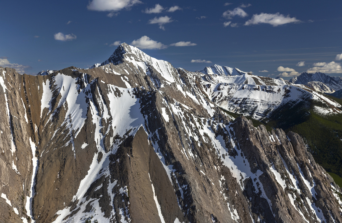 Kananaskis Peak. Rugged connecting ridge to the left
 |
|||
 Panoramic View south on descent; Kananaskis Peak center, Old Baldy and Mackay Hills behind
 |
|||
 Telephoto of Wedge Mountain just before treeline; Mackay Hills center left
 |
Abstract
| Overall Difficulty | D4 | Mostly steep hiking with one avoidable 4m high rock wall (class 3) just before summit. Moderately lose final talus slope | |||
| Snow Factor | S3 | Talus slope above treeline often windblown, comfortable snowshoe ascent otherwise with little danger. | |||
| Scenery | Front ranges and distant Alberta Foothills. Great views of Kananaskis Village, Mt. Kidd and Mt. Allan Centennial Ridge. | ||||
| Trail/Marking | Very Good | Distinct Trail all the way to final talus slope, except for initial part that has been washed out. Cairns | |||
| Suggested Time | 4-5 hr | Trail runners can probably do it under 3 hours. Descent twice as fast as ascent. | |||
| Elevation | Start: 1440m Max: 2350 m Total: ~920 m | Round Trip: ~7.5km | |||
| Gear | Day Hikers with good ankle coverage in dry conditions. Poles suggested. | ||||
| Water | Drainage near the start, dry hike otherwise. Carry 2L minimum | ||||
| Dog Friendly | Yes | Standard back-country travel precautions. Trail popular on weekend so be considerate to other hikers. | |||
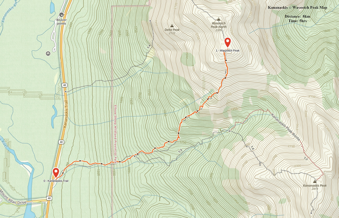 Wasootch Peak GAIA Map
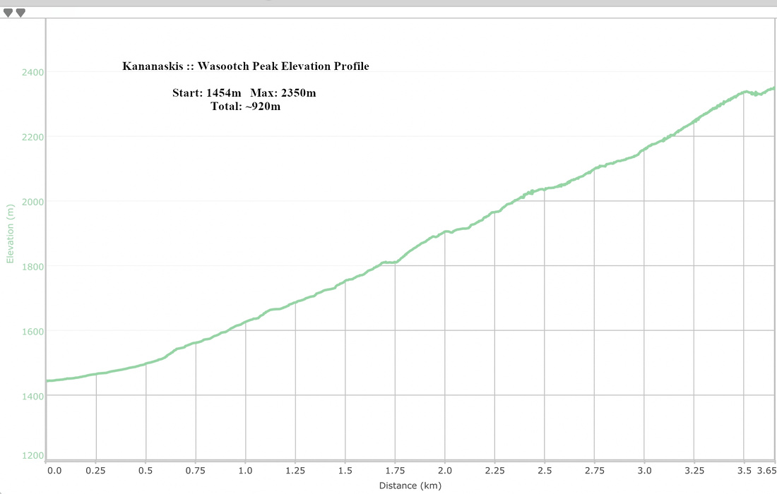 Wasootch Peak Elevation Profile