Google Map |
Rockies :: Kananaskis :: Midnight Peak |
GPS Track |
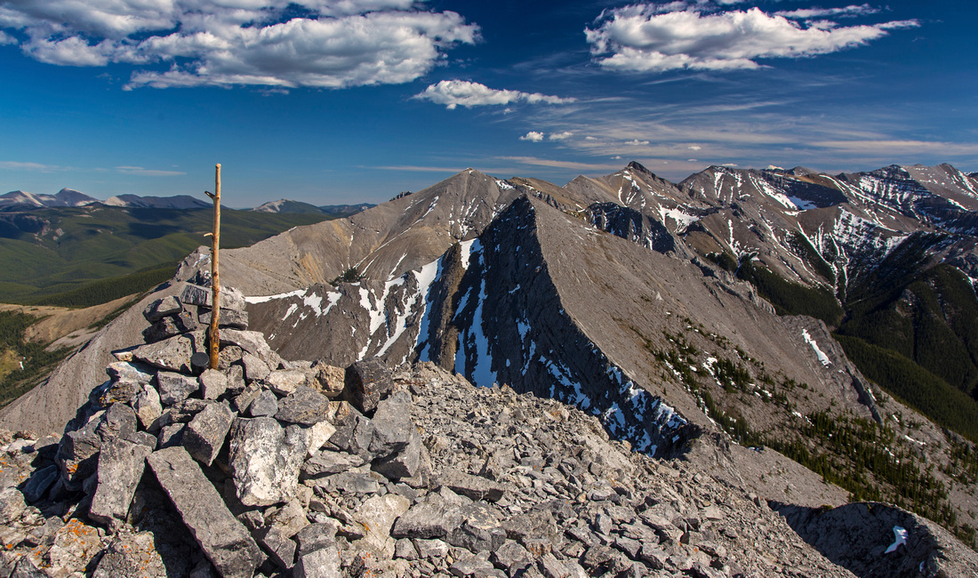 
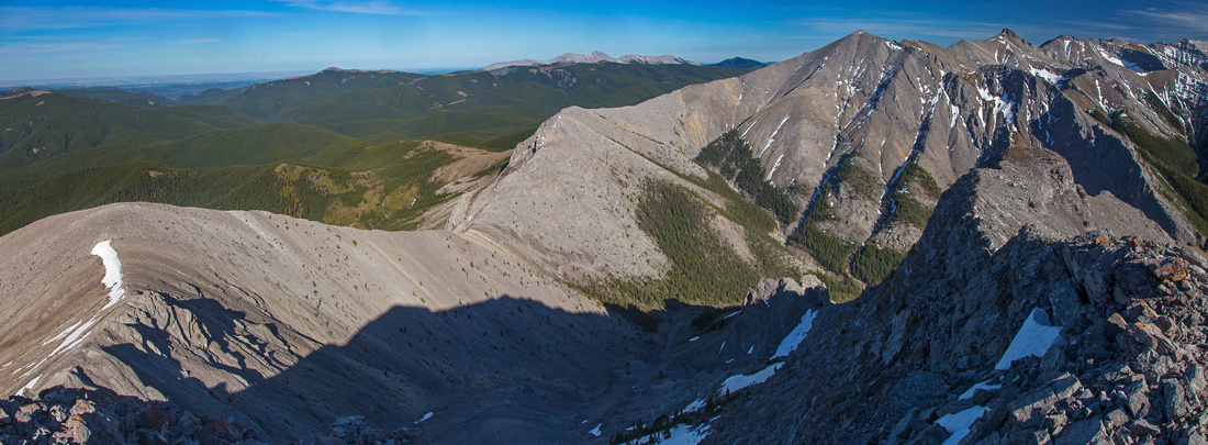
Summit of Midnight Peak looking SE towards south summit (aka "Midday Peak"). Length of Boundary ridge leading to Tiarra peak behind |
|||
| Trip Summary | |||
May 2, 2016Midnight peak is the north end of long ridge extending above Baldy Pass all the way to Tiarra peak. There are two summits; on some maps south summit is named "Midnight" while north summit is unnamed. Other resources identify south summit as "Midday" peak (or "half-past Midnight"!). Regardless of naming, this is very pleasant scramble in front ranges of Kananaskis country. Benefiting from easy access via established Baldy Pass trail north summit is frequently done year-round. Extending the trip to south summit is more involved as it includes drop of ~150 vertical meters to low saddle followed by mostly class 2 scramble on section of knife-edge ridge. Journey can be extended even further by continuing over Boundary ridge to Tiarra peak with loop return on Porcupine Ridge. This option is reserved only for very fit and fast scramblers as it involves whopping amount of elevation gain as well as some very difficult scrambling.
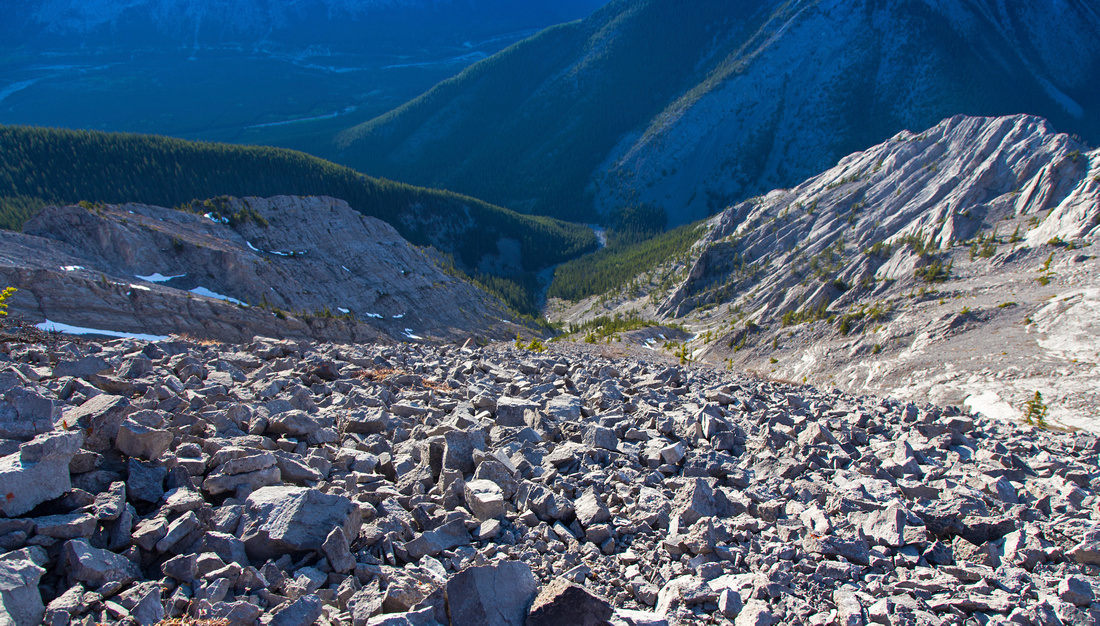
Hike Baldy Pass trail starting from parking at west side of Kananaskis Trail (Hwy 40). Turn left in 10 minutes on junction with Wasootch horse trail and follow washed out drainage towards the pass. Trail is wide and easy to follow. In winter it is sometimes very icy so traction might be required. In about an hour trail reaches low saddle between Mt. Baldy to the left and Midnight north to the right, then ascends open slopes. Leave the trail when it dips east into the forest and continue on game trails towards Midnight peak. Higher up large boulder field must be ascended; above with a little luck you can pick-up good trail rising steeply through the forest towards upper scree slope. Final portion on open east slopes has number of trails beaten in the scree. Summit cairn that sometimes has register is reached in about 2.5 - 3 hours of moderate pace from the parking.
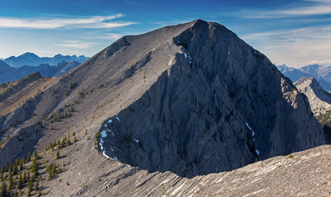
Entire ridge leading to "Midday" is clearly seen below. Despite appearance, it is generally easy. Most of the descent has distinct trail beaten in the scree, while gendarme about halfway down can easily by skirted on right side. Other side leading to "Midday" is steeper. Crux is section of knife-edge with peeling slabs to the right that is much easier than it appears. It is possible to bypass this section by dropping right to the scree, but it is entirely unnecessary when dry. Best line stays right on ridge crest entire way.
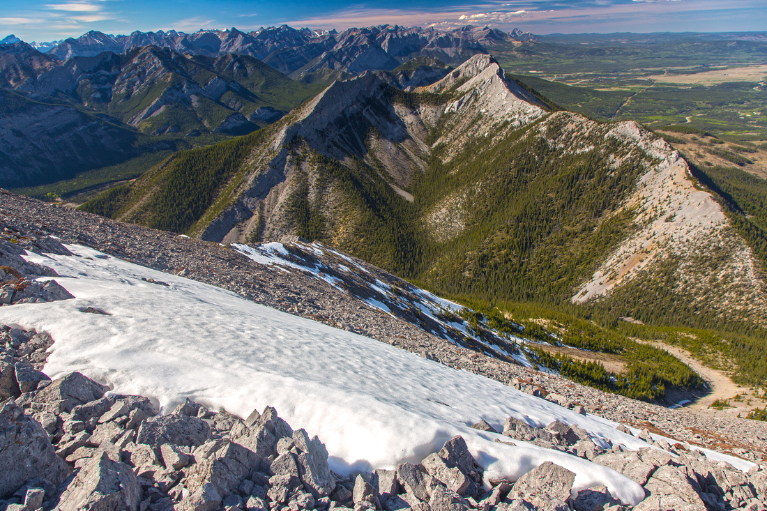
On return there are several options. It might appear tempting to drop directly to Porcupine creek drainage from "Midday", but this is not recommended as this descent is quite involved and uncomfortable in lower part. Easiest is to retrace steps back to north summit, then return either via Baldy Pass trail - or continuing via west ridge to form a loop. This option is described in Kananaskis Country trail guide (Vol 1, 4th ed, trip 10C). More adventurous option is to descend down big wide drainage, about 15 minutes from north peak. This descent is feasible, but nowhere as straightforward as it appears from the top as there are cliffs in lower part. If giving it a go, stay on the right (east) side in lower part - cairn or two testify it does see some traffic. Eventually you reach Baldy pass trail near the big washout just before trail starts its ascent towards the pass -- about 25-30 minutes from the parking |
|
Gallery |
|||
 Ascent slopes of Midnight Peak above Baldy Pass (extreme lower right). Long ridge leading to Mt. Baldy South Peak above
 |
|||
 Ridge between two Midnight peaks looking back to main summit
 |
|||
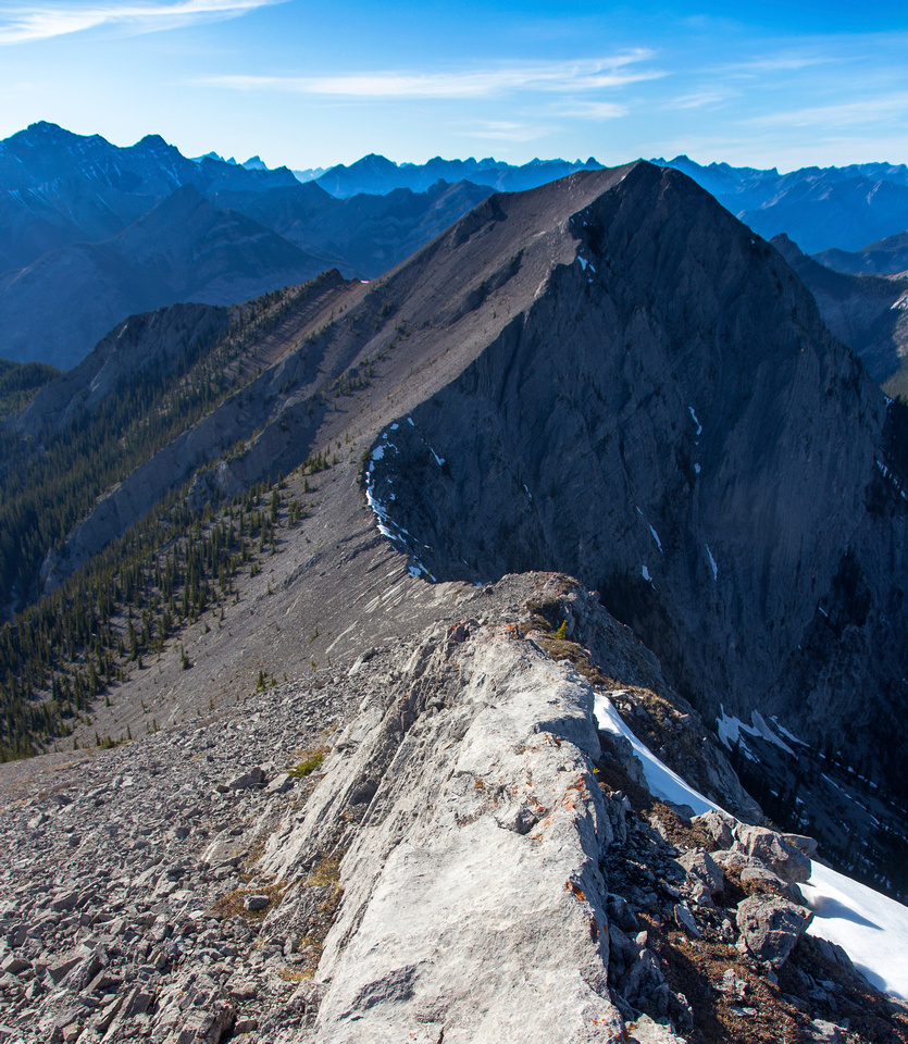
 "Midday" ridge above the narrow section
 |
|||
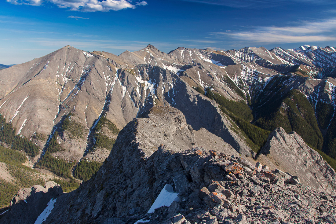
 Boundary Ridge from "Midday" peak leading to Belmore Browne and Tiarra Peaks
 |
|||
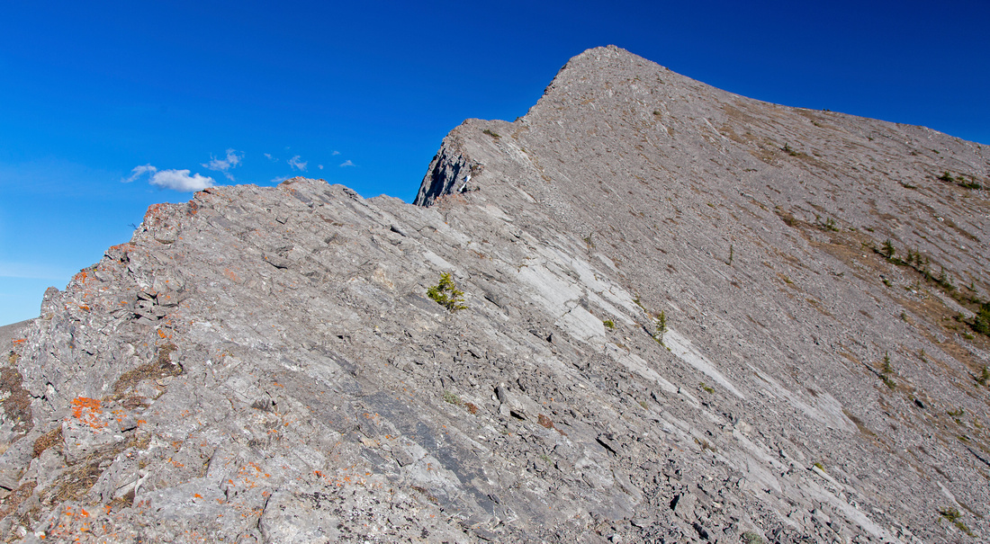
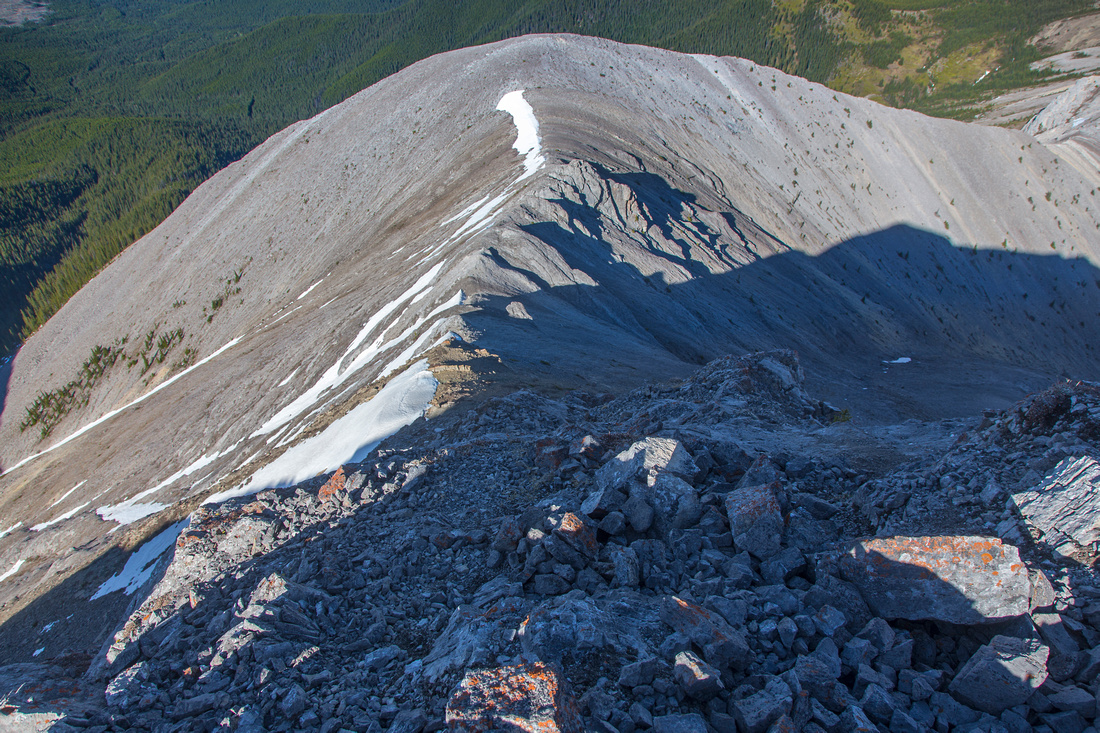
 View back to Midnight peak. Easiest and quickest is to stay on ridge crest the entire way
 |
|||
 Steep descent from "Midday" to Boundary ridge
 |
|||
 Porcupine Ridge leading to Tiarra peak in the distance from "Midday" peak
 |
|||
 Alternate descent to Baldy Pass trail
 |
Abstract
| Overall Difficulty | D5 | Scramble up boulder fields and scree slopes. One (avoidable) section of knife-edge ridge between two summits. Alternate descent is very loose and requires route-finding skills in lower part | |||
| Snow Factor | S4 | Trip is doable in winter conditions as front ranges are frequently windblown, but unstable snow cover on north slopes of Midnight peak would pose real avalanche treat. Alternate descent would likely not be possible | |||
| Scenery | Classic front range views extending into Kananaskis country and prairies to the east | ||||
| Trail/Marking | Very Good | Well defined and wide trail to Baldy Pass, cairns and flags above. Scree trails below Midnight peak and in connecting ridge between Midnight and "Midday" | |||
| Suggested Time | 7-8 hr | 5-6 hr for Midnight peak only, add 1 hour (each way) for "Midday". Very long day if exploring Boundary Ridge | |||
| Elevation | Start: 1410 m Max: 2330 m Total: ~1200 m | Round Trip: ~14 km | |||
| Gear | Hiking poles extremely helpful for stability. Gaiters for scree slopes. Ice-axe for steep snow slopes in winter. Rock helmet could be an asset in larger groups, specially for alternate descent. Spikes helpful in winter on Baldy Pass trail portion. | ||||
| Water | Possible water in early season in Baldy drainage, none after. Dry hike. Carry 3-4L | ||||
| Dog Friendly | Yes | Pets should be kept on leash. Scramble bit will likely pose no problems. | |||
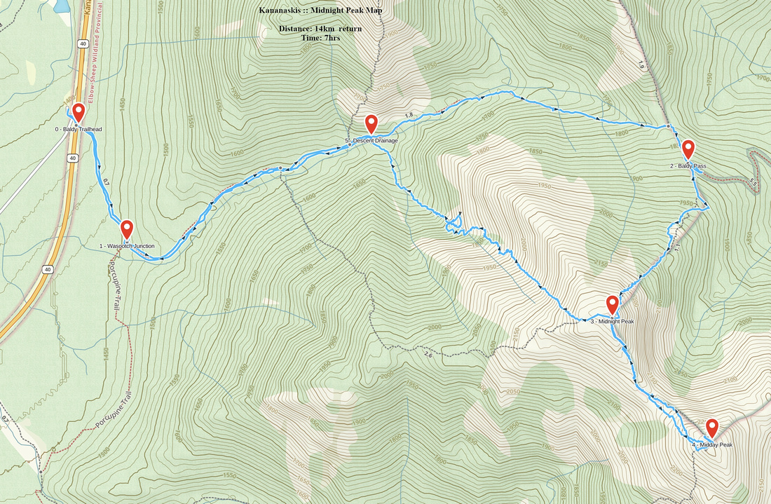 Midnight Peak GAIA Map
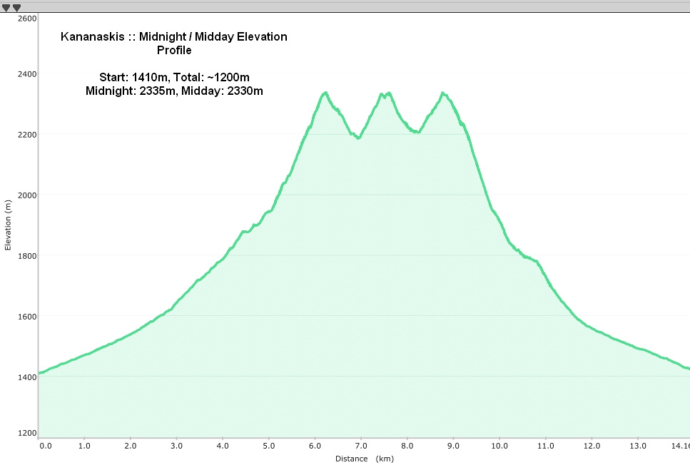 Midnight Peak Elevation Profile