Google Map |
Rockies :: Kananaskis :: Mt. Baldy South Peak |
GPS Track |
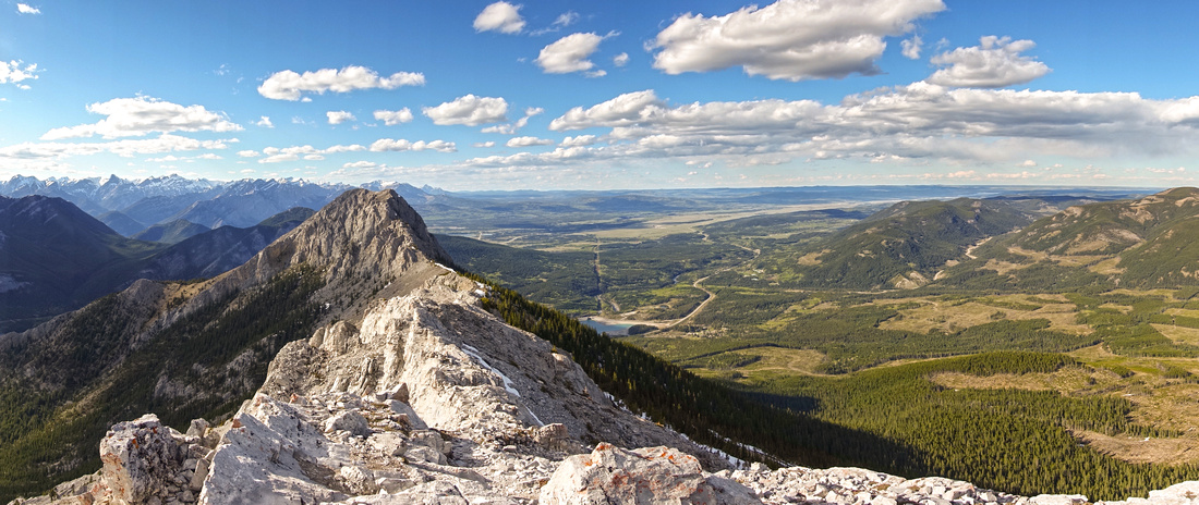 
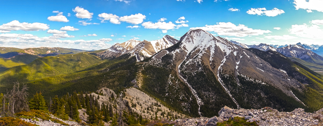
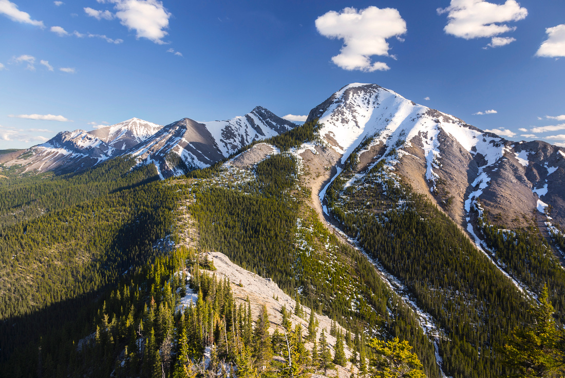
Panoramic View North from South Peak of Mt. Baldy. Main Summit left center with connecting ridge in foreground |
|||
| Trip Summary | |||
May 27, 2020Mount Baldy is prominent peak on transition from Foothills to Front Ranges of Kananaskis Country. Main summit towering above Barrier Lake on Kananaskis Trail (Hwy40) it is very popular year-round ascent. South and West summits are lower and not so frequently visited. Traverse of all 3 summits is described in Kane scrambles book, but involves very difficult downclimb below main summit. Easier option is from the south via gentle ridge extending from Baldy Pass, accessed via official K-country trail. It is also described in Daffern K-Country guidebook. Only obstacle is Rock Tower partway up the ridge - class 2 rock step, preferably dry. Trip can be extended by scrambling North Peak, but this is more difficult (class 3 with some micro-terrain routefinding).
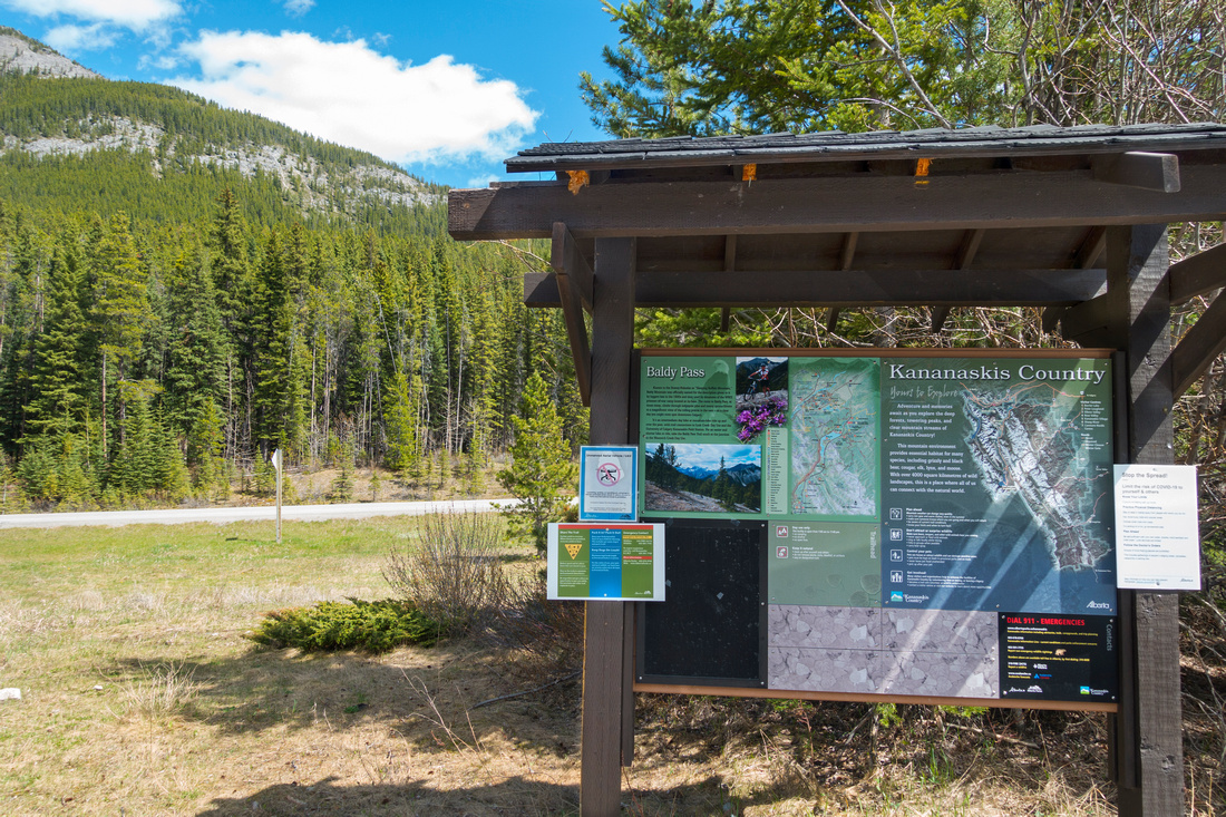
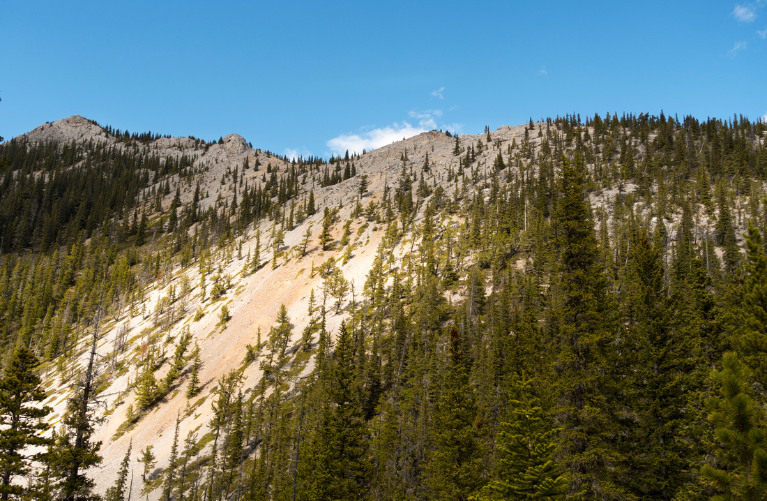
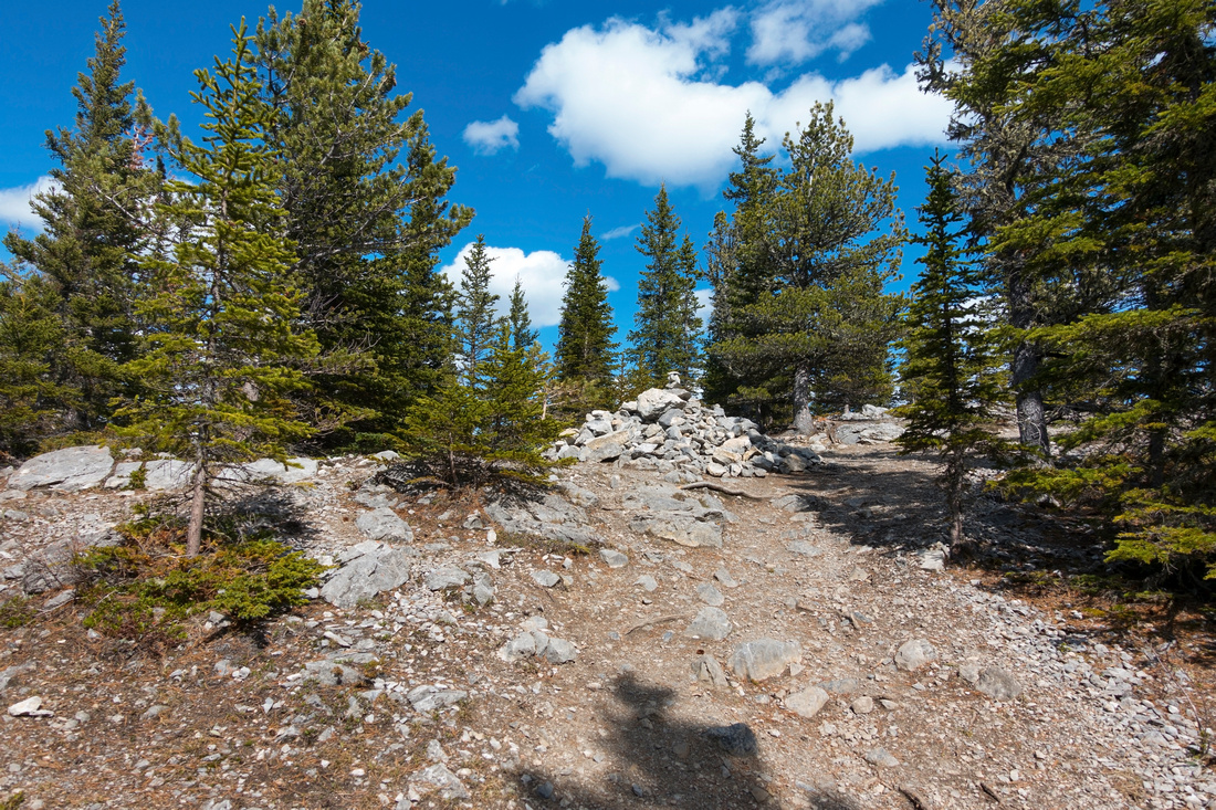
Follow official Baldy Pass trail from parking on west side of Hwy40; about 1.5 hrs of moderate pace. From the pass, marked by sizeable cairn, turn left (right is Midnight peak scramble route). Scree path is well defined and it leads to Rock Tower. Path exists on the right side, but leads nowhere - you must scramble head on (see picture in gallery). Above is simply delightful ridgewalk over several bumps and fantastic panoramic 360 views of the Foothills. Ridge narrows but is never exposed and great fun. Final summit block can be trashed on good scree trail on climber left, but for confident scrambler better option is to stay right on spine and scramble up (stiff class 2), then transition back to left in upper part and intercept trail. Summit is wide and hosts large cairn. Connecting ridge north to main summit looks very difficult and it is hard to believe it is just a scramble. To the left is North Peak; initial drop to the saddle is not much more than simple talus trash, but rockband guarding the summit is more serious. This extension will extend the day ~2 hours. For return there are some adventurous options described in Nugara guidebook, but best is to follow your steps back the same way. Late afternoon views of Midnight Peak can be stunning! |
|
Gallery |
|||
 Baldy Pass trailhead on west side of Hwy40; ~15min drive from Trans-Canada
 |
|||
 Gentle ridge leading to South Peak from Baldy Pass Trail
 |
|||
 Semi-forested Baldy Pass (cairn). Turn left for South Peak
 |
|||
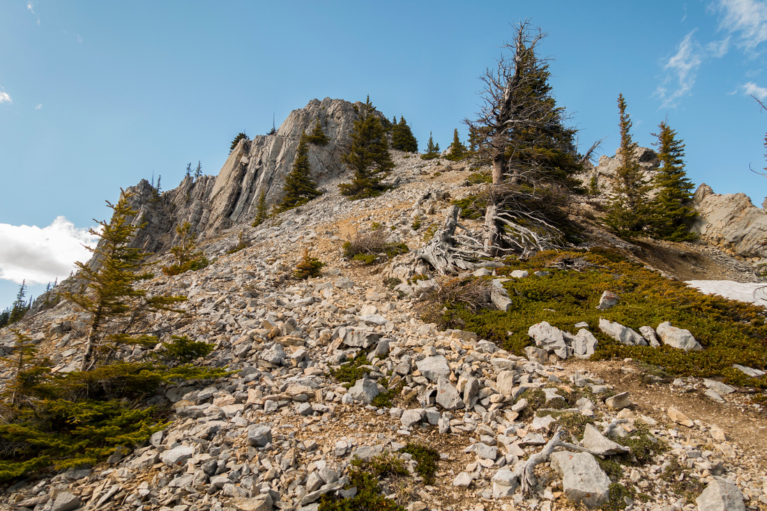 Scree trail rising to "The Tower" and start of upper ridge
 |
|||
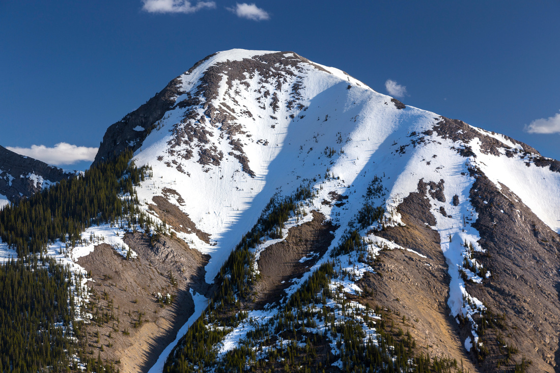
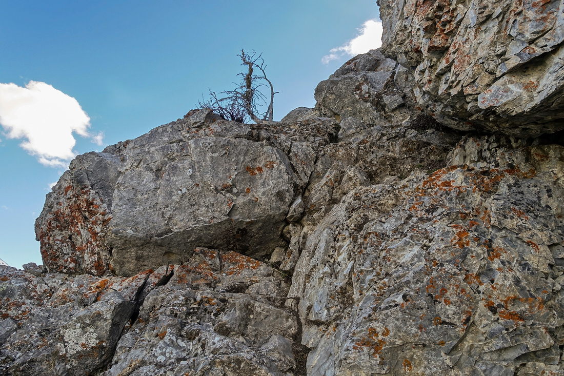 Rock Step on "The Tower" - class 2. Easier than it looks on the photo
 |
|||
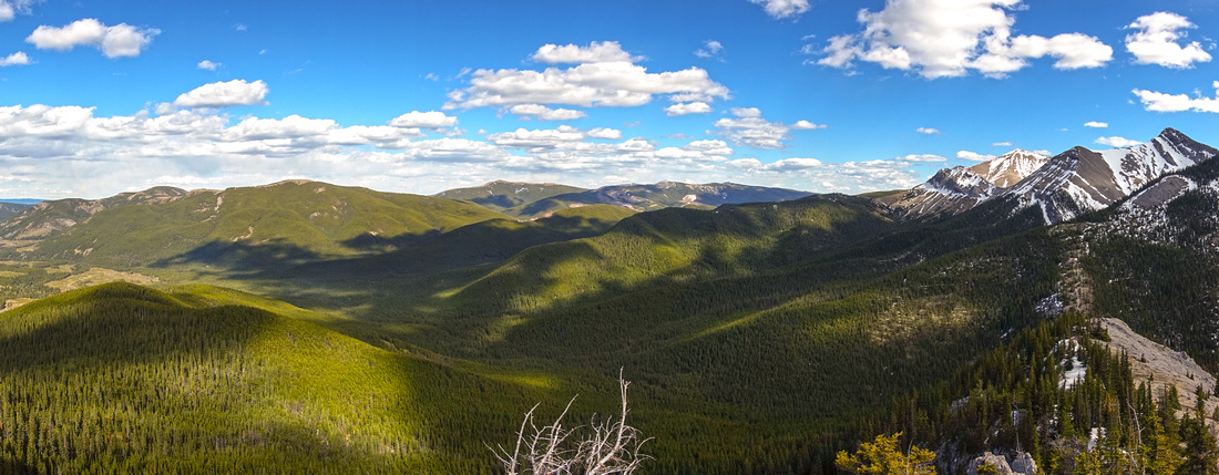 Foothills Panorama from top of "The Tower" with views of Hunchback Hills, Cox Hill and Jumpingpound Ridge. "Midday" and Tiarra peaks extreme center right
 |
|||
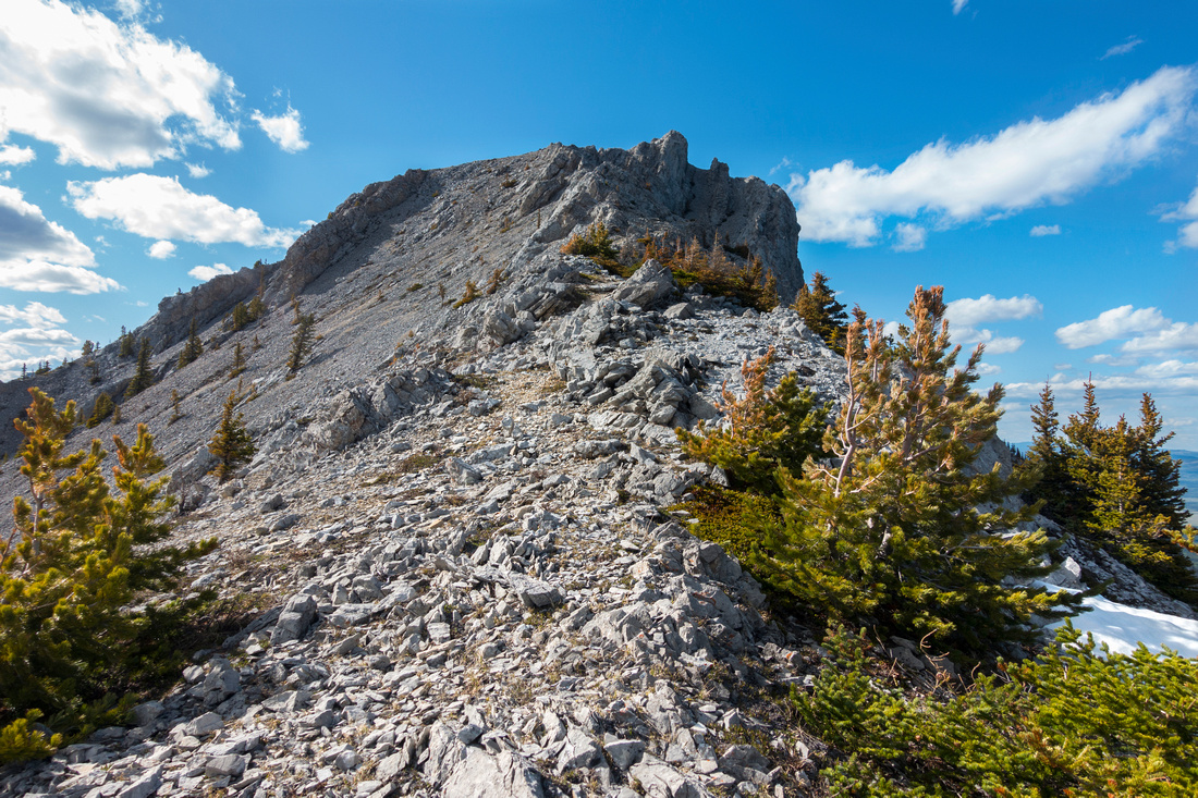
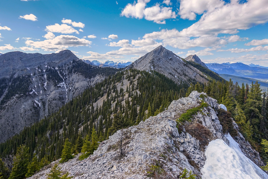 Continuing along the ridge past "The Tower". All 3 peaks of Mt. Baldy can be seen; South is in center, West to its left. Main peak poking to the right. Takes about 45min to an hour from this point
 |
|||
 Great Views back (south) to Midnight / Midday / Tiarra Peak
 |
|||
 Final summit block of Baldy south. Good scree trail is on the left side, but better is to scramble up in the middle (stiff class 2, not more difficult from "The Tower") and reconnect with scree trail higher up
 |
|||
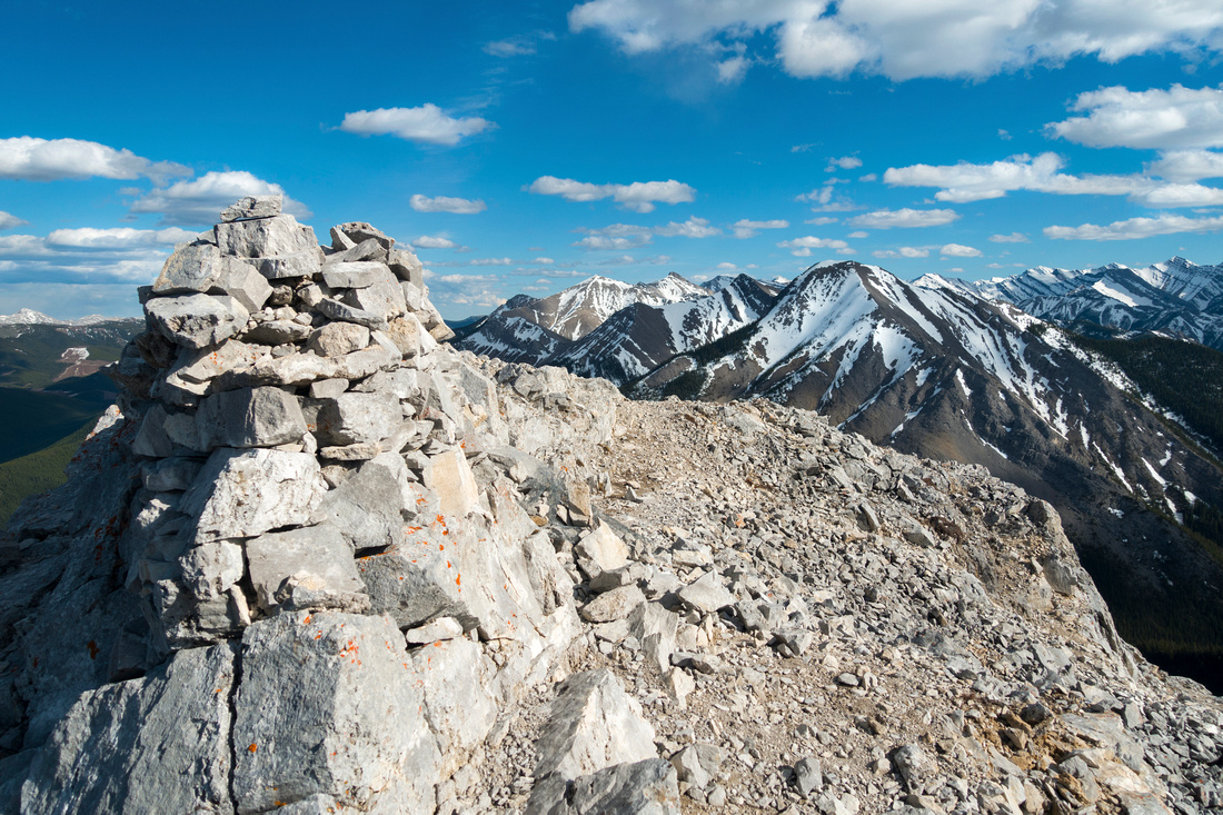 Summit cairn on 2185m South Peak of Mt. Baldy looking back
 |
|||
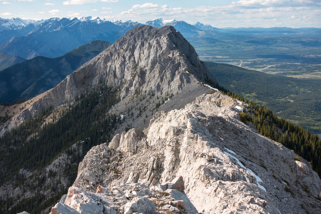 Connecting Ridge to Main Summit -- hard to believe it qualifies as scramble. Normal route is from Hwy40 up left side ridge
 |
|||
 Great late afternoon light on Midnight peak on return
 |
|||
 Closer look at Midnight Peak. Scramble route follows forest patch on left side then switchbacks up scree above. Obviously not quite in shape on this day
 |
Abstract
| Overall Difficulty | D4 | Trail hiking for the most part with some class 2 scrambling and scree slopes | |||
| Snow Factor | S3 | Trip is doable in winter conditions as front ranges are frequently windblown. No avalanche danger. Possibility of icy conditions on Baldy Pass trail and steeper bits of the ridge | |||
| Scenery | Classic front range views extending into Kananaskis country and prairies to the east | ||||
| Trail/Marking | Very Good | Official trail to Baldy Pass with marked junctions. Trail well defined on the ridge | |||
| Suggested Time | 6 hr | If going only to South Peak and returning the same way. Extension to Baldy West will add 1.5 - 2 hrs | |||
| Elevation | Start: 1410 m Max: 2185 m Total: ~850 m | Round Trip: ~13 km | |||
| Gear | Hiking poles extremely helpful for stability. Gaiters for scree slopes. Rock helmet not necessary. Spikes helpful in winter on Baldy Pass trail portion. | ||||
| Water | Possible water in early season in Baldy drainage, none after. Dry hike. Carry 2L | ||||
| Dog Friendly | Yes | Pets should be kept on leash. Scramble bits will likely pose no problems. | |||
 Mt. Allan via Centennia Ridge GAIA Map
 Mt. Allan via Centennial Ridge Elevation Profile