Google Map |
Rockies :: Kananaskis :: Porcupine Ridge |
GPS Track |
|
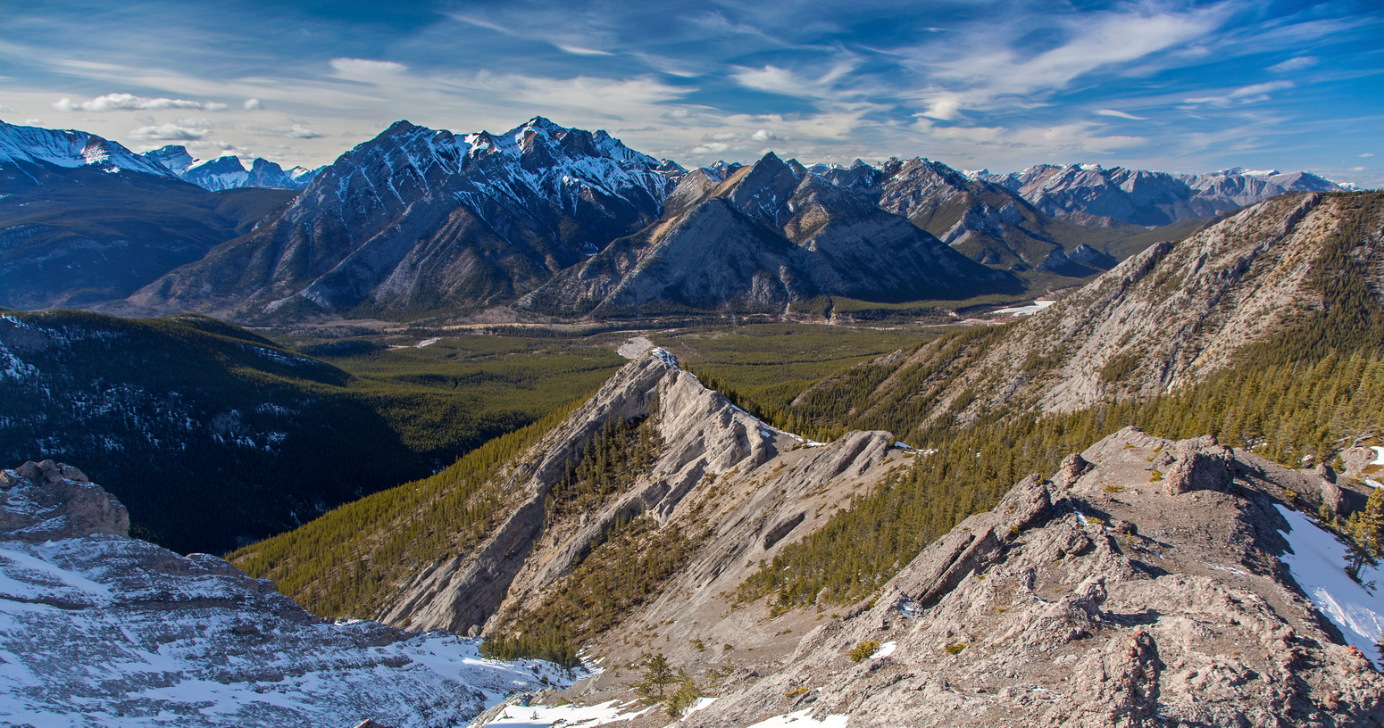
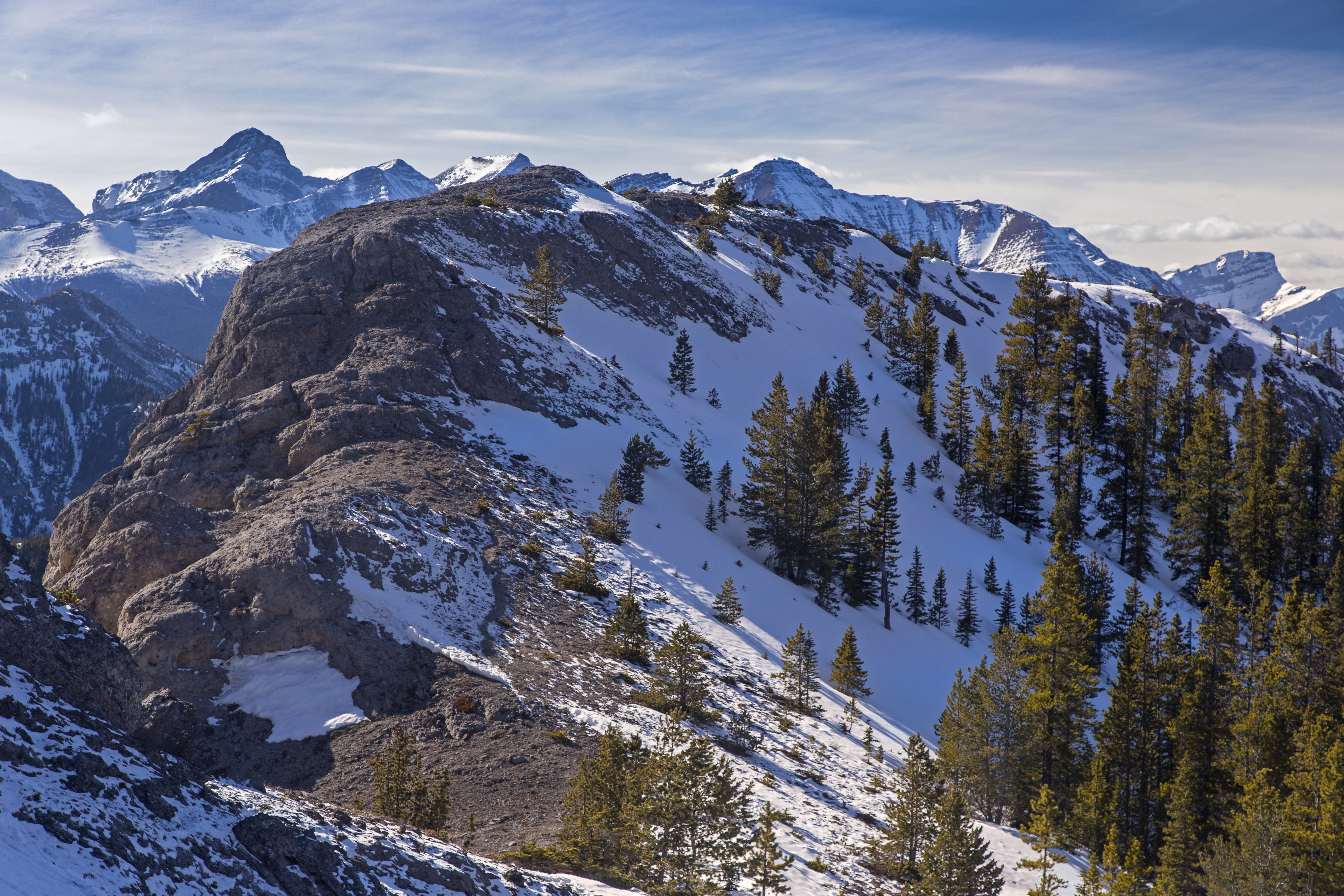
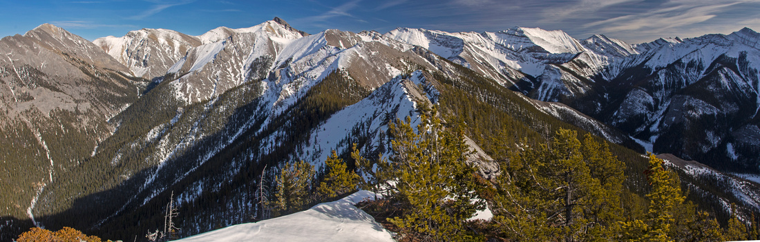
Porcupine Ridge from Pinnacles Section. Crux is the rock rib roughly in center of photo. Low end of Wasootch ridge left, Mt. Lorette in the distance |
|||
| Trip Summary | |||
March 26, 2016Porcupine ridge is north neighbor to much more popular Wasootch ridge with 2 ridges being separated by (south fork of) Porcupine creek. It is considerably more scenic with highlight being set of spectacular rock pinnacles in upper part of the ridge. It is also more rugged and offers some real scrambling with crux low angled class 3 crack. Much opportunities to make trip technically hard exist, and north fork of Porcupine creek is also popular with rock climbers that can sometimes be seen with ropes and gear. Challenging option is to continue towards Tiara peak - but this is reserved only for very competent scramblers as section of knife edge ridge must be negotiated. Most hikers will chose section with pinnacles as turnaround point or perhaps highpoint of the ridge some 20 minutes to the east. Parking is at left (east) side of Kananaskis Trail (Hwy 40) just before crossing of Porcupine creek; it is 1-2 minutes after you pass Baldy Pass trailhead. There is bit of old (and muddy) logging road that can accommodate 8-10 vehicles. From there hike on north side of Porcupine creek; pinnacles that mark upper part of the ridge can be seen far in the distance. Creek enters canyon, and there are several logs bridging the creek as you must hop back and forth when water level is high. In early spring or late in the summer it is usually possible to stay entirely on the left side with couple of easy rock hops. Reach the forks in about 20-25 minutes from the parking. From here climbers go up the left fork while there is also hiking trail that follows the right fork. For scramblers heading for Porcupine ridge it is best to head up the intervening forested rib right at the forks. Initially it is a bit steep, but soon you are able to pick-up bits of trail. Higher up some orange and blue flagging mark the way, but whenever in doubt stay close to right (south) side -- some good views of Wasootch ridge from the clearings as well! Clearing and mid-part of the ridge are reached within an hour. Here the forest opens up and very enjoyable flat part ensues. Sometimes very nice firepit can be found here too. Above the flat part second rise ensues; it is easiest to stay left on the crest which is frequently dry even in the winter, while snow on the right side provides for quick descent on return. Above is the crux - section of easy scrambling over the rock rib that looks harder than it really is. Initial section can be ascended either up the groove on the left side, or (easier) up ledges to the right. Bit of mildly exposed traverse ensues finishing with descent down low angle crack with zero exposure. Magnificent view of pinnacles are constant distraction and it is likely you will take photo break here! Final part to the pinnacles ascends forested slope, then finishes with bit of open ridge traverse. Scramble up to lower pinnacle for magnificent view of the higher gendarme. If continuing further, bypass the intervening rock rib on the shadier left (north) side; in early spring it will likely harbor snow and be quite awkward, while in dry conditions it is merely a short side-hill bash. On the other side ridge is less enjoyable as bush is more dense, but way is still obvious. Reach the high-point about 20 minutes past the pinnacles and walk along the open part towards the dip leading to section of knife-edge ridge that appears impassable. This is the normal turnaround point. If continuing for Tiara peak, even if you bypass the knife-edge part, it is worth nothing that steep slopes on the north side of the peak might be a show-stopper in early season as they will be snow covered; crossing this 45 degrees angle slope feels dicey even with an ice-axe and is in realm of mountaineering. Return the same way. |
|
Gallery |
|||
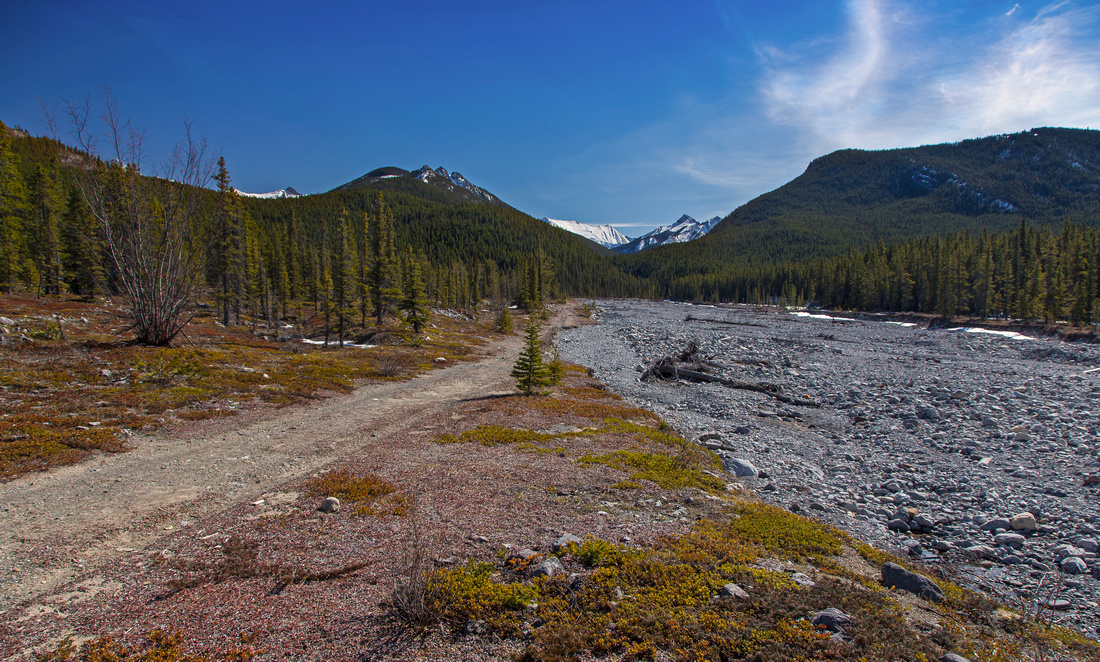 Porcupine Creek Porcupine Creek Porcupine creek full of debris from 2013 runoffs
 |
|||
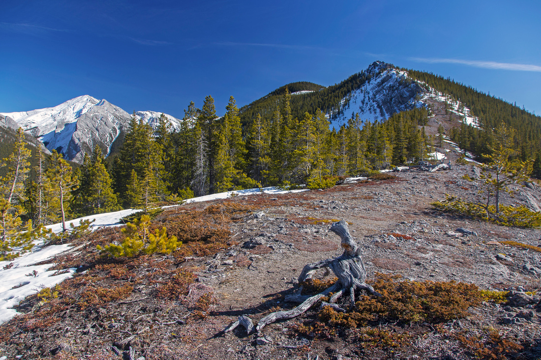 Lower Ridge
Middle part after steep ascent above the forks Lower Ridge
Middle part after steep ascent above the forks |
|||
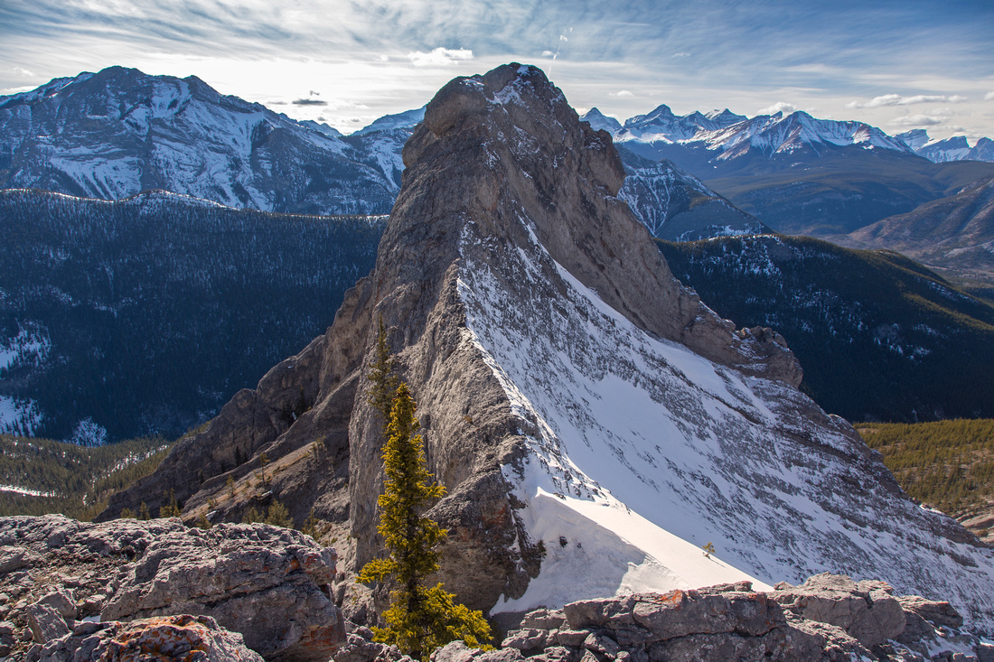
 Pinnacles Viewpoint
Pinnacles (upper right) from top of crux rock rib Pinnacles Viewpoint
Pinnacles (upper right) from top of crux rock rib |
|||
|
|||
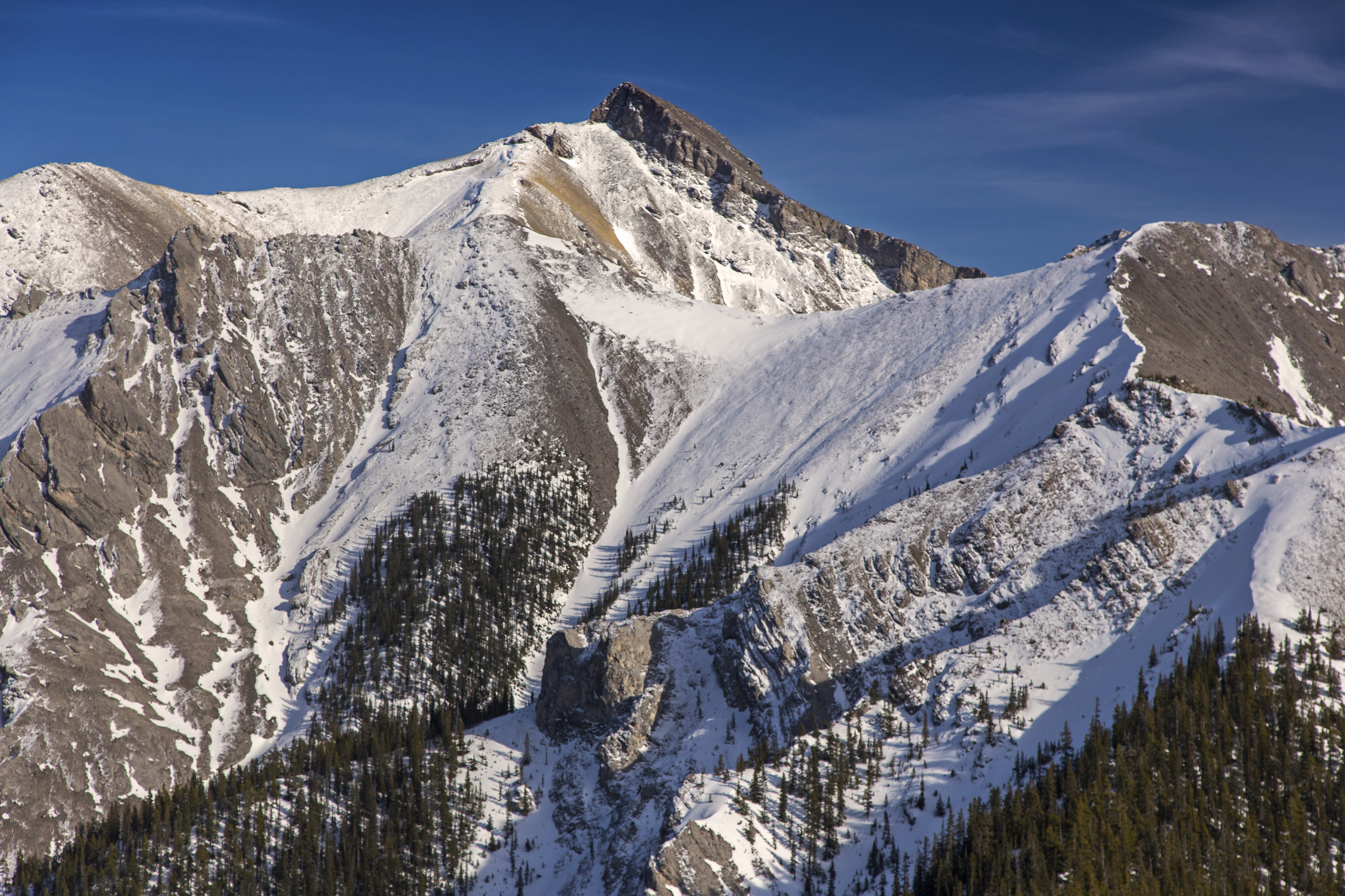
 Rock Pinnacle
Higher pinnacle. Wasootch ridge behind Rock Pinnacle
Higher pinnacle. Wasootch ridge behind |
|||
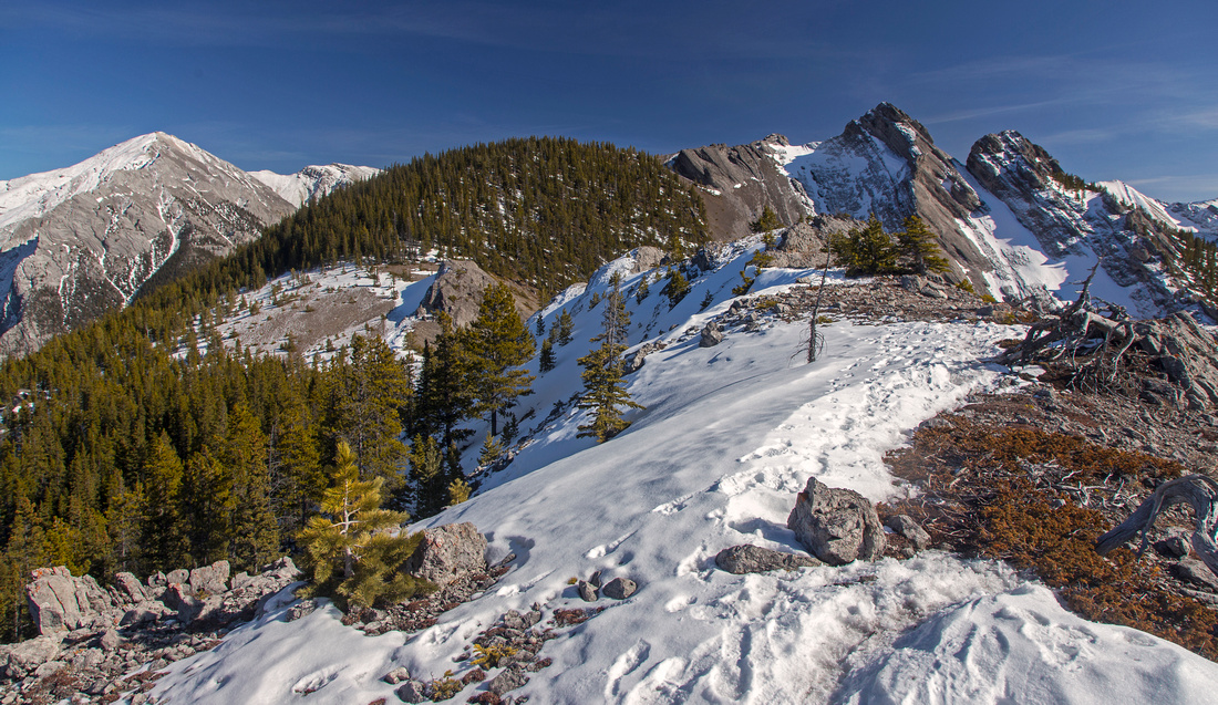
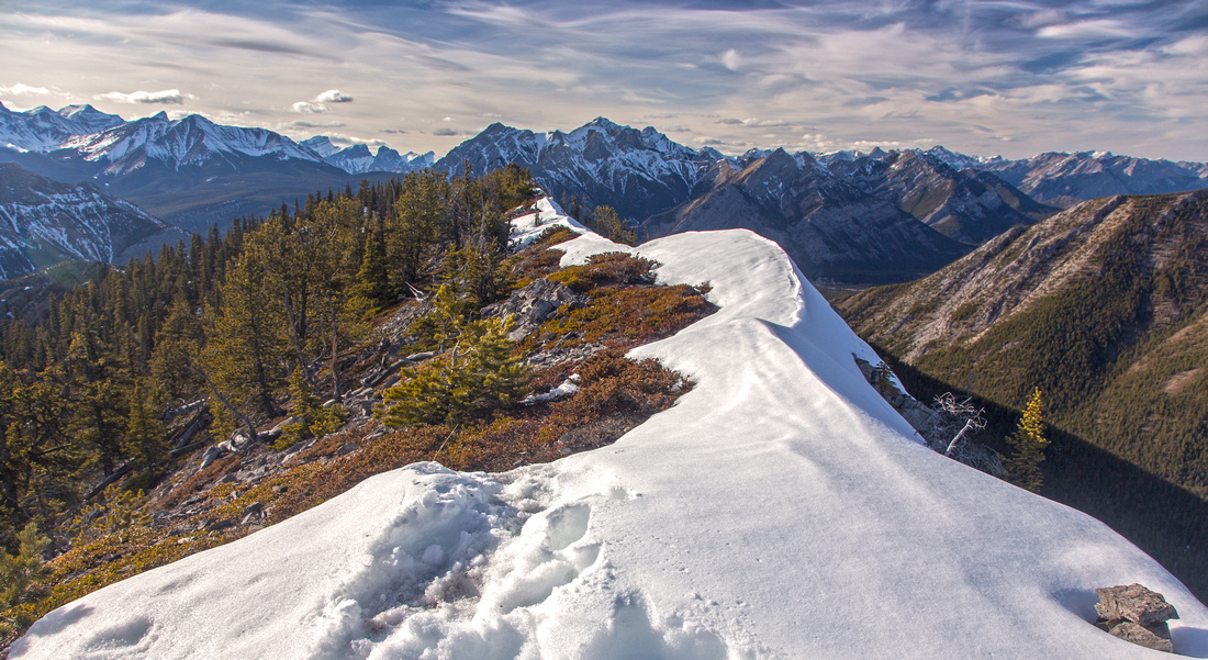 Upper Ridge
Look back at highpoint just before knife edge slab Upper Ridge
Look back at highpoint just before knife edge slab |
|||
|
|||
 Porcupine Panorama
Panoramic view from highpoint. Knife edge section directly ahead. Tiara peak upper left, high end of Wasootch ridge far right Porcupine Panorama
Panoramic view from highpoint. Knife edge section directly ahead. Tiara peak upper left, high end of Wasootch ridge far right |
Abstract
| Overall Difficulty | D5 | Rock hop across the creek in lower canyon. Steep ascent of lower rib with some mild bushwhacking. Section of high class 2 or low class 3 rock scrambling on rock rib in middle part of the ridge. Minor routefinding | |||
| Snow Factor | S2 | Ridge is generally windblown and dry most of the year. Shadier left (east) side might pose problems if continuing past the pinnacles in early season. | |||
| Scenery | Great views of front ranges including Wasootch ridge, Kananaskis peak, Tiara peak and many others. Spectacular rock pinnacles. | ||||
| Trail/Marking | Poor | Trail to the forks, occasionally flagged route to upper part of the ridge | |||
| Suggested Time | 5-6 hr | Return time to the Pinnacles. Add 45 mins to knife-edge slab, or several hours (very long day) for Tiara peak | |||
| Elevation | Start: 1450 m Max: 2110 m Total: ~770 m | Round Trip: 10-11 km | |||
| Gear | Hiking poles very helpful for stability. Snowshoes usually not necessary in winter. Some parties don the rock helmet for the pinnacles/scramble part, but it is not really necessary | ||||
| Water | No water source past the forks of Porcupine creek. Carry ~2L | ||||
| Dog Friendly | Yes | Pets should be kept on leash. Scramble bit will likely pose no problems. | |||
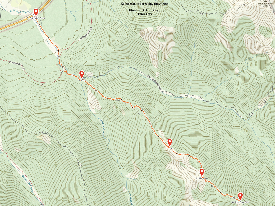 Porcupine Ridge GAIA Map
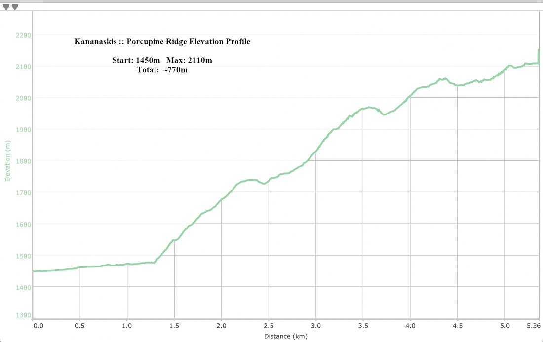 Porcupine Ridge Elevation Profile