Google Map |
Rockies :: Kananaskis :: Wasootch Ridge |
GPS Track |
|
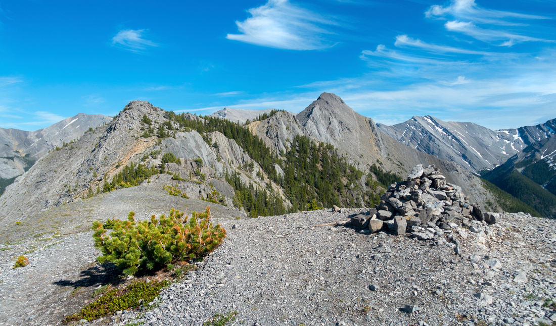
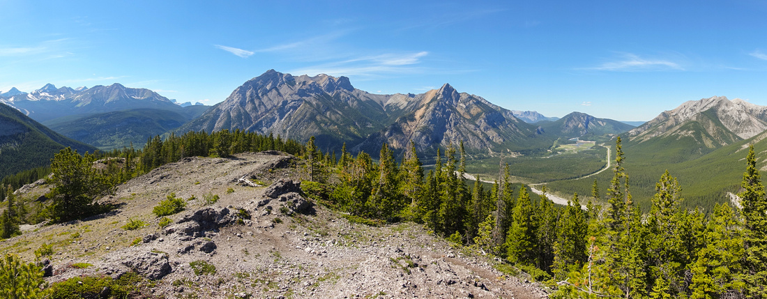
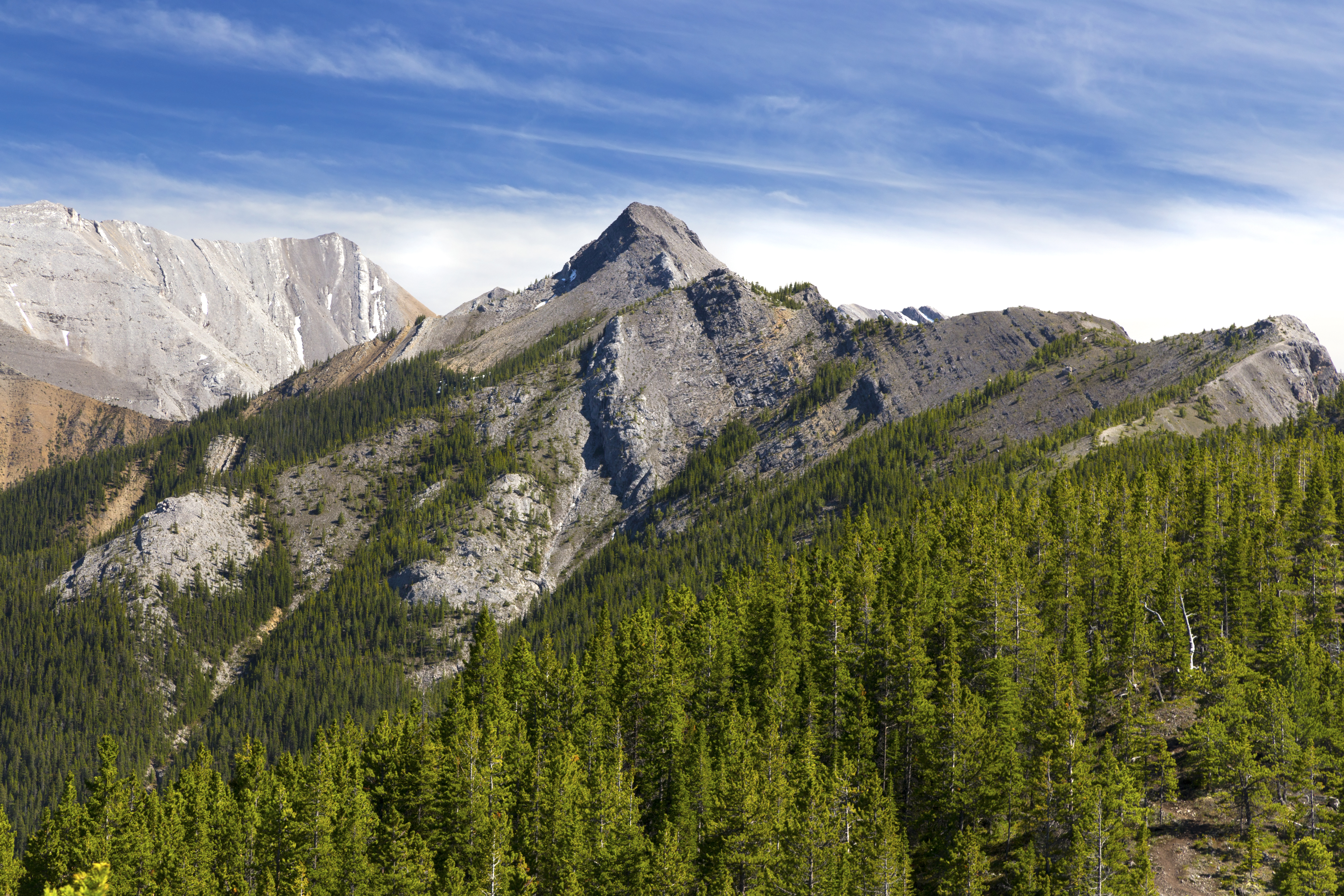
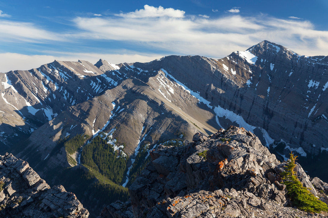
Usual Hiker turnaround point on Wasootch Ridge; Continuing to Highpoint (distance, just right of center) is much more serious undertaking |
|||
|
Wasootch ridge is one of best ridgewalks east of Hwy 40 corridor. Ridge is quite long; entire length is apparent as one drives south past Baldy Pass trailhead. After initial steep rise to fist bump, hiking is mostly above treeline granting fantastic views of Front Ranges. Trip is feasible year-round, but expect some deep postholing in shaded areas. Area is quite popular, but crowds thin off the further you go. Most people turn back at "Hiker Summit" reached in ~2.5 - 3 hrs. Highpoint visible in distance is considerably more involved and requires some hands-on moves with occasional routefinding and is recommended only for scramblers. Be wary that ridge is entirely dry and -- except for snowmelt winter/spring -- there is no source of water. On my trip to true summit on summer solstice '21 2L were not enough and I was quite dehydrated by the time I was back to parking lot. Bring at least 3L on a hot summer day. Hiker SummitDifferent Dates, last June 21 '21Turn off Hwy40 into signed Wasootch recreation site some 15km from Trans-Canada. Trail starts behind picnic area left of Wasootch Creek washout flat. Initial part is eroded and quite steep; hiking poles are of great help. In spring this section can get quite icy and without micro-spikes might even be dangerous. Trial then flattens a bit, crosses intervening section of semi-open forest, then climbs, a little less steeply to first bump: Start of Wasootch Ridge proper. This is excellent spot for first break as views literally explode around you! Continuing on mostly open ridge crest is pure joy. Trail rises over several ups-and-downs finally reaching "Hiker Summit" that is entirely open. This is usual turnaround point. Return the same way; it is possible to trash down south slopes to Wasootch Creek below and then hike out via the canyon back to parking, but this is quite tedious and can not be recommended; enjoy the ridgewalk instead, with views of Mt. Lorette, Mary Barclay and Porcupine Ridge to the north. |
|
Gallery |
|||
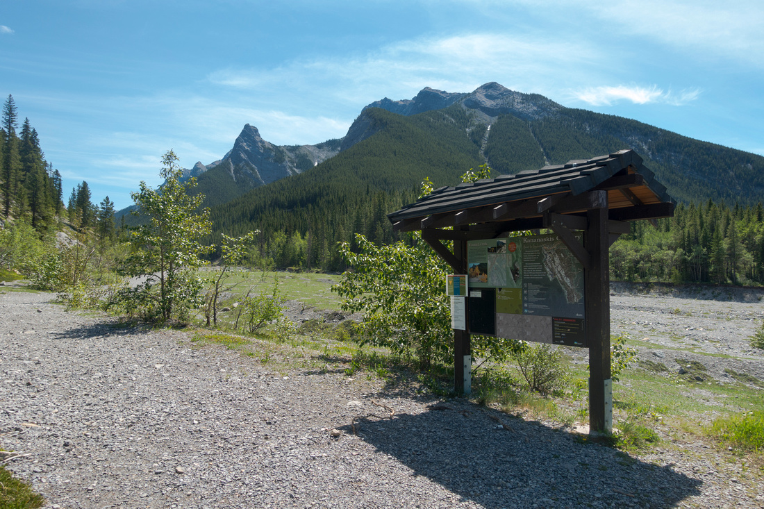 Wasootch Creek Trailhead Wasootch Creek Trailhead Usual Kananaskis Trail Kiosk by parking lot. Ridge trail starts at picnic area to the left (out of picture)
 |
|||
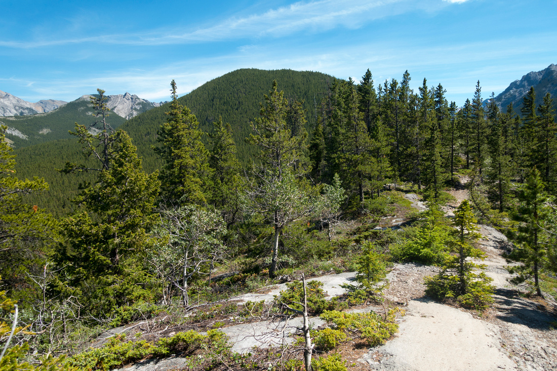 Lower Ridge
Flat portion above initial steep rise. Forested bump ahead is first highpoint Lower Ridge
Flat portion above initial steep rise. Forested bump ahead is first highpoint |
|||
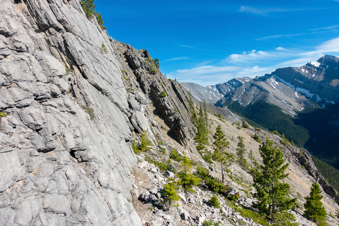
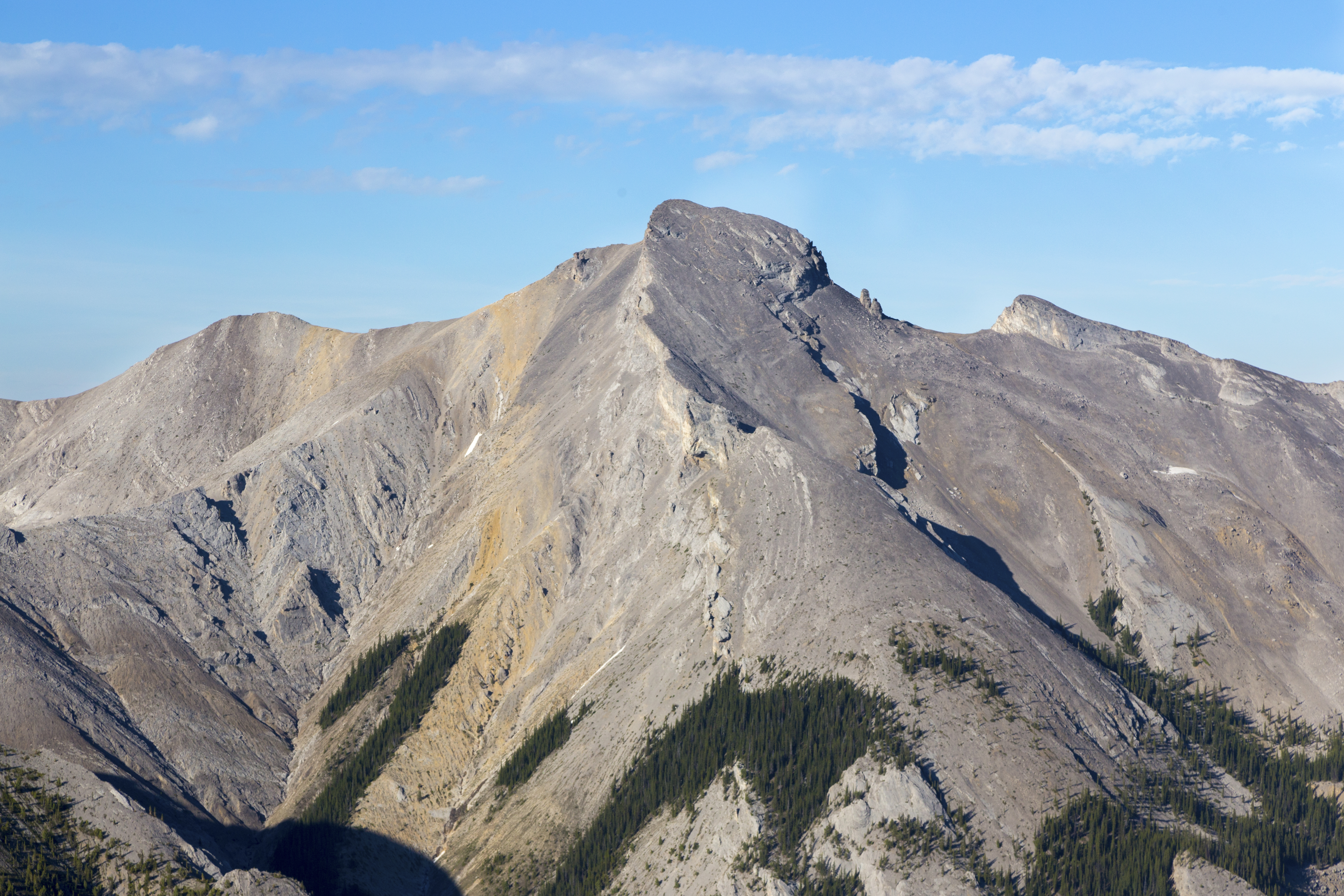
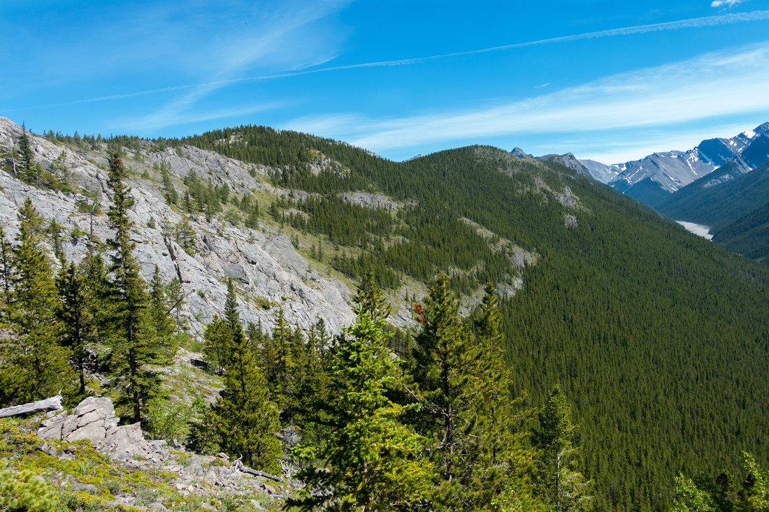 Wasootch Shoulder
Shoulder just below first Higpoint (out of picture, left). Trail follows ridge crest over several bumps. Hiker Summit still far in distance, upper center right; true Highpoint just peeking left of it. This spot is also near off-trail trash where it is easiest to link Wasootch Creek and Ridge - see here Wasootch Shoulder
Shoulder just below first Higpoint (out of picture, left). Trail follows ridge crest over several bumps. Hiker Summit still far in distance, upper center right; true Highpoint just peeking left of it. This spot is also near off-trail trash where it is easiest to link Wasootch Creek and Ridge - see here |
|||
 Highway 40 Corridor
Panoramic View back past first Highpoint. Mount Lorette just left of center, Mary Barclay to the right of it Lougheed Towers distance left Highway 40 Corridor
Panoramic View back past first Highpoint. Mount Lorette just left of center, Mary Barclay to the right of it Lougheed Towers distance left |
|||
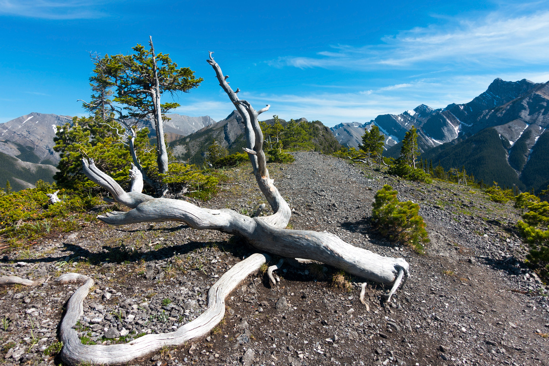 Dry Tree
 stradling ridge crest, quite common for Front Ranges Dry Tree
Dry Tree stradling ridge crest, quite common for Front Ranges |
|||
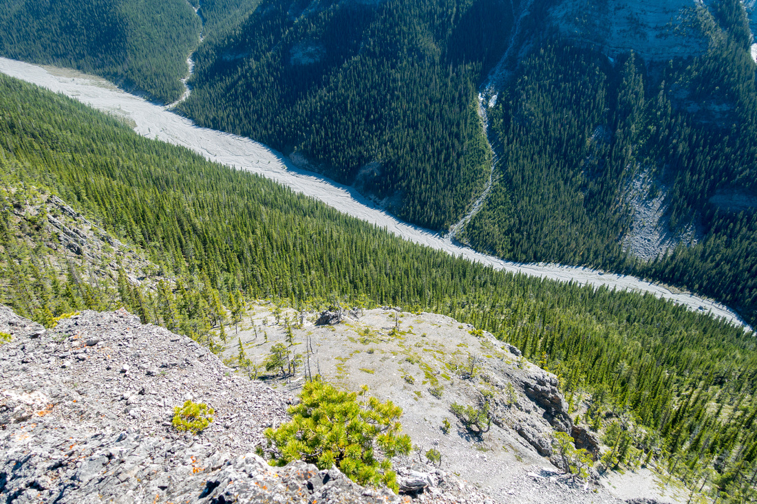 Wasootch Creek
Aerial View of Wasootch Creek on south side. It is possible to trash down forested slopes, then hike out via the creek. See here for one possible variation Wasootch Creek
Aerial View of Wasootch Creek on south side. It is possible to trash down forested slopes, then hike out via the creek. See here for one possible variation |
|||
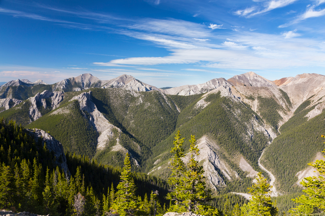 Porcupine Ridge
 directly north is also fantastic ridgewalk Porcupine Ridge
Porcupine Ridge directly north is also fantastic ridgewalk |
|||
 |
|||
|
|
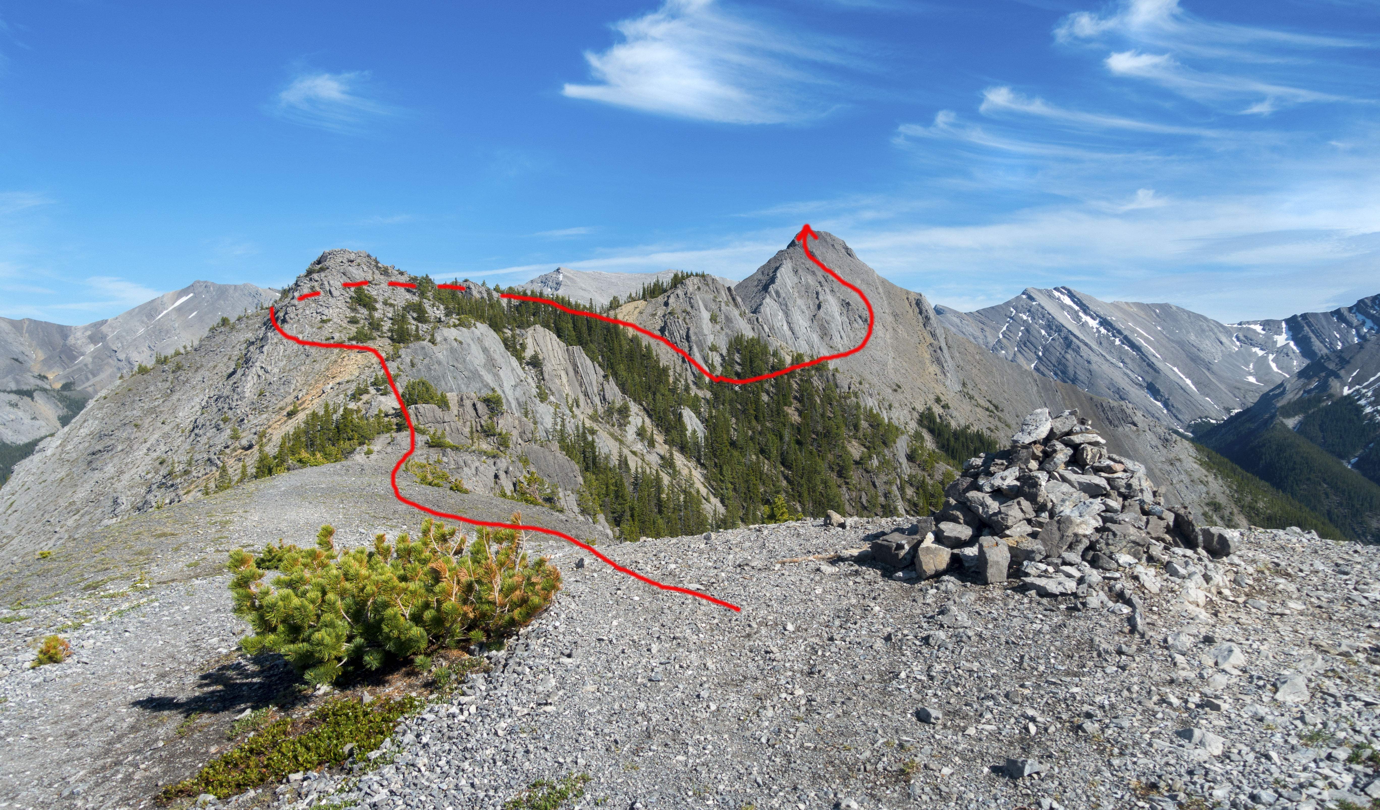
Highpoint ScrambleJune 21, 2021Continuing past Hiker Summit is best done in dry conditions; wait till snow has completely melted. Drop initially a bit to wide saddle, then bypass first section on left (north) side; there is one brief class 3 downclimb here. Next section can be hiked directly on ridge crest with only minimal scrambling, but there is also trail in the forest on right side. Within 30 minutes is bivi coral, where lots of people stop as continuing is more involved. Ridge crest becomes knife edge, and bypass trail drops down talus on right side. Continue along trail that hugs the base of impressive near vertical cliffs, then scramble back up to the ridge; cairns help along the way. Final bit is loose and climbs through lots of broken rock to highpoint, reached in ~1.5 hrs from Hiker Summit. Views are simply fantastic and you are likely to have it all to yourself. Although it is possible to trash down into head of Wasootch Creek on east side, it is best to return the same way and it will be considerably faster. |
 |
|||
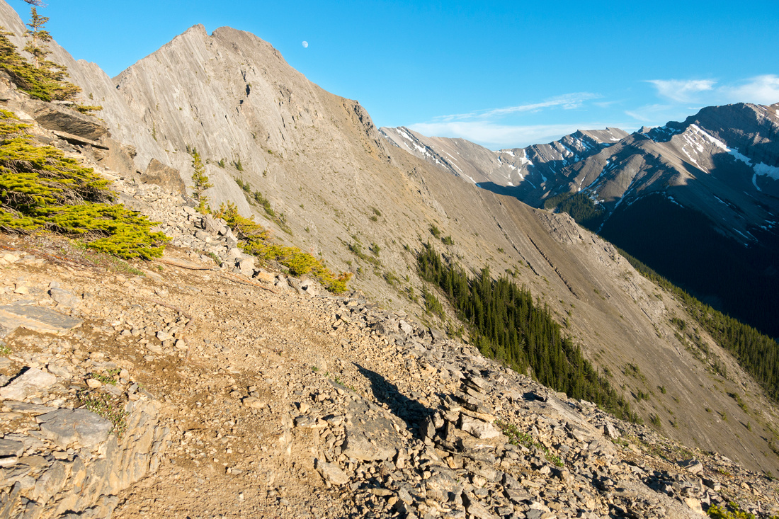
 Ridge Bypass
Exposed knife-edge section of ridge ahead; bypass trail drops to talus slopes on right side Ridge Bypass
Exposed knife-edge section of ridge ahead; bypass trail drops to talus slopes on right side |
|||
 The Split
Routefinding problem; after dropping down bypass trail comes to junction. Take left (upper) branch; descending on right handside trail eventually disappears and will force sidehilling back to upper trail The Split
Routefinding problem; after dropping down bypass trail comes to junction. Take left (upper) branch; descending on right handside trail eventually disappears and will force sidehilling back to upper trail |
|||
 Bypass Trail
Upper Bypass trail hugs base of impressive nearly vertical cliffs and is mostly easy going Bypass Trail
Upper Bypass trail hugs base of impressive nearly vertical cliffs and is mostly easy going |
|||
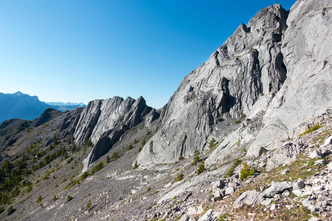 Wasootch Cliffs
Looking back from Bypass Trail; Hiker summit is extreme center left Wasootch Cliffs
Looking back from Bypass Trail; Hiker summit is extreme center left |
|||
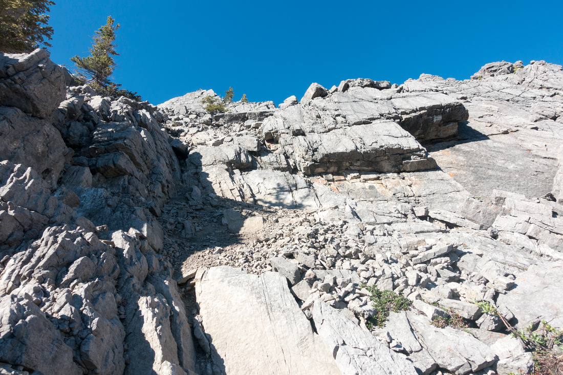 Scree Scramble
Scrambling back up the ridge crest on loose talus slopes. This bit is probably the crux. There are cairns, but look back periodically to be able to recognize easiest way on return Scree Scramble
Scrambling back up the ridge crest on loose talus slopes. This bit is probably the crux. There are cairns, but look back periodically to be able to recognize easiest way on return |
|||
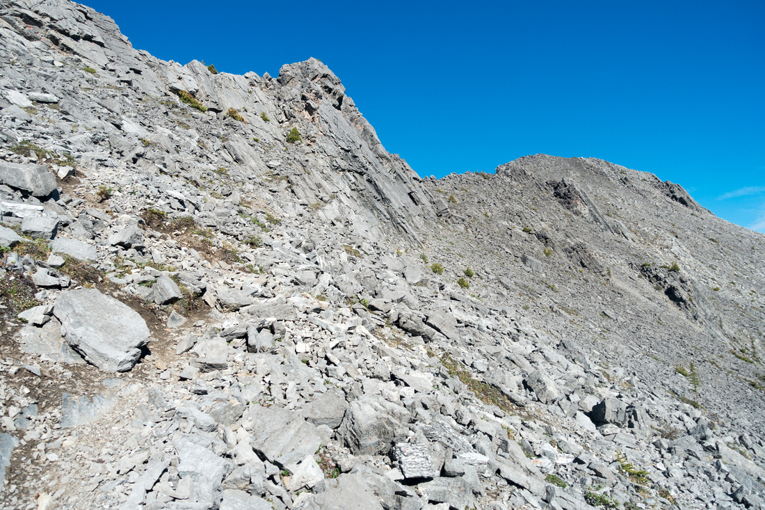 Final Part
Scrambling final part to the Highpoint upper right. Despite appearance this part is not cakewalk either and calls for periodic use of hands Final Part
Scrambling final part to the Highpoint upper right. Despite appearance this part is not cakewalk either and calls for periodic use of hands |
|||
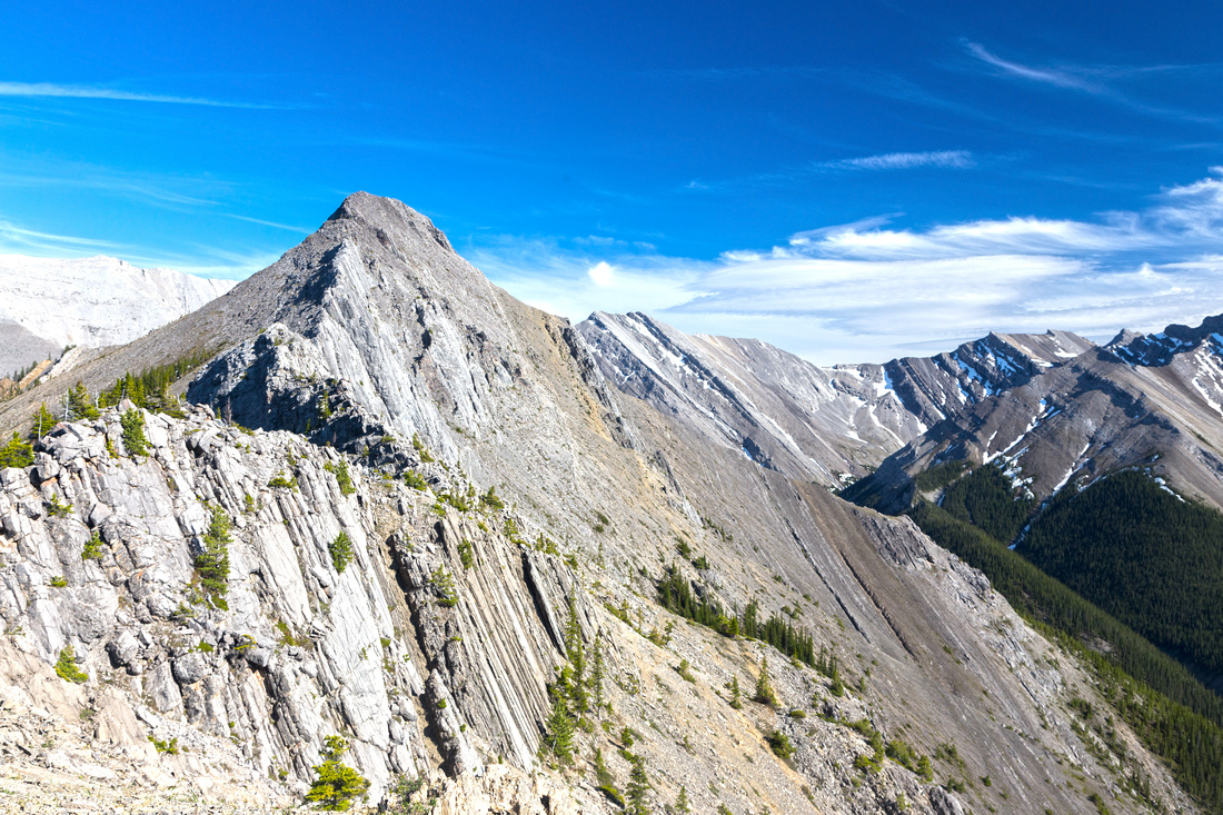
 Wasootch Highpoint
Looking east from Wasootch Highpoint; continuing on this side is not scrambling anymore Wasootch Highpoint
Looking east from Wasootch Highpoint; continuing on this side is not scrambling anymore |
|||
 |
|||
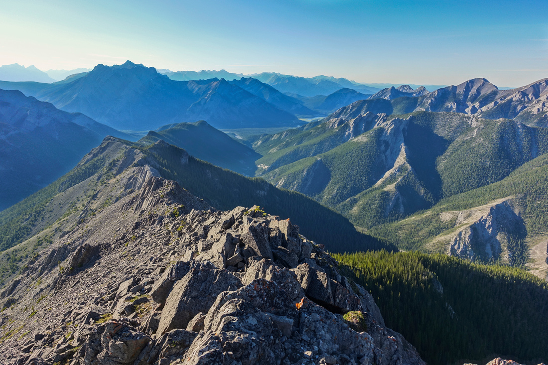 Wasootch Spine
Entire length of Wasootch Ridge from Highpoint looking back. One can appreciate how long it really is Wasootch Spine
Entire length of Wasootch Ridge from Highpoint looking back. One can appreciate how long it really is |
|||
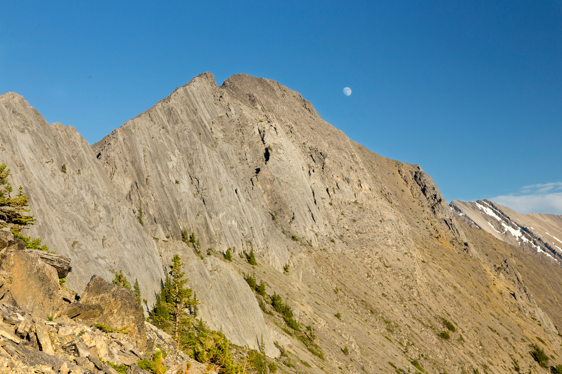 Wasootch Moon
Full Moon rising above Wasootch Higpoint on return Wasootch Moon
Full Moon rising above Wasootch Higpoint on return |
|||
|
|
Abstract
| Overall Difficulty | D3(5) | Trail Hiking with some steep parts to Hiker Summit (D3) Easy/Moderate scramble with some route-finding for Highpoint (D5) | |||
| Snow Factor | S2 | Low avalanche danger and frequently done in winter. Continuing past Hiker summit not recommended with snow cover. Often slippery/icy section just above parking lot | |||
| Scenery | Extended periods above treeline with fantastic Views of Front Ranges including Porcupine Ridge and Tiara Peak | ||||
| Trail/Marking | Good | Well defined trail most of the way to Hiker Summit. Cairns and occasional trail with some route-finding for Highpoint | |||
| Suggested Time | 5-8 hrs | 5 hr return for Hiker Summit. Add 1.5 hrs to Highpoint, with ~1hr return | |||
| Elevation | Start: 1450m Max: 2050m / 2310m Total: 850m / 1200m | Round Trip: 11km / 15km | |||
| Gear | Day hikers or full boots. Poles very helpful for Highpoint scramble. Spikes in winter/spring for icy steep rise above parking lot; snowshoes will minimize postholing in shady areas further along the ridge | ||||
| Water | Entirely dry hike. Depending how far you plan to go, carry 2-3L | ||||
| Dog Friendly | Yes | Standard back-country precautions. First part is also very popular so please keep pet on leash for courtesy to other hikers | |||
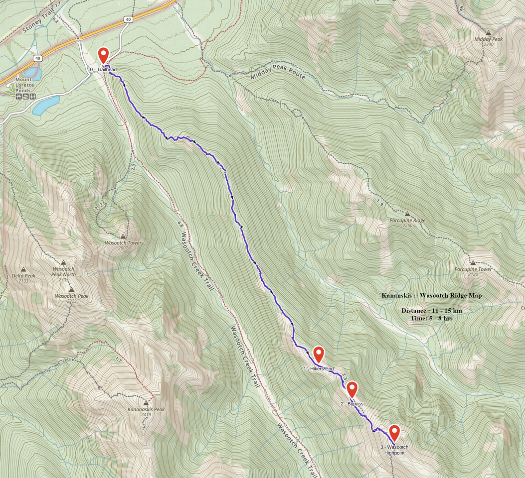 Wasootch Ridge GAIA Map
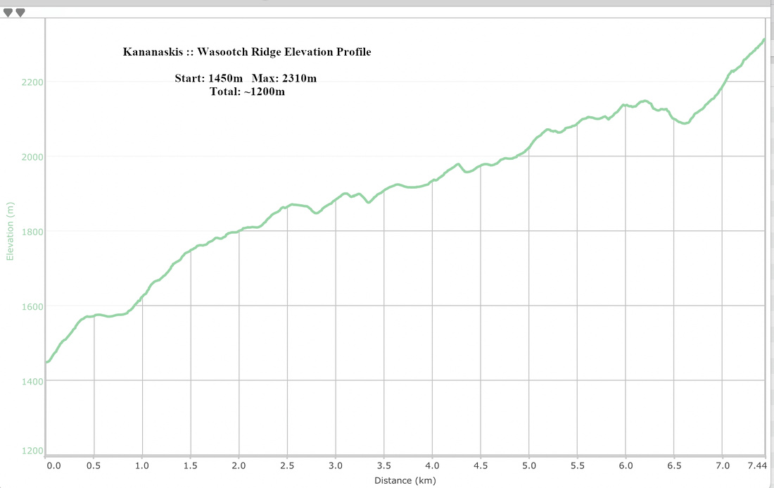 Wasootch Ridge Elevation Profile