Google Map |
Rockies :: Kananaskis :: Wasootch Creek |
GPS Track |
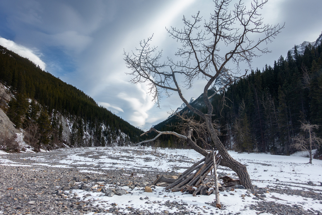 
Dried out tree at head of Wasootch Creek near the Trailhead |
|||
| Trip Summary | |||
March 7, 2025Long stony drainage separating popular Wasootch Ridge on north side and Wasootch Peak/Tower to the south. I looked at during several Ridge hikes and shelved for potential exploration at some point of time. It is listed in Daffern K-country Trial guide and has several points of interest early on - Wasootch Slabs climbing area, as well as steep gully providing climber access to Wasootch Tower. Creek extends itself for over 6km to the Forks below Kananaskis Peak. In early March '25 I abandoned planned revisit of Wasootch Ridge and decided to hike up the Creek because of strong winds, as well as slippery conditions in first part of Ridge trail directly above the Parking lot. Going up the creek is easy, in particular initial bit leading to "Wasootch Slabs" climbing area. Trail or at least obvious signs of traffic extend to drainage below Wasootch Tower. Very few people venture beyond. I continued to second drainage, then decided to turn back due to tiring trail breaking in wet snow. On return I decided to explore link between Creek and Ridge, something there is virtually no information about. Straightforward line that offers no difficulties exits; see Gallery. Hardest part is actually climb directly above Creekbed on steep / slippery and muddy bank; above grade moderates with only minor deadfall to navigate. Several possible lines exist to break cliffband below the Ridge; following GPS Track (download Top of Page) is the easiest and only steep hiking on Talus / Grass.
This variation will likely never become mainstream, but it does provide a nice loop with likely solitude. It is possible to link creek and ridge at several points further up, but this one is likely the easiest one with least amount of elevation gain. |
|
Gallery |
|||
 Wasootch Trailhead
Interpretive Table at Wasootch Creek Picnic Area Wasootch Trailhead
Interpretive Table at Wasootch Creek Picnic Area |
|||
 Trailhead Kiosk
Standard K-country Kiosk at head of Wasootch Creek Trailhead Kiosk
Standard K-country Kiosk at head of Wasootch Creek |
|||
|
|
|||
 Wasootch Slabs
Looking back towards Mt. Mary Barclay, upper right. Wasootch Slabs climbing area below Wasootch Slabs
Looking back towards Mt. Mary Barclay, upper right. Wasootch Slabs climbing area below |
|||
 Wasootch Tower
 - an outlier of Wasootch Peak (upper right) Wasootch Tower
Wasootch Tower - an outlier of Wasootch Peak (upper right) |
|||
 Wasootch Tower
 approach route starts at First Drainage, ~30min from Trailhead. Ascent above the Col is technical Wasootch Tower
Wasootch Tower approach route starts at First Drainage, ~30min from Trailhead. Ascent above the Col is technical |
|||
 Wasootch Creek
Section of Creek between First and Second Wasootch Tower Drainage. Wasootch Ridge "Hiker Summit" distant center Wasootch Creek
Section of Creek between First and Second Wasootch Tower Drainage. Wasootch Ridge "Hiker Summit" distant center |
|||
 Lonely Cairn
Small cairn covered by snow marking Second Wasootch Tower Drainage. I turned back here on my early March '25 Trip. Kananaskis Peak upper center Lonely Cairn
Small cairn covered by snow marking Second Wasootch Tower Drainage. I turned back here on my early March '25 Trip. Kananaskis Peak upper center |
|||
 Wasootch Creek to Ridge
Red line indicating easy route linking Wasootch Creek and Ridge. Waypoint "3 - Creek to Ridge", GPS Download Top of Page Wasootch Creek to Ridge
Red line indicating easy route linking Wasootch Creek and Ridge. Waypoint "3 - Creek to Ridge", GPS Download Top of Page |
|||
 Talus Slope
Steep, but easy slope below Wasootch Ridge after trashing up intervening forest above snowy Wasootch Creek Talus Slope
Steep, but easy slope below Wasootch Ridge after trashing up intervening forest above snowy Wasootch Creek |
|||
 Wasootch Panorama
Panoramic view of Wasootch Ridge and Creek already on standard Ridge Trail. Red Arrow indicates Second Drainage turnaround point (Waypoint "2 - Second Drainage") and Blue Arrow point where I left Creek and trashed up Forest (Waypoint "3 - Creek to Ridge") Wasootch Panorama
Panoramic view of Wasootch Ridge and Creek already on standard Ridge Trail. Red Arrow indicates Second Drainage turnaround point (Waypoint "2 - Second Drainage") and Blue Arrow point where I left Creek and trashed up Forest (Waypoint "3 - Creek to Ridge") |

Abstract
| Overall Difficulty | D3 | Easy traipsing on Rocky terrain in the Creek (D1-2). Optional trash with some bushwhack and steep talus to the Ridge | |||
| Snow Factor | S2 | No avalanche danger. Postholing in snowy creek likely. Ridge descent slippery in winter / shoulder season | |||
| Scenery | Wasootch Slabs and Tower. Mt. Mary Barclay and Mt. Lorette. Wasootch Ridge and Front Ranges | ||||
| Trail/Marking | None | No trail in the creek (not necessary). Route linking creek and ridge. Well trodden Wasootch Ridge trial | |||
| Suggested Time | 3 hrs | For variation presented above. Add several hours if continuing to head of Wasootch Creek. | |||
| Elevation | Start: 1440m Max: 1800 m (Wasootch Ridge) Total: ~430 m | Round Trip: ~6km | |||
| Gear | Full hikers and hiking poles. GPS might be helpful. Icers for slippery Ridge descent in winter/shoulder season. Gaiters | ||||
| Water | Stony creekbed usually completely dry. Carry ~1L or more, depending on season and how far you go | ||||
| Dog Friendly | Yes | Standard back-country travel precautions | |||
 Wasootch Creek GAIA Map
 Wasootch Creek Elevation Profile