Google Map |
Rockies :: Kananaskis ::Barrier Lookout / McConnell Ridge Traverse |
GPS Track |
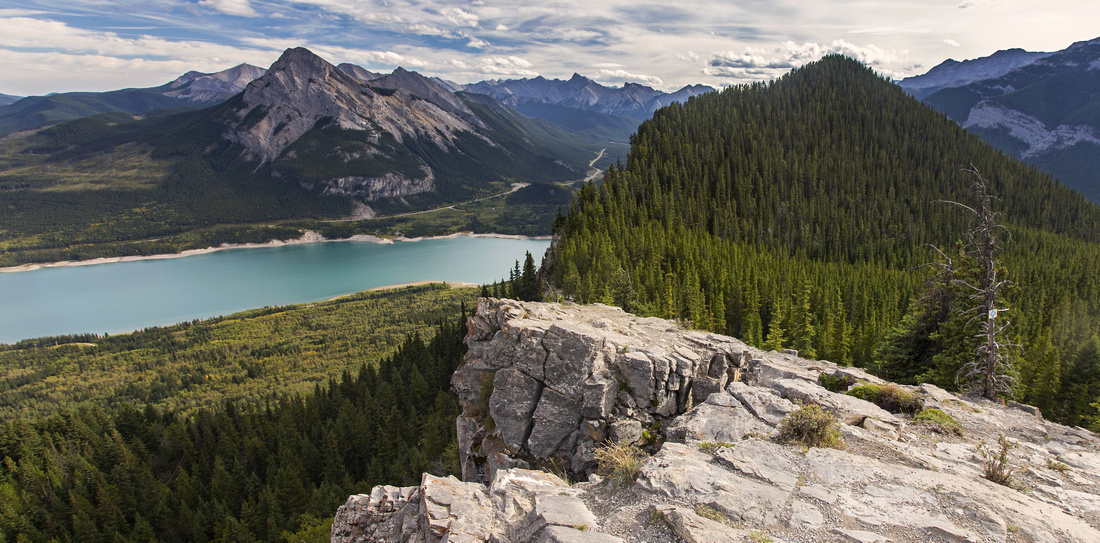 
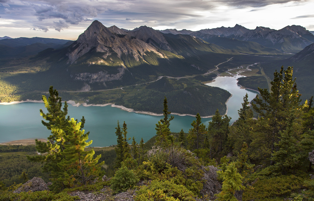
Views south from north end of McConnell Ridge. Barrier Lake and Mt. Baldy center left |
|||
| Trip Summary | |||
September 1, 2016Popular all-season half-day trip close to Calgary leading to lookout structure and fine viewpoint of front ranges. View of Barrier Lake and Mt. Baldy from north end of ridge is one of the best in K-country. You can lose crowds and spice-up things with off-trail traverse of entire McConnell ridge followed by steep scramble descent from south end. Alternate less challenging option for loop hike is return via mostly forested Jewell pass trail, which is also popular with mountain bikers.
Parking is at Barrier Dam day use area, 5-10 minutes south from Hwy 1 junction along Kananaskis Trail . Cross the dam and follow signed Prairie View trail, keeping right at Stoney Trail junction; this is where you will close the loop, if you opt for ridge traverse or Jewell Pass descent. Fire road switchbacks through forest. There are several shortcuts - please avoid them and stay on trail to prevent erosion. Be on lookout for mountain bikers that sometimes come down this way in alarming speed! Past the last switchback road ascends a bit steeply to clearing and fantastic viewpoint of Barrier Lake - about 1hr and 400m vertical from parking. Even if not going any further, effort is more than justified! Past the viewpoint road reverts to trail and ascends steeply to the north end of McConnell ridge above. Last bit is through trees and can be quite awkward when icy, specially on descent. Alternate and very pleasant option -- when dry -- is to scramble up a gully to the left past the switchback (class 2). This gully tops out next to Trans-Alta repeater station structure.
From north end of the ridge there are several options:
McConnell Ridge Traverse From the point where Jewell Pass trail plunges into forest continue straight along McConnell Ridge. There is faint trail most of the way, but generally it is best to stay close to left side. Forest is open and bushwhack is kept at minimum. Although this ridge appears entirely forested when seen on descent from Yates mountain, there are several fine viewpoints on both sides. It takes about 30-40 minutes to traverse to south end. Large cairn at high-point testifies this ridge sees some human traffic. From the cairn walk briefly left to large clearing offering excellent viewpoint of Barrier lake, usually not seen from this angle.
For return you can retrace your steps back to north end, then descend via Prairie View trail - the way you came up. Alternatively it might be possible to trash down west slopes and connect with Jewell Pass trail. Most direct option is to trash down on the east side. This is fairly challenging and good route-finding skills are required. Descend for a brief time only down the north side, then turn left and plunge down. Near the top slopes are very awkward and steep, but angle moderates further down. Aim towards obvious side ridge to the left; you might have to dodge several short cliffs along the way. Follow this side ridge; it curls gently in south-east direction. When it steepens further down descend on the right side (left has cliffs!) aiming in general direction of Powerline / Stoney trail below. There are some goat trails along the way. Final bit down the gully is moderate, but short bushwhack. Finally you exit on Stoney Trail; turn left and hike back to Barrier Dam and parking (~3km). Alternatively when water level in the reservoir is low you might be able to shorten otherwise tedious journey and walk on lake shore - footing (and views) are much better!
Return the same way (shorter), or to extend the day find trail on south side of lake outlet. This trail descends to Sheep road in about 30 minutes from the lake. Make noise here as there have been grizzly encounters. Once on Sheep road, if you have time it is worth hiking a bit south for good views from the shoulder just before road starts descent. Otherwise turn left and hike back. Sheep lakes on east side are another side-trip option; there is back-country campground there as well, but more often used by hunters. Just before road starts descent to Little Elbow junction watch for cairn - shortcut back to Tombstone road. Do not miss visit to Edworthy Falls; trail descends to the base of falls, but best viewpoint is from above when falls first come into view (did you bring the tripod?) |
|
Gallery |
|||
 Hiking towards the ridge just past Barrier Lake
 |
|||
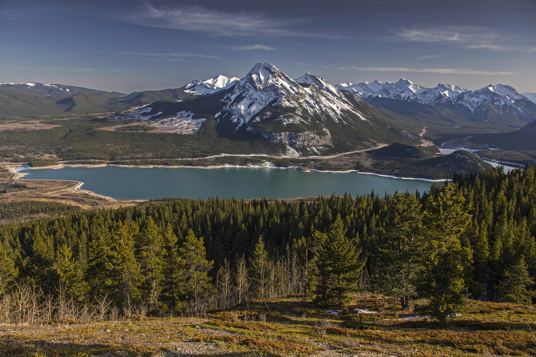 Mt. Baldy and Barrier Lake from clearing below the ridge
 |
|||
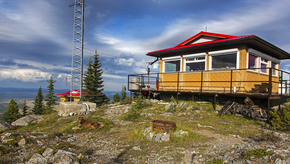 Barrier Lookout - quick side trip from north end of the ridge
 |
|||
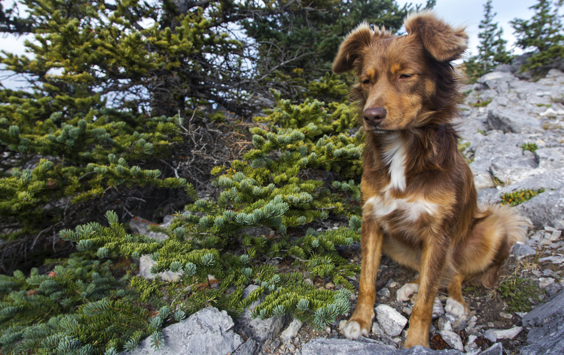 "Custodian" at the lookout mooching for food
 |
|||
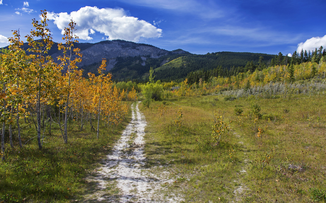
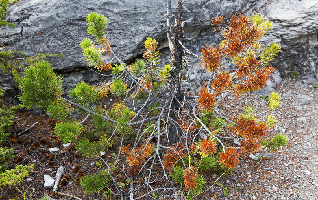 Early fall colors along the lookout trail
 |
|||
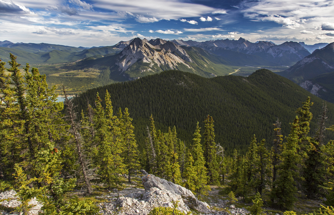 Length of McConnell Ridge from lookout trail
 |
|||
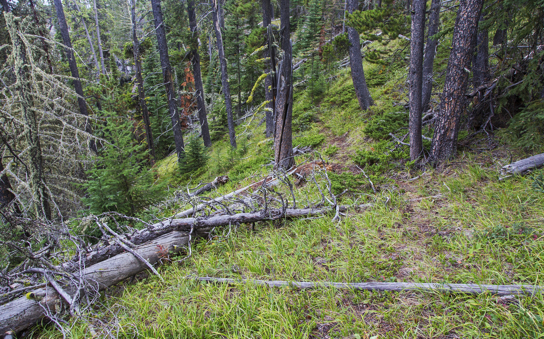 Typical section of forested ridge near the south end
 |
|||
 Barrier Lake and Kananaskis Trail from south end
 |
Abstract
| Overall Difficulty | D2/4 | Easy trail hiking with one steep section for north end of the ridge & lookout (D2). Off-trail ridge traverse. Very steep and scrambly descent with moderate bushwhack from south end of the ridge to Stoney Trail (D4) | |||
| Snow Factor | S2 | Due to easterly exposure trail is generally snow-free most of the year. Traction required for icy sections | |||
| Scenery | Fantastic view of Barrier lake and foothills. Front ranges with many Canmore area peaks from the lookout. | ||||
| Trail/Marking | Excellent / None | Gravel fire road shared with mtn. bikers to viewpoint below north end of the ridge; well defined trail afterwards to the lookout. Occasional faint trail for ridge traverse. Trash and route-finding for south end descent | |||
| Suggested Time | 5 hrs | Round trip including Barrier lookout and McConnell ridge loop traverse. If going just to the lookout 3 - 3.5 hrs | |||
| Elevation | Start: 1370m Max: 2020m Total: ~800m | Round Trip: 13km (ridge traverse and loop descent) | |||
| Gear | Day hikers are sufficient. Micro-spikes for icy sections in winter conditions. Poles recommended for traverse and south end descent. | ||||
| Water | Dry hike. Carry 1-2L | ||||
| Dog Friendly | Yes | First part is popular with mtn. bikers -- keep dog on leash | |||
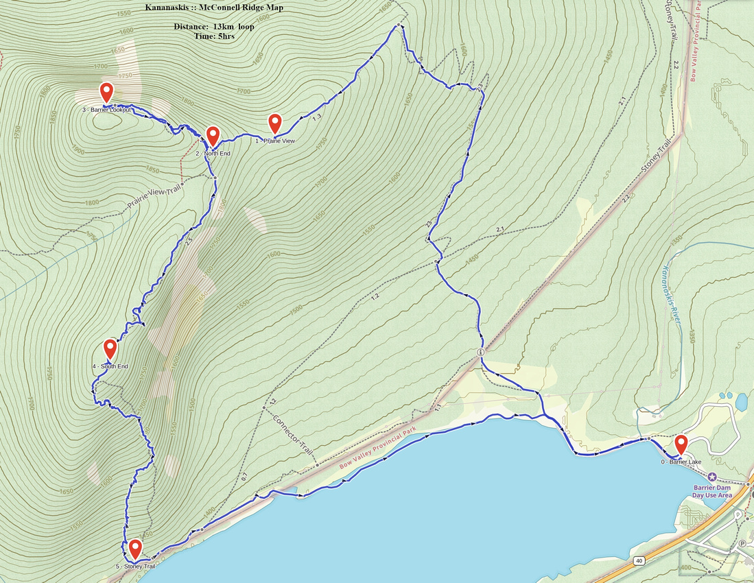 McConnell Ridge GAIA Map
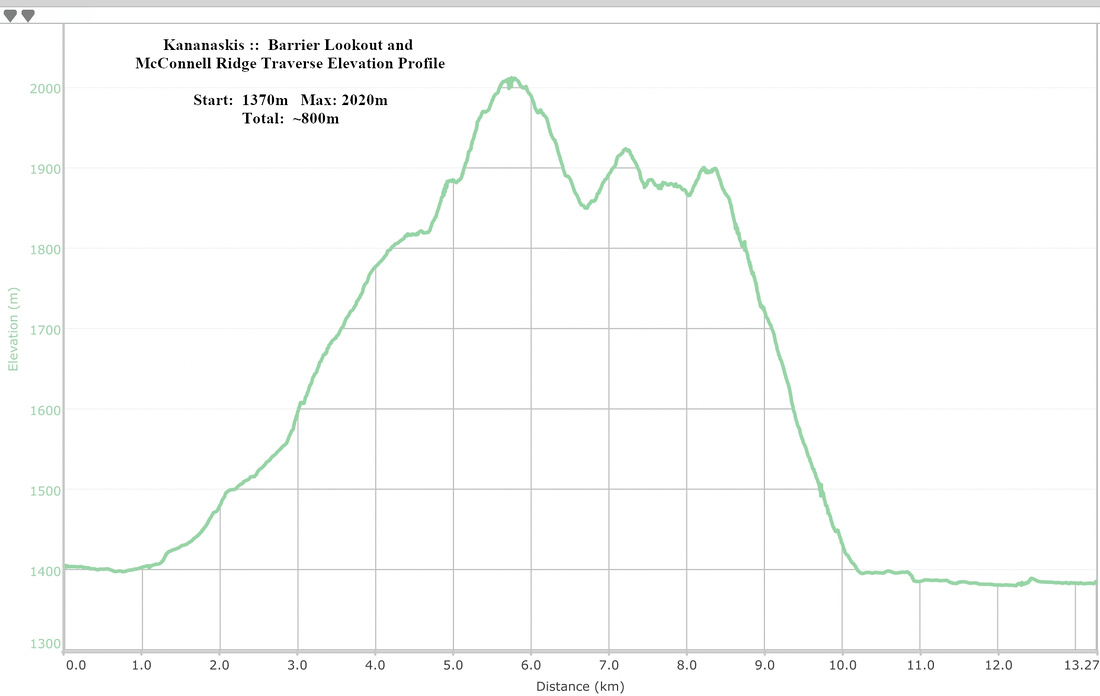 McConnell Ridge Elevation Profile