Google Map |
Rockies :: Kananaskis :: Mt. Allan via Centennial Ridge |
GPS Track |
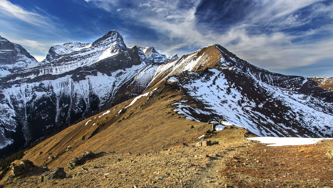 
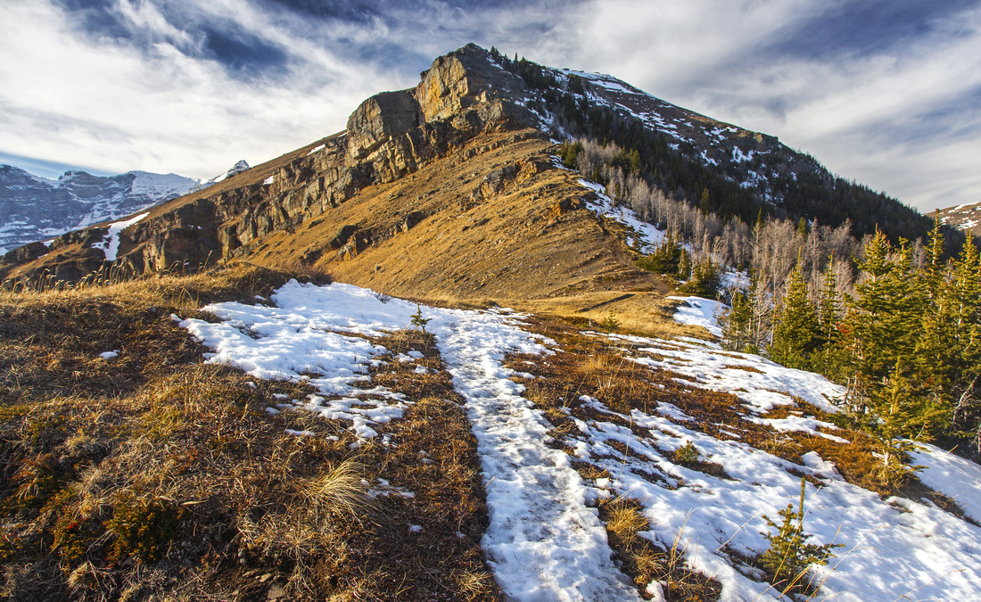
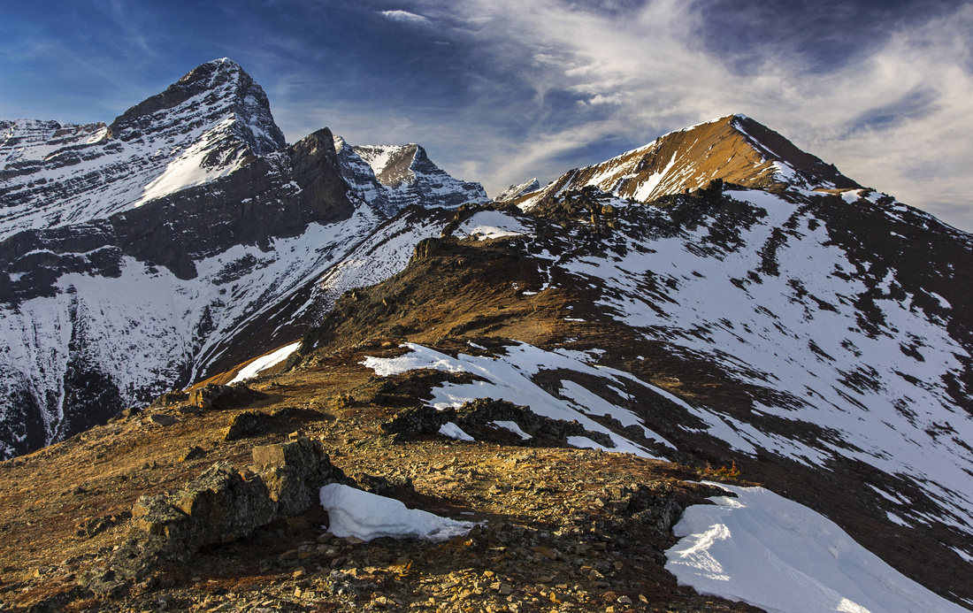
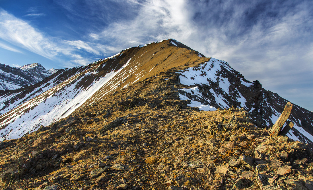
Centennial Ridge below Olympic Summit looking across Mushroom Garden towards Mt. Allan. Lougheed Towers to the left |
|||
| Trip Summary | |||
November 10, 2016Centennial Ridge is probably the nicest ridgewalk along Hwy40 corridor. Built in 1996 for Canada Centennial, highline trail links Ribbon Creek near Kananaskis Village with Dead Man's Flat near Canmore traversing over 2830m Mt. Allan as the highpoint. Except for initial stint on network of logging roads, entire time is spent above treeline with spectacular views in all directions. Traverse is highly recommended, but it requires two vehicles and some logistic planning; most hikers return the same way back to Ribbon Creek. Despite established trail, trip is best suited for experienced hikers as there is substantial elevation gain and couple of technical scramble steps. Besides traverse, possible extension include visit to Jubilee Tarns and/or Mt. Collembola, but this is better done from Canmore side. Pick calm and windless day. Note that Centennial Trail is closed April 1 - June 21, due to sheep lambing.
Park at Ribbon Creek parking lot, following directions from Kananaskis Village junction on Hwy 40 - some 15 minutes south of Trans-Canada Highway. Start of Hidden trail kiosk at north side of the parking; this is popular cross-country ski area in the winter. Follow signs for Centennial Trail -- all junctions are marked, but there is one confusing spot about 15 minutes (~1km) from the parking. Logging road comes in from the left side and map placed at this junction is confusing. Do NOT go left -- this road descends back to Ribbon Creek. Instead continue straight for 1-2 minutes to next junction; this is "Mine Scar" waypoint on GPS track. Turn left. From here direction is straightforward; you must cross logging road several more times, but big hiking sign always points in right direction leaving little doubt. Eventually trail comes to clearing with great views of Hwy40 corridor - about 45 minutes from the parking (first photo in the gallery). This is good spot for quick break and a bite perhaps as elevation gain is just about to start. Trail rises steeply through aspen forest for another 15-20 minutes, then exits to treeline and switchbacks up open slopes. Grade is steep and hiking poles are of great help here. With unfavorable snow conditions in winter, this slope has avalanche potential. At the top trail levels briefly and approaches Olympic Summit; mountain to the right on the distance is Mt. Collembola, while Mt. Allan is still hidden from the views.
Climb Olympic summit on the shady right side. Couple of steps could classify as easy scramble; in dry conditions you can get by without use of hands, but if covered with hard snow/ice, it could be dangerous - specially on descent. Most rewarding part of the day is above; you are pretty high, most of elevation gain is now behind and views are fantastic! Trail crosses several grassy bumps heading west, then turns north and heads directly for Mt. Allan - still about an hour from here. Scenic highlight of the day is directly ahead: "Mushroom Garden" - corridor through set of rock obelisks. At the end is the technical crux; 1.5 - 2m rock wall you must downclimb. There are several options, including tossing your pack and gear and simply jumping! Going up, if returning this way, is easier. Final bit is straightforward and ascends crumbly talus slope to the summit; stay on the crest or slightly on the right (east) side. (If traversing over to Mt. Collembola, best place to start descending is some 5 minutes from the summit of Mt. Allan). Unless completing the traverse to Dead Man Flat, return the same way. |
|
Gallery |
|||
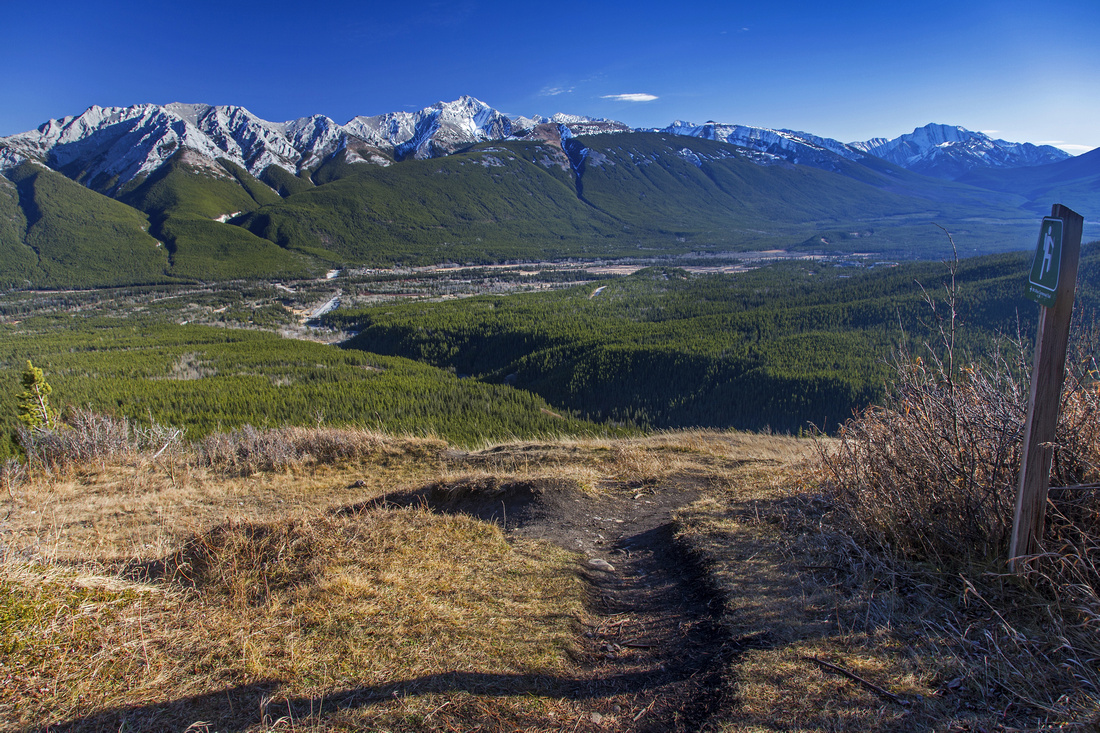 View of Kananaskis valley from clearing above Mine Scar
 |
|||
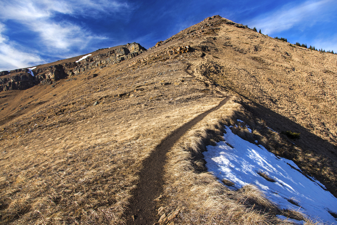 Ascending open grassy slopes to start of Centennial Ridge
 |
|||
Looking back as trail crests below Olympic Summit |
|||
 Olympic Summit. Trail ascends on shady right (east) side
 |
|||
 View back on the ridge below Olympic Summit
 |
|||
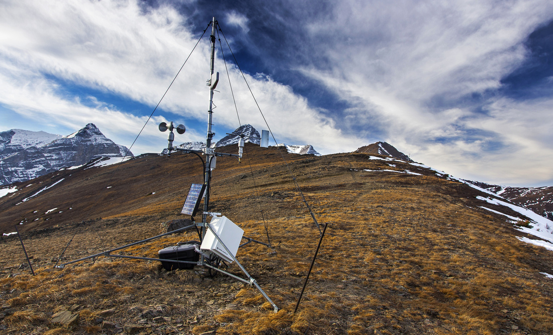 Weather station along often windy Centennial Ridge
 |
|||
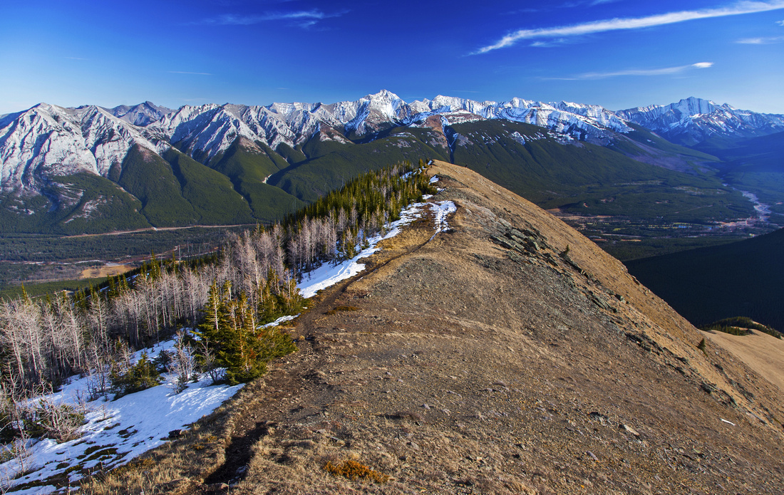
 Hiking along Centennial Ridge; Mt. Allan far right
 |
|||
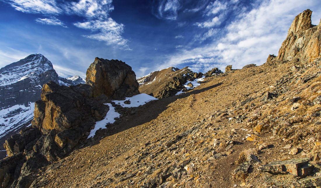
 Descending to Mushroom Garden. Summit is still ~1hr away
 |
|||
 Entering Mushroom Garden
 |
|||
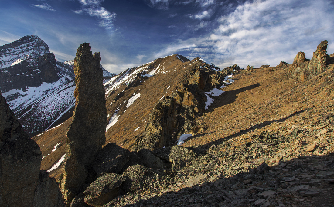 Cool Rock Obelisks
 |
|||
 Crux downclimb
 |
|||
 Final summit block
 |
|||
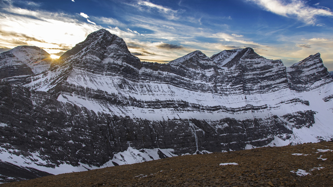 Lougheed Towers from summit of Mt. Allan
 |
|||
 North side of Mt. Allan. Mt. Collembola right, Bow Valley and Canmore distance right
 |
|||
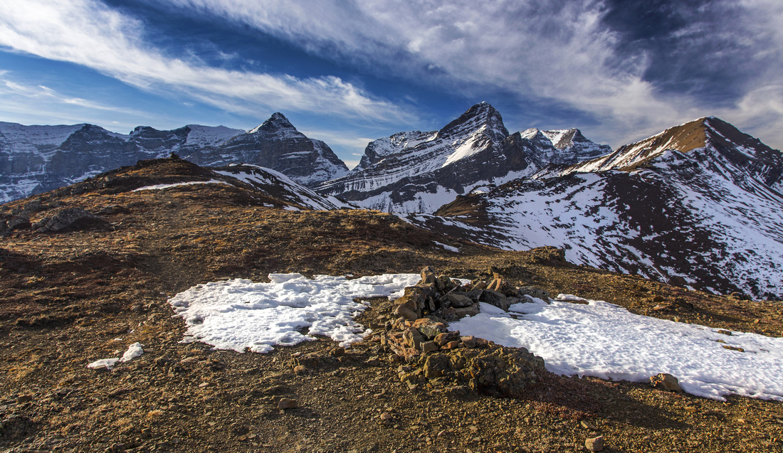
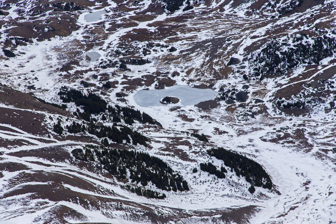 Jubilee Tarns in cirque between Mt. Allan and Mt. Collembola
 |
|||
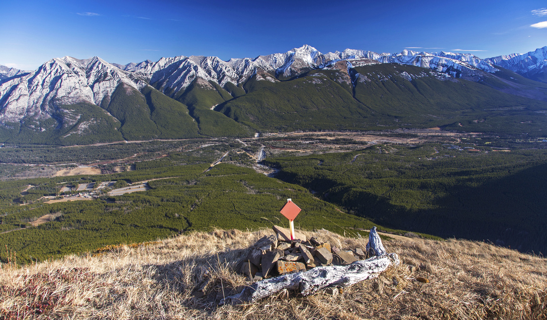
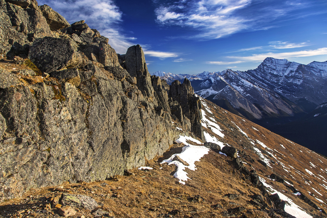
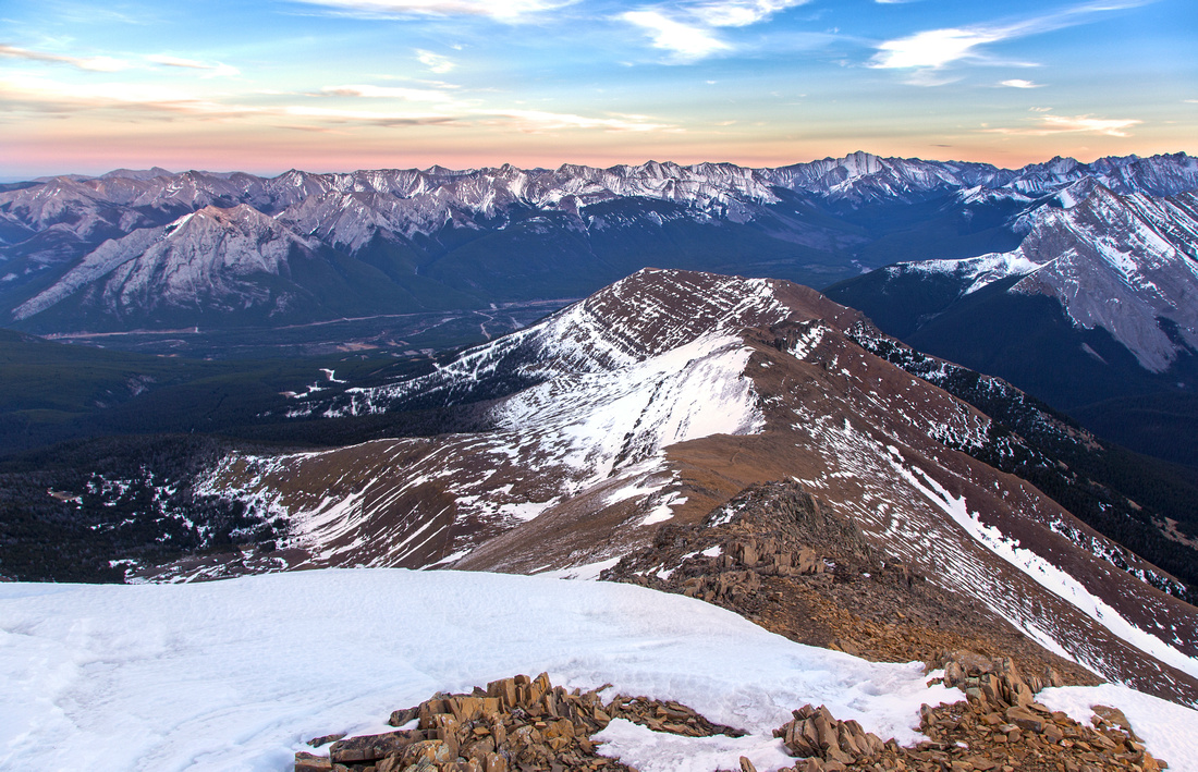 Length of Centennial Ridge on descent back to Ribbon Creek
 |
Abstract
| Overall Difficulty | D4/5 | Steep ascent slopes with significant overall elevation gain. Minor scramble below Olympic Summit. One tricky downclimb (low class 3) along Centennial Ridge | |||
| Snow Factor | S3 | Steep open slopes above Mine Scar with avalanche potential in winter conditions. Possibility of hard, frozen snow/ice in shoulder season on shady sections might require micro-spikes | |||
| Scenery | Except for initial approach entire trip is spent above treeline with fantastic views of Kananskis Valley, Ribbon corridor, Mt. Kidd, Mt. Bogart and Mt. Spparowhawk. "In your face" view of Lougheed Towers from the summit and northerly views towards Bow Valley and Canmore. Unique rock obelisks in Mushroom Garden along Centennial Ridge | ||||
| Trail/Marking | Very Good | Official trail with signed junctions to treeline, followed by well defined bed in the alpine with wands and cairns. One potentially confusing part below Mine Scar on approach | |||
| Suggested Time | 7-8 hrs | Return the same way to Ribbon Creek. One-way traverse to Canmore is long day and requires 2 vehicles | |||
| Elevation | Start: 1470m Max: 2830m Total: ~1450m | Round Trip: 17km | |||
| Gear | Full hiking boots recommended. Micro-spikes for icy sections in shoulder season; snowshoes or skis in winter | ||||
| Water | Dry hike. On a hot day steep ascent to Olympic Summit will drain your water supplies very quickly - carry 3L | ||||
| Dog Friendly | Yes | Mountain goats frequent the ridge; keep control of your pet. | |||
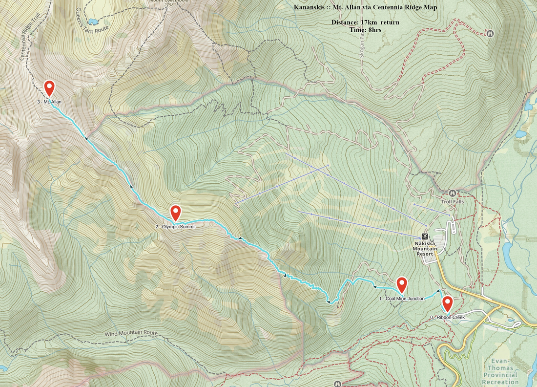 Mt. Allan via Centennia Ridge GAIA Map
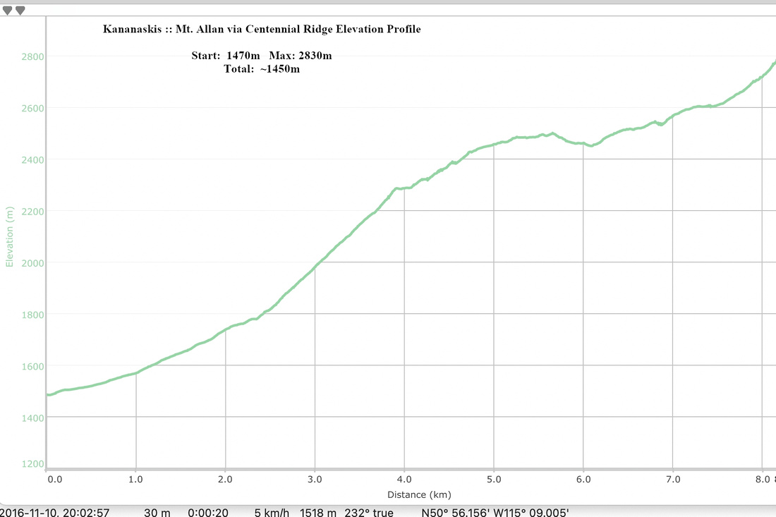 Mt. Allan via Centennial Ridge Elevation Profile