Google Map |
Rockies :: Canmore and Bow Valley ::Mt. Collembola / Jubilee Tarns |
GPS Track |
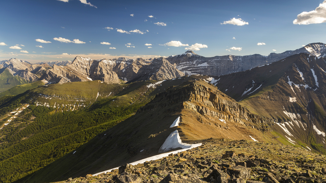 
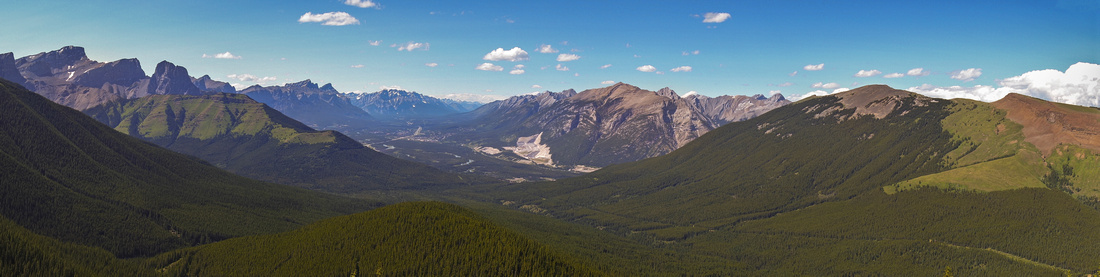
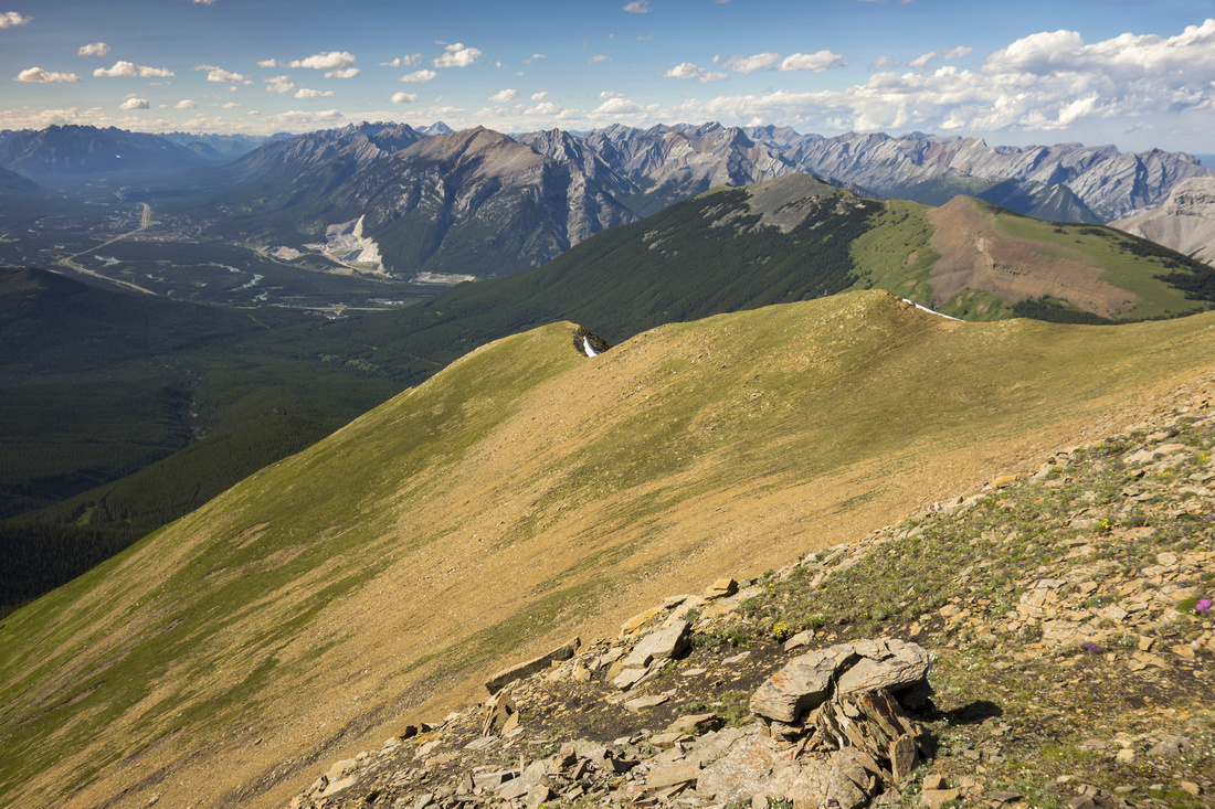
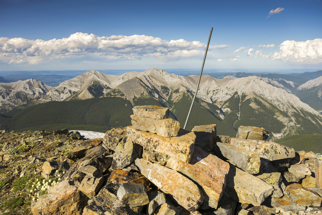
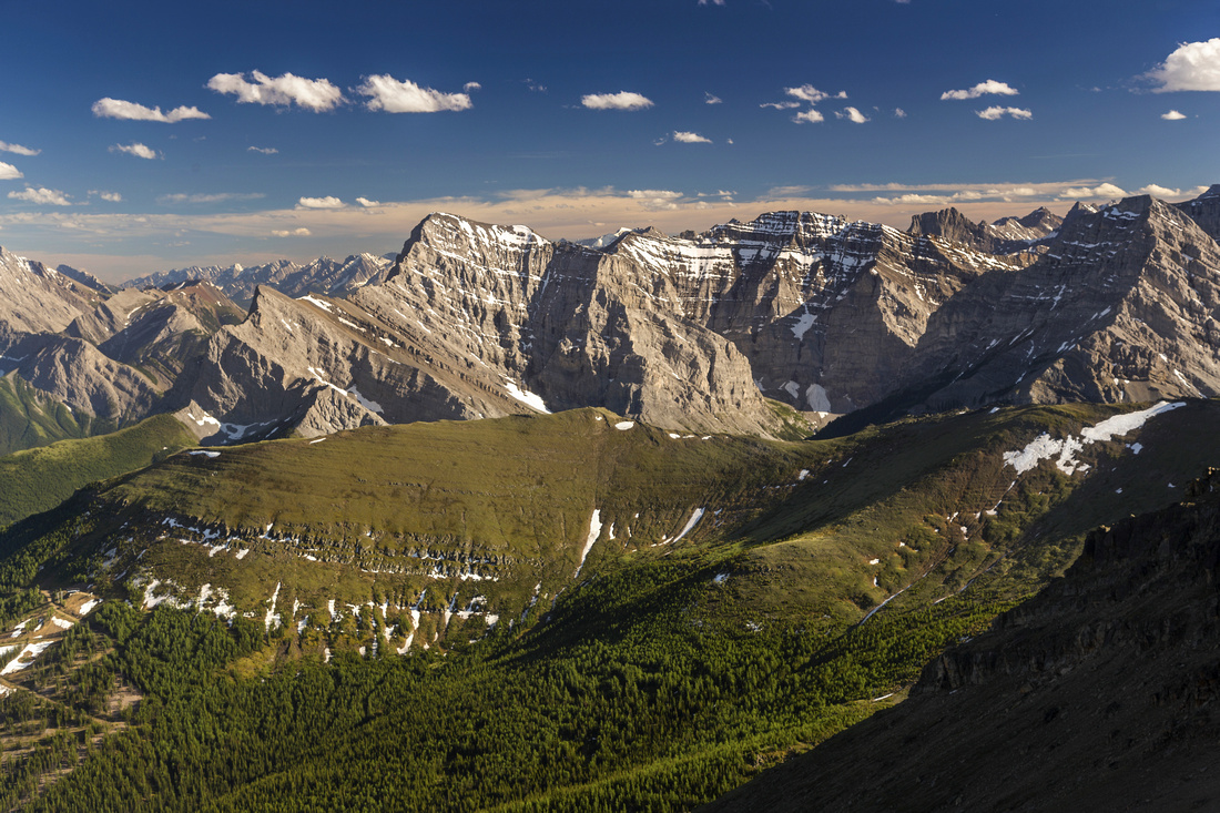
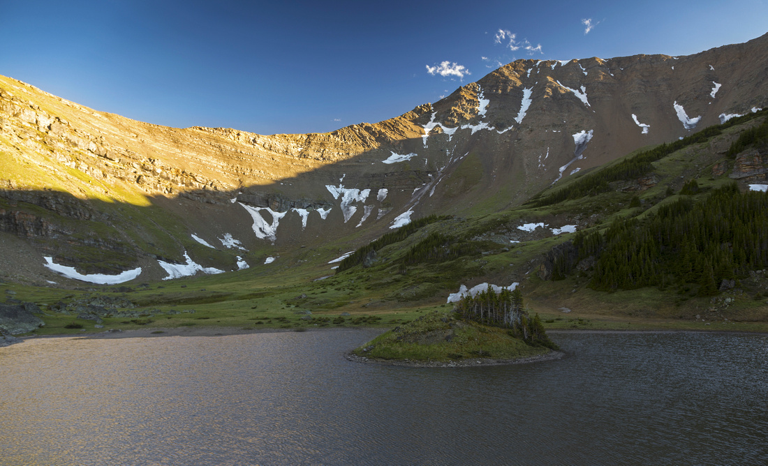
View south from Collembola Summit to Centennial Ridge and Kananaskis Peaks along Hwy40 corridor. Mount Bogart just right of center |
|||
| Trip Summary | |||
June 27, 2017
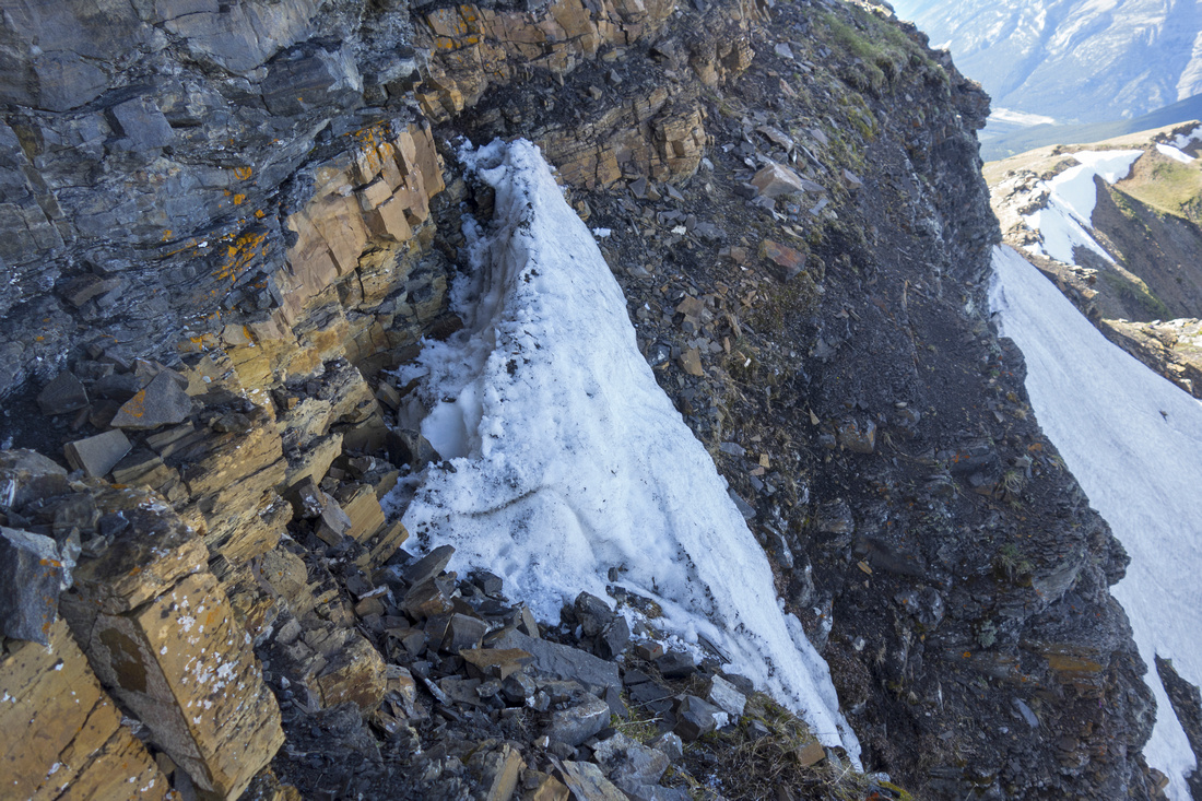
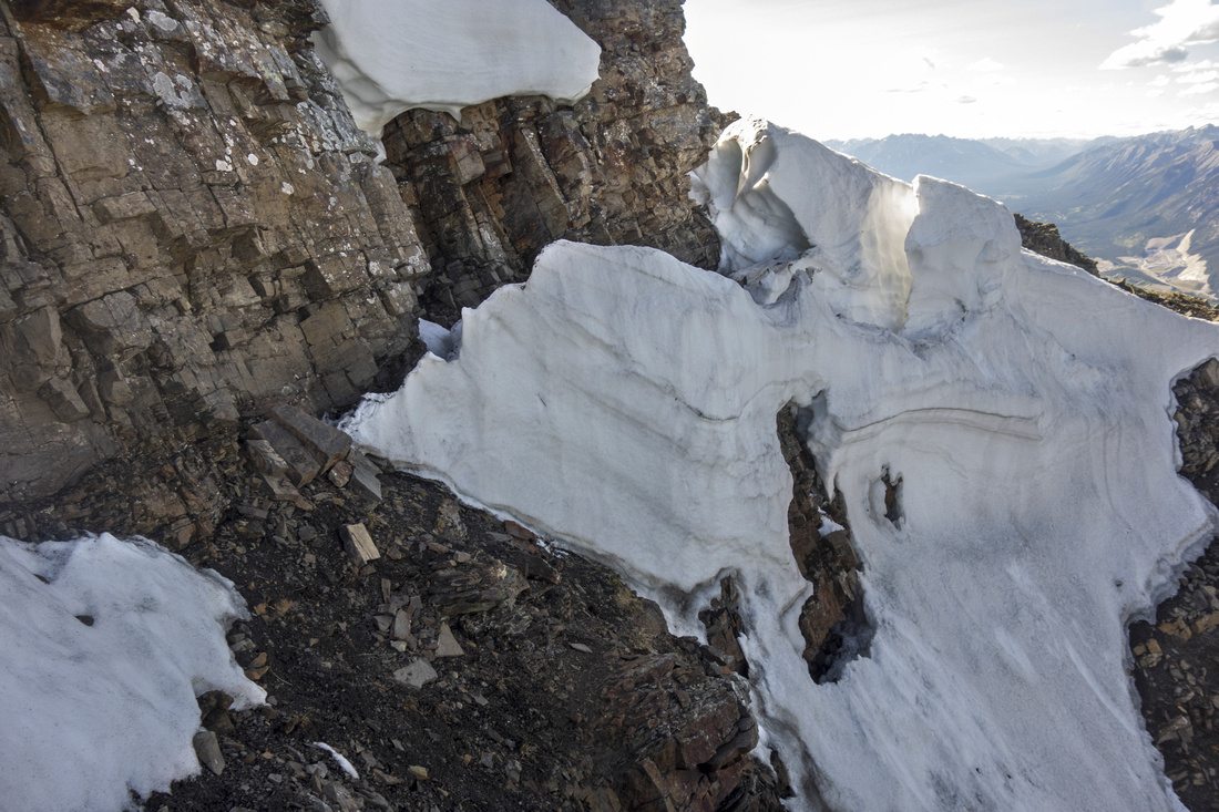
Mount Collembola is more demanding ascent from nearby more popular Mount Allan. Both can be combined in a long-day, but pleasant alternative for Collembola is to return via pocket valley sandwiched between two mountains and visit 3 small lakes -- Jubilee Tarns. Canmore side approach is more practical for this option. Final summit block when approaching from north is guarded with technical cliff band, forcing detour to east face. Scrambling is easy/moderate when dry, but in early season snow patches and/or stubborn cornice can make it much more difficult or even non-feasible. In that case summit can still be obtained by contouring on Jubilee Valley side, although this requires considerable elevation loss and much side-sloping and unpleasant trashing. Scenery is fabulous throughout. Note that Centennial Trail used for approach is closed till June 21.
Park at Banff Gate (Skogan Pass Trailhead) exiting Trans-Canada at Dead Man Flat overpass. Marked start of Centennial Trail is reached after 10-15 minutes, just after trail crosses rebuilt bridge across Pigeon creek; turn left. Next part is spent hiking ~6km up the old fire road. This part is not overly exciting, but progress is fast and couple of clearings provide scenic interest. In upper part this road steepens up considerably; watch for mountain bikers coming down. After ~1.5 hours of steady hiking grassy cone of Collembola lower ridge comes into view. Watch for cairn on left side and leave Centennial trail. This section is bushy and trail marginal at best, but it is mercifully over fast. Rest of travel is obvious: Follow the ridge to the summit. In lower part it is quite steep; constant 30-35 degree angle that will tire you. There are several short cliff bands that pose no real challenge, but it is not entirely hiking with hands in your pockets either. Ridge flattens out and Jubilee Valley comes into view. Note that at any time you could descend grassy slopes on the right side.
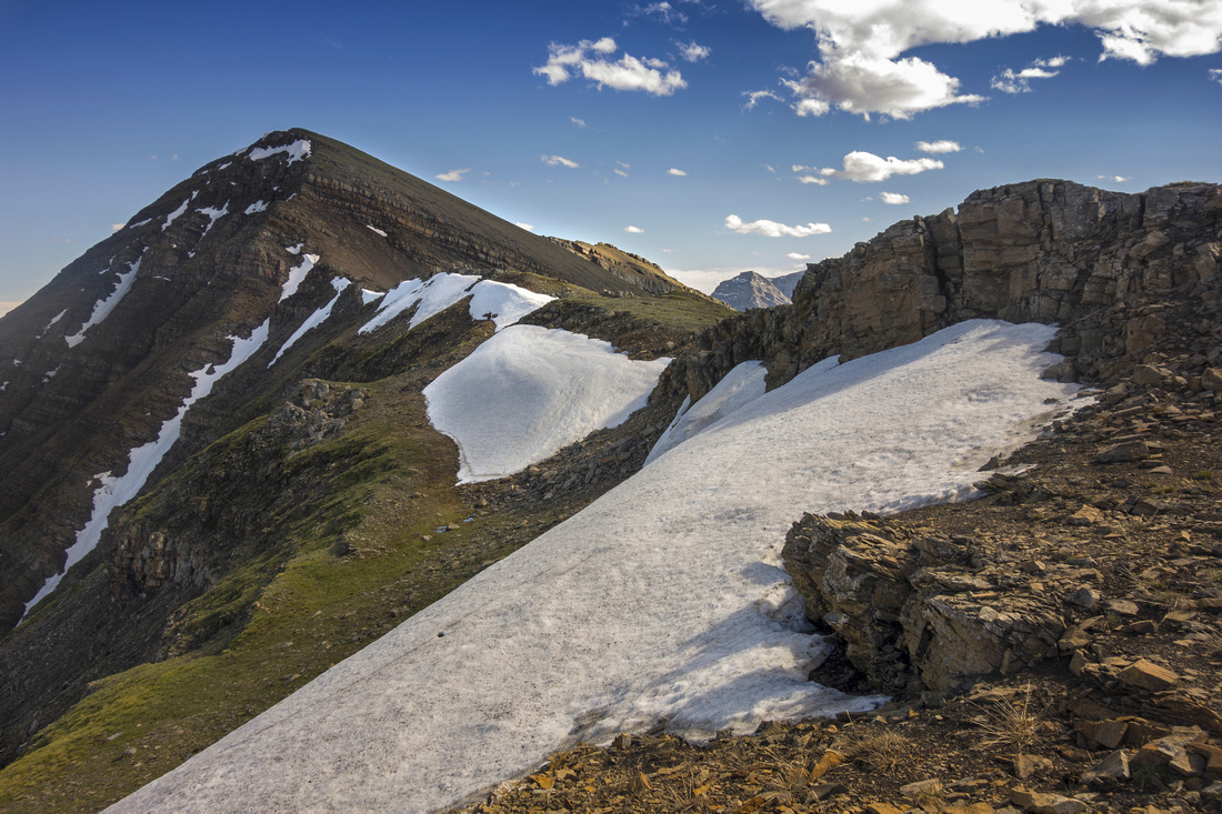
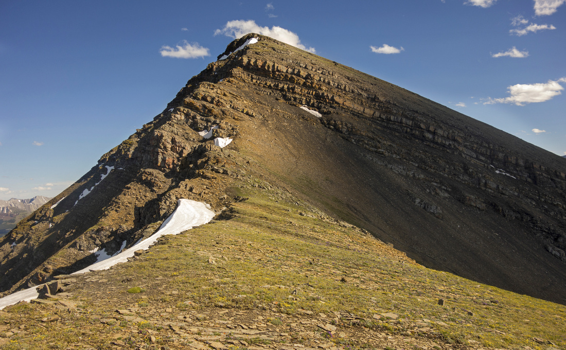
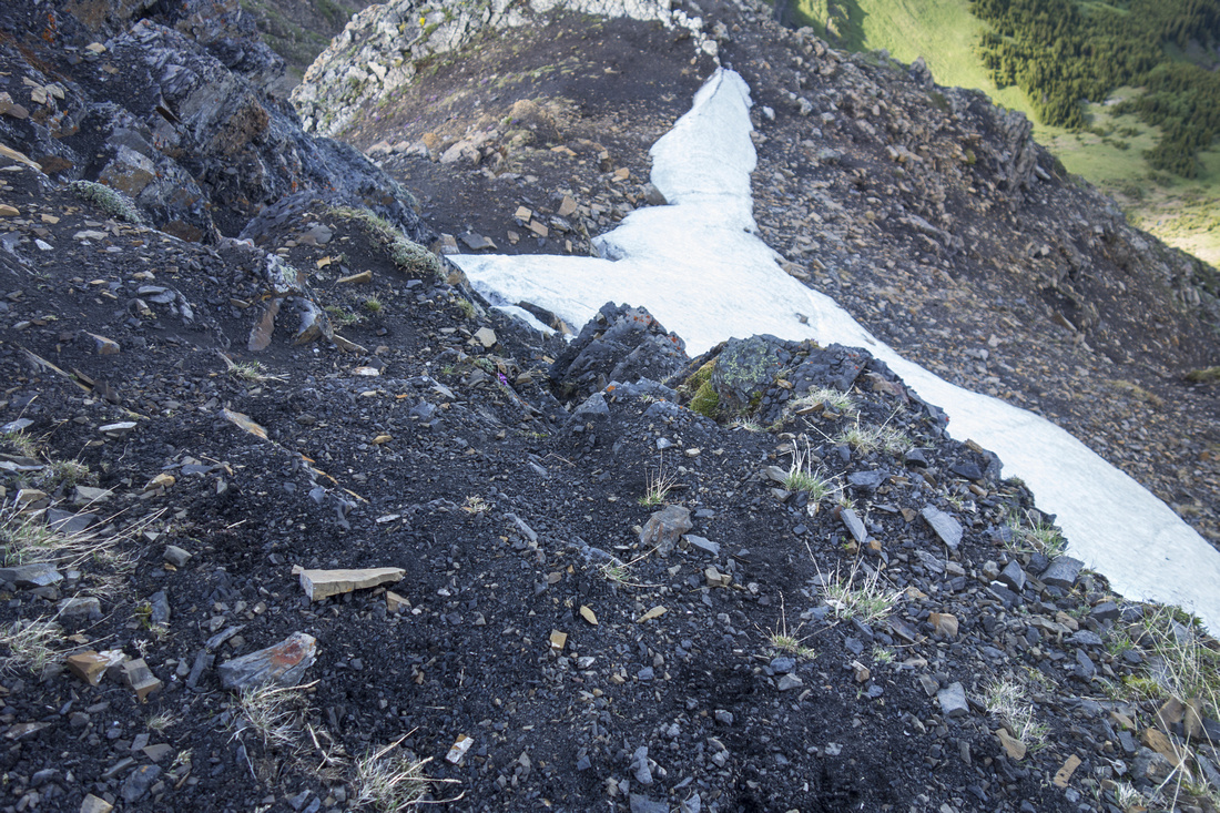
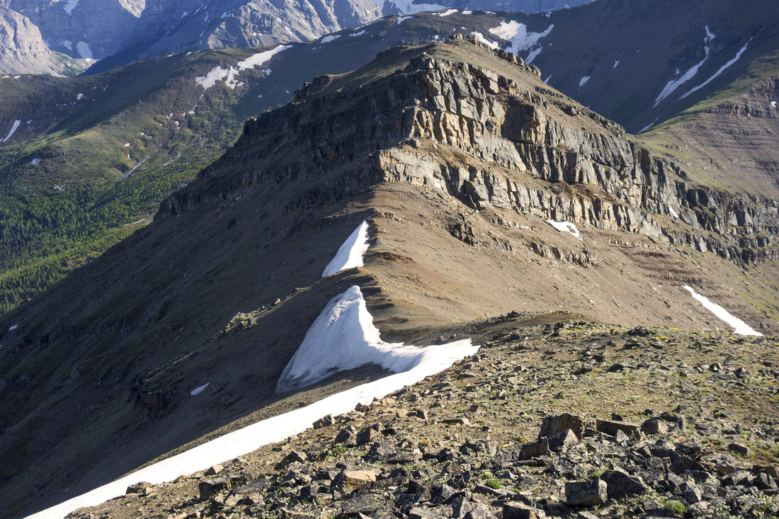
Final summit block is guarded by cliff band that from distance looks like it could be scrambled, but upon coming close it becomes apparent there is no easy way up. Trash up the lower part on talus, then just below the cliff band move left to east face. It looks fairly serious, but there is reasonable way up. First ascend the rock step to distinct ledge above and follow to the left. In central part this ledge narrows, and you might need to hug the rock in order to pass safely. At the end of this ledge turn right and ascend dirty gully for a short time only. It is wrong to follow this gully all the way; higher up it becomes more tricky and exposed, finishing with cliffs and potential cornice early in the season. Instead climb only 4-5 m from lower ledge, then turn right onto the next one. This ledge can be followed without any trouble all the way back to the ridge; it exits directly above the cliff band. Turn left and hike up remainder of gently angled grassy slope to the summit.
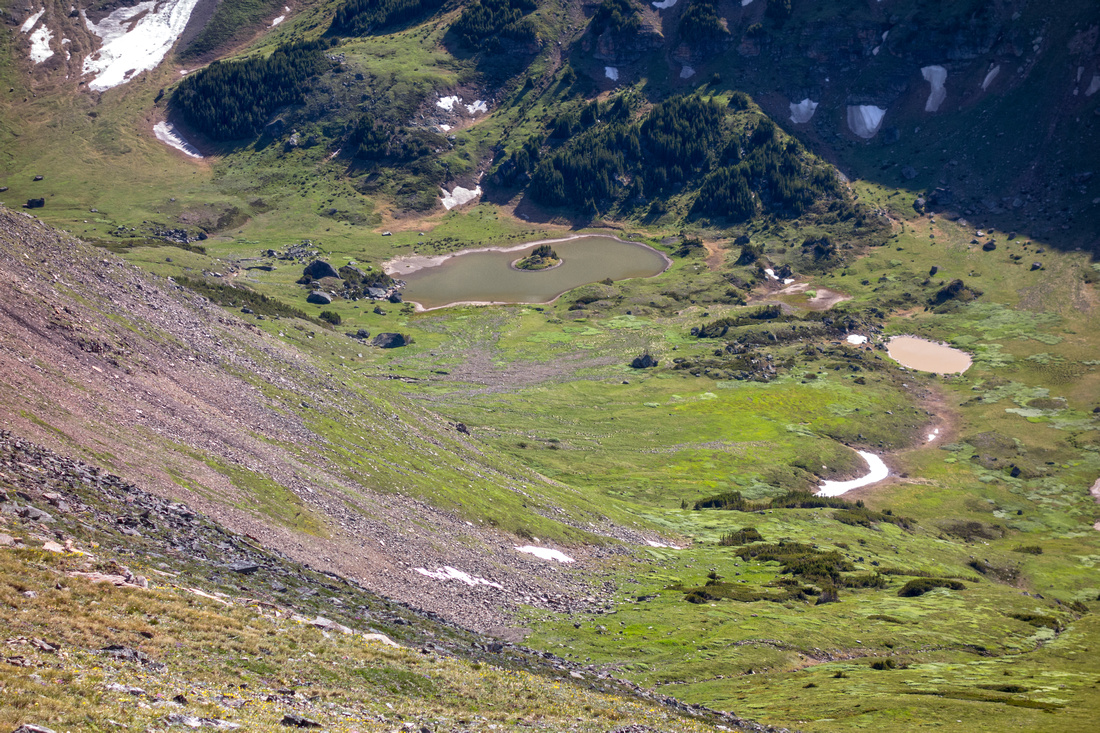
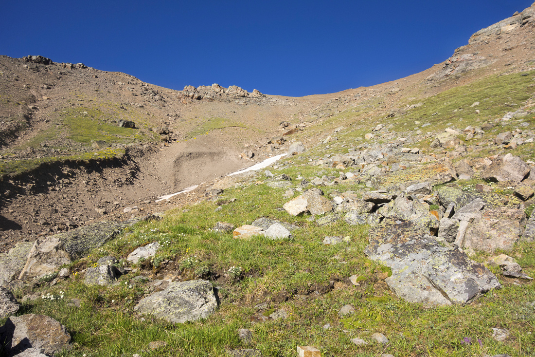
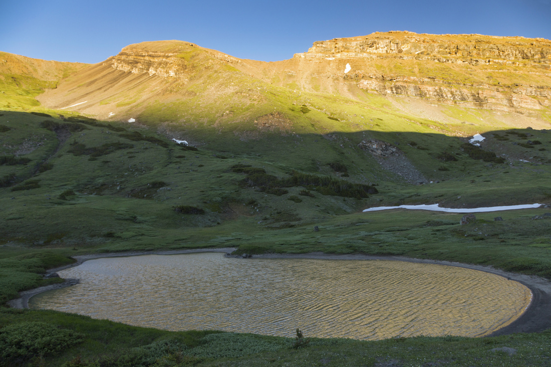
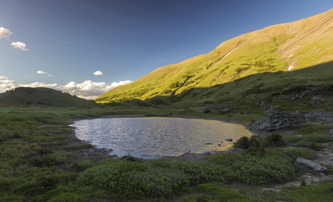
From Collembola summit descent to Jubilee Tarns is obvious. Drop down shale slope to the col directly below, then turn right and trash down. This slope offers no difficulties but there are minor rock outcroppings in lower part; stay on skier left side of sizeable drainage heading for largest Jubilee Tarn. (If continuing for Mt. Allan, easiest way to scramble up lower Collembola summit from the col is to head left; hidden, but cairned trail through the rock exists). You will lose over 500m vertical to the valley floor. Meadows around the tarns are very idyllic and beg for a break. This is also prime bear territory; so take caution. On hike out it is best to stay on the right side of the valley, passing two smaller Jubilee Tarns along the way. There is no trail, but way is obvious. Finally descend grassy slopes interspersed with trees and intercept Centennial Trail about 1.5km from the point where you left and started ascending Collembola ridge and hike out.
|
|
Gallery |
|||
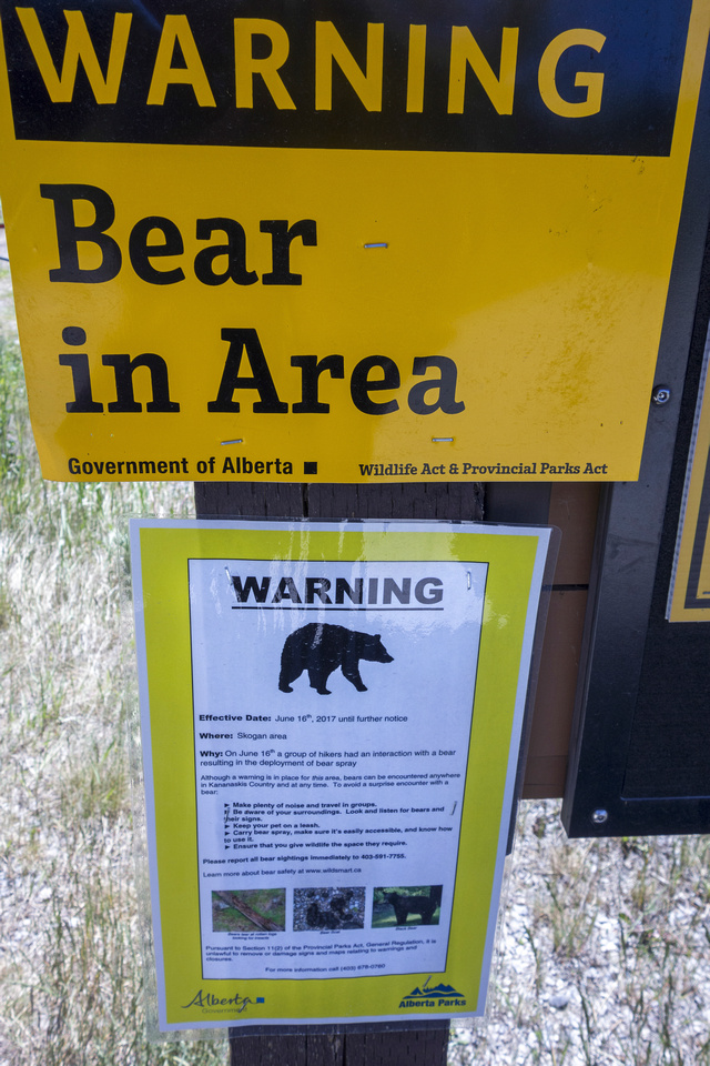 Bear Warning at Banff Gate Trailhead
 |
|||
|
|
|||
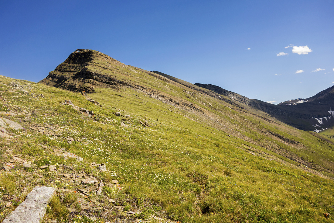
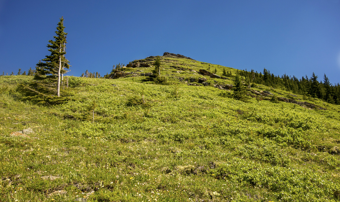 Steep grassy slopes on lower Collembola Ridge
 |
|||
|
|
|||
|
|
|||
|
|
|||
|
|
|||
|
|
|||
|
|
|||
|
|
|||
|
|
|||
|
|
|||
|
|
|||
|
|
|||
|
|
|||
|
|
|||
|
|
|||
|
|
|||
|
|
|||
|
|
|||
|
|
|||
|
|
|||
|
|
Abstract
| Overall Difficulty | D6 | Moderate scrambling on final summit block with route-finding; tricky or even dangerous when not dry. Considerable overall elevation gain. Steep talus slopes and off-trail hiking | |||
| Snow Factor | S4 |
Centennial Trail closed until June 21 by which time most snow should be melted. Snow cornice might persist on east face of final summit block and make final scramble difficult or impossible. |
|||
| Scenery |
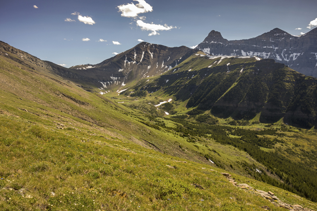
Great view of Canmore area peaks above Treeline, including Wind Ridge, Three Sisters, Pigeon Mountain, Mount Allan and Lougheed Towers. Olympic Summit above Nakiska and length of Centennial Ridge. Picturesque Jubilee Tarns in alpine cirque between Collembola and Mount Allan. |
||||
| Trail/Marking | Good / None | Official Centennial Trail with markers in lower part, none after | |||
| Suggested Time | 9 hr | Return time for return via Jubilee Tarns. If extending to Mount Allan, add 1-2 hours | |||
| Elevation | Start: 1430m Max: 2780m Total: 1490 m | Round Trip: 21km | |||
| Gear | Full hiking boots. Poles essential. Gaiters helpful for talus descent to Jubilee Tarns | ||||
| Water | Dry Hike. Jubilee Tarns can be used in emergency but water must be boiled. Carry 3-4L | ||||
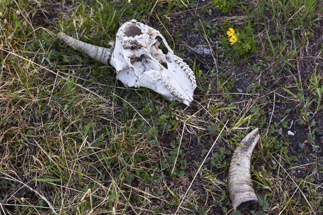
| Dog Friendly | No | Crux scramble on Collembola east face might prove too difficult. Area frequented by mountain sheep and bears | |||
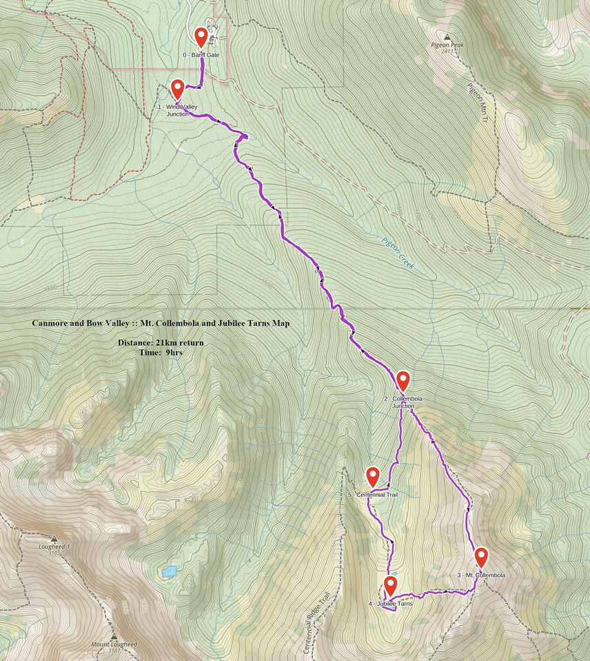 Mt. Collembola and Jubilee Tarns GAIA Map
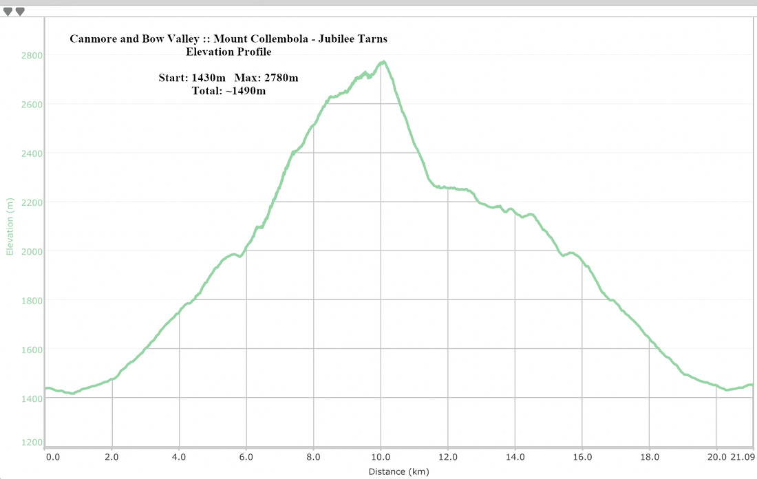 Collembola - Jubilee Tarns Elevation Profile