Google Map |
Rockies :: Canmore and Bow Valley ::Pigeon Mountain |
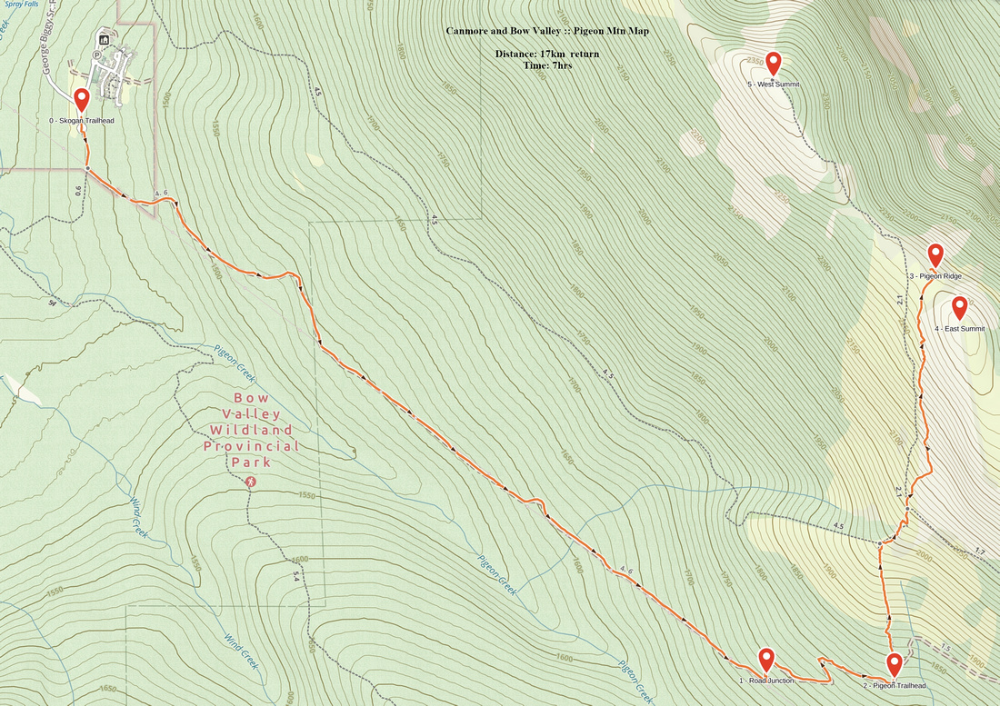
GPS Track |
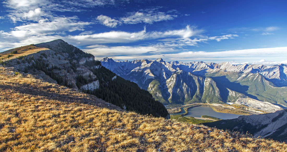 
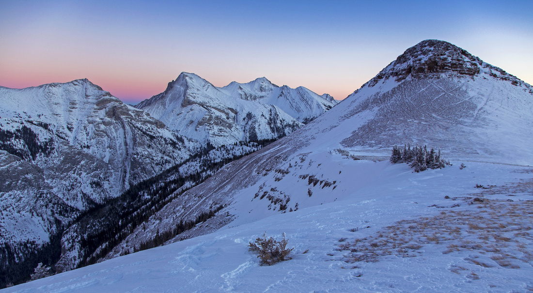
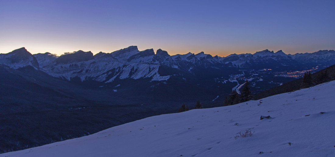
Summit ridge on Pigeon mountain showing gentle ascent slopes to higher west summit. Lac De Arcs lower right |
|||
| Trip Summary | |||
October 10, 2014
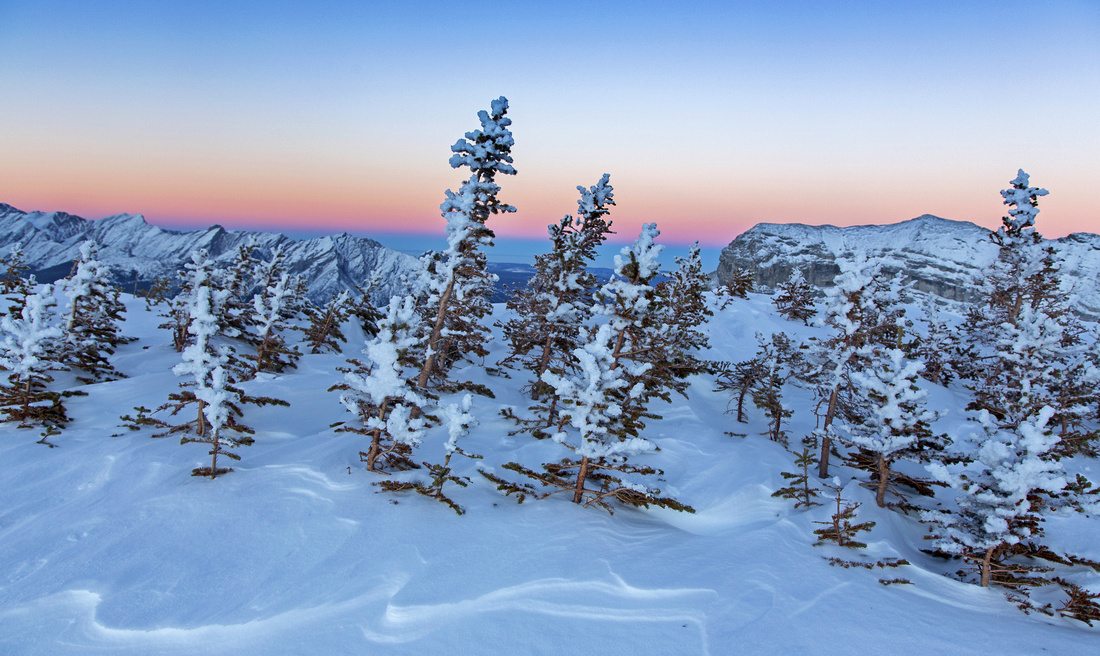
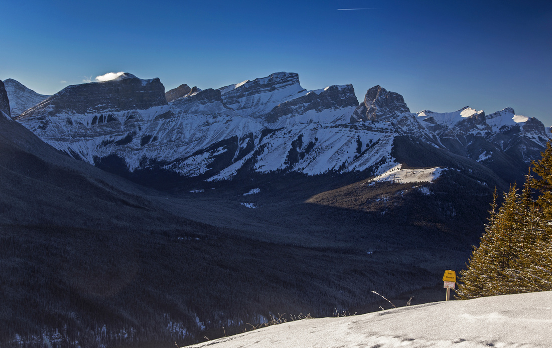
When seen from Trans-Canada highway driving by Lac De Arcs, Pigeon mountain cliffs appear formidable. Tucked behind on the other side are gentle grassy slopes that can be ascended by fit hikers without much trouble. It is still fairly strenuous undertaking as it entails around 1000 vertical meters of elevation. Prerequisite is (too) long trudge along the Skogan pass "trail" -- rather mundane walk on old forest road, mostly under the powerline. However once you reach the treeline trip becomes very scenic. Highlight of the day is summit ridgewalk - over a kilometer hands-in-your-pockets walk along gently rising ridge with 360 views. This ridge boasts 2 highpoints: West one is higher and this is official Pigeon mountain summit. East one is bit more challenging as band of eroded cliffs must be scaled, but it does not present significant challenge. Trip is feasible year-round. In winter Skogan Pass trail is shared with cross-country skiers. Beware of cougars who frequent this area. Note that trail is closed May 1 - June 15 due to wild sheep lambing. They can often be seen in upper grassy slopes curiously staring at hikers. Take Dead Man's Flat exit from Trans-Canada highway and drive south (up) for few minutes. Parking and trailhead is on the right side immediately past Banff Gate Mountain resort junction. Hike to the powerline and turn left. Now you are on Skogan Pass trail. Follow uphill this old forest road; most of the way it stays under the powerline with 2 detours north (left), of which 1st one is much longer. Critical part is fork in this road, about an hour of brisk pace from the parking. This junction is not marked; take the left branch. Couple of switchbacks later be on alert for trail branching to the left; sign about seasonal area closure is here. This is Pigeon Mountain trailhead. Trail gains elevation briskly and reaches treeline in 10 minutes or so. Open grassy slopes rise above showing easy ascent slopes. Rise to first shoulder leads to junction with deactivated "Touch of Class" mountain biking trail. This is excellent spot for a breather as fantastic views back to Three Sisters, Wind Ridge and Windtower open behind. Continuing up trail cuts towards the cliffs, then turns left and climbs to the low point on the ridge -- saddle between two summits. Most people first visit the east summit following distinct trail through eroded cliffband. Hiking poles are an asset here. On top grassy plateau leads to weather station. Entire length of Skogan trail can be observed, while further to the east Mt. McGillivray looks fantastic. True summit is some 20-30 minutes of easy ridgewalk from the saddle. Views of Bow Valley and Canmore are spectacular. Return the same way, but for adventurous hikers that need no trail it is possible to descend west ridge. There is no trail and quite a bit of bushwhacking that eventually ends somewhere in vicinity of old ski-hill above Banff Gate resort. GPS is must for this alternate descent that can not really be recommended. |
|
Gallery |
|||
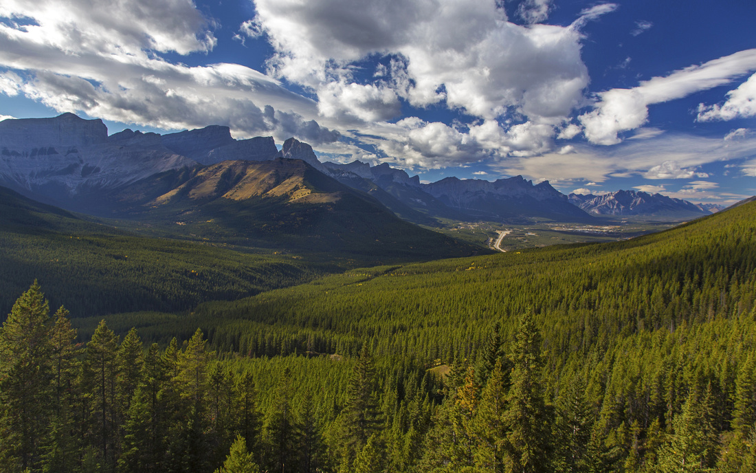 Forested Skogan pass trail and Bow Valley at treeline
 |
|||
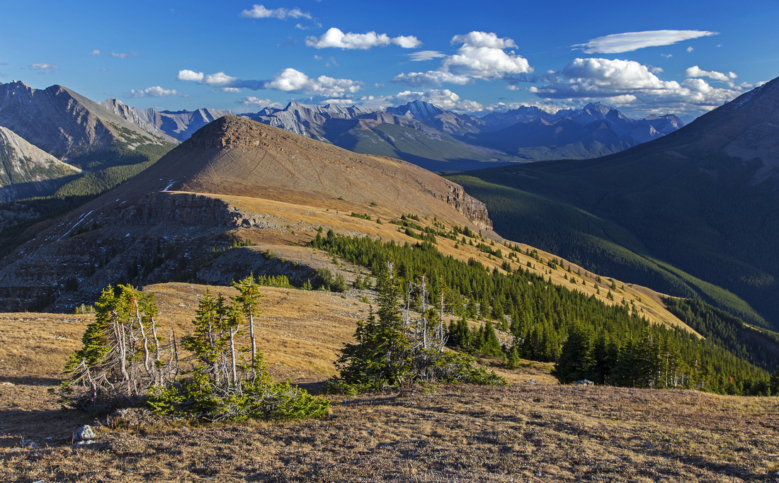 Pigeon ridge looking back to lower (east) summit
 |
|||
|
|
|||
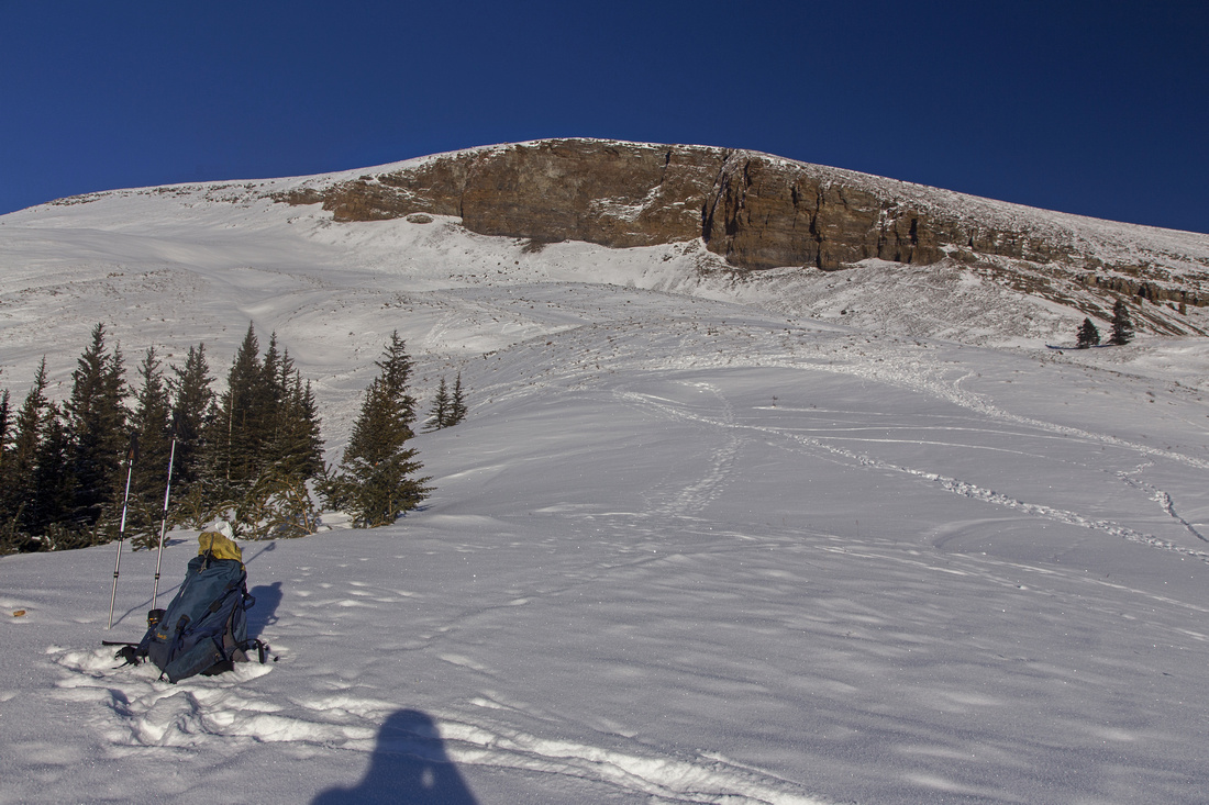 Mid-ascent slopes. Tracks in the snow are made by goats
 |
|||
 Windswept Pigeon ridge at low point between two summits
 |
|||
 View back to east summit while hiking towards highest point
 |
|||
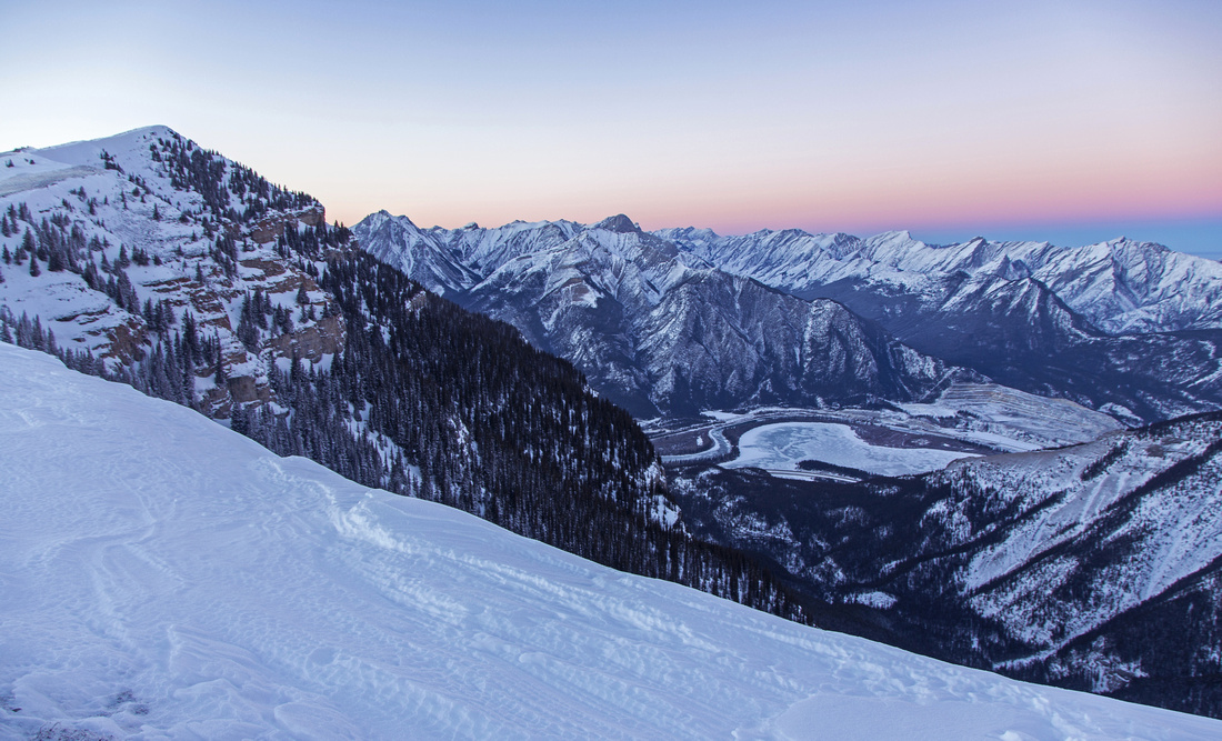 View from the ridge to Lac De Arcs. Pigeon Mtn far left
 |
|||
|
|
Abstract
| Overall Difficulty | D4 | Steep ascent on mix of grass and talus ending with gentle ridgewalk to true (west) summit. Optional east (lower) summit is an easy scramble | |||
| Snow Factor | S3 | Ascent slopes are often windswept and do not pose avalanche danger. Steep sections and some side-sloping | |||
| Scenery | Fantasic panoramic views of Bow Valley and nearby peaks, including Three Sisters. Bird-eye view of Lac De Arcs. Great view of infrequently ascended Mt. McGillivray to the east. | ||||
| Trail/Marking | Good | Initial logging road walk under powerline with one unmarked junction. Good trail to treeline eventually fades near the ridge, but way is obvious. | |||
| Suggested Time | 6 - 7 hr | Includes visit to both summits. Travel in winter conditions will be slower -- add at least an hour | |||
| Elevation | Start: 1430 m Max: 2400 m Total: ~1000 m | Round Trip: ~17 km | |||
| Gear | Full hiking boots for ankle support. Hiking poles essential for stability. Snowshoes often not required in winter for the alpine | ||||
| Water | Dry hike. Recommended: Carry 2-3L | ||||
| Dog Friendly | Yes | No on-leash restrictions. Be on alert for cougars. Large herd of mountain goats makes lower slopes home - please keep control of your pet | |||
 Pigeon Mtn GAIA Map
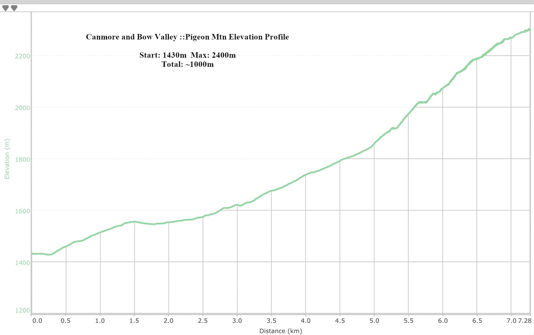 Pigeon Mtn Elevation Profile