Google Map |
Rockies :: Canmore and Bow Valley ::Wind Ridge |
GPS Track |
North end of Wind Ridge, above the crux rock step |
|||
| Trip Summary | |||
November 29, 2016
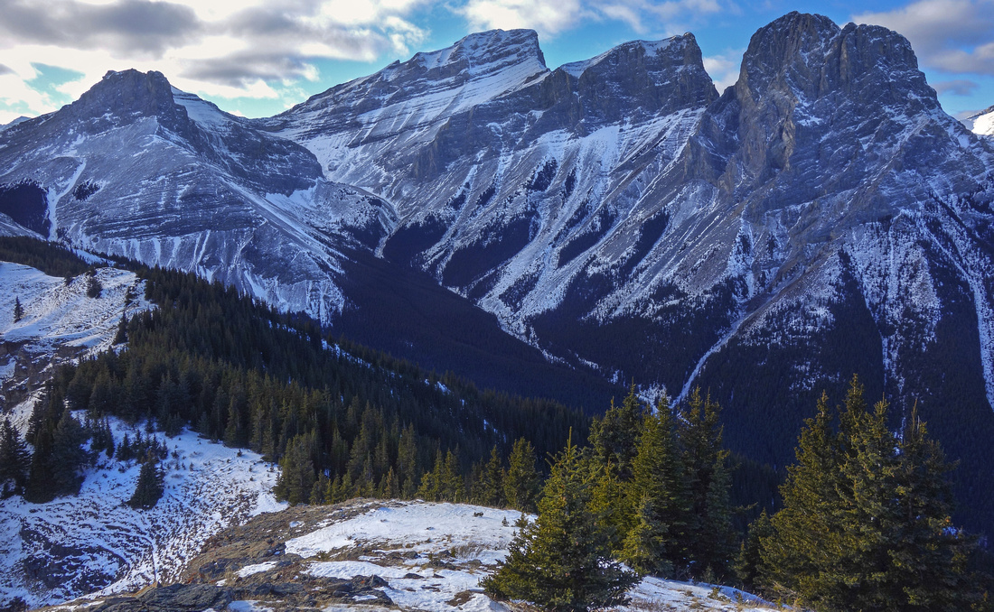
Wind Ridge is the craggy hump above Wind Valley. It appears dwarfed by neighbor Windtower and Rimwall, but offers respectable views nevertheless. Approach utilizes network of deactivated forest roads and quickly leads to treeline. Ascent is steep, but scenic reward more than adequate. Most people return the same way after reaching the high point, but for experienced hikers that need no trails full traverse with loop return via West Wind Valley is highly recommended. Only real difficulty is brief scramble up rock bluff in upper part of the ascent; it is semi exposed, and requires brief class 3 maneuver but alternate non-technical bypass exists. Note that area is important wildlife corridor and closed to human traffic Dec 1 - June 15.
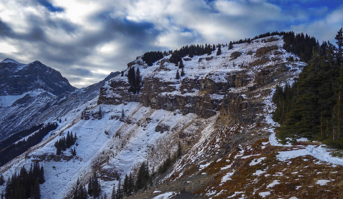
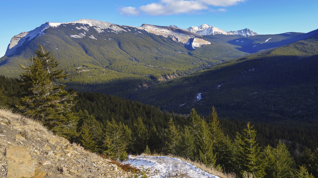
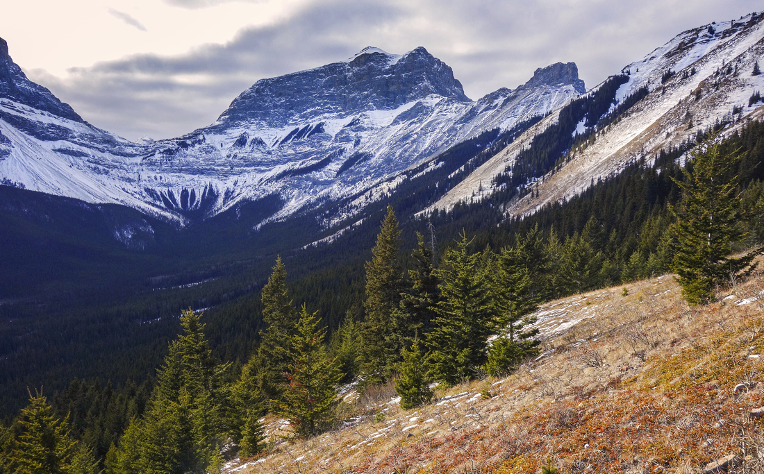
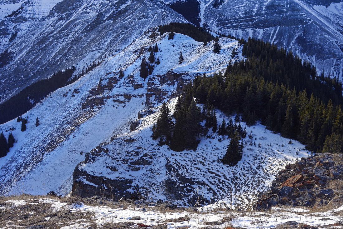
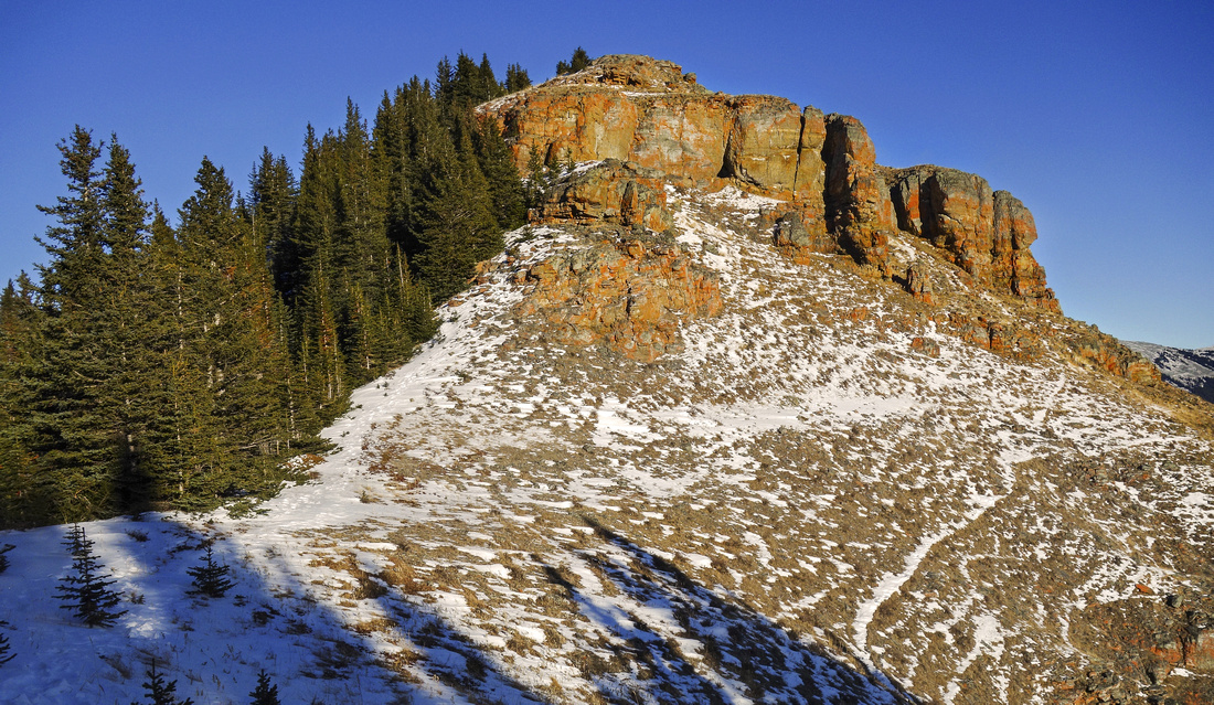
Parking is at end of Banff Gate access road at Dead Man' Flats. It is the same trailhead as for Mt. Collembola, Pigeon Mountain and Skogan Pass. Hike for few minutes to powerline, then continue straight and descend to bridge over Pigeon creek, rebuilt post 2013 floods; marked Centennial ridge junction is on the other side. Turn right and follow deactivated forest road to crossing of Wind Creek. Bridge has been destroyed and there is lots of deadfall, but easiest spot to cross is flagged. Continue on road on the other side heading south towards Wind Valley ignoring all side roads on the right side. After some 20 minutes past Wind Creek is the junction: turn right and head up (straight is Wind Valley and your return path if you chose to do the full loop). Elevation gain starts now and after couple of zigs road reverts to trail and reaches treeline. Fantastic views back to Skogan Pass corridor and Pigeon Mountain are good reason for first photo break, specially as real elevation gain is about to begin. Follow well beaten trail rising in several steps towards main ridge visible above. Infamous crux is reached after steep and lose dirt section, than can be quite tricky if trail is icy, specially on descent. Crux is best tackled head on; initial step is the hardest. Alternate option is to head right along the base of crags for couple of minutes (flags), then at corner turn left and ascend steep terrain. Cliffs have been eroded at this point, but it is quite lose and unpleasant. This bypass eventually exits to "main" trail above the crux step; it is less direct, and really not worth the trouble. Cairn marking south end of Wind Ridge is reached some 15-20 minutes past the crux step. Great view to the other side of Canmore and Bow Valley unfolds, while Stewart Creek and Three Sisters are directly across; entire scramble route up Middle Sister is visible. Continue south for few minutes to ridge high-point at top of drop-off. This is the best viewpoint of the day, and logical turnaround point if not doing the loop traverse.
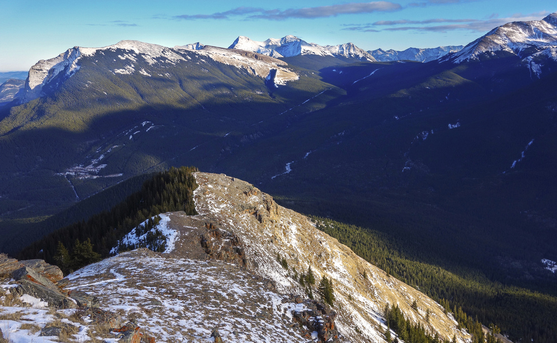
If continuing, find broken trail in the forest on the right (west) side, but cliffs can also be downclimbed by competent scramblers. Remainder of the ridge is best navigated if staying right on the crest, although several --mostly animal -- trails can be found on the left side. Traverse couple of bumps before finally dropping to forested saddle below Rimwall; about 20 minutes past the high-point. Turn left and trash down open slopes aiming towards the rightmost meadow in Wind Valley below. There are no trails and terrain is steep; with non-favorable snow cover, this section could be dangerous. Otherwise it is just steep off-trail trash. Aim to intersect drainage to your left side. Crossing of this drainage is more involved than it appears; easiest spot is below little aspen stand, and well defined trail appears. Use the provided GPS track (waypoint "4 - Drainage Crossing") if in doubt. Past the crossing side slope out of the drainage, then descend more or less straight toward the meadow. Final bit is forested; it is easiest to follow little ramp to the right, then with little luck find bits of trail and follow to the meadow. Upper Wind Valley trail is intercepted here; turn left and hike out, reaching the junction with main trail in about 1/2 hour crossing one more rather pretty meadow along the way. If time permits, upper Wind Valley is great spot for further exploration; most trails found are made by hunters. |
|
Gallery |
|||
 Looking back to Pigeon Mtn as trail exits treeline
 |
|||
 West Wind pass (L) and Rimwall (R) from treeline
 |
|||
|
|
|||
 View of Lougheed Towers near ridge high-point
 |
|||
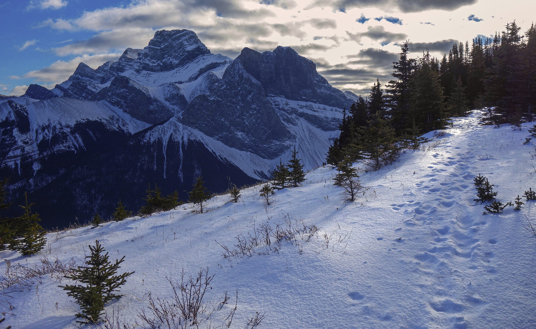
 Stewart Creek and 3 Sisters at ridge high-point; Orphan left
 |
|||
 South end of the ridge; faint trail exists close to the crest
 |
|||
 Looking back at ridge high-point; trail skirts cliffs on forested left side
 |
|||
|
|

Abstract
| Overall Difficulty | D4 | Steep sections above treeline. One (avoidable) class 3 rock step. Off-trail trashing and some route-finding on optional loop return via south Wind Valley | |||
| Snow Factor | S3 |
Area closed after Dec 1, but in early snow years steep east slopes could be avalanche prone. Possibility of slippery/icy sections in shoulder season |
|||
| Scenery |
Fantastic views of Lougheed Towers, Windtower and Three Sisters. Bow Valley corridor from Exshaw to Canmore. Skogan Pass corridor linking Dead Man Flats and Ribbon Creek area |
||||
| Trail/Marking | Good / None | Good trail to north end of the ridge and in upper Wind Valley; off trail for ridge traverse and optional loop descent | |||
| Suggested Time | 6 hr | Return time for loop return; 4-5 hrs if descending the same way | |||
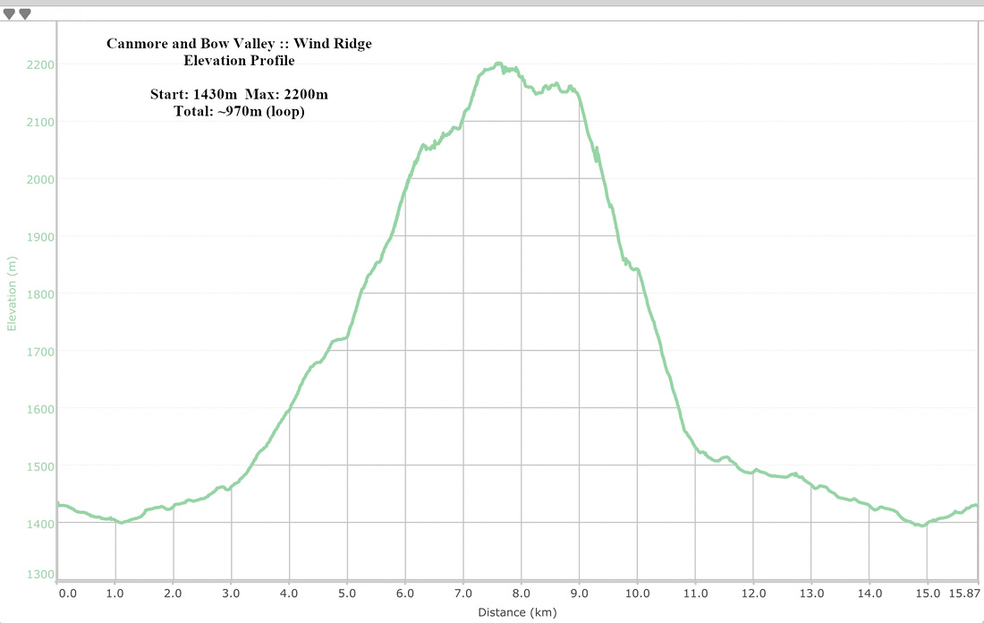
| Elevation | Start: 1430m Max: 2200m Total: 970 m (loop) | Round Trip: 16km (loop) | |||
| Gear | Full hiking boots preferred. Poles recommended for stability on steep slopes above treeline (specially if doing full loop). Micro-spikes for icy sections in shoulder season; snowshoes depending on conditions in early snow years | ||||
| Water | Pigeon and Wind creeks in the valley, but ridge is dry. Carry ~2L | ||||
| Dog Friendly | Yes | Wind Valley sometimes frequented by bears. Might need help (push) up crux rock step | |||
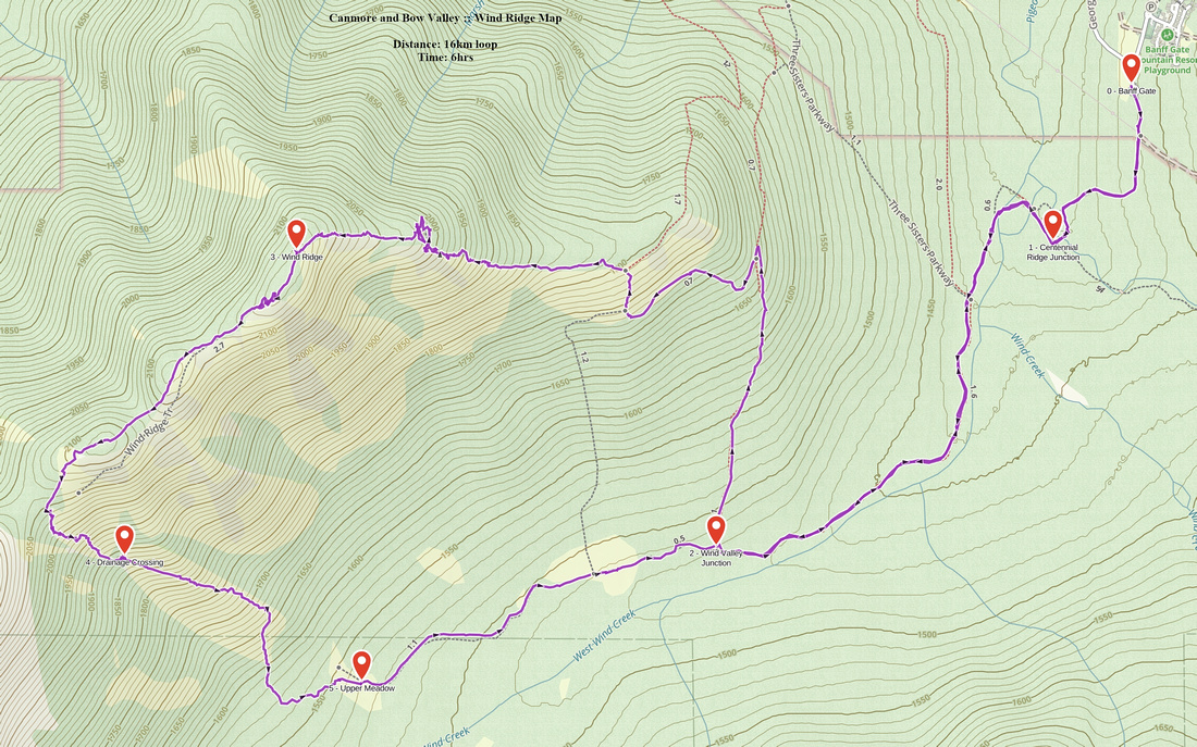 Wind Ridge GAIA Map
 Wind Ridge Elevation Profile