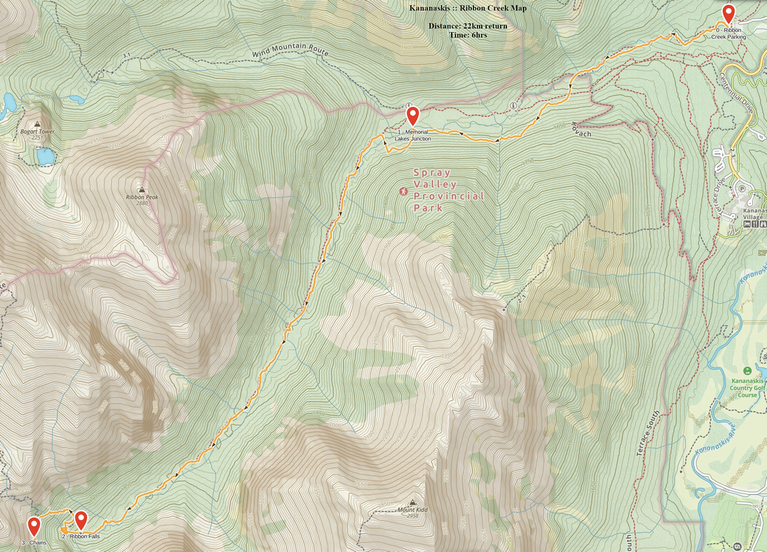
Google Map |
Rockies :: Kananaskis :: Ribbon Creek |
GPS Track |
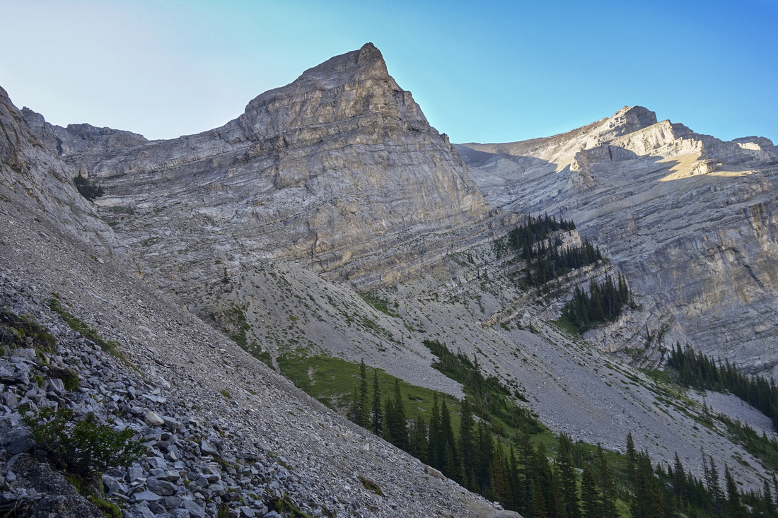
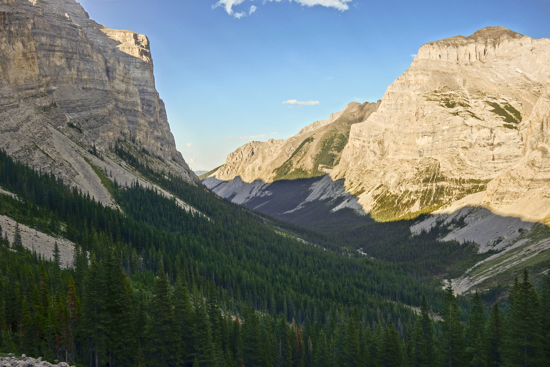  Ribbon Creek valley from upper Headwall
 |
|||
| Trip Summary | |||
July 20, 2018Ribbon Creek is one of most popular K-country trails. Well defined and officially maintained trail leads deep into the valley sandwiched between Mt. Kidd and Ribbon Peak/Mt. Bogart. First half of the trail was badly damaged during historical 2013 spring floods, but has been rebuilt with several new bridges and completely re-routed section between Kovach trail junction (km 2.5) and Bike Locks (km 4). Unless staying at nearby back-country campground, spectacular Ribbon Falls reached around 10km are culmination of the journey and logical turnaround point. Past the falls trail switchbacks up the forest, then traverses talus slope towards the headwall below Ribbon Lake. There is no easy way up this cliff; before the chains were installed several fatalities have occurred. Even with chains it is still dangerous, in particular upper 5-6m of near vertical rock bulging in the middle - very difficult if carrying overnight back. Recommended way to visit Ribbon Lake is either via Galatea Lakes/Guinn Pass or from the west via South Buller Pass. Talus slopes above Ribbon Falls are also scramblers access point to moderately rated Kane scramble up Mt. Bogart.
This hike is about the journey - rushing Ribbon creek with many cascades and small waterfalls constantly makes you go stop and go check what it's doing. It is also great leg fitness exercise for fast walkers or trail runners. First 4km are also popular with mountain bikers. Black bears frequent the valley in summer months, in particular area near North Ribbon Creek (Memorial Lakes) junction below south slopes of Mt. Allan.
Update Summer '23: Although I haven't been there in person, there is now apparently Via Ferrata at Ribbon Cliffs, making it less dangerous. I plan to check it in some point at which time I will update this page. |
|
Gallery |
|||
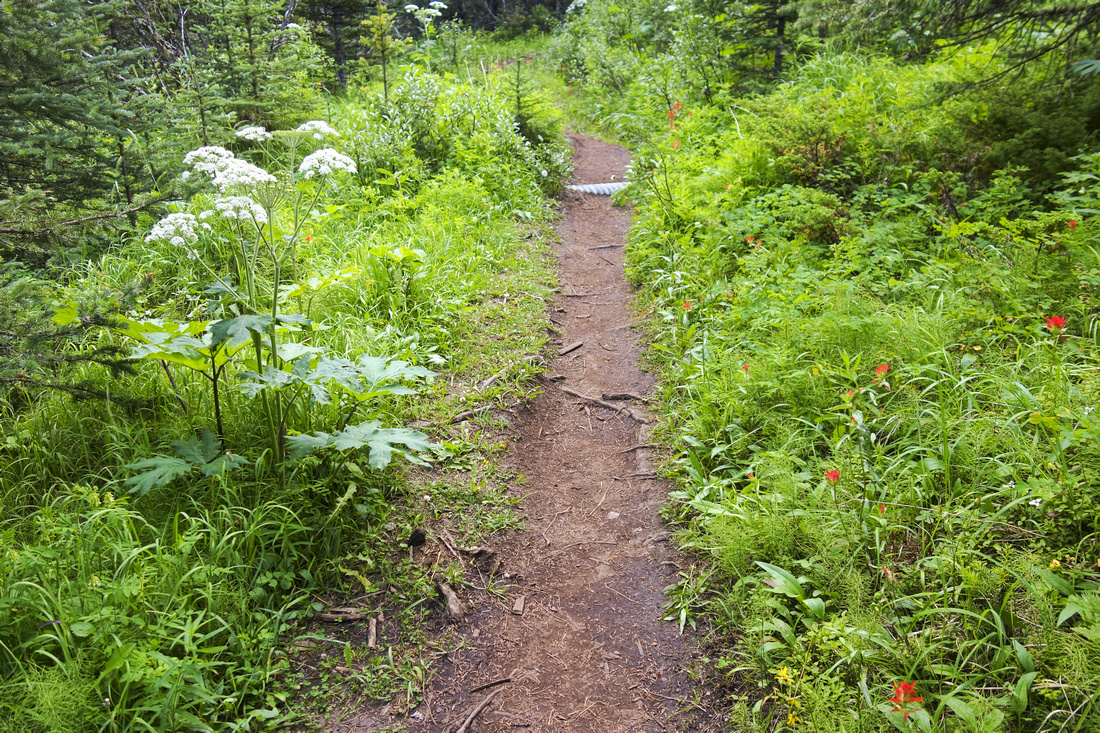
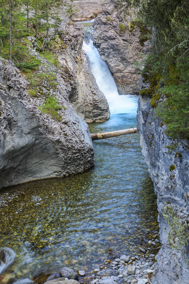 Small Waterfalls past North Ribbon Creek Junction
 |
|||
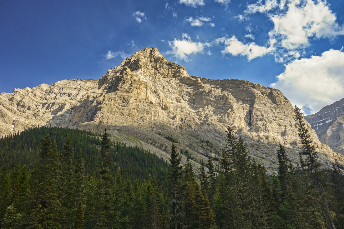 View across the canyon to Mt. Kidd; scramble access route is from the other side
 |
|||
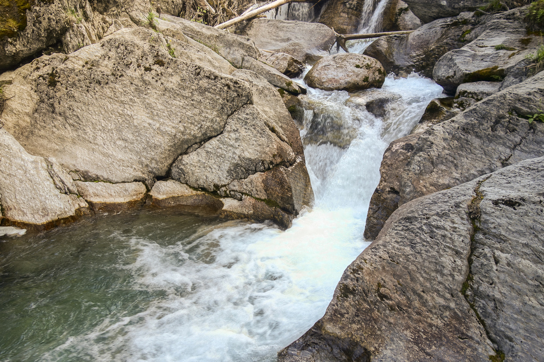
More cascades between km 6 and km 8 |
|||
 Trail crossing base of huge avalanche slope below Ribbon Peak
 |
|||
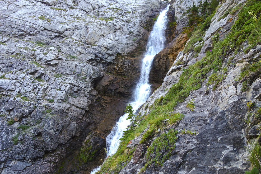
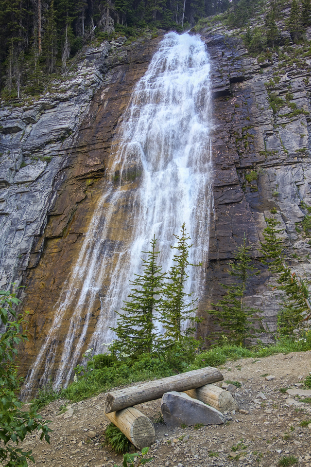 Ribbon Falls above back-country campground at 10km mark
 |
|||
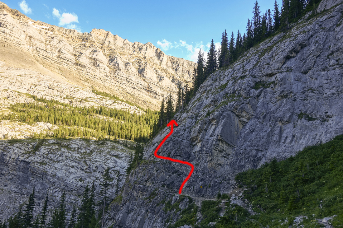 Chained section of Headwall below Ribbon Lake with approximate path indicated by red line
 |
|||
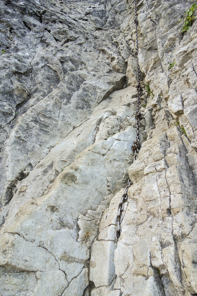 Initial chained part shown here is followed by exposed horizontal ledge traverse, then near vertical 5-6m climb up the rock bulging in the middle
 |
|||
 View back from base of chains. Ribbon Peak upper right, Mt. Bogart behind rock pinnacle in center
 |
|||
 Upper Waterfall of Ribbon Creek can be reached by side trail just below cliffs with chains
 |
Abstract
| Overall Difficulty | D2/3 | Gentle trail hiking with minor elevation gain, but non-trivial return distance. Suitable for trail running. Climbing the headwall below Ribbon lake difficult and even dangerous despite chains (D7) | |||
| Snow Factor | S4 | Steep avalanche slopes off Ribbon Peak past km 6 - trail not recommended in winter | |||
| Scenery | Pretty Ribbon creek with small canyons and waterfalls. Magnificent Ribbon Falls. Steep cliffs of Mt. Kidd and Bogart | ||||
| Trail/Marking | Excellent | Wide and well defined trail with washout sections re-routed and rebuilt past 2013 floods. | |||
| Suggested Time | 5-6 hr | 5hr return for Ribbon Falls only; continuing to chains adds ~1hr | |||
| Elevation | Start: 1500m Max: 2020 m (chains) Total: ~600 m (chains) | Round Trip: ~22km (chains) | |||
| Gear | Day Hikers with good ankle coverage in dry conditions. | ||||
| Water | Ribbon Creek. No need to carry more than 0.5L | ||||
| Dog Friendly | Yes | Standard back-country travel precautions. Frequent bear sightings in summer months | |||
 Ribbon Creek GAIA Map
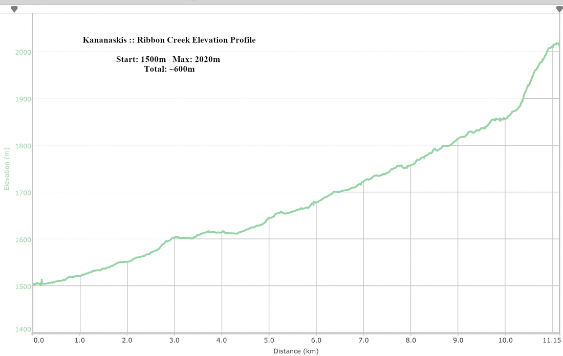 Ribbon Creek Elevation Profile