Rockies :: Alberta Foothills :: Boundary Peak |
 
Boundary Ridge north Panorama, Midnight Peaks upper left, Baldy South behind. Lusk Ridge center right |
||||||
|
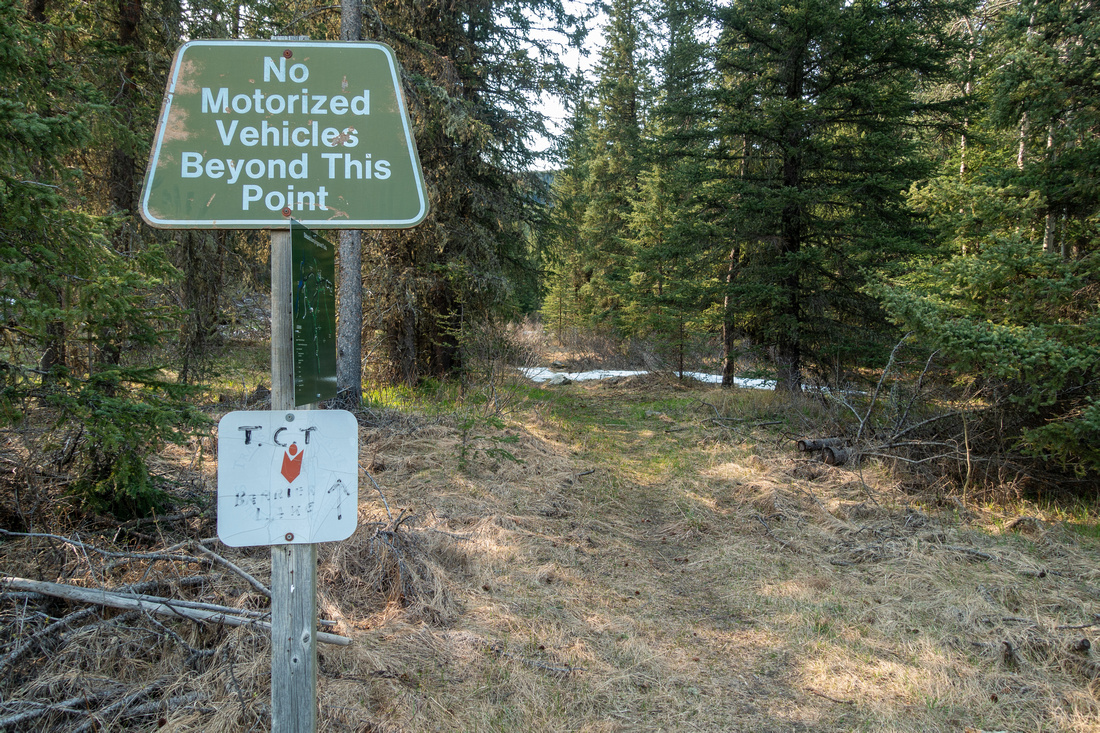
Boundary Peak is highpoint of long and very elegant ridge linking Midnight Peak above Baldy Pass to the north and ending with Tiarra Peak to the south. It is simply fantastic viewpoint with sweeping panorama of Foothills and Front Ranges. There are 2 possible ways to climb this non-technical peak, both starting from Powderface Road (seasonally closed December 1 - May 14):
These 2 trailheads are only ~3km apart, and 1-way Traverse is best option even without second vehicle or bicycle as intervening section of Powderface Road can be speed walked in less than 45 minutes. I present it here as 2 separate Trips aggregated on same page, because this is how I did it. First time I climbed via Belmore Browne and almost went for a loop; reason prevailed as I didn't feel comfortable descending route I was not familiar with. In retrospect, now that I am familiar with both sides, this was good decision - route finding on Lusk side is not trivial. This is main reason why I believe North - South traverse direction is better, in addition to steep Headwall above Lusk Meadows that is easier to ascend than descend.
Oct 24, 2025
I describe this option first, as this is how people usually climb Boundary Peak (most return the same way). Trailhead is at east side of Powderface Trail, some 5km south of Dawson Winter Gate (1st photo in Gallery below). Lusk Meadows route forks off on left side shortly after initial creek crossing; this spot might be easy to miss if not paying attention. On my trip trail appeared freshly brushed off, but there are reports of some previous alder bashing - be prepared just in case. First route-finding problem is at Hunters camp ~30min in. Cross the marsh and pick up trail on the other side; there might be flag marking the spot. Hiking is fairly pleasant with moderate grade following old cutline. After sharp right turn trail reaches treeline in about an hour mark and fades away. This is second critical routefinding spot in order to pick up trail on descent. Lusk Meadows are quite scenic with open views back to Foothills. Steep Headwall below Boundary Ridge ahead looks like it might present problems, but is just class 2 scrambling - when dry. On my trip in Oct '25 there thin layer of snow made things a bit spicy, specially on descent. Aim for stand of Pine trees about halfway up, then follow diagonal scree trail topping up by small cairn and possible flag. This is third critical routefinding spot if descending this way, and if not familiar with area is also easy to miss.
Ensuing ridgewalk to Boundary Peak looming above is super enjoyable - if not windy. On my trip gale winds almost knocked me over couple of times. Otherwise there are no difficulties as ridge is not exposed, and final ascent slope is just your classic Rockies moderate grade Talus. Views are fantastic in all directions; Belmore Browne route to the south, described in second part of this page, is readily observable from the summit. |
||||||
|
Gallery |
|||
 Lusk Pass Trailhead
Parking area at west side of Powderface Trail, just across standard Jumpingpound Ridge / Cox Hill south trailhead Lusk Pass Trailhead
Parking area at west side of Powderface Trail, just across standard Jumpingpound Ridge / Cox Hill south trailhead |
|||
 Lusk Junction
Lusk Meadows route junction 7-8min from Trailhead; note Cairn. Waypoint '1 - Lusk Junction' Lusk Junction
Lusk Meadows route junction 7-8min from Trailhead; note Cairn. Waypoint '1 - Lusk Junction' |
|||
 Creek Crossing
One of several creek crossings; simple rock-hop late in season Creek Crossing
One of several creek crossings; simple rock-hop late in season |
|||
 Hunter Camp
 ~30min in, well worth brief detour. Do not follow trail beyond the camp; instead cross marsh and pick-up trail at north side of the creek Hunter Camp
Hunter Camp ~30min in, well worth brief detour. Do not follow trail beyond the camp; instead cross marsh and pick-up trail at north side of the creek |
|||
 Forest Trail
Pleasant forest hiking as trail starts gaining elevation past Hunter Camp Forest Trail
Pleasant forest hiking as trail starts gaining elevation past Hunter Camp |
|||
 Lusk Meadows Treeline
Reaching Treeline just below Lusk Meadows ~1hr of brisk pace from Powderface. Trail ends around here Lusk Meadows Treeline
Reaching Treeline just below Lusk Meadows ~1hr of brisk pace from Powderface. Trail ends around here |
|||
 Treeline Flag
Flag marking end of Lusk Meadows trail - important for return. Waypoint ('3 - Lusk Meadows') Treeline Flag
Flag marking end of Lusk Meadows trail - important for return. Waypoint ('3 - Lusk Meadows') |
|||
 Lusk Meadows
Crossing Lusk Meadows towards Boundary Ridge; Midnight Peaks behind Pine Tree Lusk Meadows
Crossing Lusk Meadows towards Boundary Ridge; Midnight Peaks behind Pine Tree |
|||
 Lusk Meadows
Looking back at Lusk Meadows just below Headwall. Treeline trail end extreme center right Lusk Meadows
Looking back at Lusk Meadows just below Headwall. Treeline trail end extreme center right |
|||
 Boundary Headwall
. After passing band of trees find scree trail climbing diagonally left Boundary Headwall
Boundary Headwall. After passing band of trees find scree trail climbing diagonally left |
|||
 Boundary Headwall
Mixed rock/talus scramble slope. Aim for tree island upper left Boundary Headwall
Mixed rock/talus scramble slope. Aim for tree island upper left |
|||
 Boundary Headwall
Diagonal scree trail above Tree Island becomes less steep Boundary Headwall
Diagonal scree trail above Tree Island becomes less steep |
|||
 Ridgeline Exit
Topping up at Boundary Ridge by skimpy cairn and small flag (lower left corner); this spot is essential for return, and is not obvious if descending for the first time. Waypoint '4 - Boundary Ridge'. Boundary Peak upper right Ridgeline Exit
Topping up at Boundary Ridge by skimpy cairn and small flag (lower left corner); this spot is essential for return, and is not obvious if descending for the first time. Waypoint '4 - Boundary Ridge'. Boundary Peak upper right |
|||
 Boundary Ridge
Hiking windswept, but not exposed, Boundary Ridge towards Boundary Peak upper right corner Boundary Ridge
Hiking windswept, but not exposed, Boundary Ridge towards Boundary Peak upper right corner |
|||
 Boundary Ridge
Looking back length of Boundary Ridge. Point where Lusk Route tops up is behind patch of pine trees upper center. Midnight Peaks left Boundary Ridge
Looking back length of Boundary Ridge. Point where Lusk Route tops up is behind patch of pine trees upper center. Midnight Peaks left |
|||
 Boundary Climb
Starting final push for Boundary summit; hands free scree hiking Boundary Climb
Starting final push for Boundary summit; hands free scree hiking |
|||
 Boundary Summit
Summit cairn at 2450m Boundary Summit. Tiara peak upper right corner Boundary Summit
Summit cairn at 2450m Boundary Summit. Tiara peak upper right corner |
|||
 Boundary Panorama
Boundary Peak north Panorama with length of Boundary Ridge below. Lusk meadows just right of center Boundary Panorama
Boundary Peak north Panorama with length of Boundary Ridge below. Lusk meadows just right of center |
|||
 Front Ranges
Hwy 40 corridor with Canmore area peaks on Horizon from Boundary Summit Front Ranges
Hwy 40 corridor with Canmore area peaks on Horizon from Boundary Summit |
|||
 Boundary Panorama
Boundary Peak south Panorama. Belmore Browne route center left Boundary Panorama
Boundary Peak south Panorama. Belmore Browne route center left |
Abstract
| Overall Difficulty | D5 | Steep Class 2 Headwall below Boundary Ridge. Unbridged creek crossings with some bushwhack. Routefinding. Possibility of strong winds above treeline. | |||
| Snow Factor | S4 | Serious avalanche danger with unstable snow on steep Headwall above Lusk Meadows | |||
| Scenery | Elegant Boundary Ridge, Front Range Peaks and Foothills | ||||
| Trail/Marking | Poor / None | Occasionally overgrown forest trail disappears at treeline. Problematic routefinding at Hunter Camp. Flags | |||
| Suggested Time | 6 hrs | Same way or Belmore Browne return | |||
| Elevation | Start: 1630m Max: 2450m Total: ~800m | Round Trip: ~14km | |||
| Gear | Full hiking boots and poles. GPS essential. Layers and windbreaker - Ridge often super windy. Climbing helmet in groups | ||||
| Water | SW Fork of Jumpingpound Creek till Hunters Camp, none after. Carry 1-2L depending on season | ||||
| Dog Friendly | Yes | Standard back-country travel precautions | |||
 Jumpingpound North GAIA Map
 Jumpingpound North Elevation Profile
Google Map |
Belmore Browne Route |
GPS Track |
Oct 7, 2024
Full approach details are described in Belmore Browne Report. After topping up on the ridge, turn right and follow obvious scree trails initially losing just over 100m vertical to low saddle, then hike up following well defined trail that presents no problems. It will take ~45minutes only from the point where you first intersected the ridge. If not windy, entire ridgewalk is super enjoyable - just like the Lusk Meadows route.
|
Gallery |
|||
 Tiara Drainage
Good trail at treeline ascends easy talus slopes below Belmore Browne Tiara Drainage
Good trail at treeline ascends easy talus slopes below Belmore Browne |
|||
 Belmore Panorama
Looking back to Belmore Browne (center left) from top of ascent gully below Tiara Ridge Belmore Panorama
Looking back to Belmore Browne (center left) from top of ascent gully below Tiara Ridge |
|||
 Boundary Panorama
Boundary Ridge Panorama from Tiara Saddle Boundary Panorama
Boundary Ridge Panorama from Tiara Saddle |
|||
 Boundary Peak
 from Belmore Browne connecting ridge. Despite appearance entire route is simple hiking only Boundary Peak
Boundary Peak from Belmore Browne connecting ridge. Despite appearance entire route is simple hiking only |
|||
 Boundary Summit
Summit cairn at 2450m Boundary Peak Boundary Summit
Summit cairn at 2450m Boundary Peak |
|||
 Golden Foothills
Foothills Autumn Colour Change from Boundary Peak summit. Mt. Yamnuska roughly center, Wendell East behind Golden Foothills
Foothills Autumn Colour Change from Boundary Peak summit. Mt. Yamnuska roughly center, Wendell East behind |
|||
 Front Ranges
 telephoto from Boundary summit. Midnight Peaks left, all 3 summits of Mt. Baldy center right. Note first part of Boundary ridge below Midnight South (a.k.a "Midday) - despite appearance on this photo, it is not difficult Front Ranges
Front Ranges telephoto from Boundary summit. Midnight Peaks left, all 3 summits of Mt. Baldy center right. Note first part of Boundary ridge below Midnight South (a.k.a "Midday) - despite appearance on this photo, it is not difficult |
|||
 Boundary Foothills Panorama
Foothills Panorama with length of Boundary Ridge below. Lusk Meadows lower right Boundary Foothills Panorama
Foothills Panorama with length of Boundary Ridge below. Lusk Meadows lower right |
Abstract
| Overall Difficulty | D4 | Rocky Creek bed and moderately steep Talus slopes. Elevation gain / loss, with no scrambling. | |||
| Snow Factor | S3 | Moderate avalanche danger in Gully below Tiara Ridge | |||
| Scenery | Sweeping scenery of front ranges and foothills Very scenic Boundary and Tiara Ridges | ||||
| Trail/Marking | Poor / None | Trailhead problematic. Mostly a Route with sporadic cairns and flags. | |||
| Suggested Time | 5-6hrs | Return the same way; Belmore Browne extension adds 30min | |||
| Elevation | Start: 1760m Max: 2450m Total: +870m -190m | Round Trip: ~12km | |||
| Gear | Full hiking boots, poles and gaiters. GPS essential. Wind-breaker as ridge is wind-blown year round. Climbing helmet in groups | ||||
| Water | Jumpingpound Creek drainage, dries off higher up. Seasonal snow patches. Carry 1L+ depending on season | ||||
| Dog Friendly | Yes | Standard back-country travel precautions | |||
 Boundary Peak South GAIA Map
 Boundary Peak South Elevation Profile