Google Map |
Rockies :: Canmore and Bow Valley ::Wendell East Peak |
GPS Track |
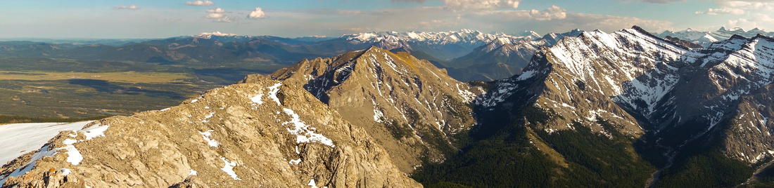 
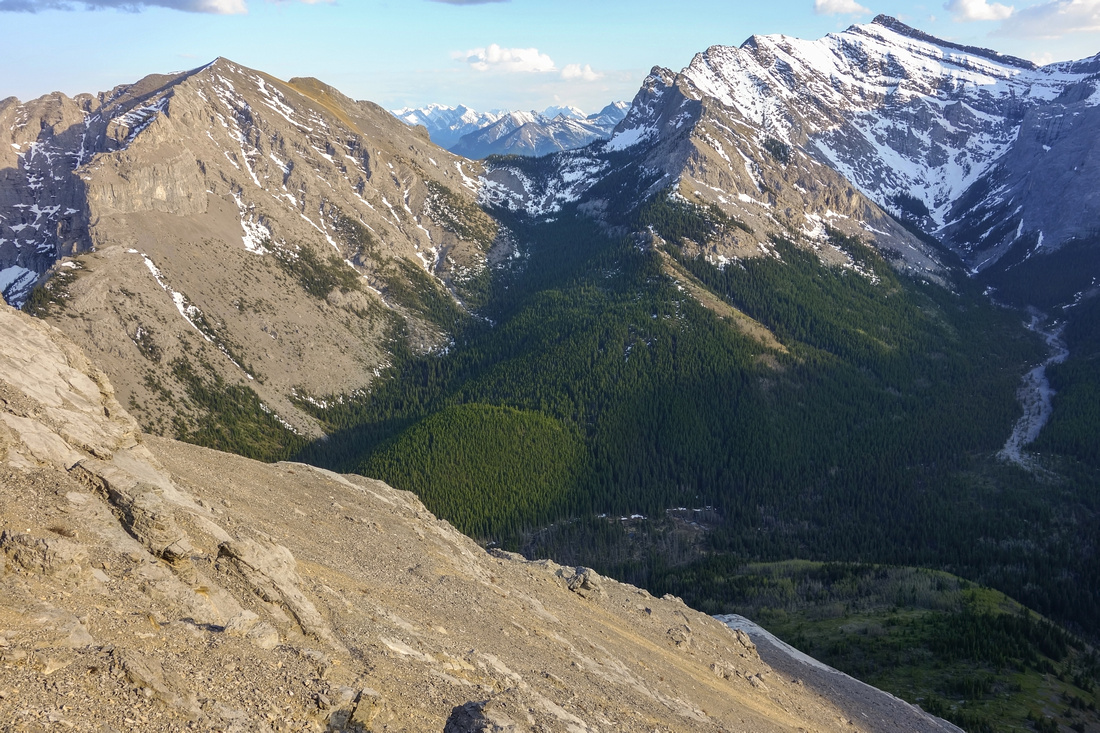
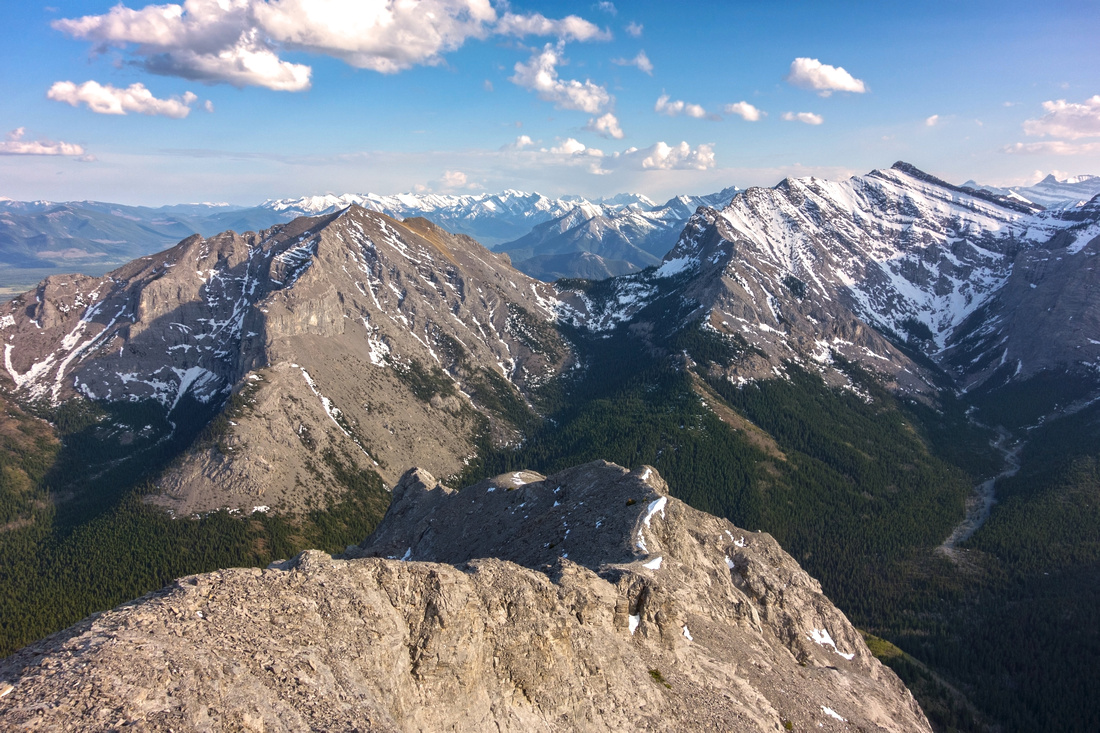
Panoramic View south from Wendell East Summit. Yamnuska in center, Goat Mtn. to the right. Foothills and Sea of K-country peaks behind |
|||
| Trip Summary | |||
May 27, 2019
Wendell East is peak behind Mount Yamnuska, seen across CMC Valley at Ravens End - end of Yamnuska Hiking Trail. It is infrequently ascended and trip provides respite from relentless crowds on Yamnuska hiking trail. On my ascent I had to fight for elbow place between large groups of school kids till Ravens End, but saw just 1 group of 3 people afterwards. Ascent is technically straightforward, but talus slope leading to upper ridge is very lose and will drain lots of energy. Crux is slick slab traverse below rock wall just before summit ridge - dangerous if not dry. Final ridge is simple walk in dry conditions. Loop return via Old Fort Creek - Cutline bordering Native Indian Land will trim some of elevation gain on return, but terrain is more difficult and will not save time.
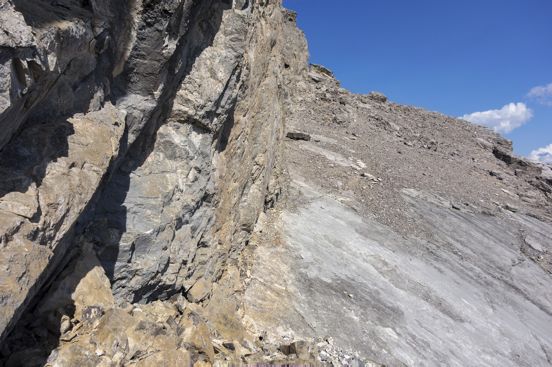
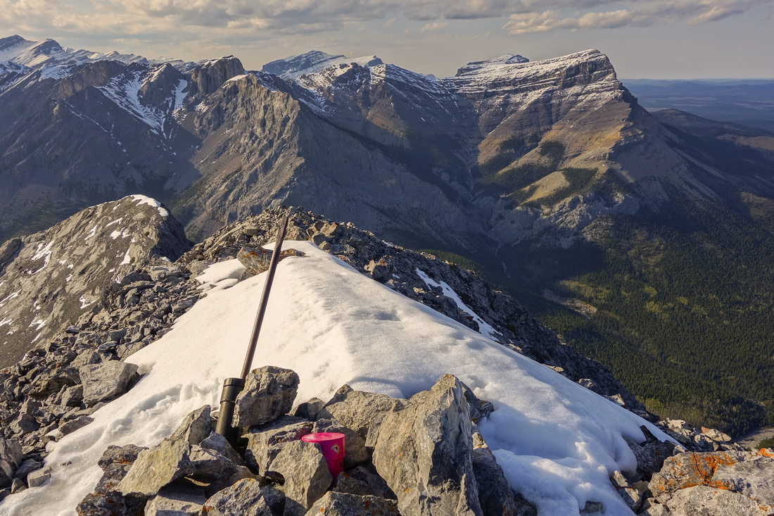
From standard Mount Yamnuska parking, follow well trodden trail keeping right at climber junction ~15min in. Upon reaching ridge trail turns sharp left (rock arrow in trailbed). Continuing straight leads to Native land cutline and drop to Old Fort Creek - optional return. Reach end of Hiking Trail at Ravens End ~1hr 30min from the parking. This is good place for the break and study rest of approach route to CMC valley. Ensuing elevation loss (~300m) is discouraging as it must be regained on return, with tired legs. There are no trails down this slope but none are really necessary. Follow path of least resistance through forest with some deadfall in lower part, then cross Old Fort Creek at the bottom. In spring this creek might be swollen but good place to cross can usually be found by venturing one way or the other. On my trip shelf of hard snow / ice on creek bank allowed me to simply step across. Good trail can be found on the other side; turn left (west) and follow to far end of CMC valley. Alternatively head straight up to base of cliffs, then traverse left for Nugara "scenic" route under some impressive rock pinnacles. Both routes join behind the corner at base of large talus slope leading to summit ridge. Note horizontal scree trail continuing straight - do not go this way as it is more than scrambling. Instead trash up talus; initially trail helps a bit, but soon it becomes easier to vend right utilizing bit of peeling rocks for better footing. This slope will sap lots of energy, specially if sun is beating straight down on you! Upon reaching the top traverse horizontally left to base of sheer rock wall, then turn right and cross slick slab to summit ridge. This part is the crux. Note carefully the point where you first reached the ridge for return. Summit cairn and register are ~30 minutes away and remainder of the ascent is much easier - mostly hiking. Great panoramic views from the top include Mt. Association / Edge Mountain and Sea of Ghost Peaks to the North while on the South once can admire Foothills (Calgary downtown towers can be seen on a clear day) and backside of Mt. Yamnuska, totally different from its usual side seen from Trans-Canada.
On return descent down the talus will take 3 times less and allows for some great scree surfing. Once in CMC valley either retrace your steps to Yam shoulder, or continue down Old Fort Creek to Cutline, then turn right and ascend back to Mt. Yamnuska Hiking trail. |
|
Gallery |
|||
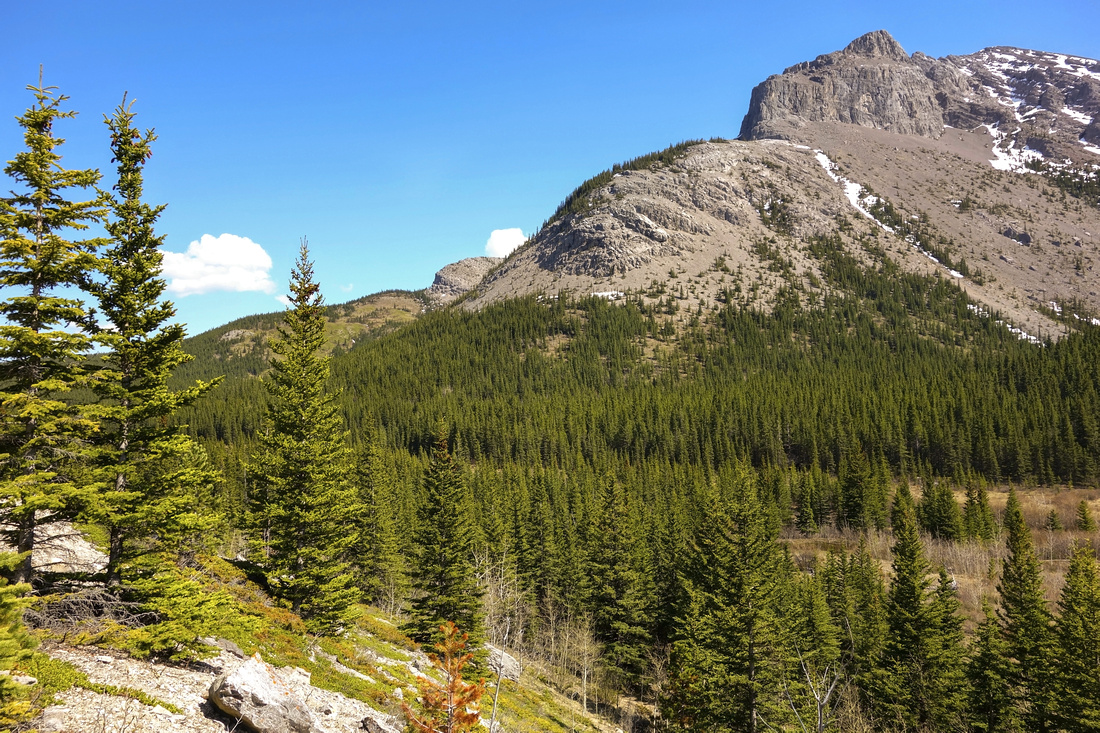
 Hiking well trodden trail towards shoulder of Mt. Yamnuska
 |
|||
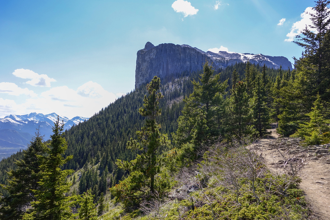
 CMC Valley from Yam shoulder. Wendell East just left of center, Wendell Mtn. further to the left. Route descends to CMC Valley then angles left to wide talus slope out of view that provides easy access to the summit ridge. Association Peak far right.
 |
|||
|
|
|||
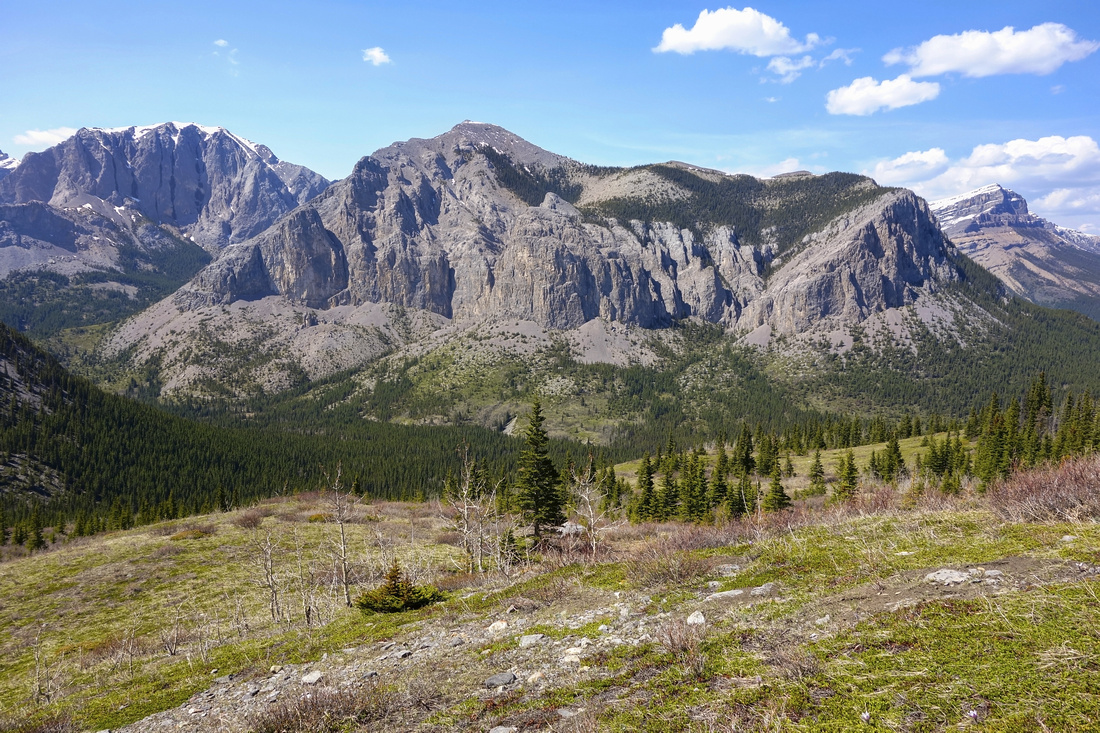
 Pleasant meadow hiking at far end of CMC Valley, but terrain is soon going to change. Talus ascent slope around the corner upper left
 |
|||
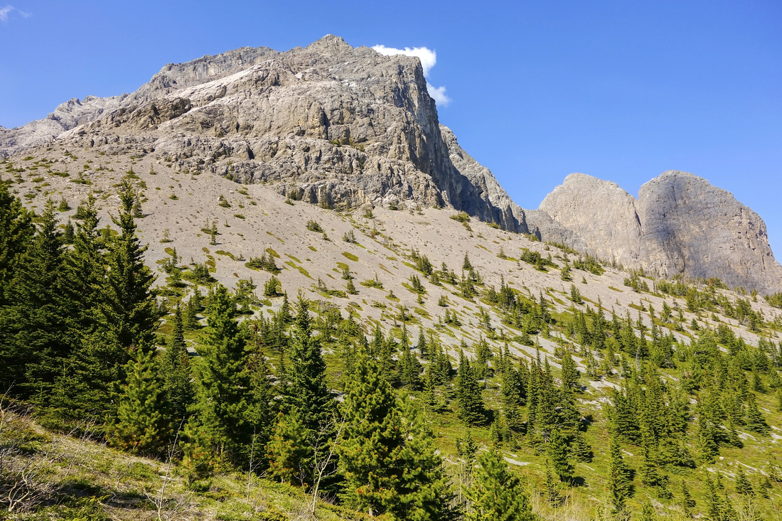
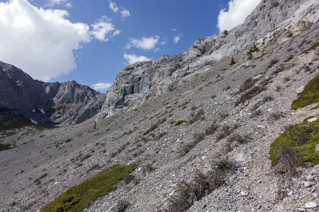 Base of ascent slope. Nugara difficult route continues straight (faint path in scree can be found) - don't even think about it
 |
|||
 View down Talus after > 1 hr spent wallowing in scree. Note cream colored spur lower center -- great scree surfing on return!
 |
|||
|
|
|||
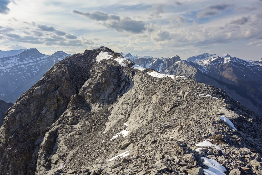
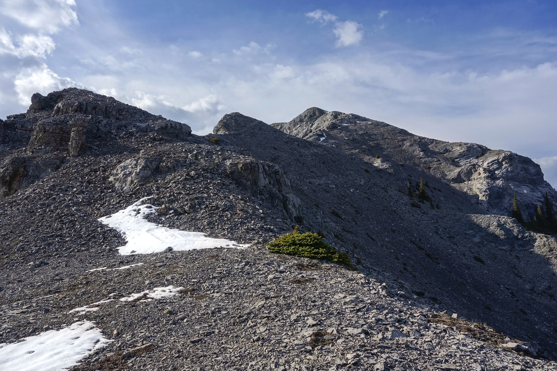 Ridge from the col - summit is still hidden at this point. Takes about 30 minutes of mostly easy hiking
 |
|||
|
|
|||
|
|
|||
|
|
Abstract
| Overall Difficulty | D6 | Steep ascent on rubble and/or peeling cliffs. Semi-exposed slab traverse that must be dry. Routefinding with bushwhacking. | |||
| Snow Factor | S5 | Dry front ranges make this ascent feasible most of the year, but if snowy steep talus slope would be avalanche trap. Snow/Ice on slab traverse would put ascent in realm of mountaineering. | |||
| Scenery | Front Ranges and Foothills. Not often seen north aspect of Mount Yamnuska. Beautiful CMC Valley and Rock Pinnacles. | ||||
| Trail/Marking | Good/None | Well defined and busy trail to Yam shoulder, off-trail bushwhack to CMC valley followed by faint paths | |||
| Suggested Time | 8-9 hr | Most commonly used option from Yam shoulder. Possible extensions via Old Fort Creek and Highline Traverse below Rock Pinnacles | |||
| Elevation | Start: 1630 m Max: 2260m Total: ~1300m (+970m, -330m) | Round Trip: ~18 km | |||
| Gear | Full Hiking Boots. Climbing Helmet. Hiking poles and Gaiters essential. GPS recommended for navigation from Yam Shoulder to CMC Valley, but not absolutely necessary | ||||
| Water | Old Fort Creek in CMC Valley, possible snow patches on final ridge. Carry ~2L | ||||
| Dog Friendly | Yes | Please keep dog on leash on Yamnuska hiking trail. Standard back-country precautions in CMC valley. | |||
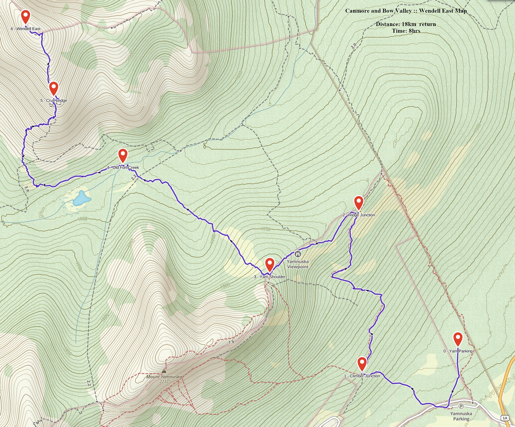 Wendell East GAIA Map
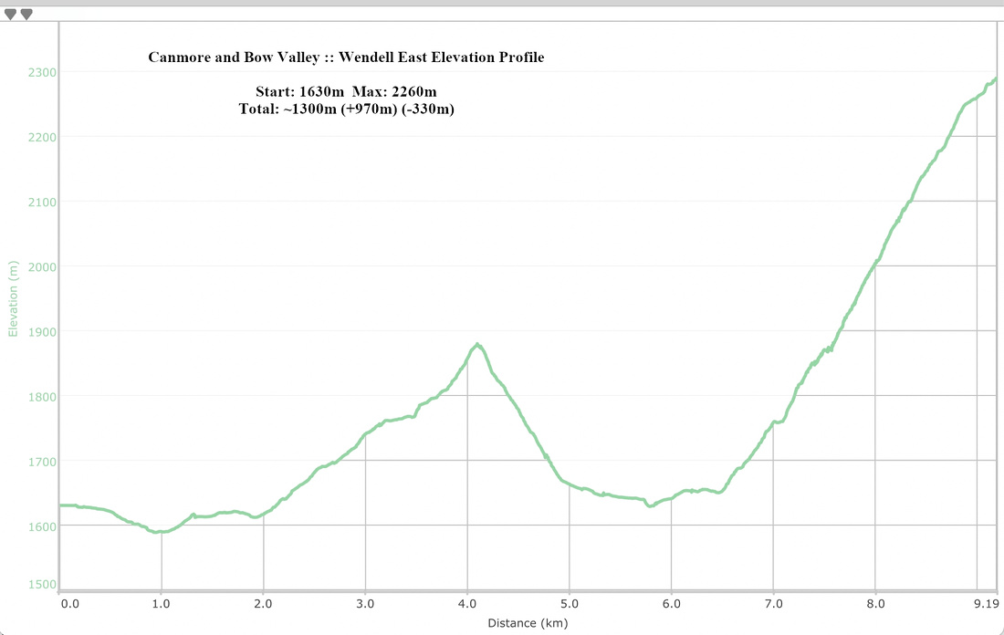 Wendell East Elevation Profile