Rockies :: Canmore and Bow Valley :: Mount Yamnuska
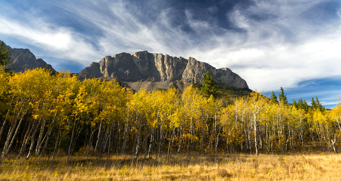 
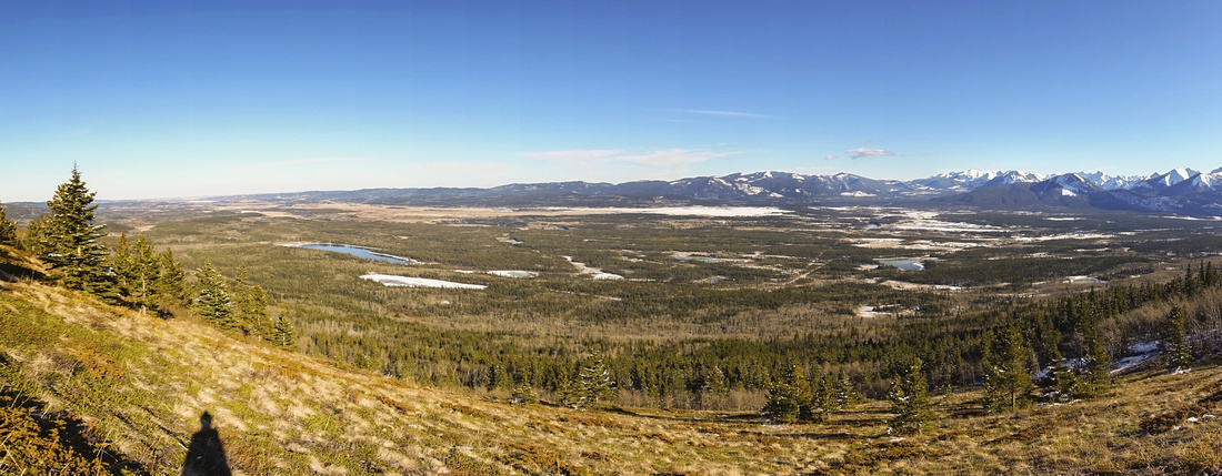
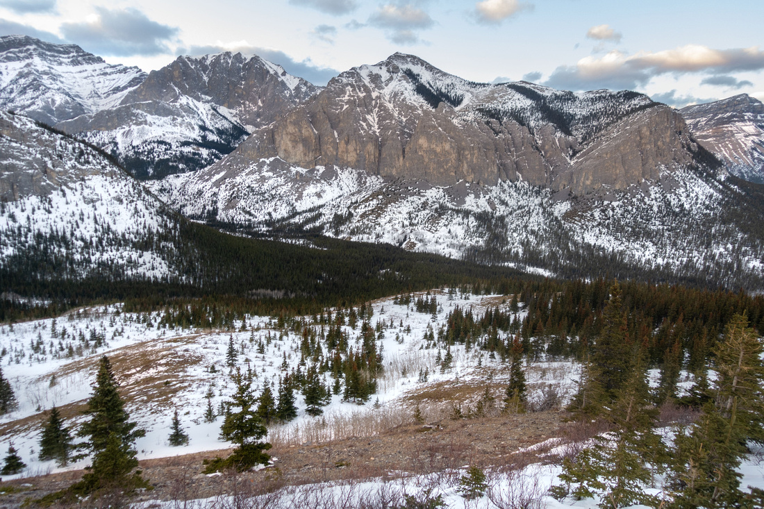
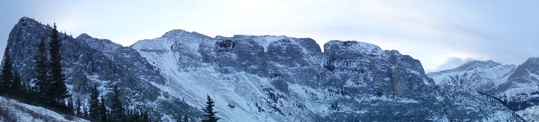
Yamnuska Cliffs from Aspen Meadows in Bow Valley Provincial Park. Ravens End right side, West Col left |
|||
|
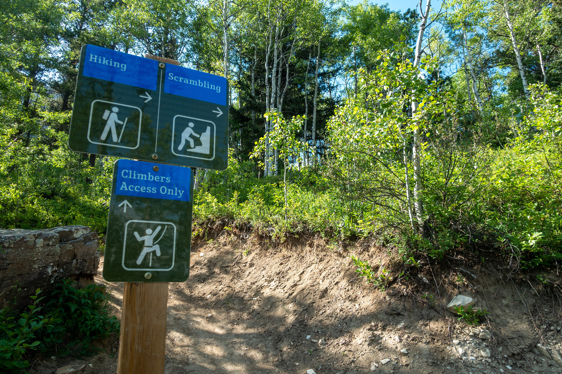
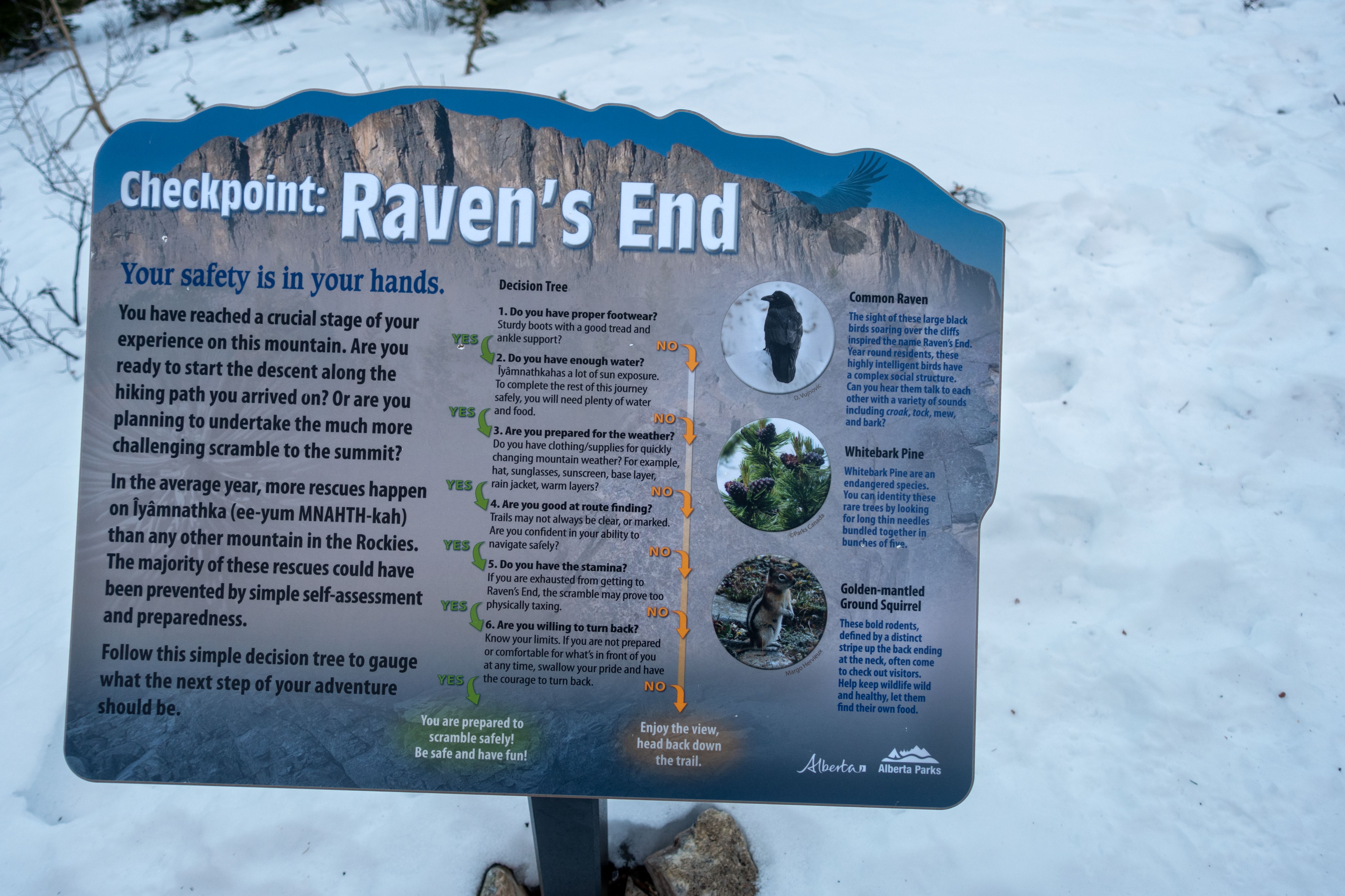
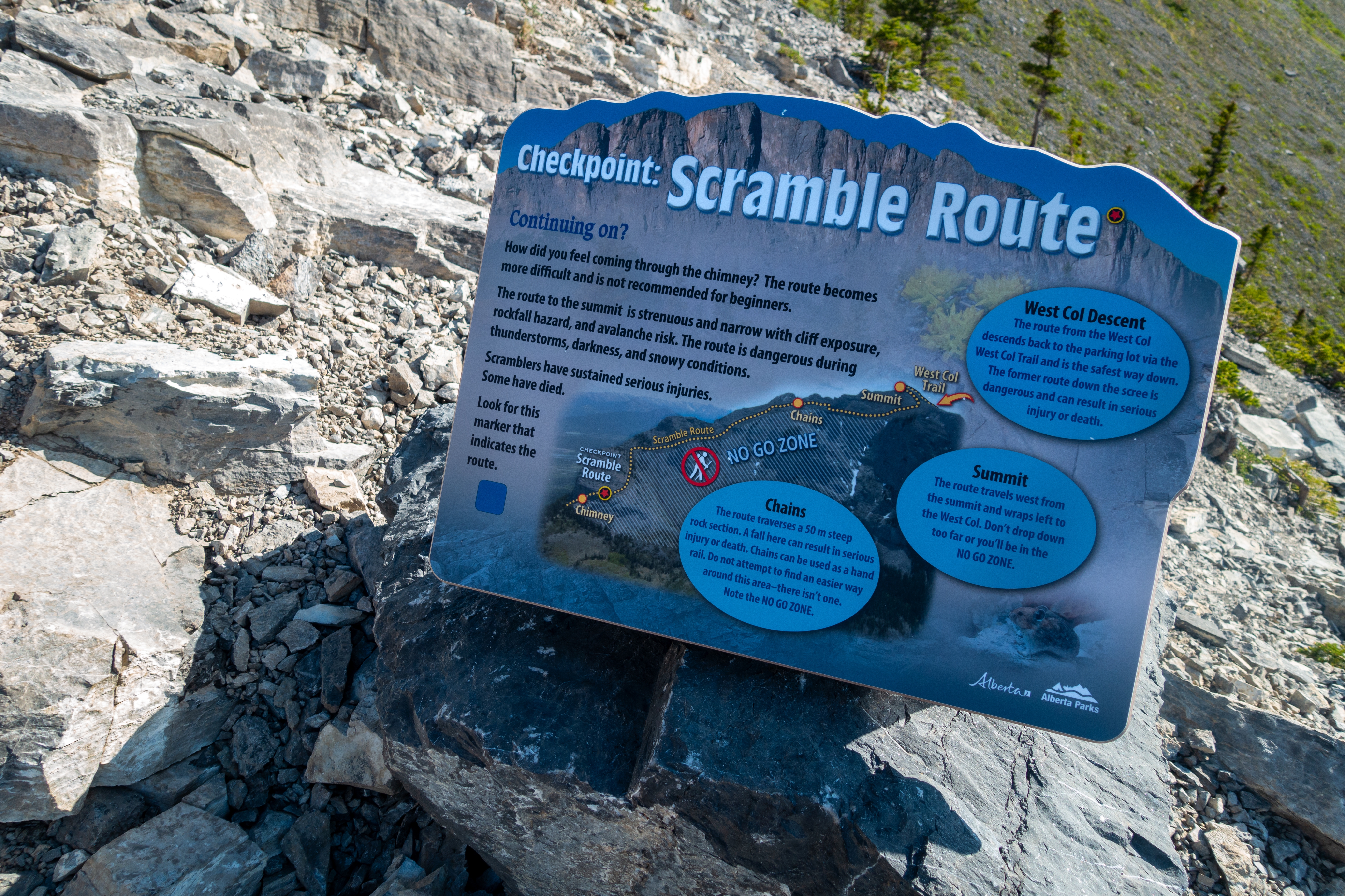
Mt. Yamnuska or Mt. John Laurie is first big mountain on right(north) side as Trans-Canada Highway enters Rockies few minutes past Seebe-Exshaw 1x junction. It is somewhat akin to Squamish Chief on BC Coast - formidable cliffs on front with number of technical climbing routes, while tamer back side has hiking/scrambling trails. Another similarity is popularity; inclusion of Scrambling Route in Kane guidebook contributed to over-saturation and over the years accidents, even deaths occurred. All that led to Alberta Parks doing some significant trail upgrades, including brand new west col descent and extensive signage with blue markers and wands. Chinook winds and east exposure means less snow and year-round hiking. I've been to the area many times as it is essential Foothills experience. By timing the trip on weekday afternoon one can usually have most of the area to themselves. Two main hiking options are Full traverse is best done in CCW (east - west) direction as hands-on parts are easier to ascend than descend. One can also climb Yam summit from west side and return the same way which avoids tricky sections in entirety. Ravens End is just first part of Traverse, but I am presenting it as separate entry as it is very rewarding few hours exercise doable year round that can be done in less than 3 hours. |
| Google Map | Ravens End | GPS Track |
Multiple Dates, Last May 30, 2023
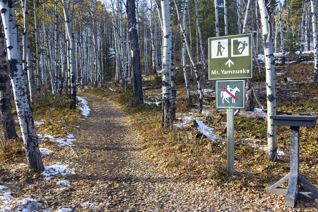
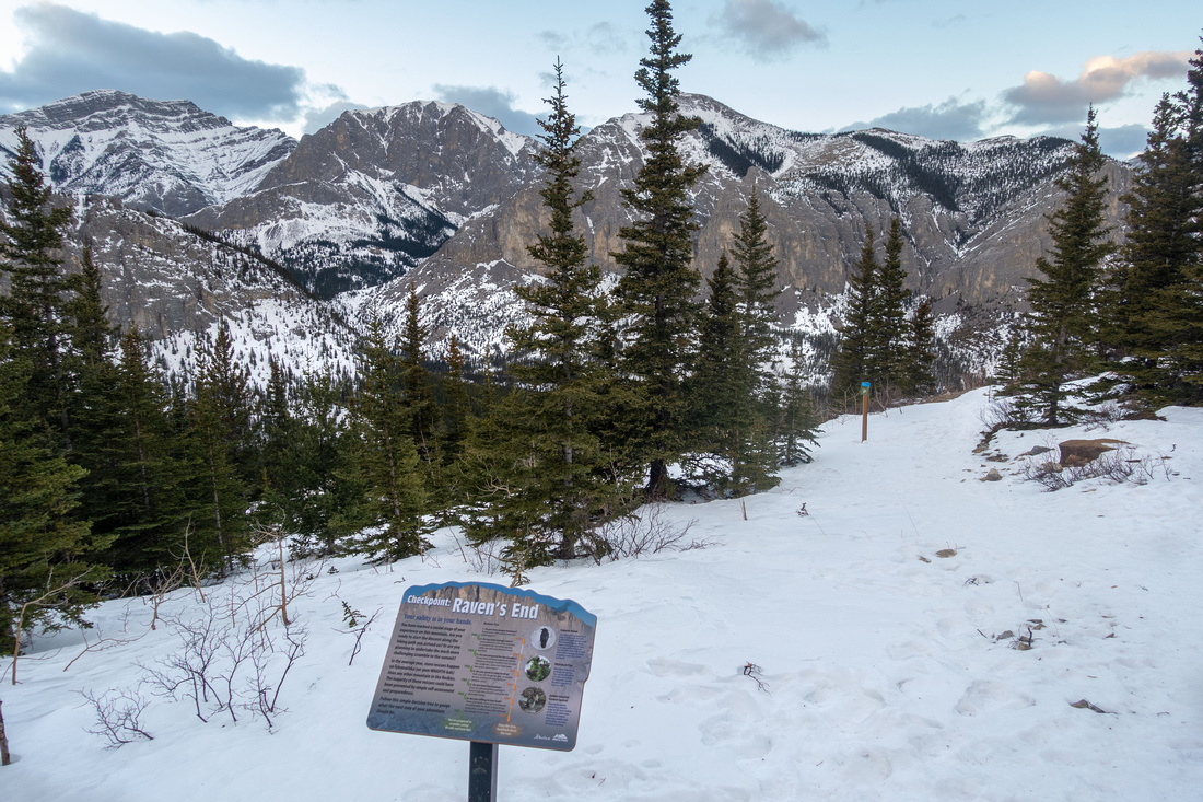
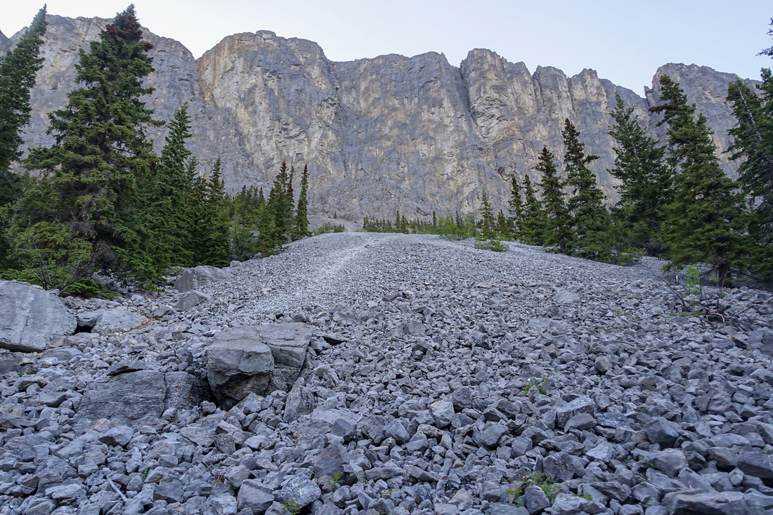
Yam trailhead are few km east from 1x / Seebe/Exshaw junction. Despite fair size, parking lot fills fast on weekends. There is also picnic area and very nice open meadow/lake viewpoint just few minutes to the south. Trail starts by K-country kiosk and after brief walk crosses gravel road by climber registration table. Within 15 minutes, at top of brief but steep rise is marked junction: Turn right for Ravens End. Ensuing part has been rerouted by Alberta Parks upgrades and is fairly scenic traversing open bench before heading up steep hillside. This bit is fairly eroded and can be icy / slippery in winter. Turning right grade moderates passing by open bluff with great views - usual break spot. East ridge is reached within an hour from the parking; turn left by the sign. Overgrown trail continuing north is access for Old Fort Creek / Association Mtn area. Remainder of hike to Ravens End rises through forest towards east cliffs in another 30min. Halfway through is marked CMC Valley junction; I never investigated as I usually drop to CMC directly from Ravens End, but I might try next time. Final rise is bit steep and can also be slippery in winter. Recent upgrades have split the trail into ascent/descent legs here (signs). Open meadows at north side are super spot for break with unobstructed view of CMC Valley and several front ranges peaks.
Return is the same way; there is climber access route on the front, but it is very steep and not recommended specially for descent. Photos in the Gallery are a mix from different season as I hiked this part regularly several times a year. |
||
|
Gallery |
|||
 Aspen Trail
Trailhead with climber registration kiosk Aspen Trail
Trailhead with climber registration kiosk |
|||
 Aspen Trail
Initial flat part through open aspen forest; Ravens End is slightly off center in upper part of the photo Aspen Trail
Initial flat part through open aspen forest; Ravens End is slightly off center in upper part of the photo |
|||
 Lower Junction
Hiker/Climber junction ~15min in, start/end point of Yam Traverse. Go right for Ravens End Lower Junction
Hiker/Climber junction ~15min in, start/end point of Yam Traverse. Go right for Ravens End |
|||
|
|
|||
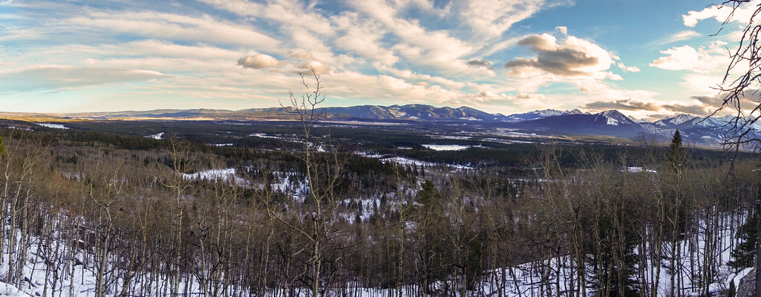
 Prairie Foothills
Much Improved Views higher up as trail swings east. This is excellent spot for a break after steep forested ascent Prairie Foothills
Much Improved Views higher up as trail swings east. This is excellent spot for a break after steep forested ascent |
|||
 Yam Shoulder
Shoulder ~1hr in, looking back. Yam trail turns west by the sign. Overgrown trail for Old Fort Creek/Association Mtn. continues north Yam Shoulder
Shoulder ~1hr in, looking back. Yam trail turns west by the sign. Overgrown trail for Old Fort Creek/Association Mtn. continues north |
|||
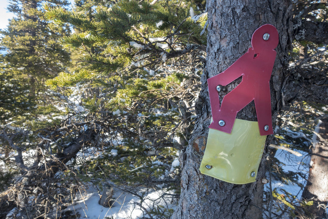 Trail Markings
Frequent markings makes it impossible to go off trail Trail Markings
Frequent markings makes it impossible to go off trail |
|||
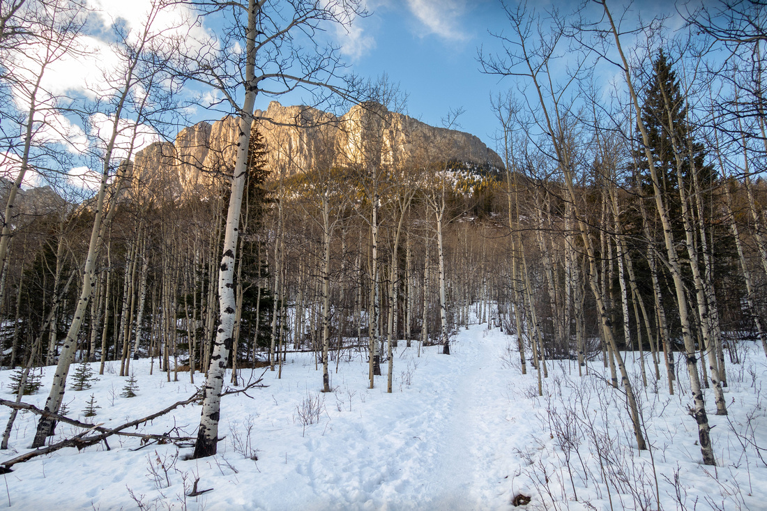
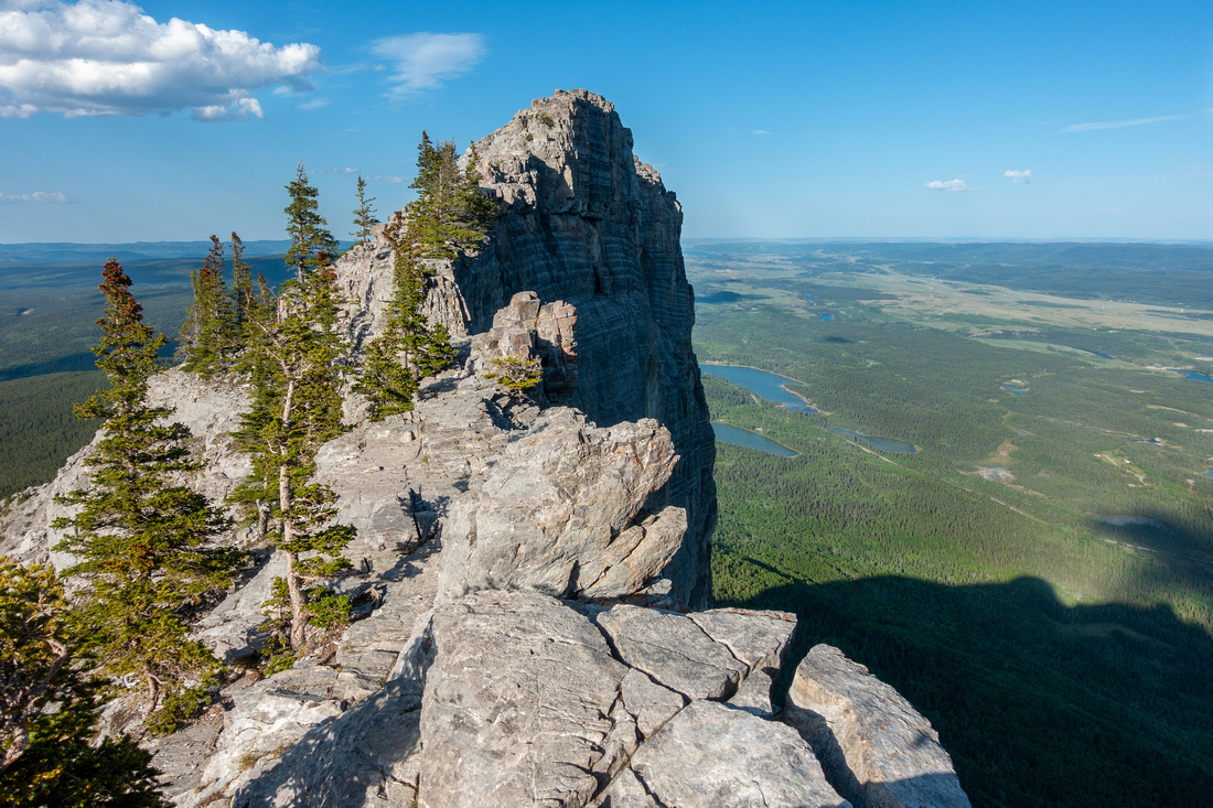
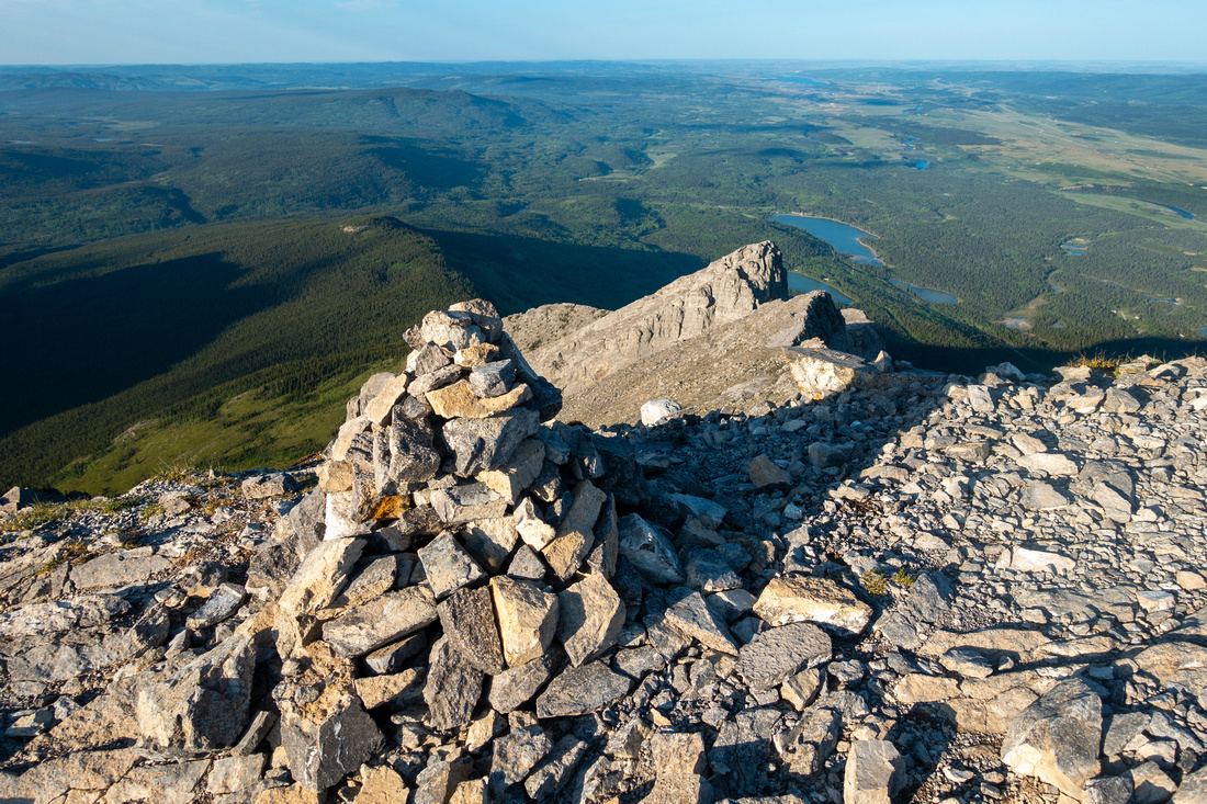
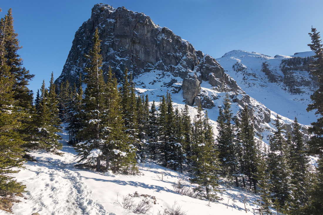 Ravens End
 on a Winter Trip ~1.5 hrs from Trailhead. Buttress above, popular rock-climbing spot, can also be reached by steep trash on the other side, starting off climber access trail lower down Ravens End
Ravens End on a Winter Trip ~1.5 hrs from Trailhead. Buttress above, popular rock-climbing spot, can also be reached by steep trash on the other side, starting off climber access trail lower down |
|||
 CMC Valley
Wendell East from open slopes below Ravens End. Descending into CMC Valley from here is off-trail but straightforward CMC Valley
Wendell East from open slopes below Ravens End. Descending into CMC Valley from here is off-trail but straightforward |
|||
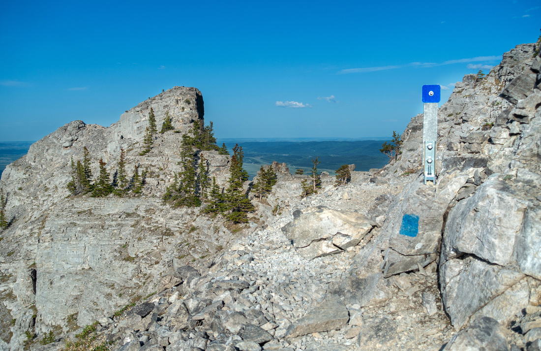
 Ravens End
 Table is recent addition. Alternate return by blue sign (center right), re-joins main trail in ~10min lower down Ravens End
Ravens End Table is recent addition. Alternate return by blue sign (center right), re-joins main trail in ~10min lower down |
|||
 |
|||
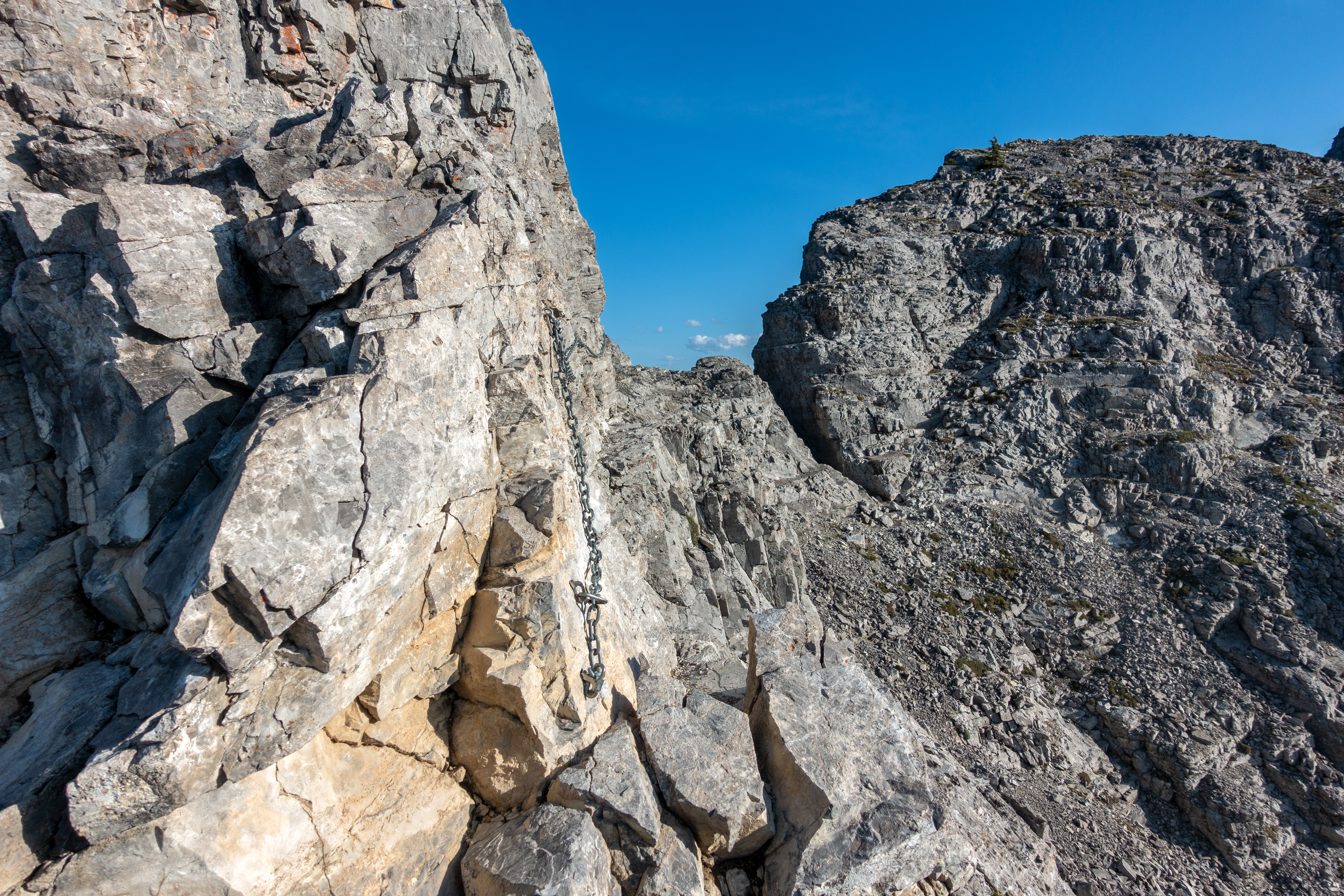
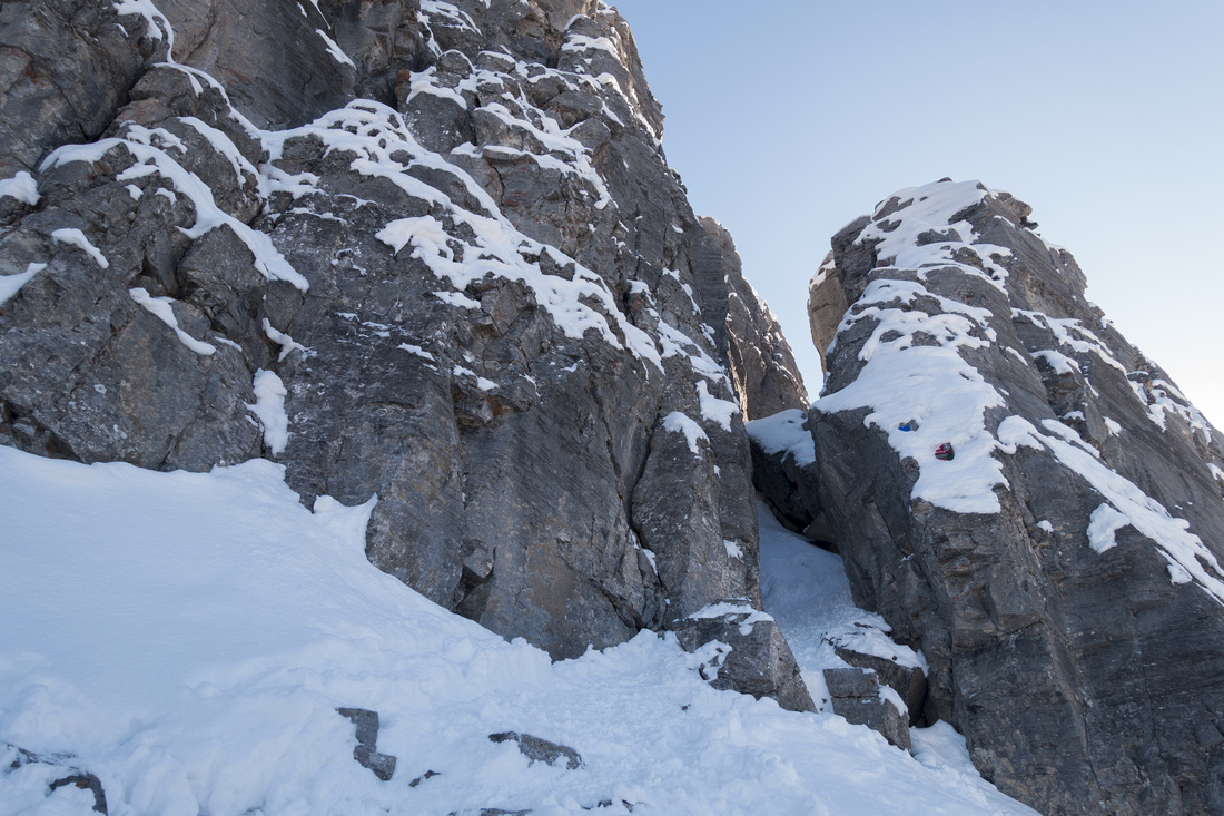 Ravens Chimney
Start of Scrambling for Main peak, turnaround point. Route continues through the Chimney and should be snow free Ravens Chimney
Start of Scrambling for Main peak, turnaround point. Route continues through the Chimney and should be snow free |
|||
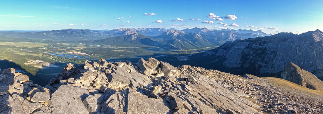
 Yam Pano
Yamnuska Backside Panorama. Scramble route stays close to ridge crest most of the time Yam Pano
Yamnuska Backside Panorama. Scramble route stays close to ridge crest most of the time |
|||
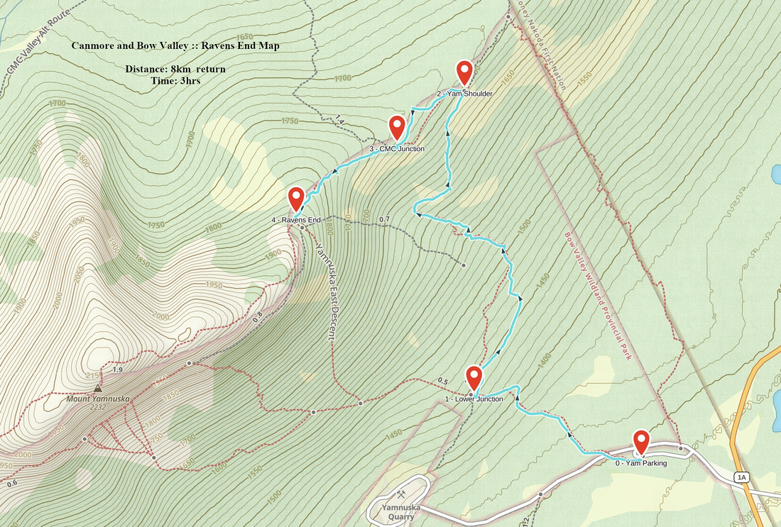 Ravens End GAIA Map Ravens End GAIA Map
|
|||
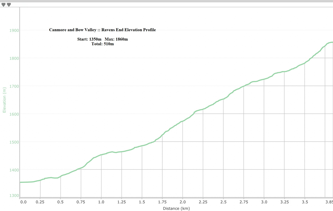 Ravens End Elevation Profile Ravens End Elevation Profile
|
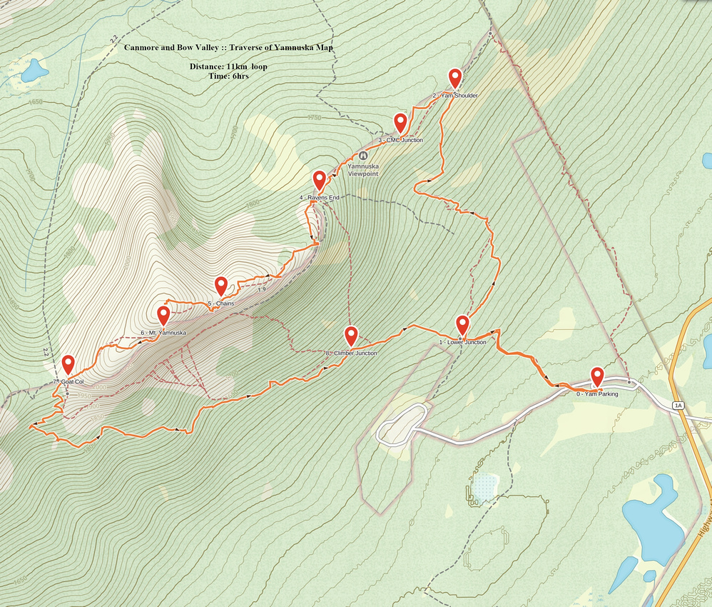
| Google Map | Traverse of Yamnuska | GPS Track |
Multiple Dates, Last May 30, 2023
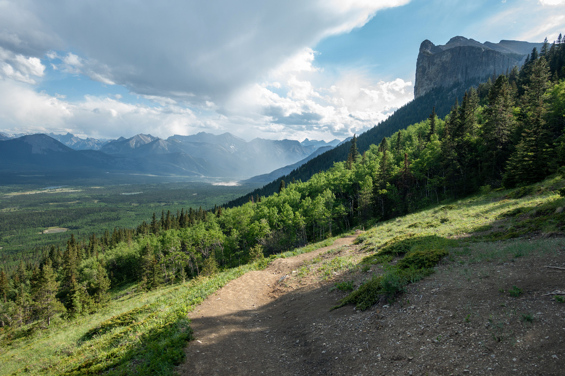
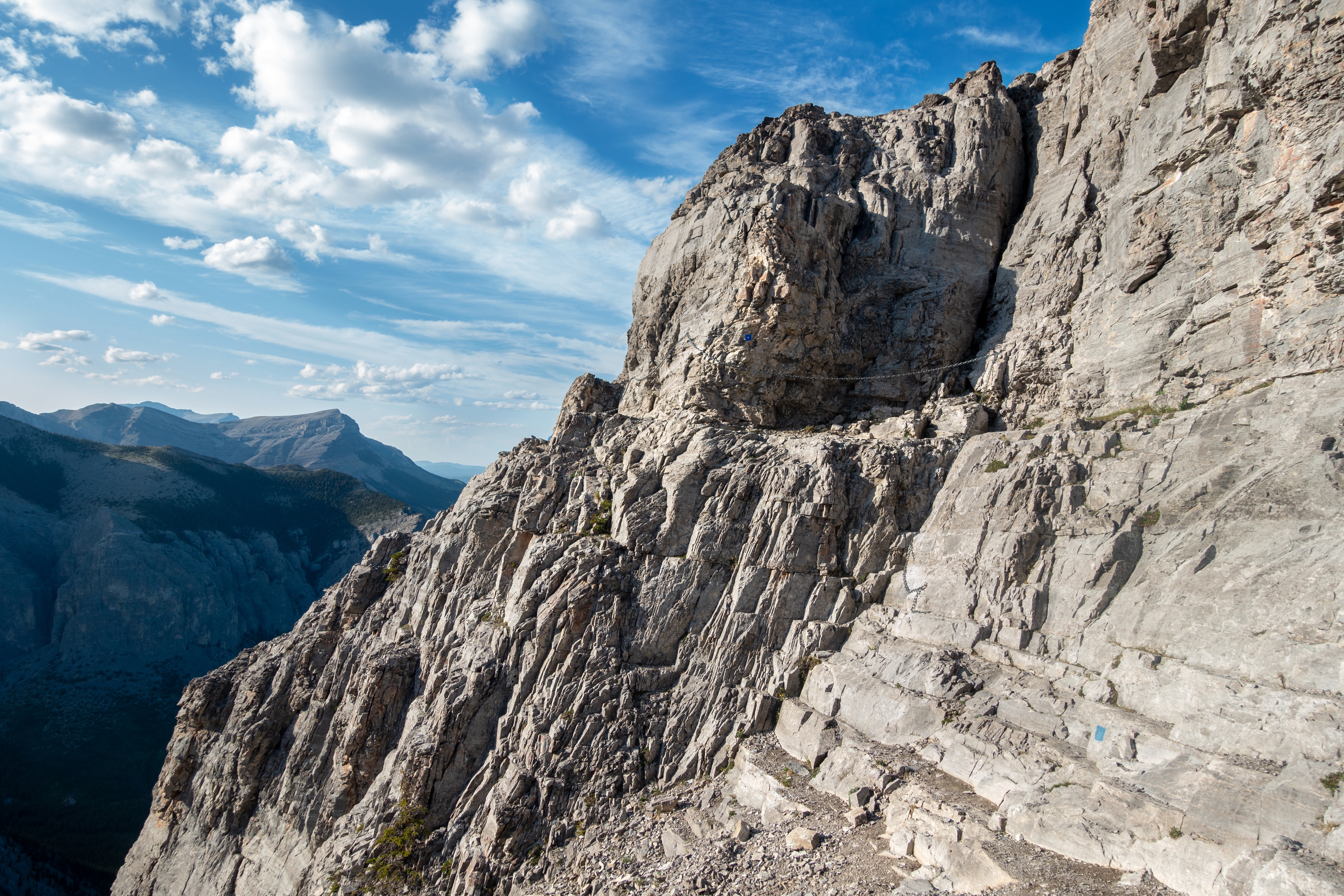
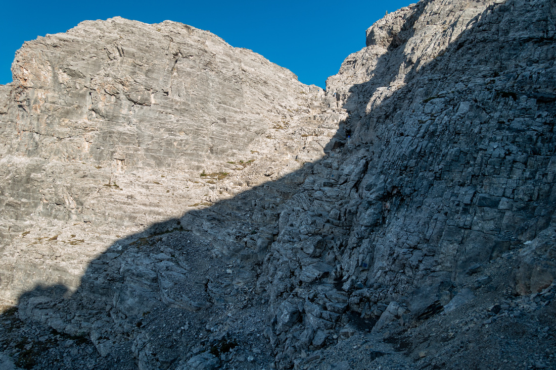
Best left when snow/ice free, although done year round. Description is for preferred east - west direction. Chimney above Ravens End is test - if difficult know things do get worse. Chimney itself is short with one pull up boulder near the top. There is also talus trash bypass on right side. Past the chimney solid trail with blue wands hikes up open hillside, then climbs up short wide gully that looks far worse from distance than it really is. If short on time, or not really feeling up for entire traverse, this is also good turnaround point as trail reaches top of the cliffs with great views (see Gallery). Crux section is reached within an hour from Ravens End; exposed ledge with dropoff on right side. Before chains went in this was very dangerous as fall would cause serious injury or even kill. Even with chains it feels quite airy as rock bulges at one point and brief step down is required. Main danger is, as often the case, crowds - on busy weekends traffic jam forms here with all kinds of unprepared people. Past the chains it is still slow going as descent down steep and lose gully is required before conditions again mellow. Final part to the summit is simple talus/scree hiking, about 1 1/2 hr from Ravens End. Views are great necessitating extended summit stay when wind free.
Descent down west side is more difficult than perhaps expected. Trail stays fairly high and leads to tedious section of ball-bearing scree on slab that require care; hiking poles are great asset. When busy rolling rocks from people above is serious hazard (helmets). Best option is to scree surf from the notch ~10min below the summit instead of following the trail, then angle horizontally and reconnect with trail lower down. (Do not go too far down as there are cliffs below!). Goat col, ~45-50min from the top is another super spot for the break. Climber route from Goat Mtn. comes down from the other side, and I've also heard it is possible to descend north to CMC valley, but have not confirmed. From Goat (West) col in the past route would head for huge scree run, visible even from Trans-Canada, but after death in '21 Alberta Parks built excellent "West Col Descent" trail I highly recommend. Well constructed and wide switchbacks that provide safe and fast travel. Final part is quick hike back to Trailhead, ~1hr from Goat Col. It is also possible to traverse below Yam cliffs on climber route and by staying high hike back all the way to Ravens End. For that option take "Scree Run" trail from West col; I've done this once and although not entirely hands-in-your-pockets it is still easier than scramble parts on east side. |
||
|
Gallery |
|||
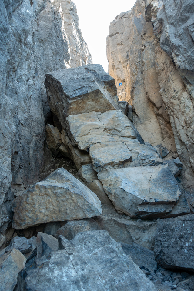 Ravens Chimney
Brief scramble up Chimney above Ravens End. Stiff class 2 and easier than this photo might suggest, but needs to be ice free. Bypass on the right side is not really necessary if dry Ravens Chimney
Brief scramble up Chimney above Ravens End. Stiff class 2 and easier than this photo might suggest, but needs to be ice free. Bypass on the right side is not really necessary if dry |
|||
 Ravens Chimney
Looking back after passing through the Chimney; note blue marker Ravens Chimney
Looking back after passing through the Chimney; note blue marker |
|||
 |
|||
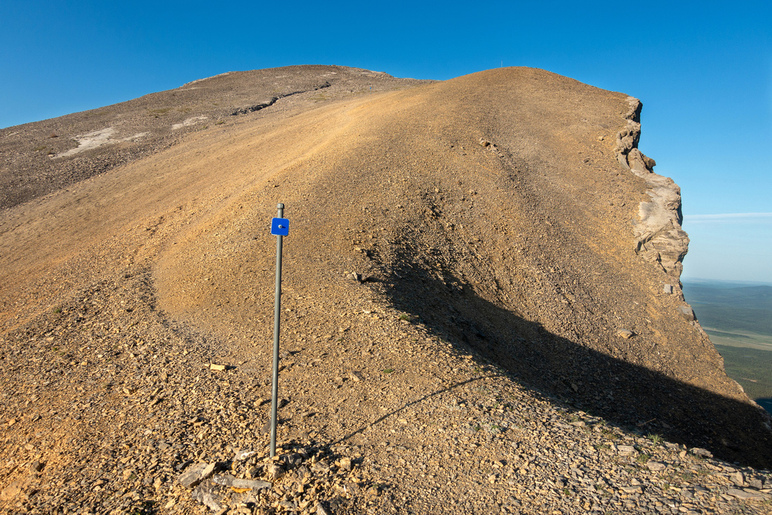
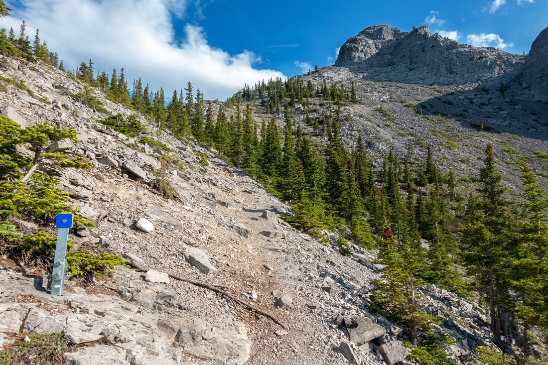 Backside Trail
Well defined and marked trail heading up through last trees then ascends cleft upper right Backside Trail
Well defined and marked trail heading up through last trees then ascends cleft upper right |
|||
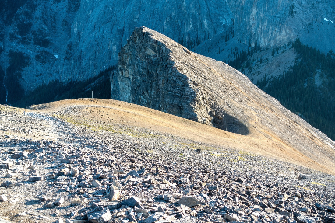
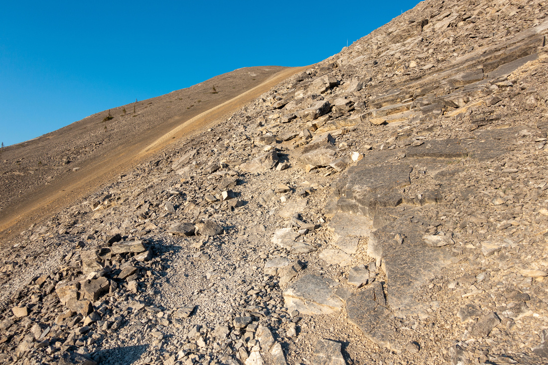
 Yam Cliffs
Passing near drop-off where several climbing routes come up from below Yam Cliffs
Passing near drop-off where several climbing routes come up from below |
|||
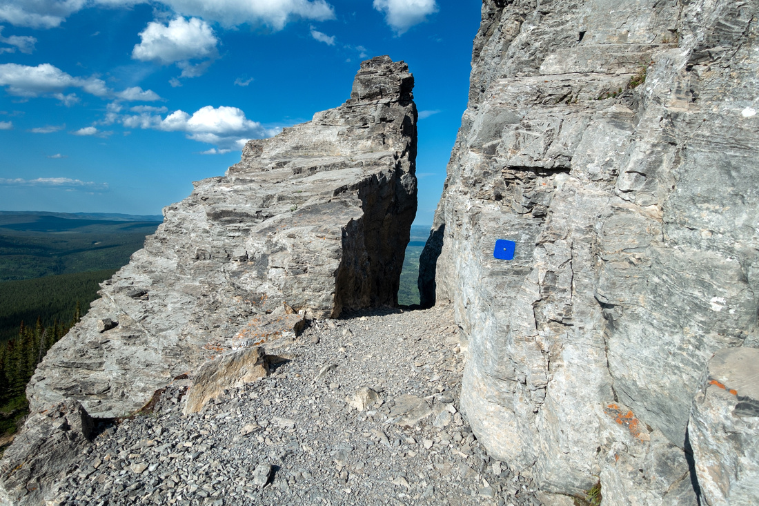
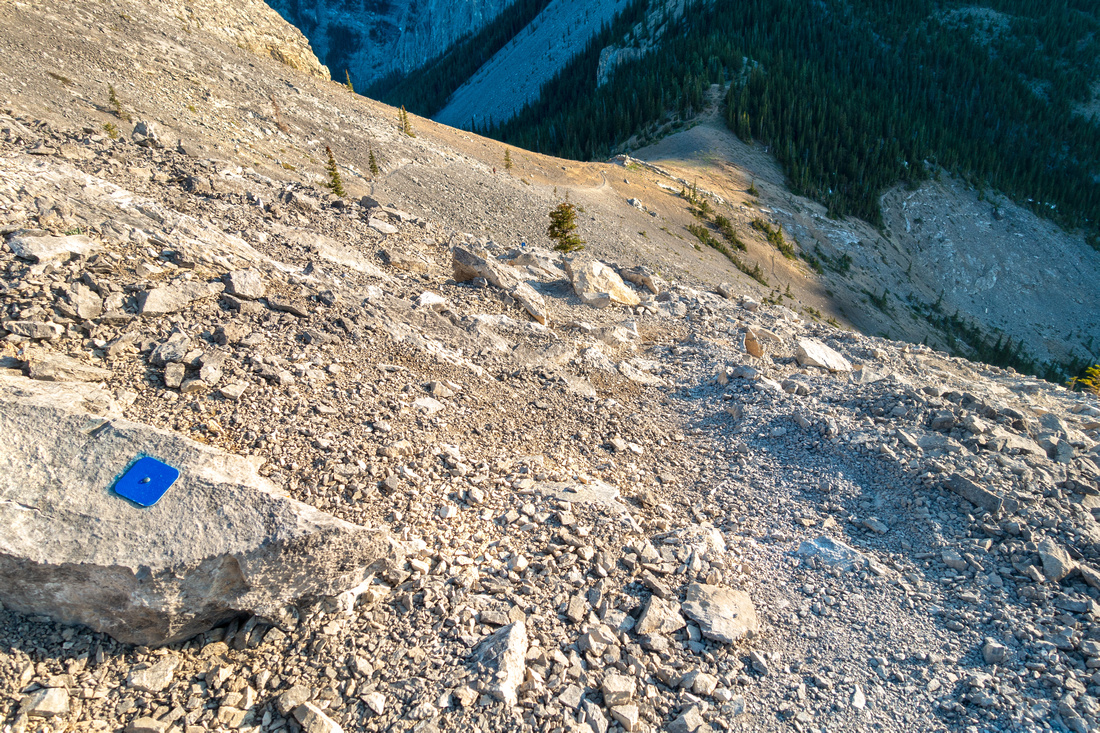
 Blue Markings
Frequent markings facilitate route-finding as there are various options. Metal wand is recent addition Blue Markings
Frequent markings facilitate route-finding as there are various options. Metal wand is recent addition |
|||
 |
|||
 |
|||
|
|
|||
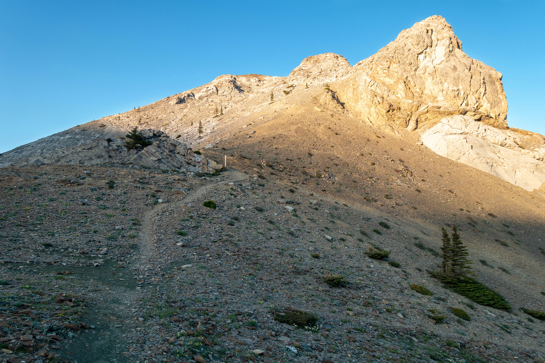
 Yam Summit
Summit Cairn ~1.5 hrs from Ravens End with great Prairie and Front Ranges views Yam Summit
Summit Cairn ~1.5 hrs from Ravens End with great Prairie and Front Ranges views |
|||
 K-country Panorama
Panoramic view south into K-country from Yam summit; Barrier Lookout (Yates Mtn) across, Loder/Doorjamb right K-country Panorama
Panoramic view south into K-country from Yam summit; Barrier Lookout (Yates Mtn) across, Loder/Doorjamb right |
|||
 West Ridge
 Descent, more involved than this photo might suggest. Marked trail stays high but best option is to scree surf directly down from the saddle center right, then traverse horizontally west and reconnect with marked trail further below West Ridge
West Ridge Descent, more involved than this photo might suggest. Marked trail stays high but best option is to scree surf directly down from the saddle center right, then traverse horizontally west and reconnect with marked trail further below |
|||
 West Ridge Descent
Looking back up to Yam summit from the saddle West Ridge Descent
Looking back up to Yam summit from the saddle |
|||
 Eroded Trail
Uncomfortable ball bearing scree on slab that requires care. Hiking poles are great help here. Scree surf option upper center Eroded Trail
Uncomfortable ball bearing scree on slab that requires care. Hiking poles are great help here. Scree surf option upper center |
|||
 Goat Col
Easier Final part of Goat Col descent Goat Col
Easier Final part of Goat Col descent |
|||
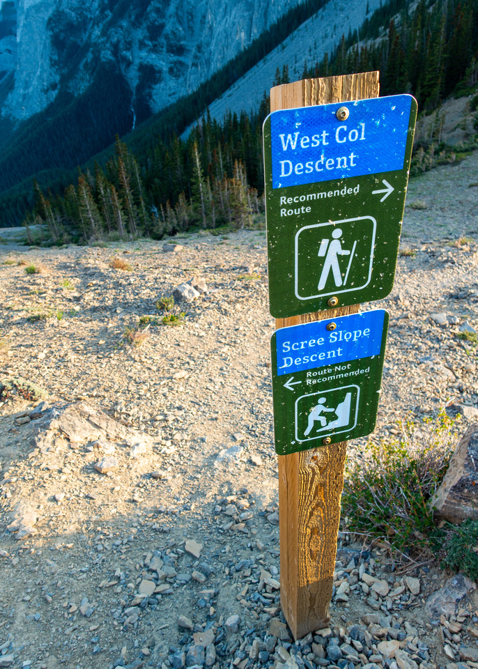 West Col Junction
In old days route would head straight down to infamous scree run. After deaths in '21 Alberta Parks built preferred West Col Descent Trail West Col Junction
In old days route would head straight down to infamous scree run. After deaths in '21 Alberta Parks built preferred West Col Descent Trail |
|||
 Goat Col
Late afternoon sun reflecting of Yam cliffs already on West Col descent trail Goat Col
Late afternoon sun reflecting of Yam cliffs already on West Col descent trail |
|||
 Scree Run
West Col descent passing bottom of Infamous Scree Run. Parking is less than an hour from here. Climber trail hugs base of the cliffs and can be used to traverse all the way back to Ravens End Scree Run
West Col descent passing bottom of Infamous Scree Run. Parking is less than an hour from here. Climber trail hugs base of the cliffs and can be used to traverse all the way back to Ravens End |
|||
 Traverse of Yamnuska GAIA Map Traverse of Yamnuska GAIA Map
|
|||
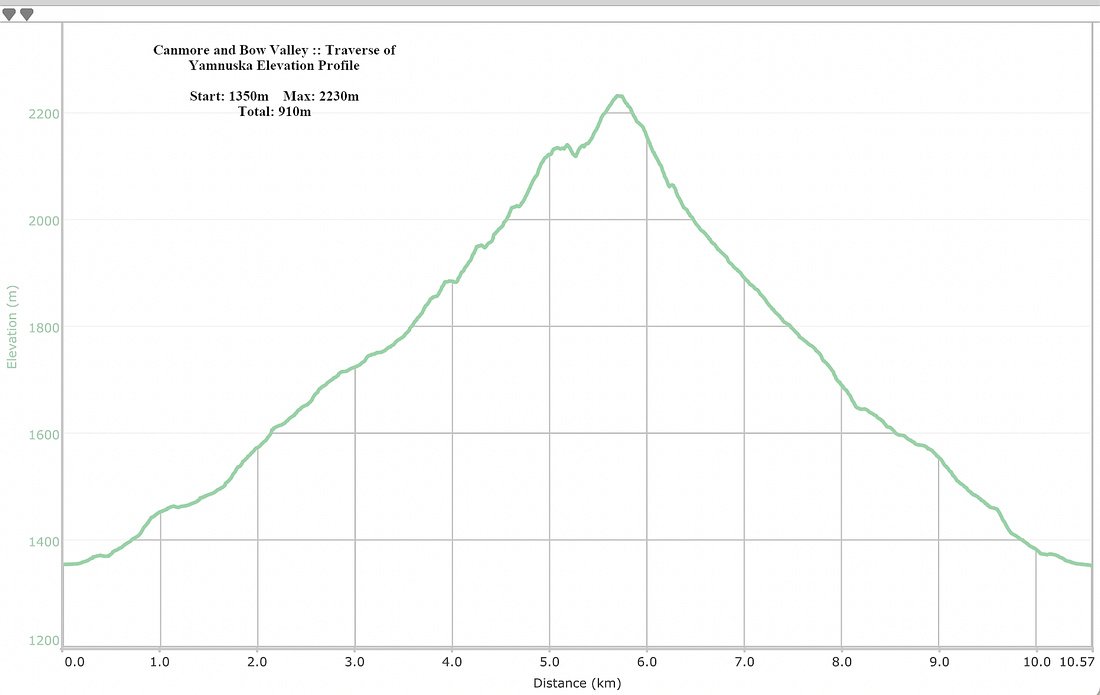 Traverse of Yamnuska Elevation Profile Traverse of Yamnuska Elevation Profile
|
Abstract
| Overall Difficulty | D2/5 | Easy hiking with some steep parts for Ravens End; Class 2/3 scramble for Traverse with Exposed Crux. Rockfall danger | |||
| Snow Factor | S2/4 | Ravens End doable year-round. Possibility of icy sections and/or postholing. Traverse feasible but preferably dry | |||
| Scenery | Foothills, Aspen Forests and Impressive Yam cliffs | ||||
| Trail/Marking | Excellent | Well defined trail throughout with blue markers/wands | |||
| Suggested Time | 3/6hrs | 3hrs return for Ravens End, 5-6 hrs for Traverse | |||
| Elevation | Start: 1350m Max: 1860 (2230)m Total: ~510 (910)m | Round Trip: 8km (Ravens End), 11km (Traverse) | |||
| Gear | Full hiking boots preferable. Spikes in winter. Poles and Helmet (Rockfall) for Traverse | ||||
| Water | Dry hike. 1L for Ravens End, 2 for Traverse depending on season | ||||
| Dog Friendly | Yes | No on-leash restrictions. For traverse chain section could be a problem | |||