Google Map |
BC Coast :: Sea to Sky :: Stawamus Backside |
GPS Track |
Back side of Stawamus Chief 3rd summit from Slhaney trail |
|||
| Trip Summary | |||
April 8, 2013Relatively unknown trail that ascends 3rd peak of Stawamus Chief from the north and avoids crowds on standard approach via Olesen Creek. Challenges are considerate, but scenery is better. Many possibilities for further exploration exist. Returning the same way is shortest option; pleasant alternative is loop that descends gully between 2 and 3 summit and links with Slhaney trail. Optional visit to Slhaney (a.k.a Stawamus Squaw) will require a full day and is not as scenic as main trail. Heading north on Sea-to-Sky turn right on Mamquam Main FSR just before entering Squamish. Drive just under 2km and park on pullout at right side; if you see sign "2 up" you have gone too far. Trail heads into forest and soon start gaining elevation. Follow well defined footbed with occasional flags to base of steep cliffs, then turn right and continue towards the Chief. This section is rough and occasionally calls for use of hands. Within an hour trail emerges to saddle that offers fabulous viewpoint of Squamish valley -- well worth a break! Note nearby signed Olesen Creek junction in case of alternate loop return. Continue towards the Chief ignoring all side trails. Ascent is steep with crux halfway up - 1.5 m high angle slab. It might have rope and/or via ferrata iron bars; otherwise it is very stiff class 3. Final exit to the summit is steep climb up granite wall that might be intimidating to people not used to such places. From the top either return the same way, or follow flagged trail to col between summits 2 and 3 then descend occasionally awkward gully to junction with Slhaney trail. Turn left, climb past Cirque of the Uncrackables then descend to Olesen junction and hike down where you came up. If continuing to Slhaney past Olesen junction, follow remnants of old deactivated forest road sometimes choked with alders. Flags are infrequent and with snow cover it might not be obvious where to go. After about an hour from Olesen junction watch for flagged trail on left side. Hike up and reach old fire lookout in about 15-20 minutes. If continuing to Slhaney, 2 alternate descents back to the parking are possible:
|
|
Gallery |
|||
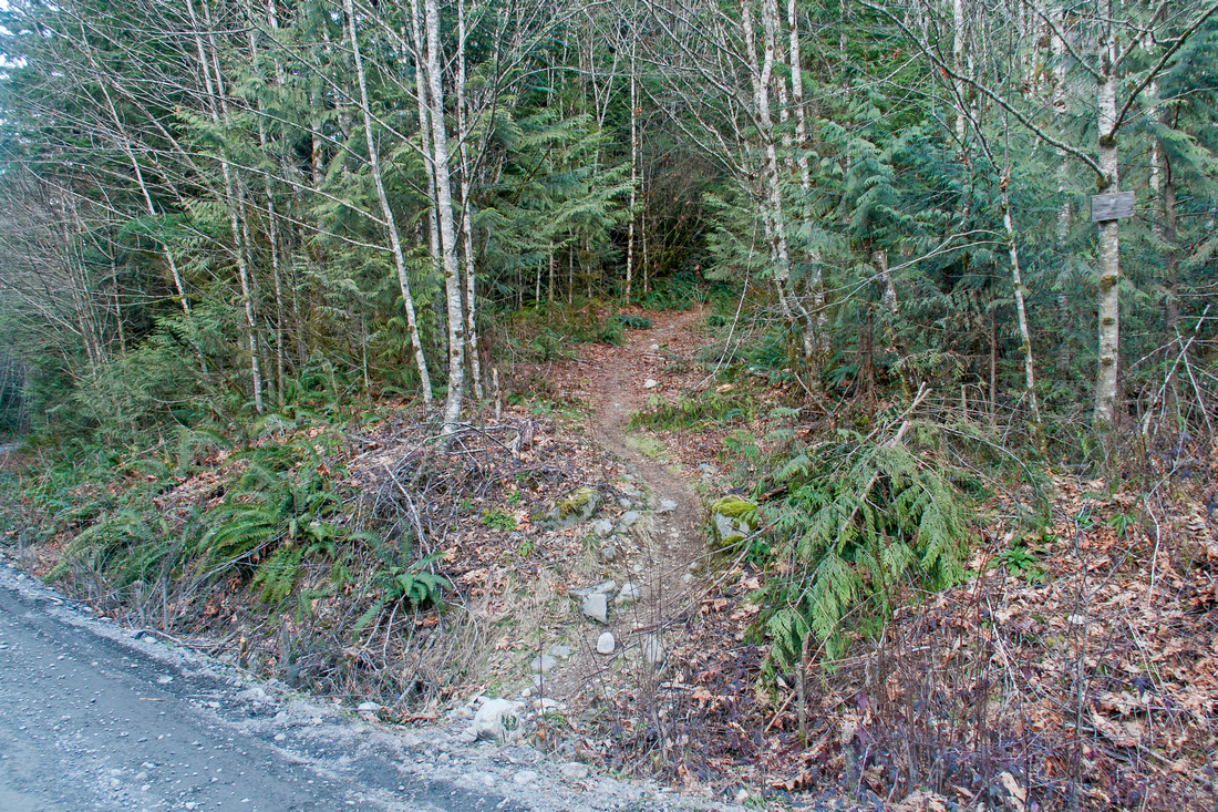 Valley trail at east side of Mamquam Main
 |
|||
 Cliffs at base of Slhaney ~20 mins from trailhead; go right
 |
|||
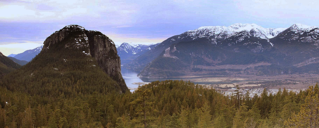
 Panoramic views of Squamish valley from saddle between Chief and Slhaney. Tantalus range behind
 |
|||
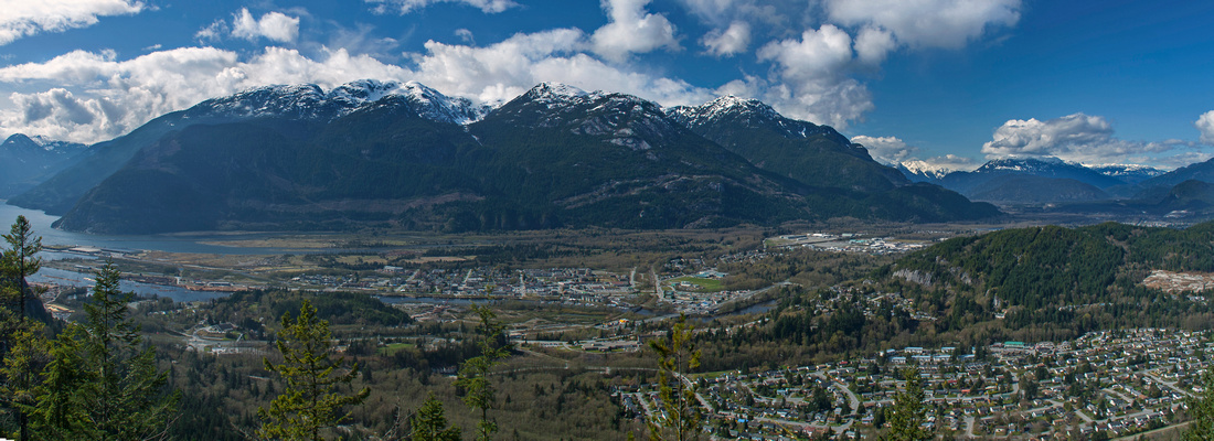
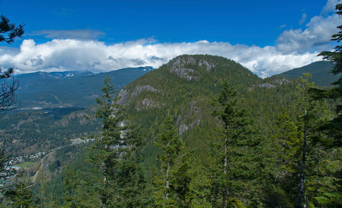 View of Slhaney from clearing on Chief north side
 |
|||
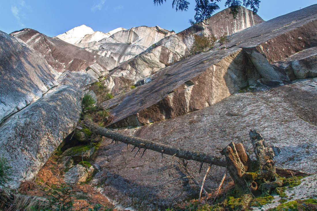
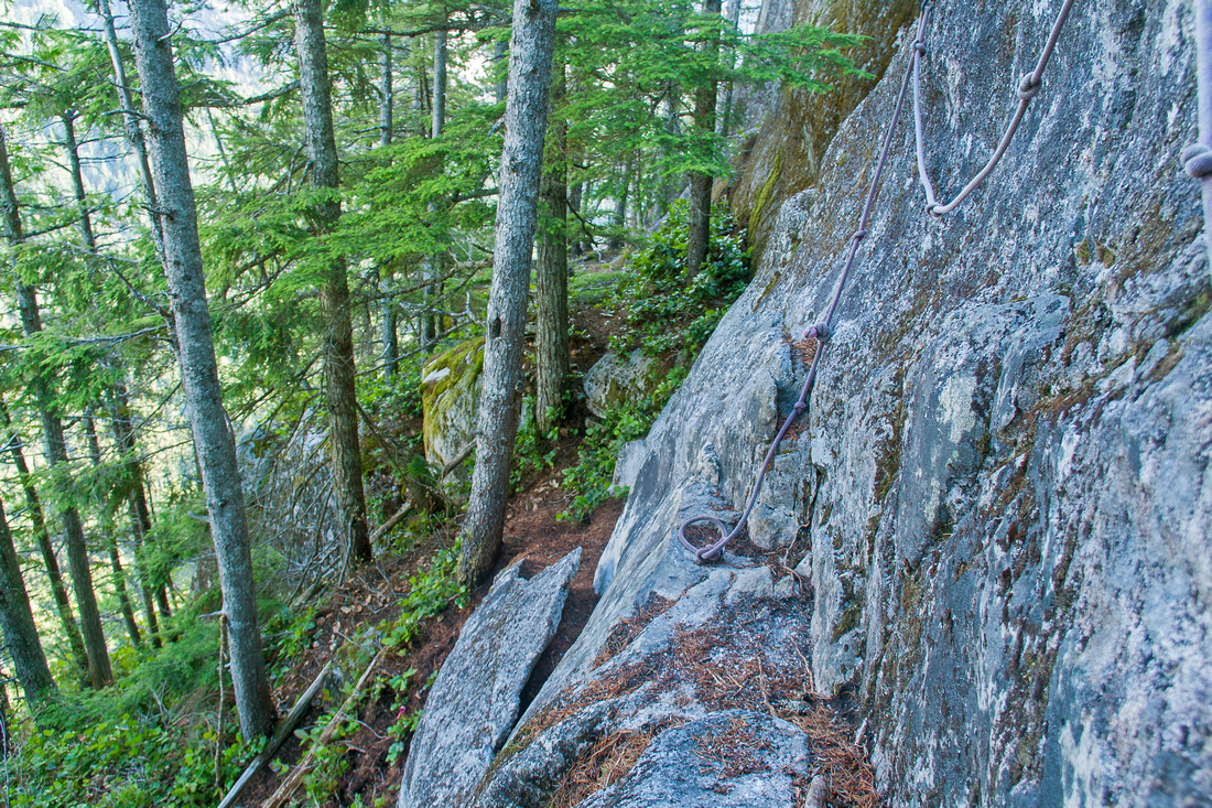 Technical crux: Stiff class 3 pull of 1.5 m high bluff
 |
|||
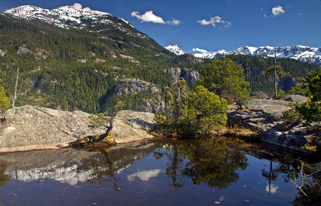 Lovely tarn on third summit of Stawamus Chief. Habrich ridge left, Goat ridge right
 |
|||
 "Cirque of the Uncrackables" along Slhaney trail
 |
|||
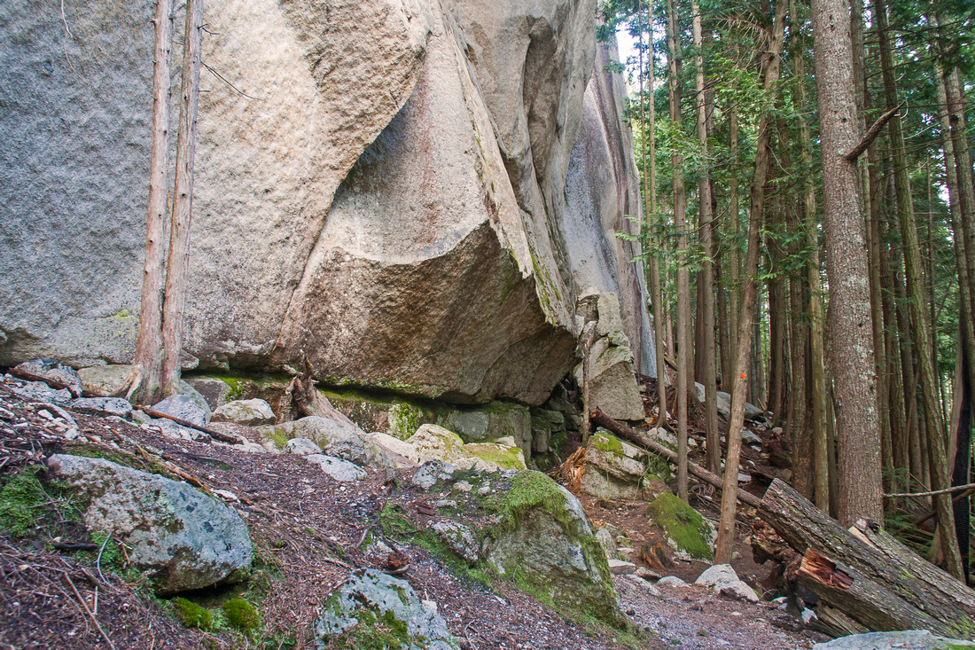
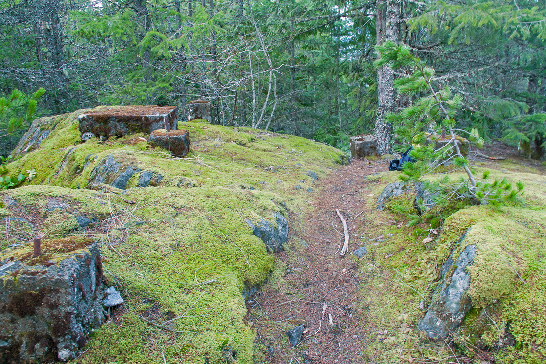 Remnants of old fire lookout structure on Slhaney
 |
Abstract
|
Overall Difficulty |
Several stiff class 3 scramble steps up bluffs and polished granite. Routefinding. Awkward descent down gully between 2 and 3 peaks on alternate return |
||||
|
Snow Factor |
Due to low elevation trail is snow-free most of the year. In early season possibility of deep snow that makes navigation awkward if continuing to Slhaney |
||||
|
Scenery |
Spectacular views of Squamish valley, Tantalus range, Co-pilot, Habrich and Goat ridges. Imposing granite walls |
||||
|
Trail/Marking |
Good / Poor |
Flagged trail with solid footbed. Most junctions are marked. Less defined for Slhaney |
|||
|
Suggested Time |
5 hr |
Loop return via Slhaney Trail, less if descending the same way. Add min 2 hours if continuing to Slhaney |
|||
|
Elevation |
Start: 35m Max: 695m Total: ~850m (1100m) |
Round Trip: 8km (13km) | |||
|
Gear |
Full-hiking boots for ankle support and possible muddy spots. Poles essential for stability. GPS recommended |
||||
|
Water |
Olesen Creek and small streams. Seasonal pond / snow melt on top of Stawamus Chief. Carry 1-2L |
||||
|
Dog Friendly |
No |
Steep scramble up granite blocks not suitable for dogs |
|||
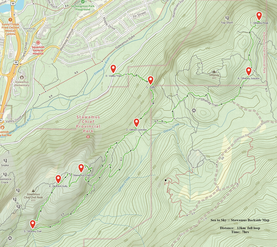 Stawamus Backside GAIA Map
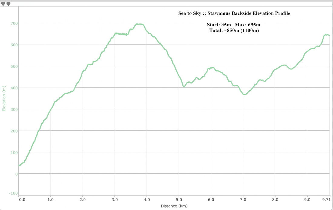 Stawamus Backside Elevation Profile