Google Map |
Rockies :: Alberta Foothills :: Lusk Ridge |
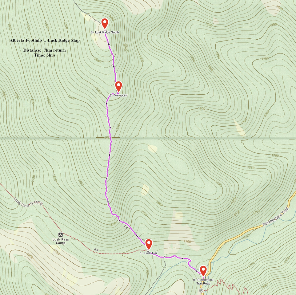
GPS Track |
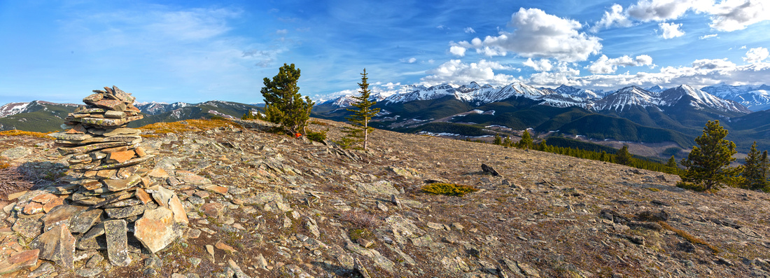 
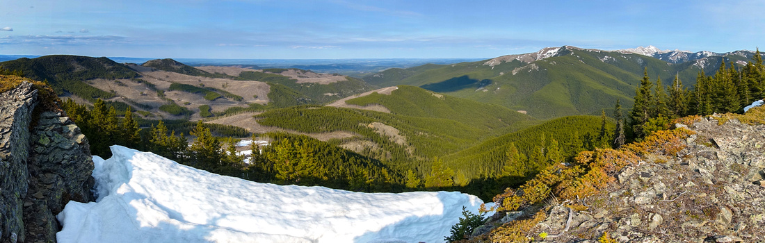
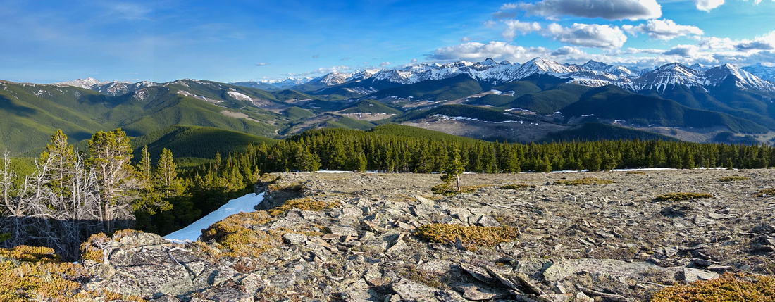
Panoramic Views South from Lusk Ridge North Summit with Range of Snow Covered Front Range Peaks on Horizon |
|||
| Trip Summary | |||
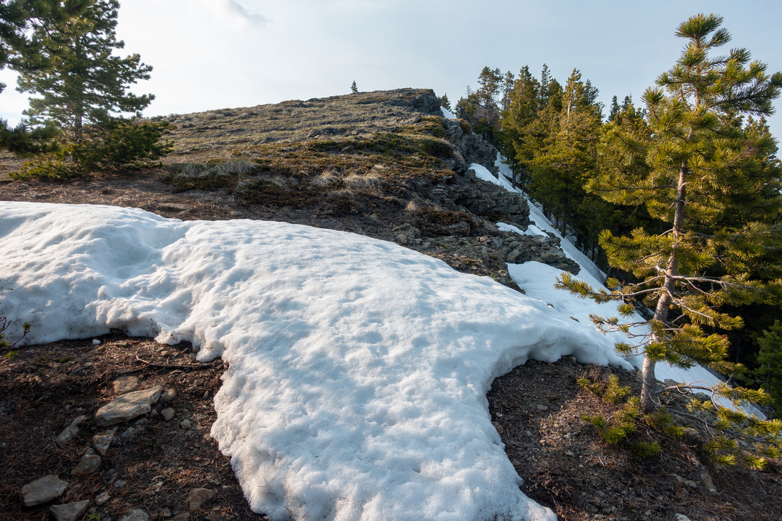
May 30, 2024Mostly forested ridge sandwiched between Sibbald Trail to the North and Powderface Trail Road to the South-East. There are several bumps forming horseshoe of a sort, earning nickname "Hunchback Hills". Traverse is possible but entails lots of ups/downs, bushwhack and micro-terrain route finding. Most simply ascend South Summit as presented on this Page , incidentally also the highest point with spectacular 360 Views.
Trailhead is at east side of Powderface Trail Road, just across standard Jumpingpound Mtn parking area, some 5km south of Dawson Winter Gate (seasonally closed Dec 1 - May 15). Initial part follows Lusk Pass trail (which ends at Barrier Lake), crossing Jumpingpound Creek to north side on solid wood bridge after few minutes. This section is also shared with Trans-Canada Trail (TCT) and sees regular equestrian traffic. Ridge Trail forks off 0.7km from trailhead; junction was marked with cairn and flag as of May '24. If in doubt download GPS Track Top of Page (Waypoint "1 - Lusk Trail"). After crossing wide logging area trail climbs fairly steeply then levels off and becomes faint after crossing deadfall area. There are some cairns and flags, but generally just stay close to climber right escarpment, reaching open area with fantastic views ~1hr from Lusk Pass Trail. South summit is 15-20min away and this part often has deep snowdrifts in early season; I found gaiters very helpful as on occasion I was sinking above the knee. Treeline exit below the summit (see Gallery) ends with short grassy hill hike to Highpoint that has humongous Cairn. Panoramic 360 views are great and more than enough Reward for fairly modest effort. This wide open clearing is also prone to strong year-round winds, offering little shelter. On my visit I was able to find nice spot for quick break by descending west side meadow then ducking behind some low trees. If not planning on continuing, simply return the same way. It is very easy to go off trail - on my trip I had to consult my own GPS track several times.
It is also possible to reach Lusk Ridge from the North, starting from Sibbald Trail ~2km east from Horton Hill Trailhead. This access becomes popular in winter months as Powderface Trail Road is closed south of Dawson Recreation Area. Very little else works in advantage of this variation as most of the approach follows ugly logging areas with possibility of deep unconsolidated snow. Ridge is reached near the apex with views nowhere as good as on South Summit. This trip, just like Horseshoe Traverse, has low Reward and is not recommended. |
|
Gallery |
|||
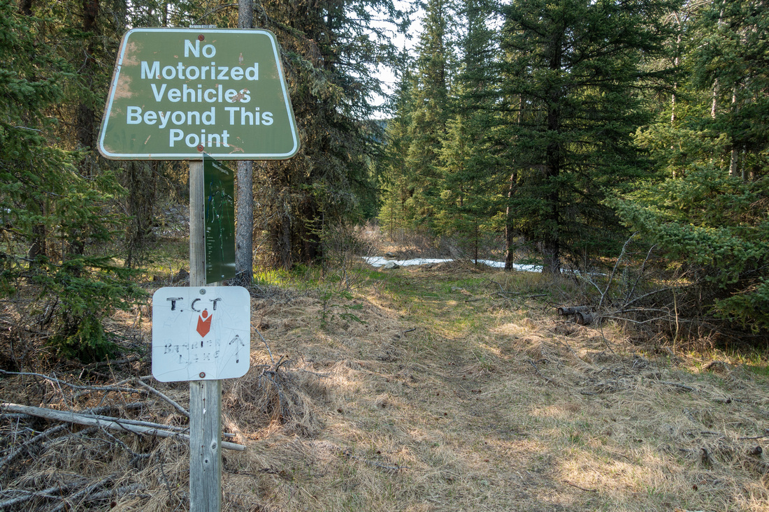 TCT Trailhead
Lusk Pass Trailhead at west side of Powderface Trail Road TCT Trailhead
Lusk Pass Trailhead at west side of Powderface Trail Road |
|||
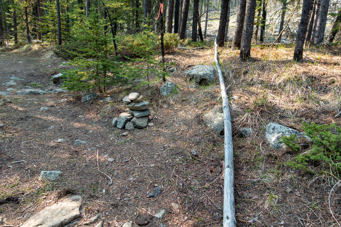 Lusk Ridge Junction
Cairn and Flag marking Ridge Junction ~10min (0.7km) from Trailhead Lusk Ridge Junction
Cairn and Flag marking Ridge Junction ~10min (0.7km) from Trailhead |
|||
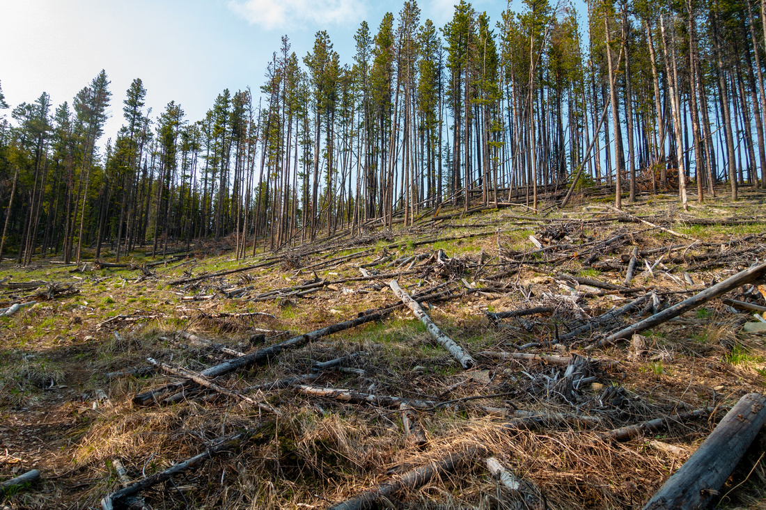 Logged Area
Initial section of ridge trail crossing area scared by logging Logged Area
Initial section of ridge trail crossing area scared by logging |
|||
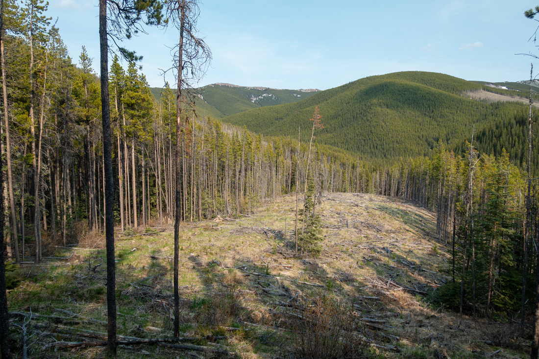 Logged Area
View east from top of logged clearing towards Cox Hill area Logged Area
View east from top of logged clearing towards Cox Hill area |
|||
 Powderface Corridor
View south down Powderface Trail corridor after fairly steep initial ascent. Trail becomes faint past this point Powderface Corridor
View south down Powderface Trail corridor after fairly steep initial ascent. Trail becomes faint past this point |
|||
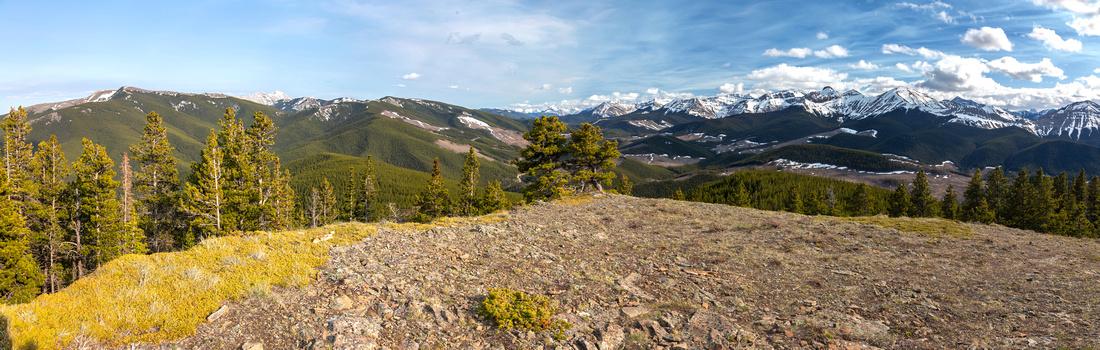 Powderface Panorama
Sweeping southerly Panorama from open viewpoint 15-20min before South Summit Powderface Panorama
Sweeping southerly Panorama from open viewpoint 15-20min before South Summit |
|||
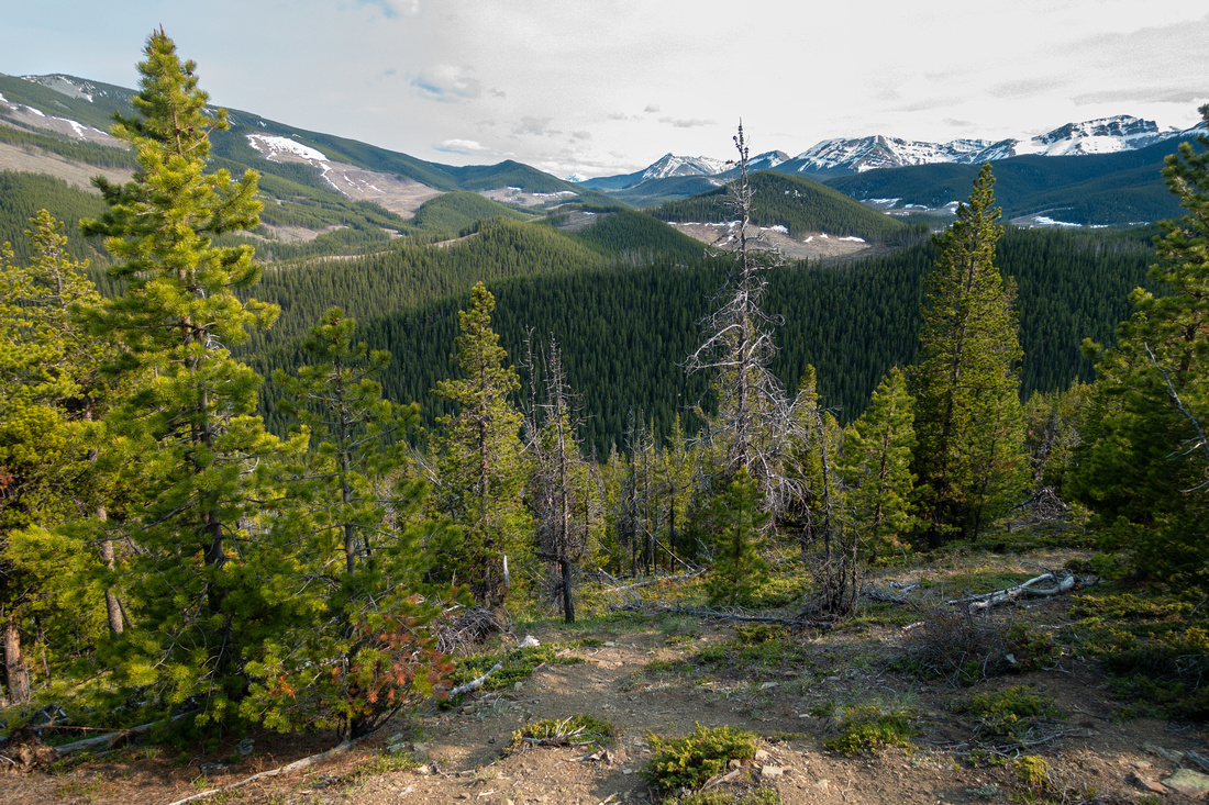
 Treeline Exit
South Summit Treeline. Deep postholing is likely in shoulder season Treeline Exit
South Summit Treeline. Deep postholing is likely in shoulder season |
|||
 Hunchback Panorama
Easterly Panorama from just above Treeline. Cox Hill center right, Moose Mtn behind Hunchback Panorama
Easterly Panorama from just above Treeline. Cox Hill center right, Moose Mtn behind |
|||
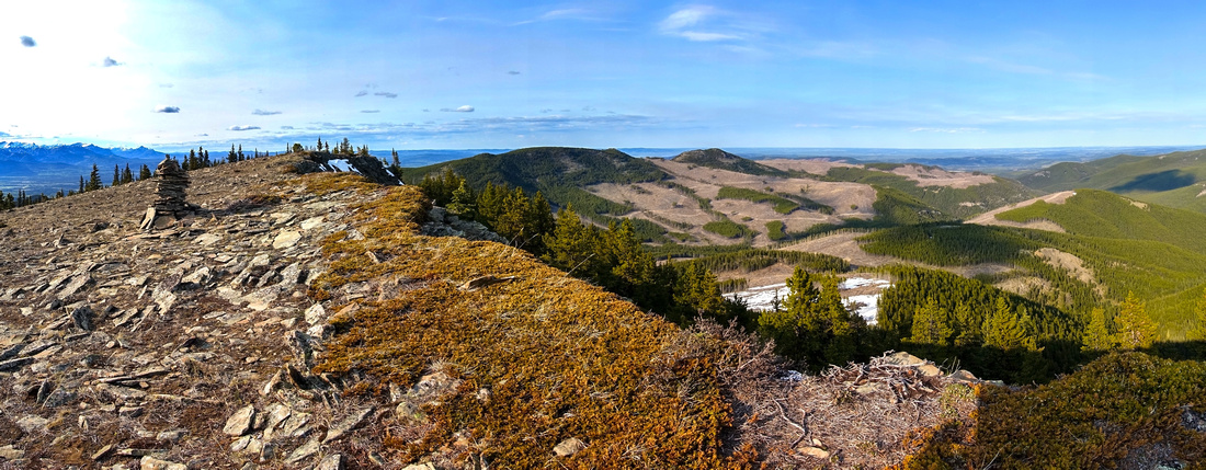 Hunchback Panorama
Northerly Panorama approaching South Summit Cairn. Most of Hunchback Hills Horseshoe can be traced here Hunchback Panorama
Northerly Panorama approaching South Summit Cairn. Most of Hunchback Hills Horseshoe can be traced here |
|||
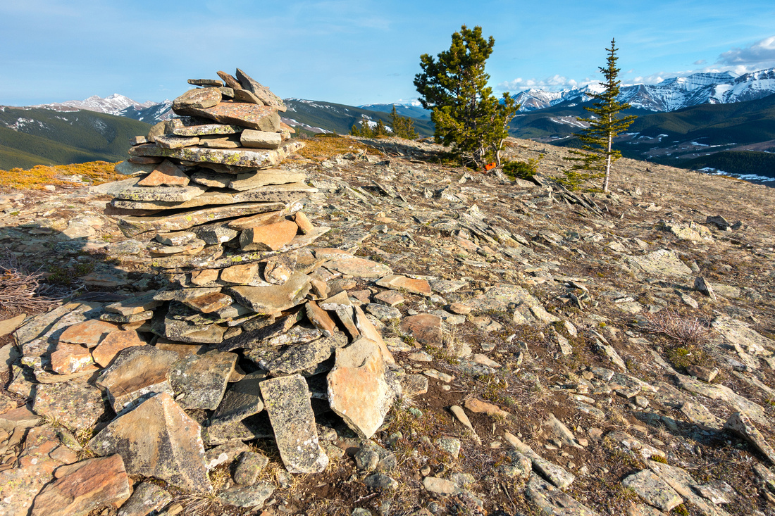 Summit Cairn
Humongous Summit Cairn (~1.5m) at 2115m North Summit. Register in Orange container below tree behind to the right Summit Cairn
Humongous Summit Cairn (~1.5m) at 2115m North Summit. Register in Orange container below tree behind to the right |
|||
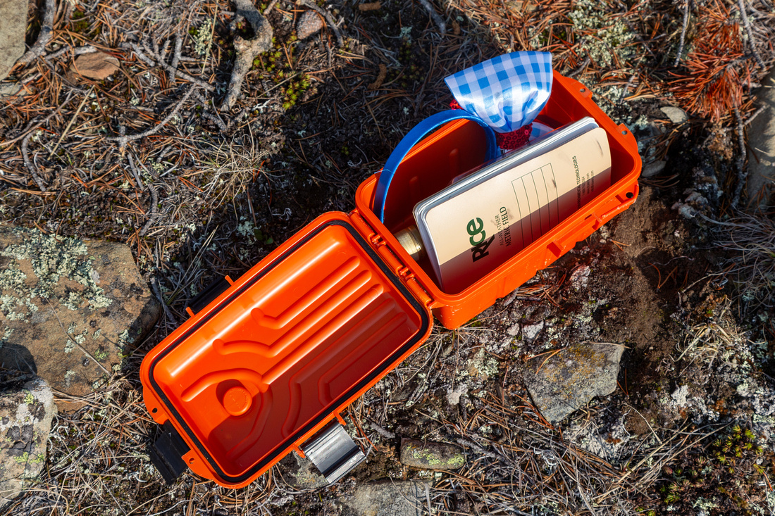 Summit Register
s in Rockies are always fun to inspect. Mine was first entry in 2024 Summit Register
Summit Registers in Rockies are always fun to inspect. Mine was first entry in 2024 |
|||
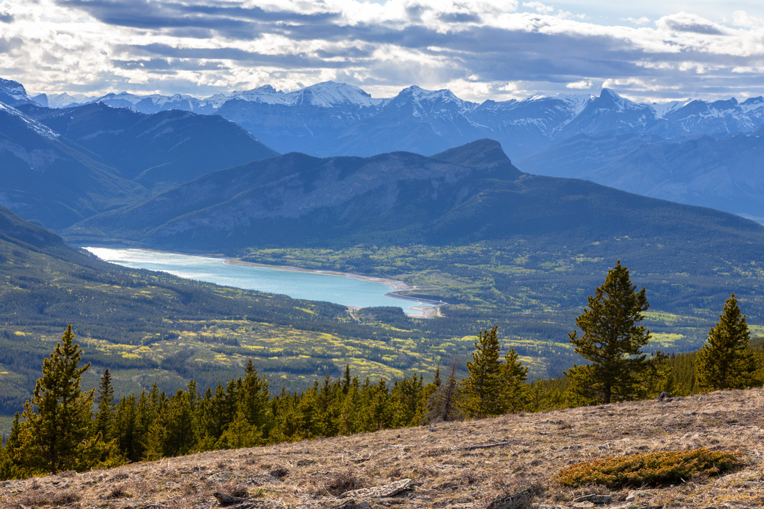 Barrier Lake
 area from west side treeline. McConnell Ridge center Barrier Lake
Barrier Lake area from west side treeline. McConnell Ridge center |
|||
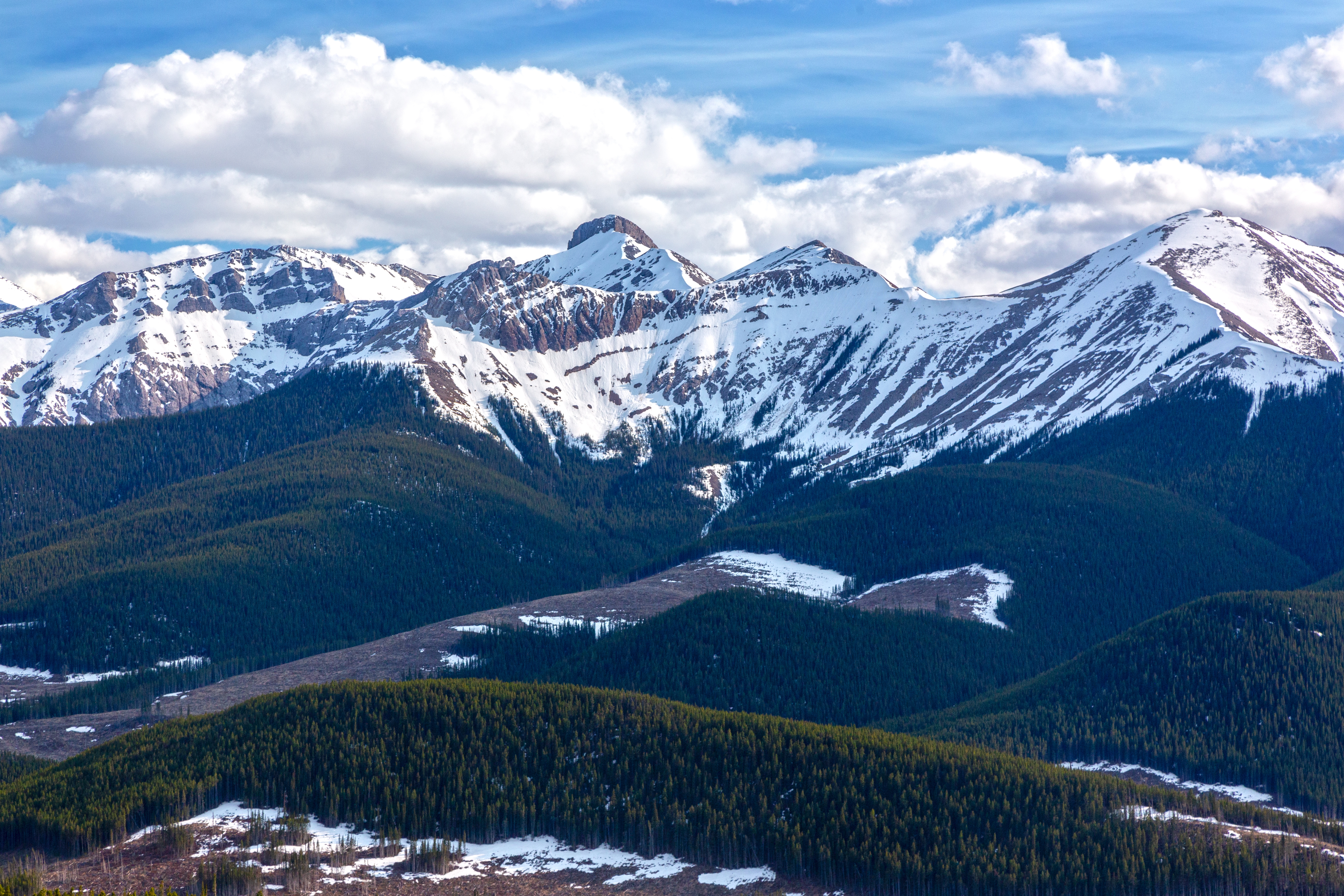
 Powderface Panorama
Sea of snow covered Kananaskis Front Range peaks on descent. Look for orange flag marking point where trail dips in the forest Powderface Panorama
Sea of snow covered Kananaskis Front Range peaks on descent. Look for orange flag marking point where trail dips in the forest |
|||
 |
Abstract
| Overall Difficulty | D3 | Moderately steep ascent mainly below treeline | |||
| Snow Factor | S2 | Mostly forested trek with no avalanche danger. Deep postholing in shoulder season | |||
| Scenery | Sweeping scenery of front ranges and foothills | ||||
| Trail/Marking | Poor | Well defined Lusk Pass Trail for ~10min only. Faint Ridge route with occasional flags and cairns. Deadfall areas with navigation problems | |||
| Suggested Time | 3 hrs | Return time for South summit only. Hunchback traverse of entire ridge a full day | |||
| Elevation | Start: 1665m Max: 2115m Total: ~500m (North Summit OnB) | Round Trip: ~7km (South Summit OnB) | |||
| Gear | Day hikers sufficient in dry conditions. Gaiters a must in shoulder season. GPS very helpful. Wind-breaker essential as ridge is wind-blown year round. | ||||
| Water | Jumpingpound Creek at start. Seasonal snow patches. Carry 1L+ depending on season | ||||
| Dog Friendly | Yes | Standard back-country travel precautions | |||
 Lusk Ridge GAIA Map
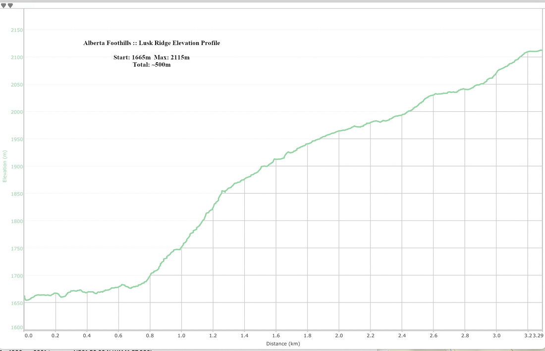 Lusk Ridge Elevation Profile