Google Map |
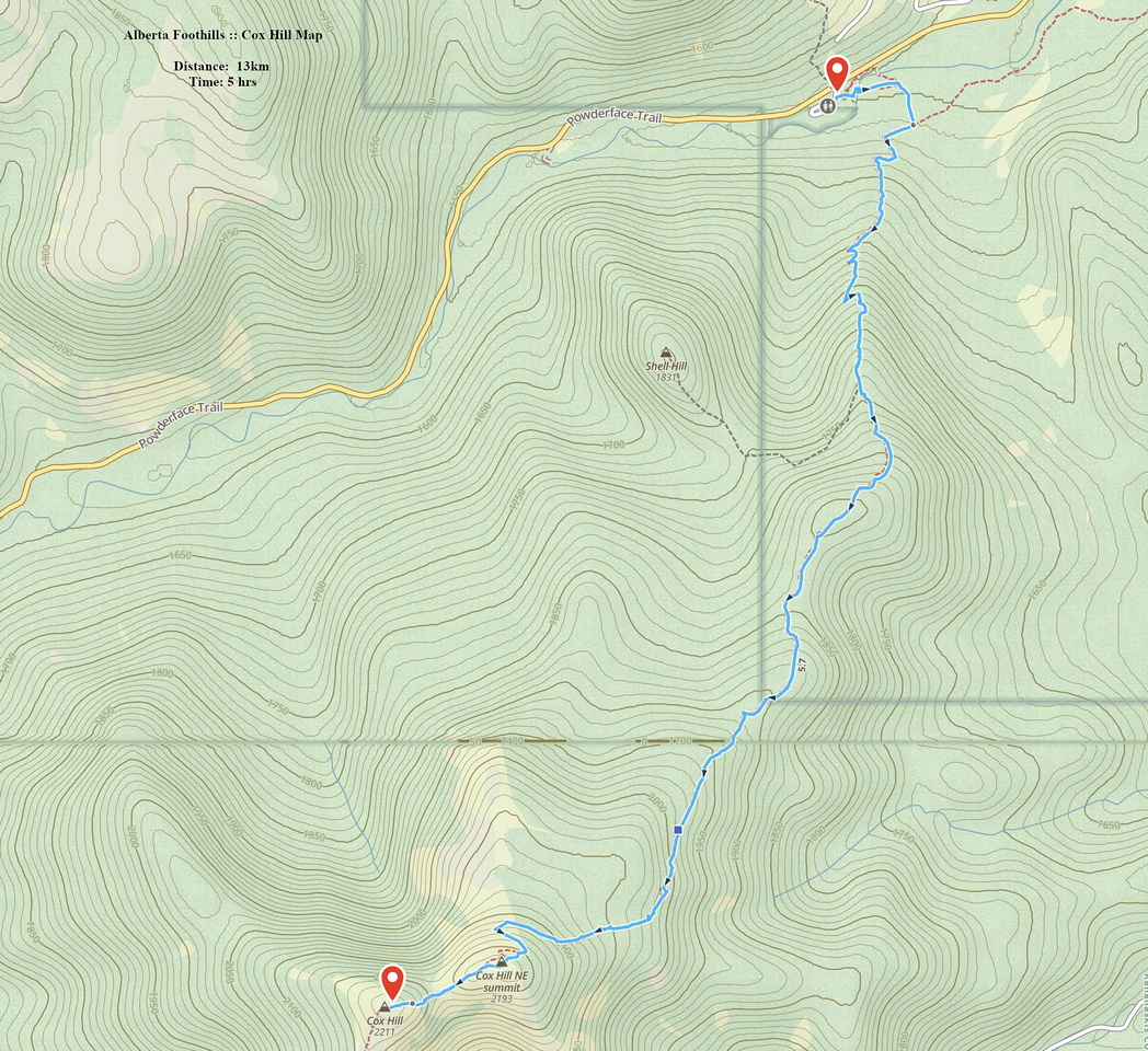
Rockies :: Alberta Foothills :: Cox Hill |
GPS Track |
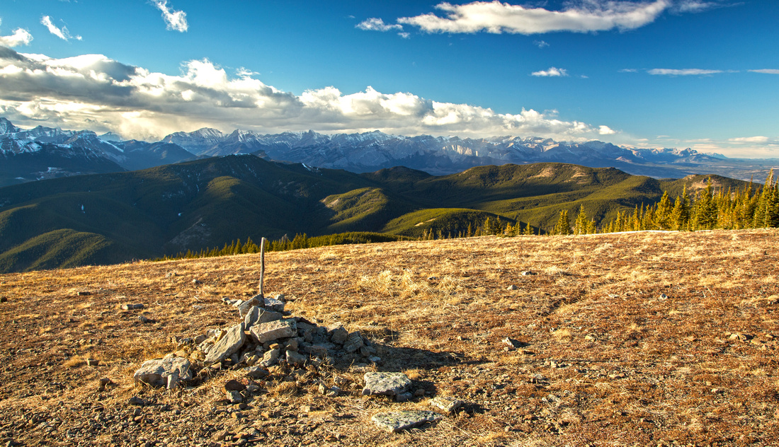 
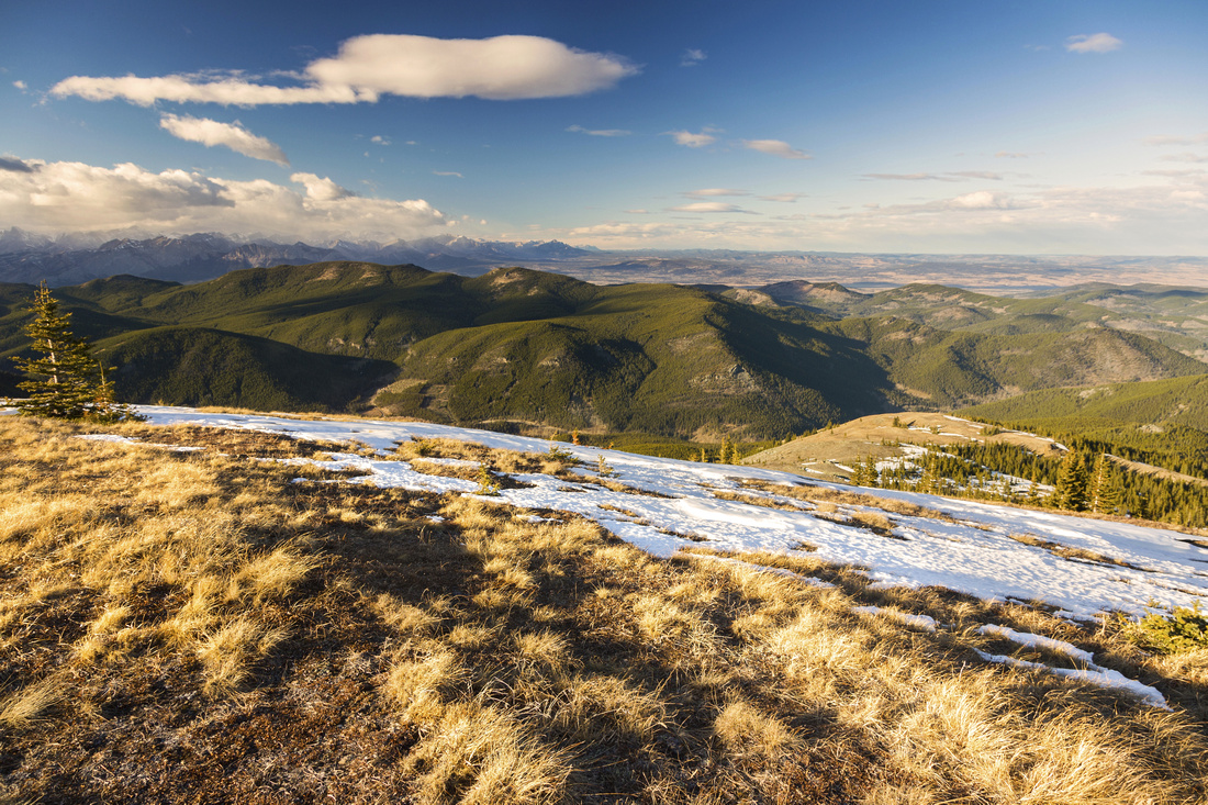
Panoramic Views NW from windswept Cox Hill Ridge Highpoint |
|||
| Trip Summary | |||
October 30, 2018Cox Hill is favorite Foothills trip. Feasible year-round it leads to fabulous viewpoint. It is also highest point on Trans-Canada trial (TCT). Many possibilities exist to extend the trip, including descent on south side to Lusk trailhead or traverse of entire Jumpingpound ridge (2 cars required in both cases). Start from Dawson trailhead on Powderface road, couple of km south from Sibbald junction. Powderface road is closed from Dec 1 - May 14, but initial part to Dawson is open year-round. Area is popular equestrians. Bridge over Jumpingpound creek has been washed out in historic 2013 floods, but new one has been rebuilt few 100s meters east. Equestrian trail still crosses at the old point, but hikers should follow trail to the left (trailhead sign) and cross on new bridge; both options join couple of minutes past the creek. Tom Snow trail junction is reached soon after -- turn right. Rest of trek is straightforward. Trail stays below tree cover but there are couple of clearings with nice views. Beware of mountain bikers often coming down in blazing speed! After reaching treeline, trail switchbacks up steep grassy hill (could be tricky in winter) to Survey marker on north part of the ridge. Follow ridge crest for another ~10min to highpoint; fabulous 360 sweeping views await. Often there is strong and cold wind here, but shelter can be found by dropping a bit south below rock outcrops. This is fantastic spot to study the area and ponder eventual loop return via Jumpingpound trail. If returning the same way, obvious grassy meadows below switchbacks beg to be explored. They are labelled "Sunken Meadows" in Daffern K-country trail guide. There is no trail, but none is required; after wondering around, trash east through semi-open forest and reconnect with main trail. |
|
Gallery |
|||
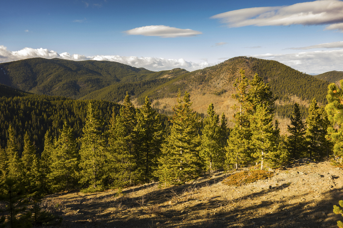 Looking back to Powderface Trail corridor from first clearing above Dawson trailhead
 |
|||
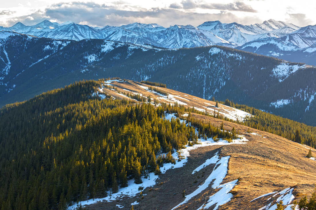
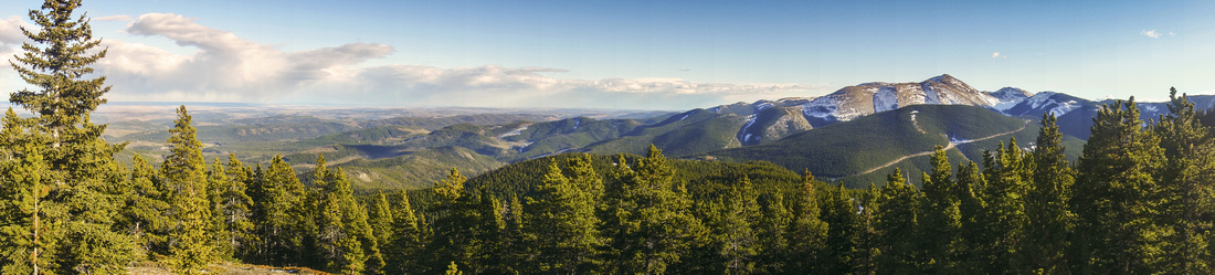 Panoramic view east towards Moose Mtn (center right) and Alberta Foothills from clearing below final ascent
 |
|||
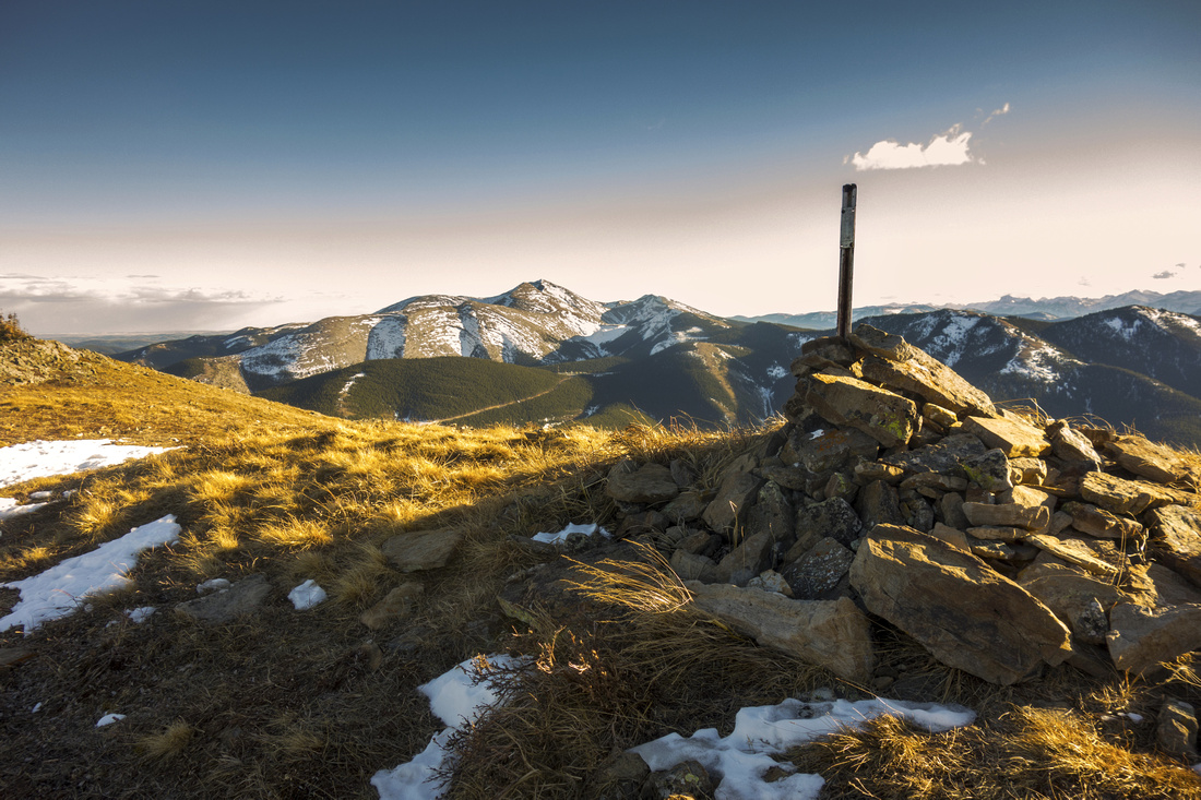 Survey Marker at start of Cox Hill Ridge. Moose Mtn behind
 |
|||
 View north from start of Cox Hill Ridge; "Sunken Valley" center right
 |
|||
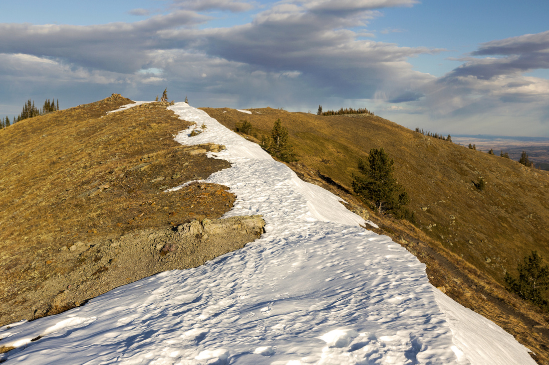 Looking back towards North End of the Ridge
 |
|||
 Cox Hill Viewpoint
Highpoint of Cox Hill Ridge looking south towards Jumpingpound Mountain Cox Hill Viewpoint
Highpoint of Cox Hill Ridge looking south towards Jumpingpound Mountain |
|||
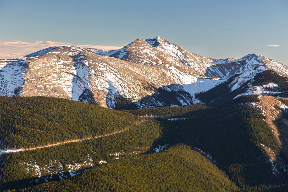 Moose Mountain Telephoto from Cox Hill Ridge Highpoint
 |
Abstract
| Overall Difficulty | D3 | Moderately steep ascent mainly below treeline on well-defined trail with no route-finding problems | |||
| Snow Factor | S2/3 | Switchbacks on steep rise leading to ridge start could be tricky. Due to north exposure trail below treeline is often icy or hard-packed, slippery snow - spikes are essential | |||
| Scenery | Sweeping scenery of front ranges and foothills | ||||
| Trail/Marking | Excellent | Wide and well defined trail shared with mountain bikers. Couple of initial junctions are marked | |||
| Suggested Time | 5 hrs | Return time from/to Dawson trailhead. Many variations exist to extend the day | |||
| Elevation | Start: 1490m Max: 2220m Total: ~800m | Round Trip: ~13km (return the same way) | |||
| Gear | Day hikers sufficient in dry conditions. Micro-spikes in shoulder season or winter. Wind-breaker essential as ridge is wind-blown year round | ||||
| Water | Dry hike. Carry 1 - 1.5L | ||||
| Dog Friendly | Yes | Standard back-country travel precautions | |||
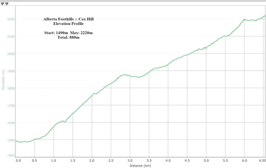 Cox Hill Elevation Profile