Google Map |
Rockies :: Kananaskis :: Ships Prow |
GPS Track |
|
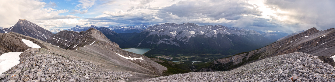
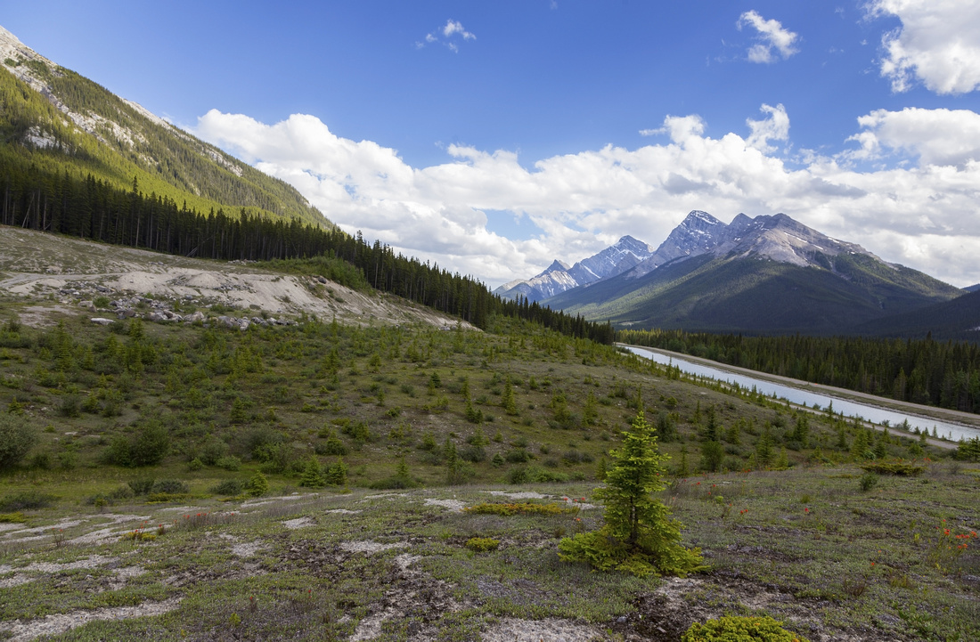
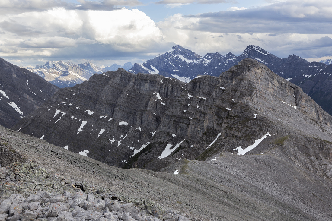
Panoramic view SW from Ships Prow summit ridge with storm clouds advancing over Spray Lakes corridor |
|||
| Trip Summary | |||
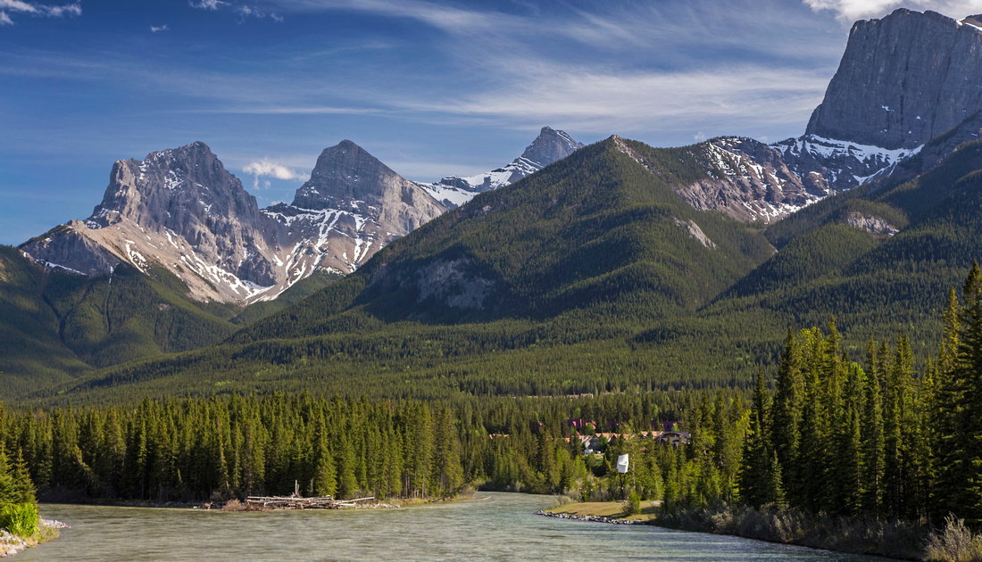
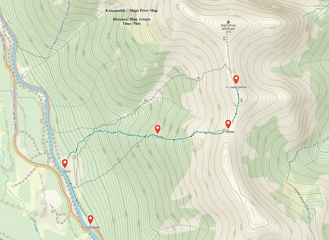
July 9, 2022When seen from Bow Bridge in Canmore, formidable looking cliff just east of Mt. Lawrence Grassi resembles forward most part of the boat - hence the name for this unofficial summit. Front facing cliffs are popular with rock climbers; much easier ascent line is from the back, starting from Goat Pond on Spray Road. Route is relatively unknown, and when nearby Lawrence Grassi, Ha-Ling / Miners Peak or East End of Rundle are swarming with people, there might be nobody on Ships Prow. As such no trail has developed (yet!) and you must be comfortable ascending moderately angled forested slopes with deadfall. There are two summits: lower, "Hikers Summit" - just a knob on final ridge, boasting huge cairn, and entirely hiking. Higher point, or "Scramblers Summit" is guarded by cliff band where conditions are preferably dry (stiff class 3 rock). Peak is sometimes ascended in winter with snowshoes, but snow conditions must be stable as considerable part is above treeline on avalanche prone slopes. Alternate approach from Canmore side is via Grassi Knob; although it saves driving on pothole ridden Spray Road, it can not be recommended as much of the ascent past the Knob is on steep and lose talus slopes (see gallery).
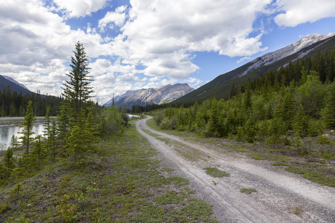
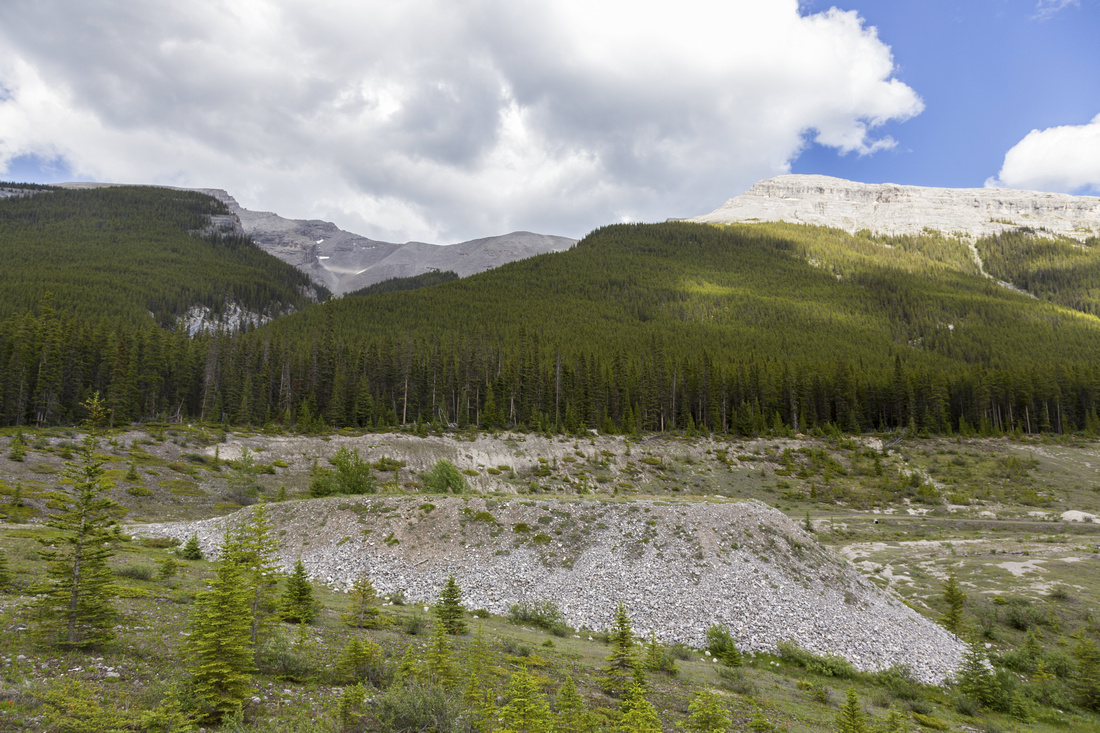
Parking is small pullout on left side of Spray Road, just past Goat Canal bridge (coming from Canmore). There is space for 4-5 cars maybe, more can be found along the road before the bridge. Follow utility road heading north by the canal for short time only until large logged quarry appears on the right. Summit ridge can be seen high above. Easiest line, as per GPS track on top of the page, ascends diagonally left-right from end of quarry, staying close to huge drainage on climber left. There is some deadfall to contend with, but nothing too bad. Couple of minor crumbling cliff bands are easily circumvented at one side or the other. Just past the hour mark trees thin out and bits of trail develop here testifying area does see some human traffic after all. Rest of the ascent to low saddle/start of summit ridge is very enjoyable on moderately angled grass, transitioning into stable scree near the top. Dramatic view of Three Sisters awaits at the saddle, while Hikers Summit is ~15 minutes away ascending gently angled and wide ridge. This is recommended turnaround point as views from Scramblers summit will not be better.
Return is the same way; it might be tempting to trash down huge gully directly below the peak, but this is not recommended due to lose and utterly unpleasant terrain. Recommended easy scramble with great views and likely solitude.
|
|
Gallery |
|||
 Canmore Bridge Canmore Bridge Ships Prow (upper right corner) from Bow Bridge in Canmore
 |
|||
 Quarry Road
Initial walk on Utility Road by Goat canal; EEOR in distance Quarry Road
Initial walk on Utility Road by Goat canal; EEOR in distance |
|||
 Quarry Trailhead
Logged Quarry 10-15min from the parking with summit ridge upper center. Easiest line climbs forested ridge slanting left-right staying close to drainage Quarry Trailhead
Logged Quarry 10-15min from the parking with summit ridge upper center. Easiest line climbs forested ridge slanting left-right staying close to drainage |
|||
 Goat Canal
Crossing the quarry with View back towards Goat Peak and Mt. Nestor Goat Canal
Crossing the quarry with View back towards Goat Peak and Mt. Nestor |
|||
 Treeline
Reaching the treeline after just over an hour of easy/moderate bushwhack. Ships Prow Ridge above, Mt. Lawrence Grassi extreme upper left Treeline
Reaching the treeline after just over an hour of easy/moderate bushwhack. Ships Prow Ridge above, Mt. Lawrence Grassi extreme upper left |
|||
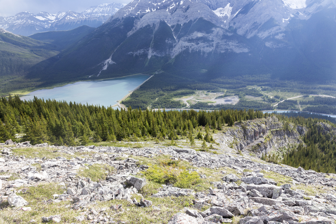
 Goat Pond
View down to Goat Pond just above the treeline Goat Pond
View down to Goat Pond just above the treeline |
|||
 Grassy Slopes
Delightful hiking up grass and talus towards summit ridge Grassy Slopes
Delightful hiking up grass and talus towards summit ridge |
|||
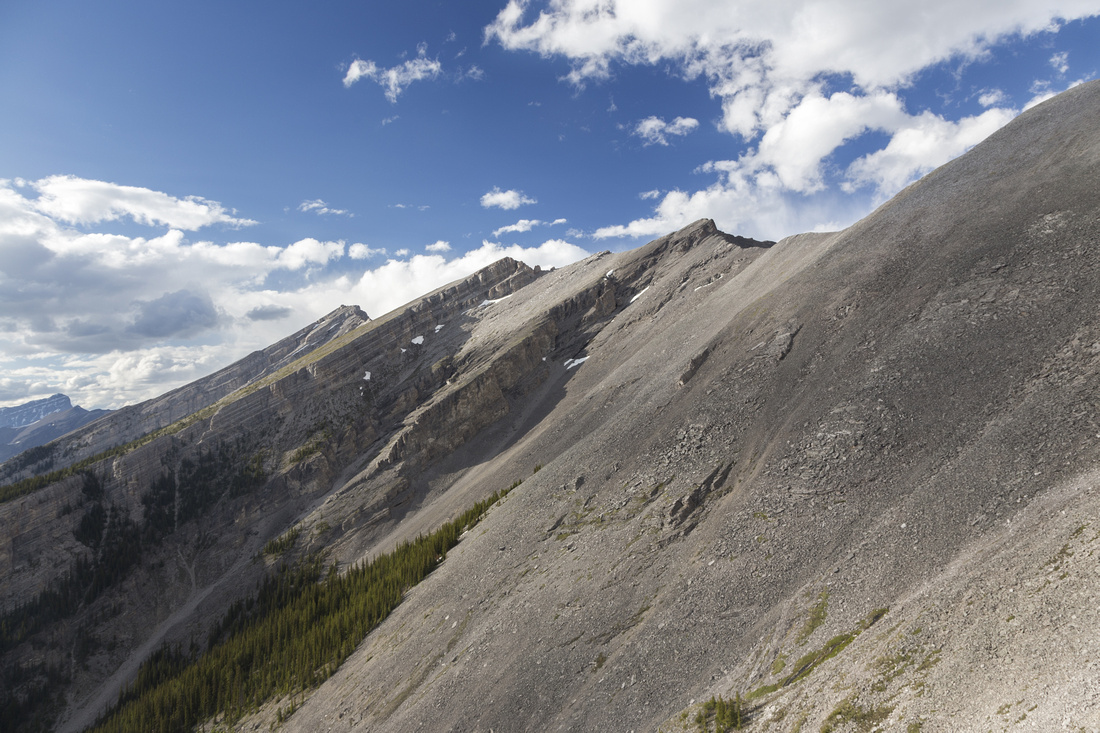 Steep Grade
Steep drainage climber left has been used as alternate descent, but it's lose and more difficult compared to "normal" route Steep Grade
Steep drainage climber left has been used as alternate descent, but it's lose and more difficult compared to "normal" route |
|||
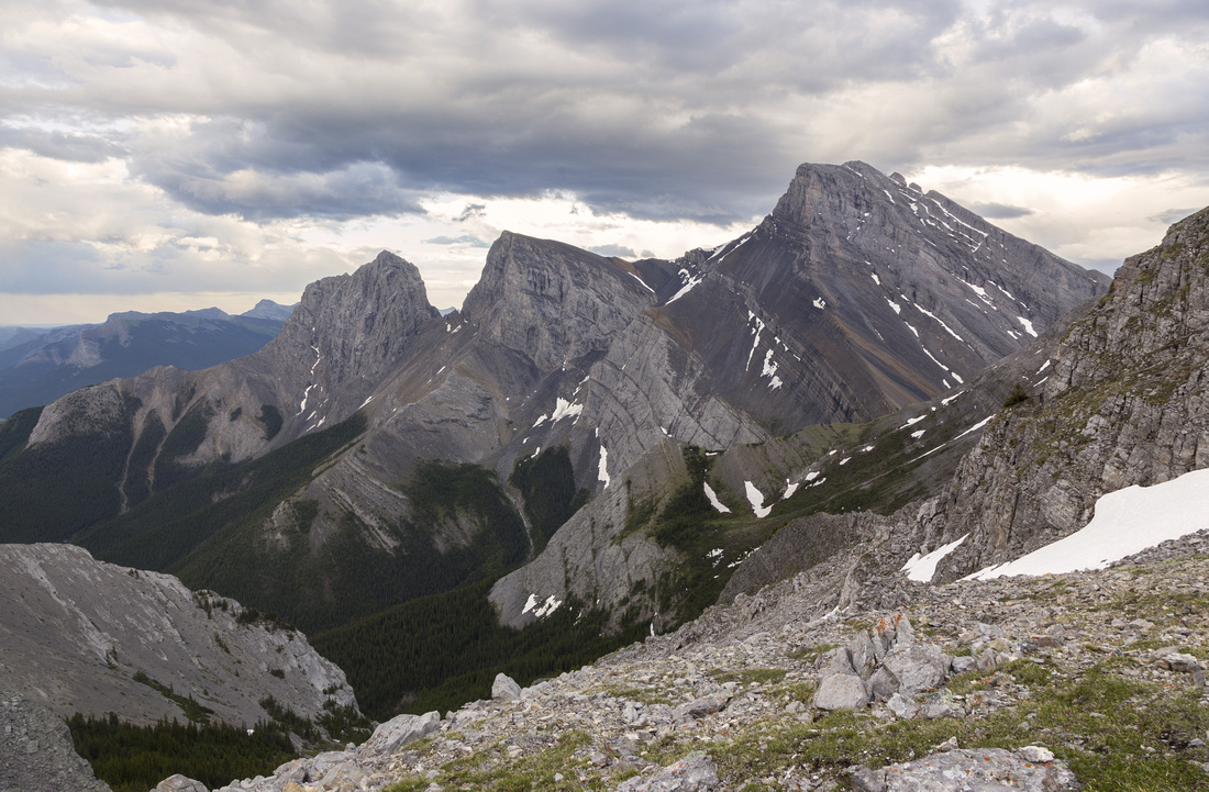 The Sisters
Great view of Three Sisters from low saddle at start of Ships Prow ridge. Three Sisters Pass center right The Sisters
Great view of Three Sisters from low saddle at start of Ships Prow ridge. Three Sisters Pass center right |
|||
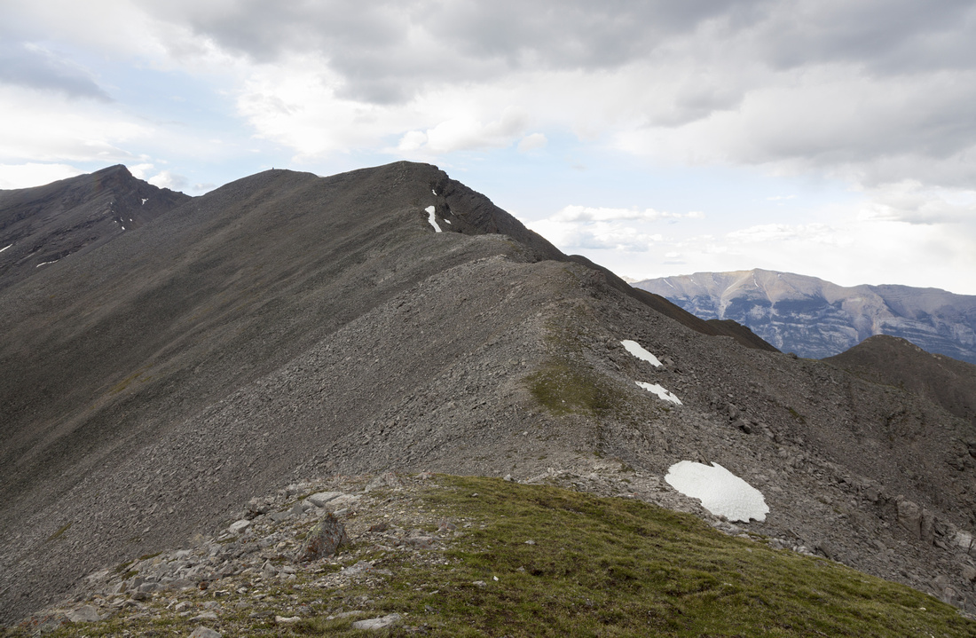 Summit Ridge
Easy ridgewalk towards "Hikers Summit" - cairn is visible. Takes ~15 minutes. "Scramblers Summit" extreme left, Grotto Mtn right background Summit Ridge
Easy ridgewalk towards "Hikers Summit" - cairn is visible. Takes ~15 minutes. "Scramblers Summit" extreme left, Grotto Mtn right background |
|||
 Summit Ridge
Looking back towards the saddle near Hikers Summit Summit Ridge
Looking back towards the saddle near Hikers Summit |
|||
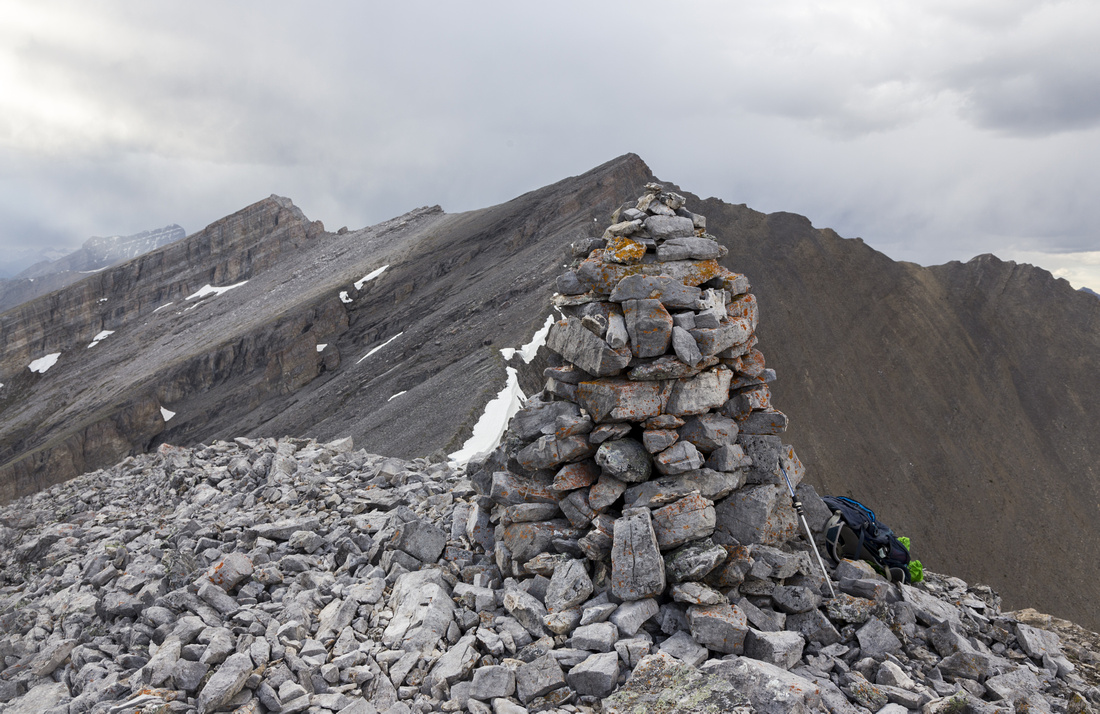 Hikers Summit
Large Cairn at "Hikers Summit" - great wind shelter too! "Scramblers Summit" is ~30 minutes away but considerably more difficult Hikers Summit
Large Cairn at "Hikers Summit" - great wind shelter too! "Scramblers Summit" is ~30 minutes away but considerably more difficult |
|||
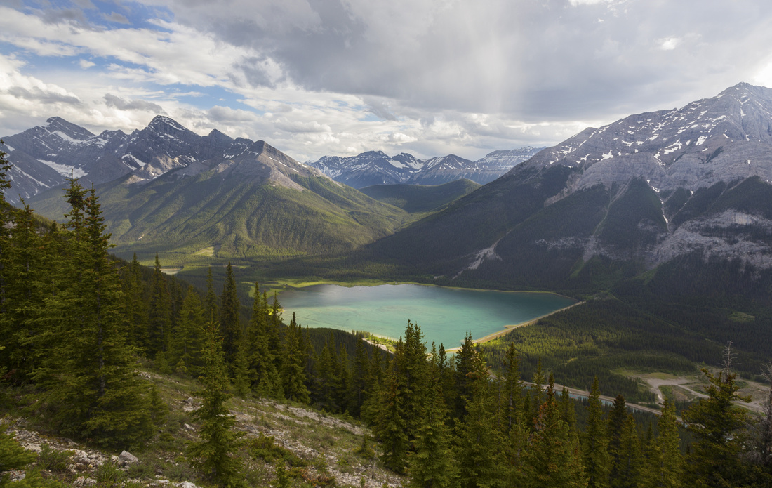
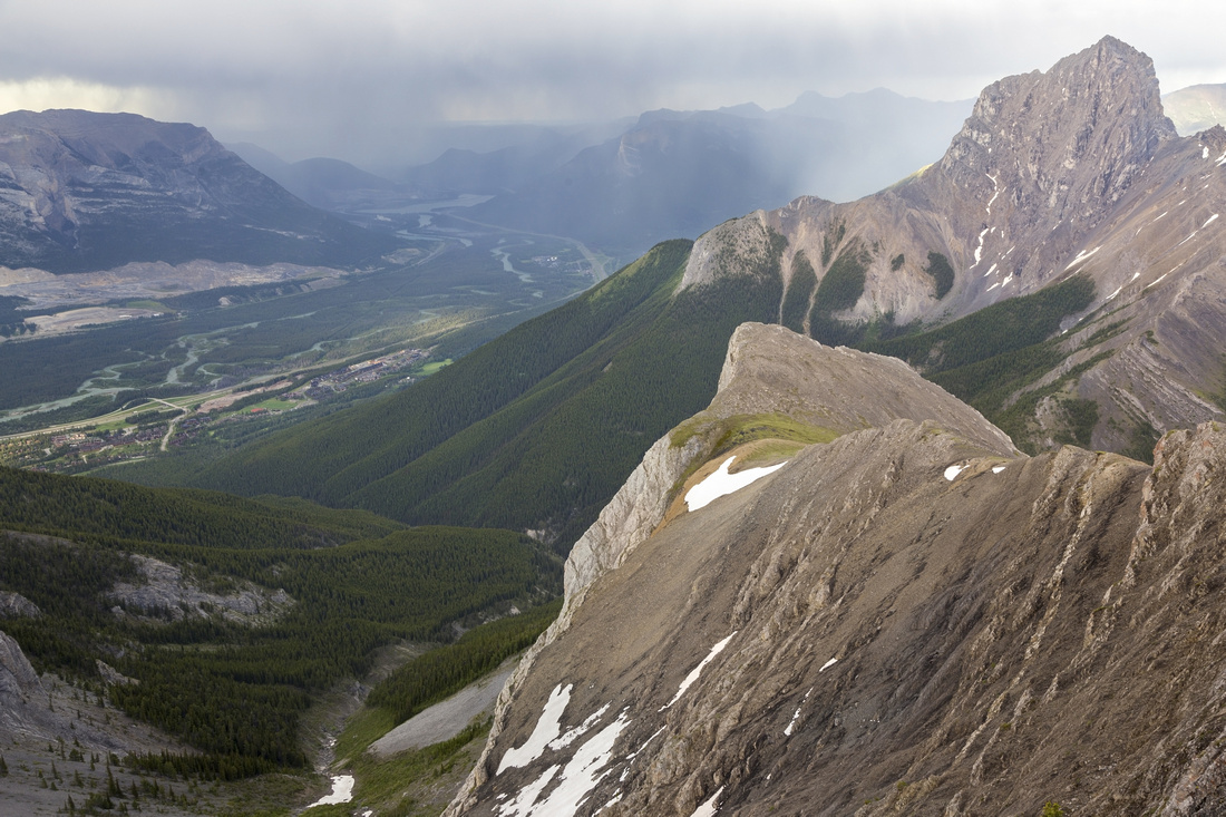 Three Sisters Creek
Aerial view of Three Sisters Creek from "Hikers Summit" as late afternoon storm advances over Bow Valley. Little Sister extreme center right Three Sisters Creek
Aerial view of Three Sisters Creek from "Hikers Summit" as late afternoon storm advances over Bow Valley. Little Sister extreme center right |
|||
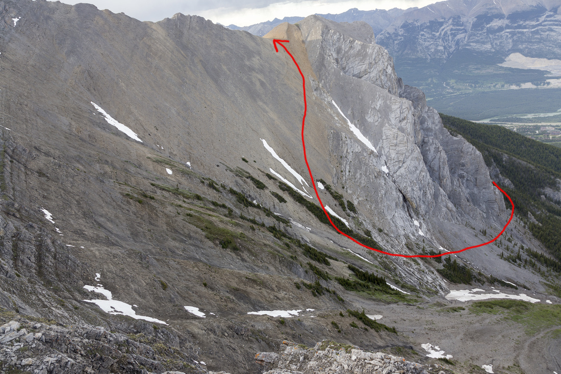 Grassi Knob Route
Alternate route from Grassi Knob on Canmore side - steep and lose talus trash, not recommended Grassi Knob Route
Alternate route from Grassi Knob on Canmore side - steep and lose talus trash, not recommended |
|||
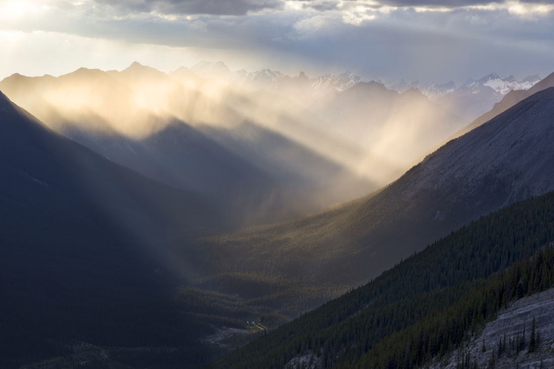 Light Play
Fantastic light conditions over Spray Corridor on descent from Ships Prow Light Play
Fantastic light conditions over Spray Corridor on descent from Ships Prow |
Abstract
| Overall Difficulty | D4 | Mostly steep hiking for lower (Hikers) summit. Moderate class 3, depending on route, for true summit (D5) | |||
| Snow Factor | S3 | Occasionally ascended in winter, but snow conditions must be stable above treeline | |||
| Scenery | Kananaskis Rock, Spray corridor and Bow Valley. Dramatic view of Three Sisters from the saddle | ||||
| Trail/Marking | None | Forested approach with easy/moderate bushwhack. Intermittent trails above treeline, but direction is obvious | |||
| Suggested Time | 5hrs | Hikers Summit. Add ~1hr if continuing to true summit | |||
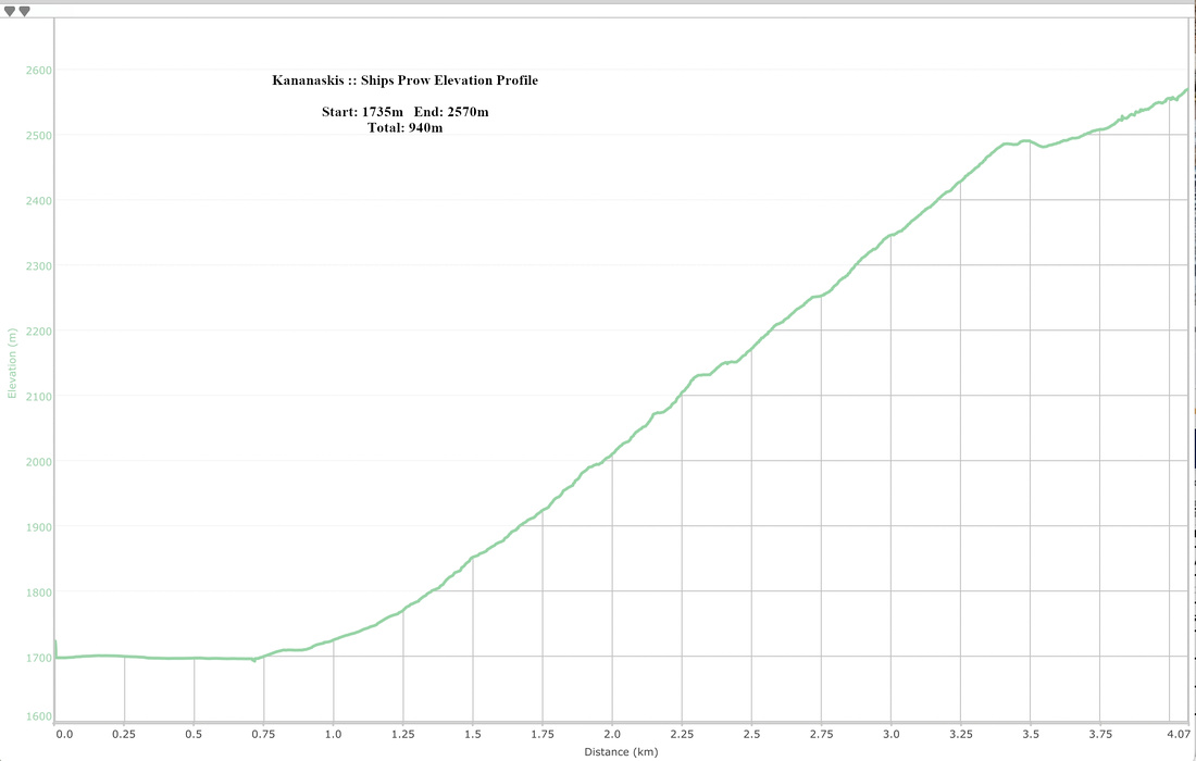
| Elevation | Start: 1735m Max: 2570 m Total: ~940m (Hikers Summit) | Distance: ~8km (Hikers Summit) | |||
| Gear | Full hiking boots and poles; gaiters helpful | ||||
| Water | Dry hike. Carry 1-2L, depending on season | ||||
| Dog Friendly | Yes | Standard back-country travel precautions | |||
 Ships Prow GAIA Map
 Ships Prow Elevation Profile