Rockies :: Canmore and Bow Valley :: Grotto Mountain
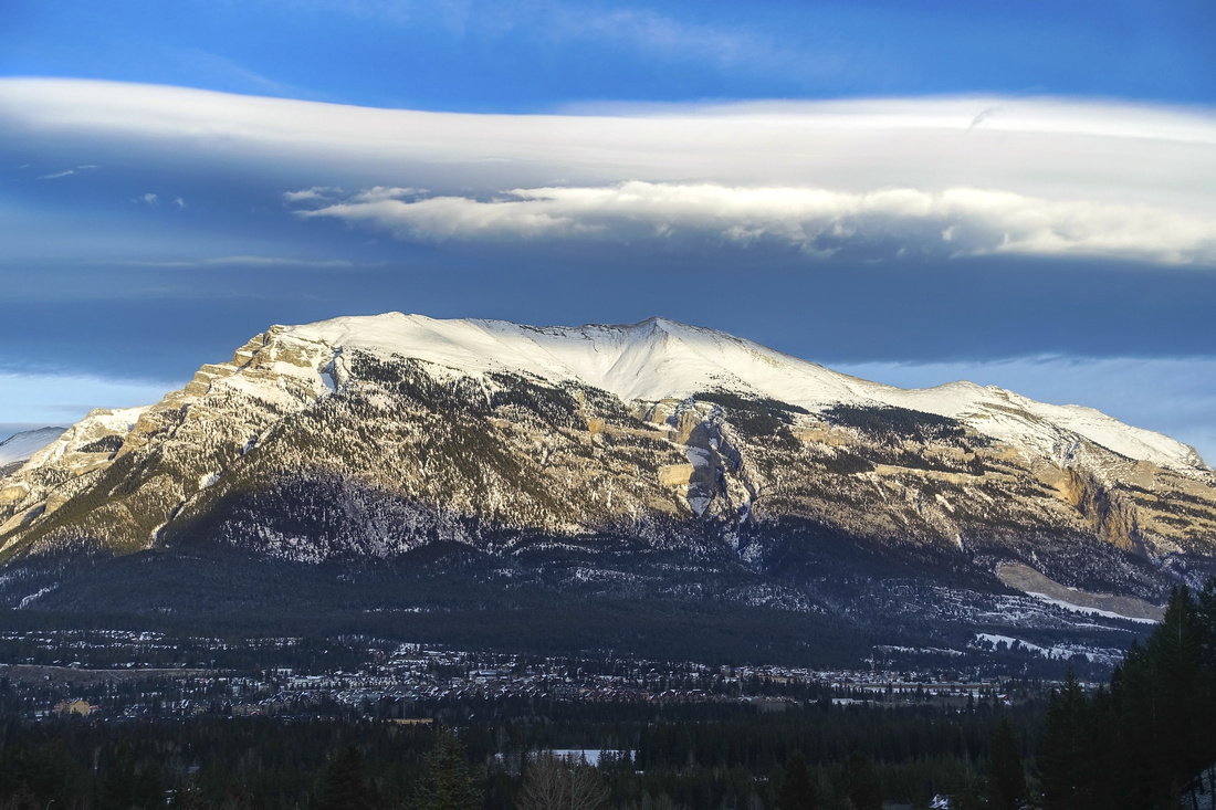 
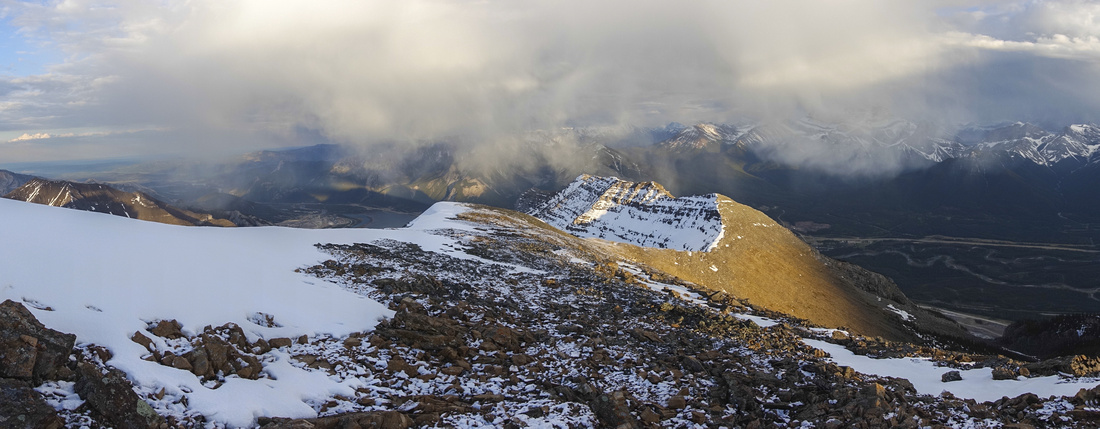
Grotto Mountain from south side of Bow Valley; Highest point in center, Carter route via Lower Grotto right, Cougar Ridge left |
|||
| Together with Mount Lady MacDonald, Grotto Mountain flanks Cougar Creek drainage at North side of Bow Valley. Many equestrian and cycling trails at the bottom as well as several hard rock technical routes higher up all contribute to overall popularity. As result there are (at least) 4 scrambling trails up. Most frequently used is ACC Trail, starting from Alpine Club of Canada headquarters. It is by margin the most eroded and least recommended - specially for descent. Peakbaggers that don't really care about much else than another notch in the belt often use "Big Gully" route, also starting from ACC trailhead, but branching off east across Echo Canyon drainage shortly after. Much better are other 2 access routes as described on this page, situated at opposite sides of the mountain:
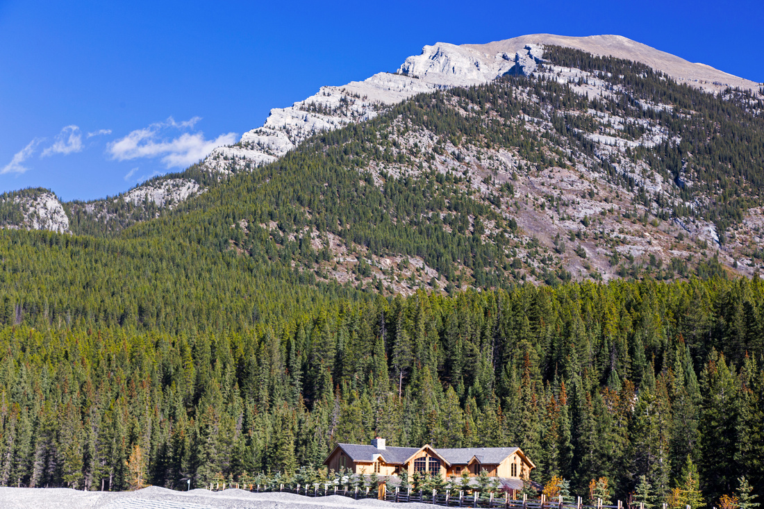
Combined they lead naturally for traverse, and this is the most rewarding way of tackling Grotto. If you decide on this approach, keep in mind that East Ridge (Carter Route) is harder and better suited for ascent. You will also need to figure transport logistics as trailheads are ~10km apart; if going solo, bicycle will do the job. I suggest leaving the car at Benchlands parking, then cycling down Elk Run and Bow Valley (Parkway 1A) to Carter Trailhead, where you can stash the bike, then simply drive back from Benchlands to pick it up at end of the day.
Due to south exposure mountain is often dry even in winter thus making trip feasible most of the year. Views from the summit ridge are commendable, in particular north panorama of Fairholme range and several distant not-so-often accessed back-country areas. |
| Cougar Ridge/ACC Route | ||
October 14, 2015
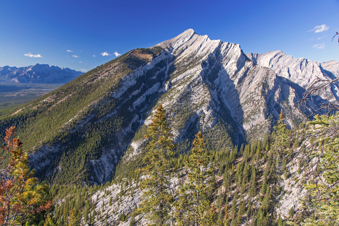
From parking at top of Benchlands Trail walk up left side of the creek, then cross to the right side past last houses. Alternatively you can walk back and cross the bridge on Elk Run blvd, then hike up from the start on the right side. Find first trail that heads in the woods, then continue parallel with Cougar creek. Do not follow one of many trails heading right; instead continue north and find narrow, but well defined forest path that continues above the berm, then switchbacks up lower slope of Cougar ridge. This trail emerges to open bench with good views of Bow valley, turns right, dips a bit then starts direct ascent. There is alternate, bit more adventurous start available as well. For this one hike up Cougar Canyon for ~10-15 minutes When you come to first big gully coming down Grotto on right (east) side, leave the canyon and scramble up on left side; you should be able to pick-up fairly decent trail. This trail eventually dwindles and you must cross the drainage then short bit of bushwhack brings you to "Cougar trail" running up the ridge, about 1/4 of the way up.
Higher up cliff band can be scrambled directly, or bypassed to the left on wide talus ledge and convenient chimney towards the end . Upon joining ACC trail follow obvious path in scree climbing up towards skyline ridge. At the top, turn right and follow the ridge to the summit; it is about 30-40 minutes away. It is best to stay at the crest of the ridge throughout. Only at one point there is short downclimb (class 2/3) as you must bypass low cliffband; alternatively descend the scree to the right, then grovel back up to the ridge. Final bit is very enjoyable with great views throughout. Views from the summit are exceptional and in my opinion better than from Lady MacDonald across the street. If you decide to descend via ACC route - as showcased on GPS Based Map - short couple of km on Upper Horseshoe Cycling trail, just above ACC Clubhouse, can be followed back to Cougar Parking.
Cougar Creek Construction Note: Retention Dam Construction at mouth of Cougar Canyon has barred the access to both Cougar Creek at lower part of Cougar Ridge since summer of 2020. End to this calamity seems to be nowhere in sight, but it is still possible to access Cougar Ridge trail by veering a bit east in the forest on upper Horseshoe cycling trail, then trashing up semi-open forest above blasting site and intersecting normal trail. |
||
|
Gallery |
|||
 Cougar Ridge
Gently slopping Cougar Ridge from the parking Cougar Ridge
Gently slopping Cougar Ridge from the parking |
|||
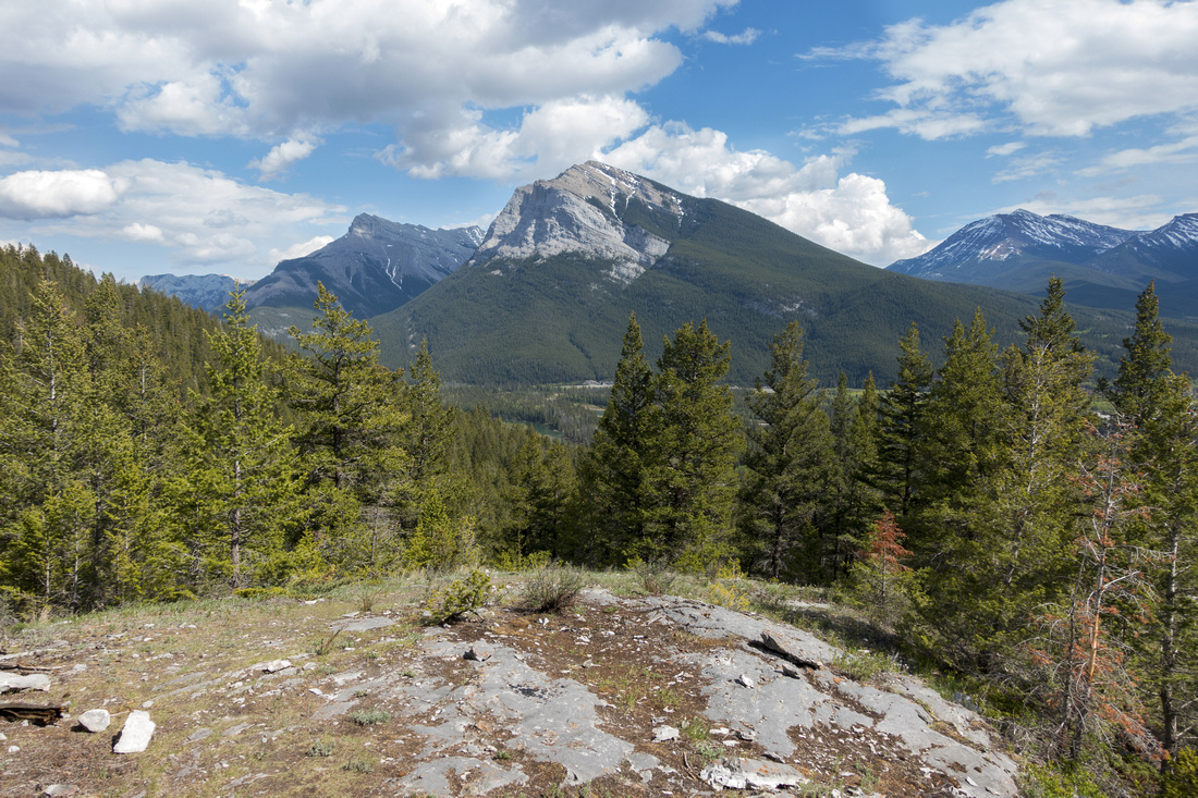
 Mount Lady MacDonald
View of Mt. Lady MacDonald halfway up Cougar ridge Mount Lady MacDonald
View of Mt. Lady MacDonald halfway up Cougar ridge |
|||
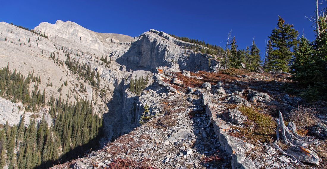 Cougar Ridge
Crisp autumn conditions in upper part of the ridge. Ledge in upper center is easily breached via wide chimney near left end Cougar Ridge
Crisp autumn conditions in upper part of the ridge. Ledge in upper center is easily breached via wide chimney near left end |
|||
|
|
|||
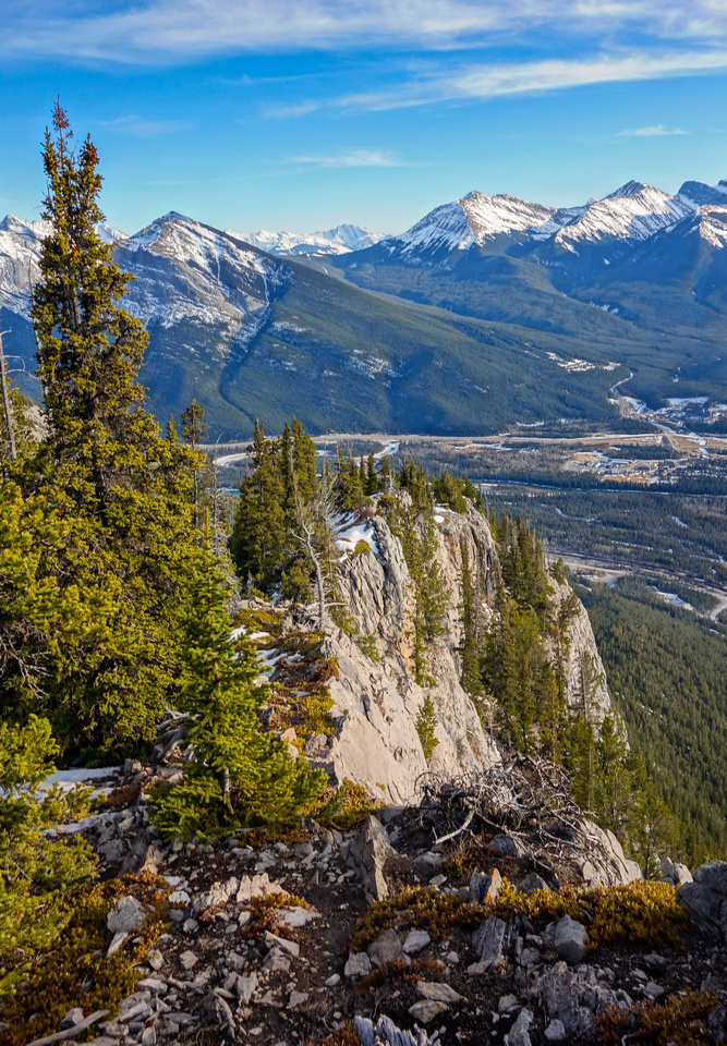
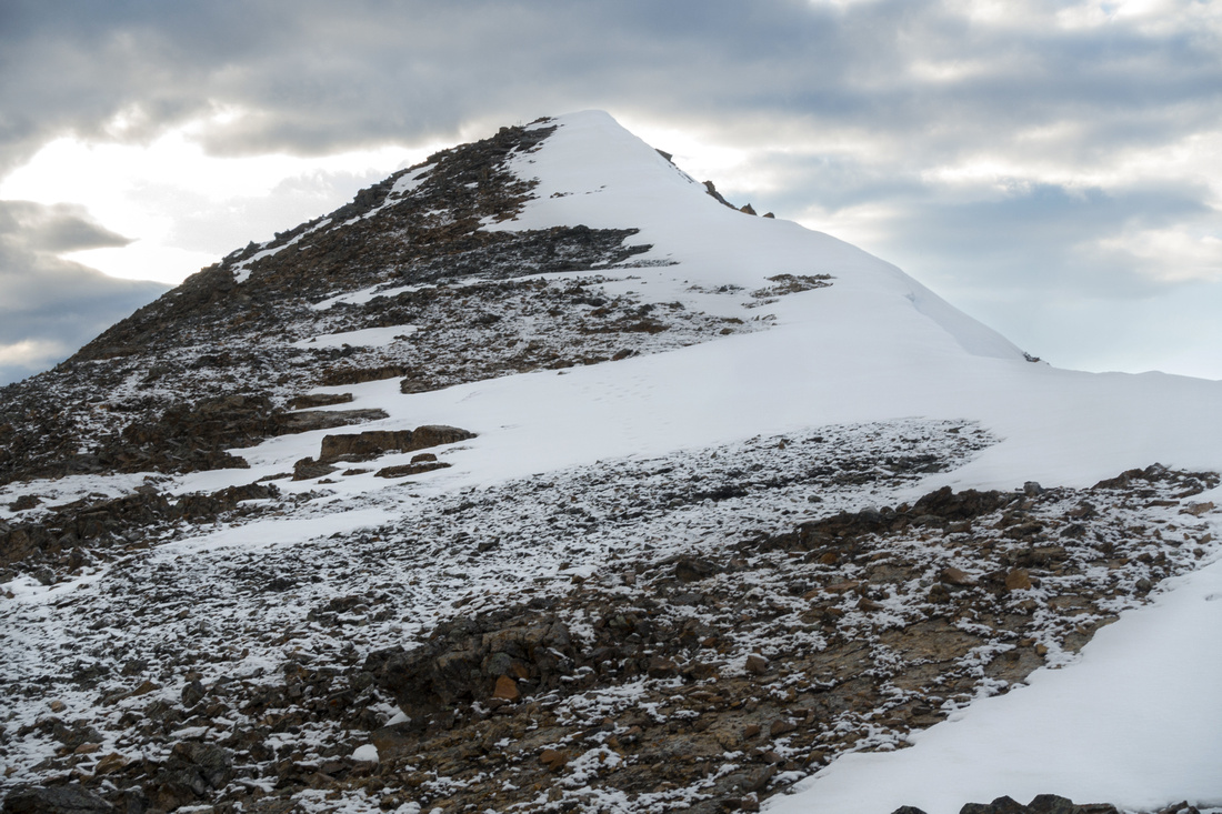
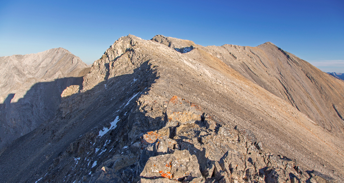 Grotto Ridge
Final ridgewalk leading to the summit (upper right) Grotto Ridge
Final ridgewalk leading to the summit (upper right) |
|||
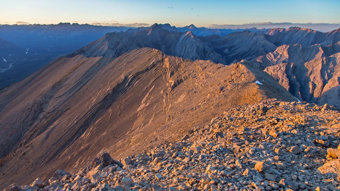 Grotto Ridge
Summit view back to length of final ridge Grotto Ridge
Summit view back to length of final ridge |
|||
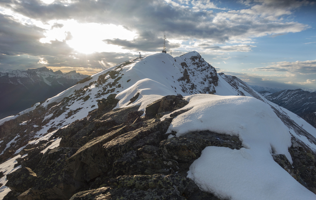
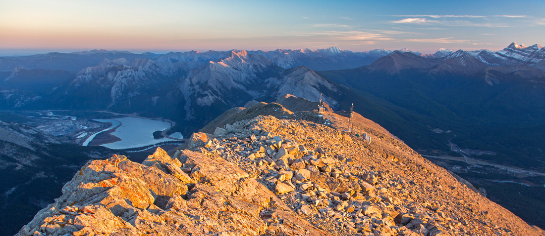 East Ridge
Views east from the summit. Exshaw and Lac De Arcs to the left. Carter Route follows ridge part weather station towers then descends to the right of "Lower Grotto" East Ridge
Views east from the summit. Exshaw and Lac De Arcs to the left. Carter Route follows ridge part weather station towers then descends to the right of "Lower Grotto" |
Abstract
| Overall Difficulty | D5 | Steep ascent with several short cliff bands. Plenty of talus. Upper ridge has one class 3 step. | |||
| Snow Factor | S3 | Frequently windblown and feasible year-round. Steep parts are below treeline and thus no objective avalanche danger. Upper ridge could be risky if frozen and slippery | |||
| Scenery | Bow Valley and Rundle massif, Wall of Canmore and 3 Sisters. Good views of upper reaches of Cougar canyon | ||||
| Trail/Marking | Good | Trail up "Cougar" ridge well defined, but trailhead might be hard to locate. Way is obvious above treeline. ACC route (optional loop descent) is well-trodden but eroded, with several forks that might be confusing. | |||
| Suggested Time | 6-7 hrs | Return time for loop return via ACC route; shorter if descending the same way | |||
| Elevation | Start: 1430m Max: 2720m Total: ~1300m | Round Trip: 13 km | |||
| Gear | Full hiking boots and gaiters. Hiking poles very helpful, specially on descent. Climbing helmet optional | ||||
| Water | Dry hike. Carry 3L minimum, more in summer season and when temps are warm | ||||
| Dog Friendly | Yes | No on-leash restrictions | |||
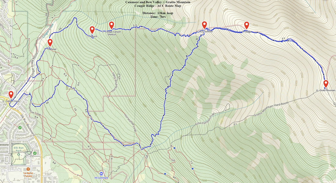 Grotto Cougar/ACC GAIA Map
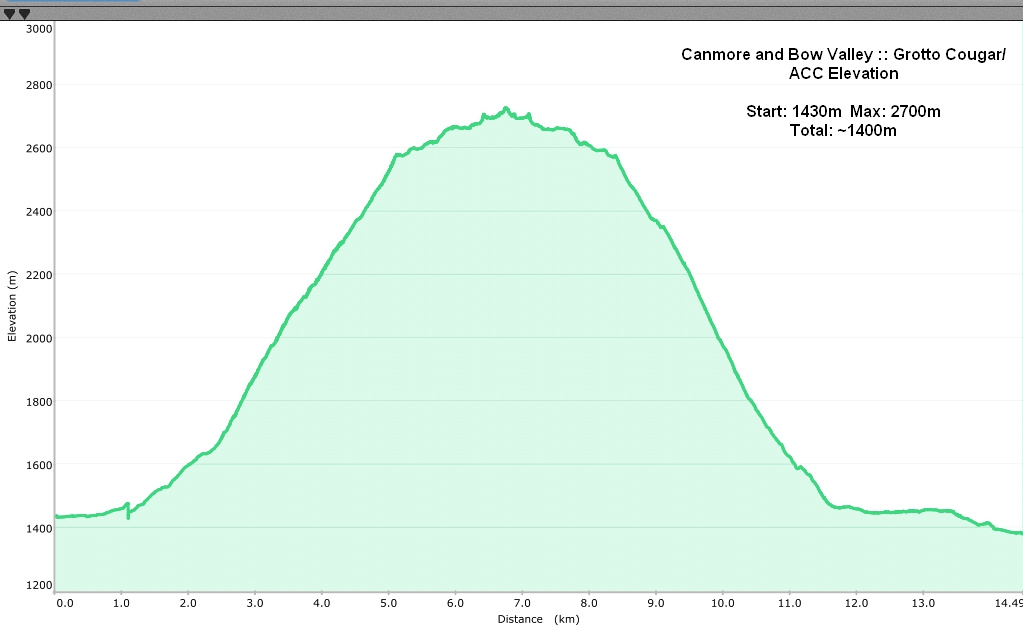 Grotto Cougar/ACC Elevation Profile
| Carter Buttress (East Ridge) | ||
June 1, 2022
This is by margin the hardest of 4 Grotto hiking routes. It is brutally steep with loose terrain above treeline and several short low class 3 rock steps. Most hikers turn back at Rock Promontory near treeline called "Carter Buttress"; even this is not trivial as ~850m must be gained just to here! Route above the Buttress is not always obvious and I do not recommend descending this way first time around if coming up via other routes. The reward is probably better views overall and feeling of remote back-country route when compared to much more frequently ascended west ridge.
Parking is at pullout along Bow Valley Parkway (1A), just past the quarry - use GPS track. It is the same as for famous Rats Nest Cave, and first part of hike is shared between the two. After crossing the powerline Carter route continues straight up. Grade is moderate, but higher up there are couple of short chimneys that call for use of hands. About 1hr 15min in is the confusing bit; trail reaches base of rock cliff, and while it appears logical to continue on climber left, this choice will lead to increasingly harder terrain that requires ropes. Correct way is zig-zag on couple of ledges to climber right, then continue above the edge of Rats Nest Canyon. Ensuing part, despite defined trail, is very steep - on return one spring I felt necessary to put on spikes for traction, even if it was not icy! Eventually trail mellows and reaches the Buttress - 1:45 to 2 hrs from parking. Views are great and this is obvious spot for break.
Above the buttress trail ascends thinning trees to treeline. Follow cairns up eroded slabs, then move to loose ridge heading up towards obvious knob above - also known as "Lower Grotto". Rougher than expected descent to saddle is followed by moderately angled ridgewalk past weather stations to the summit; about 40-45min from "Lower Grotto", or 1:30 - 1:45 from Carter Buttress. On return it is possible to angle on rubble below Lower Grotto, and while saving extra bit of elevation gain, it will not really be saving in time as terrain is very loose and concentration will be needed. |
||
|
Gallery |
|||
 Lower Clearing
One of several clearings along lower Carter Trail, looking back towards Pigeon Mountain (center) and Mt. Collembola (far right) Lower Clearing
One of several clearings along lower Carter Trail, looking back towards Pigeon Mountain (center) and Mt. Collembola (far right) |
|||
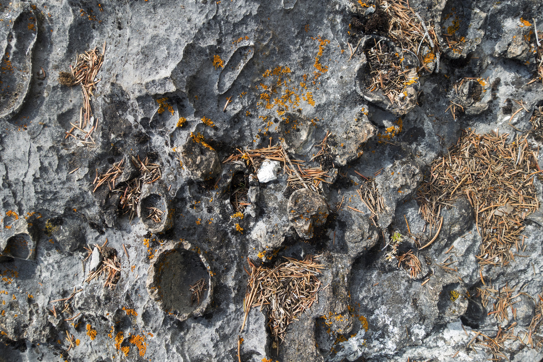 White Oyster Shells
Fossilized Remains of White Oyster Shells White Oyster Shells
Fossilized Remains of White Oyster Shells |
|||
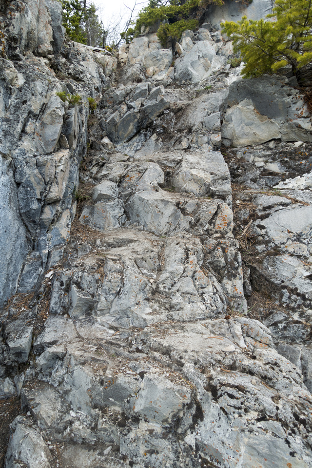 Rock Chimney
Short class 2/3 chimney scrambled head on Rock Chimney
Short class 2/3 chimney scrambled head on |
|||
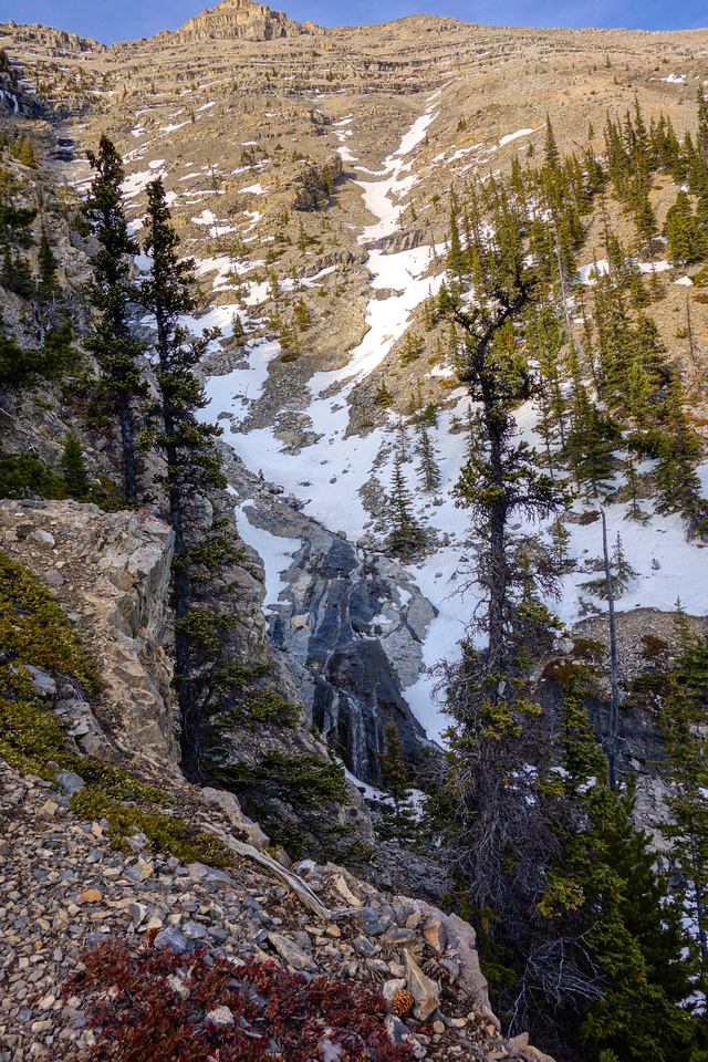 Rats Nest Canyon
Final part before Carter Buttress ascends steeply west side of upper Rats Nest Canyon Rats Nest Canyon
Final part before Carter Buttress ascends steeply west side of upper Rats Nest Canyon |
|||
 Carter Ridge
Looking down cliffs below Carter Buttress Carter Ridge
Looking down cliffs below Carter Buttress |
|||
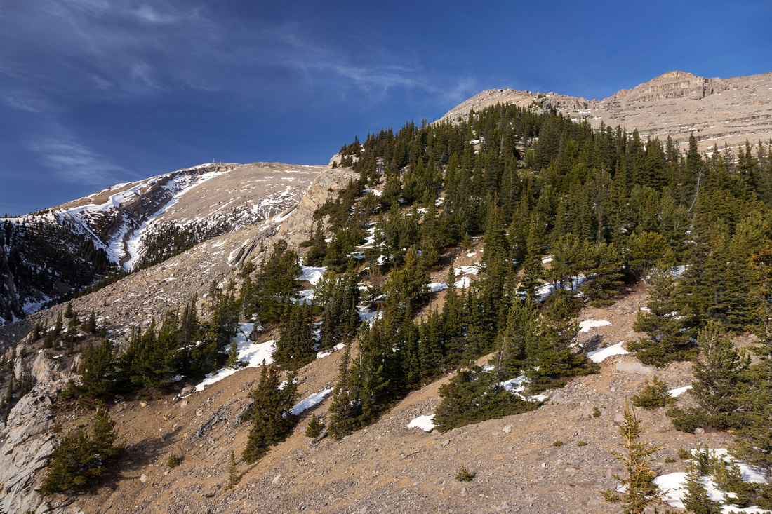 Carter Buttress
Route above Carter Buttress follows ridge above treeline to "Lower Grotto" upper center right Carter Buttress
Route above Carter Buttress follows ridge above treeline to "Lower Grotto" upper center right |
|||
 Scramble Ridge
Scrambling loose ridge crest above treeline; similar in nature to ascent of Mt. Rundle main peak above Banff Scramble Ridge
Scrambling loose ridge crest above treeline; similar in nature to ascent of Mt. Rundle main peak above Banff |
|||
 Lower Grotto Saddle
Saddle between Lower Grotto and main summit Ridge Lower Grotto Saddle
Saddle between Lower Grotto and main summit Ridge |
|||
|
|
|||
 Grotto Mountain
Final part of East Ridge directly before Weather Station; summit upper center right Grotto Mountain
Final part of East Ridge directly before Weather Station; summit upper center right |
|||
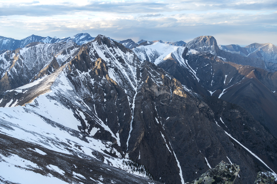 Fairholme Range
View north include Mt. Townsend, Mt. Fable and "Gable" ridge to the right Fairholme Range
View north include Mt. Townsend, Mt. Fable and "Gable" ridge to the right |
|||
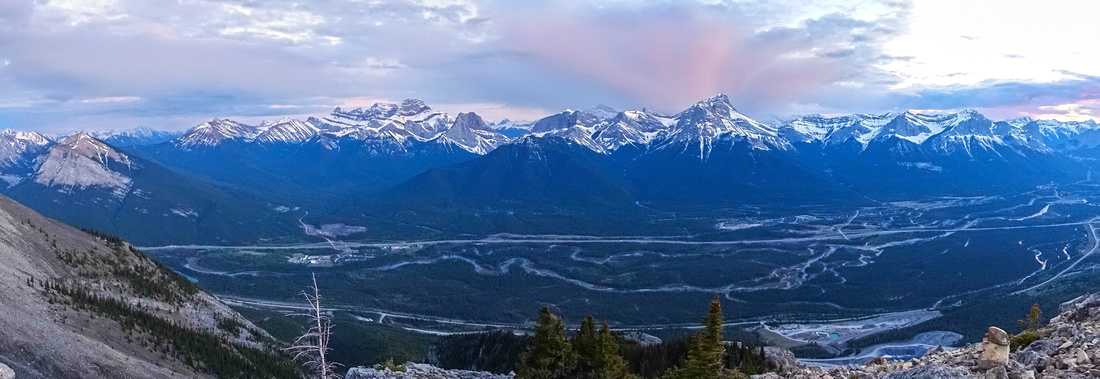 Bow Valley Panorama
 with bit of sunset colors reflected off clouds on descent Bow Valley Panorama
Bow Valley Panorama with bit of sunset colors reflected off clouds on descent |
Abstract
| Overall Difficulty | D6 | Very steep ascent with several short cliff bands and shifting talus in upper part | |||
| Snow Factor | S3 | Frequently windblown and feasible year-round above treeline. Upper ridge could be risky if frozen and slippery. Steep ascent below Carter Buttress can be tricky when icy | |||
| Scenery | Bow Valley and Peaks on north side. Great aerial views north towards Front Range peaks, including Mt. Fable and Townsend | ||||
| Trail/Marking | Good/None | Well defined trail to Treeline with cairns, Route above | |||
| Suggested Time | 7-8 hrs | Return time if descending the same way, add ~1hr for entire Grotto ridge traverse and descent via ACC or Cougar Ridge | |||
| Elevation | Start: 1430m Max: 2720m Total: ~1450m | Round Trip: 12 km | |||
| Gear | Full hiking boots and gaiters. Hiking poles very helpful, specially on descent. Climbing Helmet with group suggested. Micro-spikes an asset when steep part below Carter buttress is icy or even muddy | ||||
| Water | Dry hike. Carry 3L minimum, more in summer season and when temps are warm | ||||
| Dog Friendly | Yes | No on-leash restrictions | |||
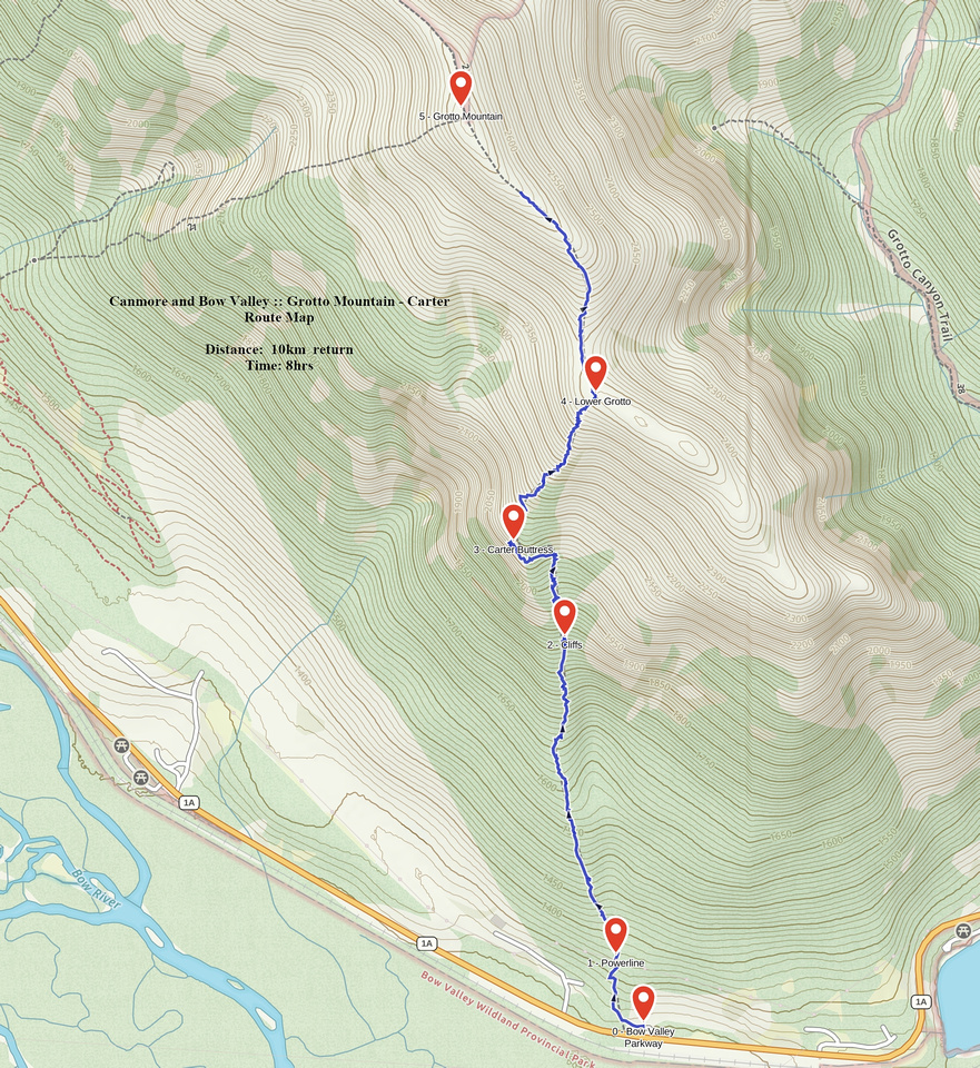 Grotto via Carter Buttress GAIA Map
 Grotto via Carter Buttress Elevation Profile