Google Map |
Rockies :: Canmore and Bow Valley ::East End of Rundle |
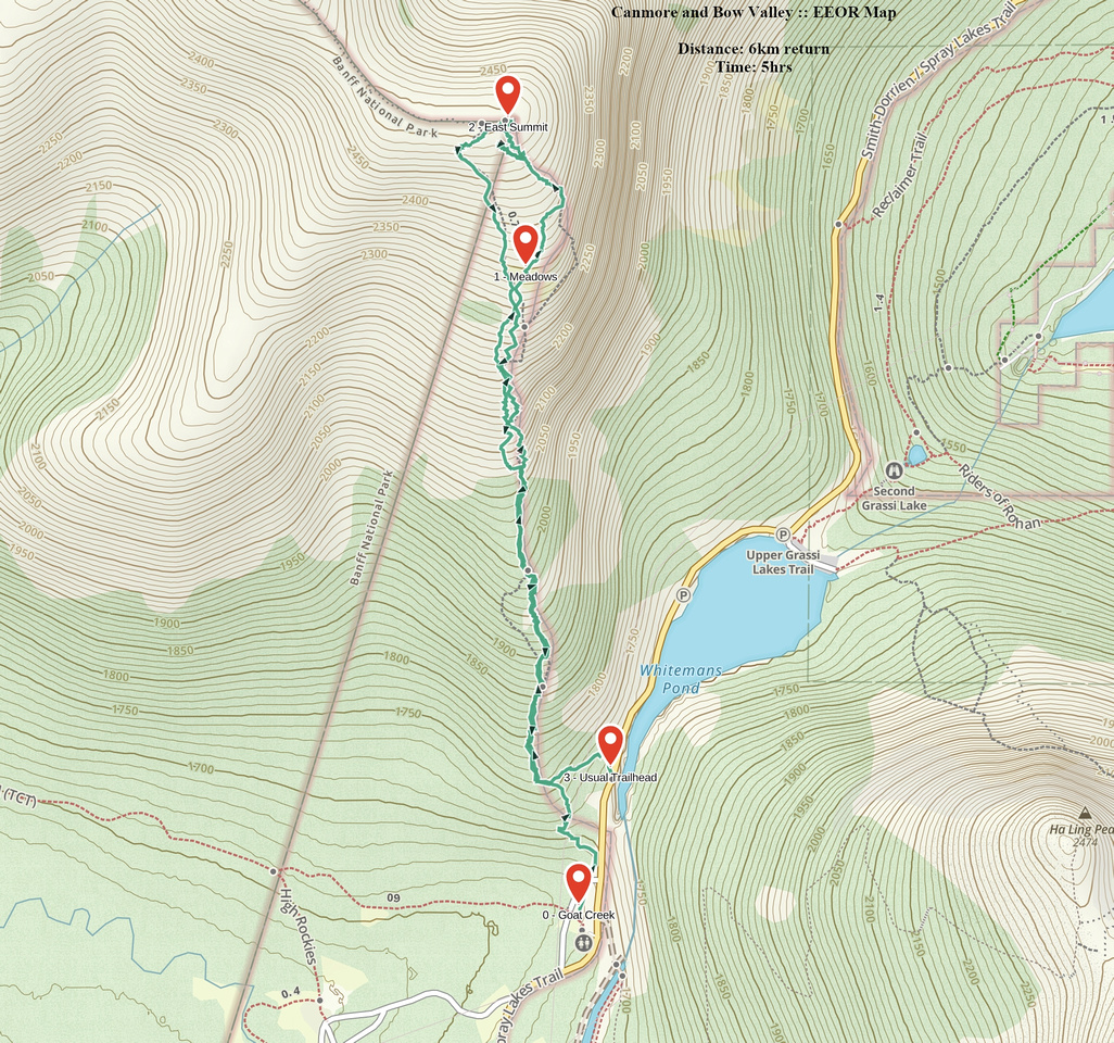
GPS Track |
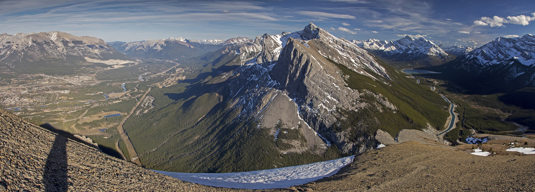 
Panoramic view from summit ridge of EEOR to Bow Valley (left) and Spray Valley (right) separated by Ha Ling/Lawrence Grassi massif |
|||
| Trip Summary | |||
Multiple Dates, last April 25, 2025
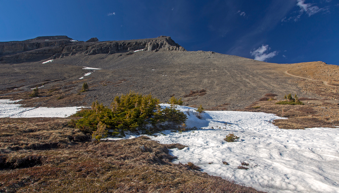
EEOR is well-known Kane scramble on south side of Bow Valley. Less popular but more rewarding from its easterly neighbor Ha Ling. Entire route can be observed from the parking lot at Goat Creek just past Whiteman Pond. There are no surprises - what you see is what you get. Initial bit through trees is the steepest; grade somewhat moderates once you approach treeline while brief sections of small rock steps provide entertainment. Only challenge is rock band guarding the summit block. It can probably be scaled anywhere, but most popular option is to follow Kane suggestion and ascend skyline ridge on climber right, then trash down somewhat loose gully slicing the face further west. Most scramblers turn back after visiting cairned east summit, but pleasant option is to visit west bump some 15 minutes or so along the summit ridge. This is also approach for ambitious traverse of entire Rundle ridge eventually leading to main summit directly above Banff townsite. Although a scramble for good part of its length, sections do require rope and are thus reserved only for experienced rock climbers.
Follow Spray Road past Canmore Nordic Center and drive past Whiteman Pond to Goat Creek parking lot. This is also starting point for frequently done bike ride to Banff on south side of Rundle massif. Although official trailhead is back up the hill on west side, it is possible to trash up directly from parking lot and intersect main trail after some 15-20 minutes. Staying right close to edge of drop-off is generally the easiest option all the way up to the only flat portion - meadows below the summit block. Beaten paths in scree ascend the right side towards skyline ridge which looks like it might have its moments but is generally very easy with broken steps and good holds - easily the most enjoyable part of the day. Past the rockband more scree and couple of cairns lead to the summit which hosts large cairn and superb views of Bow valley. On return follow obvious paths in scree to descent gully. Hiking poles are great help here. If in group, climbing helmet is recommended as well due to loose nature.
EEOR is short trip and can easily be done after work. Beware of ticks in spring, in particular if you take a break in 'meadows' which are a hotspot
|
|
Gallery |
|||
 Ha Ling View
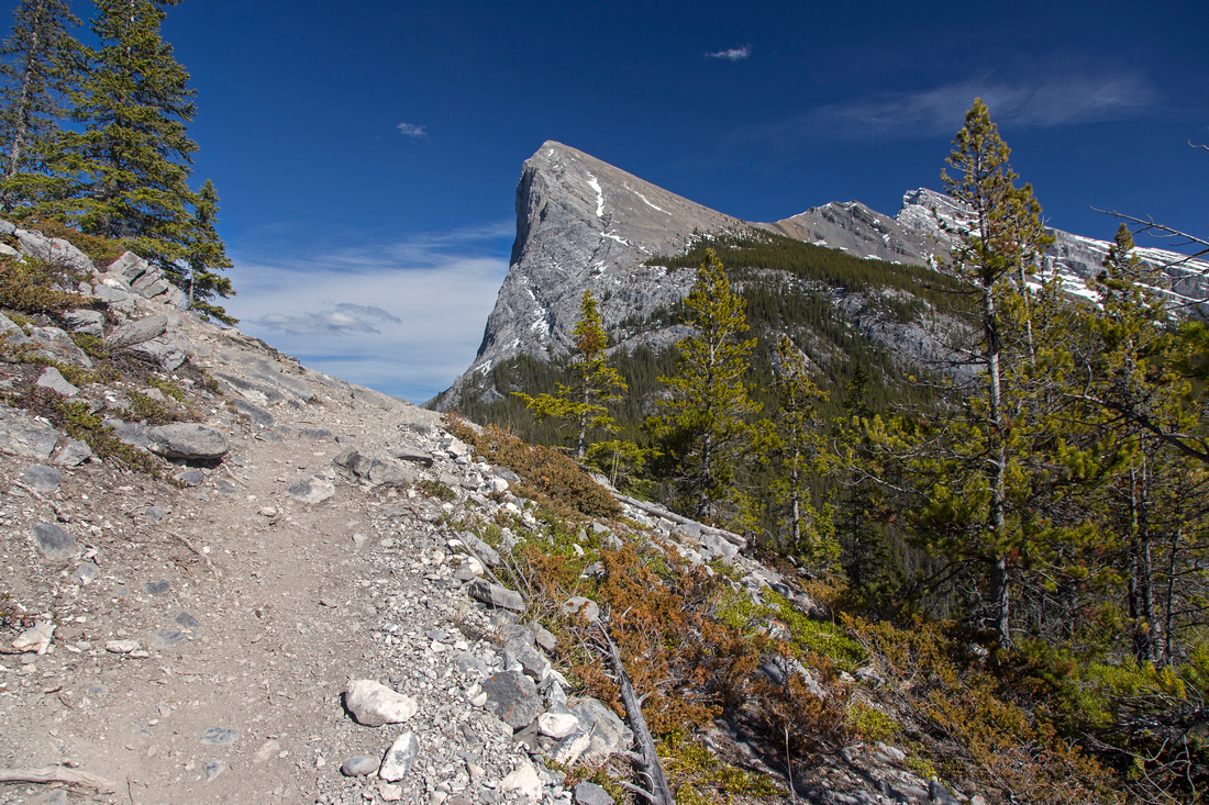
Typical section of trail in lower part Ha Ling View
Typical section of trail in lower part |
|||
 Spray Valley
View back to Ha Ling, Lawrence Grassi and Spray Valley Spray Valley
View back to Ha Ling, Lawrence Grassi and Spray Valley |
|||
|
|
|||
 EEOR East Ridge
Apr '25 Trip: Delightful East EEOR Ridge at edge of Climber drop-off EEOR East Ridge
Apr '25 Trip: Delightful East EEOR Ridge at edge of Climber drop-off |
|||
 EEOR East Ridge
Apr '25 Trip: Looking down East ridge to Spray Corridor; Ha Ling/Miners peak across Whiteman Pond below EEOR East Ridge
Apr '25 Trip: Looking down East ridge to Spray Corridor; Ha Ling/Miners peak across Whiteman Pond below |
|||
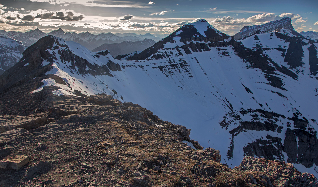
 East Ridge Panorama
Apr '25 Trip: Bow Valley (L) and Spray Corridor (R) panorama from top of East Ridge East Ridge Panorama
Apr '25 Trip: Bow Valley (L) and Spray Corridor (R) panorama from top of East Ridge |
|||
 Ha Ling - Miners Peak
Apr '25 Trip: Ha Ling - Miners Peak Telephoto from EEOR East Ridge Ha Ling - Miners Peak
Apr '25 Trip: Ha Ling - Miners Peak Telephoto from EEOR East Ridge |
|||
 East Ridge Crux
Apr '25 Trip: East ridge Crux - easier than it looks, but should be dry East Ridge Crux
Apr '25 Trip: East ridge Crux - easier than it looks, but should be dry |
|||
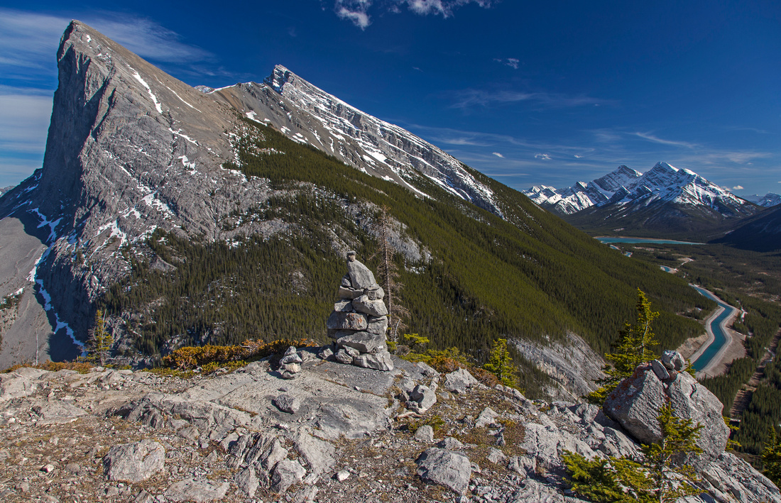
 Rundle Ridge
Length of Rundle Ridge from East Summit Rundle Ridge
Length of Rundle Ridge from East Summit |
Abstract
| Overall Difficulty | D5 | Eroded trail in lower part followed by sections of talus and class 2 rock scramble on SE ridge. Loose sections of scree on slab on alternate gully descent | |||
| Snow Factor | S3/4 | Steep and exposed snow slopes above treeline that might be avalanche prone | |||
| Scenery | Great views of Canmore and Bow Valley from the summit. On descent Ha-Ling, Lawrence Grassi and Spray Valley are constantly 'in your face' (afternoon light preferable). Most of the trip is above treeline. | ||||
| Trail/Marking | Good | Multitude of well-defined and occasionally eroded trails in lower part converging in meadows below summit block. Paths beaten in scree and occasional cairns afterwards | |||
| Suggested Time | 4-5 hr | Return time for east summit. Add 1/2 hour if traversing to west summit | |||
| Elevation | Start: 1670m Max: 2575m Total: ~900m | Round Trip: 6km | |||
| Gear | Full hiking boots for ankle support. Hiking poles essential for stability on descent. Rock helmet for upper rock band (optional) | ||||
| Water | Snow patches earlier in season, bone dry hike otherwise. Recommended: Carry 2-3L | ||||
| Dog Friendly | Yes | No on-leash restrictions. Most dogs should not have trouble scaling summit rock band | |||
 EEOR GAIA Map
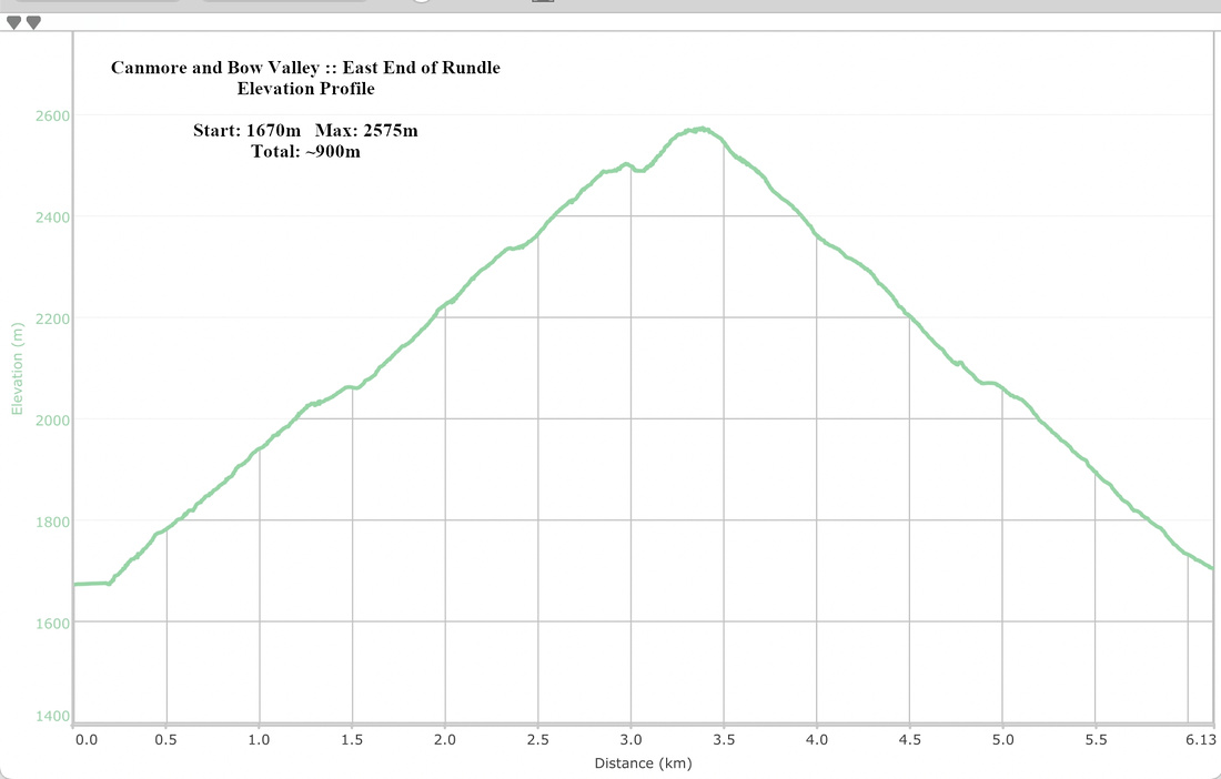 EEOR Elevation Profile