Google Map |
Rockies :: Canmore and Bow Valley ::Ha Ling - Miners Peak |
GPS Track |
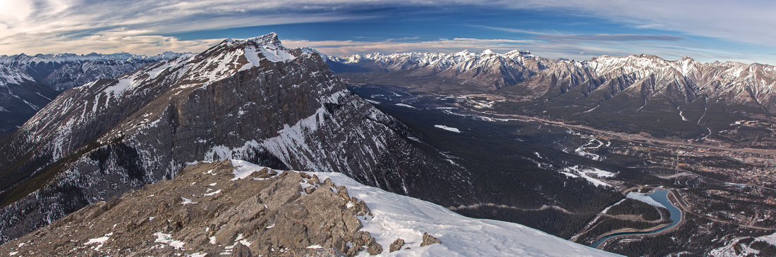 
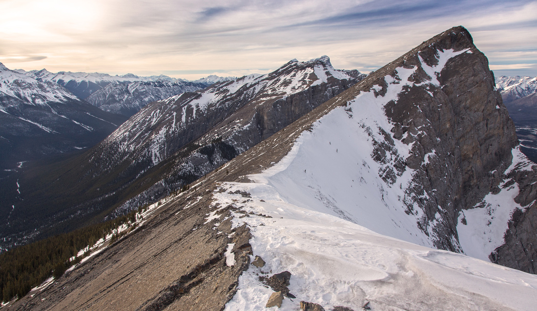
Summit view from Ha Ling. EEOR center left, Canmore and peaks on north side of Bow Valley right |
|||
| Trip Summary | |||
Various Dates, last May 3, 2023
Together with Lady MacDonald on north side of Bow Valley, Ha Ling is most frequently climbed Canmore area peak. It used to be called "Chinaman Peak" - the story is that some Chinese cook in early Canmore days made a wager he'd climb the peak and be back to townsite in 10 hours; this was in the days when Smith-Dorrien did not exist & you had to hike all the way from Bow Valley! Today ascent is much more tame; you drive to Goat parking lot and walk up to the summit. Although officially listed as scramble in A. Kane book, many feet have trodden the backside over the years and as result there is wide trail that makes all difficulties non-existent. It is still reasonably steep and sections have eroded making the descent sometimes awkward. Views are naturally fantastic and this is good candidate for after-dinner leg stretcher in long summer days to watch the sunset behind Rundle range. Worthy extension is ridgewalk to Miners peak below Lawrence Grassi. Most hikers seem to head for Ha Ling only, so you might find some solitude as well! Trip is feasible year round, but beware of icy trail and potential of corniced connecting ridge.
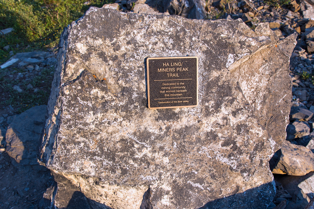
From Goat Creek parking lot cross the road, head up the ramp and cross bridge over the channel. Trailhead is marked by plaque in large rock. Trail plunges in trees, heads directly up then makes couple of large switchbacks before reaching the treeline. Odd section is narrow and you might need to make use of your hiking pole for stability. Depending on your pace, you will reach treeline within 1 - 1 1/2 hours. Trail is most eroded in this part. Low point of ridge directly above is the saddle between Ha Ling and Miners Peak. For Ha Ling continue along the main trail. Couple of slabs present easy challenge near the summit. For Miners peak it is possible to follow the ridge crest to the saddle, then ascend trail beaten in scree to the summit. Large plateau below towering Lawrence Grassi is excellent spot for the break as Miners summit is a bit narrow. On descent follow the trail from the saddle directly to main Ha Ling trail.
In summer of 2019 City of Canmore has performed major trail re-routing in order to address erosion resulting from heavy trail usage. Switchbacks are now wider, and there is set of wooden stairs with chain railings as trail exits alpine below Ha Ling/Miners saddle. |
|
Gallery |
|||
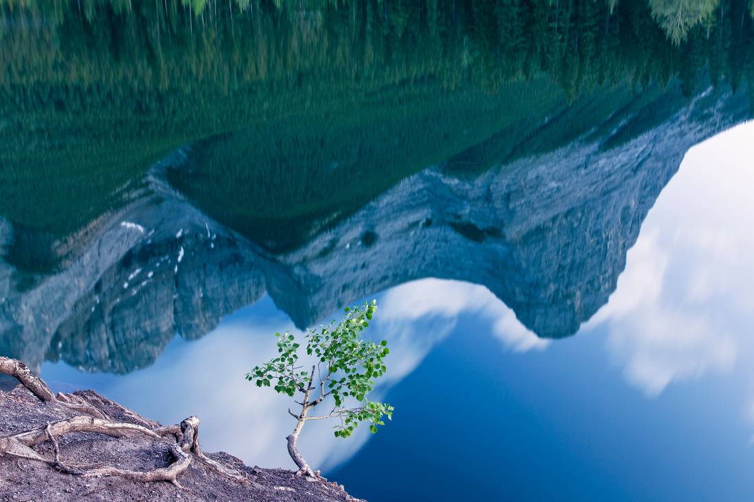 Grassi Lakes Reflection
Ha Ling and Miners Peak reflected in lower Grassi Lake Grassi Lakes Reflection
Ha Ling and Miners Peak reflected in lower Grassi Lake |
|||
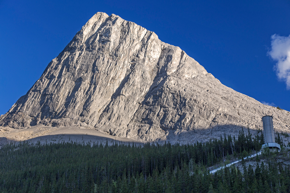 Ha Ling Peak
Classic view of Ha Ling from Grassi Lakes trail Ha Ling Peak
Classic view of Ha Ling from Grassi Lakes trail |
|||
|
|
|||
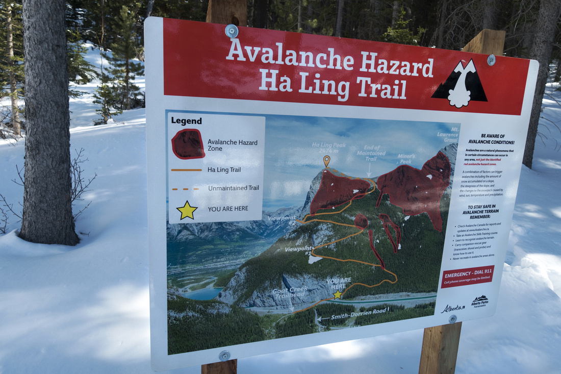 Avalanche Map
 just before new trail dips into forest Avalanche Map
Avalanche Map just before new trail dips into forest |
|||
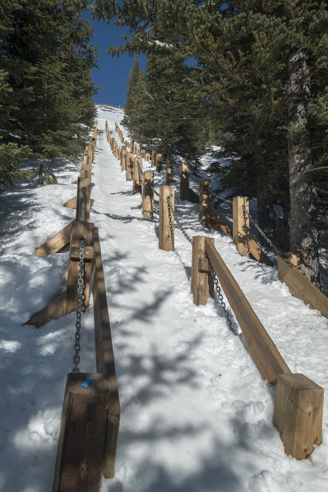 Slippery Stairs
Wooden Stairs as trail reaches alpine. Added in 2019 during major trail overhaul to prevent erosion. In winter this is the "crux" as hordes of unprepared kids in city shoes, unable to descend safely, slide on their bum and create unsafe conditions for everyone Slippery Stairs
Wooden Stairs as trail reaches alpine. Added in 2019 during major trail overhaul to prevent erosion. In winter this is the "crux" as hordes of unprepared kids in city shoes, unable to descend safely, slide on their bum and create unsafe conditions for everyone |
|||
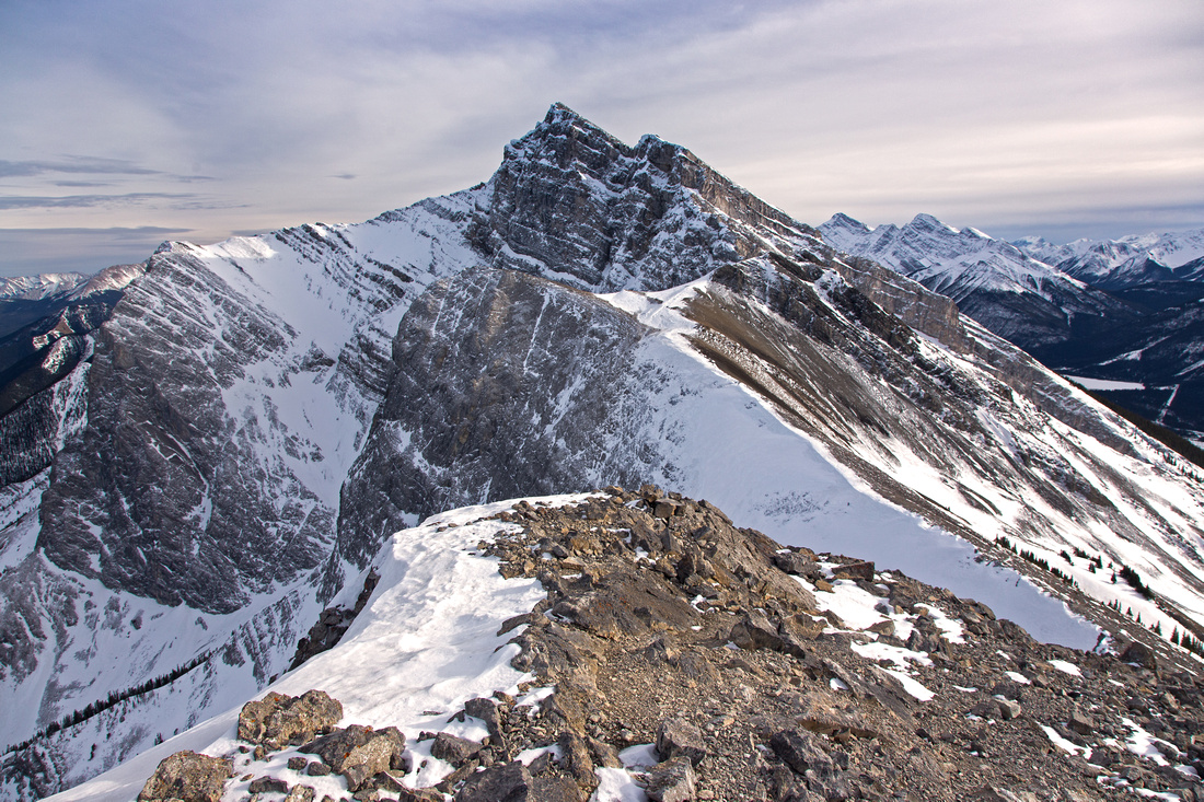 Ha Ling Summit View
View from Ha Ling summit south towards Miners Peak Ha Ling Summit View
View from Ha Ling summit south towards Miners Peak |
|||
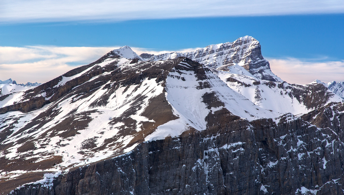 Rundle Range Panorama
Closer look at EEOR upper slopes. Mt. Rundle massif behind Rundle Range Panorama
Closer look at EEOR upper slopes. Mt. Rundle massif behind |
|||
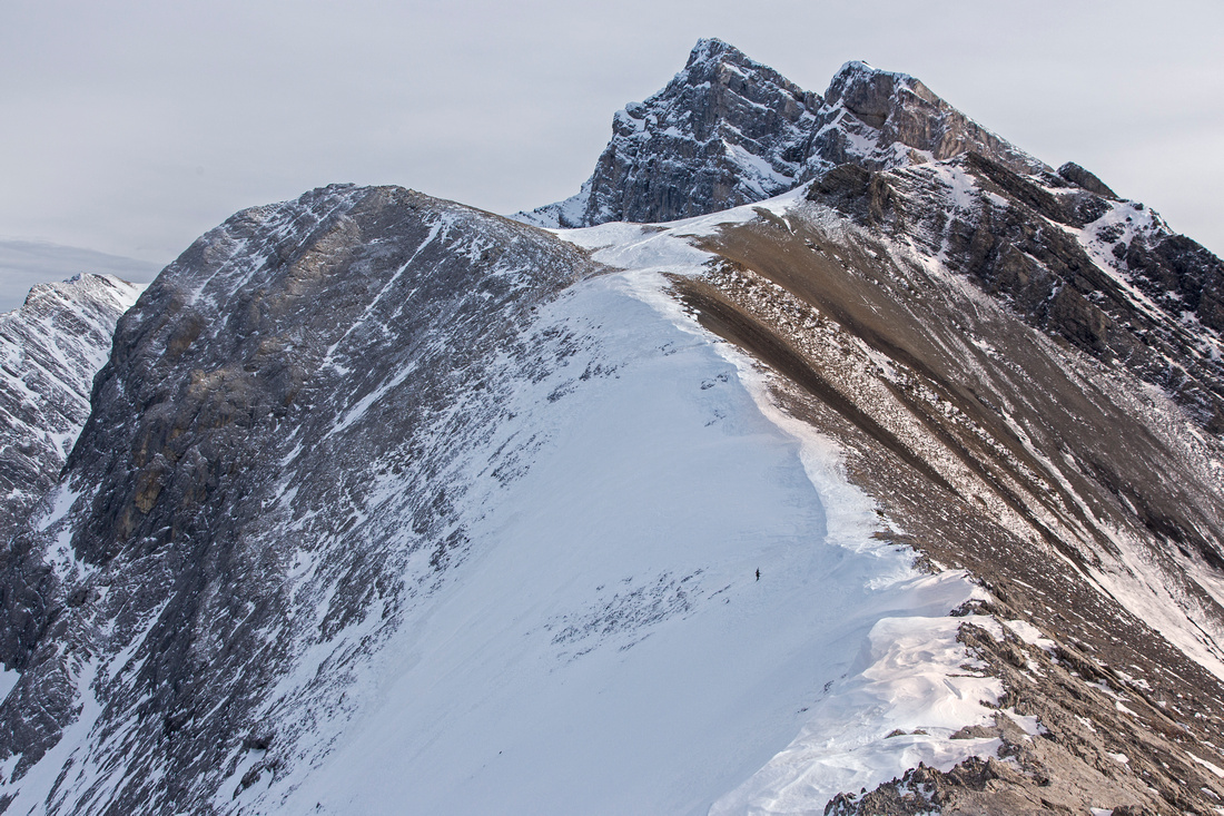 Miners Ridge
Snowy but wide Miners ridge. Lawrence Grassi behind. Direct "Bowl Route" from Canmore side tops up around here Miners Ridge
Snowy but wide Miners ridge. Lawrence Grassi behind. Direct "Bowl Route" from Canmore side tops up around here |
|||
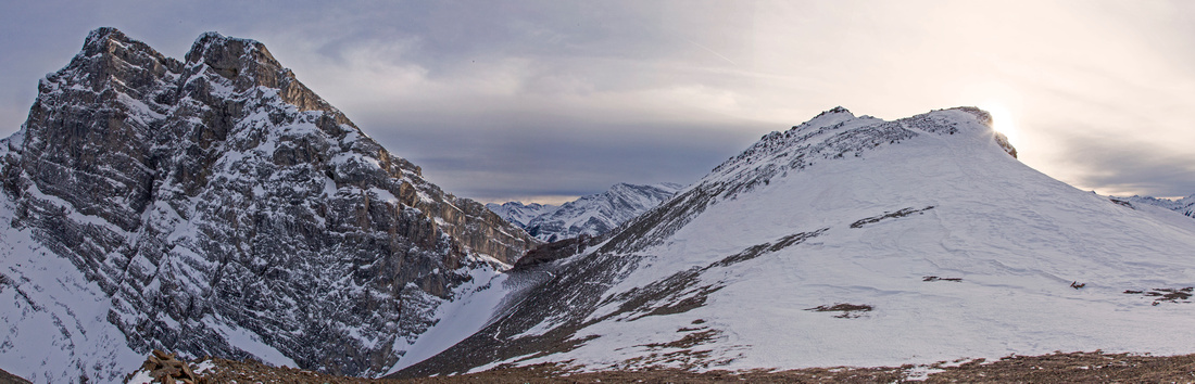
 Ha Ling Ridge
View back from Miners ridge towards Ha Ling Ha Ling Ridge
View back from Miners ridge towards Ha Ling |
|||
|
|
|||
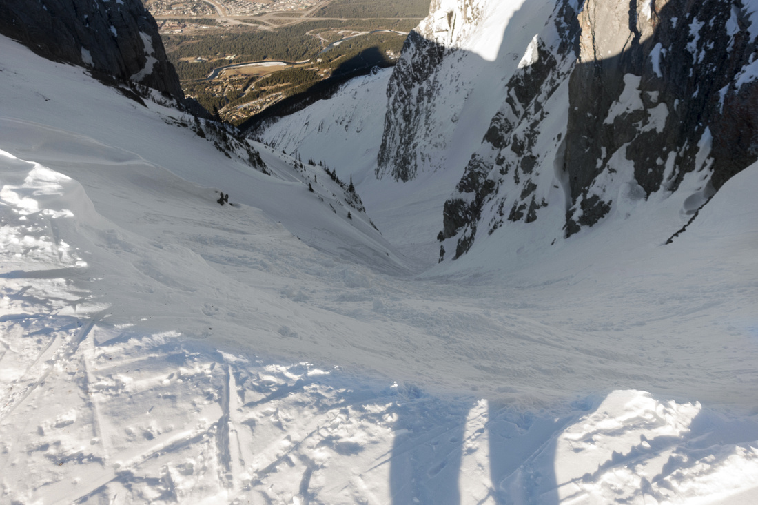 Lawrence Grassi Gully
Stones Gully below Lawrence Grassi and Miners Peak; advanced alpine skiing ending at Highline Trail. See here for hikers access to waterfalls in lower part Lawrence Grassi Gully
Stones Gully below Lawrence Grassi and Miners Peak; advanced alpine skiing ending at Highline Trail. See here for hikers access to waterfalls in lower part |
Abstract
| Overall Difficulty | D4 | Steep ascent below treeline. Parts of trail are eroded and fairly awkward on descent. Some minor slab scrambling for Ha Ling; pleasant and trouble free ridge traverse towards Miners Peak | |||
| Snow Factor | S3 | Parts above treeline are often windswept and snow free. Biggest objective hazard is icy trail in late winter / early spring | |||
| Scenery | Fantasic panoramic views of Bow Valley, Rundle massif and south towards Spray Valley. Towering Lawrence Grassi from Miners Peak | ||||
| Trail/Marking | Excellent | Wide and well-defined trail till upper ridge where way is obvious. | |||
| Suggested Time | 4-5 hr | Includes visit to both peaks; less if doing only Ha Ling | |||
| Elevation | Start: 1660 m Max: 2480 m Total: ~920 m | Round Trip: ~7.5 km | |||
| Gear | In summer light hikers will be enough. Hiking poles helpful on steep and eroded parts of trail. Snowshoes often not required in winter but micro-spikes are essential when trail is icy | ||||
| Water | Dry hike. 1L might suffice in winter, but carry 2-3L in summer | ||||
| Dog Friendly | Yes | No on-leash restrictions, but be courteous to others as this is very popular trail | |||
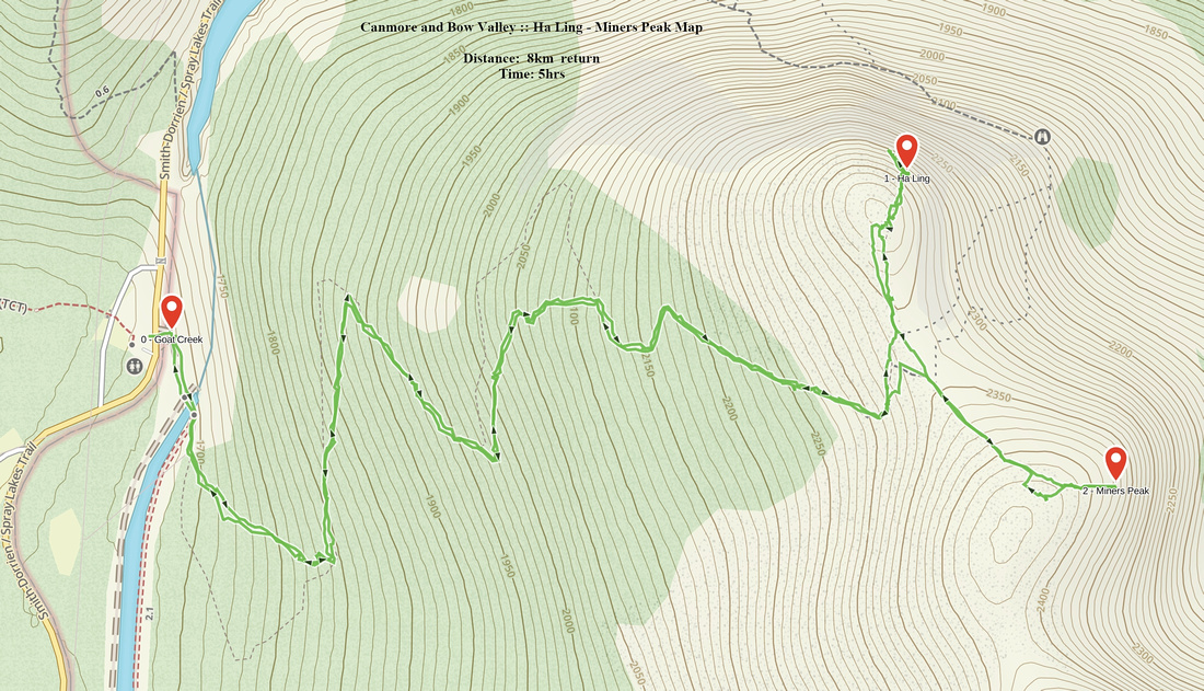 Ha Ling - Miners Peak GAIA Map
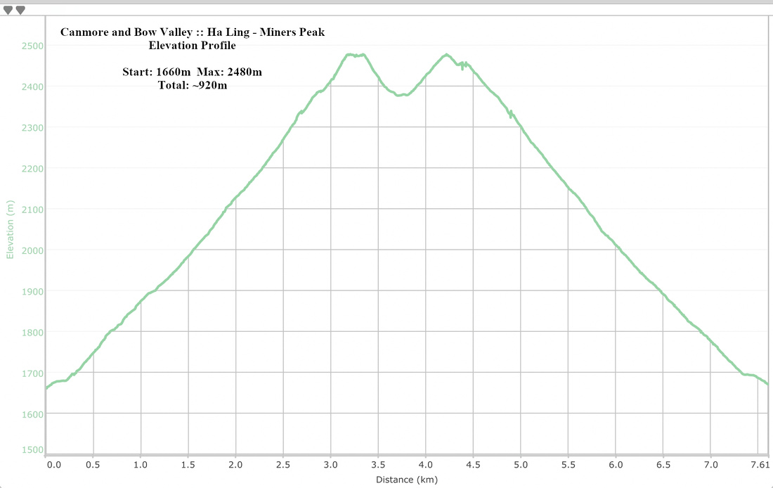 Ha Ling - Miners Peak Elevation Profile