Google Map |
Rockies :: Canmore and Bow Valley ::Stones Gully |
GPS Track |
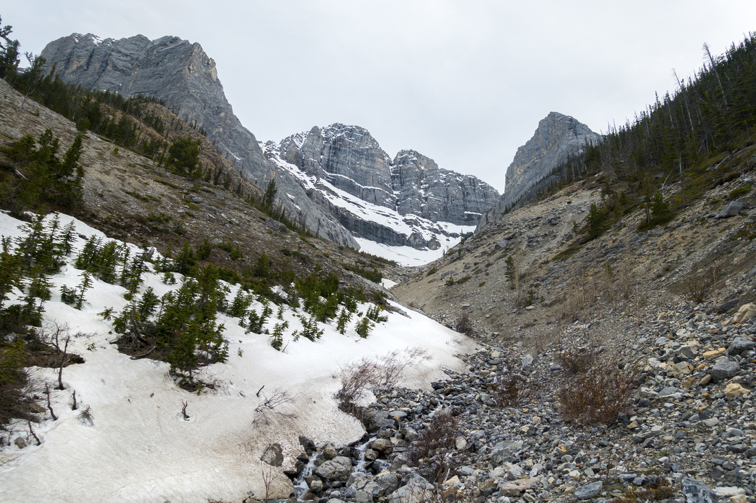 
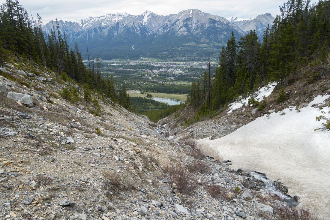
Upper part of Stones gully above point where skier descent trails at both sides converge. Miners Peak right, Lawrence Grassi center |
|||
| Trip Summary | |||
May 30, 2021
During regular early springtime Ha Ling hike I noticed skiers track down deep gully between Miners Peak and Lawrence Grassi (photo). Later bit of poking on Internet identified this gully as "Stones Canyon" or "Stones Gully", and it is apparently quite popular as advanced skier descent. (It must be quite a task carrying skis in plastic boots up ~800m of Ha Ling trail, but that's another story). What intrigued me is lower part -- one can see from Canmore it is not likely to be able to ski all the way down; this means some sort of descent trail made by skiers must exist. In mid-to-late springtime, there is lots of water cascading down; I am big sucker for waterfalls, so this warranted a look! Bottom line: There is trail on both sides of Stones Gully starting from Highline Trail; and they converge about halfway up, above upper waterfalls. So nice loop hike is possible, and this is shown in this report and on GPS track. Abstract stats are given from Quarry Lake. (Note that as of spring of '21 parking is not free anymore at Quarry Lake; locals can get a pass, but if you are out of town you will have to pay - or leave vehicle somewhere downtown then hike from there).
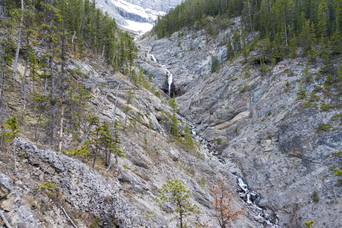
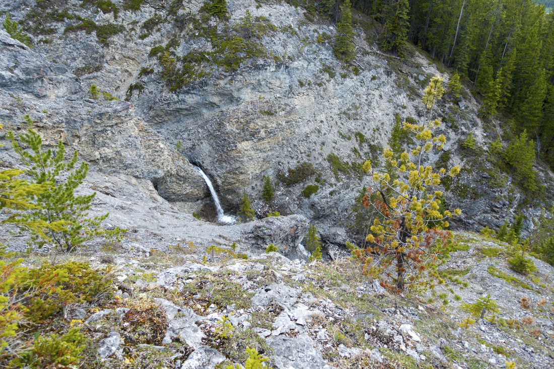
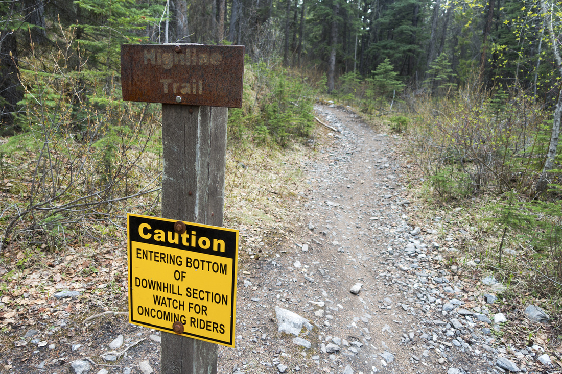
From Quarry Lake follow Highline Connector; within 10 minutes it crosses Powerline Trail, then almost immediately there is split. You can go both ways, but right (west) is much faster. This part is very popular with mountain bikers, so be careful! After some switchbacks trail intersects Highline Trail in about 25-30min. Turn left and reach Stones Drainage. Now you have a choice - left or right side; both work. On my hike I went on right (west) side and descended on the other. Trail is steep but fairly well defined. Within 30min you reach lower waterfall, and if short with time -or energy- this is good place to call it a day; you can also cross over and pick up trail on the other side for descent. For upper gully continue up; it is quite steep and hiking poles are great help here. It should also be dry; if still snowy probably best to come on a later date. Eventually trail drops down to gully bed after passing by couple more waterfalls. This is the end of "trail"; apparently this is the end of skiing and start of hiking when coming down. Note obvious trail beaten in scree on the other side (gallery); I crossed some snow patches to get there. East side trail is fairly easy to follow; initially it moves away from the gully to circumvent some cliffs, then comes back and stays fairly close to the edge. After coming down to Highline, return is the same way.
|
|
Gallery |
|||
 Quarry Trailhead
Trailhead Table by Quarry Lake Parking Lot. Stones gully is just left of center; skier descent trails can be found on both sides and they converge above point where gully curls to the right above lower snow patch Quarry Trailhead
Trailhead Table by Quarry Lake Parking Lot. Stones gully is just left of center; skier descent trails can be found on both sides and they converge above point where gully curls to the right above lower snow patch |
|||
 Powerline Junction
Powerline Trail junction ~10min above Quarry Lake, still on Highline Trail connector; keep straight Powerline Junction
Powerline Trail junction ~10min above Quarry Lake, still on Highline Trail connector; keep straight |
|||
|
|
|||
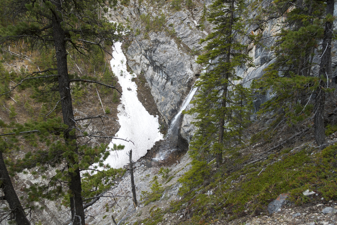 Stones Waterfall
Lower Stones Waterfall, following trail on climber right side. For shorter trip It is possible to drop to the waterfall here, then scrabble on the other side Stones Waterfall
Lower Stones Waterfall, following trail on climber right side. For shorter trip It is possible to drop to the waterfall here, then scrabble on the other side |
|||
 Upper gully
Above upper waterfall where trails on both sides converge (note trail lower left) as skiers can't continue on skis further. Crossing can be tricky under snow cover with moats softened by melting snow Upper gully
Above upper waterfall where trails on both sides converge (note trail lower left) as skiers can't continue on skis further. Crossing can be tricky under snow cover with moats softened by melting snow |
|||
 Gully Crossing
Crossing Stones Gully above upper Waterfall with views of Canmore; Quarry Lake below Gully Crossing
Crossing Stones Gully above upper Waterfall with views of Canmore; Quarry Lake below |
|||
 Upper Waterfall
Upper Stones Waterfall from east side descent. It is fairly obvious why skiing down is not feasible anymore Upper Waterfall
Upper Stones Waterfall from east side descent. It is fairly obvious why skiing down is not feasible anymore |
|||
 Lower Waterfall
Nice view of lower Stones Waterfall from east; trail on the other side is visible in trees upper right Lower Waterfall
Nice view of lower Stones Waterfall from east; trail on the other side is visible in trees upper right |
Abstract
| Overall Difficulty | D4 | Trail hiking to junction, steep trash bordering scramble above. Potentially tricky gully crossing if doing loop | |||
| Snow Factor | S3 | Spring avalanche risk factor; best done in May after snow has compacted and waterfalls are full | |||
| Scenery | Neat canyon and couple of waterfalls. Cliffs on Miners Peak and Lawrence Grassi; aerial view of Bow Valley and Quarry Lake | ||||
| Trail/Marking | Very Good/None | Marked and well defined Highline Connector, faint trails above with some flagging on east side | |||
| Suggested Time | 3hr | Return time starting from Quarry Lake to upper gully; shorter if going just to first waterfall | |||
| Elevation |
Start: 1560m Max: 1750m Total: ~390m |
Round Trip: ~5km (Quarry Lake to upper gully) | |||
| Gear | Day Hikers with good ankle coverage if snow has melted. Hiking poles very helpful | ||||
| Water | Stones Gully usually flowing in lower part. Carry ~0.5L | ||||
| Dog Friendly | Yes | Caution - bears frequent Highline Trail area | |||
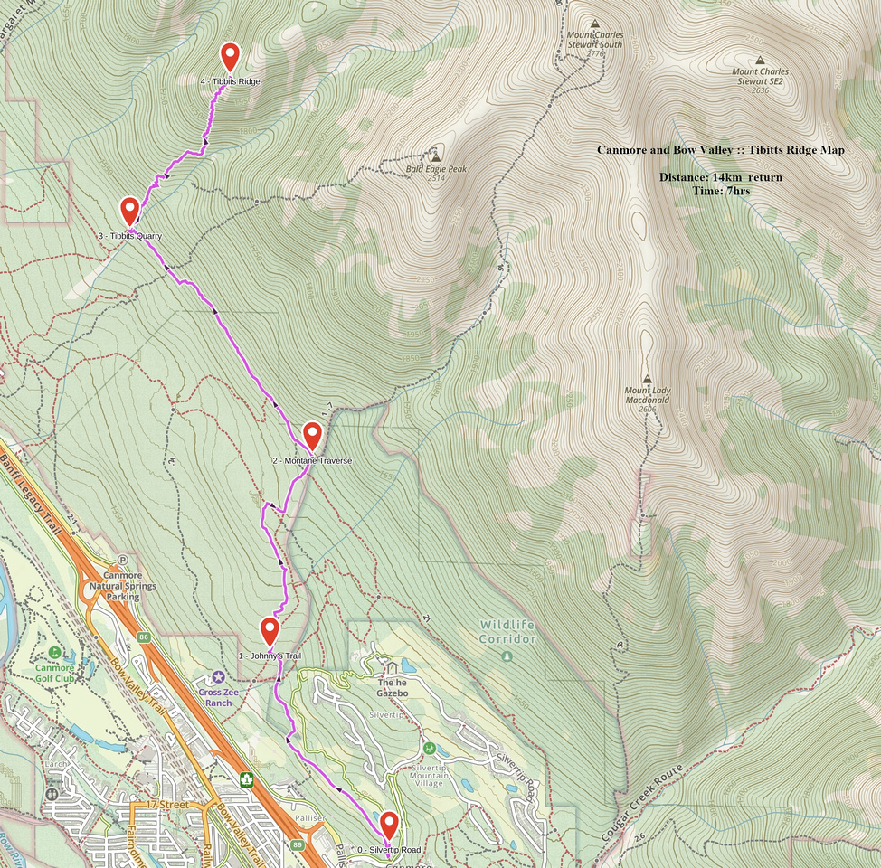 Tibitts Ridge GAIA Map
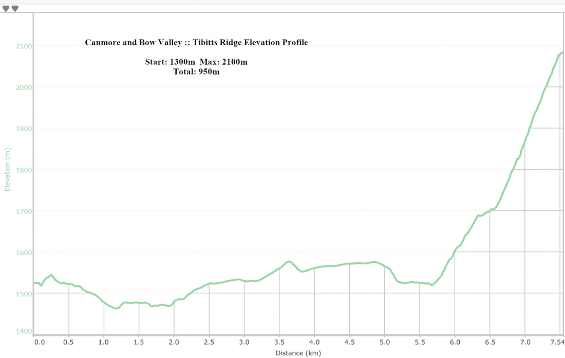 Tibitts Ridge Elevation Profile