Google Map |
Rockies :: Canmore and Bow Valley ::Little Sister (Base of) |
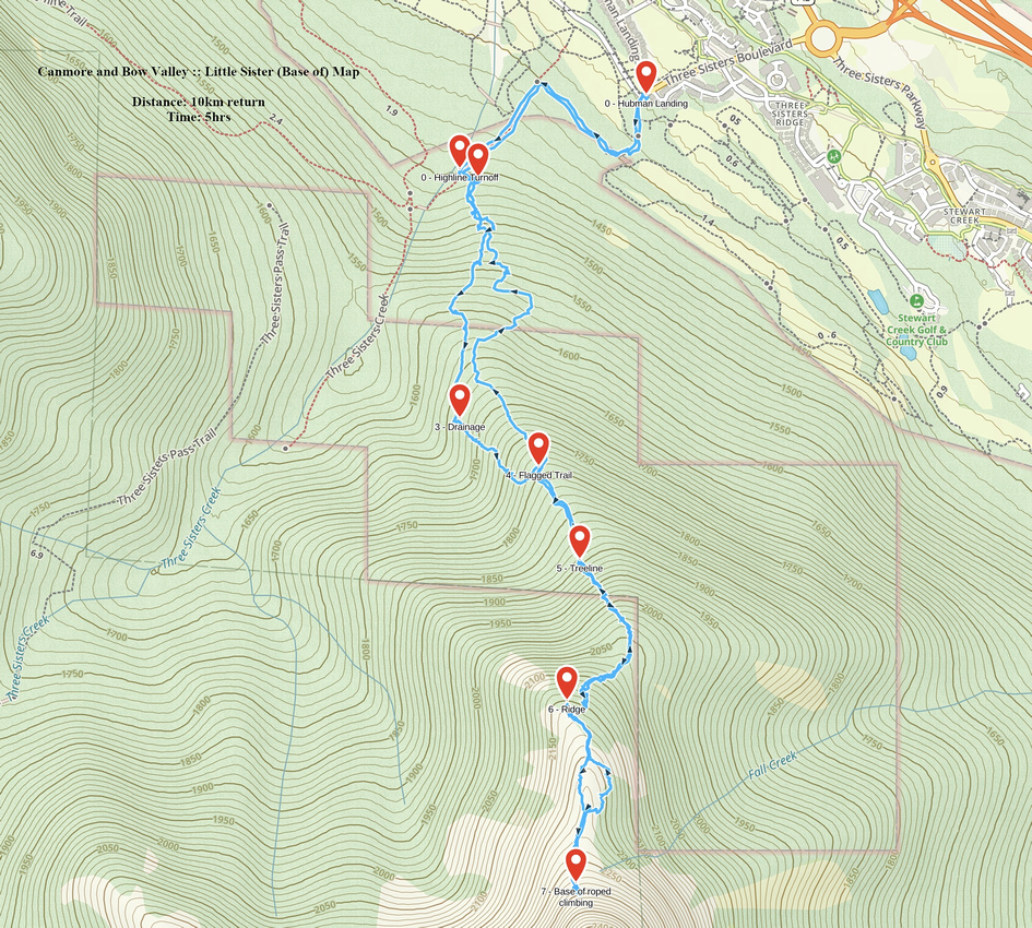
GPS Track |
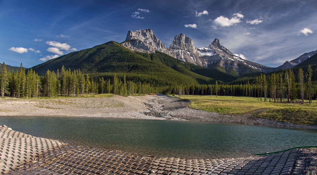 
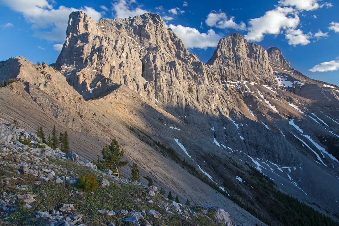
View of Three Sisters from dam on 3-Sisters creek. Climber approach route to Little Sister follows gently sloped forested ridge to top of pyramid shaped cone, then scrambles ridge to the right to base of roped climbing |
|||
| Trip Summary | |||
June 7, 2015
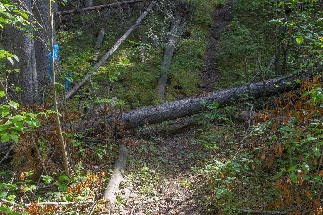
Three Sisters, also known as "Three Nuns" - Hope, Faith and Charity - are famous Canmore landmark, seen and admired from many vantage points in Bow Valley. Middle and Big Sister are well-known Kane scrambles and frequently ascended during summer months. Ironically, the shortest Sister has no easy walk-up from the back. Normal route includes ascent of 5.6 rock chimney and is off limit to hikers. As such there is no established hiking trail; however reasonable way up exists following climber access route. Biggest challenge is in lower part, where forested slopes are choked with deadfall and travel is difficult. Higher up trail exists and is fairly well flagged to treeline. Continuing past the saddle requires some steep scrambling on broken slopes above dropoff, however it all pays off upon reaching the upper ridge that offers phenomenal view of all 3 Sisters. Continuing past the wide rock gendarme involves some steep and lose slope bashing while holding no particular scenic advantage for non-climbers. Drive to Hubman Landing at top of Three Sisters Drive (exit 93 from Trans-Canada Highway). There is plenty of street parking. Take Highline trail that starts right past the iron gate; watch for mountain bikers. This trail is wide and well marked with blue signs. It meanders through the forest, then approaches east bank of 3 Sisters creek. Continue past first side forest road to next one; about 15 minutes of fast pace from parking. If you reach bridge over 3 Sisters creek you have gone too far and backtrack about 5 minutes. Leave Highline and follow left side trail for only about a minute. Be on alert for flag and fallen log on start of faint trail on the right side - this is the "Little Sister Trailhead". Initially steep but well defined it soon fades in section choked with deadfall. Bushwhack up to flattish bench; caution is required here because of soft moss where your feet sink way more than expected. At the bench there are 2 options. Either follow faint trails generally heading right (south), or continue clambering up. If you continue right, you will reach edge of drainage coming down from Little Sister; sizeable cairn here indicates you should turn left and start climbing. Higher up angle left and you should be able to pick up trail with newer blue flagging. This option is longer, but has less bush to contend with. Trail gets better defined the higher you go; eventually it reaches treeline and green slopes seen from 3 Sisters Creek -- about 1 hour from "Trailhead". Continue up open terrain to the saddle, then scramble right to beginning of the ridge. Blue flags disappear but direction is obvious and any number of paths can be taken. It could be quite tricky when wet or under snow cover. Start of the ridge has large cairn and is fantastic viewpoint; ideal spot for a break. Continuing towards Little Sister is off interest to climbers only, as views generally deteriorate. Rock gendarme straddling the ridge can be bypassed on either side, but right (west) is considerably easier. Final bit leading to ascent chimney (5.6) is on lose class 3 terrain.
For more details on climb up Little Sister, refer to excellent article on Summit Post. |
|
Gallery |
|||
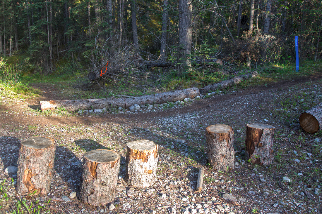 Turnoff from Highline Trail; go left at orange flag
 |
|||
 Little Sister "Trailhead", 1-2 minutes from Highline turnoff
 |
|||
|
|
|||
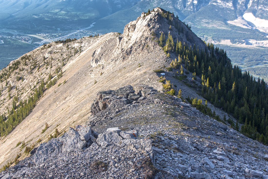
 Upper ridge leading to base of roped climbing
 |
|||
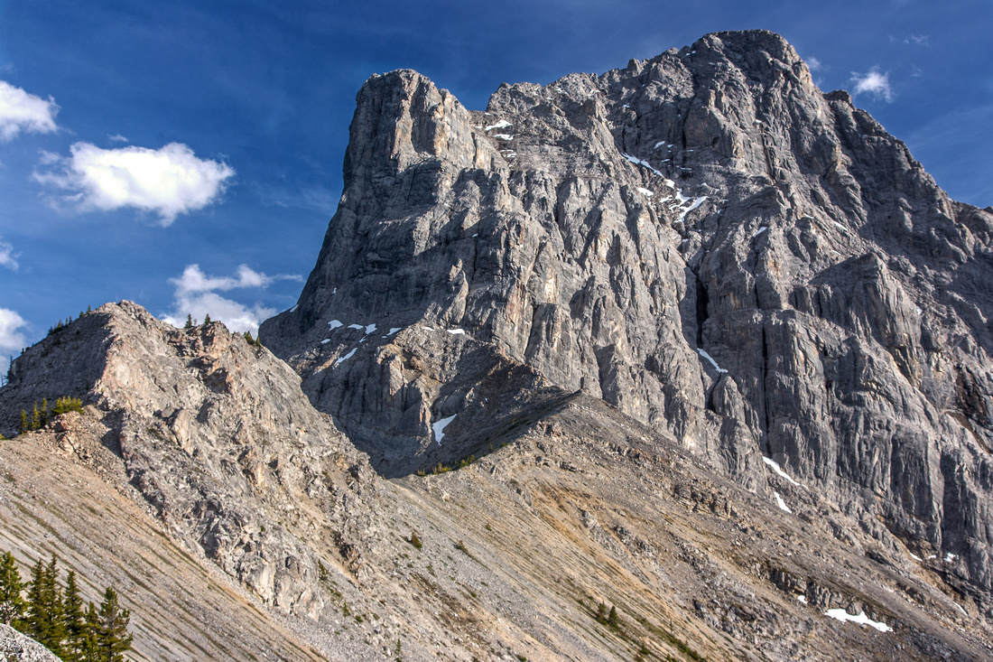
 View back to gendarme that can be bypassed on either side
 |
|||
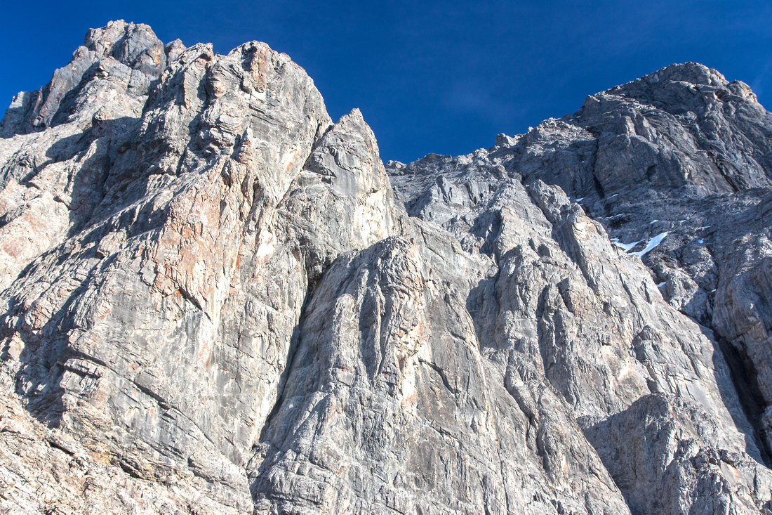 Turning point at base of roped climbing
 |
|||
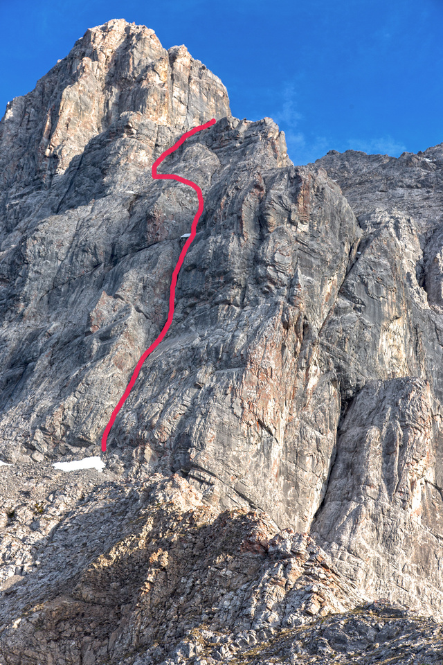 Technical portion (5.6) of climb up Little Sister
 |
|||
|
|
Abstract
| Overall Difficulty | D5 | Steep forested slopes with deadfall. Bushwhack and route-finding. Class 2-3 scrambling on upper ridge | |||
| Snow Factor | S3 | Some steep slopes leading to upper ridge; route likely not traveled in winter | |||
| Scenery | Great view of 3 Sisters from unusual angle. Rock chimneys at base of roped climbing. Panoramic view of Bow Valley. | ||||
| Trail/Marking | Poor / none | Sporadic trail and flagging disappears in lower slopes choked with deadfall. Mid-section has newer blue flagging and is easily followed. Occasional cairns above treeline | |||
| Suggested Time | 5 hr | Return time to base of roped climbing | |||
| Elevation | Start: 1390m Max: 2320m Total: ~950m | Round Trip: 9.5 km | |||
| Gear | Light hikers or full hiking boots. Gaiters for bushwhack, Poles helpful on upper slopes. GPS is essential. | ||||
| Water | Dry hike. Possible snow-patches higher up, depending on season. Carry 2-3 L | ||||
| Dog Friendly | Yes | No on-leash restrictions | |||
 Little Sister GAIA Map
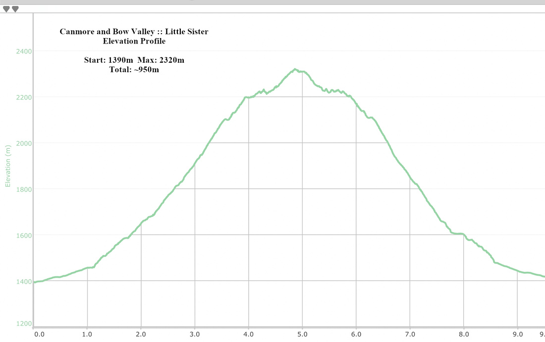 Little Sister Elevation Profile