Rockies :: Kananaskis :: Running Rain
 
Highwood Panorama from Running Rain South Ridge Highpoint. Mist Mtn and Lipsett across, Nameless and Mist Ridges in the distance |
|||
| Beautiful lake tucked behind cliffs of Running Rain peak in South Highwood. Mostly visited by Fishermen and largely off hikers radar. While insane hordes swamp Highwood Pass only few km to the north, you are likely to be by yourself even if trail is described in ubiquitous K-country guide. Parking is at pullout on west (right coming from north) side of Hwy40, few km south of signed Mt. Lipsett picnic area (Waypoint "0 - Hwy40", GPS Track download below). Getting just to the lake is short half-day and while perfectly worth on its own, ridges at both sides of the valley offer terrific exploration opportunities for seasoned hiker - in particular late September timeframe due to abundance of Golden larches. Both are presented on this page as separate trips:
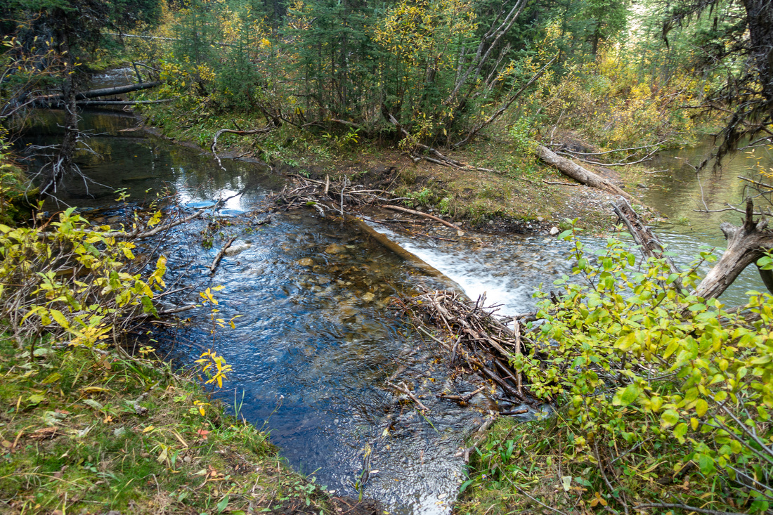
Crux, in both cases, is actually getting to confluence of Storm and Running Rain creeks, which is real trailhead. While not involved, specially in late season, Storm creek ford directly below parking area is mandatory. More problematic is swamp area directly after. Several trails lead all over the place, but there is no easy way across. I've seen photos of people being able to boot up across beaver dams but conditions change and you must be prepared. At each case, do not change in boots right after fording Storm Creek. On my South Ridge trip I tried different ways but none was straightforward - so just suck it up best you can. Pair of old sandals or crocs are best (hip waders are huge overkill and not necessary). Walk down from the car carrying hiking boots in your hands, then after sloshing across all the water obstacles to trailhead (Waypoint "1 - Running Rain Creek", GPS Download below) change to boots and stash crossing shoes for return.
Trail below parking pull-out drops steep-ish bank to Storm Creek Ford site. Note Flags
Storm Creek Ford below parking in late September - with gaiters one could probably run directly across. Odlum Ridge behind
Swamp area and Beaver Dams where conditions change all the time. This is primary reason why one needs to be prepared with some sort of wading shoes |
Note Dec 1 - Jun 15 Hwy40 Season Closure between Highwood Junction and K-Lakes turnoff
| South Ridge | GPS Track | |
Sep 27, 2024Good trail initially climbs above north bank of Running Rain creek, then settles for easy - and very enjoyable - stroll for about an hour to the Lake. After crossing the creek on log ~2km in, trail reaches clearing at base of Avalanche gully extending to saddle below South Ridge Highpoint - this is (optional) shortcut descent. Waypoint "3, 7 - Gully", GPS Track download above; I also built small cairn here. If you decide to climb this way, note that wide gully you start up does not connect all the way and you will be forced to transfer to much more narrow and bushier drainage climber left ~1/3 of the way up - just aim for the obvious saddle. Continuing on valley trail, lake is reached in another 10 minutes. Trail continues around the lake past Alberta Parks Fishing Kiosk, then after rock-hop across the Causeway separating lower and upper lake disappears. Aim for obvious grass/talus gully below Running Rain Peak, but do not climb all the way. Good animal trail can be found in the woods climber left reaching South Ridge in about half an hour from the Lake.
South Ridge is mostly forested, but there are several openings with good views south; Odlum Ridge is directly across while Odlum Bowl Trail - normal scrambler approach for Odlum and Running Rain Peaks - could probably be accessed from here as well. After dropping to low saddle, easily trash up to Highpoint that also has Cairn. Shortly beyond is big clearing with million dollar view of South Highwood - see Gallery. Obvious lower east bump could also be hiked from here but I have not tried drop down to Running Rain Creek on far side; it is likely steep and quite involved.
Return is the same way, but I tried Avalanche gully starting from low saddle below the Highpoint. It is initially quite steep, but manageable. Poles are huge help here. Lower down I had to navigate some avalanche debris, eventually transferring to wider drainage as seen from valley trail; rest is hands-in-your-pockets. If you have scrambling experience and don't need trails I recommend this variation.
|
||
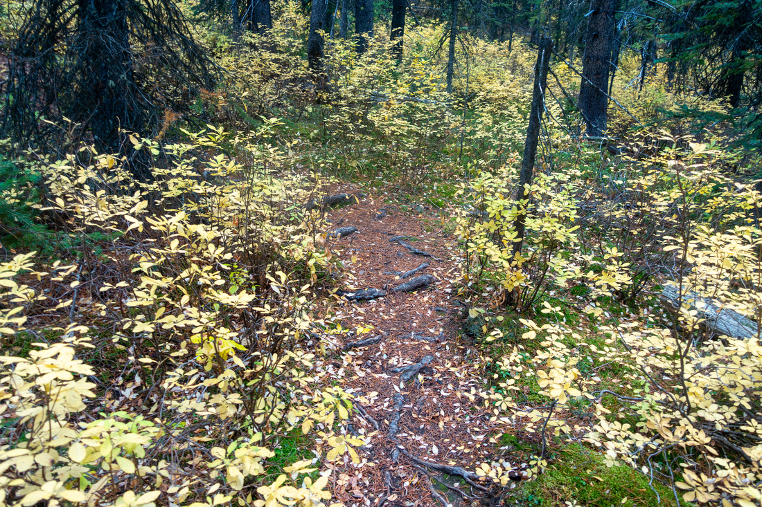 Trail Foliage Trail Foliage Very pleasant hiking on well defined trail at north side of Running Rain Creek
 |
|||
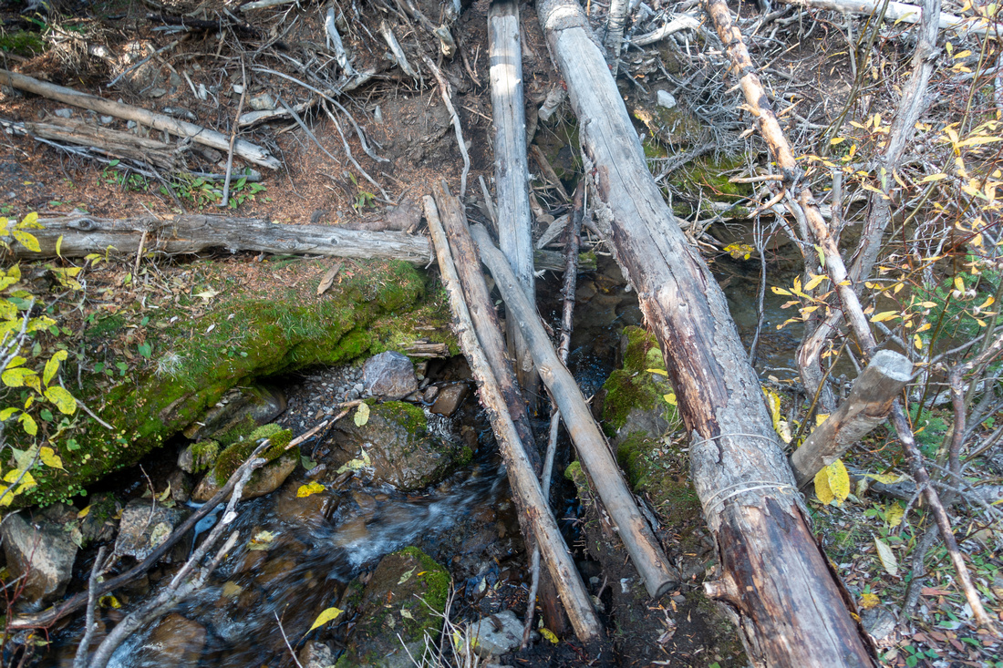 Log Crossing Log Crossing Log assisted crossing of Running Rain Creek to south side ~1km before the Lake
 |
|||
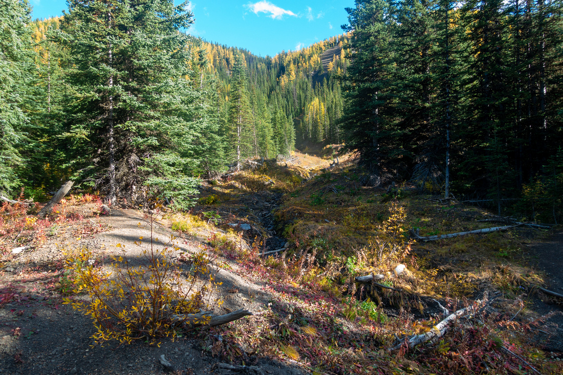 South Ridge Gully South Ridge Gully Avalanche Gully shortly before the lake that provides shortcut descent from South Ridge
 |
|||
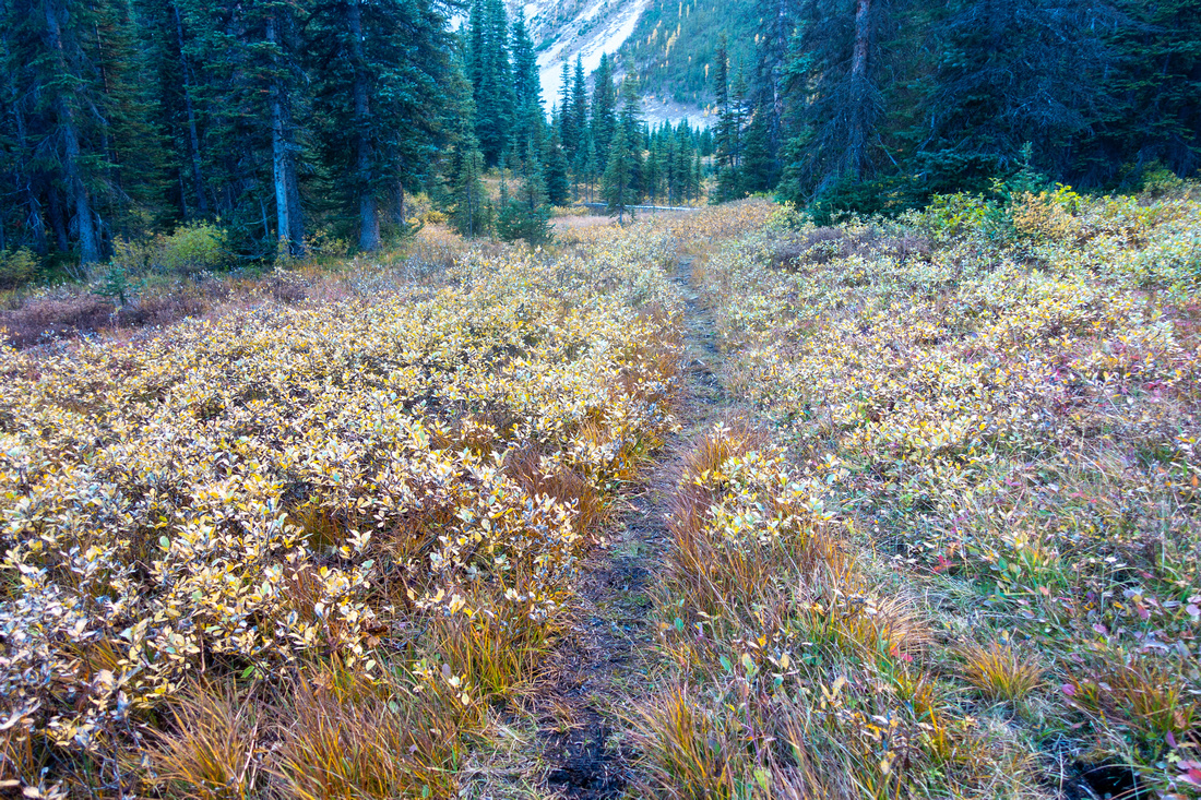 Meadow Trail Meadow Trail Trail becomes more faint but still easy to follow crossing meadows before the Lake
 |
|||
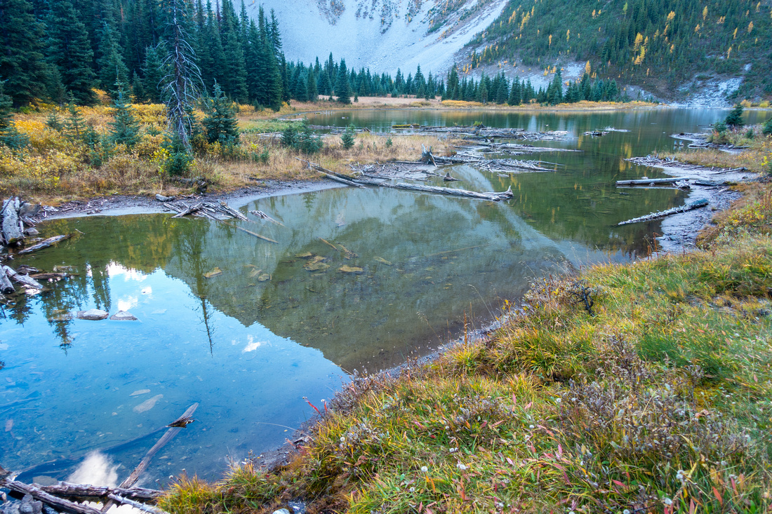 Running Rain Lake Running Rain Lake Very beautiful Running Rain Lake with Running Rain Peak reflected in calm water. Good trail continues on right side
 |
|||
 Fire Ring Fire Ring Fire Ring, built most likely by Fishermen near Parks Alberta Angler Sign, is pleasant spot for break
 |
|||
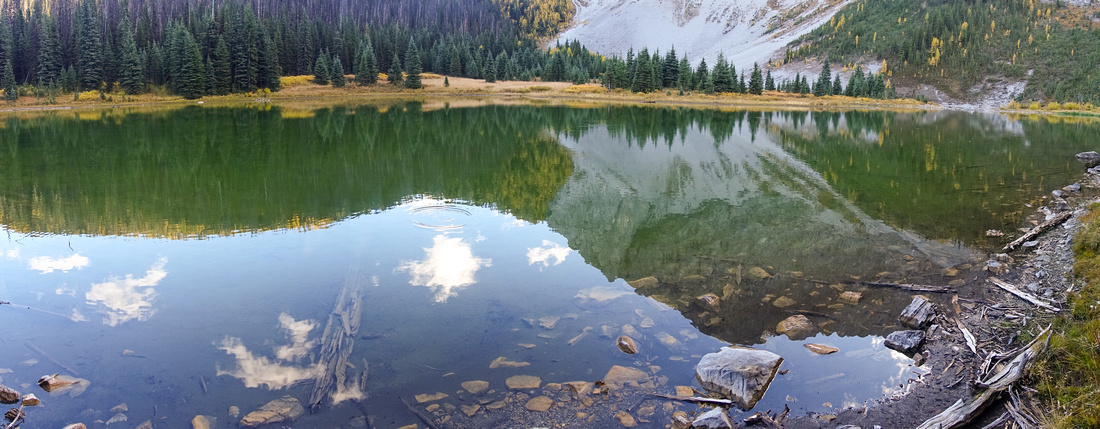 Running Rain Panorama Running Rain Panorama Running Rain Peak ridgeline reflected in calm water
 |
|||
 Causeway crossing Causeway crossing Rock Hop across the Causeway separating lower and upper Lake
 |
|||
 Avalanche Path Avalanche Path Pine Trees swept by Spring Avalanches on Talus slope below Running Rain Peak
 |
|||
 South Slope South Slope Hiking up south side Grass / Talus with view back to Running Rain Lake. North Ridge behind
 |
|||
 Fall Colours Fall Colours Steepish gully with reasonable animal trail directly below South Ridge
 |
|||
 South Ridge South Ridge Faint trail can be followed most of the way on mainly forested South Ridge
 |
|||
 Larch Splendour Larch Splendour Golden Larches at their prime in late September
 |
|||
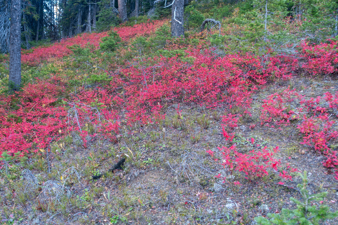 Fall Colours Fall Colours Not only larches offering vibrant Autumn colours on Running Rain South
 |
|||
 South Ridge Summit South Ridge Summit South Ridge Highpoint looking back to Running Rain Peak (center right) and Odlum Peak (left). Large cairn indicates this route does see Human presence
 |
|||
 Odlum Ridge Odlum Ridge Odlum Ridge covered in Gold directly South
 |
|||
 South Ridge South Ridge Terrific view east just past the Highpoint. Crossing over to lower bump is straightforward, but drop on other side down to Storm Creek is involved
 |
|||

|
|||
 South Gully Shortcut South Gully Shortcut Rough, but manageable shortcut Avalanche Gully back to Valley Trail
 |
Abstract
| Overall Difficulty | D3 | Storm Creek ford and Swamp area slosh. Off trail past the Lake with steep shortcut gully descent | |||
| Snow Factor | S2 | Some avalanche danger at west end of the lake. Shortcut descent gully not recommended with snow cover. Hwy40 seasonably closed Dec 1 - Jun 15 | |||
| Scenery | Beautiful Running Rain Lake. Abundance of Golden Larches. Distant views to many scenic areas of South Highwood | ||||
| Trail/Marking | Good / None | Tricky initial section to Storm / Running Rain Creeks confluence. Well defined trail to the lake, route after | |||
| Suggested Time | 5 hrs | Add ~1hr if not using shortcut descent gully, or exploring south bump | |||
| Elevation |
Start: 1900m Max: 2330m Total: ~600m |
Distance: ~9km (shortcut gully loop) | |||
| Gear | Full Hiking Boots and Poles. Gaiters very helpful. Sandals or crocs for Storm Creek Ford / Swamp area crossing | ||||
| Water | Running Rain Creek. No water above the Lake. Carry 0.5 - 1L | ||||
| Dog Friendly | Yes | Standard back-country travel precautions. Area frequented by grizzly bears | |||
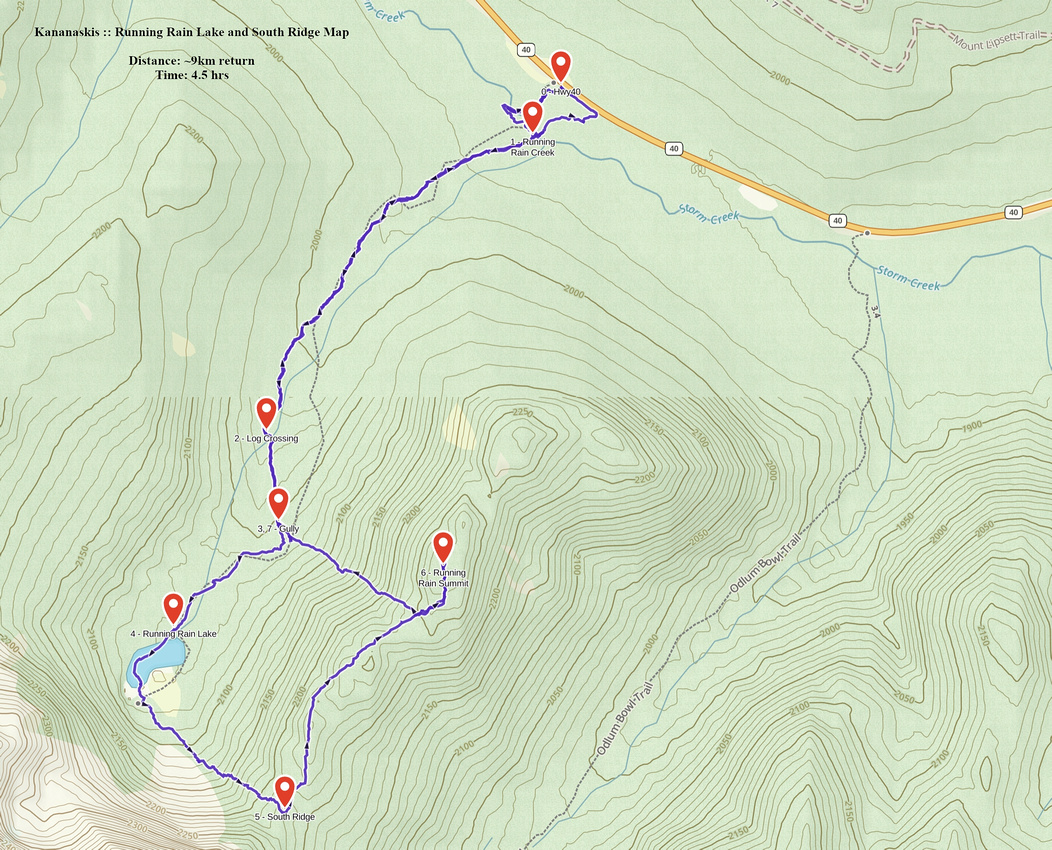 Running Rain South Ridge GAIA Map
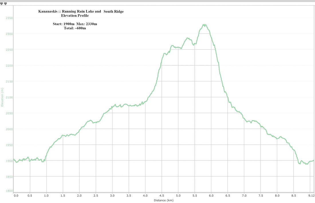 Running Rain South Ridge Elevation Profile
| North Ridge |
TBA


