Google Map |
Rockies :: Kananaskis :: Mount Lipsett |
GPS Track |
 
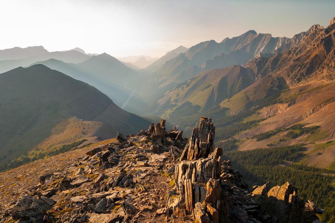
Panoramic view south from Lipsett Highpoint with South Kananaskis Peaks obscured by summer wildfire smoke |
|||
| Trip Summary | |||
August 14, 2023An excellent South Highwood hike offering great reward for the effort. Parking is at unmarked gravel pullout on east side of Hwy40, ~13km south of Highwood Pass and ~5km south of Lipsett Picnic Area. (GPS download link top of page). There are no difficulties. Trail starts by worn bear sign at top of quarry and follows old partially overgrown exploration road, with some muddy parts. While hiking below treeline is a wee bit long (just over 5km ~1.5 hrs) grade is gentle with several openings that provide scenic interest. Above treeline fantastic panorama awaits; in summer alpine meadows will be dotted with wildflowers, if your timing is right. Distant views of Elk Range are equally impressive, while great looking Odlum Ridge is directly south. Mt. Lipsett consists of three grassy hills, of which highest one is also the "summit". On sunny weekend trail is likely busy but on my midweek visit I had it all to myself enjoying early dinner in total solitude and views that even wildfire haze could not ruin.
It is possible to descend on north side to intervening col then turn left and drop to Hwy40 near Lipsett picnic area ~5km north from where you started; this variation requires 2 vehicles or a bicycle and is entirely not worth in my opinion. I returned the same way, taking a shortcut across sunny lower bump reconnecting with trail near big switchback just above treeline, while enjoying excellent early evening views.
|
|
Gallery |
|||
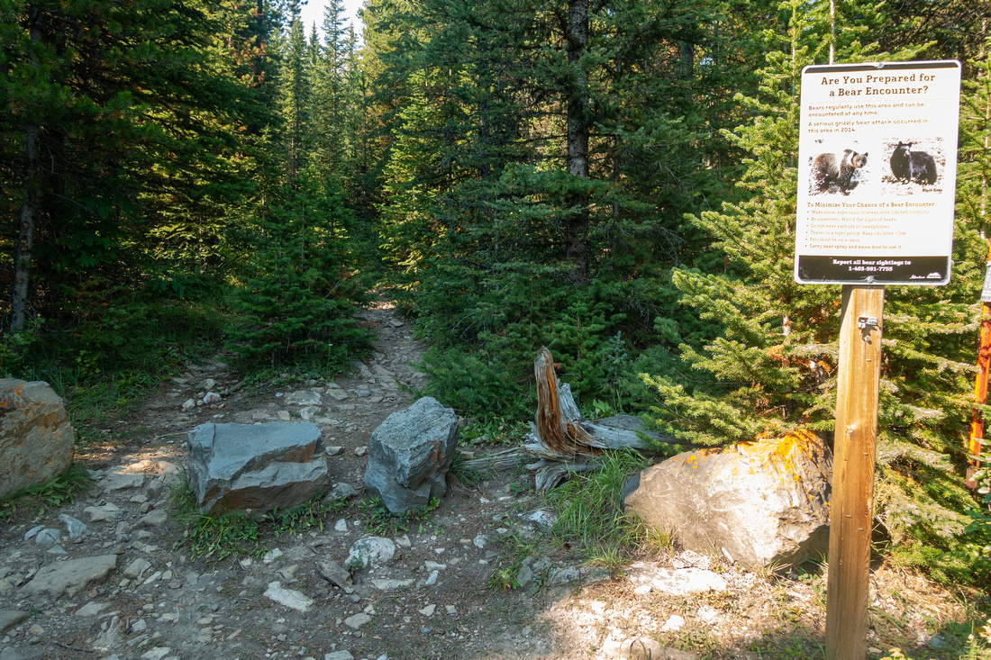 Trailhead Sign
Bear warning at Lipsett Trailhead above parking pullout Trailhead Sign
Bear warning at Lipsett Trailhead above parking pullout |
|||
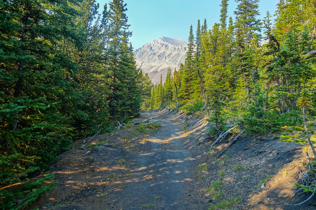
 Forest Trail
Well defined trail follows old exploration roadbed for just over 5km to treeline Forest Trail
Well defined trail follows old exploration roadbed for just over 5km to treeline |
|||
 Odlum Ridge
One of several clearings with great view of Odlum Ridge Odlum Ridge
One of several clearings with great view of Odlum Ridge |
|||
 Exploration Road
Exploration road becomes quite wide approaching treeline; Mist Mtn upper center Exploration Road
Exploration road becomes quite wide approaching treeline; Mist Mtn upper center |
|||
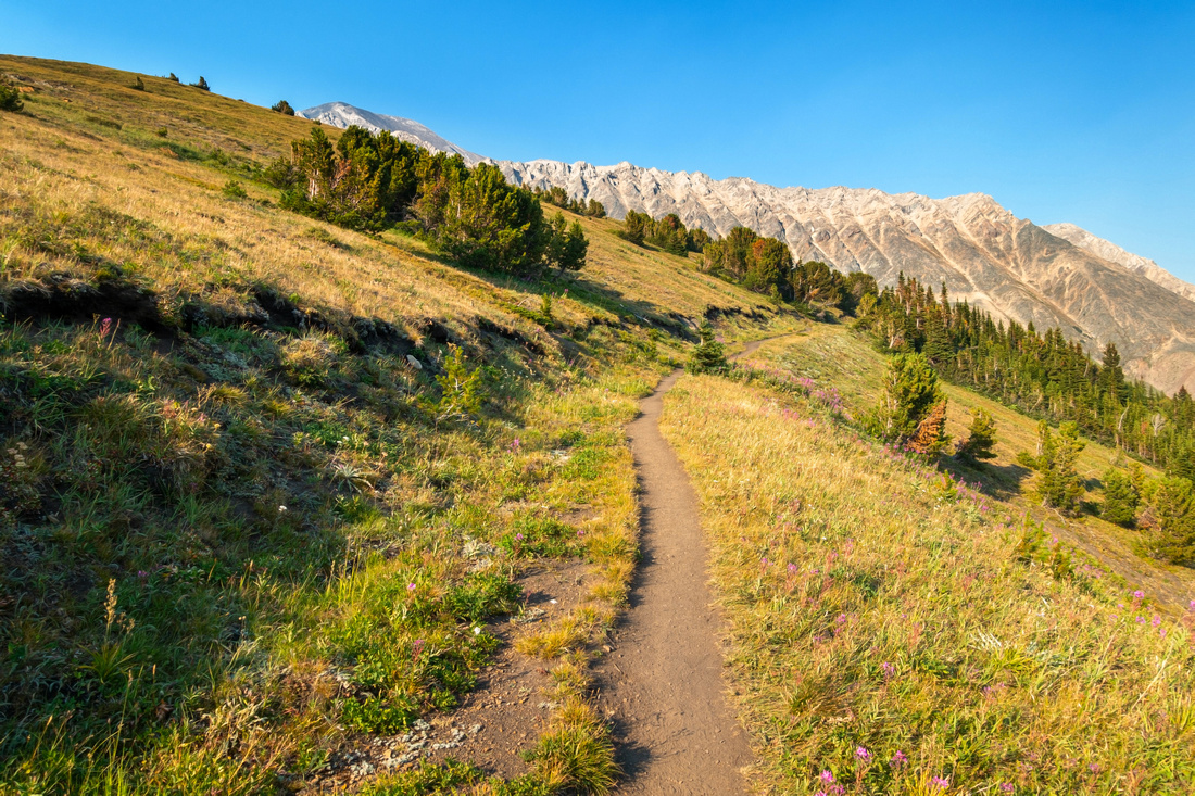
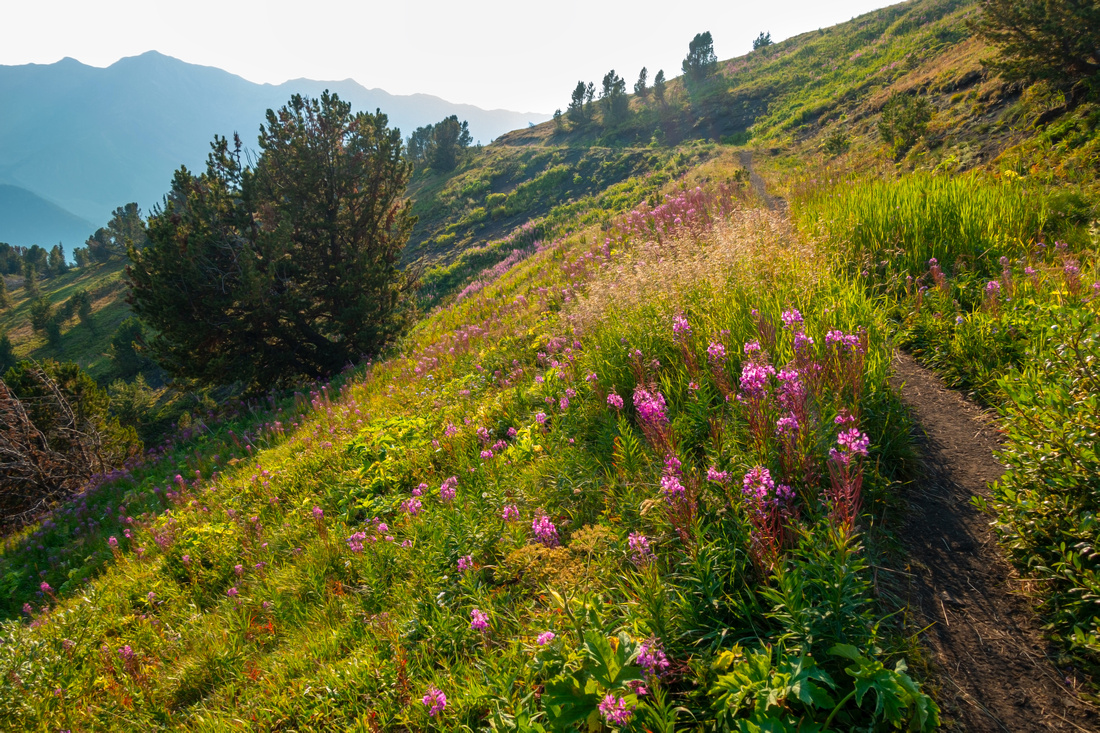 Treeline Bench
Exiting on Treeline Trail curls on wildflower dotted grassy bench Treeline Bench
Exiting on Treeline Trail curls on wildflower dotted grassy bench |
|||
 Treeline Panorama
 looking back - terrific spot for a break. Odlum Ridge across, distant smoke obscured Lineham Ridge center left Treeline Panorama
Treeline Panorama looking back - terrific spot for a break. Odlum Ridge across, distant smoke obscured Lineham Ridge center left |
|||
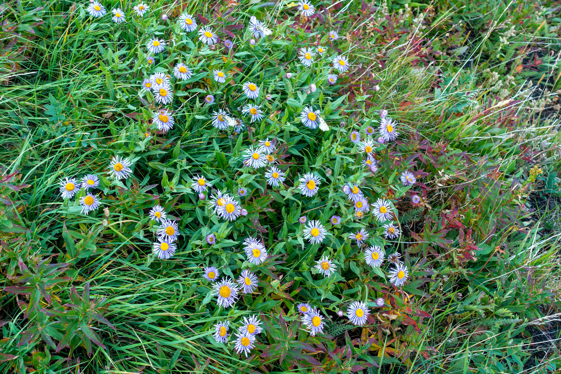 Wildflowers
Profusion of alpine wildflowers is one of reasons why summer is recommended time for Mt. Lipsett Wildflowers
Profusion of alpine wildflowers is one of reasons why summer is recommended time for Mt. Lipsett |
|||
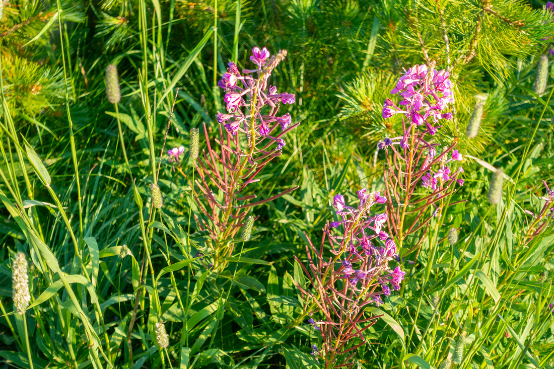 Wildflowers
More wildflowers in Lipsett alpine Wildflowers
More wildflowers in Lipsett alpine |
|||
 Alpine switchback
Trail making wide turn above alpine; on descent I dropped down green hillside on left side Alpine switchback
Trail making wide turn above alpine; on descent I dropped down green hillside on left side |
|||
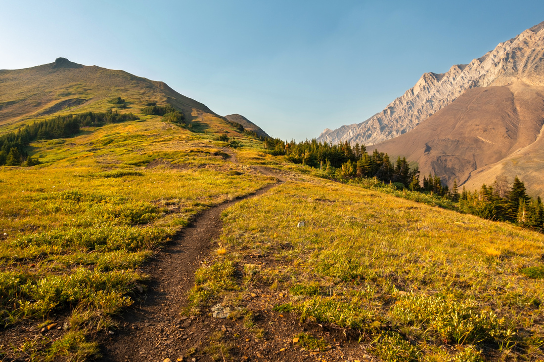 Lipsett Alpine
Gentle meadows hiking higher up; exploration road branches here to the left, while trail continues straight to Lipsett summit just poking behind in the center Lipsett Alpine
Gentle meadows hiking higher up; exploration road branches here to the left, while trail continues straight to Lipsett summit just poking behind in the center |
|||

|
|||
 Smoky Highwood
Views north from Lipsett Summit to smoky Highwood Pass. It is possible to drop down to the col below, then turn left and descend to the highway near Lipsett Picnic area, ~5km from trailhead (2 cars of bicycle). Highwood and Grizzly Ridges upper left. Smoky Highwood
Views north from Lipsett Summit to smoky Highwood Pass. It is possible to drop down to the col below, then turn left and descend to the highway near Lipsett Picnic area, ~5km from trailhead (2 cars of bicycle). Highwood and Grizzly Ridges upper left. |
|||
 Lipsett Summit
 that also contained small register on my visit, looking south Lipsett Summit
Lipsett Summit that also contained small register on my visit, looking south |
|||
 Lipsett Meadows
Geat alpine with views of Odlum Ridge on return. I continued across sunlit bump center right then descended grassy meadows on the other side and reconnected with trail lower down Lipsett Meadows
Geat alpine with views of Odlum Ridge on return. I continued across sunlit bump center right then descended grassy meadows on the other side and reconnected with trail lower down |
Abstract
| Overall Difficulty | D2/3 | Trail hiking with no difficulties | |||
| Snow Factor | S2 | Gentle slopes with no avalanche danger. Possible icy spots. Hwy40 closed Dec 1 - Jun 15 | |||
| Scenery | Great views of South Kananaskis and Elk range. Towering Mt. Mist and Alpine Meadows | ||||
| Trail/Marking | Excellent | Old exploration road (occasionally overgrown) to treeline, well defined trail after | |||
| Suggested Time | 5 hr | Return Time. Loop descent on north side would likely shave an hour, but alternate transport is required | |||
| Elevation | Start: 1870 m Max: 2590m Total: ~720m | Round Trip: ~15 km | |||
| Gear | Full hiking boots or day-hikers | ||||
| Water | No reliable water source. Carry 1.5L, depending on conditions | ||||
| Dog Friendly | Yes | Standard back-country precautions | |||
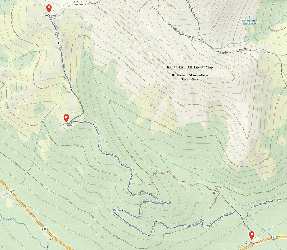 Mt. Lipsett GAIA Map
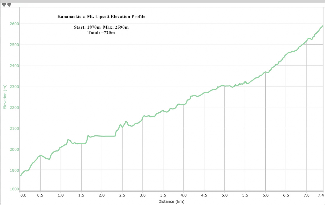 Mt. Lipsett Elevation Profile
© Autumn Sky Photography