Google Map |
Rockies :: Kananaskis :: Lineham Ridge |
GPS Trackƒ |
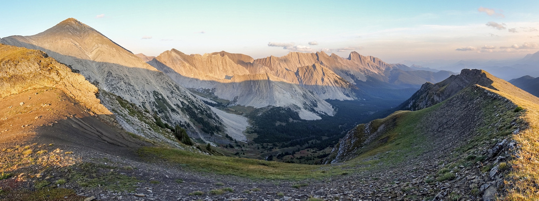 
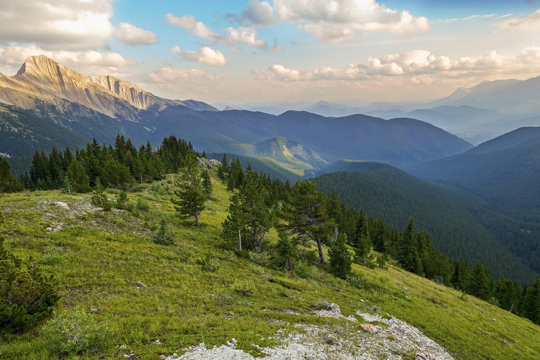
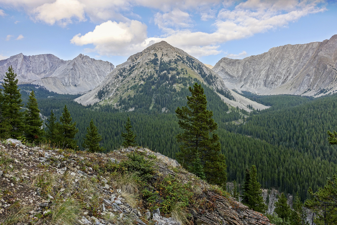
Panoramic view south from end of Lineham Ridge Hiking portion. Picklejar Peak upper left, "Lineham Creek Peaks" center, Lineham Cirque below |
|||
| Trip Summary | |||
September 15, 2022Lineham Ridge is terrific ridgewalk in South Highwood. Parking is 15-20min south from Highwood Pass between Lantern Creek and Cat Creek rec areas at east side of the road. Note Hwy40 seasonal closure Dec 1 - Jun 15. Outing is well described in Daffern K-country trail guide (Vol 5, 4th ed, green) and unfolds pretty much as in the book. Only obstacle is major washout of Lineham Creek ~1km from the start - stay on left (north) side of the creek and follow cairns/flags. Shortly after trail resumes is unmarked junction - left for the ridge, straight for "Lineham Cirques". Ridge trail is well defined and after initial steep bit settles for long forested haul alternating flat stretches with moderate rises. After about an hour of fast walking trail exits to treeline and beautiful views unfold. My trip in Sep '22 was in hazy conditions due to ever recurring BC wildfires, yet it was more scenic than expected. Craggy section ahead can be bypassed on snippets of trail to the left, but it is also great fun staying right on the crest if mild exposure to the right doesn't bother you. Obvious highpoint (see Gallery) is logical turnaround point, but even if not planning on scrambling Lineham Peak it is worth continuing another 10 min or so to final bump and end of hiking portion.
Many options for longer trip include Lineham Peak scramble; most peakbaggers seem to access from Picklejar side but despite shorter it is less scenic and unpleasant - not recommended. Optimal outing which I'm bound to explore at some point in the future will include drop on grassy hillside to head of Lineham Creek valley, then return via Lineham Cirques as described in Daffern guidebook.
|
|
Gallery |
|||
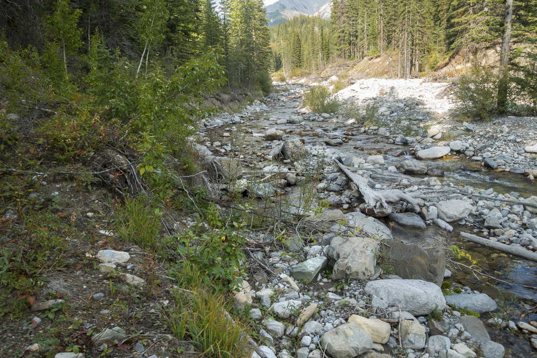 Creek Washout
Trail drops to Lineham Creek ~15min from trailhead with washed out section ahead. Stay on left side following cairns and flags Creek Washout
Trail drops to Lineham Creek ~15min from trailhead with washed out section ahead. Stay on left side following cairns and flags |
|||
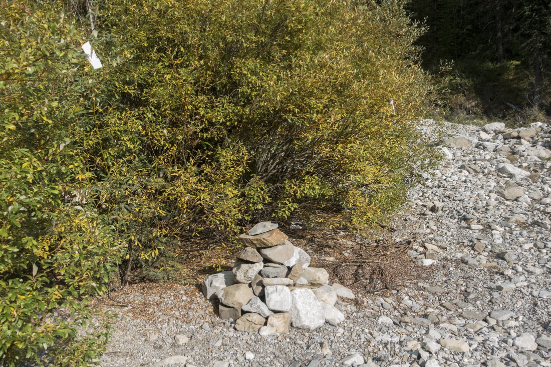 Washout Cairn
Large Cairn at far end of the washout signaling where trail resumes. Ridge/Cirque junction is few minutes ahead Washout Cairn
Large Cairn at far end of the washout signaling where trail resumes. Ridge/Cirque junction is few minutes ahead |
|||
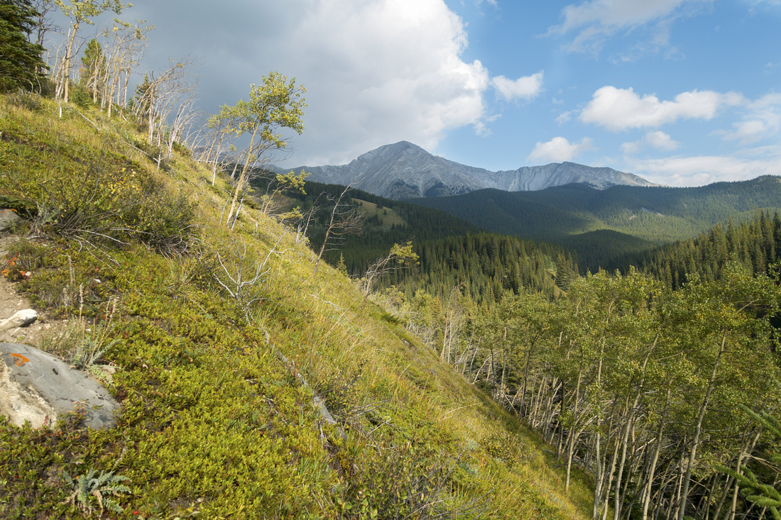 Ridge Trail
 initially rises steeply above the creek then alternates flat parts with small rises till treeline Ridge Trail
Ridge Trail initially rises steeply above the creek then alternates flat parts with small rises till treeline |
|||
|
|
|||
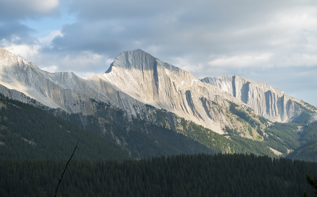 GR627936
Unnamed, but impressive rock bump at other side of Lineham Creek. Serendipity Peak behind center right GR627936
Unnamed, but impressive rock bump at other side of Lineham Creek. Serendipity Peak behind center right |
|||
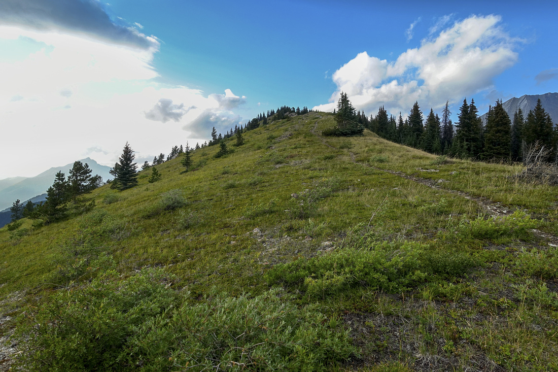 Grassy Treeline
Reaching treeline ~1hr of fast pace from the Junction. Trail now becomes less defined. Remainder of the hike is very scenic Grassy Treeline
Reaching treeline ~1hr of fast pace from the Junction. Trail now becomes less defined. Remainder of the hike is very scenic |
|||
 View Back
View back ~10 min from the treeline. Approach follows forested spire mid center right View Back
View back ~10 min from the treeline. Approach follows forested spire mid center right |
|||
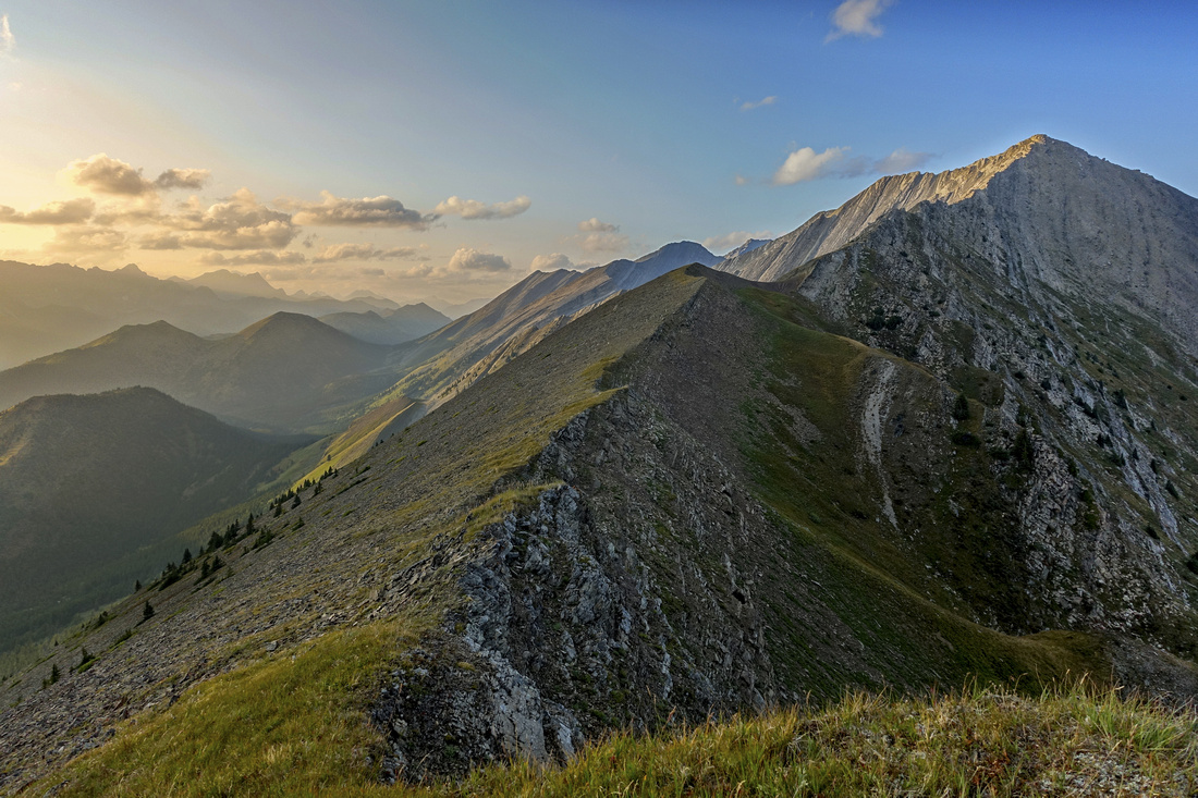
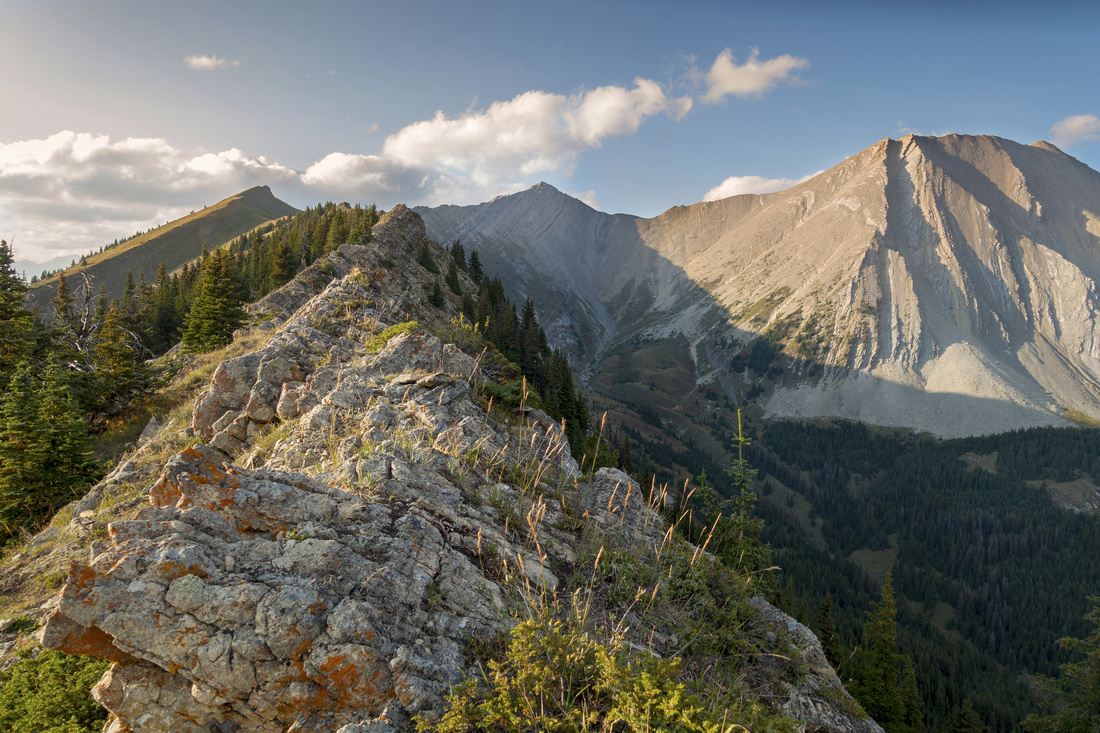 Craggy Ridgecrest
Narrow craggy section of ridge with mild exposure to the right - great fun if staying on the crest. Ridge highpoint upper center left, Lineham Peak to its right, dead center. Picklejar Peak upper center right Craggy Ridgecrest
Narrow craggy section of ridge with mild exposure to the right - great fun if staying on the crest. Ridge highpoint upper center left, Lineham Peak to its right, dead center. Picklejar Peak upper center right |
|||
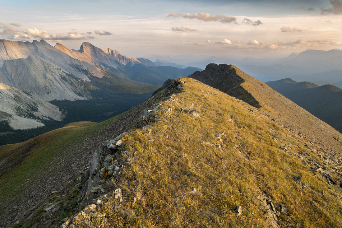
 Ridge Highpoint
, perfectly logical turnaround point. But even if not planning on scrambling Lineham Peak upper right, it is worth continuing for ~10min to next grassy bump despite minor elevation loss Ridge Highpoint
Ridge Highpoint, perfectly logical turnaround point. But even if not planning on scrambling Lineham Peak upper right, it is worth continuing for ~10min to next grassy bump despite minor elevation loss |
|||
 Lihenam Ridge
Grassy crest looking back to Highpoint -- Ridgewalkers paradise Lihenam Ridge
Grassy crest looking back to Highpoint -- Ridgewalkers paradise |
|||
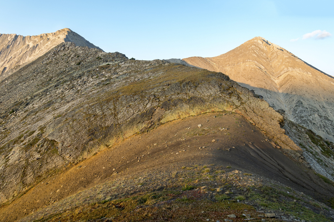 Scramble Section
Scramble part at end of Hikers Trail; Lineham Peak upper left, Picklejar Peak right. Despite conflicting opinions on Internet, continuing is apparently fairly straightforward (class 3, with possible bypass on climber right). Scramble Section
Scramble part at end of Hikers Trail; Lineham Peak upper left, Picklejar Peak right. Despite conflicting opinions on Internet, continuing is apparently fairly straightforward (class 3, with possible bypass on climber right). |
|||
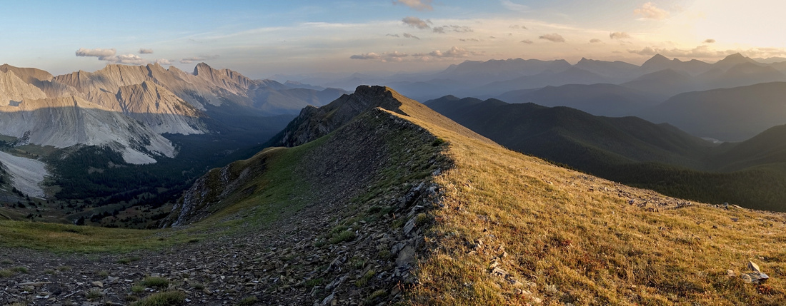 Lineham Ridge
Despite hazy conditions from BC Wildfires, view back along long Ridge Spine was very scenic in Sep '22 Lineham Ridge
Despite hazy conditions from BC Wildfires, view back along long Ridge Spine was very scenic in Sep '22 |
Abstract
| Overall Difficulty | D3(5) | Washed out section in Lineham Creek. Craggy and mildly exposed central part of the ridge (D3). Moderate scrambling on ridgecrest for Lineham Peak | |||
| Snow Factor | S5 | Not feasible in winter as Hwy40 is annually closed Dec 1 - Jun 15 past K-Lakes turnoff | |||
| Scenery | Exceptional Panoramic views of Front Ranges, Green Meadows and Alberta Foothills. | ||||
| Trail/Marking | Good | One washed out section (cairns and flags). Creek/Ridge junction not marked. Trail fades above treeline | |||
| Suggested Time | 5-6hr | Turnaround at base of scramble part. Add at least an hour if continuing to Lineham Peak, couple of hours for exploratory return via Lihenam Cirques | |||
| Elevation | Start: 1705 m Max: 2495 m Total: ~900 m (ridge highpoint) | Round Trip: ~15 km | |||
| Gear | Day Hikers and Hiking Poles | ||||
| Water | No water source past Lineham Creek; seasonal snow patches only. Carry 1.5L, depending on season | ||||
| Dog Friendly | Yes | Standard back-country travel precautions | |||
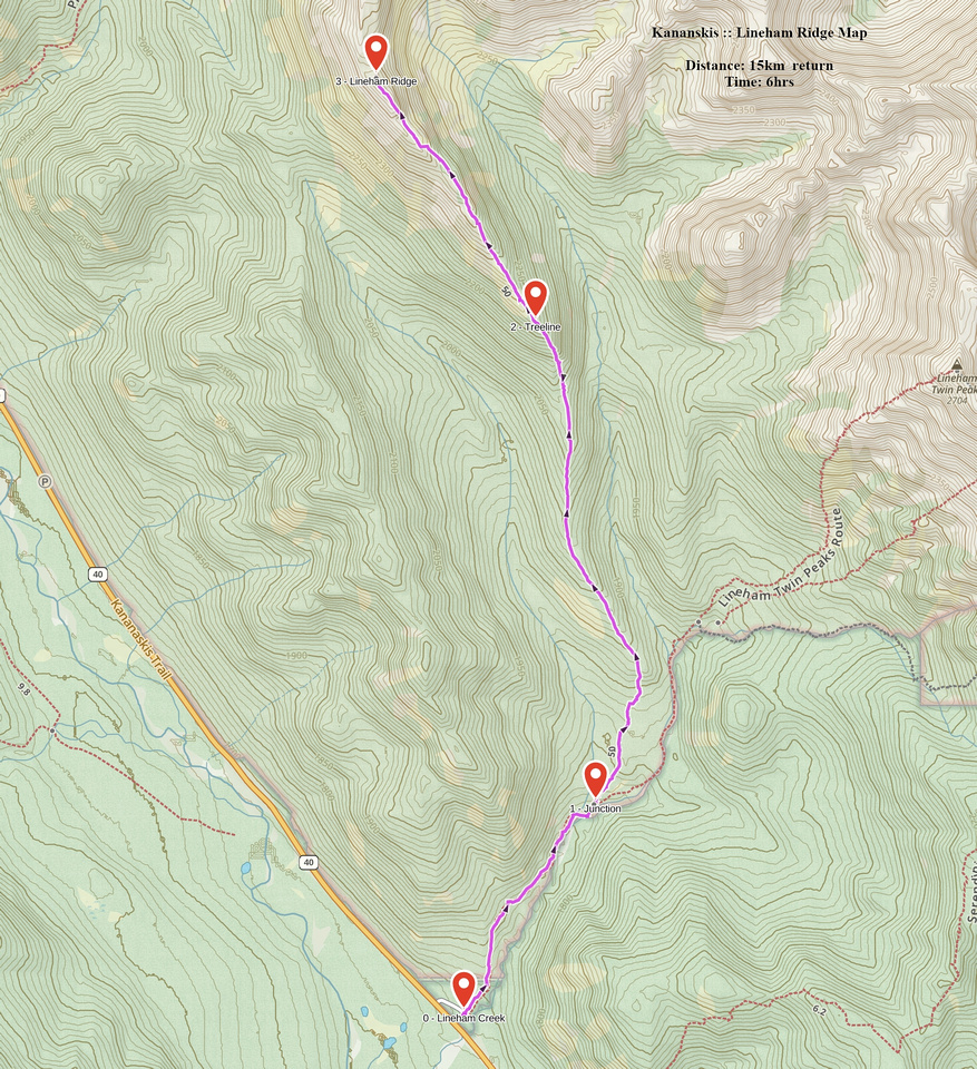 Lineham Ridge GAIA Map
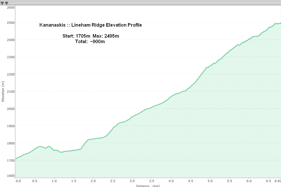 Lineham Ridge Elevation Profile