Google Map |
Rockies :: Kananaskis ::Grizzly - Highwood Ridge / Paradise Valley |
GPS Track |
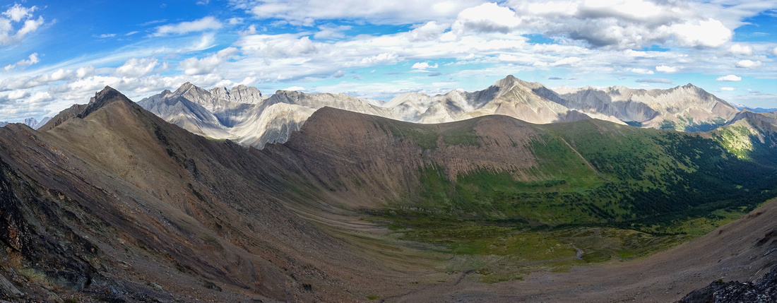 
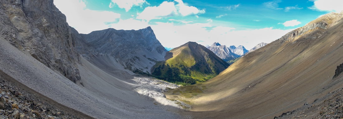
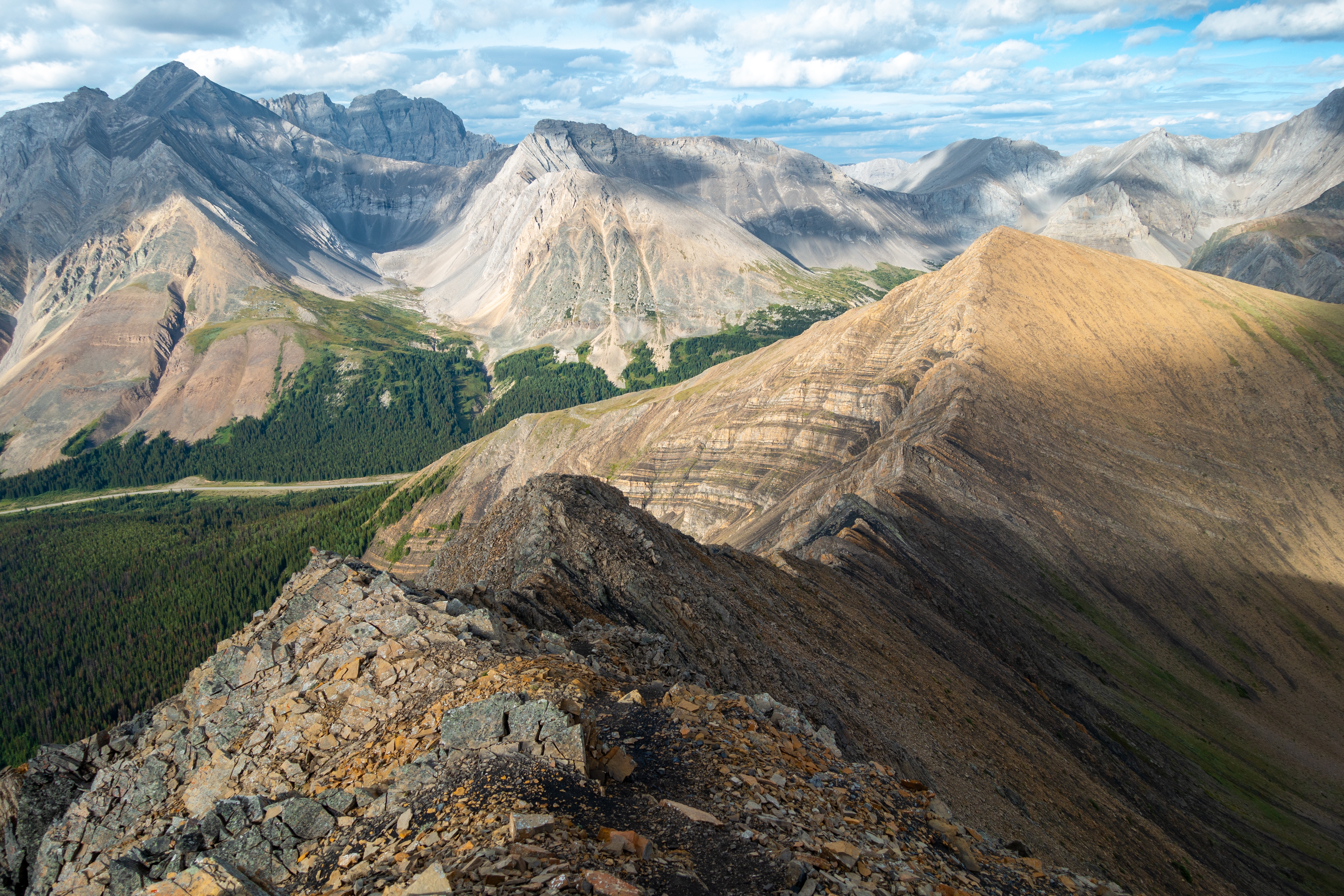
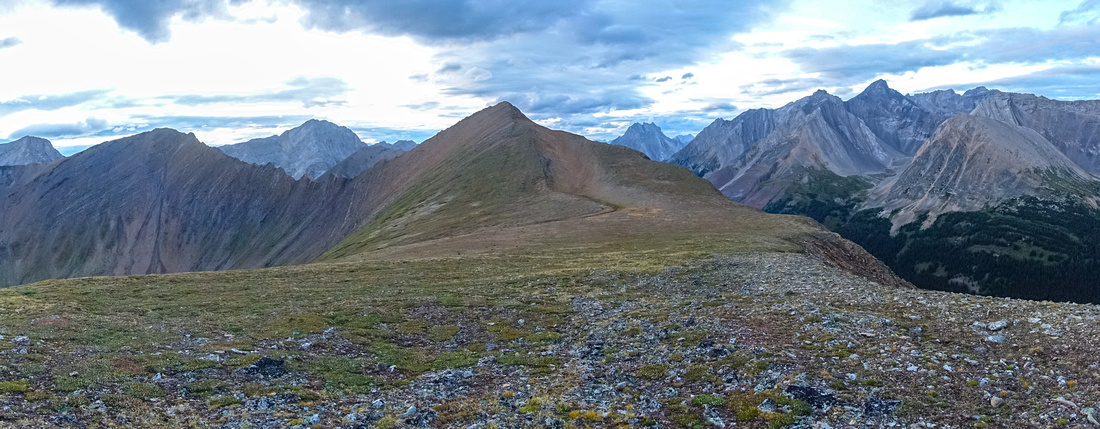
Panoramic view east from Grizzly Ridge looking across Paradise Valley to Highwood Ridge. Grizzly Peak center left |
|||
| Trip Summary | |||
August 11, 2023Great loop in Highwood area linking two fantastic ridgelines via gorgeous Alpine valley. It is not trip for beginners as connecting, self coined "Grizzwood" Ridge has parts of moderate, mildly exposed scrambling followed by off-trail navigation. This encompassing trip gives most rewarding experience of the area; less demanding options include out-and-back Grizzly Ridge / Peak or Highwood Ridge, both returning the same way and requiring separate trips. Besides doing a loop, variation presented here also offers opportunity to visit rarely visited Paradise valley tucked between two ridges. Loop can be done in either direction, but I advise CCW as presented in this report.
Trailhead is Highwood Pass, highest pass in Canada reached by paved and maintained road. Note that Hwy40 is closed Dec 1 - Jun 15. Considering high elevation and overall unpredictable weather trip is best done in high-summer or early fall. From trailhead follow popular Pocaterra Cirque trail, noting (unmarked) junction in 20-25 min (GPS Track download top of page) where direct route to Highwood North forks in. This is where you will close the loop if doing full traverse. Past Pocaterra Tarn keep left at another unmarked junction (straight leads to Pocaterra Ridge). This section is specially beautiful in Autumn as abundance of golden larches paint valley golden-yellow. Grizzly Col is reached via moderately steep trail slicing talus slope on left side (see Gallery), about 1.5 hrs from parking. If not windy this is super spot for quick break. West side is Kane route for Mt. Tyrwhitt (steep, lose, not recommended) while gentler east side gives easy access to Grizzly Ridge - 20-25min above the col. Ridge is then followed south (left) for another half an hour to highpoint - Grizzly Peak. During both of my visits it had register.
"Grizzwood" ridge is directly below and if not to your liking, simply return the same way via Grizzly Col. Descent is lose and has sections of moderate scrambling; caution is needed. It will take at least half an hour to low point; Highwood North is directly across and if not going to Paradise valley remainder of the ridge is easier. I dropped down steep shale to head of Paradise Valley, angling skier left as soon as feasible to utilize patches of grass. Highwood ridge can then be ascended anywhere but I found easiest to follow grassy bench on left (east) side of the valley until intercepting obvious drainage, then easily clambered to the ridge. Rounded ridgewalk to Highwood north is probably scenic highlight; much more exploration on a bluebird can be done. Drop down Highwood North to Pocaterra Trail is steep but straightforward and will take 40-45 minutes, with great views of Mt Rae and Arethusa rising above Ptarmigan Cirque. Parts of scramble route over Arethusa Col to Burns Lake can also be observed from here. |
|
Gallery |
|||
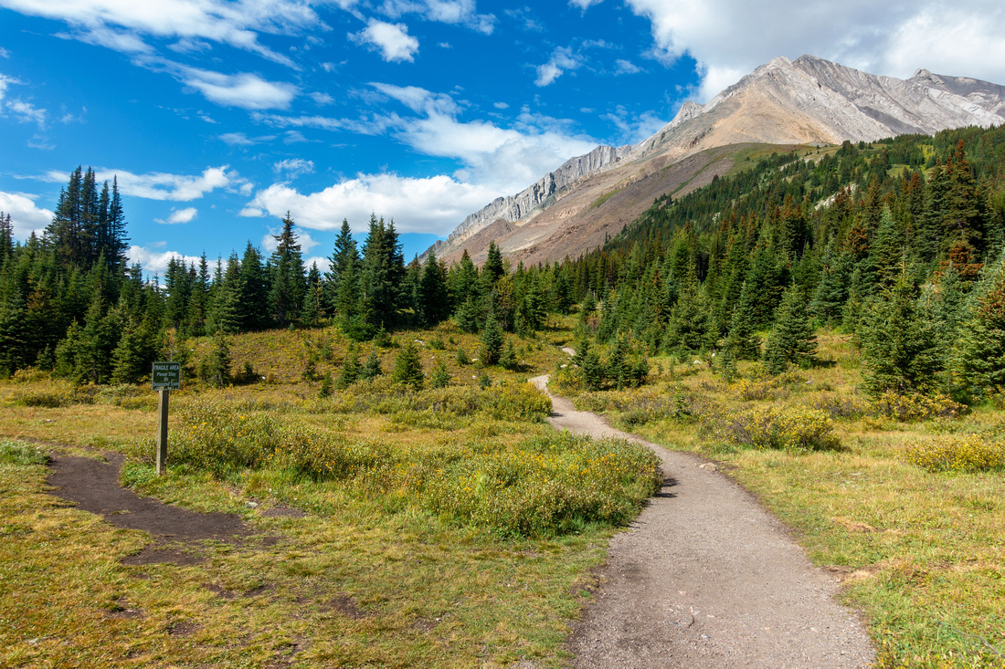 Ptarmigan Trail
Junction few minutes from parking. Ptarmigan Cirque trail continues straight, turn left for Pocaterra Cirque / Grizzly Col Ptarmigan Trail
Junction few minutes from parking. Ptarmigan Cirque trail continues straight, turn left for Pocaterra Cirque / Grizzly Col |
|||
 Pocaterra Trail
Trail reaching alpine bowl within 25-30mins. Direct route up Highwood Ridge, and eventual loop closing, is few minutes behind on left side Pocaterra Trail
Trail reaching alpine bowl within 25-30mins. Direct route up Highwood Ridge, and eventual loop closing, is few minutes behind on left side |
|||
 Pocaterra Tarn
Lovely Tarn in Pocaterra Cirque looking back. Highwood Ridge descent upper center right Pocaterra Tarn
Lovely Tarn in Pocaterra Cirque looking back. Highwood Ridge descent upper center right |
|||
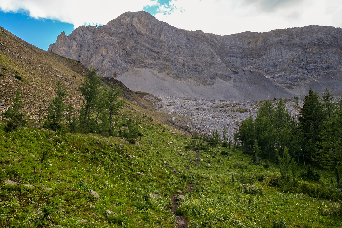 Grizzly Trail
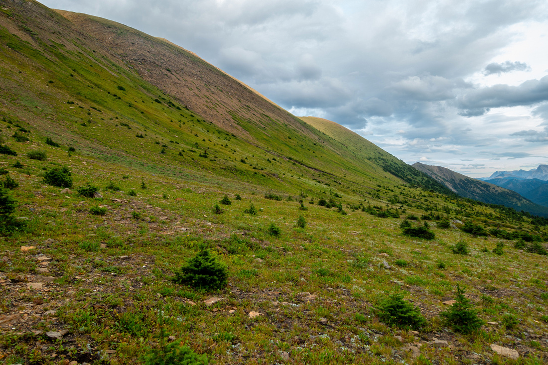
Trail rises up alpine meadows and larch trees past Pocaterra Ridge junction, then angles left behind the corner towards Grizzly Col Grizzly Trail
Trail rises up alpine meadows and larch trees past Pocaterra Ridge junction, then angles left behind the corner towards Grizzly Col |
|||
|
|||
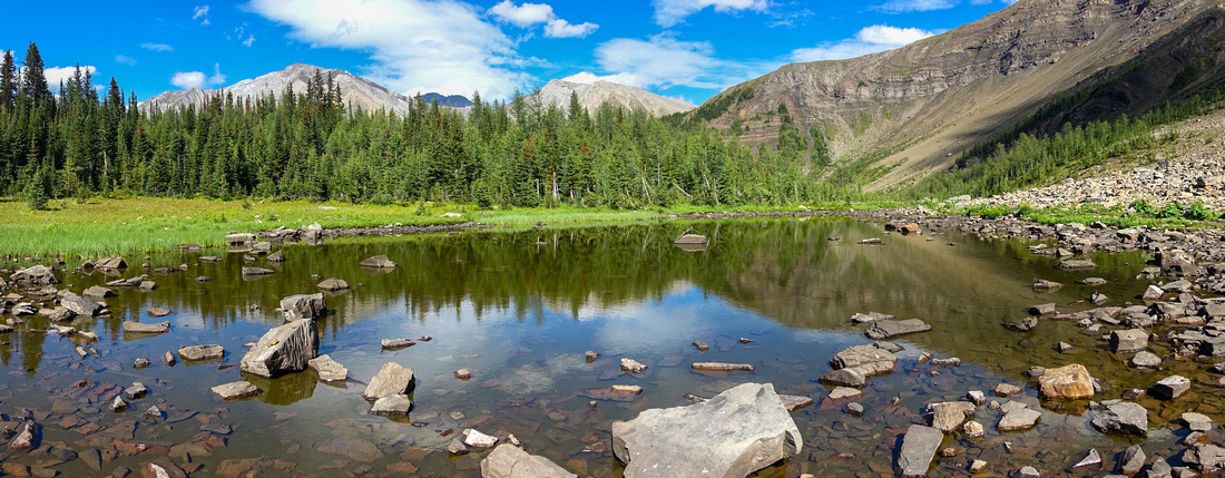
 Grizzly Col Panorama
Panoramic view north from Grizzly Col. North end of Pocaterra Ridge grassy knob center, Little Highwood Pass and Mt. Pocaterra to its left Grizzly Col Panorama
Panoramic view north from Grizzly Col. North end of Pocaterra Ridge grassy knob center, Little Highwood Pass and Mt. Pocaterra to its left |
|||
 Grizzly Col South
View south from Grizzly Col. There is no trail in this seldom visited valley; descending this way would eventually intercept Hwy40 around Mt. Lipsett picnic area Grizzly Col South
View south from Grizzly Col. There is no trail in this seldom visited valley; descending this way would eventually intercept Hwy40 around Mt. Lipsett picnic area |
|||
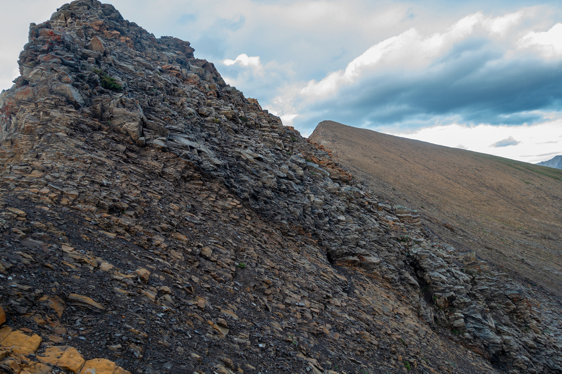
 Grizzly Slope
Easy Talus slope above Grizzly col leading to Grizzly Ridge in ~20min with well defined trail all the way Grizzly Slope
Easy Talus slope above Grizzly col leading to Grizzly Ridge in ~20min with well defined trail all the way |
|||
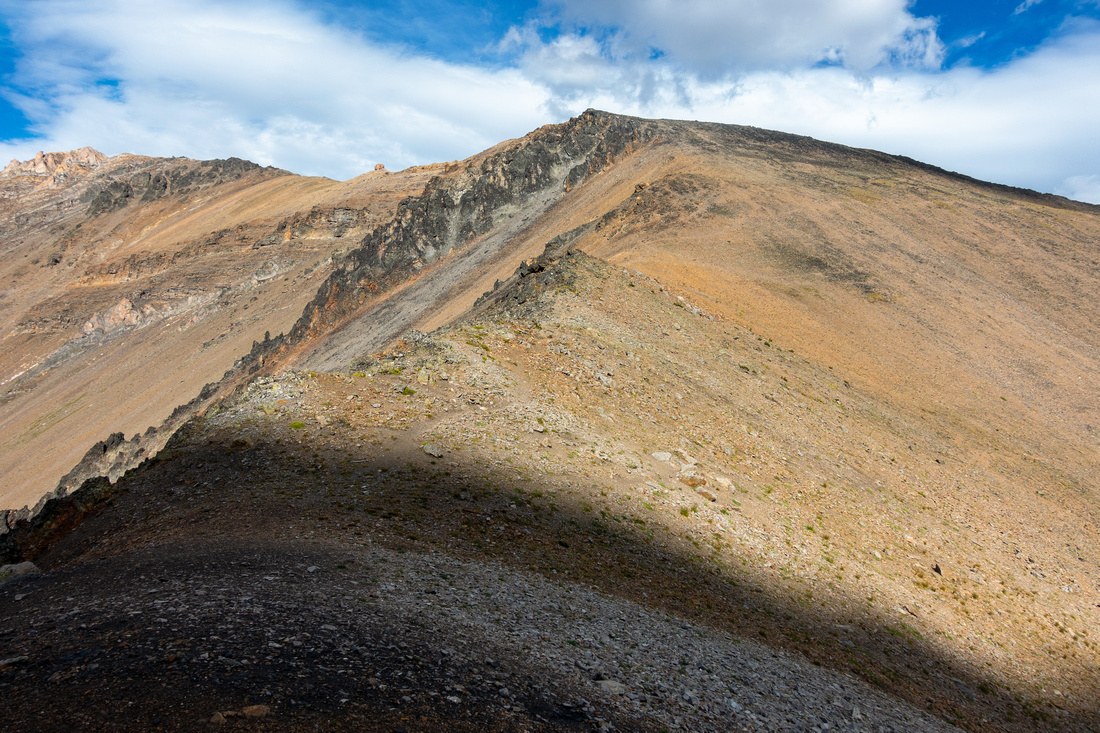
 Grizzly to Highwood
"Grizwood" Ridge between Grizzly Peak (upper left, just out of picture) and Highwood North - crux of the day. Drop into head of Paradise valley center. Mt. Rae upper left corner, Mt. Arethusa to its right Grizzly to Highwood
"Grizwood" Ridge between Grizzly Peak (upper left, just out of picture) and Highwood North - crux of the day. Drop into head of Paradise valley center. Mt. Rae upper left corner, Mt. Arethusa to its right |
|||
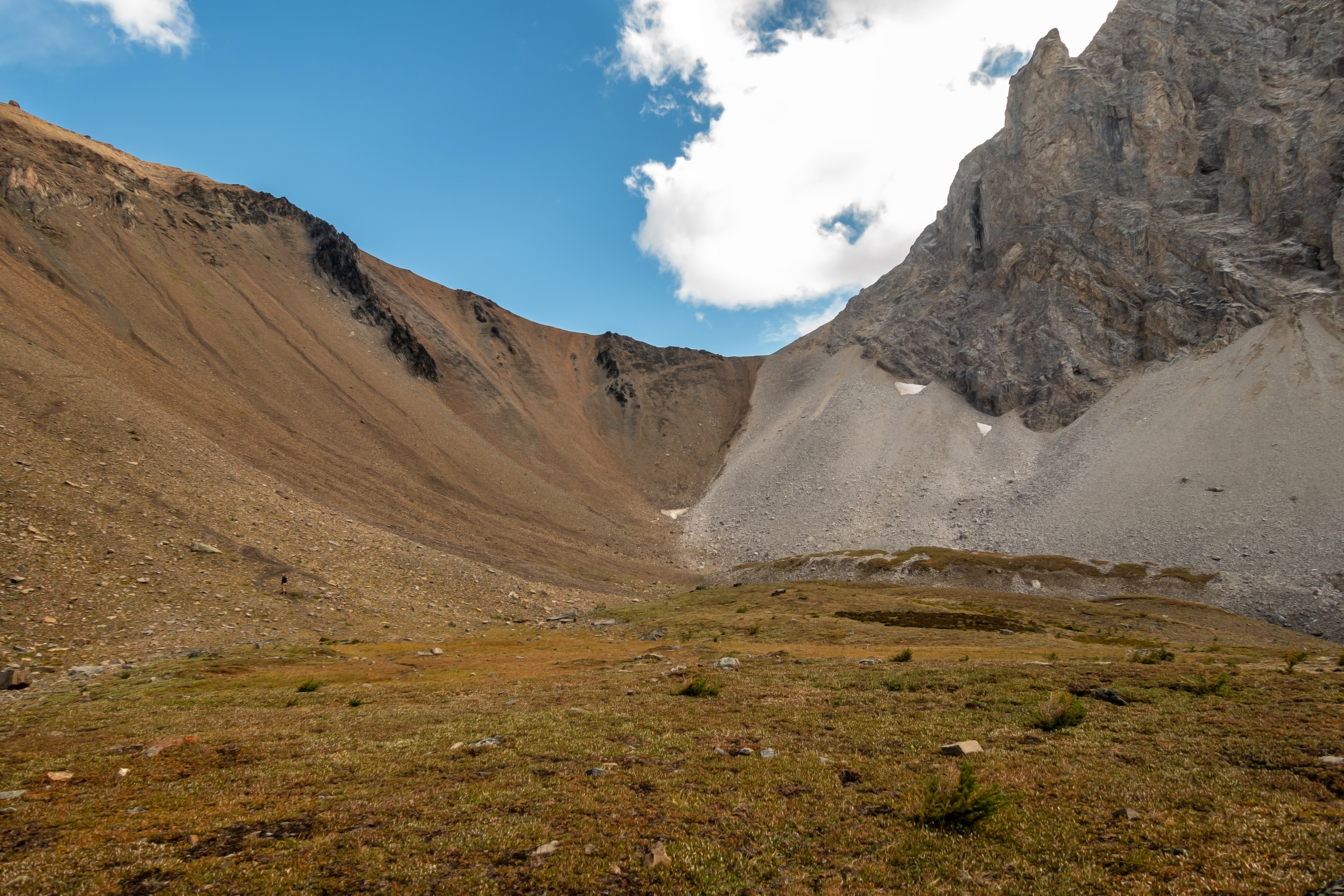
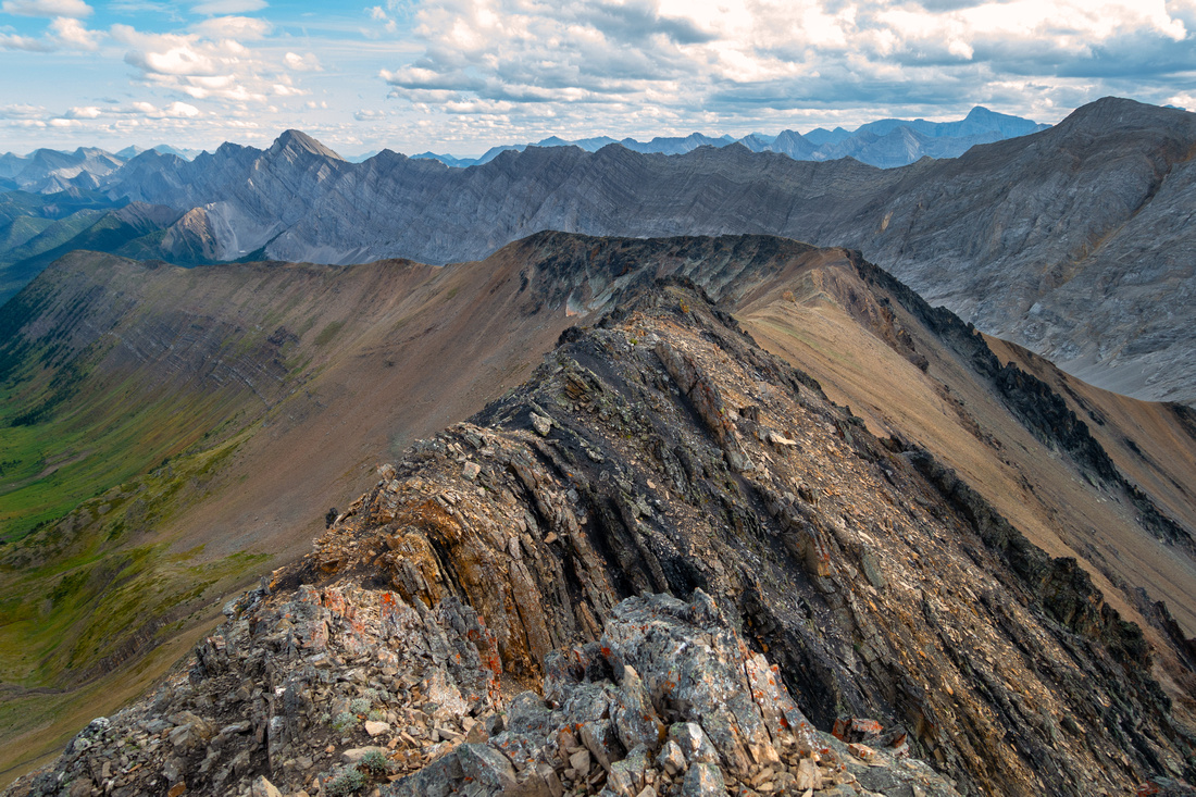 Grizzly Ridge
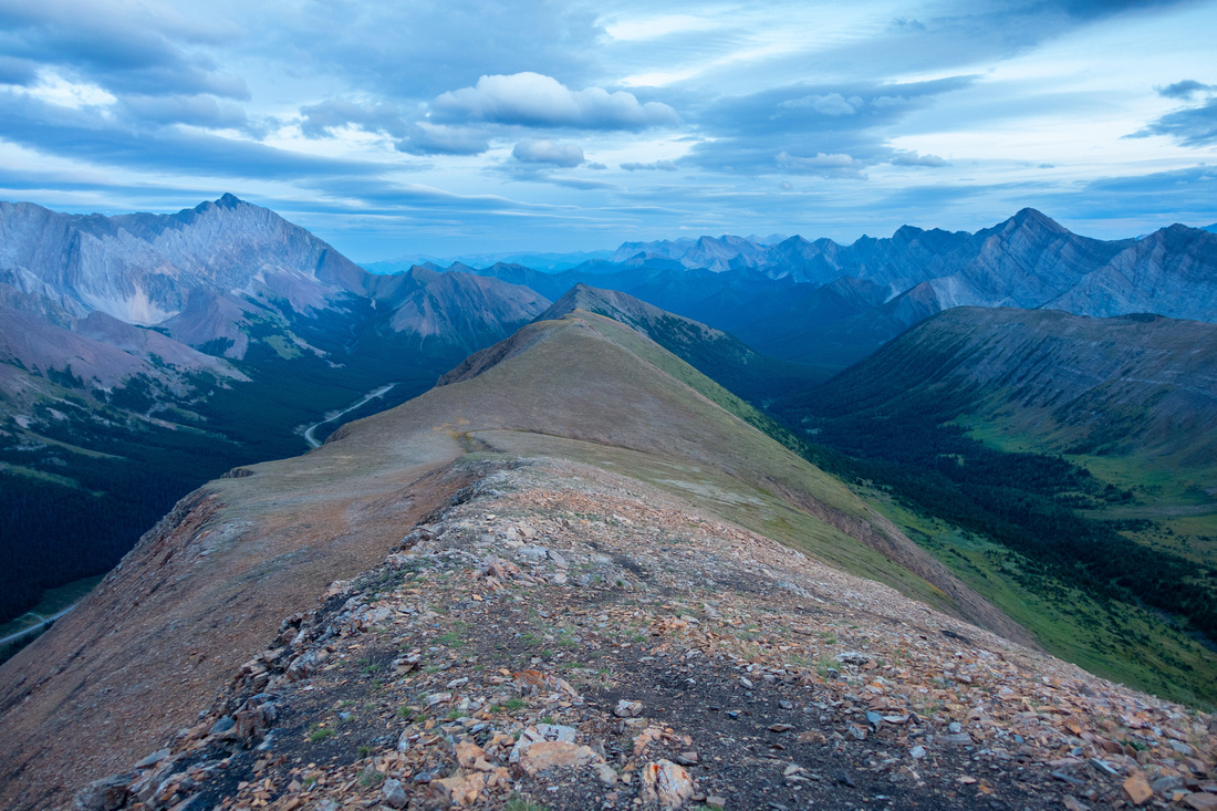
Looking back length of Grizzly Ridge from Grizzly Peak. Foreground ridgewalk is much easier than this photo suggests (D4). Grizzly Col just out of picture extreme center right. Paradise Valley route described in Kananaskis Trail guide somewhere in center, but I am still not sure exactly where Grizzly Ridge
Looking back length of Grizzly Ridge from Grizzly Peak. Foreground ridgewalk is much easier than this photo suggests (D4). Grizzly Col just out of picture extreme center right. Paradise Valley route described in Kananaskis Trail guide somewhere in center, but I am still not sure exactly where |
|||
|
|||
 Crumbly Buttress
Crumbly Rock Buttress at "Grizzwood" lowpoint. If going straight for Highwood North (center, behind) crossing this obstacle is easier than photo suggests; conditions will mellow soon with good trail developing Crumbly Buttress
Crumbly Rock Buttress at "Grizzwood" lowpoint. If going straight for Highwood North (center, behind) crossing this obstacle is easier than photo suggests; conditions will mellow soon with good trail developing |
|||
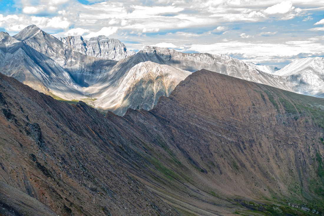
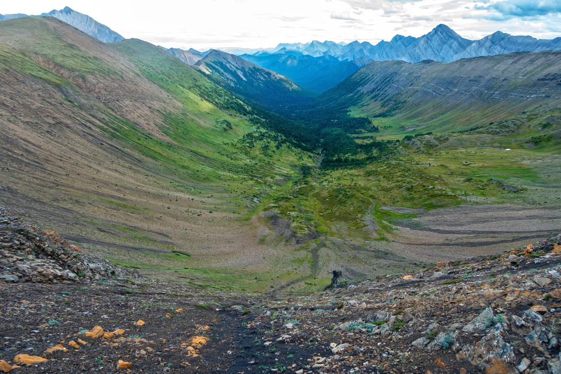 Paradise Valley
Head of Paradise Valley from "Grizwood" saddle. Drop down black shale is steeper from what appears in the photo; as soon as possible angle skier left and utilize patches of grass. Hiking poles are great asset here Paradise Valley
Head of Paradise Valley from "Grizwood" saddle. Drop down black shale is steeper from what appears in the photo; as soon as possible angle skier left and utilize patches of grass. Hiking poles are great asset here |
|||
 Paradise Valley
Rarely - if ever - visited meadows at head of Paradise Meadows (Plenty of bear diggings). Grizzly Ridge upper right. Highwood Ridge to the left can be hiked up at different points, but I found easiest to angle diagonally on grassy bench center left then easily ascended after intercepting obvious drainage Paradise Valley
Rarely - if ever - visited meadows at head of Paradise Meadows (Plenty of bear diggings). Grizzly Ridge upper right. Highwood Ridge to the left can be hiked up at different points, but I found easiest to angle diagonally on grassy bench center left then easily ascended after intercepting obvious drainage |
|||
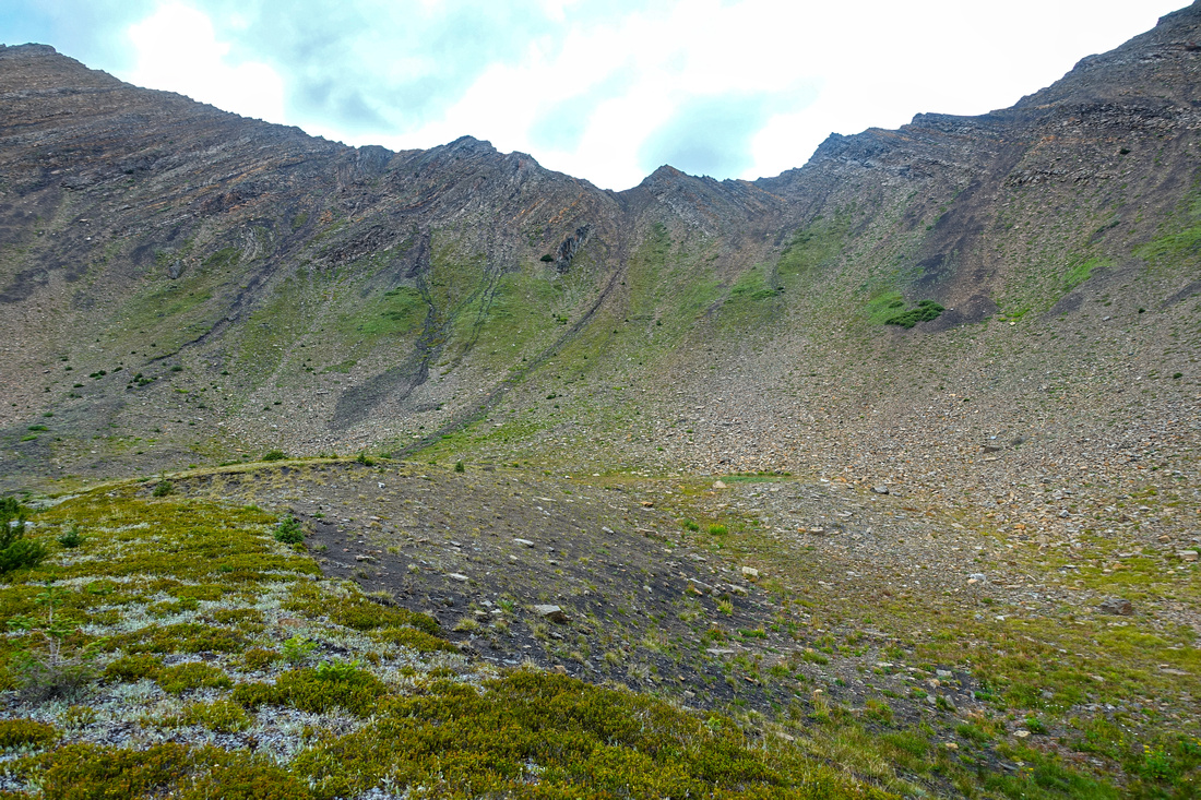 "Grizwood" Col
Looking back descent slopes from "Grizwood" Col. Upper part is fairly steep as indicated on photo. Climbing this way would be quite awkward "Grizwood" Col
Looking back descent slopes from "Grizwood" Col. Upper part is fairly steep as indicated on photo. Climbing this way would be quite awkward |
|||
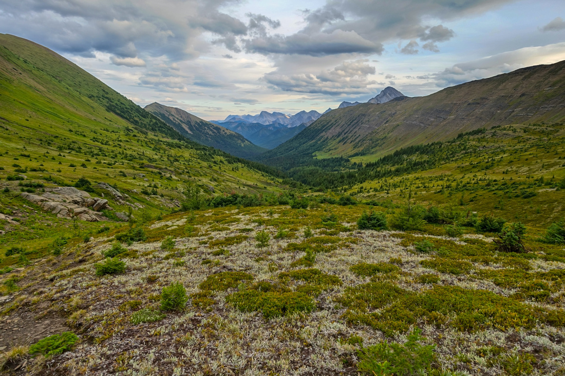
 Paradise Bench
Terrific Meadow hiking on east side of Paradise Valley Paradise Bench
Terrific Meadow hiking on east side of Paradise Valley |
|||
 Highwood Ridge
Looking south after reaching Higwood Ridge, just by obvious drainage in center. Mist mountain upper center left Highwood Ridge
Looking south after reaching Higwood Ridge, just by obvious drainage in center. Mist mountain upper center left |
|||
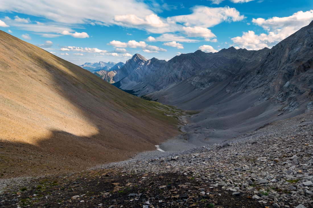
 Highwood Ridge
Broad Highwood Ridge looking towards north end, center. "Grizzwood" Ridge left Highwood Ridge
Broad Highwood Ridge looking towards north end, center. "Grizzwood" Ridge left |
|||
 Highwood North
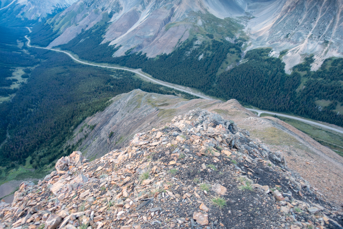
Descent slopes from north end of Highwood Ridge; just steep hiking with trail most of the way. It will take ~45min to Pocaterra Trail Highwood North
Descent slopes from north end of Highwood Ridge; just steep hiking with trail most of the way. It will take ~45min to Pocaterra Trail |
Abstract
| Overall Difficulty | D6 | Steep talus slopes. Sections of lose and mildly exposed scrambling. D4 for Grizzly Peak only | |||
| Snow Factor | S5 | Severe avalanche danger. Hwy 40 closed in Dec 1 - Jun 15. Not feasible as winter trip | |||
| Scenery | Highwood classic ridgewalk. Summer wildflowers, autumn larches. Front range peaks and meadows | ||||
| Trail/Marking | Good / None | Well defined trail to Grizzly Col / Ridge and for Highwood Ridge descent, none in between | |||
| Suggested Time | 7 hrs | Full loop with Paradise Valley extension, subtract an hour if traversing directly from Grizzly to Highwood Ridge | |||
| Elevation | Start: 2120 m Max: 2770 m Total: ~1080m | Round Trip: ~12km | |||
| Gear | Full hiking boots a must. Gaiters and poles. Climbing helmet in group. | ||||
| Water | Tarn in Pocaterra cirque, dry otherwise. Carry ~1.5L depending on season | ||||
| Dog Friendly | No | Descent from Grizzly Peak will be tough for dogs. Prime grizzly bear environment | |||
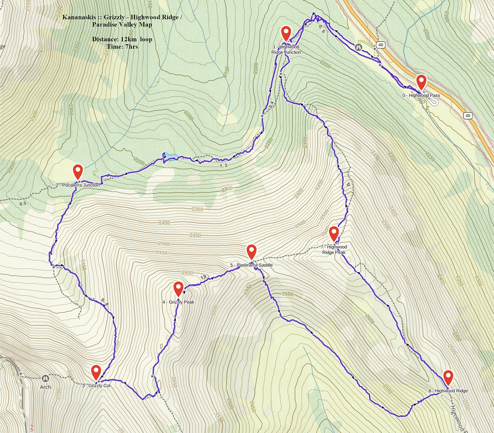 Grizzly - Highwood Ridge / Paradise Valley GAIA Map
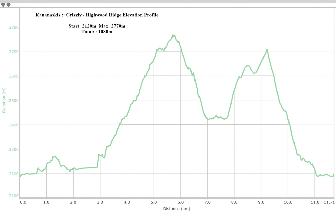 Grizzly - Highwood Ridge / Paradise Valley Elevation Profile