Google Map |
Rockies :: Kananaskis :: Pocaterra Ridge |
GPS Track |
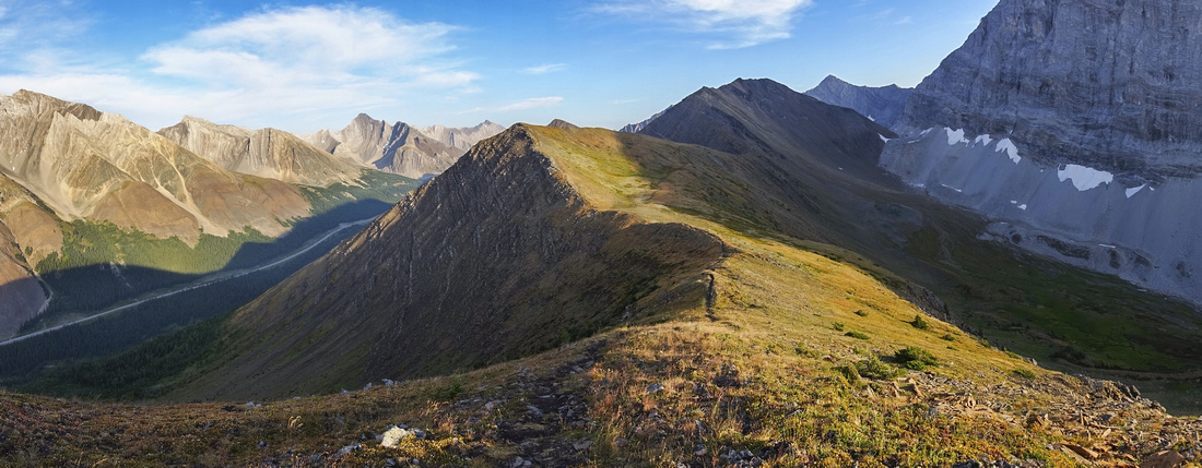 
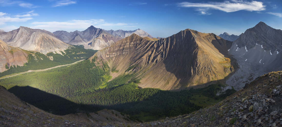
Panoramic view south from central part of Pocaterra ridge. Little Highwood Pass upper center right dropping down to Rockfall Valley used for loop hike option. Kananaskis Trail to the left with views (L-R) of Mt.Rae, Mt. Arethusa, Mt. Storm and Mist Mountain |
|||
| Trip Summary | |||
August 28, 2020Probably best loop hike in scenic Highwood Pass area. Terminal Ends are at Little Highwood Pass area day-use / Highwood Pass, and with 2 cars most groups opt for 1-way traverse, usually in South - North direction. However very scenic Rockfall valley on east side of Pocaterra Ridge can be used for return, or even better approach, thus allowing for recommended full loop. In that case suggested is clockwise direction with start from Little Highwood Day Use. That way best is left for last, including beautiful sunset above K-lakes on return if your timing is right. Description and gallery / stats are given for this option. Note seasonal closure of Kananaskis Trail Dec 1 - June 15 south of Kananaskis Lakes turnoff; this hike is best done as late summer / early fall trip.
From parking at Little Highwood day use, cross the highway and find trail on the other side (almost opposite to day use entrance). Trail drops down willow bush and crosses Pocaterra creek; later in season this crossing is fairly trivial. Main thing is to decide on direction; Pocaterra Ridge first or last? If going up Rockfall Valley first as suggested, some people had problems finding turnoff -- use GPS track download from top of page if in doubt. Or simply trash up the valley as bushwhack is not bad; trail peters out soon enough anyways. After about an hour from parking lot forest edge is reached at base of huge boulder slide coming off from the right -- it is apparent where "Rockfall" name comes from! Hike up on left side at edge of larch forest, then transition to the right and eventually descend to flats hosting seasonal Rockfall Lake in center part of the valley. If full this lake is very beautiful when seen from Pocaterra Ridge above. If lake has dried out simply walk across the flats, otherwise circle around on west side then hike up shallow canyon to upper valley below Little Highwood Pass. Good scree trail can be found below the pass just left of cream colored scree demarcation. There are no problems here, although snow lingers fairly long as slope falls in shade early in the day. From the pass turn left and ascend initially following well-defined switchbacks, then angle right as rib becomes a bit jagged. This part is lose and the crux, specially if snow has not melted (in that case easier option is to simply descend south on other side of the pass, then hike up much gentler trail branching off from Grizzly Col trail). South end is the "summit of the day" and built corals testify most groups take their lunch breaks there. Full ridge traverse in moderate pace to north end will take 1.5 - 2 hours. Initial part is the worst; descent with couple of scramble steps and hard shale; hiking poles are huge asset here. Stay right (east) of rocky rib lower down. Conditions eventually mellow down and what remains is simply beautiful grassy hike over couple of bumps with fantastic views east towards Opal Range. Elbow Lake and valley leading to Tombstone Pass / Rae Lake looks very inviting from this angle! Trail eventually descends to grassy saddle where hunter trail comes in from the right. Continue on the other side and climb through larch forest -- this part looks spectacular in second part of September! Reaching open north end trail switchbacks down initially on grass then forest in lower part, eventually meeting Rockfall valley trail junction near Pocaterra creek crossing and the highway.
(If starting from Highwood Pass follow well defined trail for into the cirque below Mt. Tyrwhitt, then turn right (south) as trail starts ascent to Grizzly col. Hike up moderate scree to South end of the ridge meeting trail ascending from Little Highwood Pass) |
|
Gallery |
|||
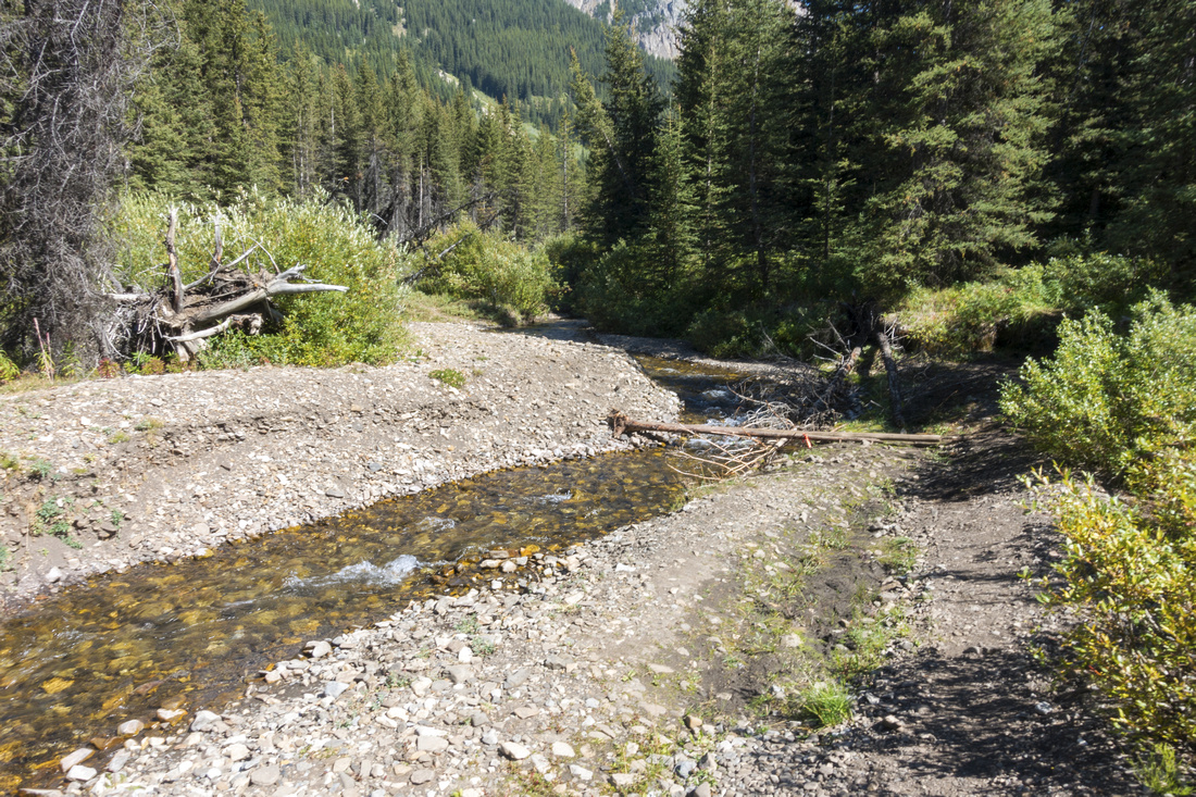 Pocaterra Creek crossing below Little Highwood Pass day-use area, fairly trivial late in season
 |
|||
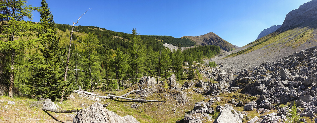 Emerging at open area below huge rockslide at head of Rockfall Valley after mild bushwhack. Center bump of Pocaterra Ridge upper right
 |
|||
 View back while hiking bits of trail at edge of larch forest. Gap peak center, Mt. Roberta left
 |
|||
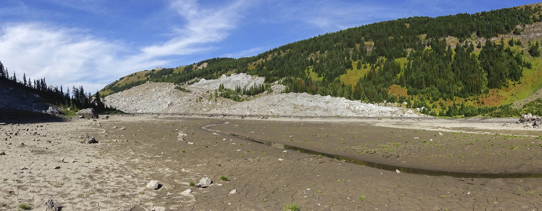 Walking on dried out flats of Rockfall Lake in central part of valley. Grassy north part of Pocaterra Ridge above
 |
|||
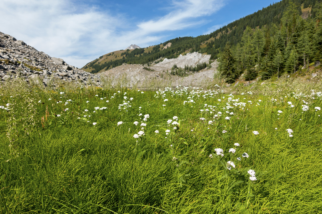 F lowery grass carpets just past Rockfall lake flats, looking back
 |
|||
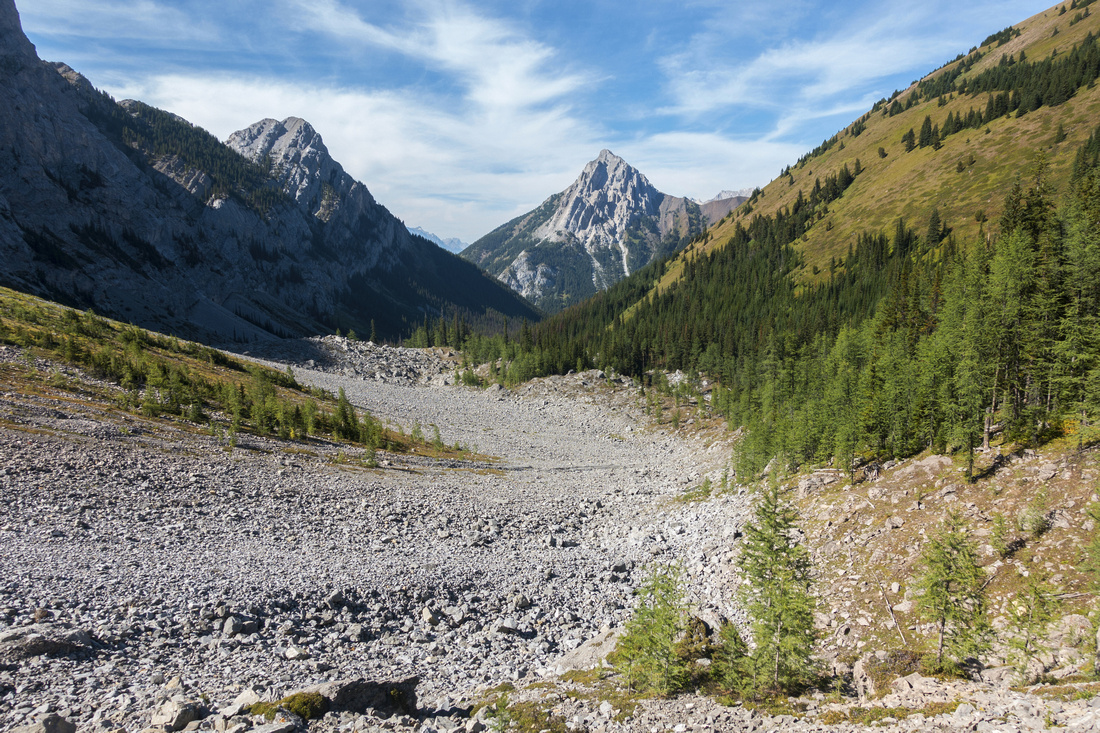
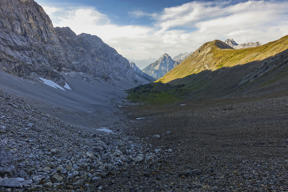
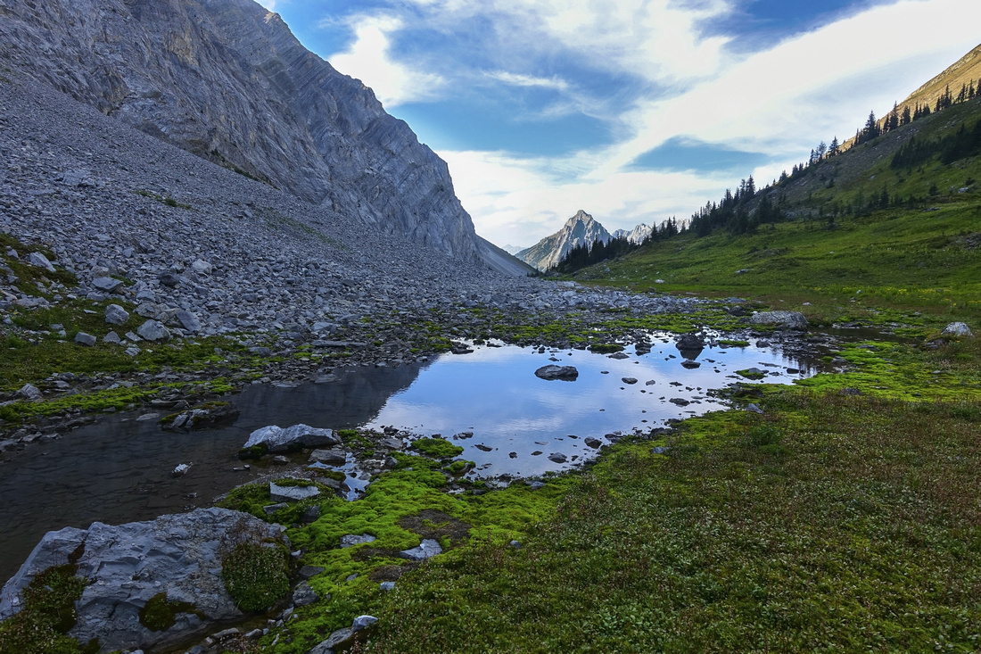 Upper part of Rockfall Valley with delightful pond looking back towards Gap Peak in distance
 |
|||
 Approaching Little Highwood Pass (upper right). Good trail can be found at demarcation between cream and dark colored talus. Rugged part of Pocaterra Ridge center left
 |
|||
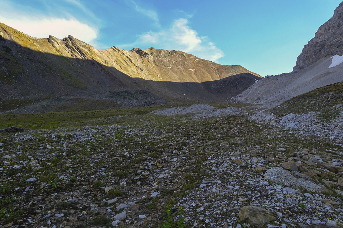
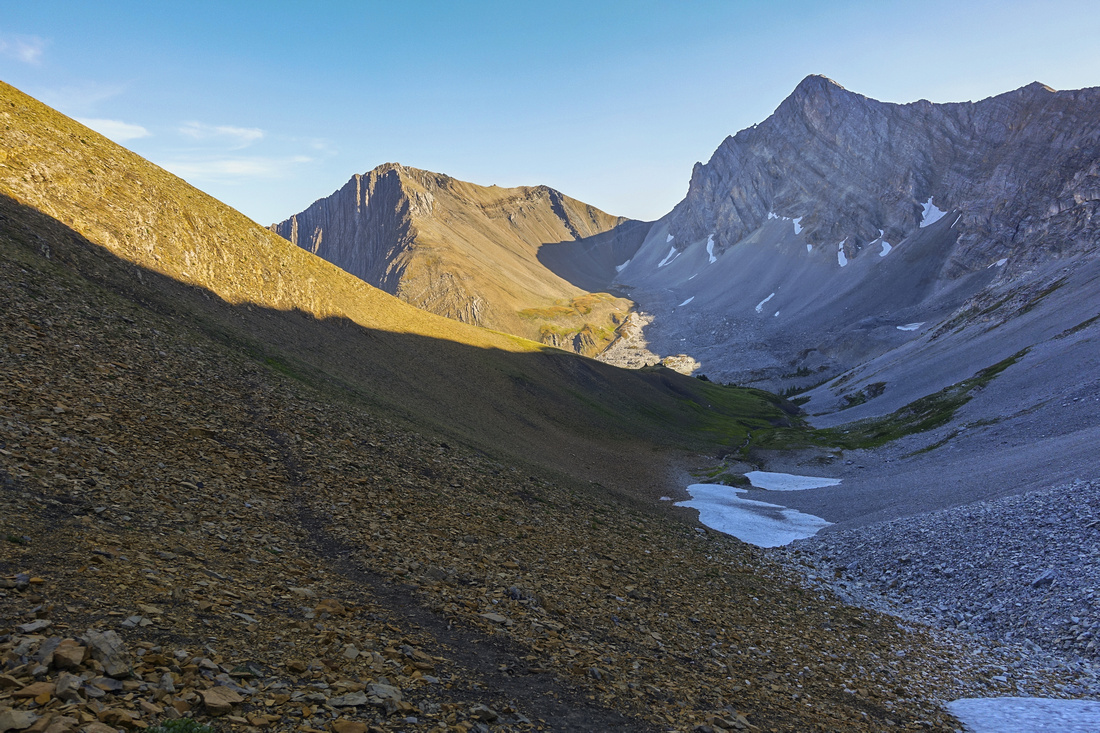
 Looking back down upper part of Rockfall Valley from near top of Little Highwood Pass. Sunny Pocaterra Ridge upper right
 |
|||
 View south from Little Highwood Pass. Grizzly col upper center, Grizzly Peak to its left, Mt. Tyrwhitt to the right
 |
|||
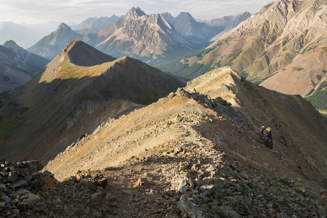
 Panorama from south end of Pocaterra ridge above Little Highwood Pass with views of Mt. Arethusa, Mt. Storm and Mist Mountain across Kananaskis Trail. Highline scramble between Grizzly Peak and Highwood Ridge north center
 |
|||
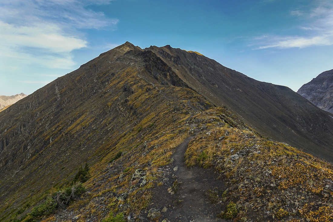
 Starting descent down rugged south end of Pocaterra Ridge. Hiking Poles help a lot here; Center bumps 1 and 2 upper left
 |
|||
 Looking back at south end as rough terrain transitions to much more enjoyable hiking
 |
|||
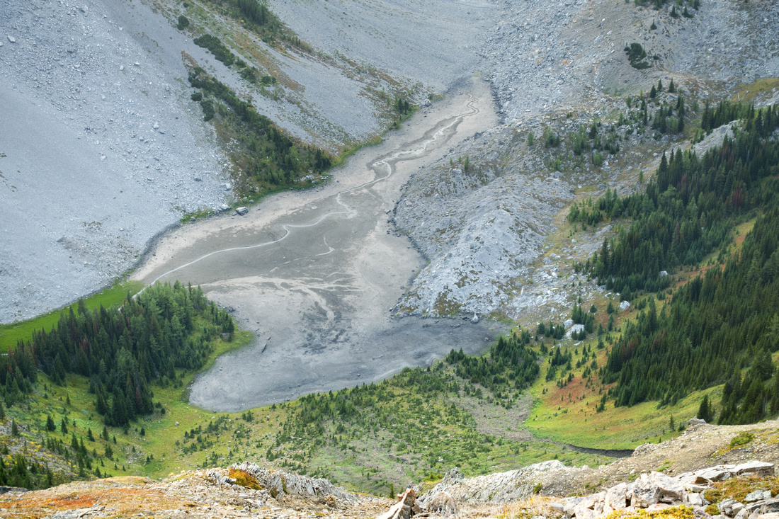 Aerial View of dried out Rockfall Lake below Pocaterra Ridge
 |
|||
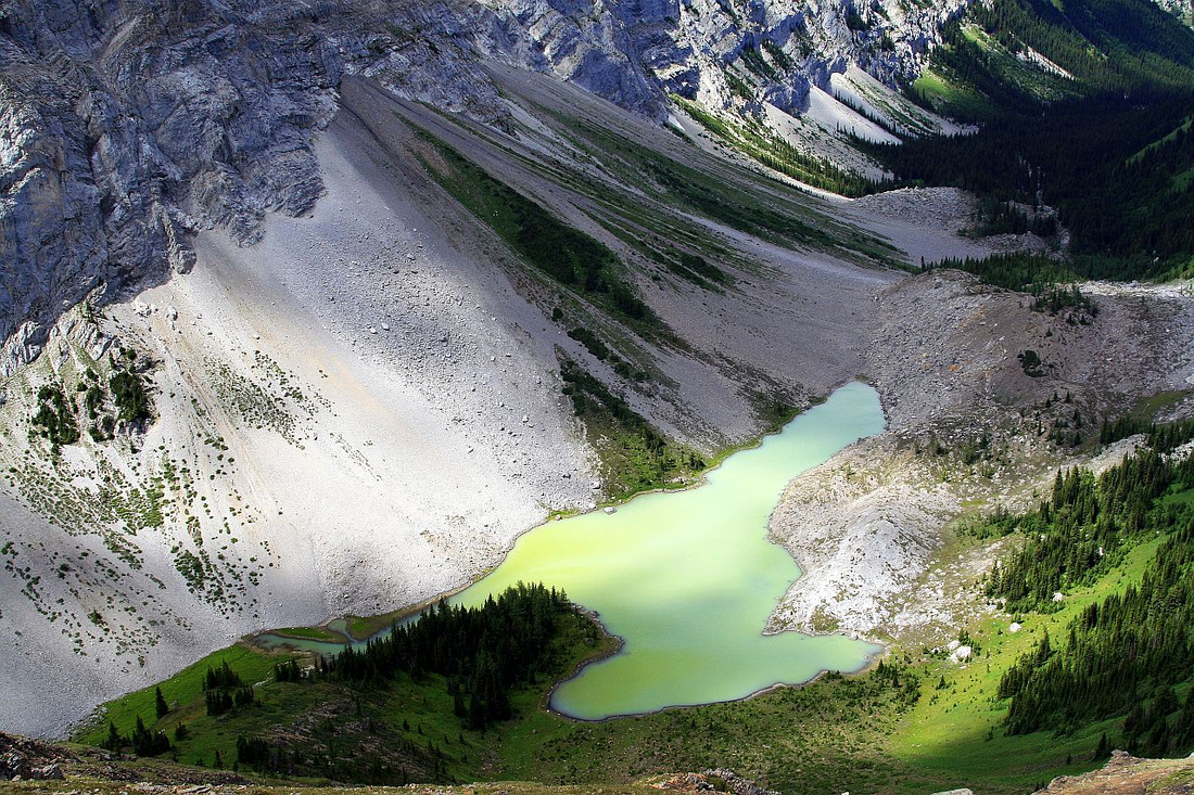 An older photo taken earlier in season from the same spot, showing Rockfall Lake full to the brim. It is usually bypassed then on far (west) side
 |
|||
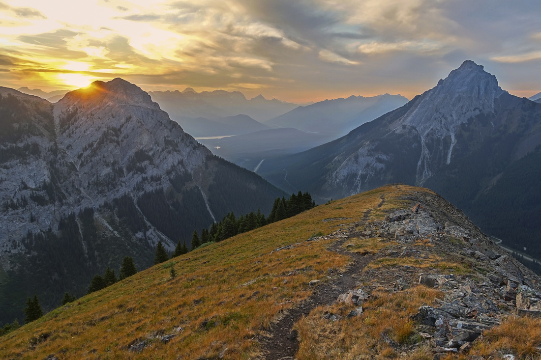 Hazy, but colorful sunset colors from grassy north end of Pocaterra Ridge just before trail dips down to the Highway. Gap Peak right, Mt. Roberta left
 |
Abstract
| Overall Difficulty | D4 | Pocaterra creek rock-hop. Mild bushwhack in lower Rockfall Valley. Moderately steep talus slopes below and above Little Highwood Pass. Rough descent from south end of Pocaterra ridge | |||
| Snow Factor | S3 | Trip not practical in winter due to seasonal Hwy40 closure. Steep snow slopes around Little Highwood Pass till mid summer | |||
| Scenery | Many front range peaks east of Highwood Pass. Pretty and compact Rockfall Valley, including seasonal lake. Abundance of golden larches in early fall | ||||
| Trail/Marking | Good / None | Distinct trail on Pocaterra Ridge and way is obvious. Well defined approach from Highwood Pass side. Occasional, but faint trail in Rockfall valley. Rockfall junction near Pocaterra Creek crossing not marked and easy to miss | |||
| Suggested Time | 6-7 hr | Full Pocaterra / Rockfall loop. If traversing 1 way 4-5 hours max | |||
| Elevation | Start: 1920m Max: 2680m Total: ~1020m (Little Highwood Day Use start with full loop) | Round Trip: 14 km (loop) | |||
| Gear | Hiking boots and poles. Gaiters helpful on steep talus slopes. Climbing helmet in larger group. | ||||
| Water | Pocaterra creek near Little Higwood Pass day-use and in upper Rockfall Valley. Ridge is dry. Carry 1-2L | ||||
| Dog Friendly | Yes | Grizzly bears frequent Highwood Pass area; take necessary precautions | |||
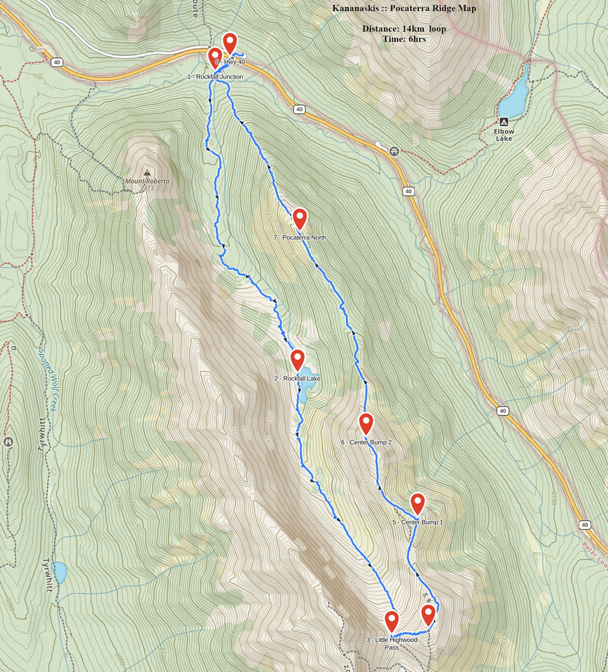 Pocaterra Ridge GAIA Map
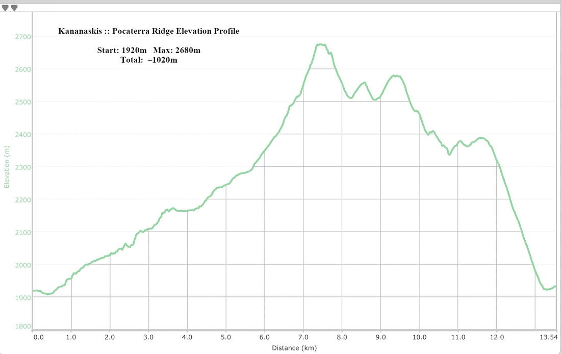 Pocaterra Ridge Elevation Profile