Google Map |
Rockies :: Kananaskis ::Burns Lake via Arethusa Crest |
GPS Track |
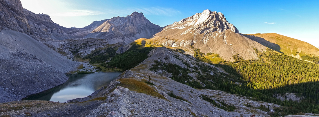 
Panoramic View north from grassy rib above Burns Lake. Arethusa Crest route comes in down grassy patch center left. Rae Creek Hills extreme center right |
|||
| Trip Summary | |||
September 5, 2019Burns Lake is infrequently visited Highwood Pass area back-country lake, mainly in domain of hunters. It has also been featured in sports fishing magazines. Lake is quite beautiful in typical front range wilderness setting, but day hikes from Highwood Pass, although feasible from distance perspective, have been largely ignored because of savage crossover via Arethusa col -- lose scramble with significant elevation loss on east side, that must be regained on return. West side of crest is considerably more rough, but faint path can be followed most of the way. Odd hiker usually backpacks via Rae Lake / Sheep trail, utilizing Arethusa crest as exit route only. It is a shame though as views are fabulous, specially ridge on south side of the lake. For competent scramblers, day-hike is feasible although backpack might be preferred. Good camp can be found at north side of the lake. Initial part is via popular Arethusa Cirque network of hiking trails, brimming with golden larches in early fall, followed by Kane scramble approach for Mount Arethusa.
Park at pullover on east side of Kananaskis Trail (Hwy 40), about 1km south of Highwood Pass (40min drive from Trans-Canada Highway; note Hwy40 seasonal closure Dec 1 - Jun15). Trail starts by "unload your guns" sign -- clear indication of primary type of its users -- and although unsigned, it is easy to follow. It rises somewhat steeply through thinning forest on right side of Arethusa Creek. Within 15-20 minutes you reach meadows, and trail splits. Cross the creek and hike up on the left side of drainage reaching meadows on top of Cirque in another 15 minutes or so. This is the end of trail; note this point in order to be able to pick it up on return. Kane Mount Arethusa is directly above you at this point, while Little Arethusa -- much more benign (and much more recommended) outing with fabulous viewpoint on top -- is to the left. Cross the meadows and churn the way up scree towards obvious low point of the ridge above. Faint trail exists most of the way. Higher up it becomes steep and lose, with couple of brief rock bands. Upper part is steep slog up hardened mud slope interspersed with scree -- very uncomfortable on descent; hiking poles are huge asset here. Nearing the top pick up trail heading right and exit to ridge crest, some 100m vertical above low point; note cliffs below, primary reason why low saddle is not feasible option. Huge cairn built here is extremely important in order to identify this spot on return.
Drop directly down talus on east side, without going down to low point, heading towards top of drainage and pick up good trail on right side. Lose and sometimes awkward, but generally easy to follow it drops steeply then crosses to other side and aims in direction of Blayney Tarn seen from above. Reaching alpine basin near the tarn trail disappears, but it is not needed anymore. Burns lake can be seen in the basin still some distance below. Follow path of least resistance down talus and meadows, crossing Blayney drainage along the way. Final bit is walk in delightful meadows (watch for grizzly bears!) towards the lake.
If you are backpacking, sheltered larch / pine area on north side is obvious camp spot. Otherwise make sure you hike up low angle grassy ridge on east side; it provides fabulous viewpoint (title photo on this page). Return will not be faster at all; plan 1:15 - 1:20 back to Arethusa Crest, then at least another hour for descent back to the Cirque and hike out to the car. |
|
Gallery |
|||
 Arethusa Cirque some 15min above Parking. Trail splits here; cross the creek and go left
 |
|||
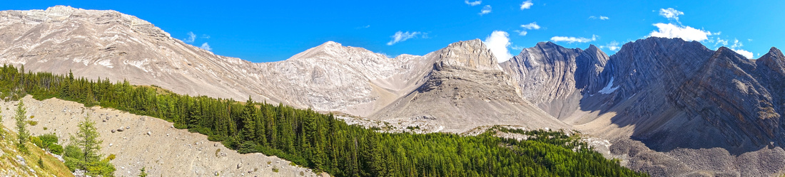 Arethusa Cirque Panoramic View as trail rises on left side of drainage coming down Little Arethusa. Obvious col center left on skyline ridge is Burns Lake route
 |
|||
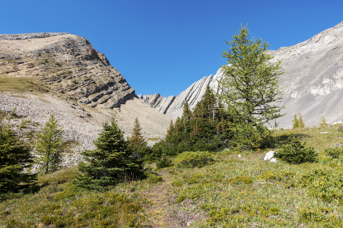 Alpine Meadows below Little Arethusa (left) and end of trail. Turn right here and find path beaten in scree cone rising left to right
 |
|||
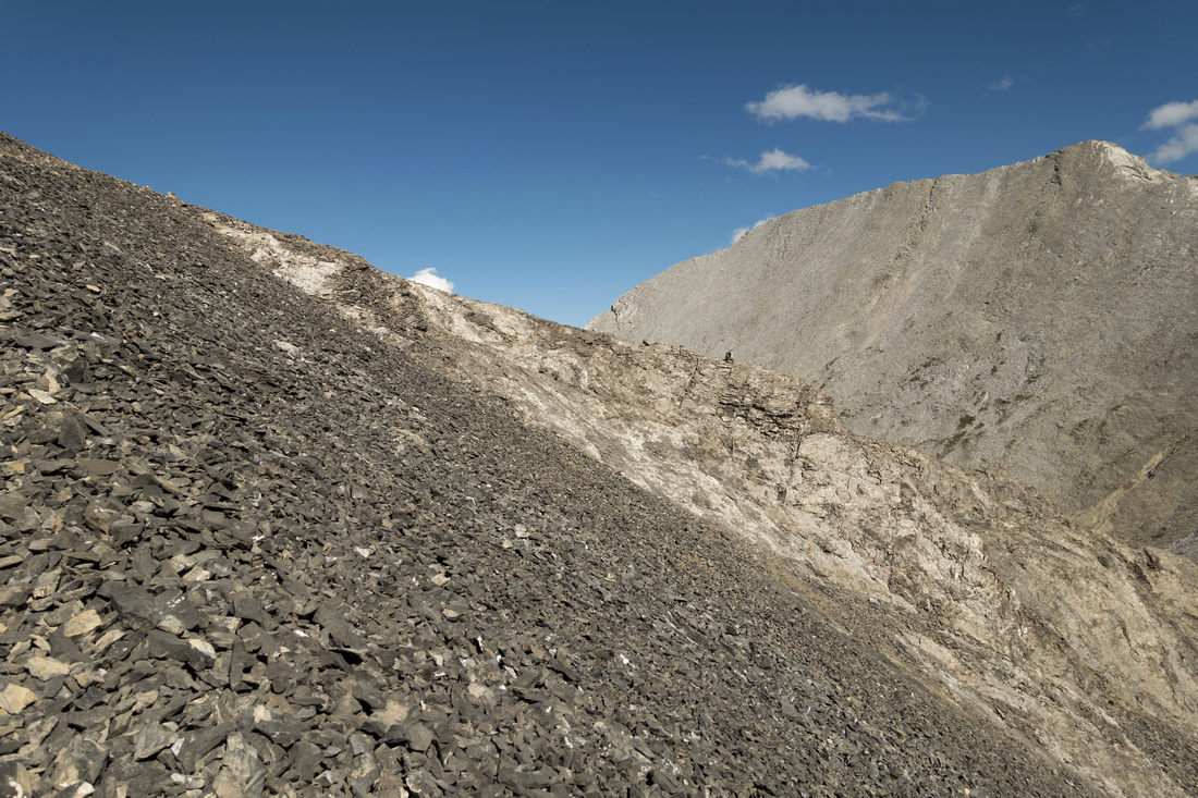 Topping up on Arethusa Crest some 300m vertical from end of Cirque trail. Note cairn upper left where you intersect the crest; it is essential to identify this spot on return, as other descent routes lead to serious climbing and are not feasible
 |
|||
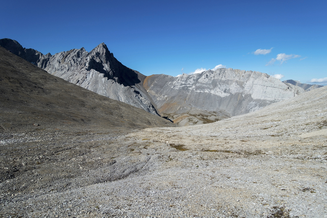
 View west from Arethusa Crest; note trail center right. Highwood Ridge in the distance
 |
|||
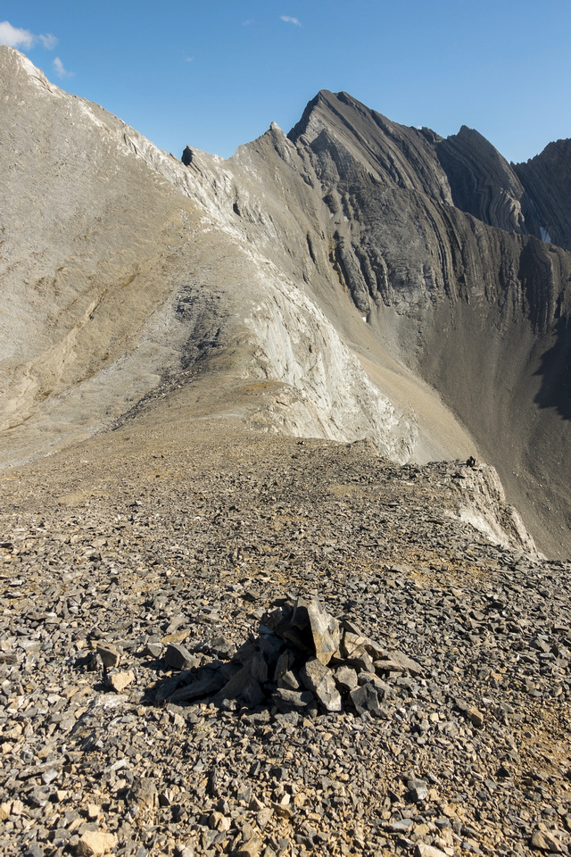 Arethusa Crest cairn, some 100m vertical above the lowest point. It is not necessary to drop to the saddle; instead turn left here and descent talus/rubble towards obvious drainage
 |
|||
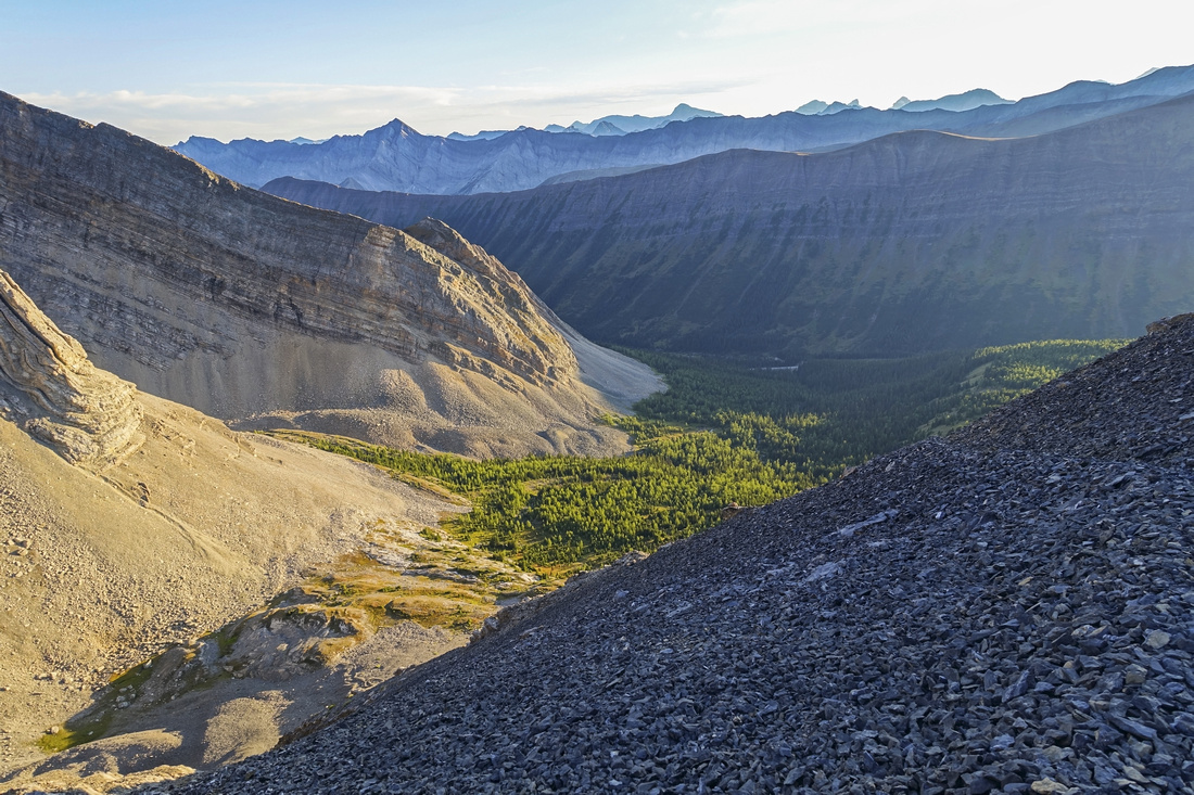
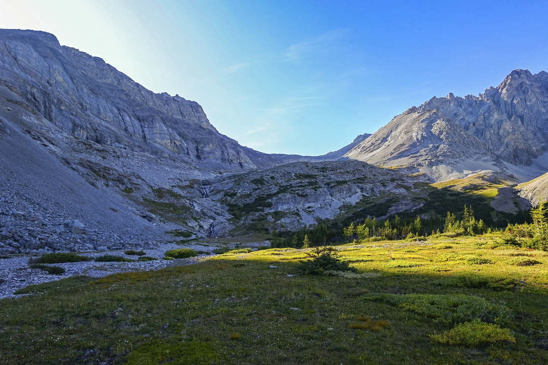
 East side of Arethusa Crest. Find trail dropping steeply on right side of drainage (roughly center of photo)
 |
|||
 Blayney Tarn, visible on topo maps, after descent trail peters out. Note this spot for return in order to be able to pick it up
 |
|||
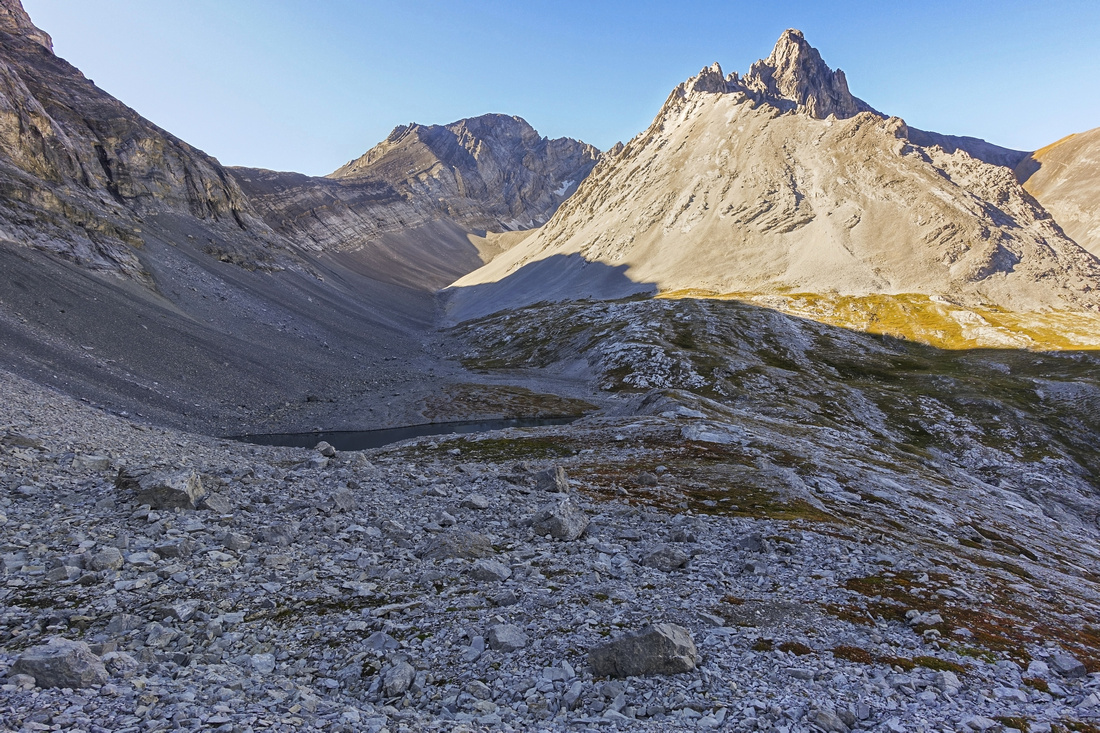
 Burns Lake from point where descent trail peters out; zig-zag on skier right of creek draining Blayney Tarn to Burns Meadows below
 |
|||
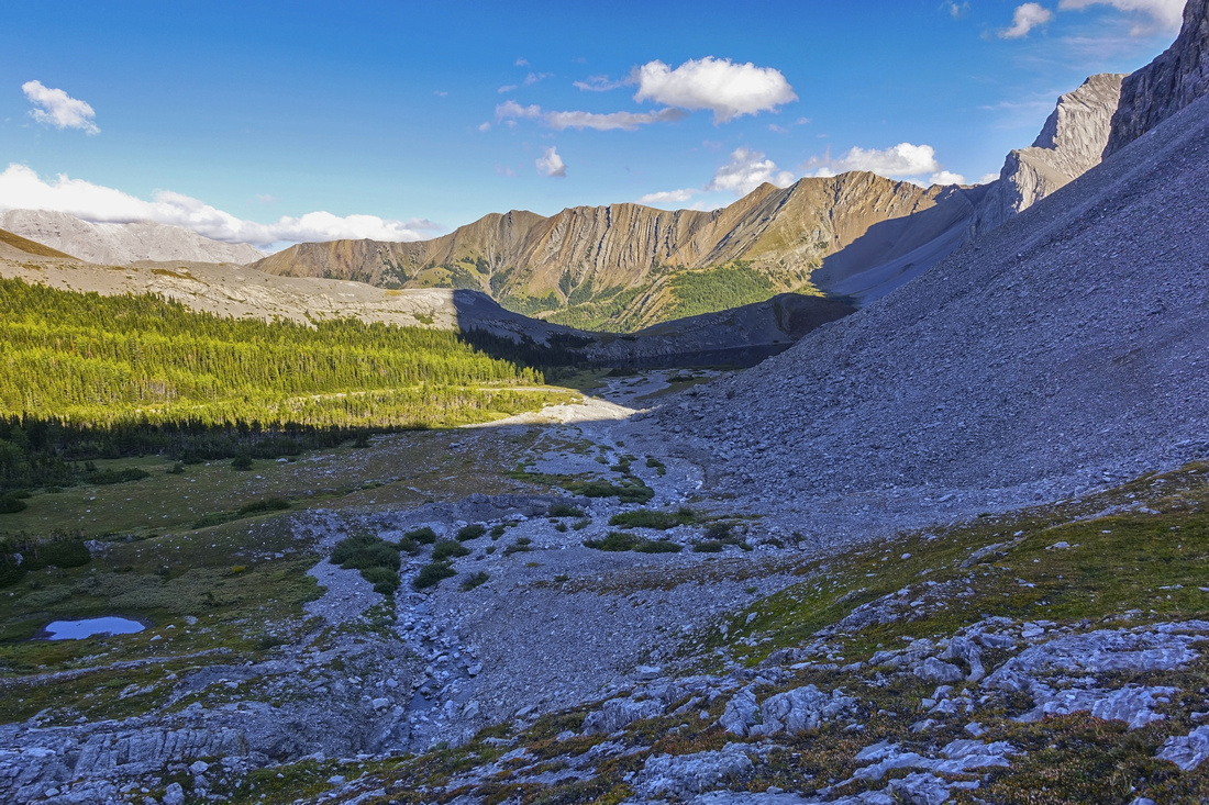 Descending towards Burns Meadows on much more gentle terrain
 |
|||
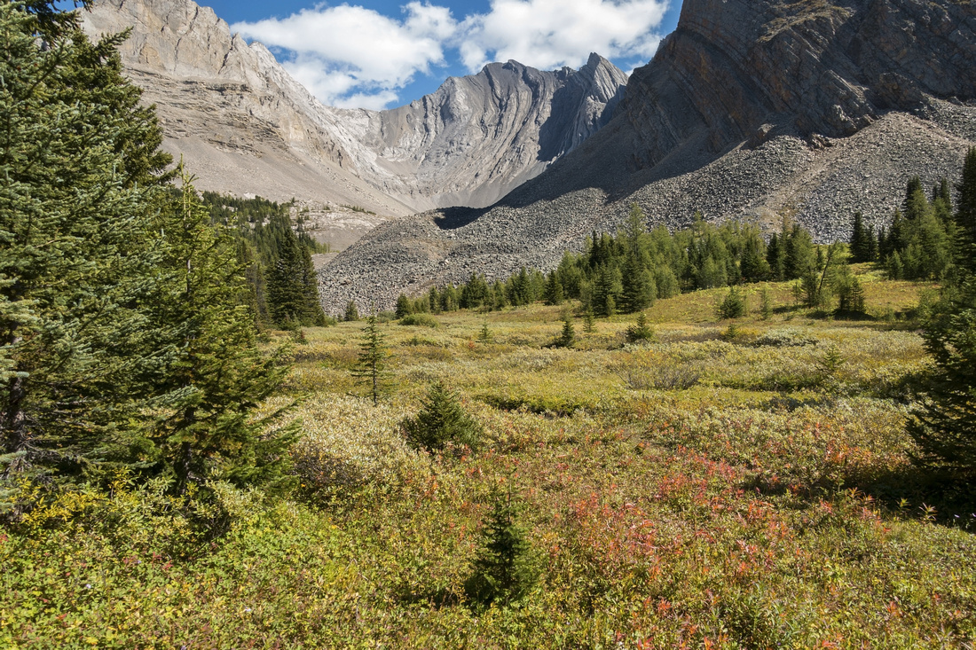
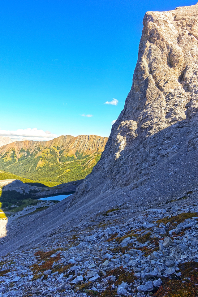
 View back from Burns Meadows, just before the lake. Waterfalls center left are draining Blayney Tarn; route stays on left side
 |
|||
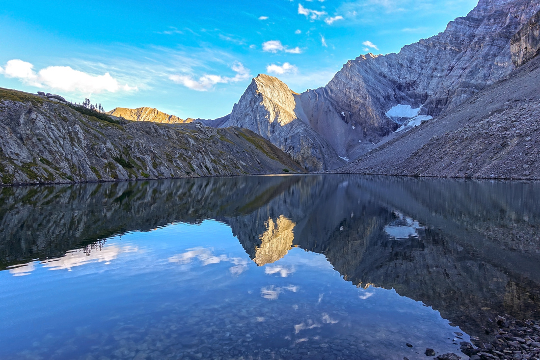 Beautiful Reflections of Storm Mountain in calm water of Burns Lake. Obvious ridge on the left side offers fantastic viewpoint (title photo on this page)
 |
Abstract
| Overall Difficulty | D5 | Steep talus scramble on both side of Arethusa crest. Lose slopes and micro-terrain route finding | |||
| Snow Factor | S5 | Huge avalanche danger on steep Arethusa slopes - not feasible for winter trip | |||
| Scenery | Beautiful seldom visited back-country lake. Larch dotted alpine Arethusa Cirque. Layered Kananaskis rock. Meadows and small waterfalls | ||||
| Trail/Marking | Good / none | Good trail to top of Arethusa cirque, faint scree paths afterwards crossing the crest. Sporadic cairns. Route finding | |||
| Suggested Time | 6 hr | Day trip return time, roughly split in half for inbound/outbound legs. If backpacking, plan ~4hrs to get to Burns lake with heavy overnight pack | |||
| Elevation | Start: 2150m Max: 2670m Total: ~980m (+530m) (-450m) | Round Trip: 10km | |||
| Gear | Hiking boots and poles. Gaiters helpful on steep talus slopes. Climbing helmet in larger group. | ||||
| Water | Arethusa Creek in the Cirque. Water can be found drainage east of Arethusa crest and further in Blayney Tarn drainage. Carry 1-2L | ||||
| Dog Friendly | Yes | Prime grizzly bear environment. Lose talus slopes should not present the problem | |||
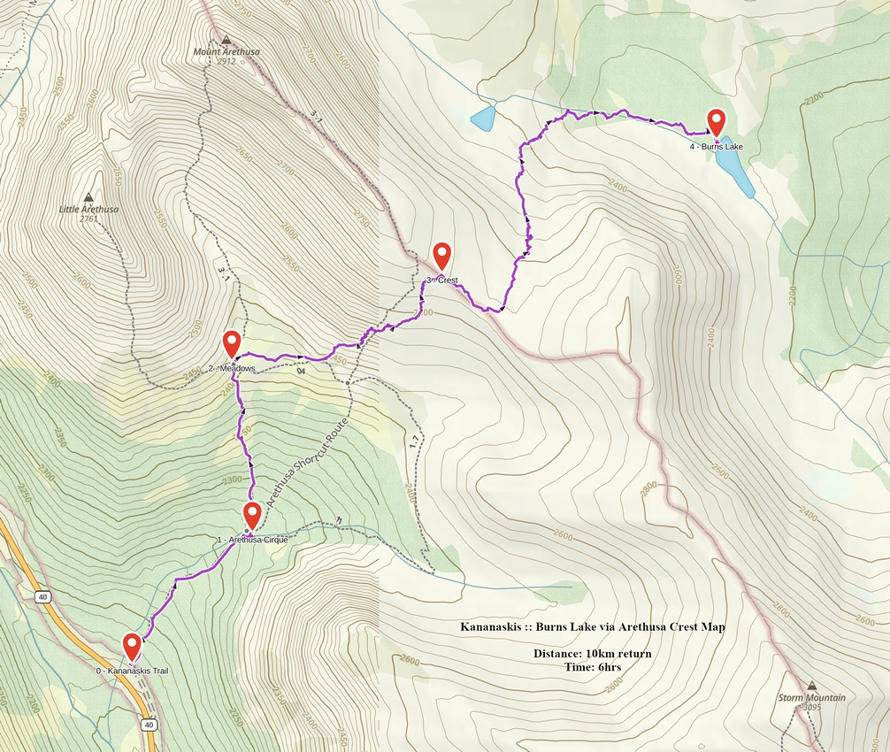 Burns Lake via Arethusa Crest GAIA Map
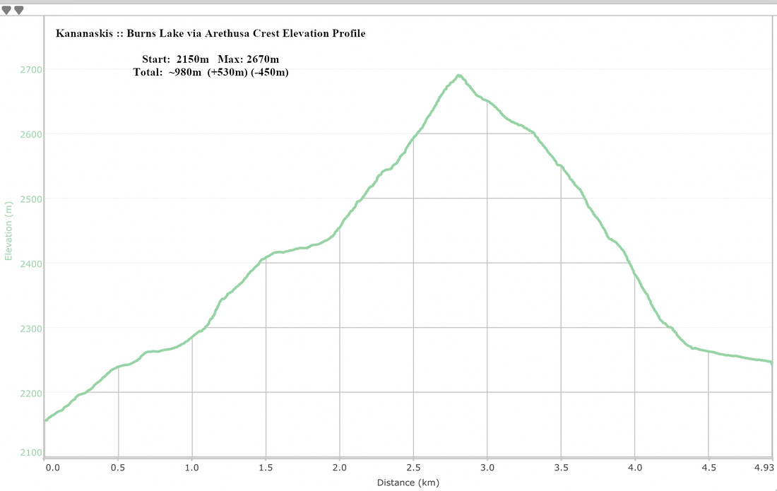 Burns Lake via Arethusa Crest Elevation Profile