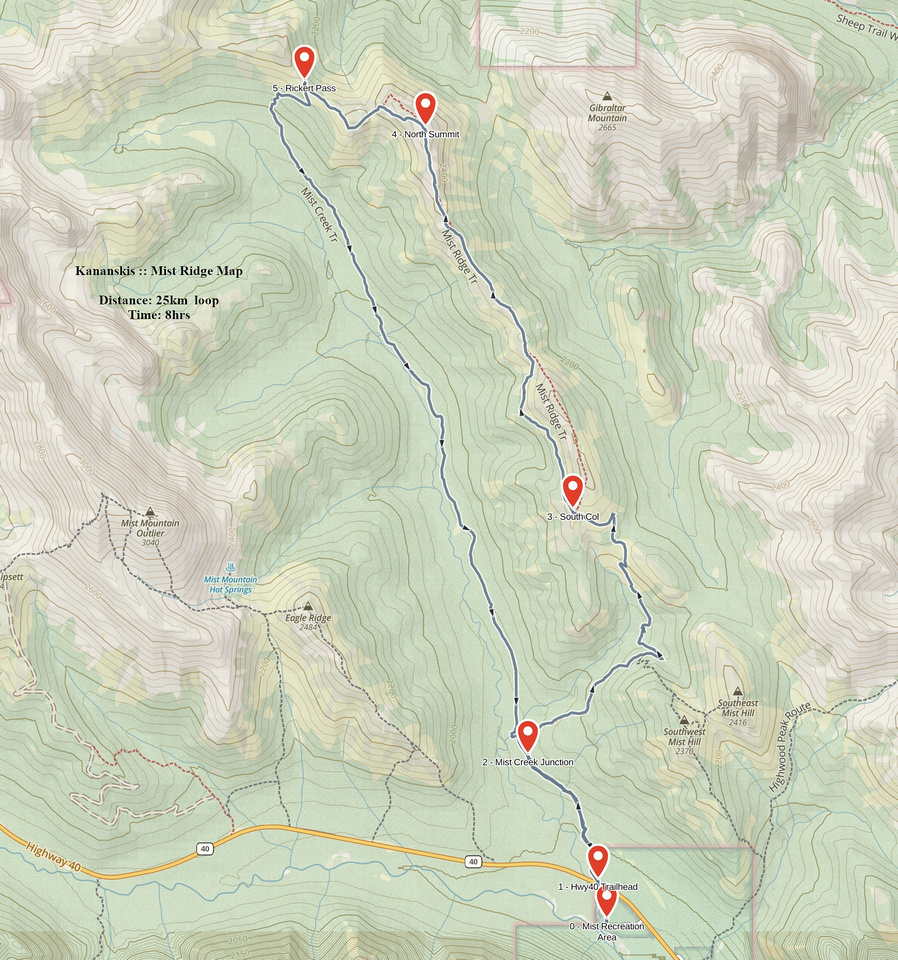
Google Map |
Rockies :: Kananaskis :: Mist Ridge |
GPS Track |
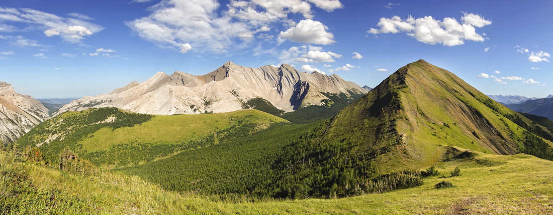 
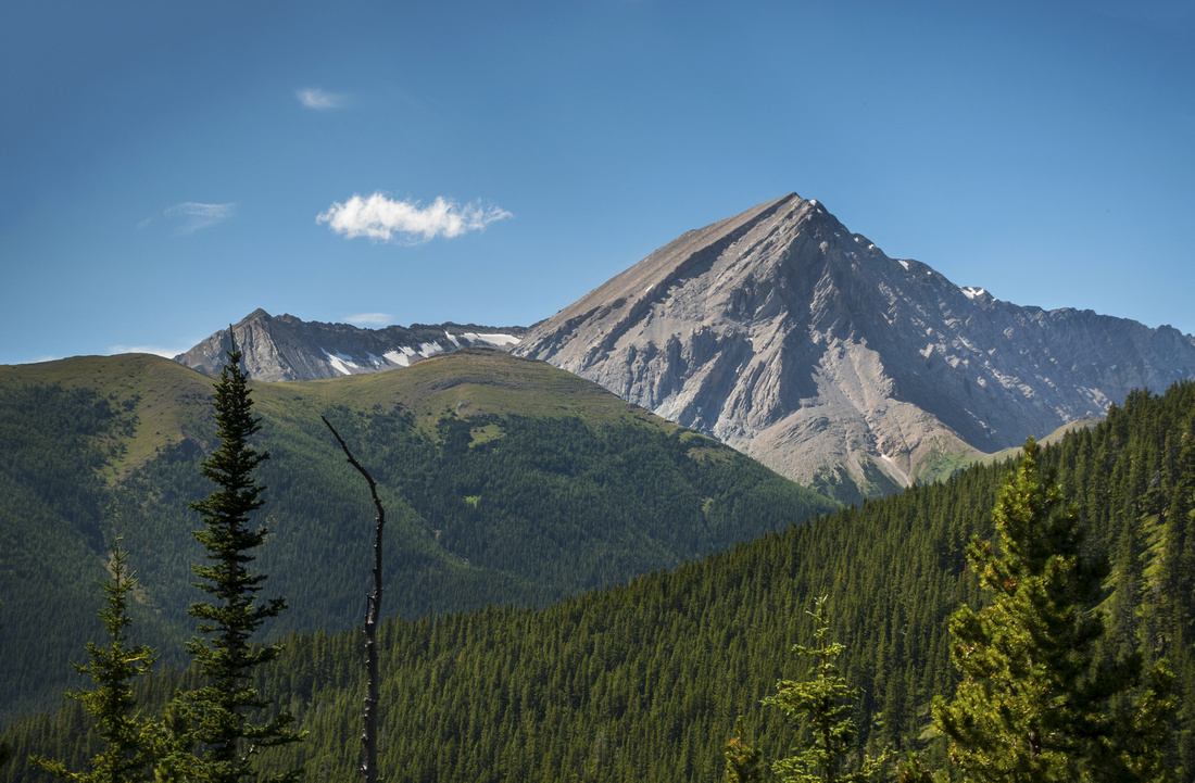
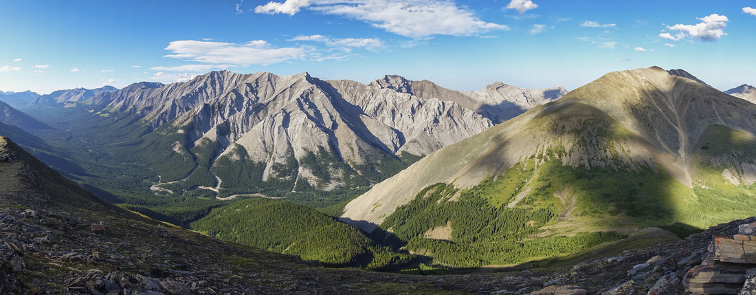
Panoramic View back to South Summit (center right) from mid-section of Mist Ridge |
|||
| Trip Summary | |||
August 5, 2020In her Kananaskis Guide book Daffern calls Mist Ridge "one of finest ridge walks in K-country". Several hours of wondering on gentle grassy ridge spine offer fine views of Sheep River Valley, Foothills and several front range peaks. There are many different options: Most popular, presented here traverses entire ridge in S-N direction to low point at Rickert Pass, then loop returns via Mist Creek valley trail, once used by native hunters. Shorter outing loops around South Summit only, while longer extensions continue north from Rickert Pass along long several grassy bumps towards Storm Mountain. Peakbaggers use Mist Ridge as access to Gibraltar Mountain; this is a very long day and not realistic target for most day hikers. It is also possible to descend on east side of Rickert Pass and visit Burns Mine (3.0 KM) and Denning's Cabin another 3.5 KM for a total, round trip, back to Rickert's Pass of 13.0 KM.
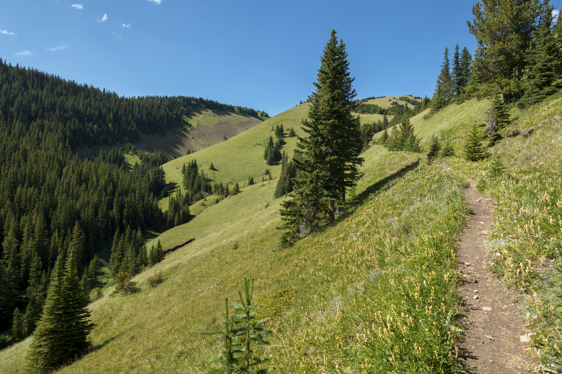
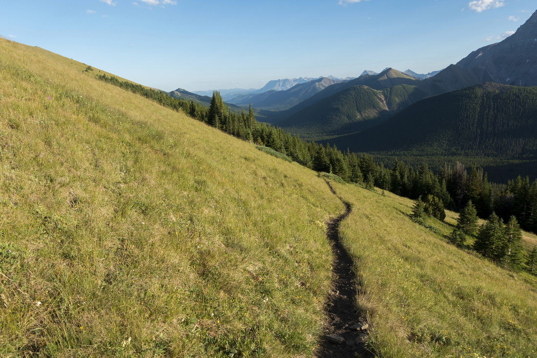
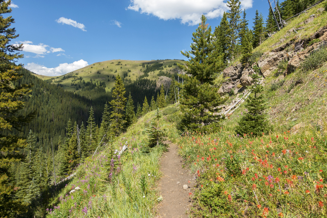
Parking is at Mist Creek Recreation area (planned to be permanently closed), some 20km south of Highwood Pass along Hwy40. Note that Hwy40 is seasonably closed Dec 1 - June 15 south of Kananaskis Lakes turnoff; this effectively puts Mist Ridge as summertime/fall destination only. Alternative start is roadside parking that cuts 400-500m of walking (see second photo of gallery). If first time here, and Mist Recreation area is still open I suggest starting from there. Trail kiosk is at north side of parking lot and wide trail meanders by Highwood River for 5-10 minutes eventually crossing Hwy40 to north side by alternative hike start. Follow trail with red markers for ~25min to junction; go right for Mist Ridge. Left branch, marked Mist Creek (3rd photo in gallery) is where you will return if you complete the loop. Trail ascends and is initially bit overgrown but soon tops on open grassy slopes dotted with wildflowers in summer. More like an old road, trail then descends ~80m vertical and crosses creek which is the only water source till well below Rickert Pass -- make sure you top up water bottles here. Couple of wide switchbacks and long horizontal traverse brings you to South Col and start of Mist Ridge -- 1.5 - 2 hrs from trailhead with moderate pace. Trail splits here by cairn; left (west) branch drops straight to Mist Creek and can be used as alternate shortcut descent. Right branch bypasses South Summit by side-sloping on west side and it is frequently used by mountain bikers. For hikers it is better to ascend South Summit off trail on grass as views are much better, then descend to mid-portion (~100m vertical loss) where bypass trail joins in. If you are short with time, this would be acceptable turnaround point.
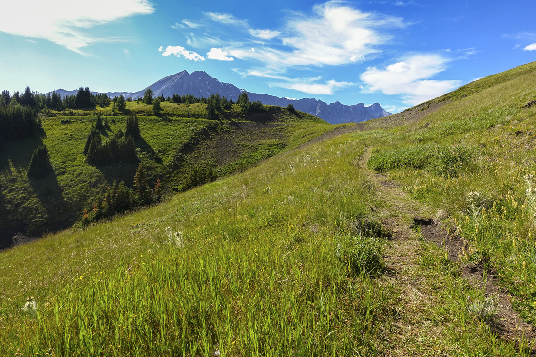
What follows is fantastic open ridgewalk for several kilometers - what Mist Ridge is best known for. Eye catcher is Gibraltar Mountain; an easy but very long scramble and not feasible as day trip for most people. North summit comes into view several bumps later. Trail bypasses on left side, but it is recommended to tag North Bump as "summit of the day", then re-join trail lower down. (Gibraltar scramblers would drop east here to obvious saddle lower down). Trail is bit more rough for a bit till it rounds the corner below rocky outcrop, then turns right and descends on grass to Rickert Pass where Mist creek trail joins in from the left near Wooden cross landmark. With enough time you can extend the day by ascending next bump north or continuing for several hours on grass towards Storm Mountain. Mist Creek loop return is mostly featureless as it stays below treeline for most of the way, except for crossing of couple of swampy meadows. It is wide and for most part, except for initial descent, flat and allows for fast return back to trailhead.
|
|
Gallery |
|||
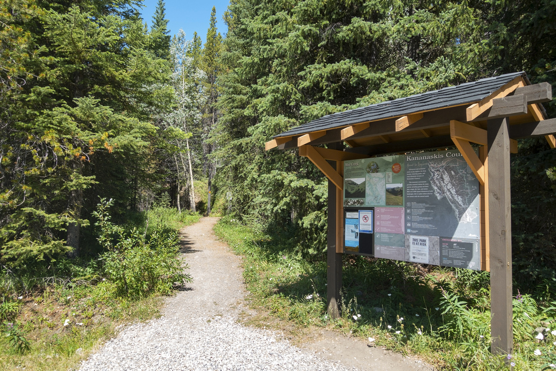 Trailhead Kiosk
Standard K-country trail kiosk at Mist Creek recreation area Trailhead Kiosk
Standard K-country trail kiosk at Mist Creek recreation area |
|||
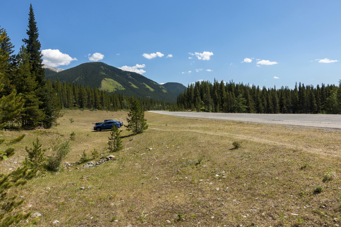 Roadside Parking
Alternate start - Hwy40 roadside parking, looking south; saves ~500m of walking Roadside Parking
Alternate start - Hwy40 roadside parking, looking south; saves ~500m of walking |
|||
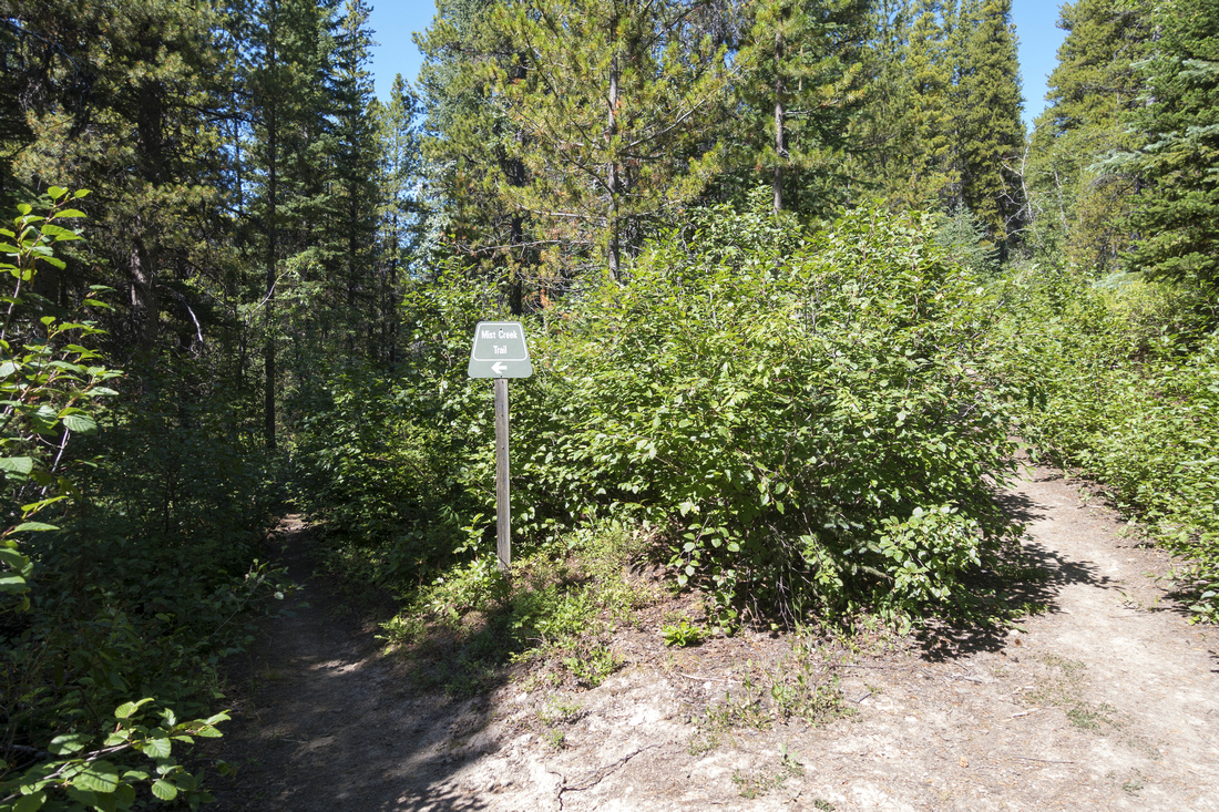 Ridge Junction
Mist Creek trail junction ~25min from Hwy40. Go right for Mist Ridge Ridge Junction
Mist Creek trail junction ~25min from Hwy40. Go right for Mist Ridge |
|||
|
|
|||
 Mist Peak
Mist Mountain telephoto. Nameless Ridge center left Mist Peak
Mist Mountain telephoto. Nameless Ridge center left |
|||
 Alpine Meadows
On a wide switchbacks part after crossing the drainage. South Summit is grassy hill upper center right Alpine Meadows
On a wide switchbacks part after crossing the drainage. South Summit is grassy hill upper center right |
|||
 South Col
Topping up at the col below South Summit (right, out of view). Obvious trail left can be used as shortcut descent to Mist Creek trail. Mist Mtn. in the background South Col
Topping up at the col below South Summit (right, out of view). Obvious trail left can be used as shortcut descent to Mist Creek trail. Mist Mtn. in the background |
|||
 South Summit
Looking back at South Summit from mid-part of Mist Ridge. Note trail South Summit
Looking back at South Summit from mid-part of Mist Ridge. Note trail |
|||
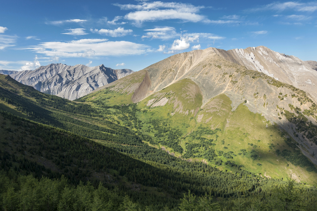
 Sheep Panorama
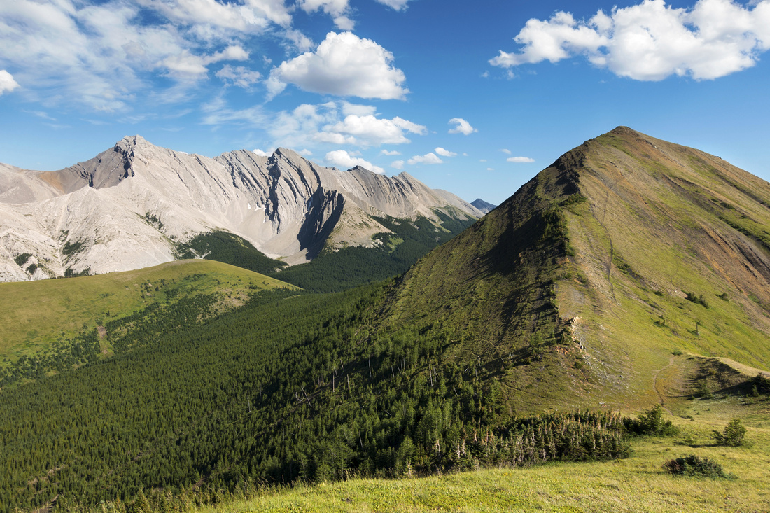
Panoramic view east from mid part of Mist Ridge. Gibraltar Mtn right, Sheep River valley lower center left. Mt. Burns upper left Sheep Panorama
Panoramic view east from mid part of Mist Ridge. Gibraltar Mtn right, Sheep River valley lower center left. Mt. Burns upper left |
|||
 Mount Gibraltar
Closer look at Gibraltar Mountain. Approach route descends from North Summit of Mist Ridge to obvious saddle center left (do not go all the way to Rickert Pass!), then ascends left skyline ridge Mount Gibraltar
Closer look at Gibraltar Mountain. Approach route descends from North Summit of Mist Ridge to obvious saddle center left (do not go all the way to Rickert Pass!), then ascends left skyline ridge |
|||
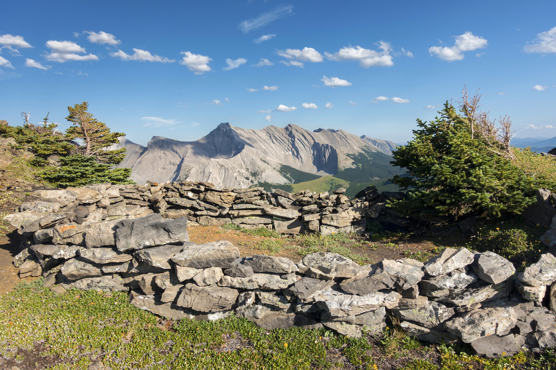 Bivi Coral
Bivi corals just below North Summit Bivi Coral
Bivi corals just below North Summit |
|||
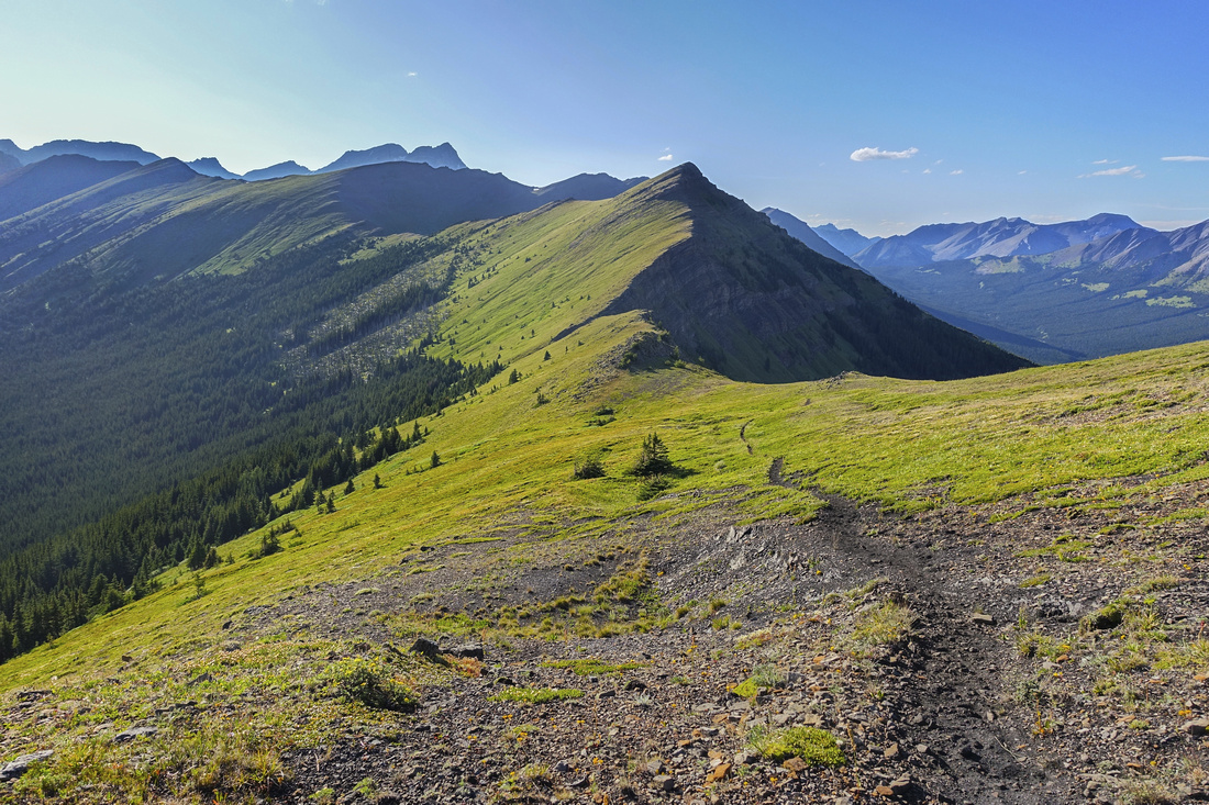 Rickert Descent
Descending from North Summit towards Rickert Pass (dead center). Journey can be extended on the other side for several hours Rickert Descent
Descending from North Summit towards Rickert Pass (dead center). Journey can be extended on the other side for several hours |
|||
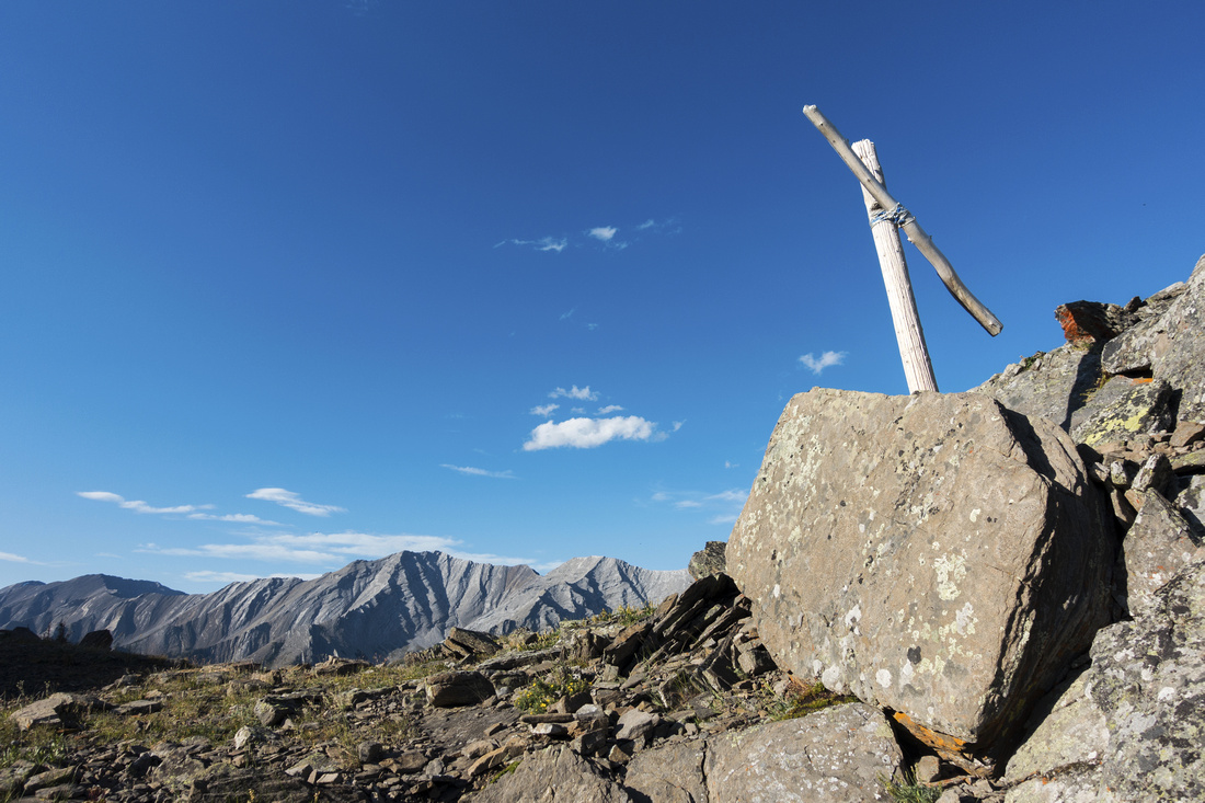 Rickert Pass
Wooden cross at Rickert Pass, where Mist Creek trail joins in Rickert Pass
Wooden cross at Rickert Pass, where Mist Creek trail joins in |
|||
 Mist Creek Descent
Loop return on Mist Creek trail; ~10km and ~2hrs of fast pace from Rickert Pass to Mist Ridge junction near trailhead Mist Creek Descent
Loop return on Mist Creek trail; ~10km and ~2hrs of fast pace from Rickert Pass to Mist Ridge junction near trailhead |
Abstract
| Overall Difficulty | D4 | Trail hiking with couple of talus sections. Some muddy sections and minor creek crossings. Substantial overall length and cumulative elevation gain | |||
| Snow Factor | S5 | Not feasible in winter as Hwy40 is annually closed Dec 1 - Jun 15 past K-Lakes turnoff | |||
| Scenery | Exceptional Panoramic views of Front Ranges. Sheep River valley, Green Meadows and Alberta Foothills. | ||||
| Trail/Marking | Very Good | Well defined trail with signed junctions (Mist creek, Rickert Pass). Becomes faint sporadically on the ridge where way is obvious | |||
| Suggested Time | 8hr | Loop return from Rickert Pass via Mist Creek trail. Subtract 2 hrs for shorter version (loop around South Summit only). Add 1-2 hrs if exploring north of Rickert Pass. Gibraltar Mtn not feasible as day trip due to overall length and elevation gain | |||
| Elevation | Start: 1750 m Max: 2540 m Total: ~1100 m | Round Trip: ~25 km | |||
| Gear | Day Hikers and Hiking Poles | ||||
| Water | No water source past drainage crossing ~4.5km from trailhead -- ridge is entirely dry. Carry min 3L on a hot summer day. Mist Creek valley return has couple of seasonal creeks with good water | ||||
| Dog Friendly | Yes | Standard back-country travel precautions | |||
 Mist Ridge GAIA Map
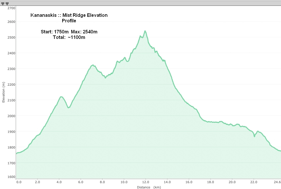 Mist Ridge Elevation Profile