Google Map |
Rockies :: Kananaskis :: Odlum Ridge |
GPS Track |
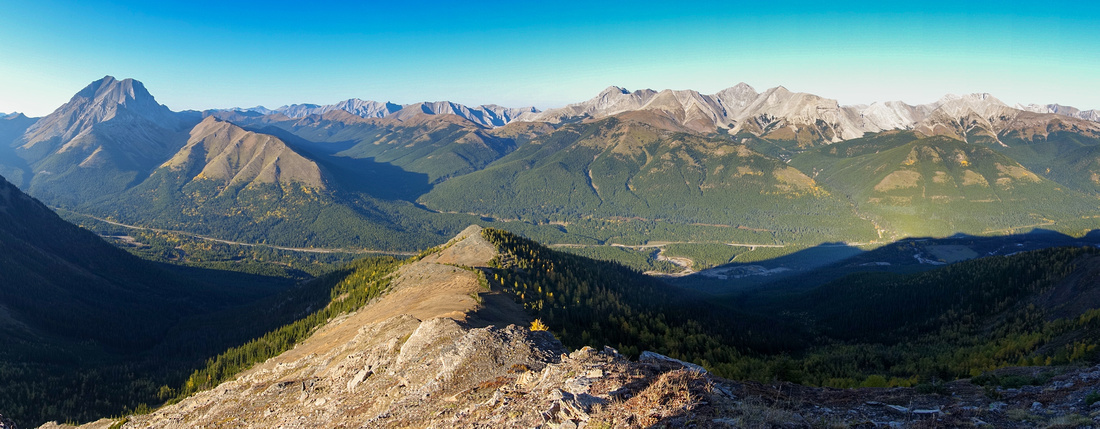 
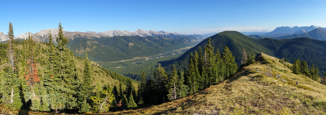
Panoramic view north from East Summit of Odlum Ridge. Mist Ridge right of center, Nameless (Eagle) Ridge left |
|||
| Trip Summary | |||
September 21, 2023South Highwood is ridgewalker paradise, and Odlum might be the best yet. However access and overall trip weight are considerably more difficult when compared to nearby Lineham, Mist or Nameless Ridges. Unavoidable ford of Highwood River, lack of established trails and signage as well as very steep slopes below treeline are some of reasons why Register on East (Highest) Summit sees just a handful of entries each season. Hike is best done in September, both because of logistics -low water level of Highwood River- and scenery -abundance of golden larches (cover photo of Kananaskis Trail Guide, Vol 5). Variety of options exist including loop traverse of entire ridge as well as north side descent to Mist Parking.
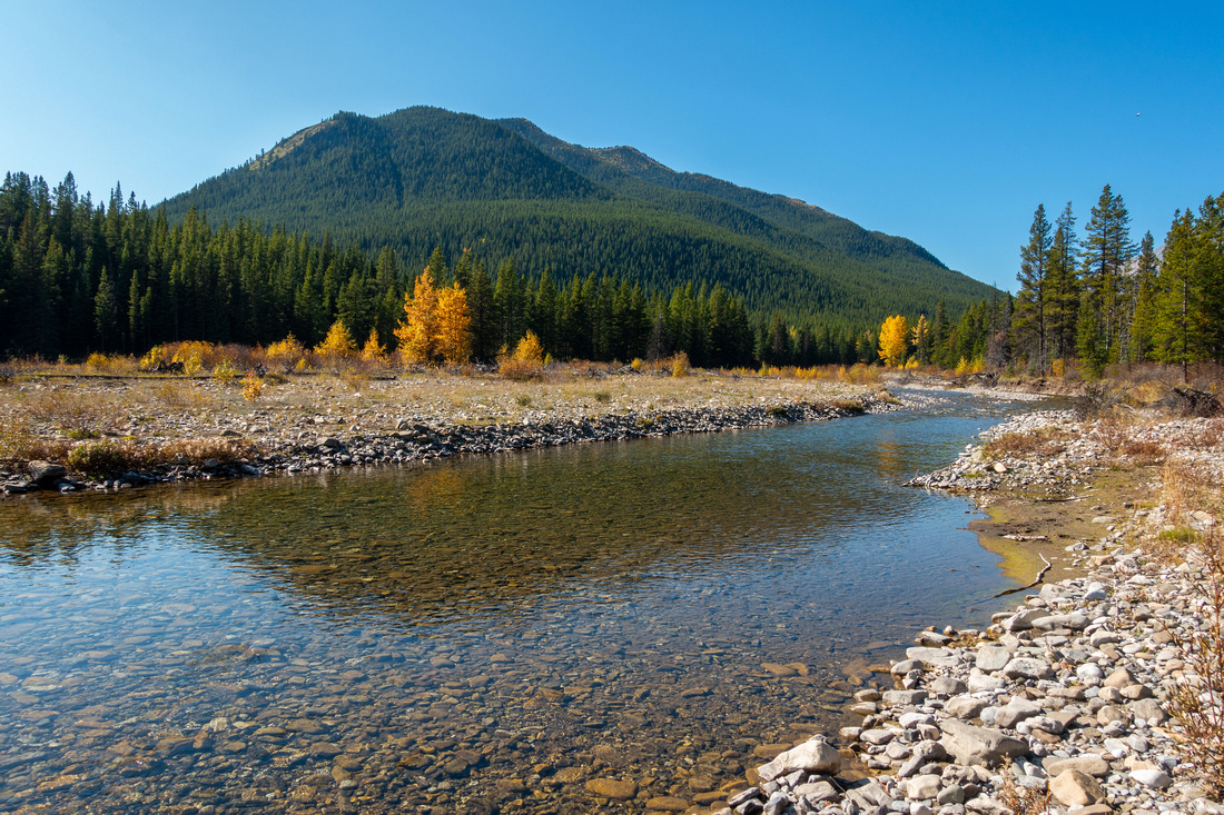
On my initial hike I went via most commonly used approach, starting from Lantern Creek Picnic area (same as for much more frequented Picklejar Lakes) First task is to find old deactivated forest road that provides easiest access to Highwood River. Walk 7-8min north up the road and look carefully for opening in the forest on left (west) side. Couple of old boulders mark the entry, but they can't be seen from the road - use GPS Track (download at Top of Page) Waypoint 1 - Forest Road. Road switchbacks to the River which must be crossed; in mid-September it is usually an easy ford, but not just a simple rock hop (first photo in Gallery). Look for old cutline at far side; it is not marked either, so if you can't locate it consult GPS again - Waypoint 2 - River Ford. Cutline soon becomes choked with alder and progress quite tedious. Hiking this part after rain would be quite miserable. Wear long sleeves and gloves and - protect your eyes. After about a km of this misery cutline reaches the apex and going becomes easier.
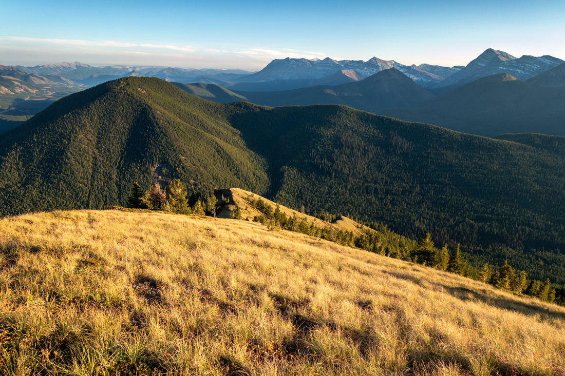
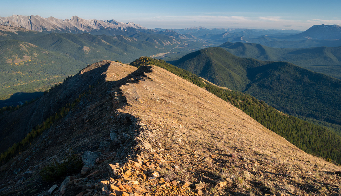
Next challenge is to find place to leave cutline and head up the forest slope on right (north) side. Resist urge to start too soon as this leads to more unpleasant terrain. Best spot is clearing just before crossing of Lantern creek (Waypoint 3 - Lantern Creek), about 5 min past obvious steep drainage coming in from the north. There are several faint trails but I was able to follow most obvious one all the way to treeline, some 300 vertical meters above of very steep grade (hiking poles extremely helpful, specially on descent). Burned Dry Tree is good landmark to be able to locate this trail on descent. Pleasant hiking on open grassy slopes above is very enjoyable leading to East end of the Ridge. Initial ridgewalk is through mixed larch/pine forest, then open terrain leading to East summit passing over sub-summit that also has cairn (see Gallery).
On my trip I turned back at East summit, mostly because of mediocre light conditions for good photography (this is photography site after all!). I am bound to return at some point for full traverse; if you do that, 2 options exist: 1) Come back the same way 2) Descend to Lantern creek at far (west) end of the ridge then return via cutline. The later is apparently not appealing, so highline option might be preferable. Both require fairly long day (8-9 hrs return time). Intriguing option that requires 2 cars or bicycle is to drop from either East or Center summit north towards the Highway; apparently game trails exist and facilitate this descent but I can not guarantee this. If you decide to try, you need to be comfortable with route finding skills. I plan to research this variation at some point too and will update this page when it happens.
|
|
Gallery |
|||
 Highwood River
Unavoidable Ford of Highwood River, easy but still not simple rock hop in September. Odlum East End upper left Highwood River
Unavoidable Ford of Highwood River, easy but still not simple rock hop in September. Odlum East End upper left |
|||
 Lantern Junction
Clearing before Lantern Creek crossing looking up - find faint trail at edge of forest and head up Lantern Junction
Clearing before Lantern Creek crossing looking up - find faint trail at edge of forest and head up |
|||
 Dry Landmark
Dry tree at treeline serves as good landmark to find trail on return Dry Landmark
Dry tree at treeline serves as good landmark to find trail on return |
|||
 Grassy Slopes
Very enjoyable hiking above treeline on moderately angled grassy slopes Grassy Slopes
Very enjoyable hiking above treeline on moderately angled grassy slopes |
|||
 Sunny Grassland
Looking down sunny elegant ascent grassy slopes Sunny Grassland
Looking down sunny elegant ascent grassy slopes |
|||
|
|
|||
 East Ridge
Hiking up east ridge through semi open larch/pine tree forest. East summit is just left of upper center East Ridge
Hiking up east ridge through semi open larch/pine tree forest. East summit is just left of upper center |
|||
 Larch Forest
Golden Larches entering their prime are main reason why second half of September is optimal time for Odlum Ridge Larch Forest
Golden Larches entering their prime are main reason why second half of September is optimal time for Odlum Ridge |
|||
 East Sub-Summit
Small cairn at east sub-summit looking north East Sub-Summit
Small cairn at east sub-summit looking north |
|||
 East Ridge
Looking down East ridge from near East summit. Grassy ascent slopes just right of center East Ridge
Looking down East ridge from near East summit. Grassy ascent slopes just right of center |
|||
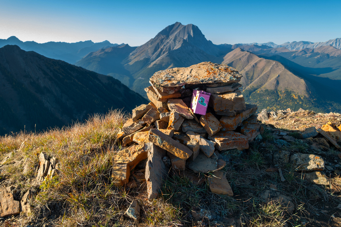 East Summit
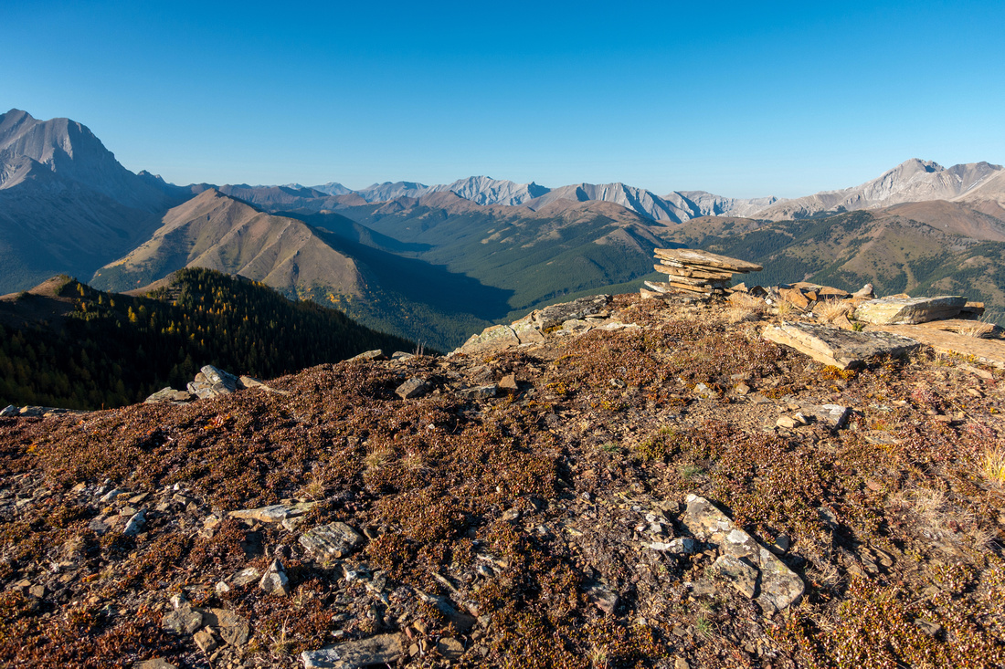
East (and highest) summit of Odlum Ridge with ever-present pink register in cairn East Summit
East (and highest) summit of Odlum Ridge with ever-present pink register in cairn |
|||
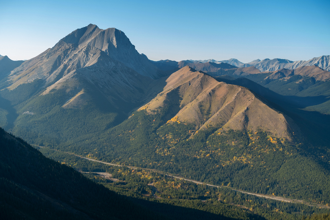 Nameless Mist
Mist Mountain and Nameless Ridge Telephoto from East Summit Nameless Mist
Mist Mountain and Nameless Ridge Telephoto from East Summit |
|||
 North Spur
Upper part of North Spur that provides alternate access from Mist Picnic area (Mist Ridge trailhead, lower center right) North Spur
Upper part of North Spur that provides alternate access from Mist Picnic area (Mist Ridge trailhead, lower center right) |
Abstract
| Overall Difficulty | D4 | Unbridged River Ford, Alder bushwhack and very steep ascent slope below treeline. Considerable elevation gain | |||
| Snow Factor | S2 | Low avalanche danger, but hike not feasible in winter as Hwy40 is annually closed Dec 1 - Jun 15 past K-Lakes turnoff | |||
| Scenery | Exceptional Panoramic views of South Highwood. Alpine Meadows, Mist Mountain and Front Ranges | ||||
| Trail/Marking | Poor / None | Overgrown cutline in Lantern creek valley, faint trails below treeline. No cairns or flags | |||
| Suggested Time | 5-6hr | Full East summit only, OnB via Lantern Creek. Full ridge traverse will add several hours | |||
| Elevation | Start: 1740 m Max: 2500 m Total: +910m -150 m (East Summit) | Round Trip: ~13 km (East Summit) | |||
| Gear | Full Hikers. Hiking poles essential. Old sandals for river ford helpful (Waders are overkill). GPS recommended | ||||
| Water | Highwood River and Lantern Creek, none after. Carry 1L min, depending on conditions | ||||
| Dog Friendly | Yes | Standard back-country precautions. Highwood River ford should present no problems later in season | |||
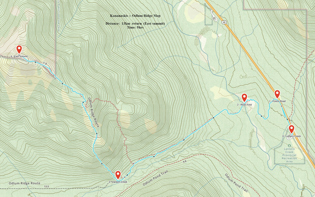 Odlum East GAIA Map
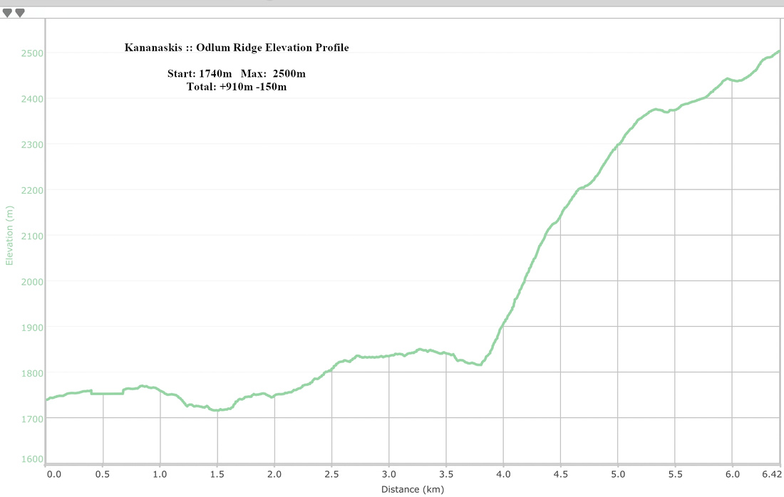 Odlum East Elevation Profile