Google Map |
Rockies :: Kananaskis :: Guinn Peak |
GPS Track |
 
Ridge above Guinn Pass; first bump upper right is Guinn Peak with Kidd South behind. Ribbon Lake and Mt. Bogart left |
|||
| Trip Summary | |||
August 14, 2024Guinn Peak is just first bump on long ridge extending between Guinn Pass and Mt. Kidd South. K-Country Trail Guide refers to it as "Peak 237374", it is also called "Guinn Pass Peak" with final unofficial name now found on various maps just Guinn Peak. Traditional Guinn Pass access was via Avalanche Gully some 15min before Lilian Lake. In the meantime Alberta Parks have built new trail forking off upper valley just before lower Galatea Lake. Pre-requisite is 6km trudge up crowd infested Galatea Creek Trail, ending at Lilian Lake back-country campground. Past the campground trail switchbacks forested then talus slopes to marked new Guinn Pass trail junction. New trail is beautifully constructed, wide and only moderately steep - pure joy to hike. In mid-summer wildflowers litter grassy slopes and are by itself reward high enough to justify the effort getting this far. At Guinn Pass (3 - 3.5 hrs from Trailhead) trail drops on the other side towards Ribbon Lake. Guinn Peak rises on the right side - about 1km and 180m vertical, 25-30min of hands in your pocket hiking. Views are fantastic, but try to come here on a crisp and clear day which is getting increasingly hard to do with "new normal" summer wildfire smoke.
From Guinn Peak there are 2 returns: Same way - with possible extension to visit Galatea Lake(s) - or by continuing along the ridge, then dropping down avalanche gully for loop of a sort that closes near Bridge #7 at Galatea Creek Trail. For a longer day Mt. Kidd South scramble is excellent choice; see bottom of this page for more details. Other option is 1-way crossover that links Ribbon Creek and Galatea Creek valleys, passing by Ribbon Lake - fairly popular with trail-runners. Main obstacle is stiff headwall below Ribbon Lake, but AB Parks have built via ferrata and it is not as awkward as it used to be. If you decide on this, it will be very long day and you will either require 2 cars or be prepared for mind-numbing Terrace Trail walk that links Galatea and Ribbon trailheads. You can also camp at Ribbon Lake back-country campground, but this requires hauling overnight gear; day trip is better option.
Note that Alberta Parks usually close Galatea Creek in May / June to allow terrain to dry off after spring snow-melts; at that time Hwy40 parking lot is gated. Check Current Trail Reports for details |
|
Gallery |
|||
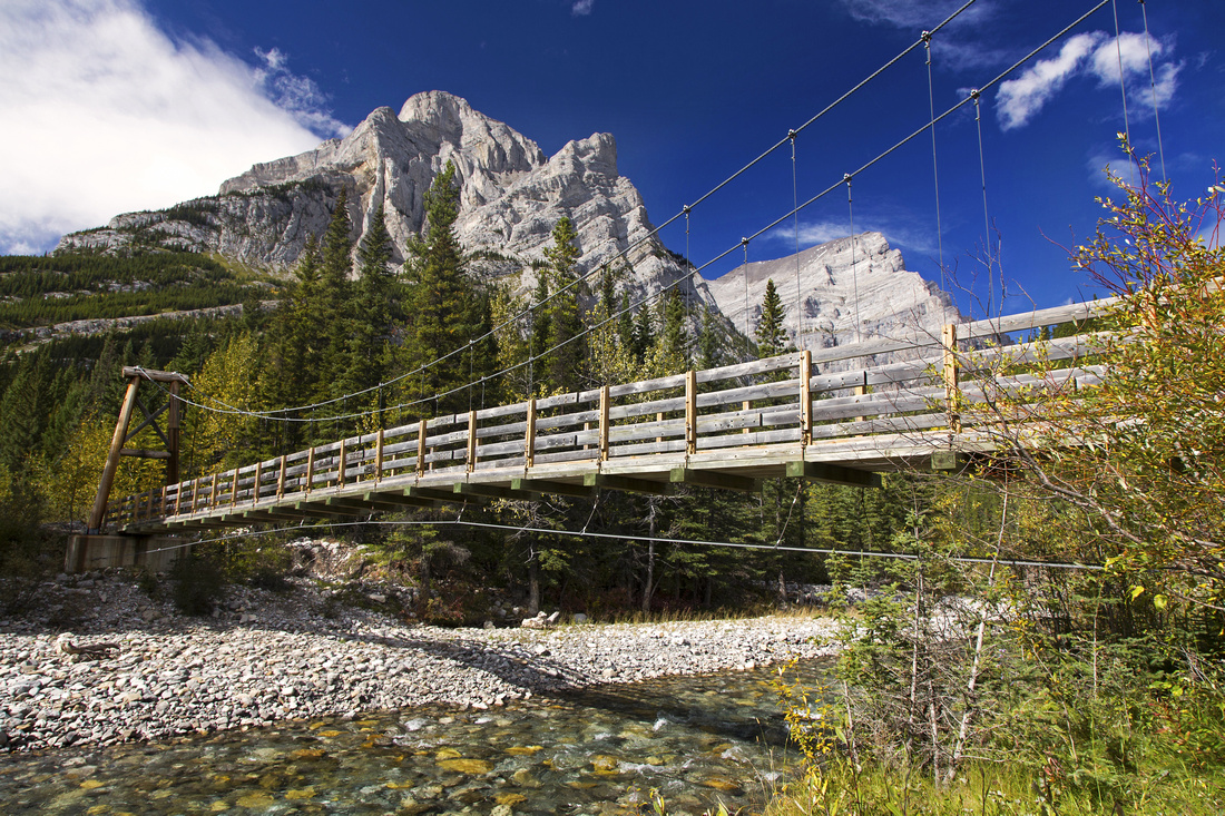 Kananaskis Bridge
Suspension bridge over Kananaskis River near the start Kananaskis Bridge
Suspension bridge over Kananaskis River near the start |
|||
 Bridge #3
One of several bridges over Galatea creek in lower part Bridge #3
One of several bridges over Galatea creek in lower part |
|||
 Galatea Creek
 from Bridge #3. Historic 2013 floods ravaged lower canyon, but Alberta Parks rebuilt all the bridges Galatea Creek
Galatea Creek from Bridge #3. Historic 2013 floods ravaged lower canyon, but Alberta Parks rebuilt all the bridges |
|||
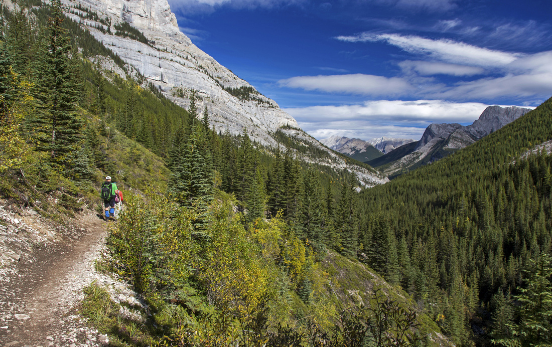 Slope Traverse
Views back as trail crosses avi slope below Kidd South Slope Traverse
Views back as trail crosses avi slope below Kidd South |
|||
 Bridge #7
Looking back after crossing Bridge #7; Lost Lake route forks off on the other side Bridge #7
Looking back after crossing Bridge #7; Lost Lake route forks off on the other side |
|||
 Kidd South Gully
Bushy Avalanche Gully - shortcut for Kidd South Scramblers ~10min after Bridge #7 Kidd South Gully
Bushy Avalanche Gully - shortcut for Kidd South Scramblers ~10min after Bridge #7 |
|||
 Lilian Lake
Lilian lake from west side looking back; several nice picnic benches are at the beach Lilian Lake
Lilian lake from west side looking back; several nice picnic benches are at the beach |
|||

|
|||
 Cairned Trail
View back as Galatea Lakes trail ascends Talus slope above Lilian Lake Cairned Trail
View back as Galatea Lakes trail ascends Talus slope above Lilian Lake |
|||
 Guinn Junction
Signed Guinn Pass Junction just above Lower Galatea Lake Guinn Junction
Signed Guinn Pass Junction just above Lower Galatea Lake |
|||
 Guinn Pass Trail
Beautifully constructed Guinn Pass trail traversing the hillside. Kidd South behind Guinn Pass Trail
Beautifully constructed Guinn Pass trail traversing the hillside. Kidd South behind |
|||
 Guinn Pass Trail
Looking back towards lower Galatea lake from Guinn Pass trail Guinn Pass Trail
Looking back towards lower Galatea lake from Guinn Pass trail |
|||
 Guinn Pass Trail
Guinn Pass trail going around short rock bluff; Lilian Lake below Guinn Pass Trail
Guinn Pass trail going around short rock bluff; Lilian Lake below |
|||
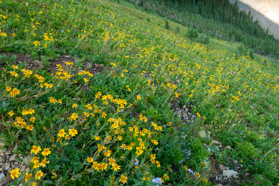 Wildflower Slope
Many wildflowers in grassy slopes below Guinn Pass Trail Wildflower Slope
Many wildflowers in grassy slopes below Guinn Pass Trail |
|||
 Guinn Pass Trail
Trail approaching Guinn Pass - low saddle upper center right. Guinn Peak right; ascent slope is as easy as it appears Guinn Pass Trail
Trail approaching Guinn Pass - low saddle upper center right. Guinn Peak right; ascent slope is as easy as it appears |
|||
 Guinn Pass
Windblown 2457m Guinn Pass. South Buller Pass extreme left, Red Peak distant upper center Guinn Pass
Windblown 2457m Guinn Pass. South Buller Pass extreme left, Red Peak distant upper center |
|||
 Guinn Ridge
Gentle ascent on grass and talus to Guinn Peak - pointed bump upper center right Guinn Ridge
Gentle ascent on grass and talus to Guinn Peak - pointed bump upper center right |
|||
 Ribbon Bogart
Mt. Bogart rising above Ribbon Lake on north side of Guinn Ridge. Ribbon Creek Valley center right Ribbon Bogart
Mt. Bogart rising above Ribbon Lake on north side of Guinn Ridge. Ribbon Creek Valley center right |
|||
 Ribbon Lake
 telephoto; backcountry campground is in the meadows on left side Ribbon Lake
Ribbon Lake telephoto; backcountry campground is in the meadows on left side |
|||
 Kidd South Panorama
Ridge connecting with Kidd south at other side of Guinn Peak. Direct approach via Avalanche gully from Lilian trail joins in roughly center of photo Kidd South Panorama
Ridge connecting with Kidd south at other side of Guinn Peak. Direct approach via Avalanche gully from Lilian trail joins in roughly center of photo |
Abstract
| Overall Difficulty | D3/4 | Easy trail hiking to Lilian lake followed by moderate ascent of Guinn Pass and Peak. Entire outing is on trail | |||
| Snow Factor | S3 | Considerable avalanche risk from Mt. Kidd south in Galatea creek and traversing steep slopes below Guinn Pass | |||
| Scenery | Galatea creek with small waterfalls and canyons. Nice Lilian Lake. Windswept Guinn Pass / Peak with aerial panorama of Ribbon Lake, Mt. Bogart and Kidd South | ||||
| Trail/Marking | Excellent | Maintained Alberta Parks trail. Bridges have been rebuilt past historic 2013 floods. All junctions are marked. | |||
| Suggested Time | 7 hrs | Round trip time with moderate pace, returning the same way. Add 2-3hrs for Kidd South | |||
| Elevation | Start: 1560m Max: 2630m Total: ~1200m | Round Trip: ~20km | |||
| Gear | Full hikers preferred. Micro-spikes for icy creek sections in winter conditions. Poles recommended for upper Talus slopes | ||||
| Water | Galatea creek. No reliable source past Lilian Lake. Carry 1-2L, depending on season | ||||
| Dog Friendly | Yes | Very popular trail - keep control of your dog at all times. Standard back-country travel precautions | |||
 Guin Peak GAIA Map
 Guinn Peak Elevation Profile
Mt. Kidd South
Easy rated Kane scramble and logical full-day extension. There are 2 possible approaches
- Guinn Pass / Peak, as described on this Page
- Direct route via Avalanche gully 10min past 7th bridge on Lilian Trail. (Waypoint "1 - Kidd South Gully", GPS Track download Top of Page)
Direct route is shorter, but I recommend it only for descent. It gets quite steep in upper part with lose footing some 250-300m vertical before intersecting Guinn Ridge. Nevertheless for peakbaggers that care for little more than another notch in Kane belt, it has become route of choice as testified by numerous YouTube videos and Social Media "Brags for Likes". My suggestion is to hike beautiful Guinn Pass trail, then enjoy the ridgewalk past Guinn Peak. Despite appearance this ridge is very straightforward with scree trails most of the way. Just before the summit there are couple of short cliff bands that force detour on climber right, but not difficult.
 Kidd South
Regardless of approach, return via south facing avalanche gullies is logical choice, also forming loop, sort of. On my trip I dropped down first gully (right of upper center), and although it was completely feasible it did require Galatea Creek ford, dumping me to Lilian trail close to bridge #6. Nowdays it is better to use aforementioned gully, leaving near that obvious knob on photo above. With moderate pace such loop will require 9-10hrs, 22km and ~1400m vertical.