Google Map |
Rockies :: Kananaskis :: Lilian and Galatea Lakes |
GPS Track |
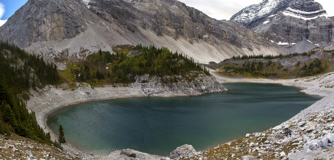 
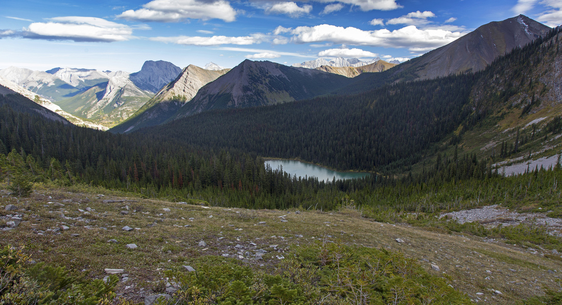
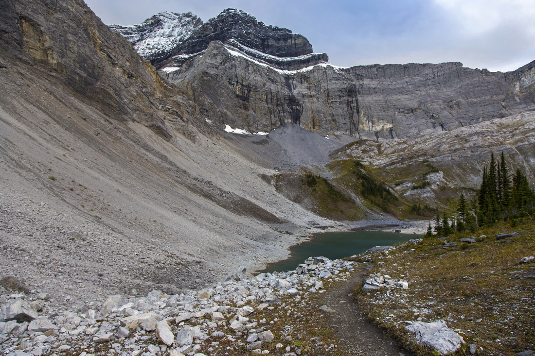
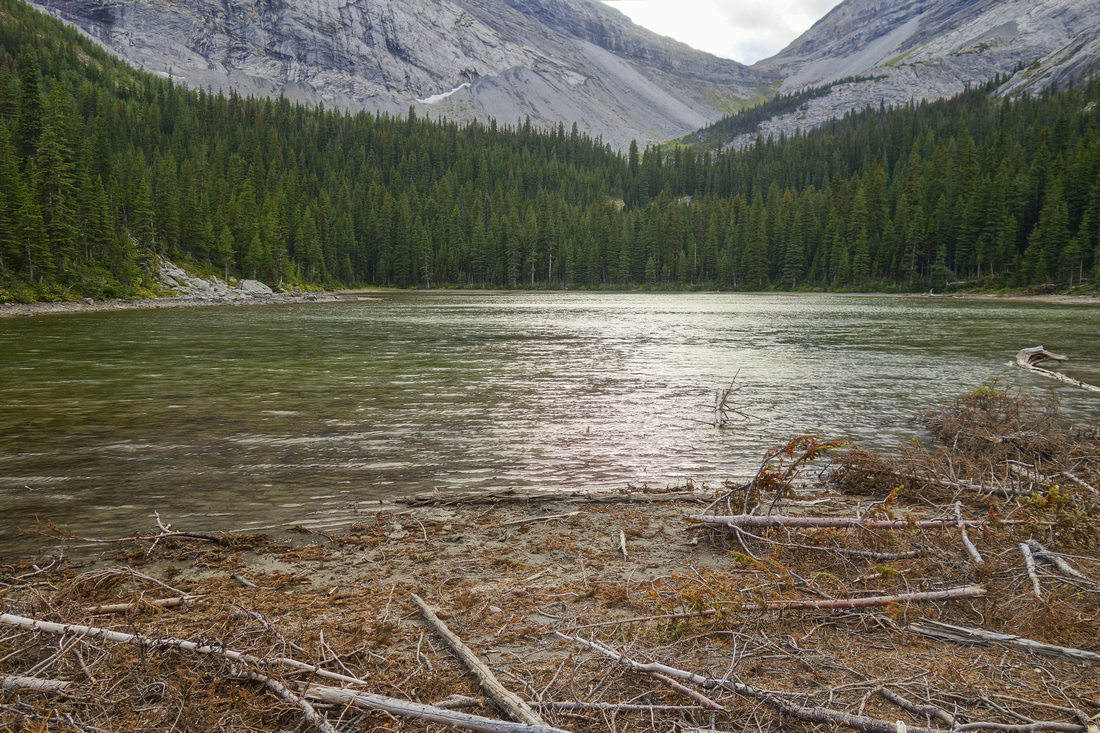
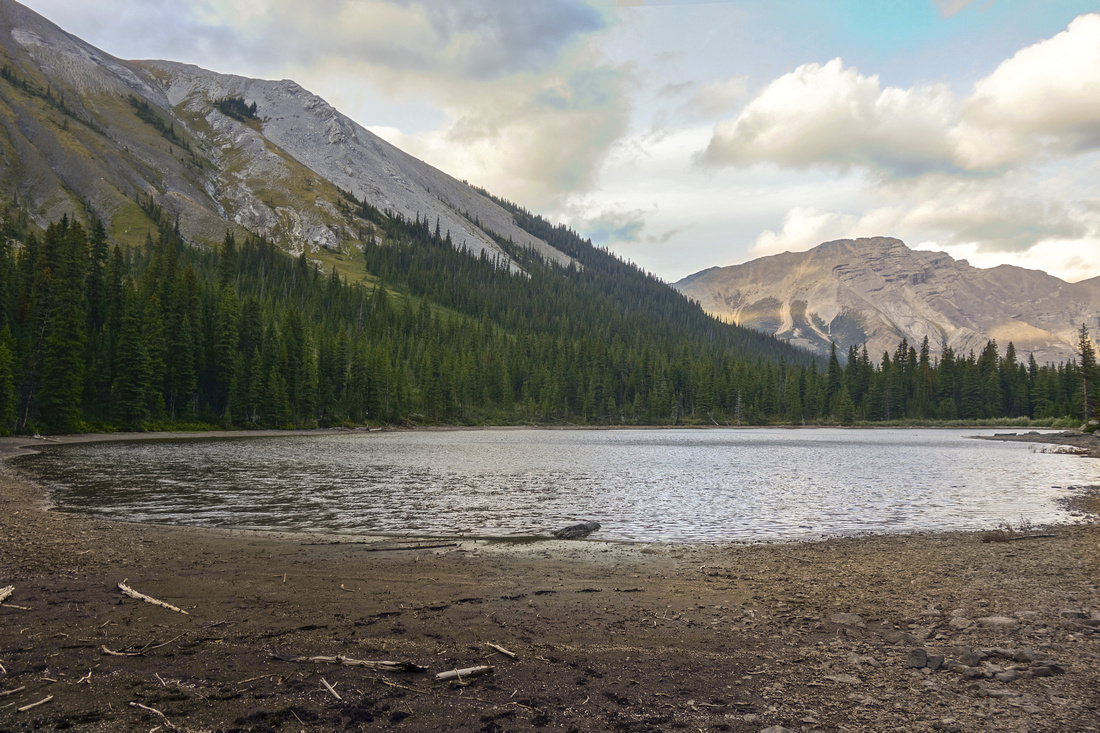
Lower Galatea Lake. Upper lake is behind the low ridge center right; Tower rising above |
|||
| Trip Summary | |||
September 9, 2016Galatea creek is popular K-country trail leading to official back-country campground at Lilian Lake. Fishing in the lake is very good, so anglers can often be spotted as well. Real reward lies in continuing to alpine cirque below the Tower that hosts 2 back-country lakes. Other destinations accessed via Galatea creek include Guinn Pass/Ribbon lake crossover, Kane scramble of Kidd south or cross-over to Smith-Dorrien corridor via Lost Lake/Rummel Pass.
Parking is west side of Hwy 40, 5-10 minutes south from Kananaskis Village junction (~20 mins from Trans-Canada Highway). Large parking lot fills fast on summer weekends. Road-like trail descends to Kananaskis River, crosses on suspension bridge, then continues to Terrace junction. Turn left and follow Galatea creek trail. This canyon has been ravaged in epic 2013 floods, but all bridges have been rebuilt. There are still some washouts in lower part but good bypass trail has developed. It takes about 1.5 - 2 hours to Lilian Lake, with steepest part after the last bridge. Past Guinn Pass junction trail descends slightly to east end of the lake and hikes around on the often muddy north side to the campground. There are several good tent sites, outhouse, food cache as well as couple of nice platforms on west shore. Needless to say, it gets filled often during the summer!
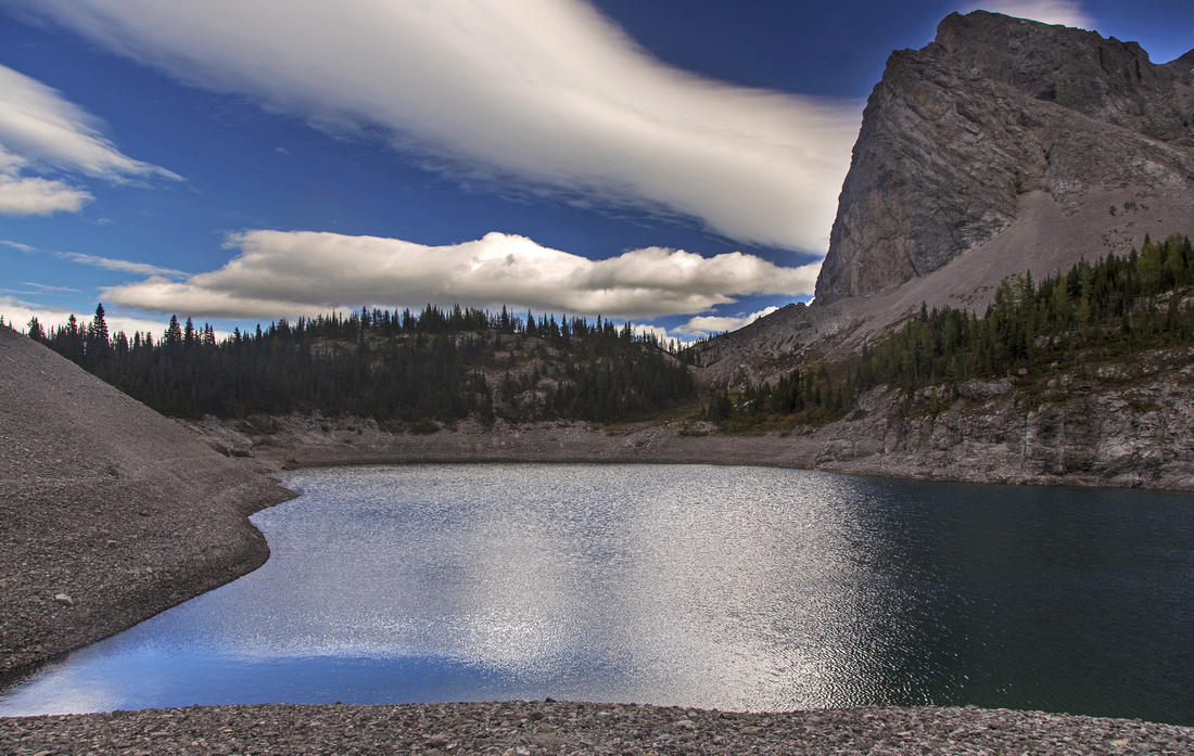
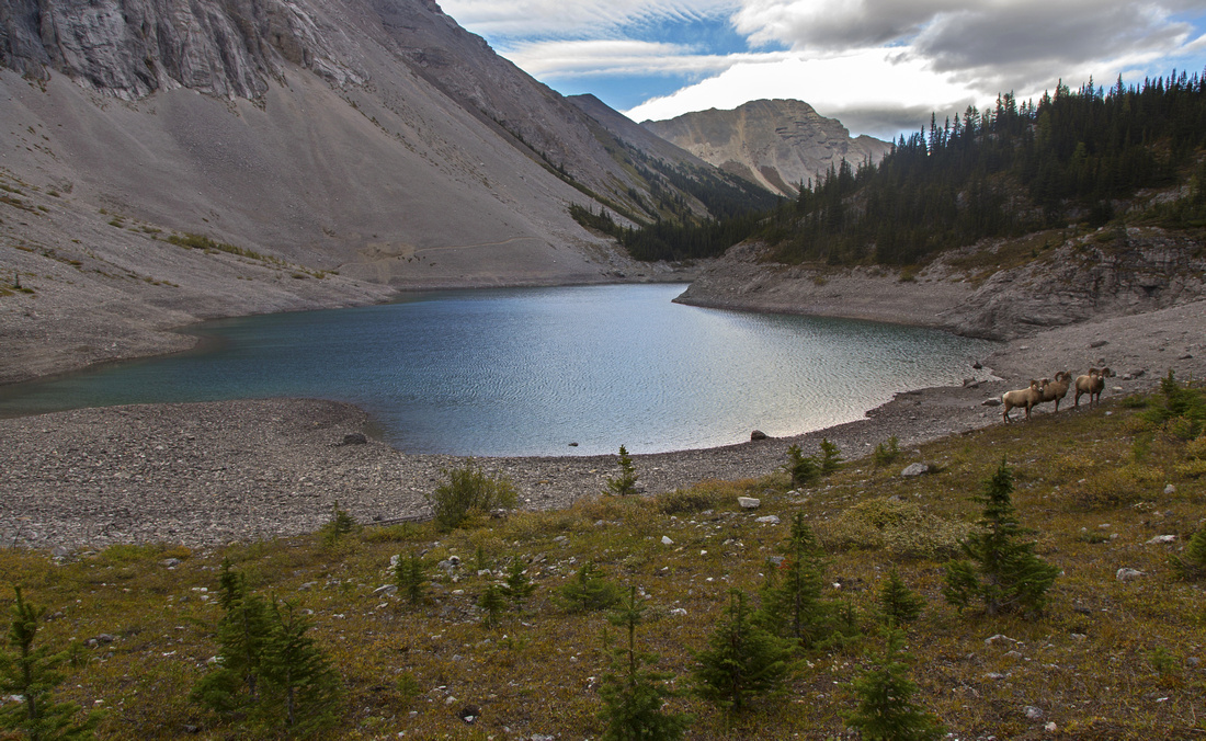
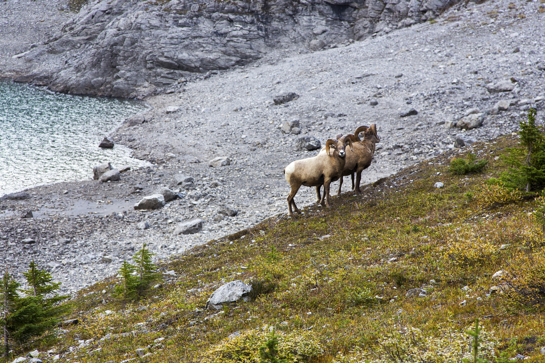
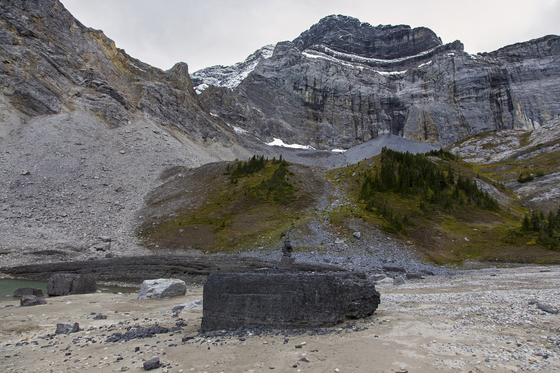
There are 2 ways to Galatea cirque past Lilian Lake. Normal access follows good trail that starts just past NW corner of the lake (before the campground). It switchbacks through thinning forest, then up talus slope above treeline to terrace above lower Galatea lake. Second way is less obvious and more demanding. Rough trail starts on the left side of the outhouse and scrambles steeply up talus slope to south side of lower lake. Most people hike up the 'normal' way then sometimes descend the 'outhouse trail' to form a loop. In each case it is well worth to hike up all the way to the upper lake set below sheer cliffs of the Tower: It is more beautiful and does not have 'reservoir-like' appearance of the lower lake when water level is low. Watch for herd of bighorn sheep that make upper cirque home.
Return the same way. Note that Guinn Pass/Ribbon Lake/Kidd South are all accessed from marked junction 5 minutes before Lilian Lake. Less frequently hiked Lost Lake/Rummel Pass crossover junction splits off just as main trail re-crosses back to north side around 5km mark. All these options are not really feasible as Galatea Lakes extension and are best done as separate trips. |
|
Gallery |
|||
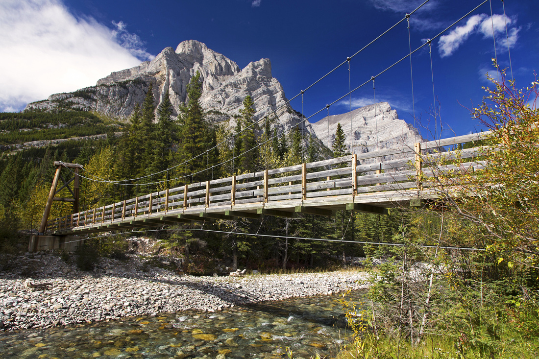 Suspension bridge over Kananaskis River near the start
 |
|||
 One of several bridges over Galatea creek in lower part
 |
|||
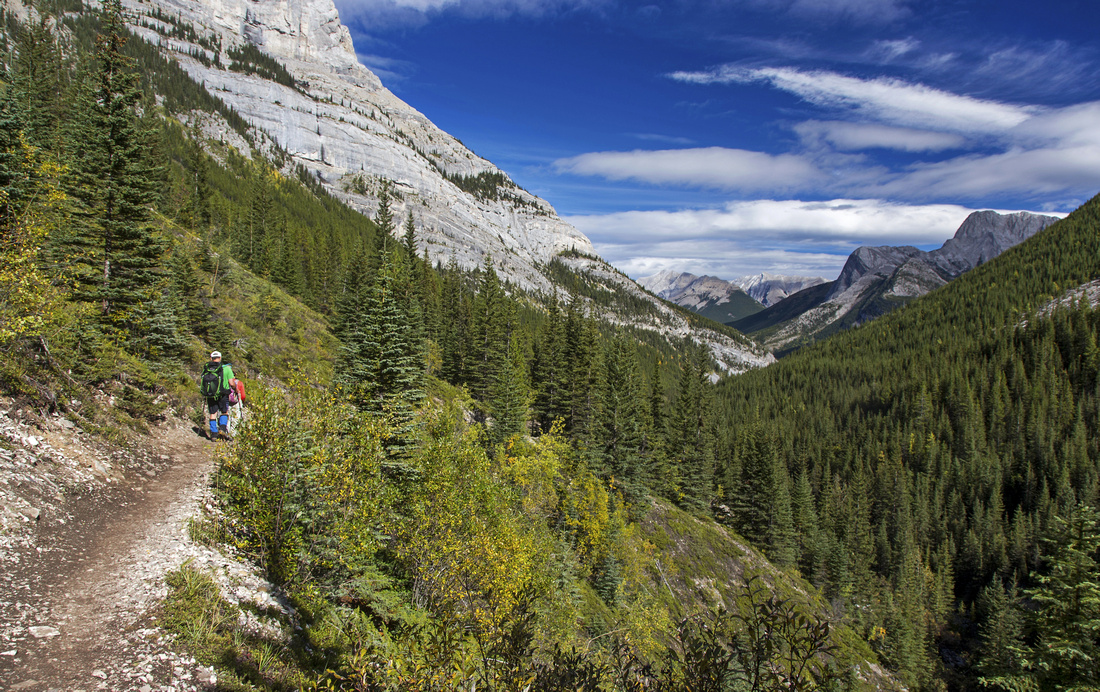 Views back as trail crosses avi slope below Kidd South
 |
|||
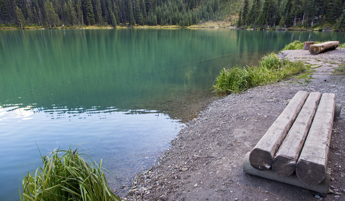 Benches at west end of Lilian Lake near the campground
 |
|||
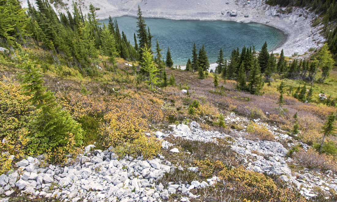
 View back to Lilian Lake from lip of Galatea cirque
 |
|||
 Lower Galatea lake - reservoir like in early fall when water level is low
 |
|||
 View back as trail ascends to upper lake
 |
|||
 Herd of mountain goats makes lower Galatea lake home
 |
|||
 Trail continues to west end of upper Galatea lake
 |
|||
 Unexpected sandy beach at west end of upper Galatea lake
 |
|||
 Fall colors above lower Galatea lake on alternate return
 |
|||
 Lilian lake on alternate return. Steep talus descent below
 |
|||
Abstract
| Overall Difficulty | D3 | Easy trail hiking to Lilian lake followed by moderate ascent to upper basin. Awkward talus slope for optional alternate descent | |||
| Snow Factor | S3 | Considerable avalanche risk from Mt. Kidd south in Galatea creek | |||
| Scenery | Galatea creek with small waterfalls and canyons. Nice Lilian Lake. Classic high-alpine cirque hosting Galatea lakes | ||||
| Trail/Marking | Excellent | Official Park trail. Bridges have been rebuilt past historic 2013 floods. All junctions are marked. | |||
| Suggested Time | 7 hrs | Round trip allowing plenty of time for exploration of Galatea cirque. Possible extensions to Guinn pass, scramble of Mt. Kidd south or crossover to Ribbon Lake are better done as separate trips | |||
| Elevation | Start: 1540m Max: 2230m Total: ~900m | Round Trip: ~19km | |||
| Gear | Day hikers are sufficient. Micro-spikes for icy creek sections in winter conditions. Poles recommended for Galatea cirque | ||||
| Water | Galatea creek and lakes. No need to carry more than 1L at any time. | ||||
| Dog Friendly | Yes | Very popular trail - keep control of your dog at all times. Standard back-country travel precautions | |||
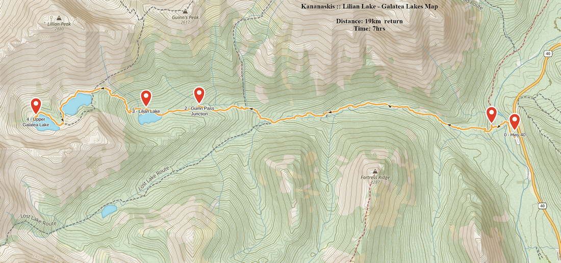 Lilian and Galatea Lakes GAIA Map
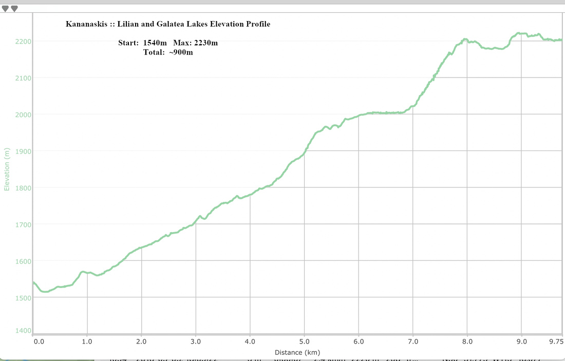 Lilian and Galatea Lakes Elevation Profile
Google Map |
Lost Lake |
GPS Track |
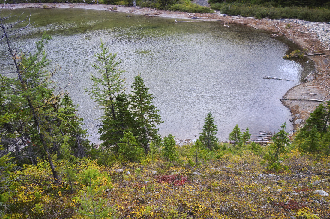
East end of Lost lake looking towards Rummel Pass below Mt. Galatea |
|||
August 31, 2018Tucked away from crowds that follow main Lilian Lake artery is wonderful forest trail up south branch of Galatea creek. It splits off ~5km mark, just as main trail crosses back to north side and starts ascent. This junction was unmarked as of September '18 but fairly obvious -- see first photo in gallery. Trail is unmaintained and deadfall has accumulated over the years, but never presents any problem and is in many ways more enjoyable than main trail. Highlight is reached in 5-10 mins from the junction -- ruins of old Alvin Guinn cabin, and significant relic of K-country bygone days. Worst section of the trail is right after the cabin but mercifully short. Only possible confusion is second drainage you come up to (waypoint "2 - Drainage Split" on GPS track). Obvious trail continues up on left side of this drainage and it leads to unnamed minor peak on south side of the valley. For Lost Lake cross the drainage and pickup trail on the other side (flags). Footbed gets better and there are always flags at any overgrown spots. Finally cross the third drainage about 1hr in from the junction and reach the Lake, about 1:15 from Lilian trail. Some Internet reports opine that Lost Lake is one of "ugliest" in Kananaskis, but this is simply not true. In many ways it is prettier than overhyped and crowd infested Lilian Lake - or reservoir like Galatea lakes. Very quiet and pristine, in impressive setting under Galatea Peak. Best spot for quiet lunch are rock stones on south side. Obvious col directly west is Rummel pass and Spray Road connector - as described in Daffern K-country guidebooks. Most parties do this traverse W-E direction for obvious reasons -- steep section between Lost Lake and Rummel Pass. There are several other options for further exploration, including grass/talus scramble to ridges on both sides of Lost Lake. Otherwise, return the same way. |
|||
 Unmarked Lost Lake trail (left) junction, just before main trail crosses bridge #8 (out of picture, to the right)
 |
|||
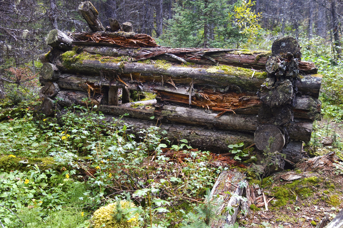 Guinn cabin ruins. Worst bushwhack is in this part; conditions considerably improve after
 |
|||
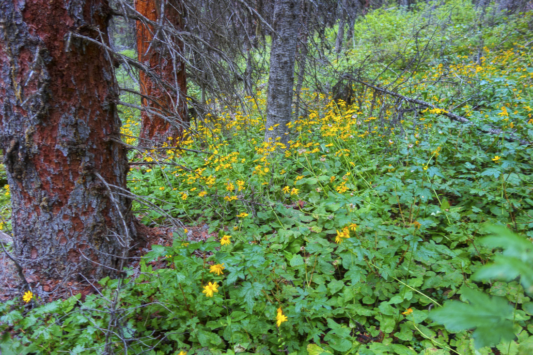 Summer flowers along the trail
 |
|||
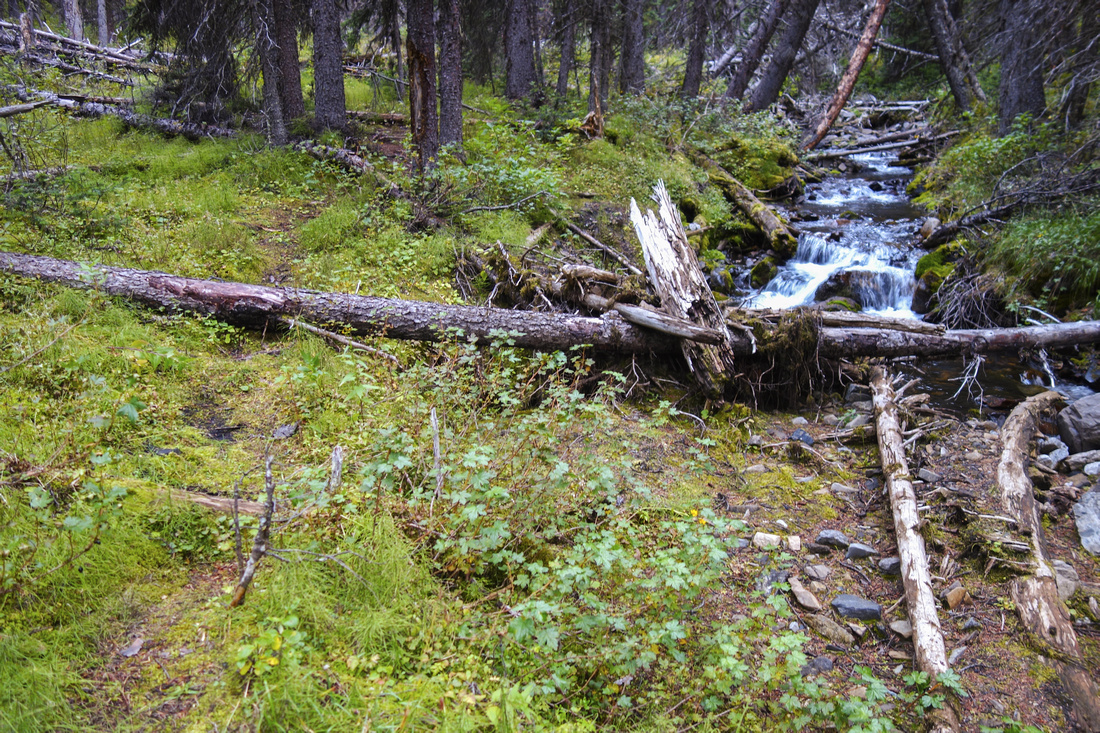 Typical section in mid-part along the creek with faint, but distinct footbed and very enjoyable hiking
 |
|||
 Looking back from west end to Kidd South (center right)
 |
|||
 Autumn colors starting to emerge in meadows above south side of Lost Lake
 |
|||
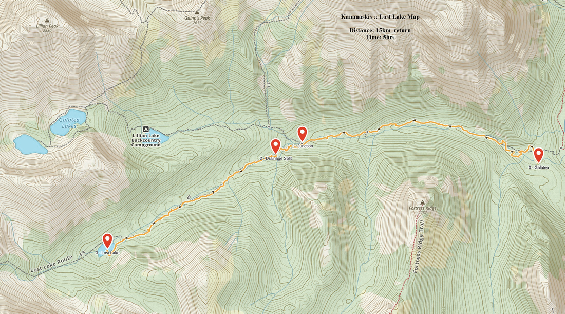 Lost Lake GAIA Map
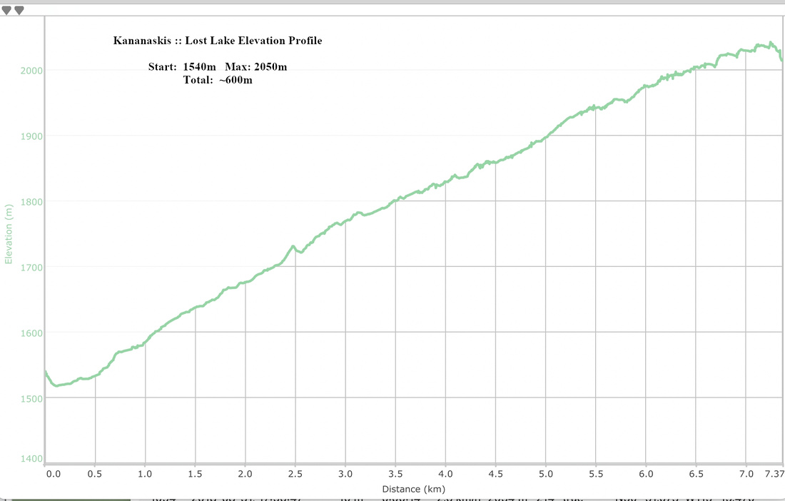 Lost Lake Elevation Profile