Google Map |
Rockies :: Kananaskis :: Rummel Lake and Pass |
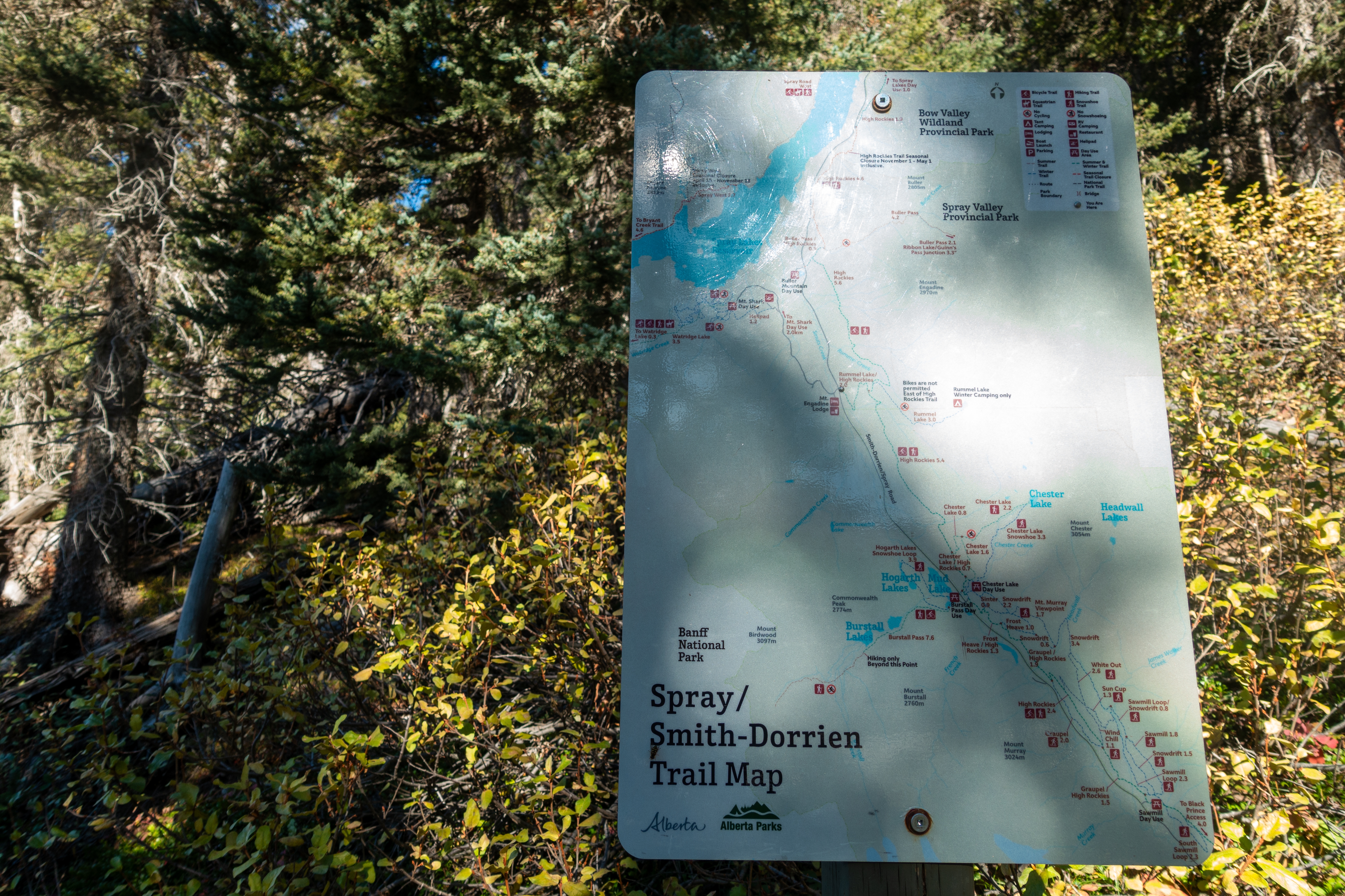
GPS Track |
|
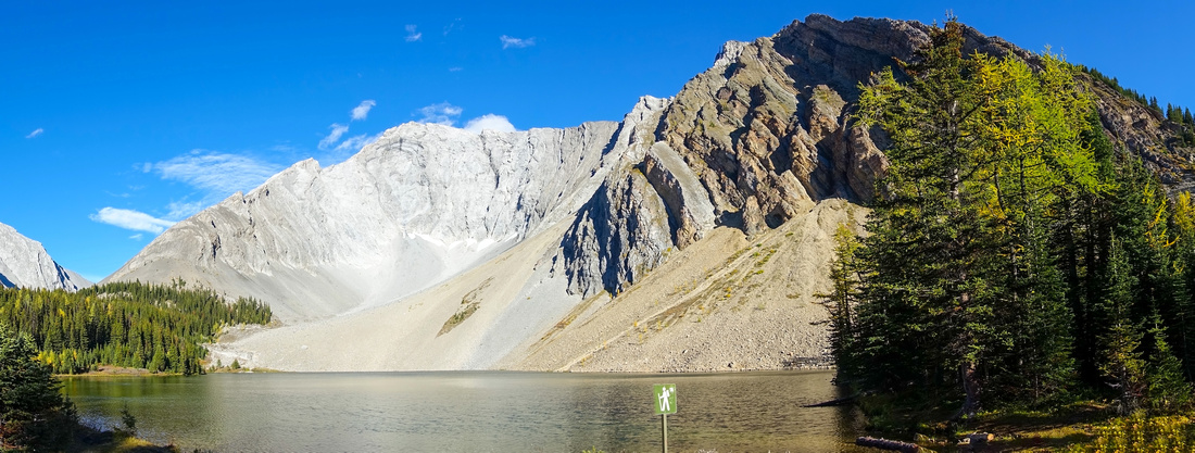
Rummel lake Panorama with Mt. Galatea in Background. Distant Rummel Pass extreme center left |
|||
| Trip Summary | |||
Sep 24, 2024Similar to Chester basin, Rummel Lake area provides pleasant and undemanding access to classic K-Country alpine. Official and maintained trail starts directly opposite Mt. Shark / Engadine Lodge turnoff. It is about 5.5km, 1:15 - 1:20 hr of moderate pace to the lake, passing signed High Rockies Trail in lower part (see Gallery). Past upper junction trail dips into the forest and becomes quite rooty, before crossing Rummel creek on solid bridge then climbing final stretch to the lake. Nestled in peaceful alpine cirque below Mt. Galatea Rummel lake also has back-country campground - but you are allowed to camp only in winter. I find this rule quite puzzling and have serious doubts anyone actually camps here; no restrictions for using outhouse though!
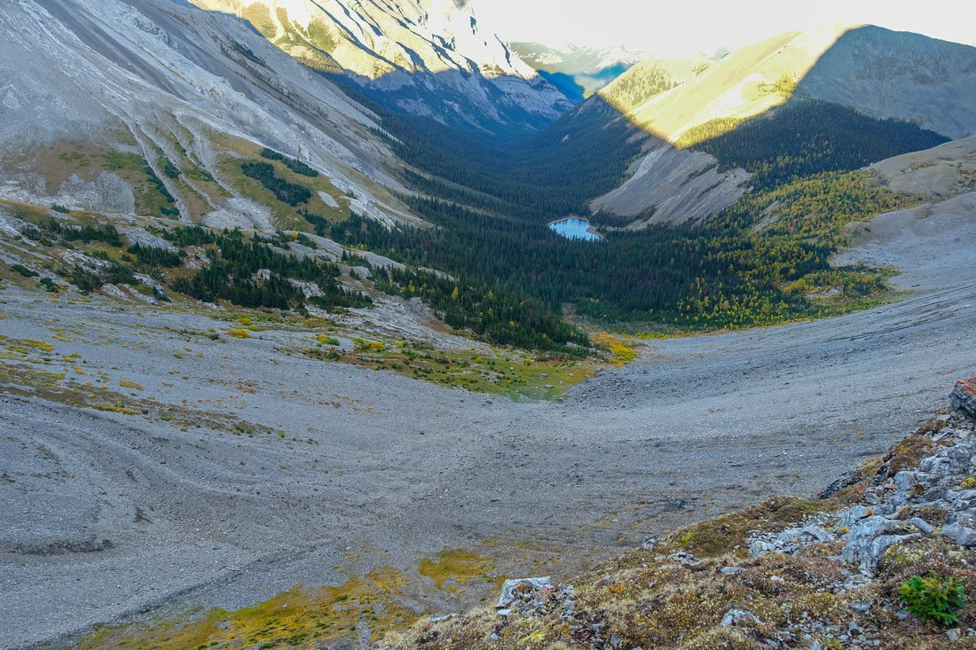
Real reward lies in hiking beyond the lake. Trail continues around the lake, then climbs shallow draw and exits in delightful alpine meadow. Several larch stands also make this very good late September destination. Two trails exist at opposite sides of this valley and eventually merge by lower Tarn which usually dries out late in season. Upper Tarn, just below 2405m high Rummel Pass will still have water. The Pass is wide and usually windswept, but offers great easterly views towards Galatea Creek and unfrequently visited Lost Lake directly below. 1-way traverse between Spray and Hwy40 corridors is possible this way, but will require 2 vehicles.
It is worth noting Rummel is frequently done on XC-Skis or snowshoes, as evident by yellow wands nailed high in trees. I have not been here in winter but it is likely very pleasant. Going further to the Pass will require safe conditions as narrow gap below the Pass is avalanche zone. |
|
Gallery |
|||
 |
|||
|
|
|||
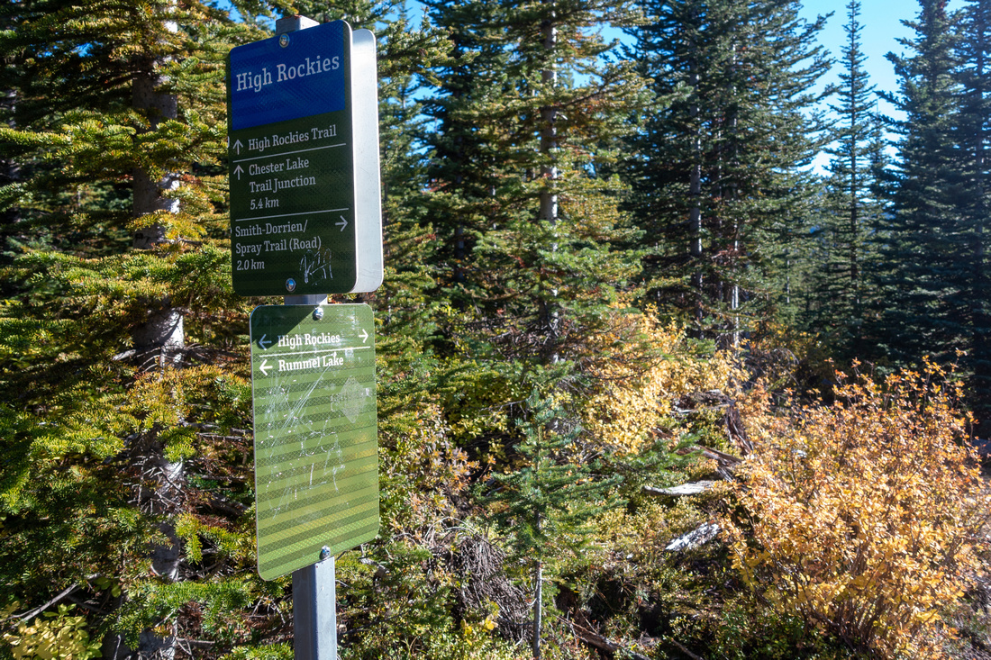 High Rockies Trail High Rockies Trail Both junctions with High Rockies Trail are signed
 |
|||
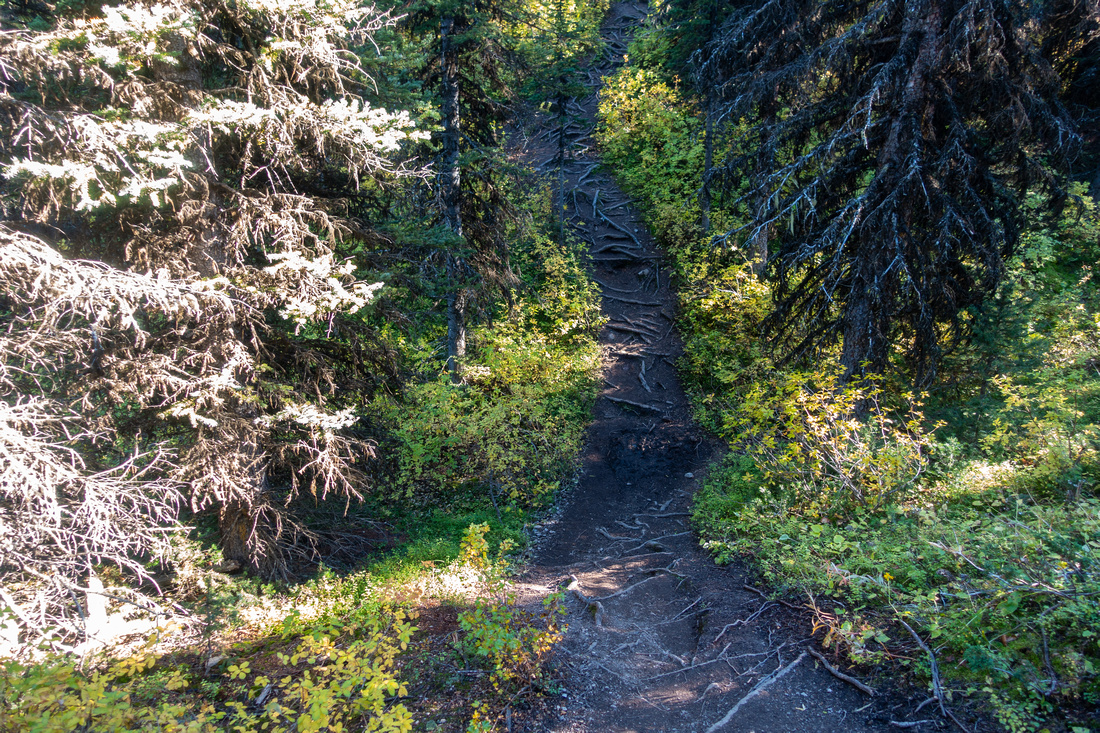 Rooty Dip
Several short dips as rooted trail follows Rummel Creek south side Rooty Dip
Several short dips as rooted trail follows Rummel Creek south side |
|||
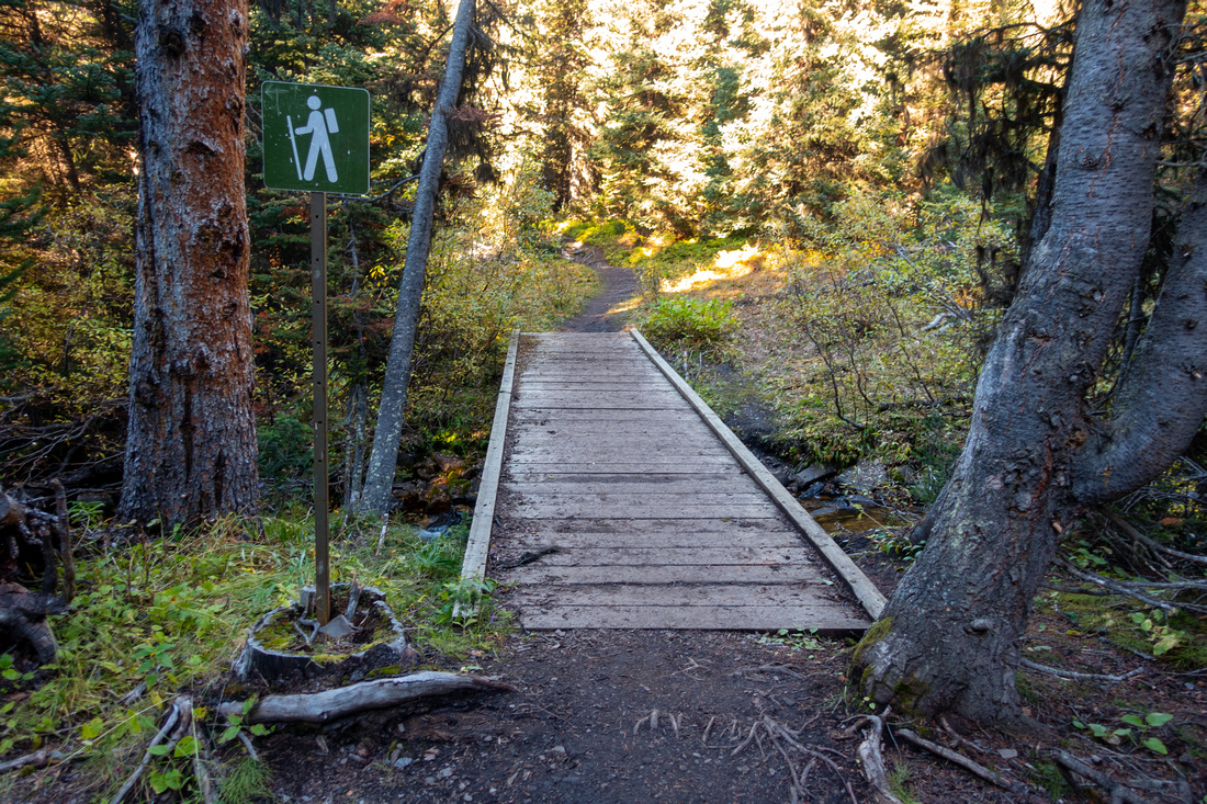 Rummel Bridge
Bridged crossing of Rummel Creek ~15min before the Lake. Shortcut forks on right side, but stay on main trail Rummel Bridge
Bridged crossing of Rummel Creek ~15min before the Lake. Shortcut forks on right side, but stay on main trail |
|||
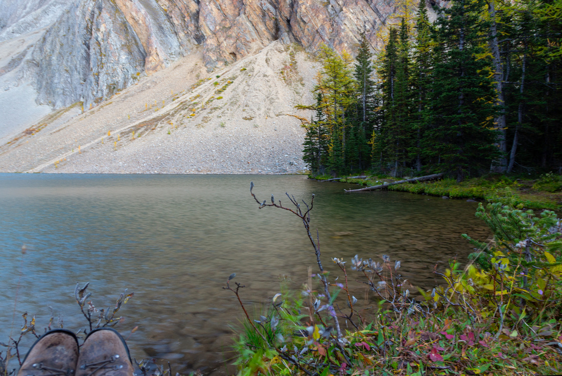 Rummel Lake
Lovely Rummel Lake 1:15 - 1:20 of moderate pace from Trailhead Rummel Lake
Lovely Rummel Lake 1:15 - 1:20 of moderate pace from Trailhead |
|||
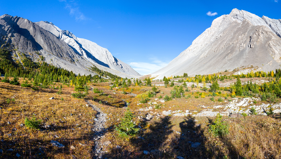 Rummel Alpine
Terrific Alpine hiking above the Lake. Distant Rummel Pass center sandwiched between Tower (L) and Galatea (R) Rummel Alpine
Terrific Alpine hiking above the Lake. Distant Rummel Pass center sandwiched between Tower (L) and Galatea (R) |
|||
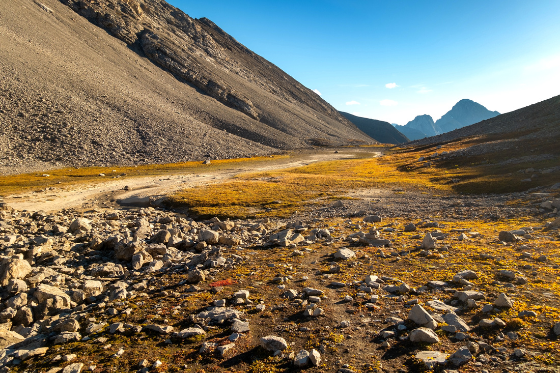
 Autumn Colours
Colourful alpine meadows approaching lower Tarn Autumn Colours
Colourful alpine meadows approaching lower Tarn |
|||
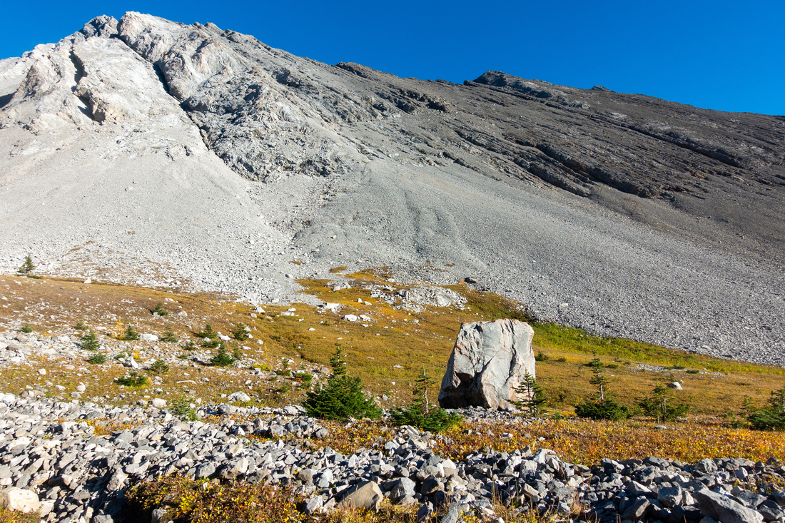 Galatea Boulder
Passing by huge boulder that rolled of Mt. Galatea north side. Good trail also runs at other side Galatea Boulder
Passing by huge boulder that rolled of Mt. Galatea north side. Good trail also runs at other side |
|||
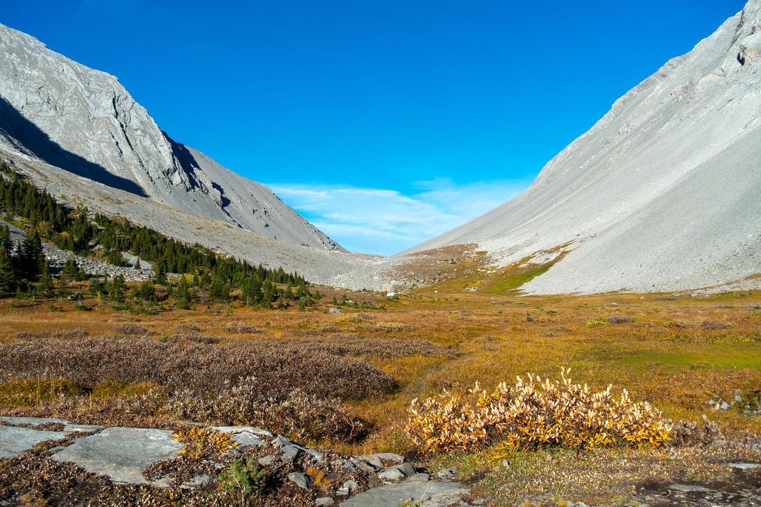
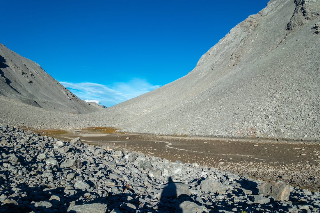 Lower Tarn
Dried out lower Tarn in 2nd Half of September. In June it will be full with snowbanks, but no fall colours - make your pick Lower Tarn
Dried out lower Tarn in 2nd Half of September. In June it will be full with snowbanks, but no fall colours - make your pick |
|||
 Lower Tarn
Looking back after crossing dried out lower Tarn. Mt. Birdwood and Commonwealth Peak in the distance Lower Tarn
Looking back after crossing dried out lower Tarn. Mt. Birdwood and Commonwealth Peak in the distance |
|||
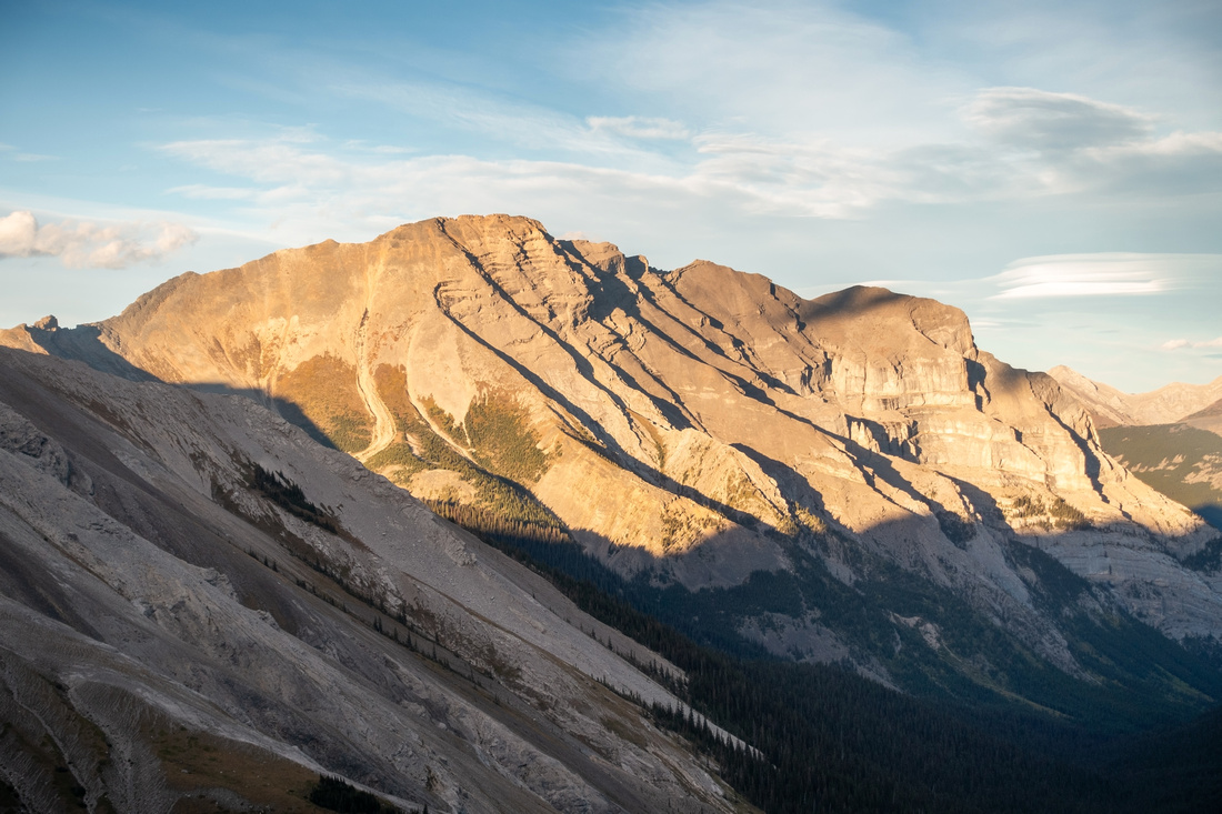
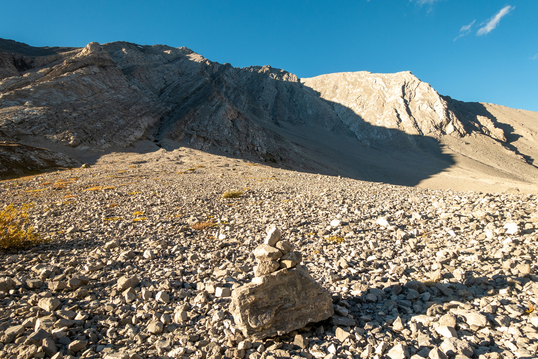 Tower Scramble
Large Cairn indicating point where Kane Tower scramble route forks off heading for obvious gully upper center right Tower Scramble
Large Cairn indicating point where Kane Tower scramble route forks off heading for obvious gully upper center right |
|||
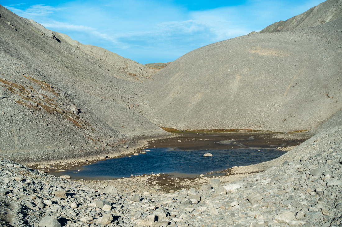 Upper Tarn
 just below the Pass usually still has water late in Season; note Trail Upper Tarn
Upper Tarn just below the Pass usually still has water late in Season; note Trail |
|||
 Rummel Pass
 Panorama. Scree trail just out of picture left descends to Lost Lake below Rummel Pass
Rummel Pass Panorama. Scree trail just out of picture left descends to Lost Lake below |
|||
 Kidd South
 Telephoto from Rummel Pass Kidd South
Kidd South Telephoto from Rummel Pass |
|||
 Larch Meadows
Plenty of larches above Rummel lake on return; this is also very nice Autumn colours hike Larch Meadows
Plenty of larches above Rummel lake on return; this is also very nice Autumn colours hike |
|||
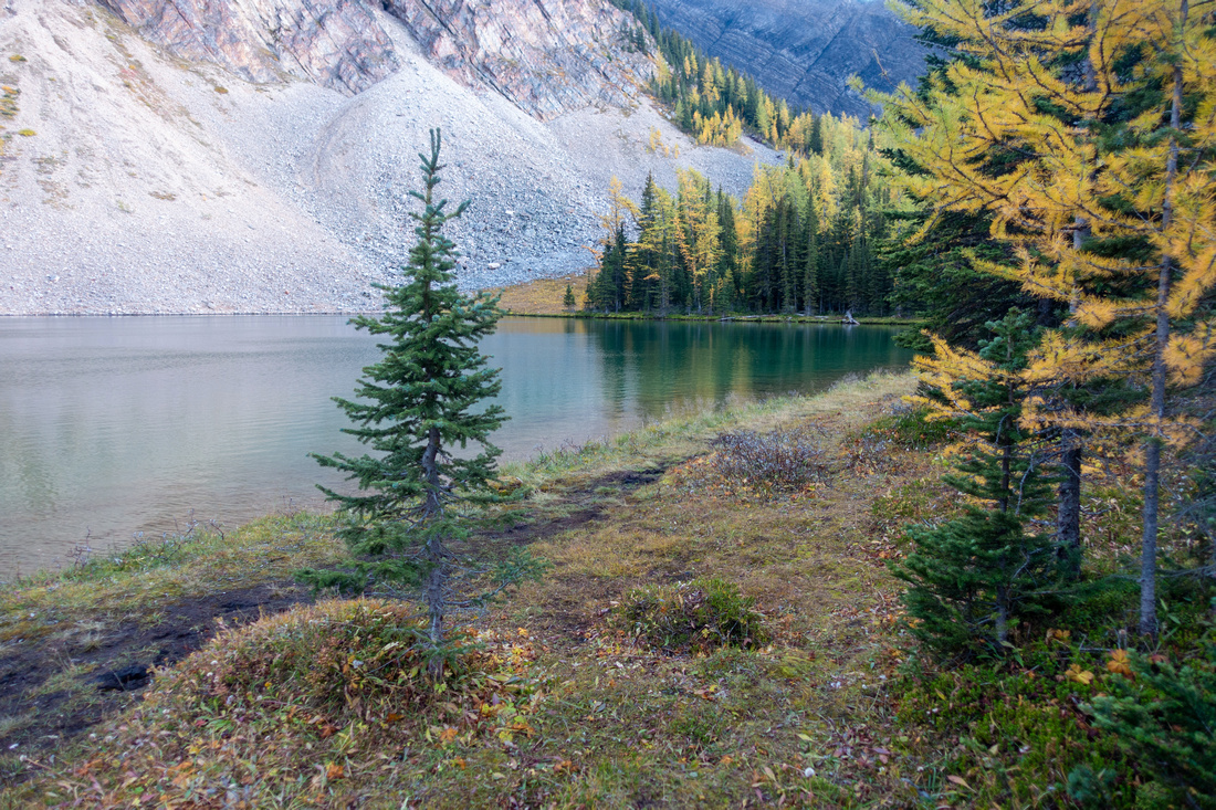 Rummel Larch
Golden Larches back at Rummel Lakeshore Rummel Larch
Golden Larches back at Rummel Lakeshore |
Abstract
| Overall Difficulty | D3 | Rooty sections of Rummel lake trail. Talus and boulder hopping below the Pass | |||
| Snow Factor | S2 | Frequently done as XC-Ski / Snowshoe Trip. No avalanche danger to the lake, possible slides from Tower below the Pass | |||
| Scenery | Spray Lakes viewpoint. Scenic Rummel Lake and classic K-country Alpine. Mt. Tower and Galatea, aerial view of Lost Lake and Lilian/Galatea corridor from windswept Rummel Pass | ||||
| Trail/Marking | Very Good | Official maintained trail with signed junctions to the lake. Trail fades in alpine below the Pass but way is obvious | |||
| Suggested Time | 5hrs | Rummel Pass return time. 3hrs or less if going just to the lake. 1-way crossover to Hwy40 corridor full day | |||
| Elevation | Start: 1845m Max: 2405 m Total: ~650m | Distance: 16km return | |||
| Gear | Full hiking boots or day hikers. XC-Ski or Snowshoes in winter | ||||
| Water | Rummel Creek, Small creeks / tarns in alpine. Carry 0.5 - 1L | ||||
| Dog Friendly | Yes | Standard back-country travel precautions | |||
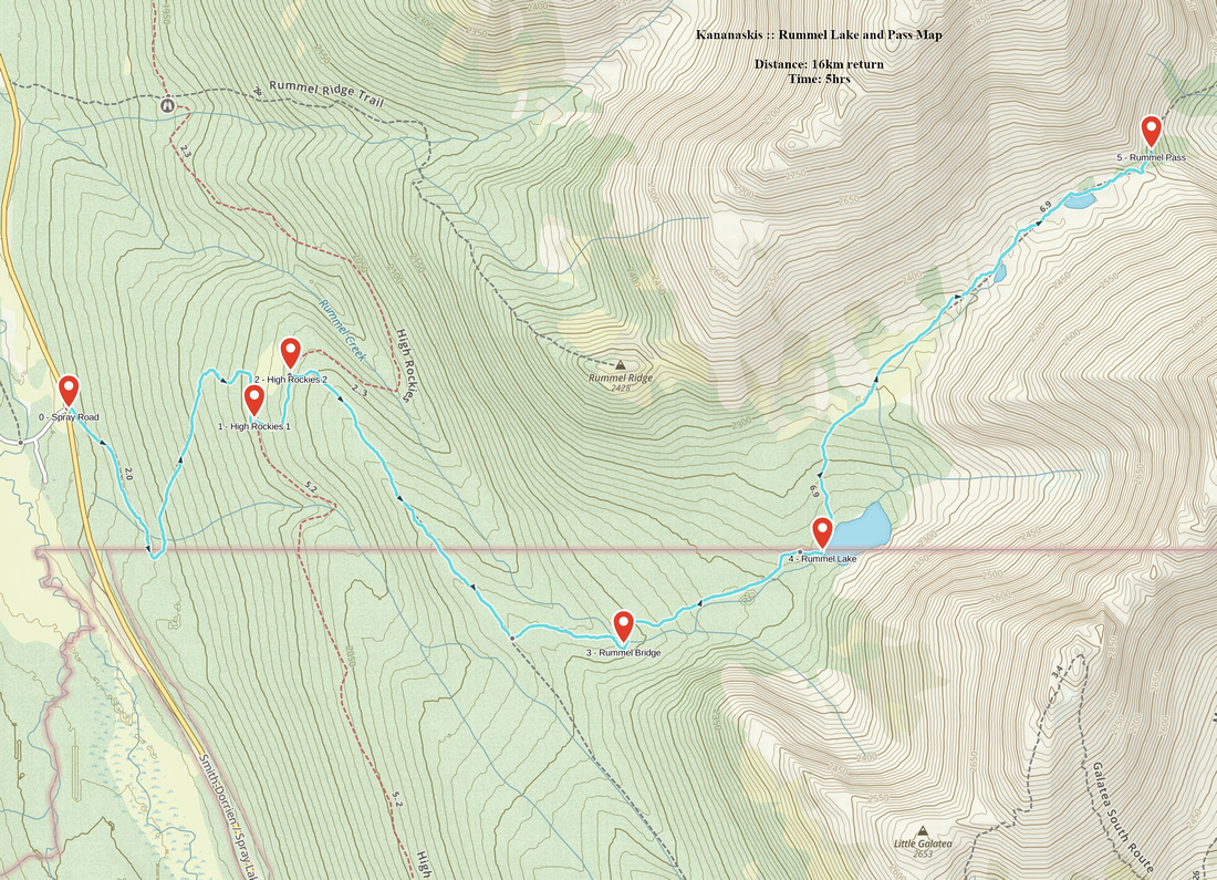 Rummel Lake and Pass GAIA Map
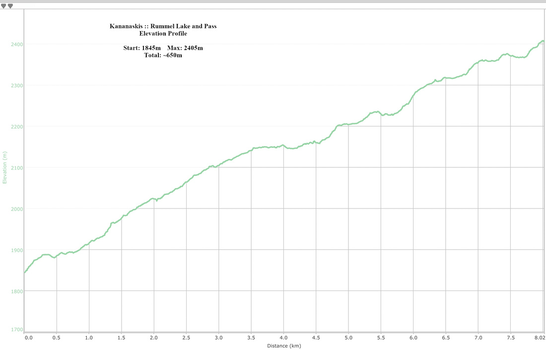 Rummel Lake and Pass Elevation Profile