Google Map |
Rockies :: Kananaskis :: South Buller Pass |
GPS Track |
 
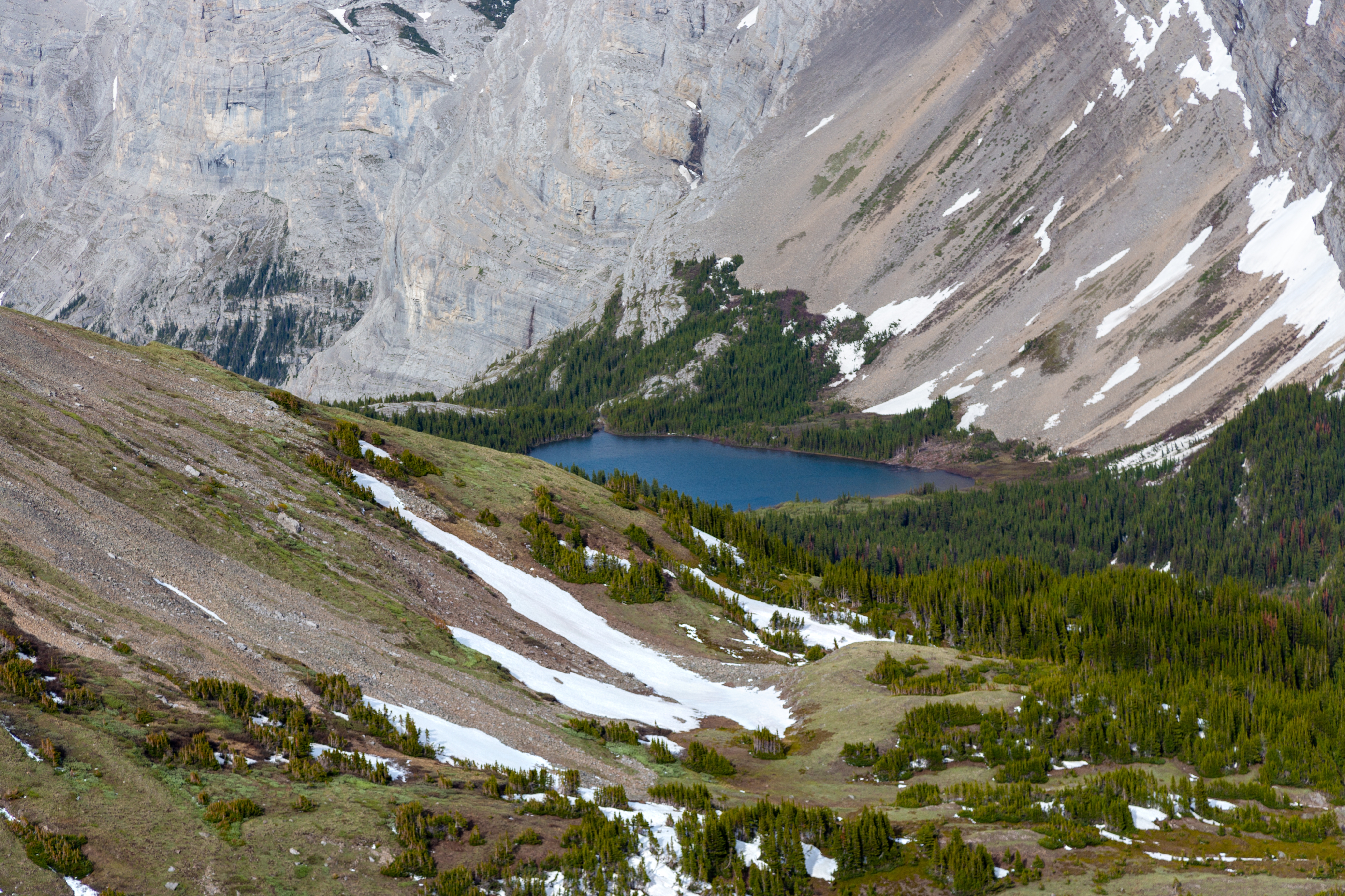
Terrific view east from South Buller Pass. Snowy Guinn Pass right, Guinn Peak, Kidd South and Mt. Kidd to its left. Ribbon Lake just left of center |
|||
| Trip Summary | |||
June 12, 2018Buller Pass Trail is classic K-country. Starting from Buller Creek Rec area on Spray Road well defined trail provides easy access to wonderful alpine that includes waterfalls, high-alpine passes, view of lakes and several relatively easily attained peaks. Many options are available, South Buller Pass being most common day hike destination. Others include loop return via North Buller Pass and through hike via Guinn Pass or Ribbon Lake to Hwy40 corridor. Ribbon Lake back-country campers not wanting to climb infamous Ribbon Chains sometime approach from this side too. Area is often snowbound till mid-June and as ascent of the pass is fairly steep it is best to wait till snow melts.
From parking walk back to road and find marked trailhead on east side. Trail is wide and easy to follow, joining Trans-Canada or "High Rockies" trail briefly, before starting ascent at north side of Buller Creek. Steep hillside is avalanche prone and blowdown trees sometimes block the trail; hopefully steep Kananaskis conservation fee will be used for backcountry trail maintenance. In about 3km trail reaches good bridge where Mt. Buller scramble access branches to the left. Main trail climbs somewhat steeply for about a kilometre topping in semi-open valley where Buller Creek has created some wonderful cascading waterfalls (Gallery). North Pass junction is just past small wood bridge and there used to be a sign here, but has been taken down as of July '23. Main trail continues SE through rockslides and semi-open larch forest reaching alpine bowl below South Buller Pass. Grade leading to the Pass is somewhat steep but of little consequence when dry as there is good scree trail. Shelter from the wind can be found by descending a bit east from 2530m high saddle that often has a cairn.
Fastest return back to Spray road is the same way and will be shorter. Popular - and recommended - extension is loop return via North Buller Pass, fully described here. It is more involved as there is some off trail hiking and North Pass is more difficult, but still in non-technical realm. |
|
Gallery |
|||
 Buller Creek Trail
Trail gradually gaining elevation on Buller Creek burnt hillside Buller Creek Trail
Trail gradually gaining elevation on Buller Creek burnt hillside |
|||
 Buller Pool
Lovely cascade collecting in crisp Buller Creek pool just past 1hr mark Buller Pool
Lovely cascade collecting in crisp Buller Creek pool just past 1hr mark |
|||
 North Buller Junction
Wood Post at ~4.3km mark has been taken off since and if heading for North Pass junction is easy to miss. It will be shortly after waterfall pool on previous photo as trail crosses short bridge North Buller Junction
Wood Post at ~4.3km mark has been taken off since and if heading for North Pass junction is easy to miss. It will be shortly after waterfall pool on previous photo as trail crosses short bridge |
|||
 Buller Alpine
Trail reaching alpine bowl below South Buller Pass among stand of Larch Trees, 15-20min past North/South Junction Buller Alpine
Trail reaching alpine bowl below South Buller Pass among stand of Larch Trees, 15-20min past North/South Junction |
|||
 Snowy Landscape
Looking back at barren alpine bowl just below South Buller Pass; note snow tracks. Mt. Engadine upper center Snowy Landscape
Looking back at barren alpine bowl just below South Buller Pass; note snow tracks. Mt. Engadine upper center |
|||
 |
|||
 South Buller Pass
View west from South Buller Pass. Mt. Assiniboine just poking distant center right; Mt. Engadine left South Buller Pass
View west from South Buller Pass. Mt. Assiniboine just poking distant center right; Mt. Engadine left |
|||
 |
|||
 |
Abstract
| Overall Difficulty | D3 | Trail hiking with steep talus slope below the Pass. More difficult if continuing on east side | |||
| Snow Factor | S3 | Steep talus slope below the pass often snowbound till July | |||
| Scenery | Buller Creek Waterfalls on approach. Great easterly panorama from the Pass (lead photo), incl. many K-country landmarks | ||||
| Trail/Marking | Very Good | Official Alberta Parks Trail; becomes faint in subalpine. Possibility of deadfall. North / South Pass junction now (July '23) easy to miss | |||
| Suggested Time | 3 hrs | One way to South Buller Pass; 5 hrs if returning same way | |||
| Elevation | Start: 1795m Max: 2530m Total: ~770m | Round Trip: 7.5km 1-way | |||
| Gear | Full Hiking Boots and Poles. Gaiters might be useful for snow field crossings in early season | ||||
| Water | Buller Creek and various seasonal creeks in alpine bowl below the pass. Carry 0.5-1L, depending on season | ||||
| Dog Friendly | Yes | Standard Back-country precautions; trail tends to get busy on weekends & dogs should be kept on leash | |||
 South Buller Pass GAIA Map
 South Buller Pass Elevation Profile