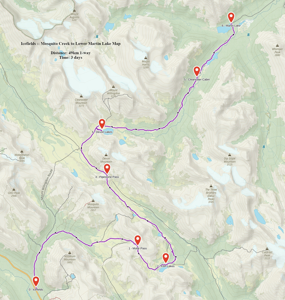
Google Map |
Rockies :: Icefields :: Devon Lakes |
GPS Track |
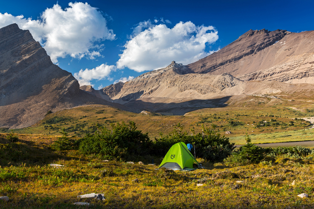 
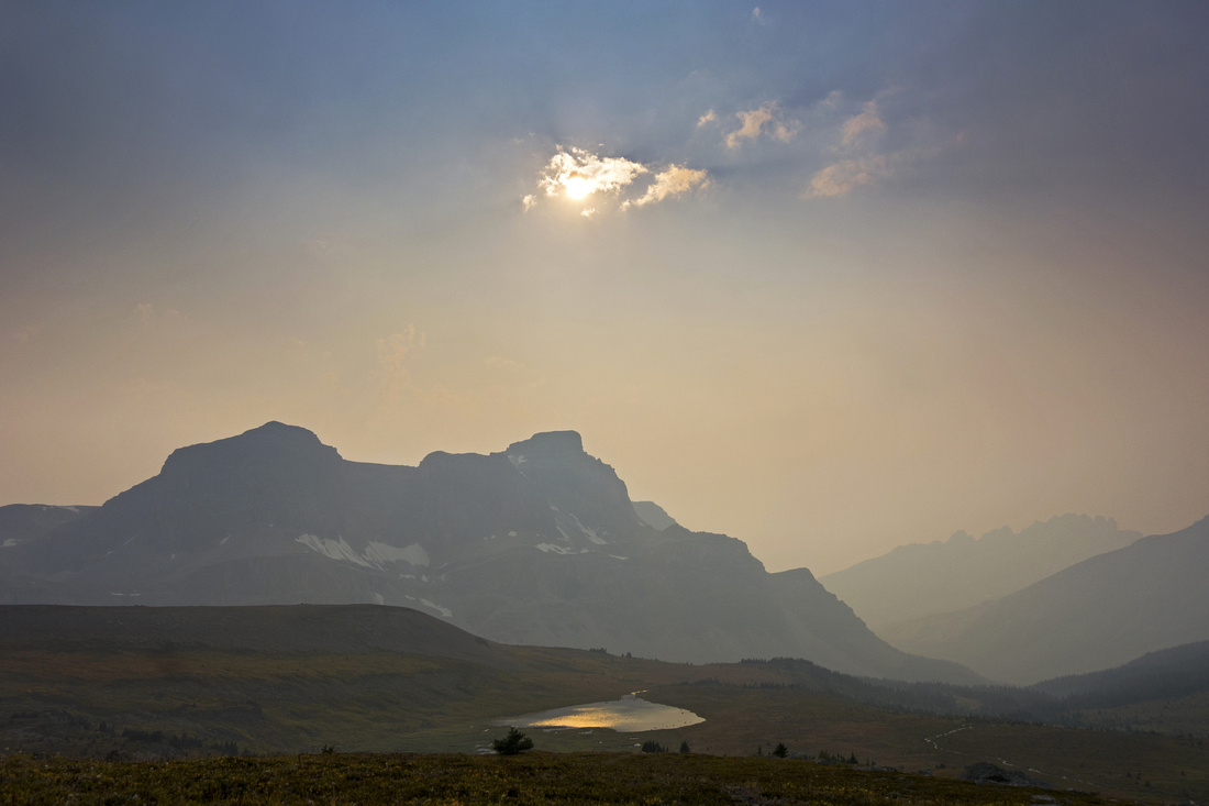
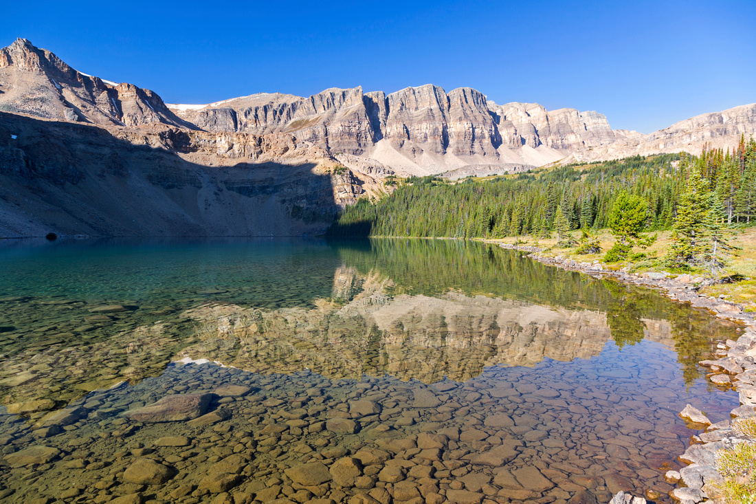
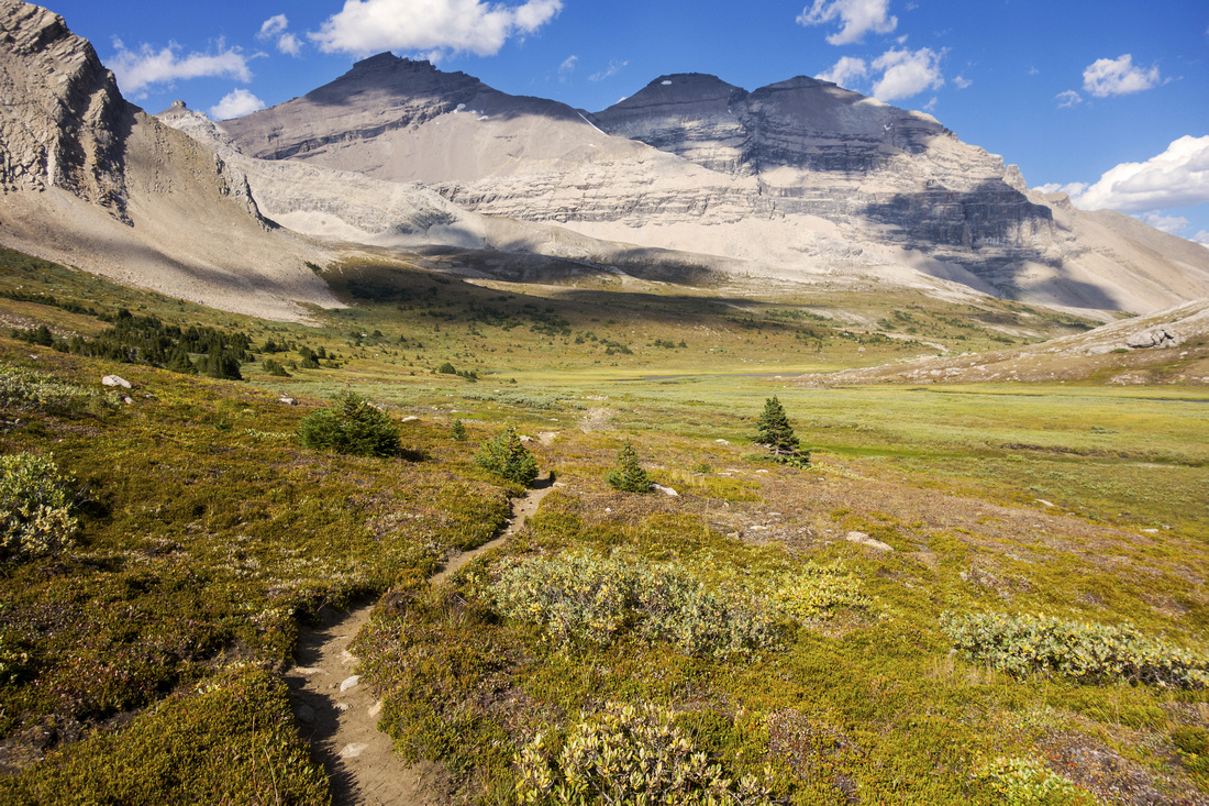
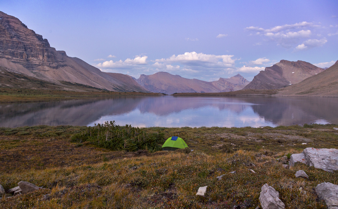
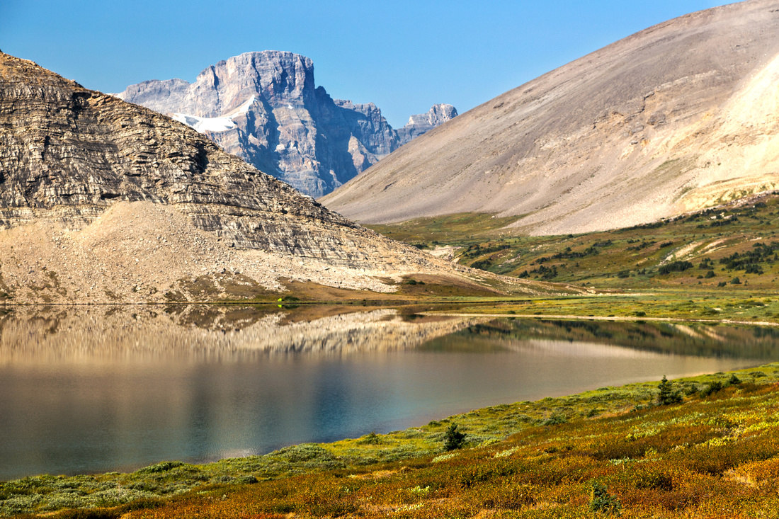
Lower Devon Lake bivi site with view of Mt. Willingdon (upper right) |
|||
|
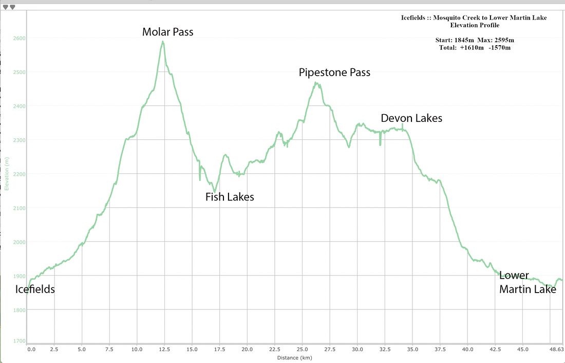
This report presents 4 days/3 nights journey into Siffleur wilderness at east ranges of Banff National Park. Dolomite Circuit loop, documented in excellent Patton-Robinson Canadian Rockies Trail Guide, is well known backpack, but few venture south over Clearwater Pass down Clearwater Lakes valley. Good trail, mostly used by horse outfitters, exists. Plan was to setup 2 nights bivi at beautiful Devon Lakes east of the Pass under Mt. Willingdon, then explore this seldom visited valley with luxury of day pack. In addition approach via Fish Lakes - Pipestone Pass was very appealing as it was an area I never visited before. Several days of high-pressure bomber weather in August of 2017 created ideal conditions. Even the smoke from wildfires that seem to become summer norm lifted, although hazy conditions returned on 3rd day. Daily breakdown (click on link for detail report for that day):
Day 4 was hike out back to Icefields via Fish Lakes (Days 1 and 2 in reverse). Initially I planned returning via (in)famous Quartzite Col, but changed my mind on the fly -- pack was lighter and I felt strong enough to hack ~34km in a day. Main reason being that Pipestone valley is simply so beautiful and I wanted another day of this alpine glory, now facing the opposite direction. Climb back from Fish Lakes to North Molar Pass was less tiresome than expected and overall I was glad I picked this longer return (although I am certain to try Quartzite col at some point, probably as express way back to Pipestone/Devon).
There are many out-of-this-world objectives in this area, including easy scrambles to Devon Peak or Clearwater Mountain, climb of Mt. Willingdon (scramble for most of the way except cliff band near the top), exploration of Martin Lakes valley / ascent of Mt. Harris, etc etc. I am certain to return at some point -- watch this space!
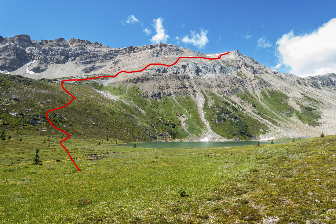
Update Aug '22: I returned to Devon, this time hiking in a day via Mosquito Col. After setting base camp at exactly same spot (lead photo on this page), I spent full day exploring wonderful Devon Lakes basin, including exploratory scramble to Devon/Deluc col - important shortcut for extremely rarely visited Deluc Alpine basin. More Details |
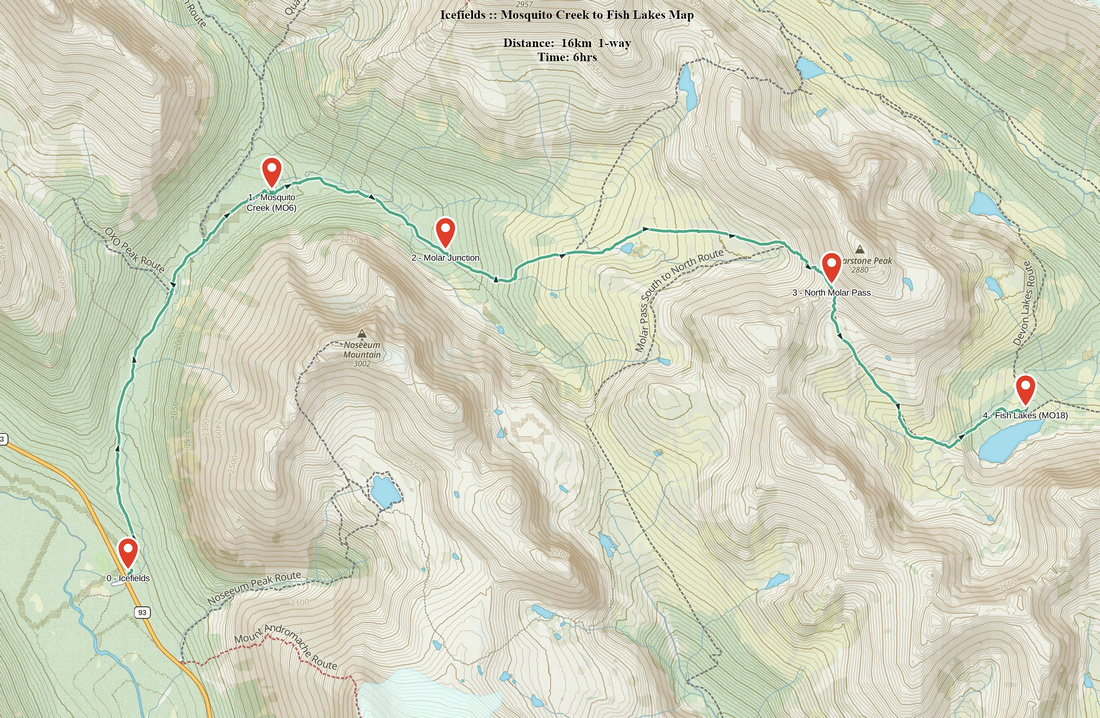
| Mosquito Creek to Fish Lakes | GPS Track | ||
|
Trailhead Parking is at Mosquito creek hostel and campground on west side of Icefields Parkway, some 20 minutes north from Lake Louise. (If you are leaving car overnight for several days, make sure your Park Pass is valid for entire time!). Trailhead is at other side of the road, past small bridge. Some trails, specially on BC Coast, require you to spend many hours below treeline before reaching the alpine; here it is simply not so! Only initial ~20min or so are spent hiking in the woods. Trail then drops onto Mosquito creek and views immediately open up. Follow the creek, passing unmarked Quartzite col turnoff by side tributary ~5km mark then reach official back-country Mo6 campground in about 1hr 20min from trailhead. Continue following creek in southerly direction to North Molar Pass junction (see gallery) and turn left. Section of rooty and moderately steep trail soon exits to spectacular meadow with views to die for! In summer alpine wildflowers make this stretch pure joy. Cross the outlet of large tarn to north side, then follow trail rising gently towards North Molar Pass, seen as "V" in obvious gap ahead. Climb to the pass is as easy as it looks; trail makes couple of talus zigs, then tops up on windblown alpine saddle, a highpoint for the day; 4-5hrs with heavy pack from the Icefields. "Molarstone" mountain (unofficial name) can easily be scrambled from the pass -- leave it for return, or even better day trip. On the other side trail drops more steeply. Views are spectacular, specially Cataract Peak in the distance -- a difficult scramble in optimal conditions. Finally after crossing large meadow upper Fish Lake comes into view (see gallery). Rock hop creek feeding the lake and descend to official campsite. There were no official tent pads on my trip, if still the case simply find nice sheltered spot. Picnic tables are right by the lake and a joy to have dinner/breakfast. Drinking / cooking water can be taken from the lake (boil), or walk 3-4min north and take directly from the creek in meadow. Lower Fish lake is ~10 min down the trail & for day-hikers the turnaround point. If backpacking, leave it for tomorrow morning as trail will take you in that direction anyways. |
|||
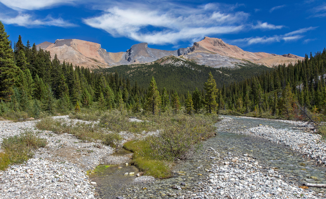 Mosquito Creek
 ~3km from trailhead with views of Quartzite (L), Ramp (C) and Mosquito Peak (L) Mosquito Creek
Mosquito Creek ~3km from trailhead with views of Quartzite (L), Ramp (C) and Mosquito Peak (L) |
|||
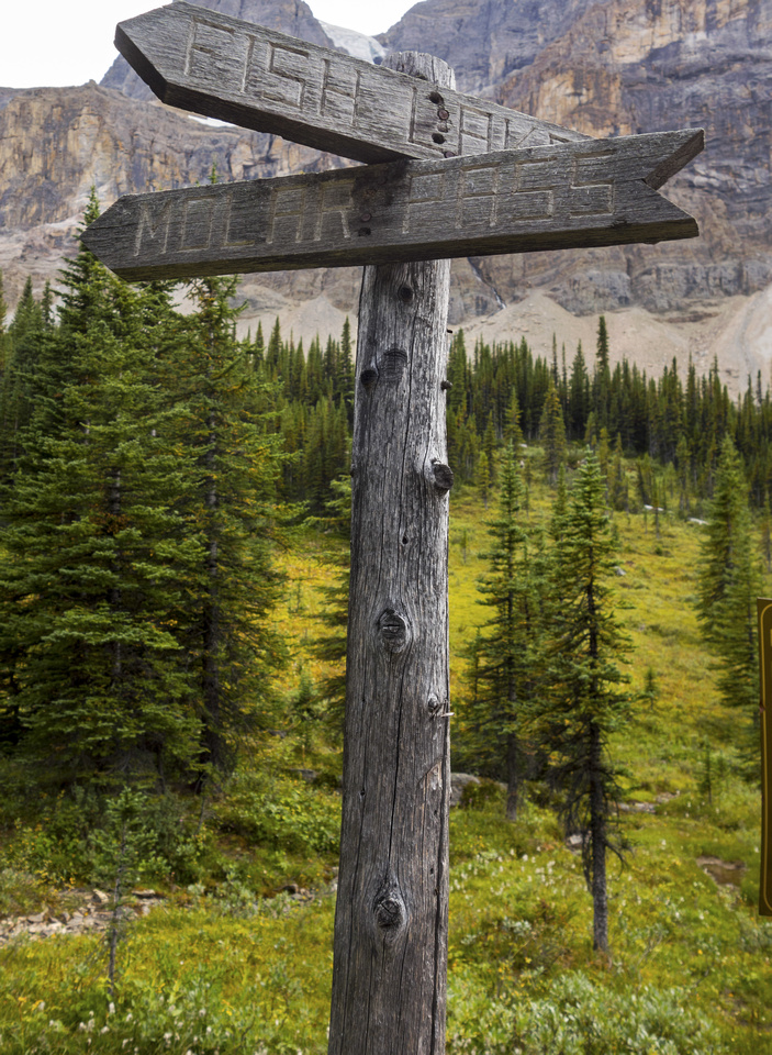 Molar - Fish Junction
Fish Lakes/Molar pass junction around 8km mark Molar - Fish Junction
Fish Lakes/Molar pass junction around 8km mark |
|||
 Molar Meadows
Entering beautiful alpine after ~1km climb past the junction. North Molar Pass right, Mosquito col center left is sometimes used as Pipestone shortcut, but drop on east side is quite steep Molar Meadows
Entering beautiful alpine after ~1km climb past the junction. North Molar Pass right, Mosquito col center left is sometimes used as Pipestone shortcut, but drop on east side is quite steep |
|||
 Molar Tarn
Beautiful alpine tarn on approach to North Molar Pass ("V" gap in center of photo) Molar Tarn
Beautiful alpine tarn on approach to North Molar Pass ("V" gap in center of photo) |
|||
 North Molar Pass ascent - as easy as it looks
 |
|||
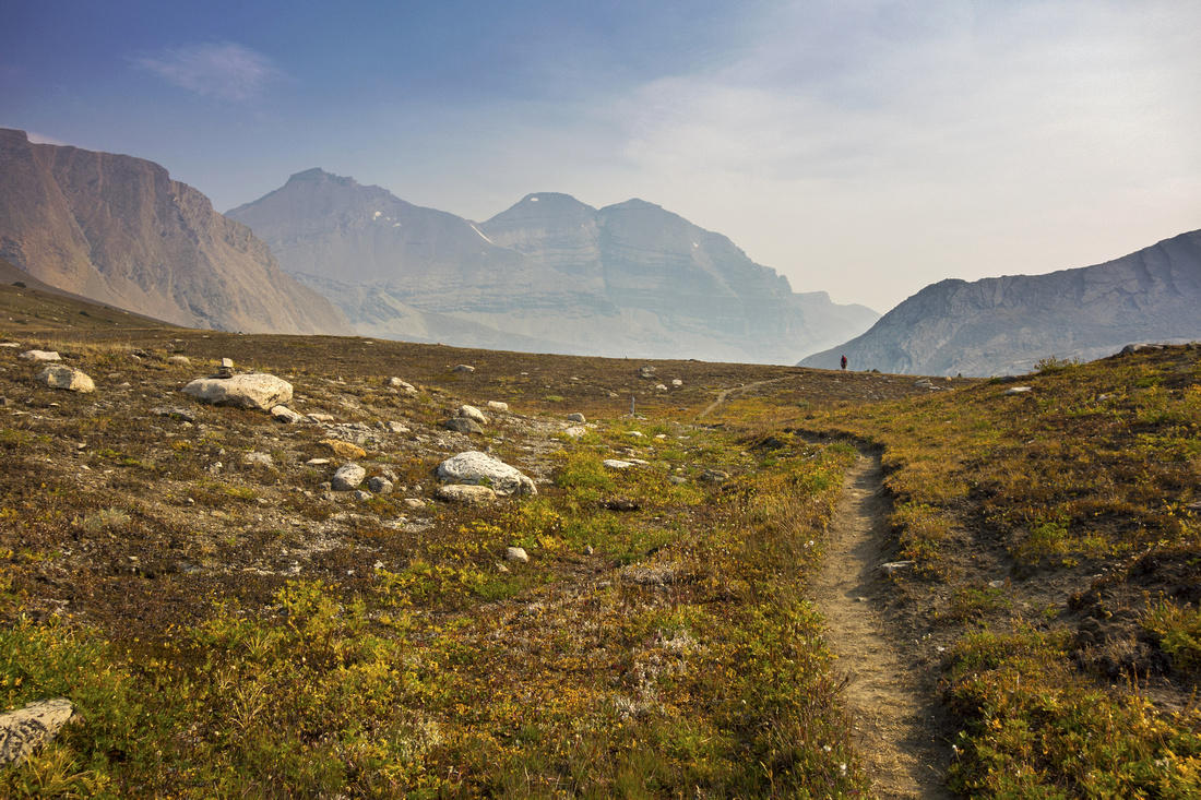
 Smoky Skyline
View back to Noseeum Peak below North Molar Pass. Picture taken on Day 4 return as smoke rolled in; compare with crisp conditions on Day 1! Smoky Skyline
View back to Noseeum Peak below North Molar Pass. Picture taken on Day 4 return as smoke rolled in; compare with crisp conditions on Day 1! |
|||
 North Molar Pass
Descent on east side of the Pass; note trail below. Fish lakes are still out of sight, ~45min away. Molar Mountain poking just left of center in the distance North Molar Pass
Descent on east side of the Pass; note trail below. Fish lakes are still out of sight, ~45min away. Molar Mountain poking just left of center in the distance |
|||
 Fish Lakes Descent
Wonderful alpine meadows approaching Fish Lakes; Cataract Peak distant center left ('22 trip) Fish Lakes Descent
Wonderful alpine meadows approaching Fish Lakes; Cataract Peak distant center left ('22 trip) |
|||
 Upper Fish Lake
; official Parks Canada campground Mo18 is on left side Upper Fish Lake
Upper Fish Lake; official Parks Canada campground Mo18 is on left side |
|||
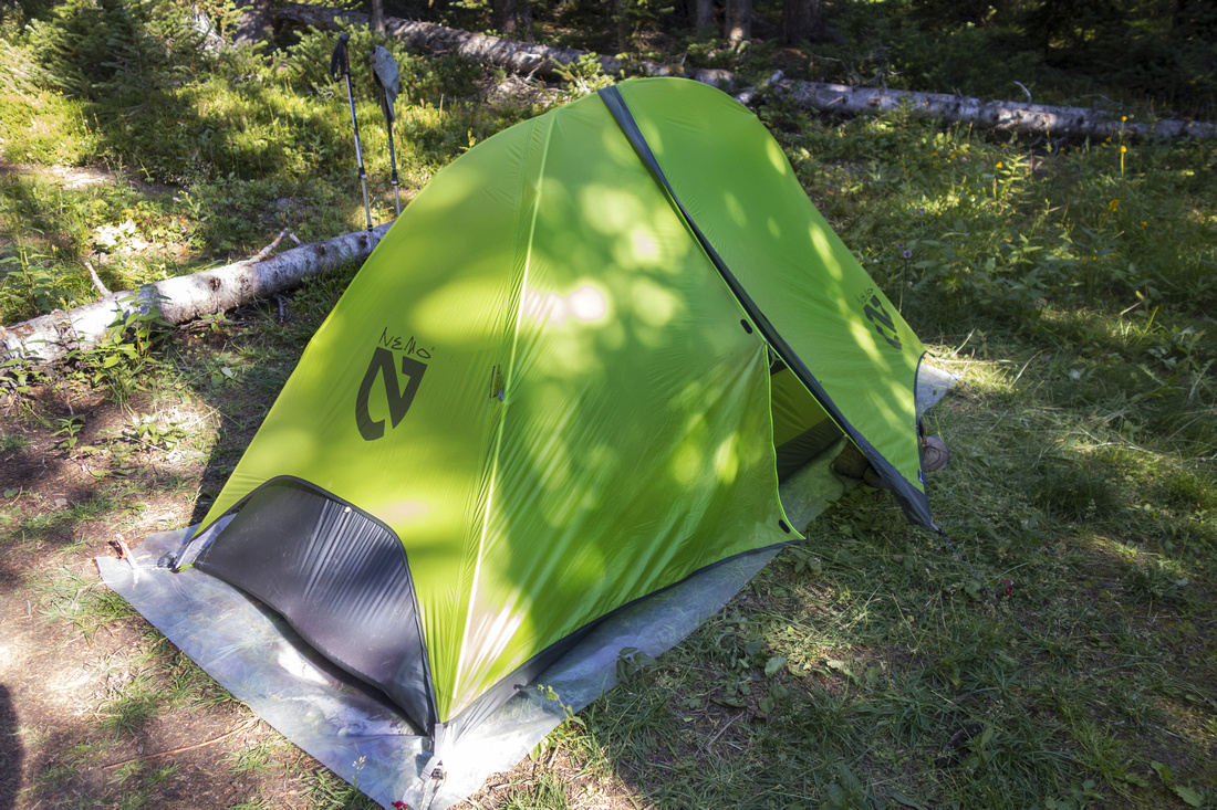 Camping Spot
Nemo at Mo18 campground. Very lightweight (~1kg) and excellent single-person tent. I improvised with tent floor at a time as I couldn't find Nemo original in Canada and online order from US was too expensive. Camping Spot
Nemo at Mo18 campground. Very lightweight (~1kg) and excellent single-person tent. I improvised with tent floor at a time as I couldn't find Nemo original in Canada and online order from US was too expensive. |
Abstract
| Overall Difficulty | D4 | Official Parks Trail. Rooty sections. Moderately steep talus. Creek rock-hop on east side of the Pass | |||
| Snow Factor | S2 | East side of the Pass is steeper and can harbor deep snow with possibility of post-holing early in the season | |||
| Scenery | Spectacular Alpine almost from the start. High alpine Pass crossing. Meadows, lakes and peaks | ||||
| Trail/Marking | Very Good | Official park maintained trail with bridged creek crossings and marked junctions | |||
| Suggested Time | 6 hrs | Moderate pace with heavy overnight backpack (1 way). Out-and-back day hike with light pack does not make much sense, but can be done in ~8hr return | |||
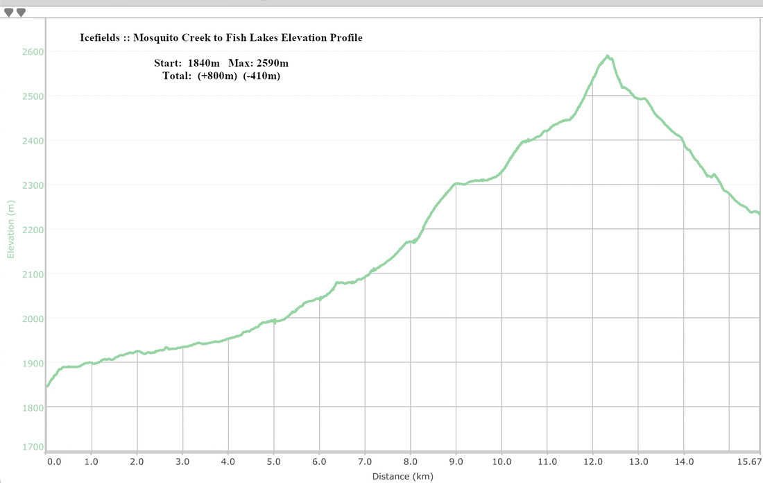
| Elevation | Start: 1840m Max: ~2590m End: 2230m Total: (+800m)(-410m) | Distance: 16 km (1-way) | |||
| Gear | Full Hiking boots and Overnight gear. Light hikers would probably suffice for summer day-hike. Hiking poles and gaiters. | ||||
| Water | Mosquito creek. Small creeks at both sides of North Molar Pass. No need to carry more than 1L | ||||
| Dog Friendly | Yes | Keep dogs under control as this is prime grizzly bear country and for consideration to other hikers. For overnight trips consider leaving pets at home | |||
 Mosquito Creek to Fish Lakes GAIA Map
 Mosquito Creek to Fish Lakes Elevation Profile
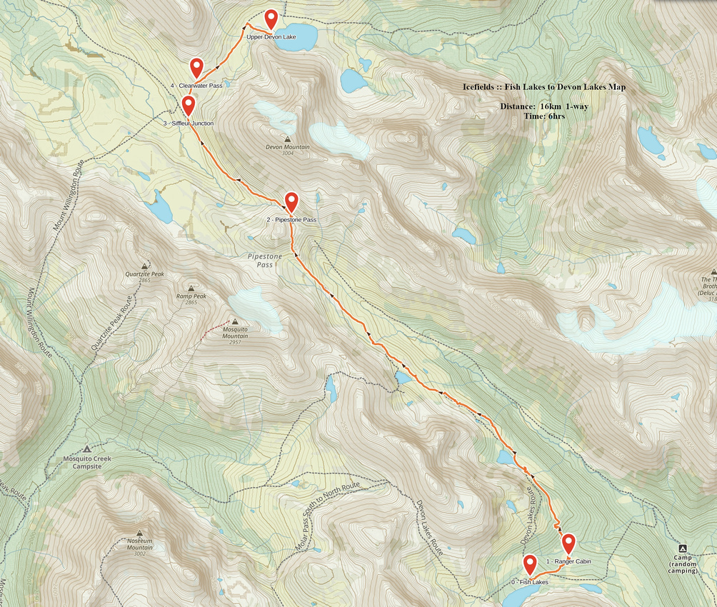
| Fish Lakes to Devon Lakes | GPS Track | ||
|
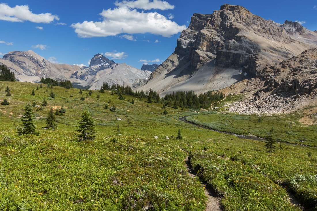
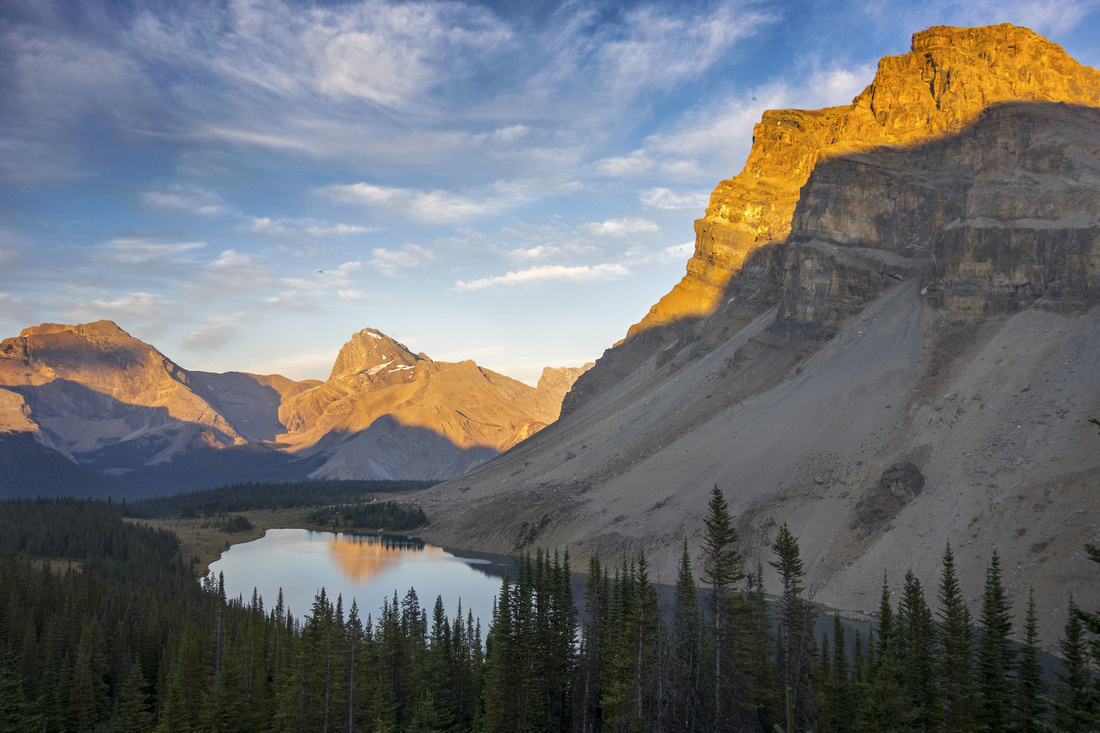
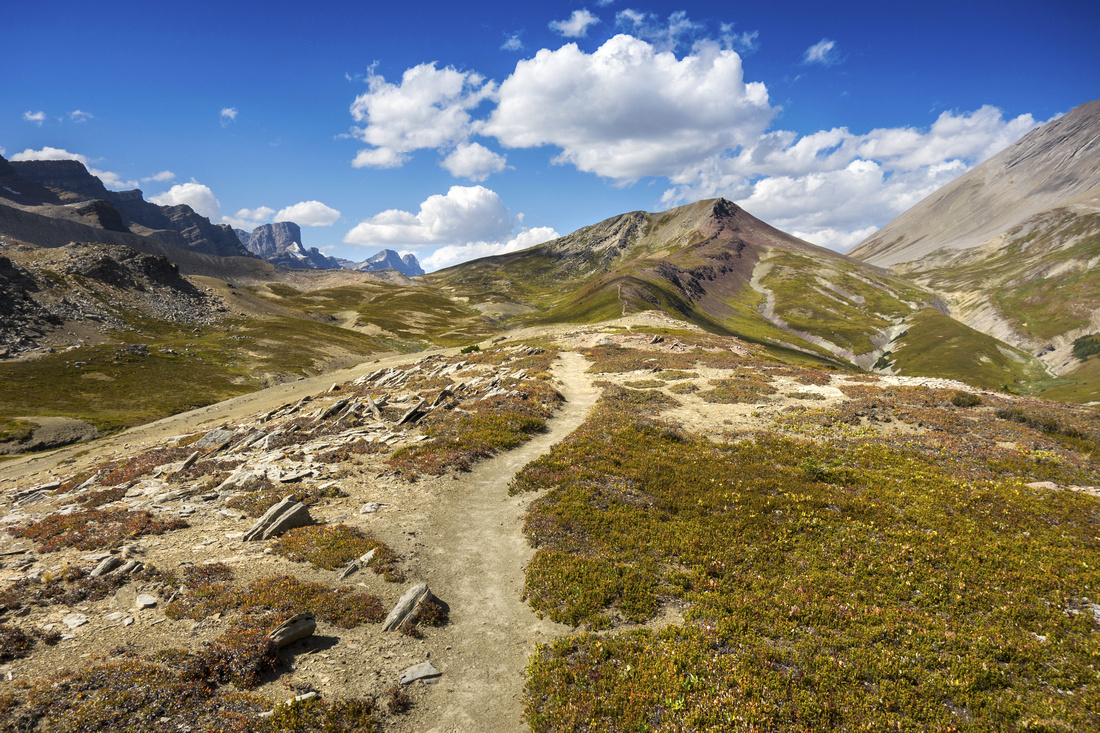
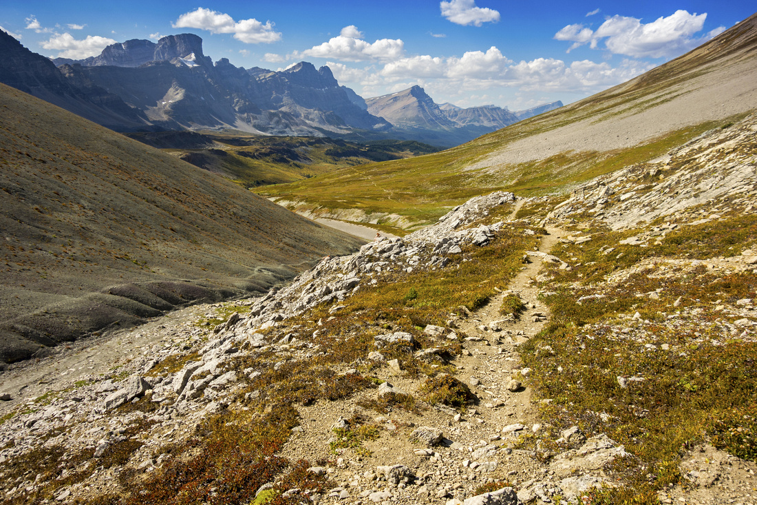
Spectacular alpine hiking gets whole new meaning on Day 2! Hike is relatively short and there is absolutely no need to rush. It is worth spending bit of time exploring Fish Lake environs that look absolutely brilliant under the morning light! After packing up camp, follow trail downhill towards lower Fish lake for ~10-15min to Parks Ranger Cabin. There are two ways to Pipestone Pass: by continuing straight one can descend to Valley floor and intersect Pipestone River Trail. This is rooty and muddy track and downright silly choice to make -- unless you are scrambler bound for Cataract Peak. Standard and way more scenic option is "Highline" trail that branches off just behind Ranger cabin. Trail crosses the creek (rock-hop) then ascends moderately through forest before descending to Moose Lake - one of scenic highlights of entire journey. It would be spectacular bivi spot & I've heard of people that do exactly that, even if it is not exactly by the rules considering nearby official Parks Campground! This is excellent second breakfast spot. Beyond the lake trail menders gently rising towards Pipestone Pass now visible in the distance. Hiking is spectacular with several small tarns and one beautiful meadow after another. Approaching the pass trail rises a bit steeper towards obvious rocky gendarme splitting the valley in half. It is possible to go on either side, but trail goes right and exits to Pipestone Pass proper; Valley trail joins in here. This pass is beautiful and desolate place with weathered Parks Canada table. For hikers in opposite direction there used to be sign made by rock pebbles pointing to Highline Trail. On the other side of the pass Siffleur valley opens up in all its splendor and it becomes clear why Dolomite Circuit is so highly rated backpack. Trail descends then enters stunt of low growth trees; be on alert for unmarked Clearwater Pass trail (Waypoint "Siffleur Junction" on GPS track). This trail turns south and climbs to vast meadow that constitutes Clearwater Pass. Devon Mountain is to the right and is an easy scramble from here, while Clearwater Mountain to the left is equally easy but accessed further down main Siffleur Trail. Mt. Willingdon, one of easiest 11000'ers comes into view directly ahead. Small tarn is to the right, but this is not Devon lake; continue for another 15min or so east from the pass and reach upper Devon Lake which is much larger body of water. Usual bivi is down the trail on north side of the lake, but I crossed to the other side and found beautiful secluded spot (see gallery) -- my home for next two nights.
|
|||
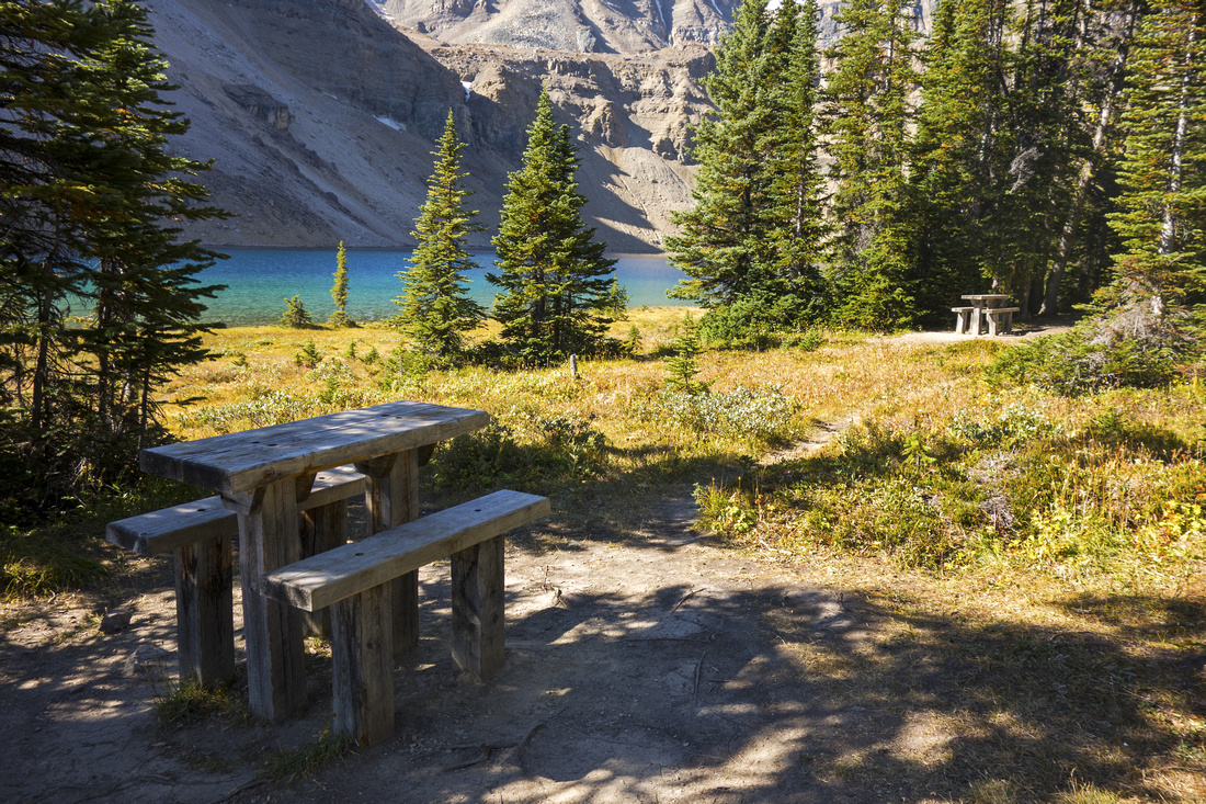 MO18 Picnic Site
Picnic tables at upper Fish lake in the morning MO18 Picnic Site
Picnic tables at upper Fish lake in the morning |
|||
 Upper Fish Lake
Glorious Morning View of Upper Fish Lake; this is prime reason why backpacking to such destinations is much preferred to day-hiking for photographers. You can't get this kind of light conditions in the middle of the day Upper Fish Lake
Glorious Morning View of Upper Fish Lake; this is prime reason why backpacking to such destinations is much preferred to day-hiking for photographers. You can't get this kind of light conditions in the middle of the day |
|||
 Ranger Cabin
Fish Lakes Park Ranger Cabin. "Highline" trail to Pipestone Pass heads north behind the cabin Ranger Cabin
Fish Lakes Park Ranger Cabin. "Highline" trail to Pipestone Pass heads north behind the cabin |
|||
 Moose Lake
Spectacular Moose Lake less than an hour from Fish Lakes Camp would be an excellent bivi spot Moose Lake
Spectacular Moose Lake less than an hour from Fish Lakes Camp would be an excellent bivi spot |
|||
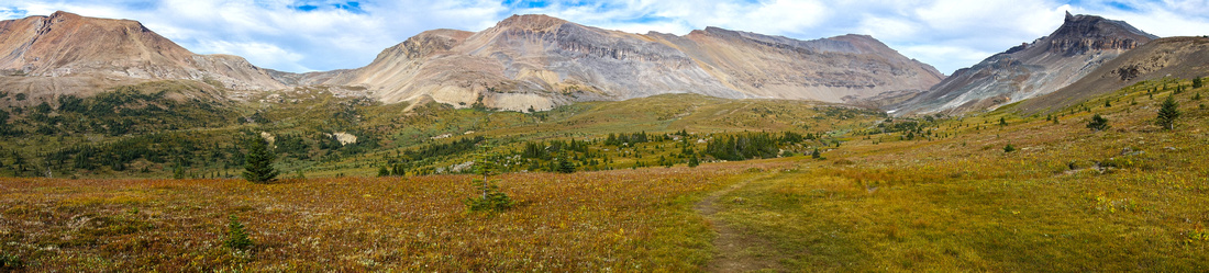
 Pipestone Meadows
Simply glorious alpine meadow stretches for miles east of Moose Lake. This photo probably illustrates best why "Highline" route is preferred Pipestone Meadows
Simply glorious alpine meadow stretches for miles east of Moose Lake. This photo probably illustrates best why "Highline" route is preferred |
|||
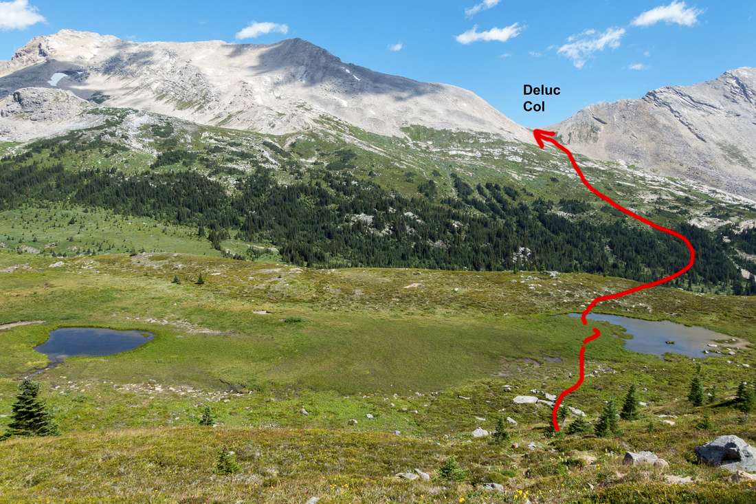
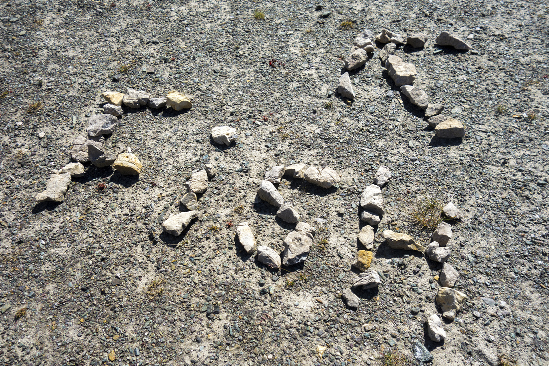
 Mosquito Col Route
Mosquito Col Alternate route, more involved than this photo might suggest. More Details Mosquito Col Route
Mosquito Col Alternate route, more involved than this photo might suggest. More Details |
|||
 Deluc Col Route
Alpine glory looking east. Obvious col in center is scramblers approach for rarely visited Deluc alpine basin ('22 trip) Deluc Col Route
Alpine glory looking east. Obvious col in center is scramblers approach for rarely visited Deluc alpine basin ('22 trip) |
|||
 Pipestone Pass
Approaching Pipestone Pass (right). It is also possible to go off-trail on left side of obvious hill ahead Pipestone Pass
Approaching Pipestone Pass (right). It is also possible to go off-trail on left side of obvious hill ahead |
|||
 Pipestone Pass Table
Weathered Parks Table at Pipestone pass. Valley route (not recommeded) joins "Highline" route here Pipestone Pass Table
Weathered Parks Table at Pipestone pass. Valley route (not recommeded) joins "Highline" route here |
|||
 Fish Highline Sign
Rock sign pointing to "Highline" route at Pipestone Pass Fish Highline Sign
Rock sign pointing to "Highline" route at Pipestone Pass |
|||
 Pipestone Pass
North side of Pipestone pass. Watermelon and Bobac Peaks left of Center, normally accessed from Alice lake. Siffleur Dolomite Circuit descends north; heading for Devon Lakes, watch for Clearwater Pass junction ~30min from here on the right side (unmarked) Pipestone Pass
North side of Pipestone pass. Watermelon and Bobac Peaks left of Center, normally accessed from Alice lake. Siffleur Dolomite Circuit descends north; heading for Devon Lakes, watch for Clearwater Pass junction ~30min from here on the right side (unmarked) |
|||
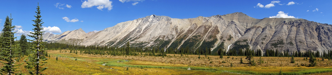
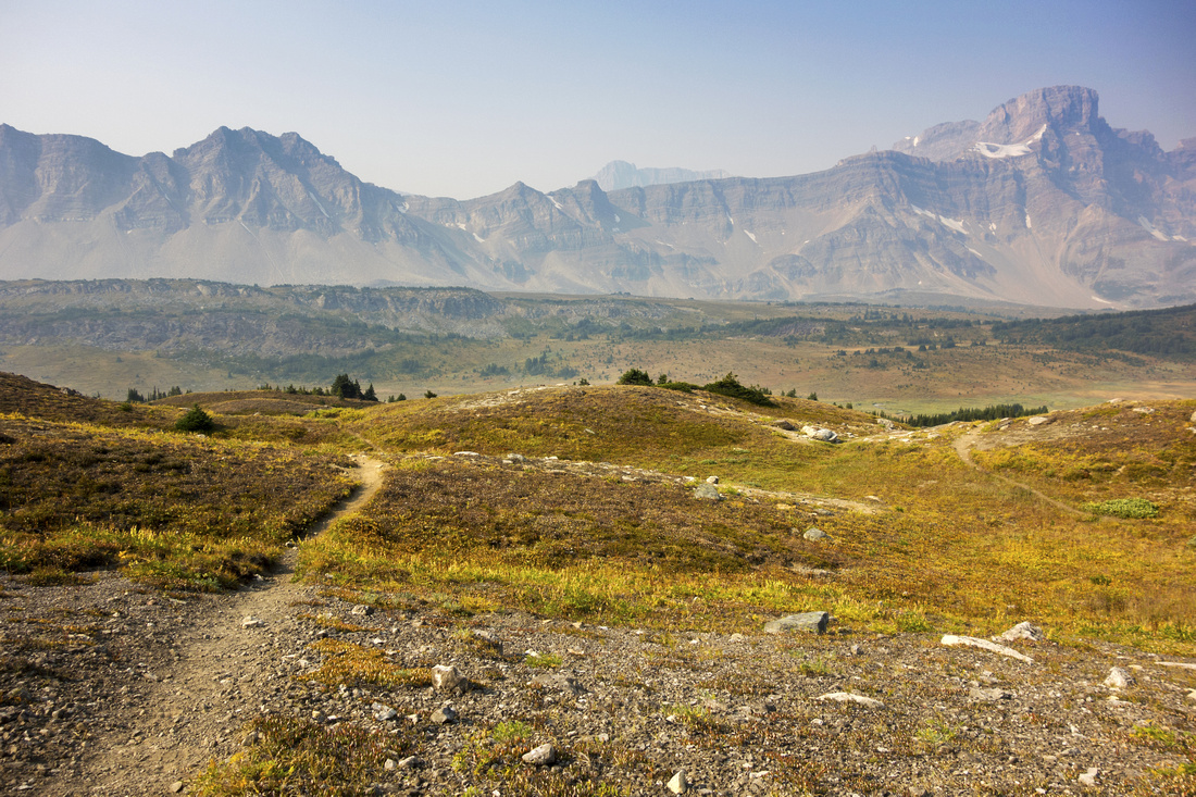
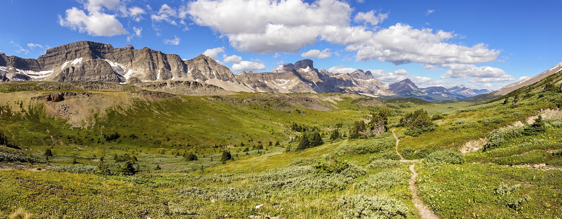 Siffleur Wilderness
 north of Pipestone Pass. Classic Dolomite Circuit trail continues down the valley Siffleur Wilderness
Siffleur Wilderness north of Pipestone Pass. Classic Dolomite Circuit trail continues down the valley |
|||
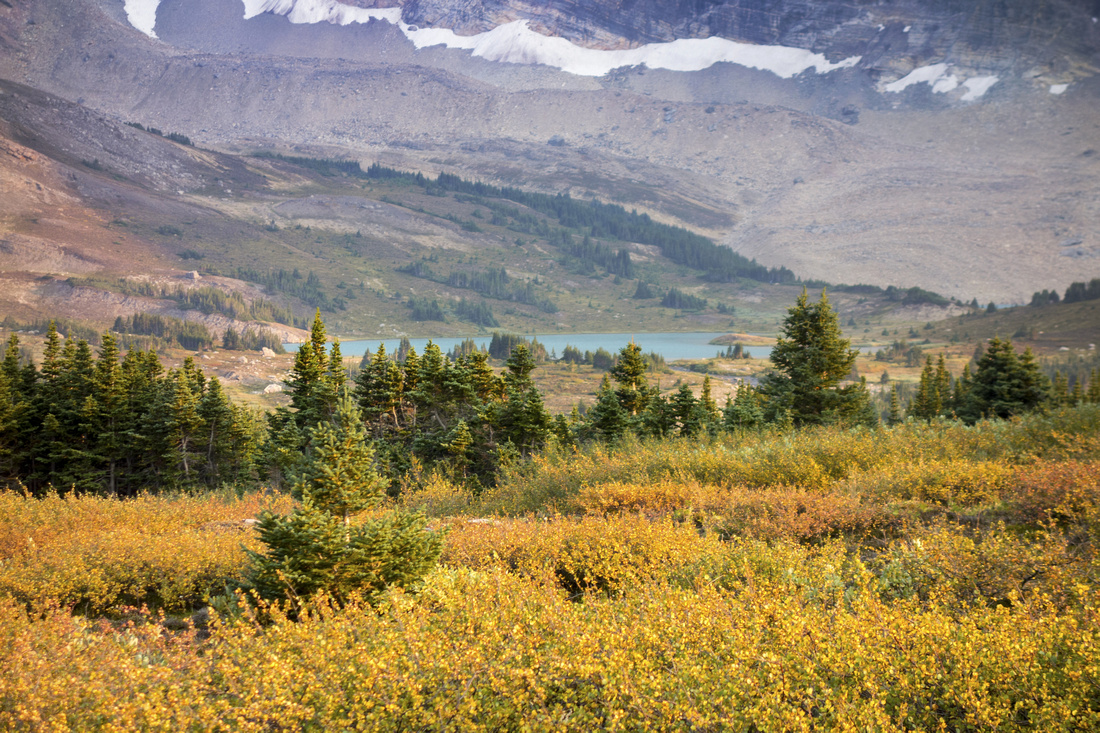
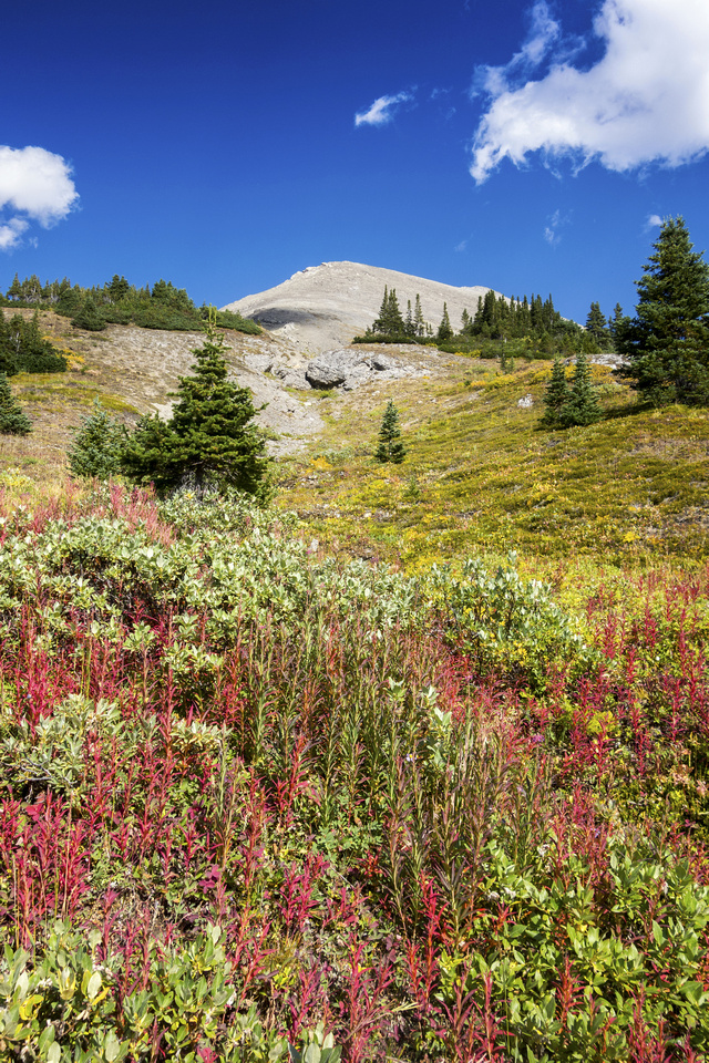 Wildflower Meadow
Summer alpine wildflower slope below Devon Peak, already past Clearwater Pass junction Wildflower Meadow
Summer alpine wildflower slope below Devon Peak, already past Clearwater Pass junction |
|||
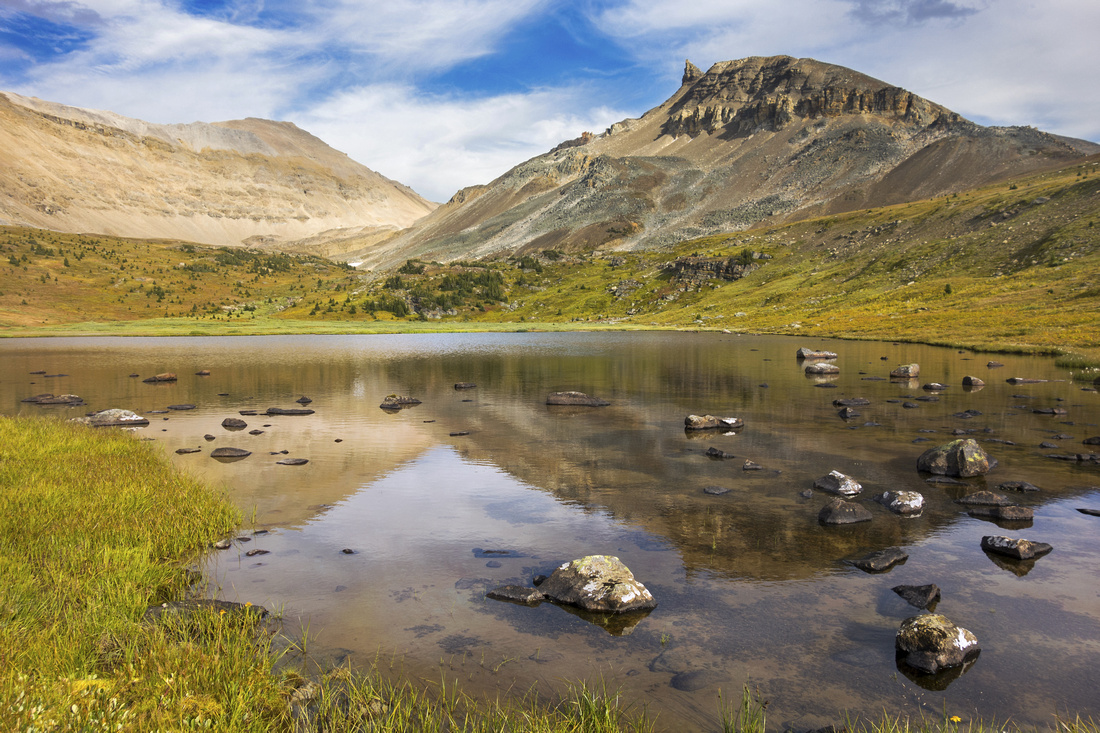
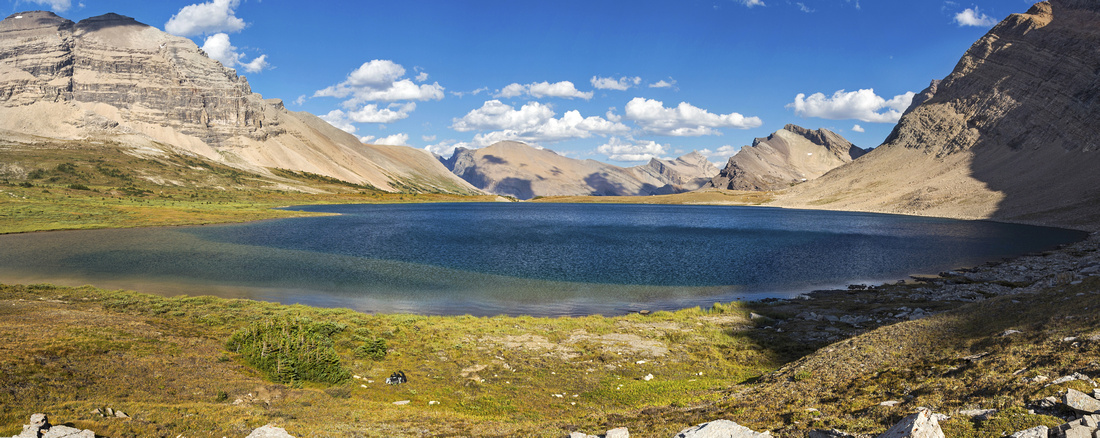
 Clearwater Pass
Spectacular Alpine of Clearwater Pass. Mt. Willingdon and Crown rising above. Upper Devon Lake is ~20min from here just behind the corner Clearwater Pass
Spectacular Alpine of Clearwater Pass. Mt. Willingdon and Crown rising above. Upper Devon Lake is ~20min from here just behind the corner |
|||
 Clearwater Pass
Same view on Day 4 - note air quality difference! Person in the distance was trail running entire Dolomite circuit that day! Clearwater Pass
Same view on Day 4 - note air quality difference! Person in the distance was trail running entire Dolomite circuit that day! |
|||
 Clearwater Pass
View back (west) from Clearwater Pass, also taken on Day 4 return. Quartzite Col left of center Clearwater Pass
View back (west) from Clearwater Pass, also taken on Day 4 return. Quartzite Col left of center |
|||
 Upper Devon Lake
 from little rise above my bivi site. People usually bivi on north (left) side of the lake, but this was just as good if not better Upper Devon Lake
Upper Devon Lake from little rise above my bivi site. People usually bivi on north (left) side of the lake, but this was just as good if not better |
|||
 Bivi Site
Nemo enjoying twilight colors at upper Devon Lake Bivi Site
Nemo enjoying twilight colors at upper Devon Lake |
Abstract
| Overall Difficulty | D3 | Trail hiking with couple of steeper ups and downs. Minor unbridged creek crossings (rock-hop) | |||
| Snow Factor | S2 | Little avalanche danger, but location is remote | |||
| Scenery | Pipestone valley, with one of most beautiful alpine meadows in BNP. Moose Lake and couple of high alpine passes. Gorgeous Devon Lake setting under Mt. Willingdon | ||||
| Trail/Marking | Good | Trail occasionally fades away in the alpine but direction is obvious and always easy to pick-up again. Unmarked Clearwater Pass junction on descent from Pipestone Pass | |||
| Suggested Time | 6 hrs | Relaxed pace with plenty of photo breaks | |||
| Elevation | Start: 2230m Max: ~2450m End: 2320m Total: (+620m) (-480m) | Distance: 16 km | |||
| Gear | Full Hiking boots and Overnight gear. Hiking poles and gaiters. | ||||
| Water | Moose Lake and Several creeks in Pipestone Valley. Carry ~1L | ||||
| Dog Friendly | Yes | Keep dogs under control as this is prime grizzly bear country and for consideration to other hikers. As this is overnight trip consider leaving pets at home | |||
 Fish Lakes to Devon Lakes GAIA Map
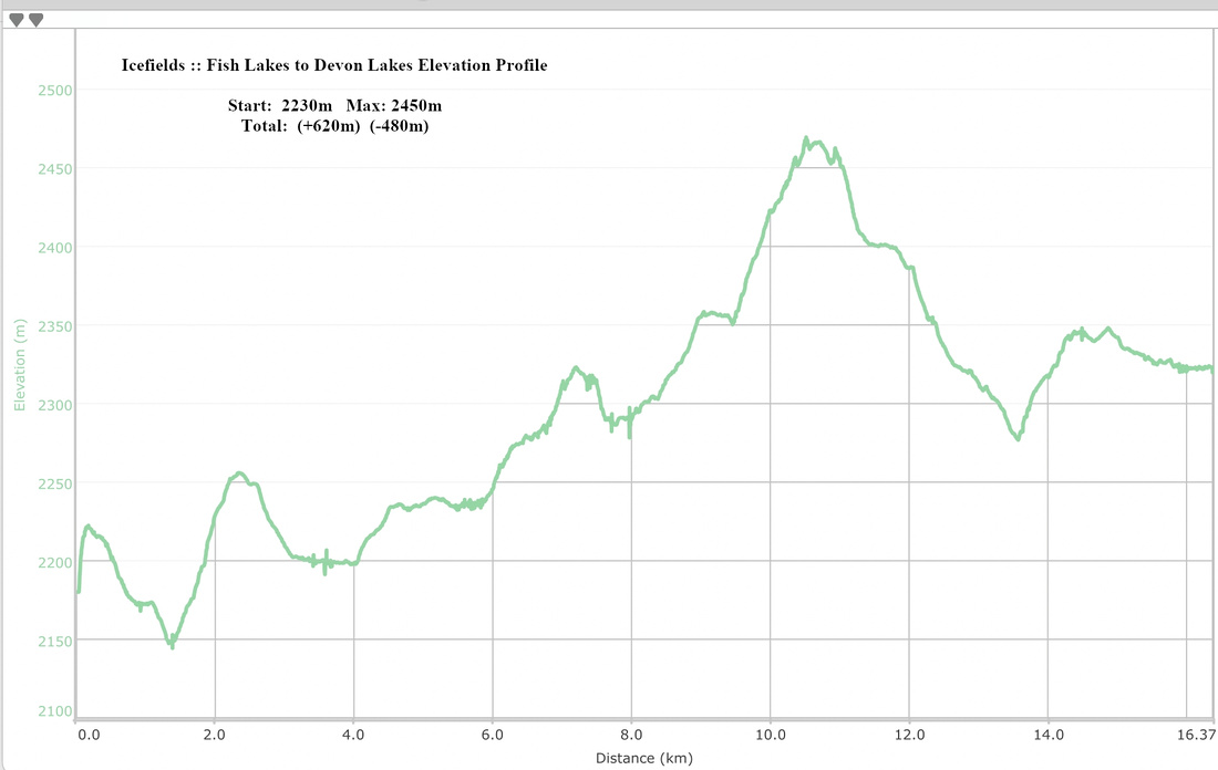 Fish Lakes to Devon Lakes Elevation Profile
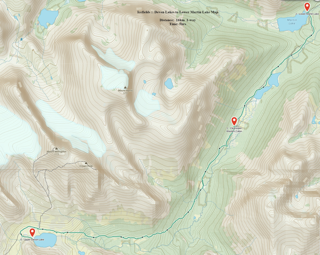
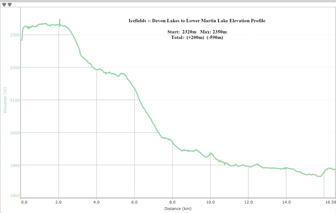
| Devon Lakes to lower Martin Lake | GPS Track | ||
|
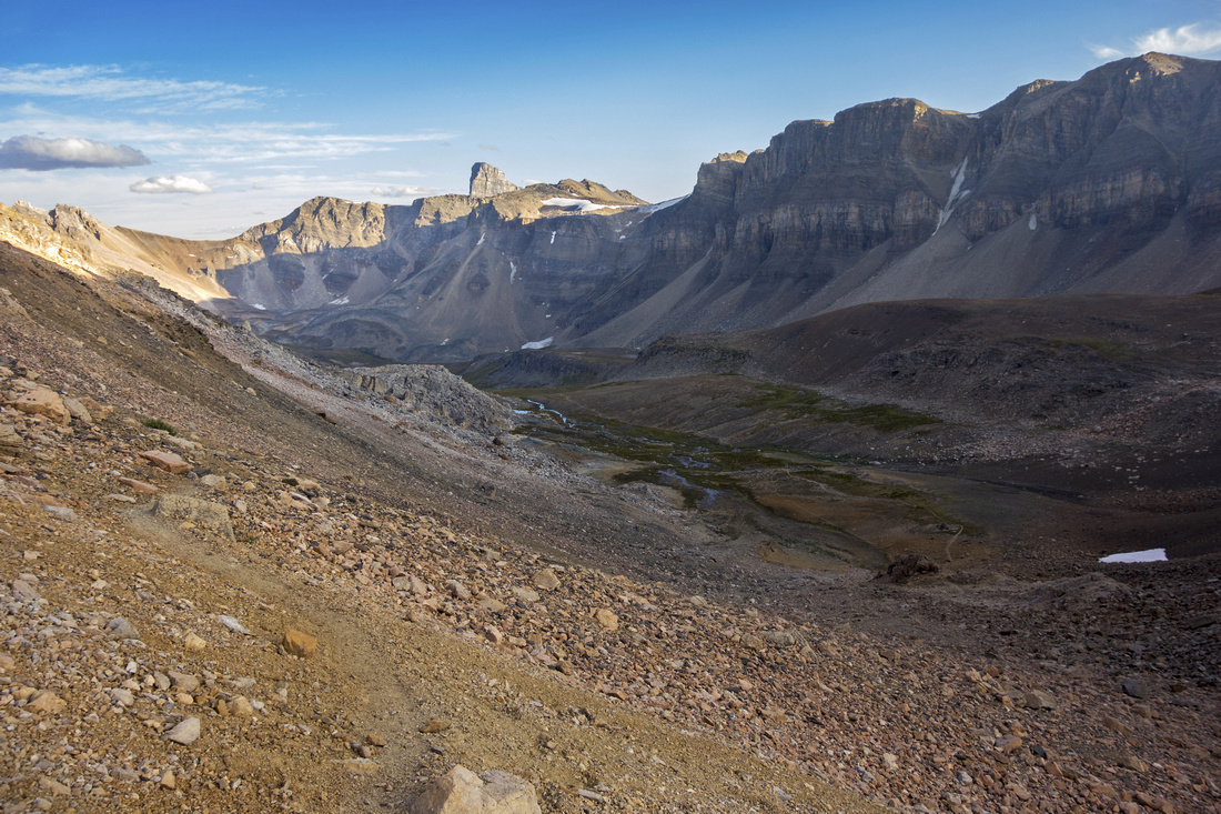
Third day was exploratory out-and-back down Clearwater River Valley to Lower Martin Lake. There are many other objectives in the area, but I tend to favor exploration of rarely traveled areas to trophy peakbagging. That being said, Mt. Willingdon is clearly the main prize of the area, and I'd have gone for it - if it was not for the cliffband near the top I was fairly confident I'd not be able to scramble on my own. So after breakfast I set of down the valley with light pack; most gear stashed at Devon bivi where I'd return that evening. Added incentive was chance to see two large back-country lakes not to many people ever visit, as well as Clearwater Ranger Cabin I heard much about. Unfortunately smoke already started to obscure the vistas (another reason to favor valley floor hike to high elevation), but excitement of stepping down rarely traveled path made for it. Trail crosses meadow south of upper Devon Lake, then drops several 100's of meters to Clearwater Valley. Always well defined and very pleasant trail and I made good progress, passing camp site along the way, apparently still in use. Further down air became a bit stuffy from advancing smoke and visibility worsened; by the time I crossed washed out area below Mt. Harris ( 2.5 hrs from Devon bivi) it was quite hazy. Undeterred I continued and soon enough reached Clearwater Lakes; two beautiful bodies of water in surreal settings due to haze. Nearby was ranger cabin, and it is in simply awesome spot (see Gallery). I sat on the porch all by myself (and likely not another human soul in 20km radius at least) and had lunch; I could easily spend whole summer right there, detached from all nonsense of modern 'civilization', petty rat race, social media stupidity etc etc. Continuing trail got a bit bushy but was still easy to follow. Finally I reached lower Martin lake outlet - my turnaround point. Trail continues on the other side but crossing (ford) is not trivial, even with low water. I trashed a bit upstream instead then spent another peaceful 30 minutes at shore of vast lower Martin Lake, gazing with longing towards mysterious Martin Lakes valley and Mt. Harris, almost teasing "come and get me".
Return back to Devon bivi was faster, even if it involved climbing back; I was not exploring behind every corner as I was going in. Whole area is simply magical; in particular I am teased with Martin Lakes valley riches that beg to be explored. If it only was not so far from trailhead. I will return at some point I am certain. Back at camp, can of beer left chilling in the lake was adequate conclusion to awesome day, already scheming plans of return to the area; stay tuned!
Hike out after packing up the camp on day 4 was, as mentioned on top of the page, days 1 and 2 in reverse and despite considerable distance highly enjoyable as well. |
|||
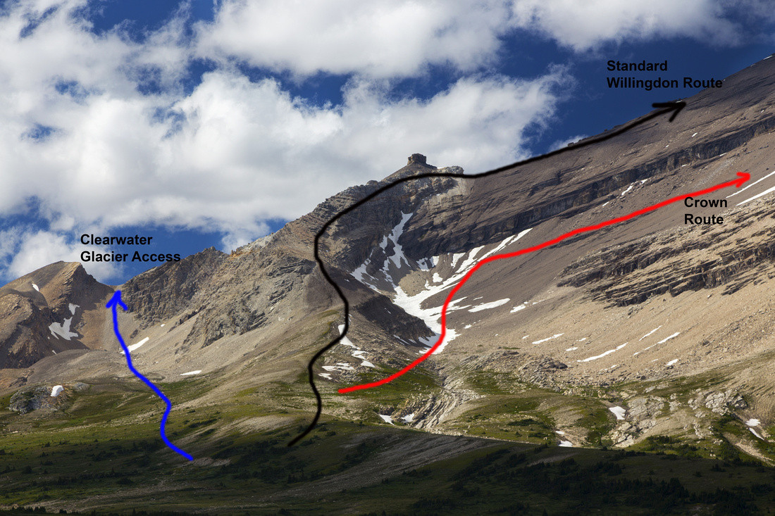 Willingdon Routes
Three possible Willingdon routes from upper Devon outlet. Blue - most direct line for Clearwater Glacier and remote Harris/Augusta valley. Black - Standard Willingdon mountaineering ascent. Red - Crown saddle scramble approach ('22 photo) Willingdon Routes
Three possible Willingdon routes from upper Devon outlet. Blue - most direct line for Clearwater Glacier and remote Harris/Augusta valley. Black - Standard Willingdon mountaineering ascent. Red - Crown saddle scramble approach ('22 photo) |
|||
 Upper Devon Lake
View back to Devon bivi site (green dot at other side of the lake) and Clearwater Pass. Watermelon mountain behind Upper Devon Lake
View back to Devon bivi site (green dot at other side of the lake) and Clearwater Pass. Watermelon mountain behind |
|||
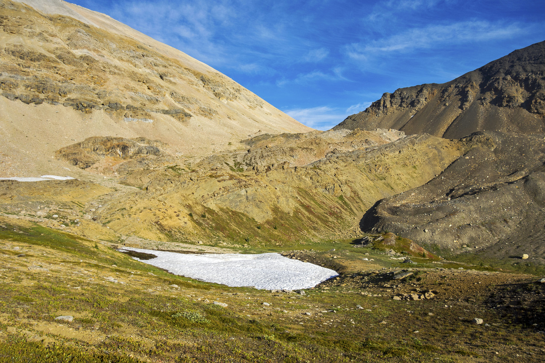
 Lower Devon Alpine Basin
Lower Devon Lake as trail starts descent to Clearwater Lakes Valley Lower Devon Alpine Basin
Lower Devon Lake as trail starts descent to Clearwater Lakes Valley |
|||
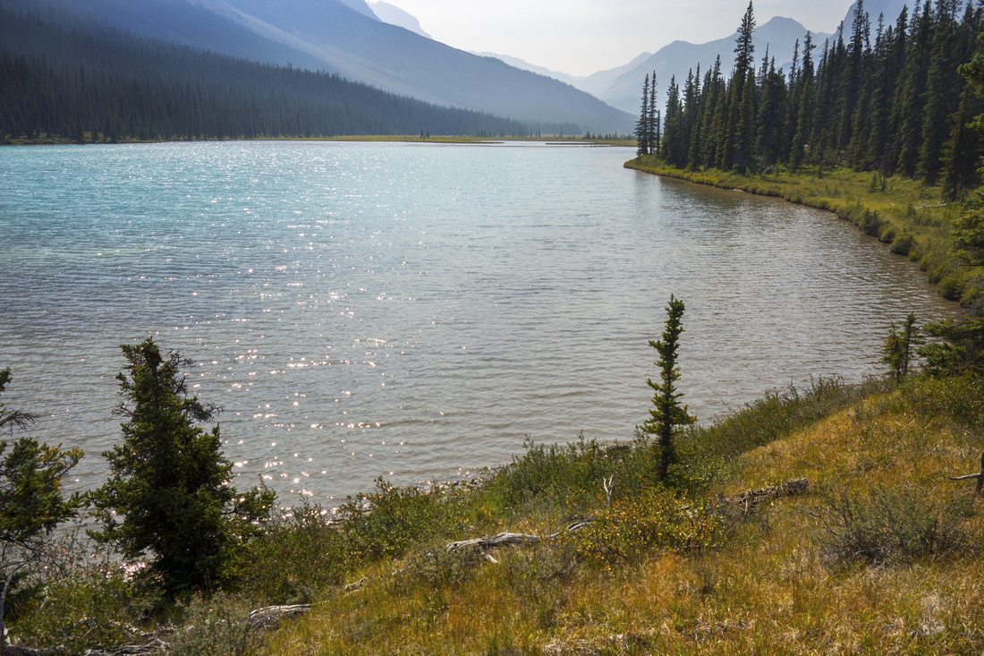
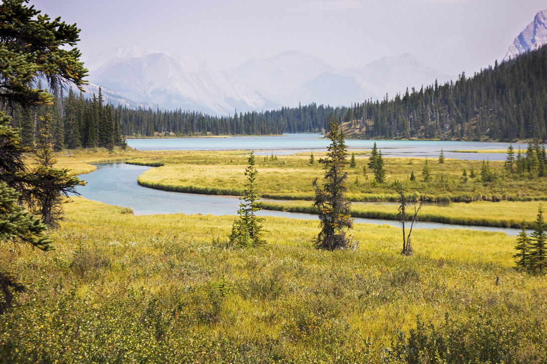 Clearwater Lakes
 in surreal setting due to wildfire smoke; ~3 hrs from Devon bivi Clearwater Lakes
Clearwater Lakes in surreal setting due to wildfire smoke; ~3 hrs from Devon bivi |
|||
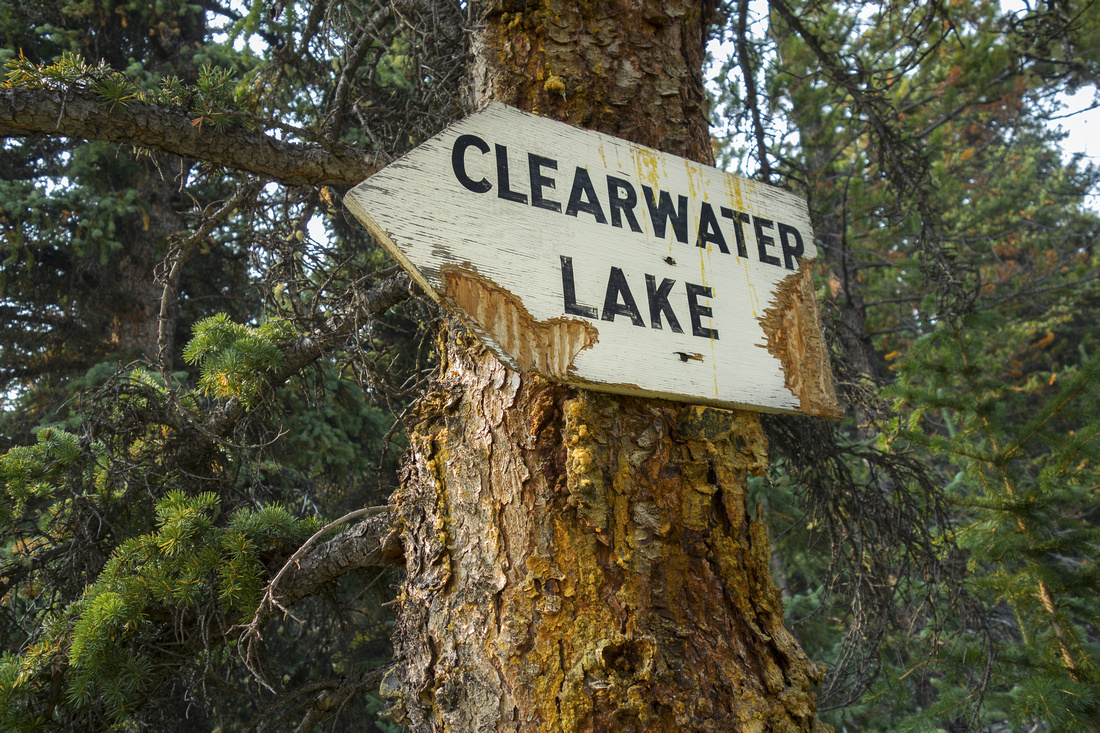 Weathered Sign
Weathered sign near the lake has seen better days! Weathered Sign
Weathered sign near the lake has seen better days! |
|||
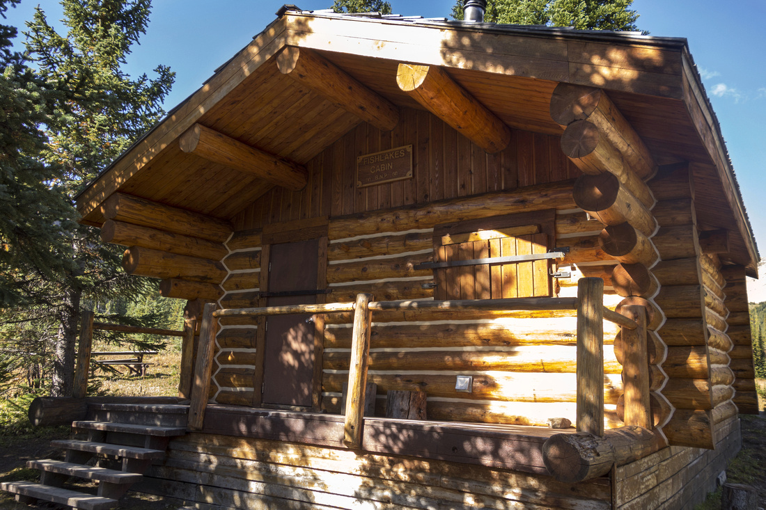
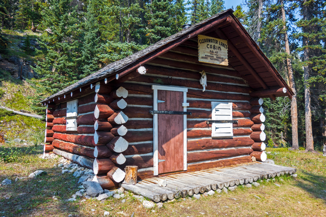 Ranger Cabin
Clearwater Lakes Ranger Cabin, built in 1930 and recognized Federal Heritage Building Ranger Cabin
Clearwater Lakes Ranger Cabin, built in 1930 and recognized Federal Heritage Building |
|||
 Ranger Cabin Yard
View from Clearwater Ranger Cabin porch; simply awesome place. Horse coral was to the left, and there was footpath leading to drinking water source - outlet of upper Clearwater Lake Ranger Cabin Yard
View from Clearwater Ranger Cabin porch; simply awesome place. Horse coral was to the left, and there was footpath leading to drinking water source - outlet of upper Clearwater Lake |
|||
 Upper Clearwater Lake
View back upper Clearwater Lake; Dip Slope peak just left of upper center Upper Clearwater Lake
View back upper Clearwater Lake; Dip Slope peak just left of upper center |
|||
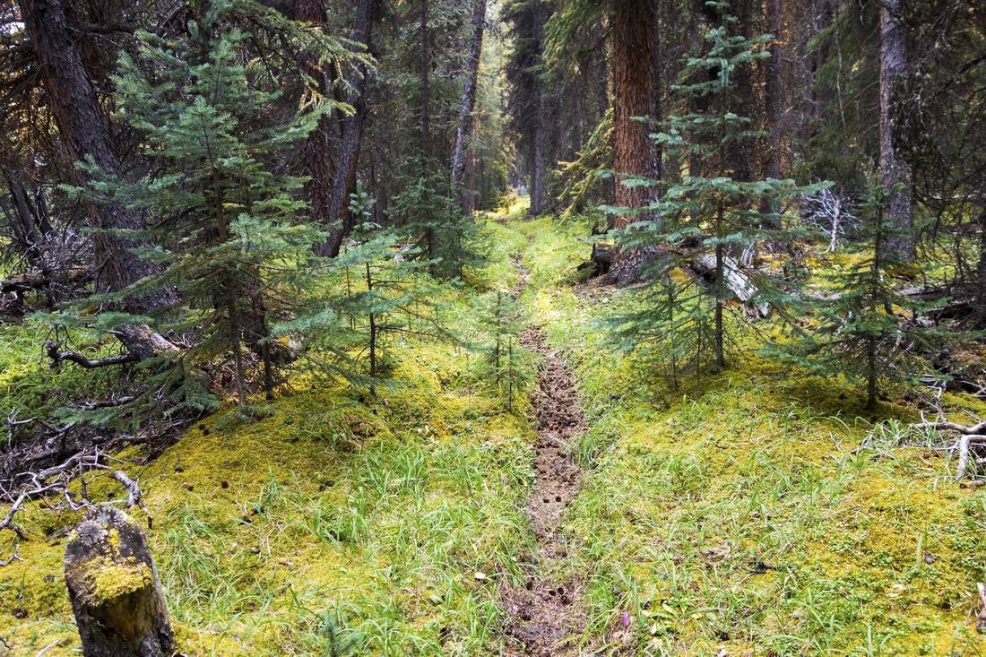 Clearwater Trail
Trail dips in forest past Clearwater Lakes and becomes less defined, but still obvious and easy to follow Clearwater Trail
Trail dips in forest past Clearwater Lakes and becomes less defined, but still obvious and easy to follow |
|||
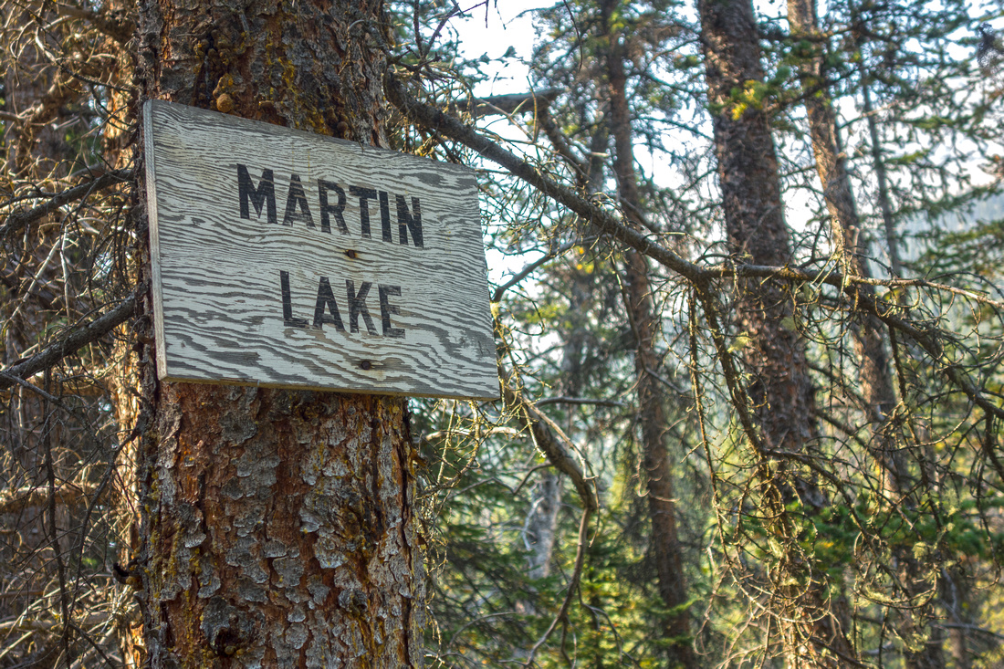 Martin Sign
Nearing lower Martin Lake as sign --in considerably better shape --indicates Martin Sign
Nearing lower Martin Lake as sign --in considerably better shape --indicates |
|||
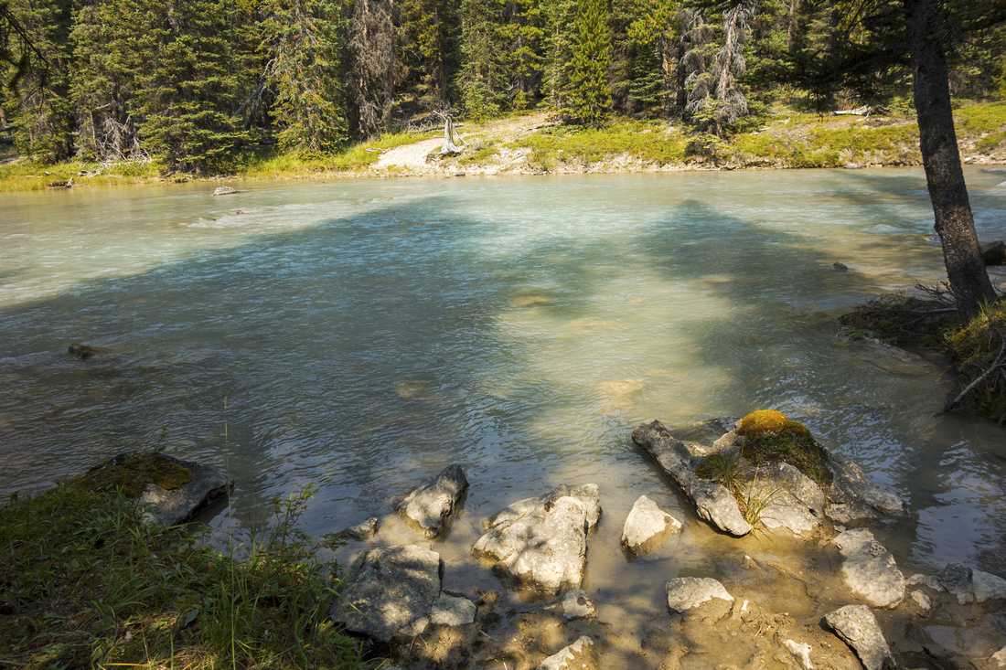 Martin Outlet
Lower Martin Lake outlet crossing and my turnaround point. Apparently not an easy ford. Trail continues on the other side. Wonderful Trident lake, awesome bivi spot, is ~30 min away Martin Outlet
Lower Martin Lake outlet crossing and my turnaround point. Apparently not an easy ford. Trail continues on the other side. Wonderful Trident lake, awesome bivi spot, is ~30 min away |
|||
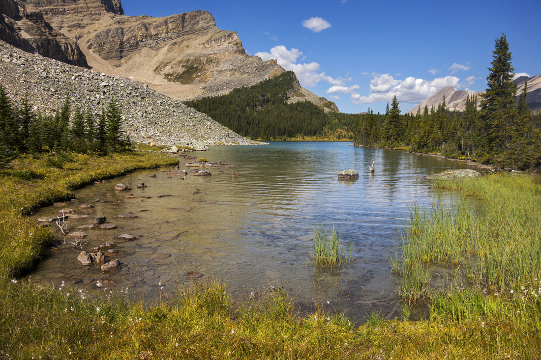
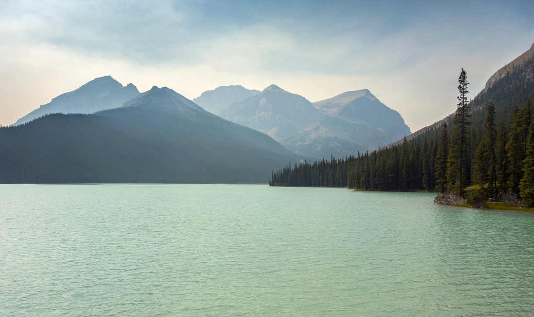 Lower Martin Lake
Mystical lower Martin Lake. I sat here for 30 minutes just gazing ahead, wishing I could continue exploring. Elusive Mt. Harris (3309m) center right. Martin Lakes valley was approach used by first recorded ascent party in early 20th century Lower Martin Lake
Mystical lower Martin Lake. I sat here for 30 minutes just gazing ahead, wishing I could continue exploring. Elusive Mt. Harris (3309m) center right. Martin Lakes valley was approach used by first recorded ascent party in early 20th century |
|||
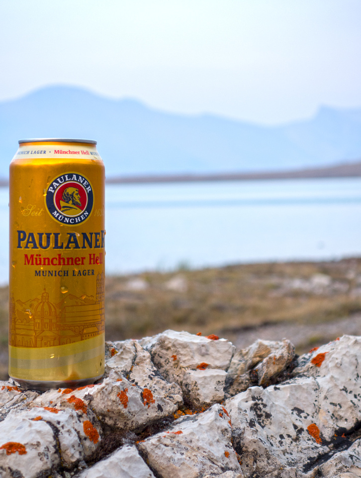 Cheers!
Refreshment after dinner back at Devon bivi after extremely satisfying day Cheers!
Refreshment after dinner back at Devon bivi after extremely satisfying day |
Abstract
| Overall Difficulty | D3 | Trail hiking with moderately steep descent to Clearwater Valley (ascent on return!) | |||
| Snow Factor | S2 | Little avalanche danger, but location is remote | |||
| Scenery | Clearwater Lakes and Lower Martin Lake. Devon Lakes alpine Meadows. Remote wilderness of Banff National Park with many seldom seen peaks | ||||
| Trail/Marking | Good | Clearwater valley trail used occasionally by horse outfitters. Generally well defined with one washed out section as drainage coming down Mt. Harris hits valley floor | |||
| Suggested Time | 8-9hrs | Return time to Lower Martin Lake with day pack | |||
| Elevation | Start: 2320m Max: ~2350m End: 1890m Total: (+200m, -590m 1-way to Lower Martin Lake) | Distance: 33 km (Devon bivi return) | |||
| Gear | Day Pack with overnight gear left at Devon Lake bivi | ||||
| Water | Clearwater Lakes and several drainages coming off Mt. Harris. Carry ~1L | ||||
| Dog Friendly | Yes | Keep dogs under control as this is prime grizzly bear country. As this is overnight trip in remote back-country consider leaving pets at home | |||
 Devon Lakes to Lower Martin Lake GAIA Map
 Devon Lakes to Lower Martin Lake Elevation Profile