Google Map |
Rockies :: Icefields :: Noseeum Lake and Mountain |
GPS Track |
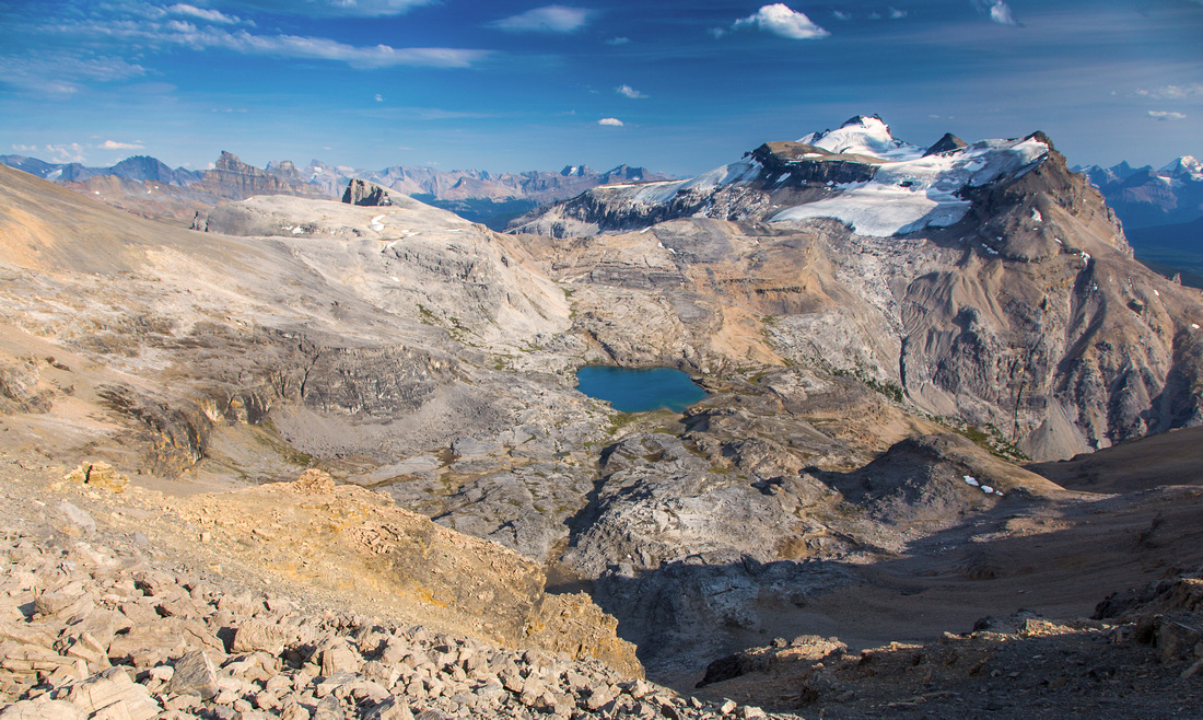 
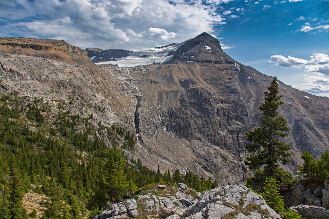
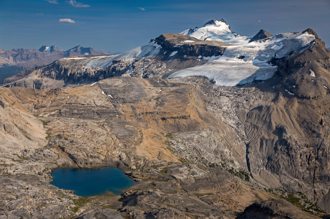
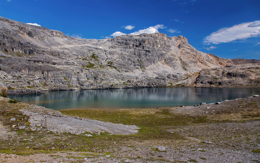
Noseeum Basin from ascent ridge. Molar glacier and Mt. Andromache behind. Big peak behind is Mt. Hector |
|||
| Trip Summary | |||
August 2, 2015Rarely visited basin at headwaters of Noseeum creek with spectacular scenery throughout. Noseeum lake can be spotted from Mt. Andromache, but access has not been documented in hiking guidebooks and as such is still very much off the beaten path. Reasonable way in exists, but it should be attempted by experienced hikers only with good route-finding skills that will limit difficulties to easy scrambling only. Much possibilities for further exploration exist above the lake. Most attractive option, that can be completed as day-hike from Icefields Parkway, is ascent of 3000m high and unofficially named Noseeum peak. Access is from north end of the lake, and it involves steep and lose scramble up the gully with considerable rockfall danger. Views are fantastic and on a clear day include many distant peaks on the Icefields.
Park at pullout on east side of Icefields parkway (N51 37.312 W116 19.206). This pullout is just after crossing of Noseeum creek and few minutes south of Mosquito creek campground. Don't follow trail on left side of the creek; it is made by tourists stopping for bathroom break, and it soon disappears. Instead walk back to the highway and cross to right (south) side of the creek. Soon fairly good trail can be found and alternates between creek bed and forest. Further up after crossing couple of boulder slopes valley opens up and you get a view of lower headwall. This headwall is first critical point: Good trail exists, but it is not easy to find where it starts. Note 2 waterfalls at base of headwall: aim for the left one, then traverse right at base of cliff band. First couple of gullies have seen obvious traffic, but neither is particularly easy. Correct, and easy option is hidden by shrub behind the corner and thus not obvious: it is still steep 3-4 meters, but steps are good and generally hands free (at least going up). Above trail switchbacks up lower headwall and disappears in mid-plateau; note couple of cairns in order to pick it up on return. Hike through semi-open forest aiming left towards the obvious waterfall descending from upper headwall: This is the second critical point. Rock hop at base of headwall to the left side where faint trail re-appears. This trail zig-zags steeply up, then climbs semi-open draw to bench with phenomenal views of Mt. Andromache behind. No trail or cairns exist past this point: this is the third critical point, as you must recognize it on return and it might not be obvious. Above this bench any direction is a good one: Climb series of talus benches interspersed with medows aiming right to climb to reach south end of Noseeum Lake. (If going straight from the peak, then continue more directly in northerly direction past end of the trail).
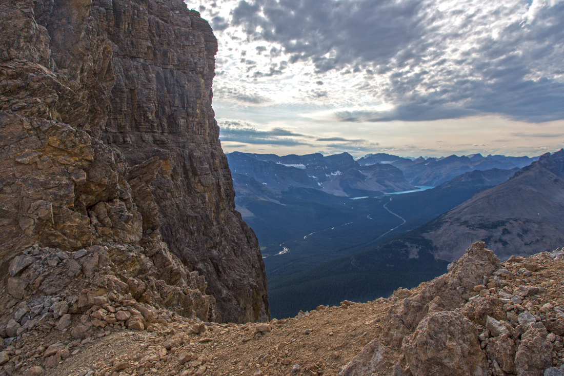
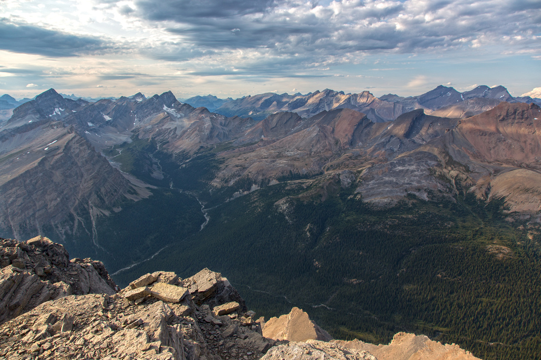
To ascend Noseeum peak, note obvious narrow scree gully breaching the cliffs at north end of the basin. This gully is quite lose and very steep in upper part; rockfall is real danger. Although no particularly difficult move is required, it is more than just easy scrambling. Going up it is easiest to stay on the right side where you can pull yourself up with your left hand on rock wall, then traverse right through the notch and scramble to the col. This col is wild place and offers superb views of Icefields and Bow Lake. Turn right and scramble up Noseeum ridge; summit is 45 min to an hour away. Initially this ridge is not a cakewalk either; easiest is to stay on the crest, but further up you encounter difficult downclimb. It can be bypassed on climber left (watch for cairn). Past the downclimb things ease to mere plod. It is necessary to go over the false summit; it might be tempting to shortcut on the right side, but this is fairly lose and not worth the effort. Stay as close to the crest as possible, then descend to the notch between false and true summits. This notch is fairly exposed on the left side. Final bit is easy scree ascent to the summit and sizable summit cairn that can be seen from far away. Summit register has been placed in 1999 and has not seen many ascents. Views are fantastic: Molar pass and meadows east, Pipestone valley and Skoki peaks south, Quartzite peak and Bobac/Watermelon group north. Across the Icefields eye catcher is glaciated Mt. Balfour. It is possible to walk south for few minutes before ridge drops for good views of unnamed pocket glacier above Molar pass.
Return the same way; be weary of that scree gully and use helmet if traveling in large group. |
|
Gallery |
|||
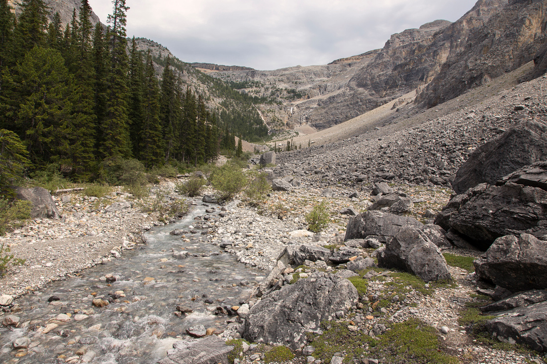 Noseeum creek valley; first headwall in the distance
 |
|||
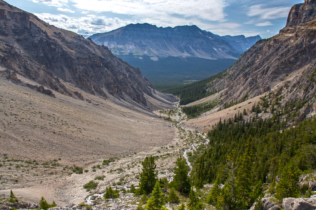 Approach valley from first headwall; Bow peak behind
 |
|||
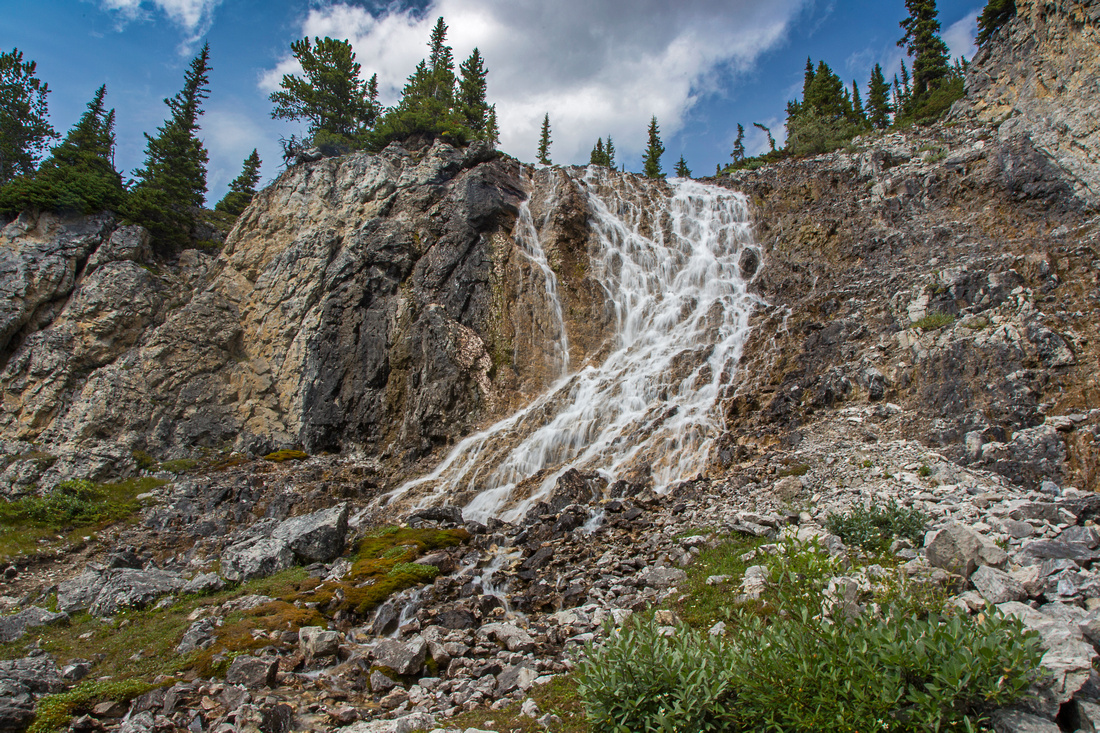 Waterfall below 2nd headwall; trail continues to the left
 |
|||
 Mt. Andromache from bench above the waterfall
 |
|||
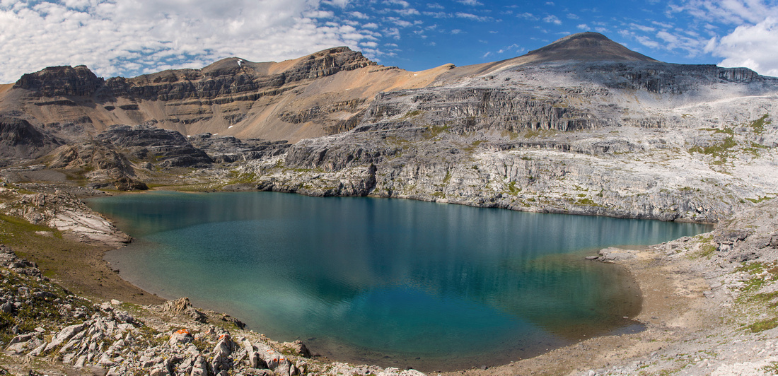 South end of Noseeum Lake. Peak is just left of center
 |
|||
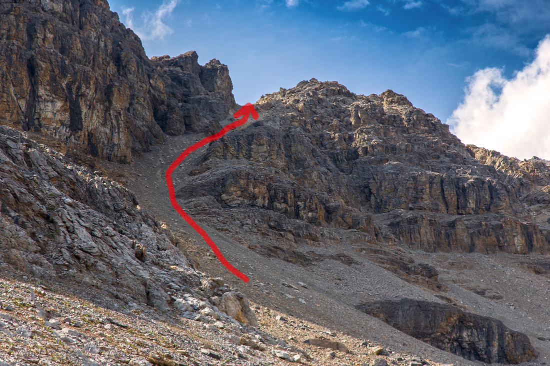 Steep and lose scree cute provides access to the ridge
 |
|||
 Northerly views at top of chute. Turn right and scramble up to start of Noseeum ridge
 |
|||
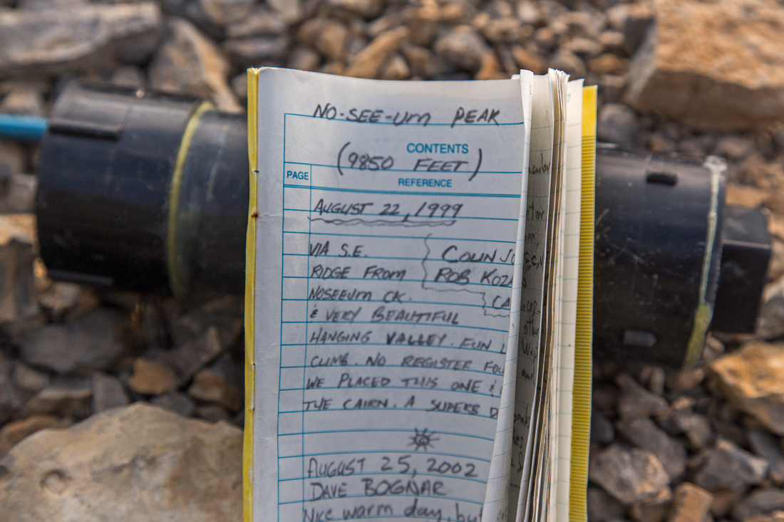 Summit register placed in 1999
 |
|||
 Noseeum Lake with Andromache and Hector behind
 |
|||
 Summit views north including Quartzite col approach
 |
|||
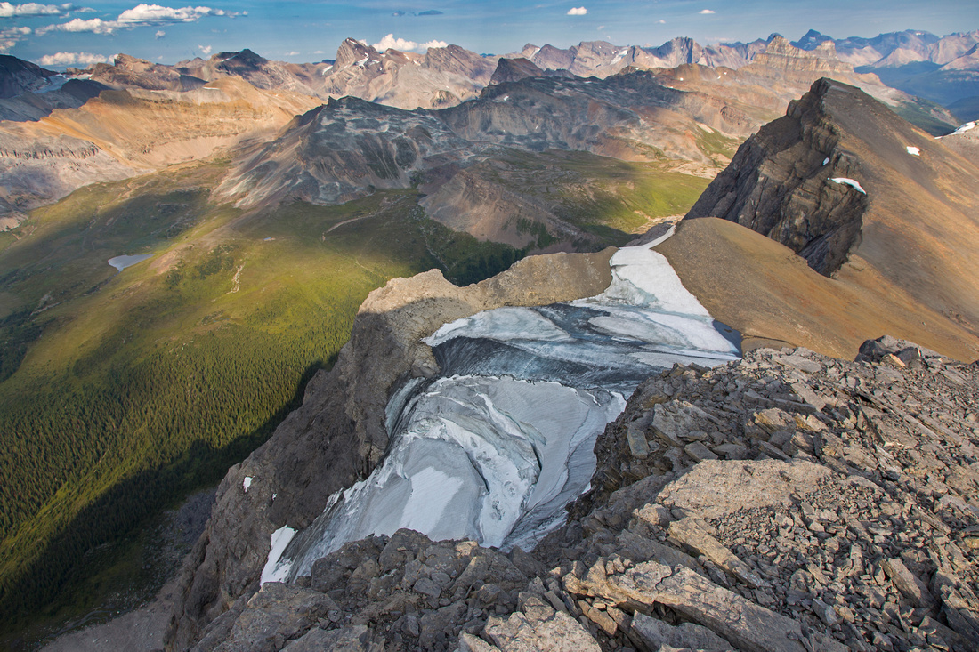 Unnamed pocket glacier along the south ridge
 |
|||
 One last shot of Noseeum Lake from NW end
 |
Abstract
| Overall Difficulty | D6 | Easy to moderate scrambling and route-finding. Steep talus slope with considerable rockfall danger | |||
| Snow Factor | S5 | Not feasible in winter due to steep headwall on approach to Noseeum Lake (avalanche danger) | |||
| Scenery | Several waterfalls on approach to Noseeum basin. One of prettiest lakes in Banff National Park. High-altitude ridgewalk with phenomenal views of Molar glacier and meadows, Mt. Hector and many other peaks along the Icefields | ||||
| Trail/Marking | Poor / none | Faint trail on south side of Mosquito creek and up the headwall with occasional cairns, none after. | |||
| Suggested Time | 9 hr | Return time including ascent of Noseeum peak. 5-6 hrs if going just to the lake | |||
| Elevation | Start: 1860m Max: 3000m Total: ~1200m (summit) | Round Trip: 15km (summit) | |||
| Gear | Hiking boots and poles. Gaiters recommended for scree chute. Climbing helmet essential, even in small groups. GPS helpful for route-finding through headwall below the basin. | ||||
| Water | Mosquito creek and waterfalls to Noseuum lake, none if going to the summit. Carry 2L | ||||
| Dog Friendly | Yes | To the lake only; steep chute leading to Noseeum ridge might prove problematic | |||
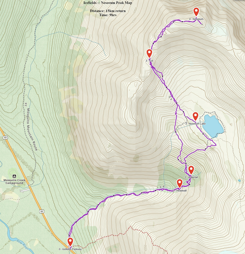 Noseeum Peak GAIA Map
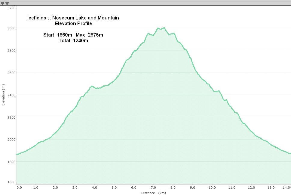 Noseeum Lake and Mountain Elevation Profile