Google Map |
Rockies :: Icefields :: Mt. Andromache |
GPS Track |
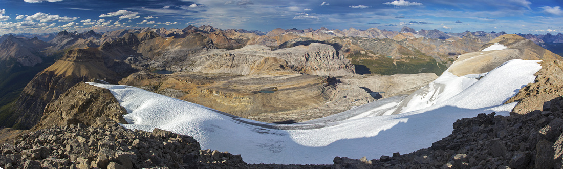 
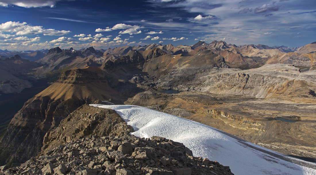
Mt. Andromache summit panorama looking north. Noseeum basin center left; Molar Pass environs to the right. Pocket Molar glacier below |
|||
| Trip Summary | |||
August 21, 2016Mt. Andromache is great scramble on the east side of Icefields Parkway, some 30 min north of Lake Louise. Part of the approach is shared with mountaineer access to Mt. Hector (great winter ski objective!), or scrambler routes to Little Hector and remote Molar Peak/Pipestone valley. Only technical difficulty is ear the start -- moderately exposed scramble up ledges next to Hector creek waterfall. No difficulties are encountered past the mouth of Hector basin, and while one must hike all the way to Hector Pass in order to avoid cliffs, hike is very scenic and effort more than pays off once you reach broad SE ridge. Alternate descent via NW ridge is possible, but slopes are very lose and best avoided. Very fit scramblers sometimes manage to bag Little Hector at the same time. It is also worth checking out access route to 5.8 Achilles Spire - great climber route up Mt. Andromache established in 2012.
Parking is at pullout on west side of Icefields Parkway, opposite Hector creek. Walk back few meters along the road, and find trail on south side of the creek. It climbs quickly through forest then emerges to bushy slopes below waterfall draining upper basin. Higher up trail crosses usually dry creek bed to the left side; you must hike few meters along the creek so watch for cairns to pick it up on the other side. The crux of the day is nearby - moderate scramble up set of mildly exposed ledges, with one class 3 step. Easier, but not so obvious route exists: Just before the cliffs watch for indistinct trail branching right. It is somewhat bushy, but still easy to follow. It rounds the cliff on somewhat exposed ledge, then climbs through timber and eventually crosses the creek to the other side. Higher up 'normal' route joins in. These distances are short, and it is worth checking both out - if doing so, note that on descent it will be much harder to recognize where the 'easy' route picks-up after creek crossing.
Good trail with cairns climbs to the mouth of Hector Basin, then turns left (north). Scramblers destined for Little Hector would leave the trail here and head straight. For Andromache climb eroded trail for 10-15 minutes only; do not follow all the way, as it is climber access trail for Achilles Spire! Instead find less defined trail heading east towards obvious headwall baring access to upper basin. Cairn mark the way and trail ascends the headwall on the left side. Past the headwall hiking gets very pleasant on soft moss descending to seasonal tarn. Hector Pass is directly above. It might appear more direct to side-hill close to left hand-side cliffs, but this is wrong as terrain is lose and going tedious. Instead stay low and ascend small slabs and sections of grass towards Hector Pass. Just before the pass note obvious talus gully climbing left through cliffs that have now eroded to mere rubble. Terrain is steep-ish, but scree is not terribly lose. Hiking poles are of great asset here! Note the cairn where you topped up in order to be able to pick it up on return. Views back to glaciated Mt. Hector are majestic, while distinct shaped Mt. Molar appears to the east. Climb the next rise leaning left, then cross wide plateau and climb to the sub-summit. Final slope is again somewhat lose; stay more to the right for easier terrain. From the sub-summit true summit appears further than expected; it will take at least 45 minutes to cross. In addition there is about 100m of elevation loss to intervening low point, followed by final push to the summit. On some topo maps this last bit is marked glaciated, but this is not so as pocket Molar glacier hangs below the ridge. Summit views are magnificent in all directions, but Noseeum Lake and basin directly north steal the show. This is also very worthwhile trip, either as scramble to Noseeum Mtn, or loop route via Molar Pass. For return you can try alternate descent via steep and brutally lose NW ridge. This option would eventually dump you ~2km north from Hector creek parking, and you will have to walk back on the highway. This option is not recommended; ascent this way would be even more brutal. It is much better to retrace your steps, paying attention to daylight as descent down the ledges next to Hector waterfall is much more difficult and unsafe in the dark. |
|
Gallery |
|||
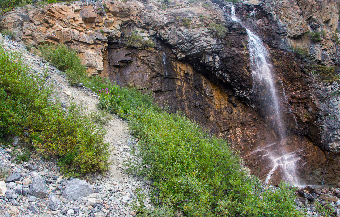 Hector creek waterfall below crux ledges in lower part
 |
|||
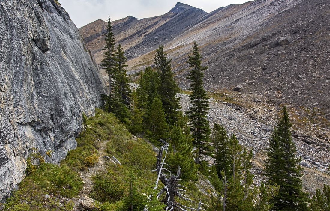 Approaching Hector basin above the ledges.
 |
|||
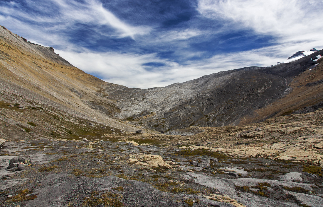 Hector Pass approach. Stay low and do not sideslope on the left side
 |
|||
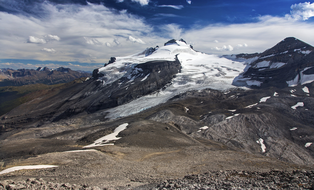 Hector Mountain and Glacier from lower talus slopes
 |
|||
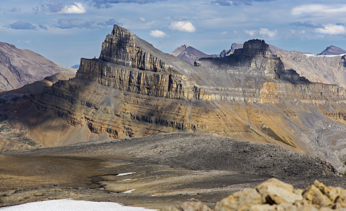 Molar Mountain from wide plateau below sub-summit
 |
|||
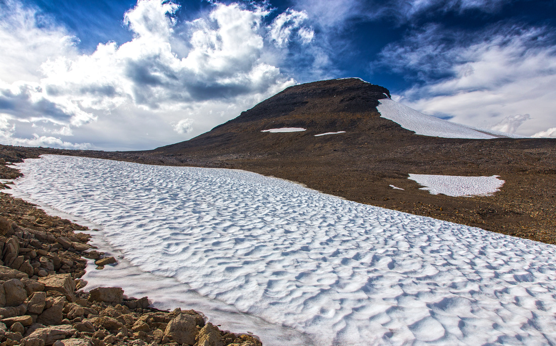 Sub-summit talus slopes. Worst bit is near the top
 |
|||
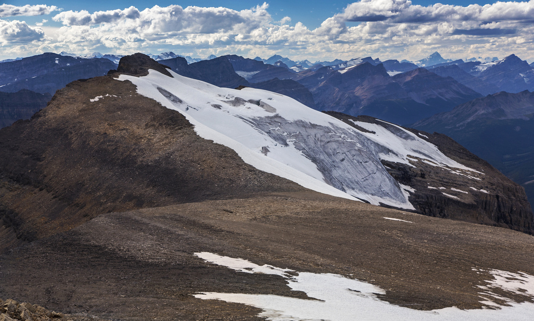 Mt. Andromache from sub-summit. Molar glacier center
 |
|||
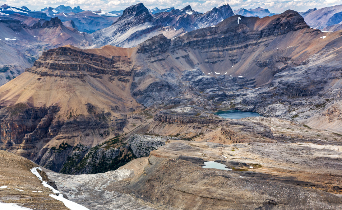 Noseuum lake and mountain from sub-summit
 |
|||
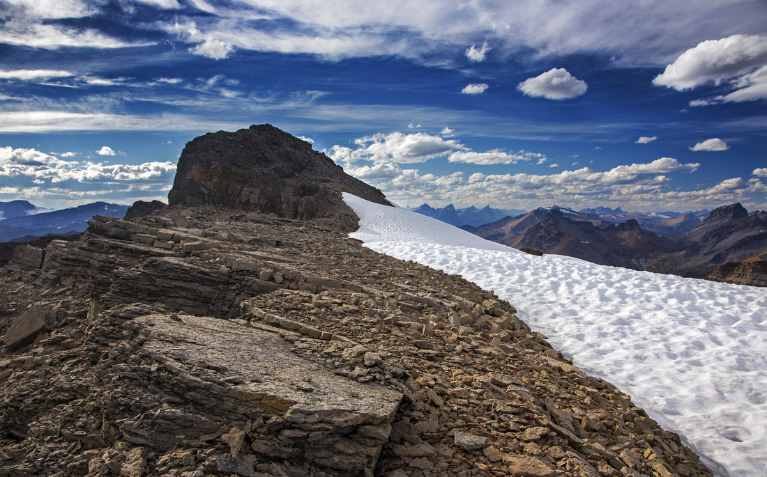 Hiking broad ridge to Mt. Andromache summit block
 |
|||
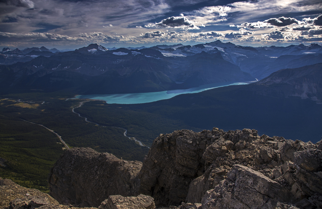 Views north towards Hector Lake and Mt. Balfour
 |
|||
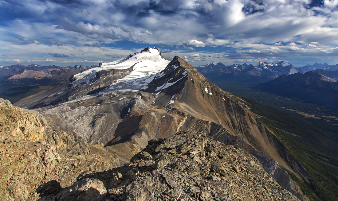 Summit views south to Mt. Hector. Little Hector right
 |
|||
 View north to Noseeum basin and distant Icefield peaks
 |
Abstract
| Overall Difficulty | D5 | Exposed ledge scramble (class 3) by the waterfall. Steep talus slopes. Final ridge abuts the glacier | |||
| Snow Factor | S5 | Feasible as ski ascent, but most parties aim for Mt. Hector (mountaineering). Considerate avalanche danger in lower part. Snowshoe trip not realistic due to overall length | |||
| Scenery | Mt. Hector and Hector Glacier. Molar Mountain and Pipestone valley. Fantastic view of Noseeum Lake basin from the summit | ||||
| Trail/Marking | Poor | Narrow, but fairly well defined trail initially disappears in upper basin. Occasional cairns | |||
| Suggested Time | 9 hr | Return time with both ascent/descent via Hector Pass. Less if trashing down NW ridge | |||
| Elevation | Start: 1750m Max: 3010m Ascent: 1400m, Descent: 150m | Round Trip: 16 km | |||
| Gear | Full hiking boots. Poles and gaiters essential. Climbing Helmet - optional | ||||
| Water | Hector creek in lower part. Seasonal tarn below Hector Pass; snow patches after. Carry 2-3L | ||||
| Dog Friendly | Yes | Standard back-country travel country precautions. Long journey with plenty of sharp rock! | |||
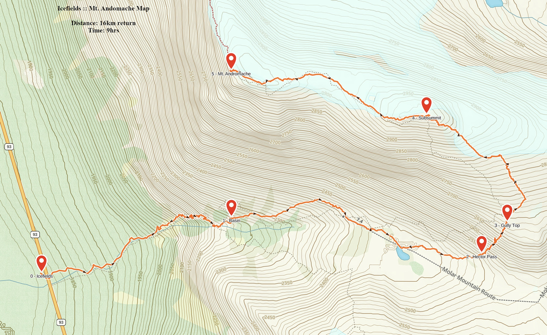 Mt. Andromache GAIA Map
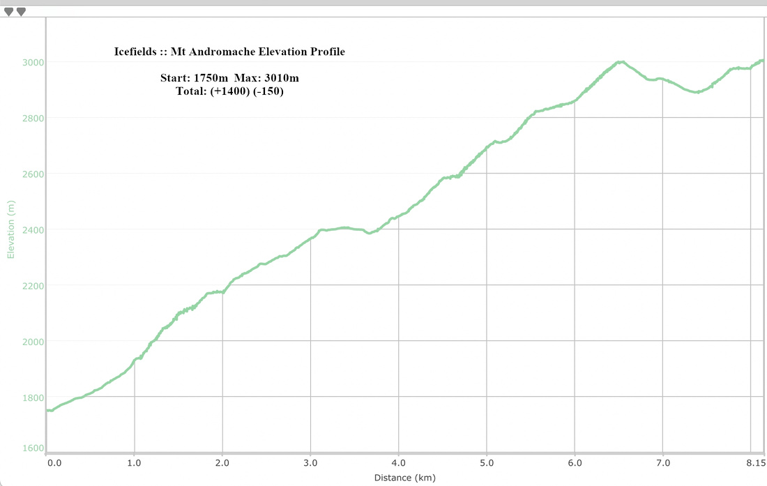 Mount Andromache Elevation Profile
|
Climber Access to Achilles Spire |
|||
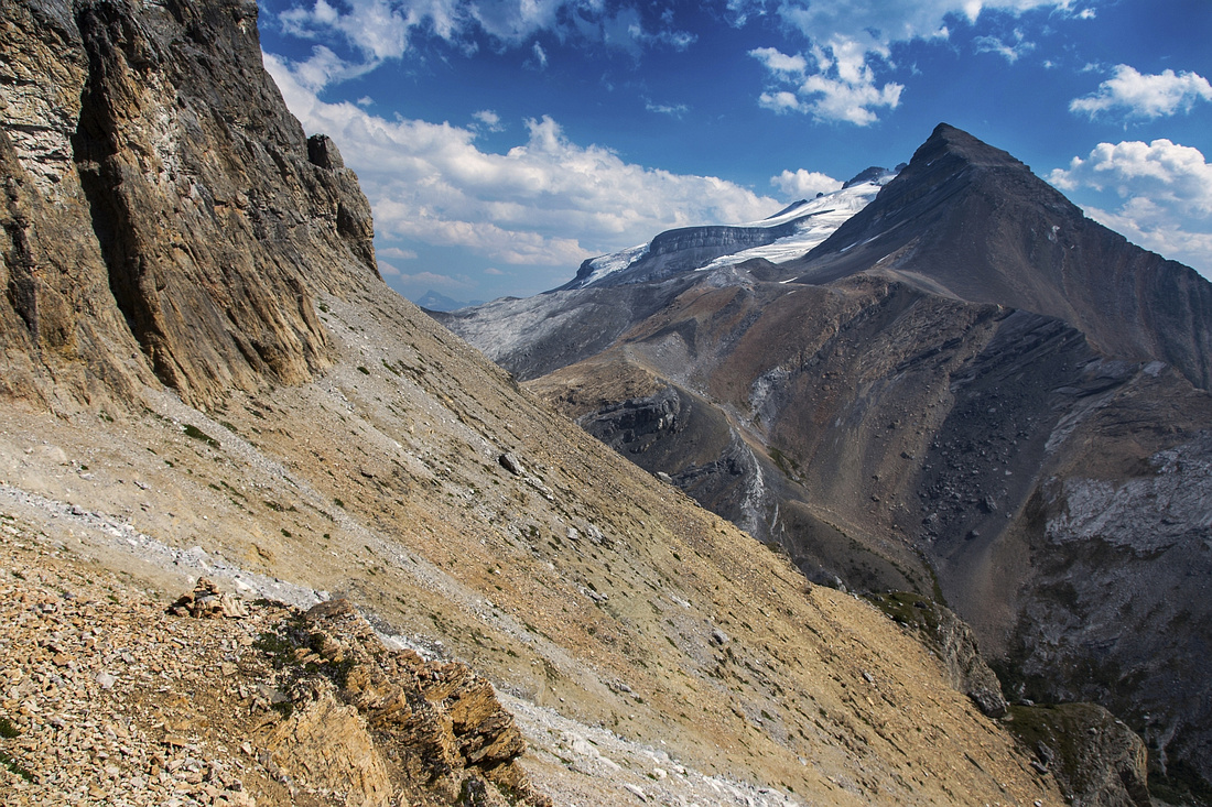
|
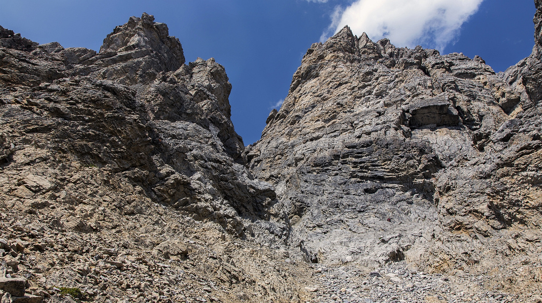
From mouth of the basin past the waterfall trail climbs directly towards the cliffs above. It is really well defined with multiple cairns; it might even look like this is normal way up the mountain! The base of roped climb is reached in about 45 min to an hour. About halfway up there is one tricky gully -- class 3. Views are magnificent and offer different angle of Little Hector. Final bit is bit lose talus slope traverse (pic above). This is where trail ends. With little luck, non-climbers might be able to enjoy watching the efforts of technical folks above before returning the same way back; about 1 1/2 hrs return from Andromache trail.
|
|||
 Talus slope looking back to Little Hector
 |
|||
 Start of roped climb ~400m below Andromache summit
 |