Google Map |
Rockies :: Kananaskis :: Chester Lake |
GPS Track |
|
Aerial view of frozen Chester Lake from little rise below Mt. Chester. Gusty Peak center, Fortress behind right, Galatea background left |
|||
| Trip Summary | |||
Multiple Dates, last Jan 9 2025Chester Lake was one of 1st K-country hikes I ever did. Over the years popularity has grown beyond proportion; in season solitude is next to impossible to find. Yet, for sentimental reasons perhaps, I tend to return fairly regularly. My trips are generally in winter when crowd infestation is relatively low; mid-week, late afternoons usually work best and I've been able to have this delicate and beautiful area to myself. Benefit of popular trail is well broken and compact track that usually does not require snowshoes. Winter / snowshoe trail stays further south from summer trail (used by skiers in winter); it is also shorter and very pretty, in particular final bit crossing expansive meadows - see Gallery. Logical extension is short hike up to "Elephant Rocks" - giant boulders that tumbled from Gusty Peak west side who-knows-when. Trail is usually well broken too.
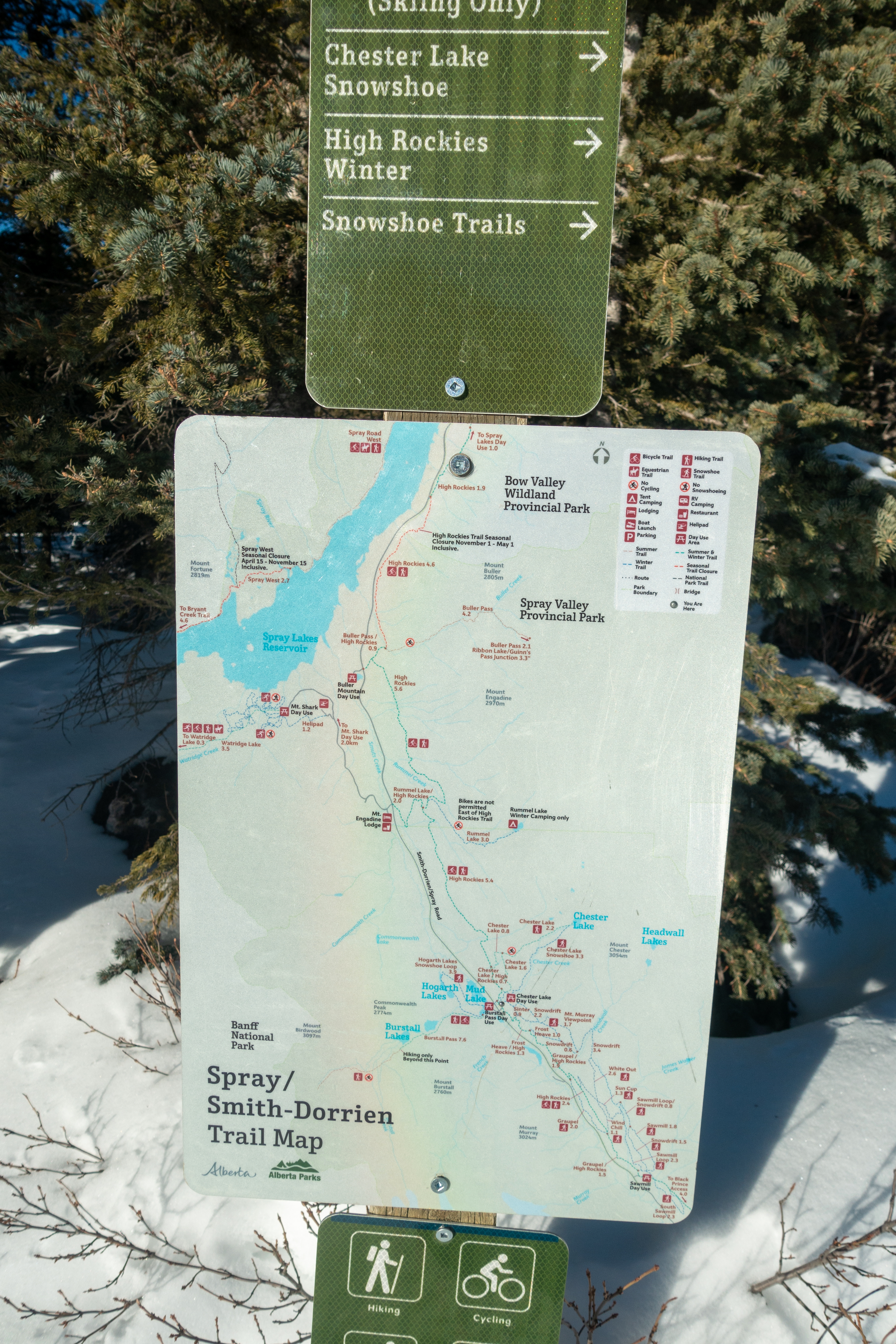
AB Parks snowshoe signs mark entire way to the lake and would be next to impossible to go off trail - even if it was not broken. Extending the journey further east into narrow valley above the lake is considerably more involved with avalanche danger; exploring this part is best done in summer conditions
|

|
Gallery |
|||
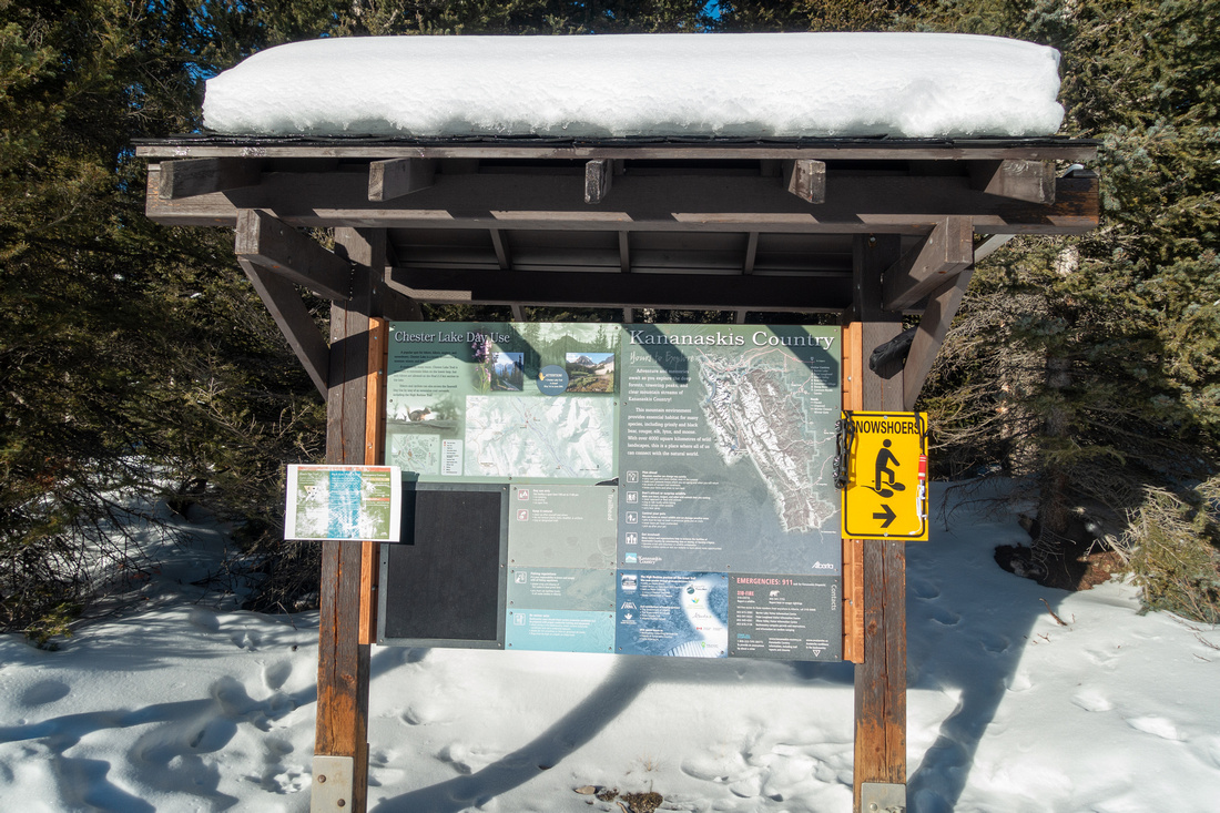 Trailhead Kiosk Trailhead Kiosk K-Country Trailhead Kiosk at north side of Chester Parking Lot; note "Snowshoers" sign
 |
|||
 |
|||
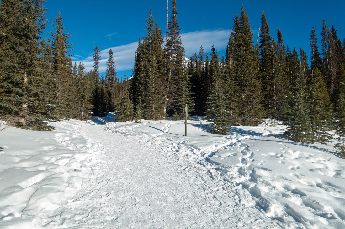 Snowy Highway
Starting up wide and compact trail. Initial section is shared between skiers and snowshoers Snowy Highway
Starting up wide and compact trail. Initial section is shared between skiers and snowshoers |
|||
 Forest Trail
Snowshoers trail ascending forested section below the Meadows; Mt. Chester upper right Forest Trail
Snowshoers trail ascending forested section below the Meadows; Mt. Chester upper right |
|||
 Chester Meadows
Crossing Chester Meadows on gorgeous winter day. L-R: Galatea, Gusty, Fortress, Mt. Chester Chester Meadows
Crossing Chester Meadows on gorgeous winter day. L-R: Galatea, Gusty, Fortress, Mt. Chester |
|||
 Mt. Chester
Shapely Mt. Chester; normal scramble approach route is via snowy gully on the right side Mt. Chester
Shapely Mt. Chester; normal scramble approach route is via snowy gully on the right side |
|||
 Gusty Peak
 towering above Chester Lake alpine bowl Gusty Peak
Gusty Peak towering above Chester Lake alpine bowl |
|||
 Summer Trail Junction
Summer Trail (skiers in winter) joins in directly before the Lake by Restroom Sign Summer Trail Junction
Summer Trail (skiers in winter) joins in directly before the Lake by Restroom Sign |
|||
 Chester Lake
 Panorama; Elephant Rocks Trail is on the left side Chester Lake
Chester Lake Panorama; Elephant Rocks Trail is on the left side |
|||
 Elephant Rocks
Boulder Field ~10min above the Lake, known as "Elephant Rocks" is short but well worth extension Elephant Rocks
Boulder Field ~10min above the Lake, known as "Elephant Rocks" is short but well worth extension |
|||
 Elephant Rocks
 Elephant Rocks
Elephant Rocks |
|||
 Skier Turns
Skier Tracks at south slopes of Chester Lake on return from Elephant Rocks with great late Afternoon light. Climbing the bowl above the Lake has considerable avalanche danger Skier Turns
Skier Tracks at south slopes of Chester Lake on return from Elephant Rocks with great late Afternoon light. Climbing the bowl above the Lake has considerable avalanche danger |
|||
 Afternoon Light
Terrific late Afternoon lighting crossing Chester Meadows on return. Mt. Birdwood upper right Afternoon Light
Terrific late Afternoon lighting crossing Chester Meadows on return. Mt. Birdwood upper right |
|||
Abstract
| Overall Difficulty | D2 | Steady switchbacks on summer trail, one steep bit on winter trail but easy otherwise | |||
| Snow Factor | S2 | No avalanche danger to the lake. One steep and potentially icy section | |||
| Scenery | Spectacular alpine bowl with emerald green lake rimmed by larch trees. Mt. Chester, Gusty Peak, Galatea and Fortress | ||||
| Trail/Marking | Excellent | Well defined trail with signed junctions. Frequent snowshoe posts. Summer and Winter trails are different. | |||
| Suggested Time | 3hrs | Return time including Elephant Rocks. Full day if continuing into upper valley / Fortress - Headwall loop | |||
| Elevation | Start: 1920m Max: 2270m (Elephant Rocks) Total: ~400m | Distance: ~8km return | |||
| Gear | Dayhikers in summer, Full hiking boots in winter. Poles, Gaiters. Snowshoes usually not necessary. Icers helpful for steep section below Treeline in winter | ||||
| Water | Chester Lake outlet. Carry 0.5L | ||||
| Dog Friendly | Yes | Grizzlies frequent alpine meadows around the lake. Busy area year-round, keep dog on leash | |||
 Chester Lake GAIA Map
 Chester Lake Elevation Profile