Google Map |
Rockies :: Icefields :: Mosquito Col |
GPS Track |
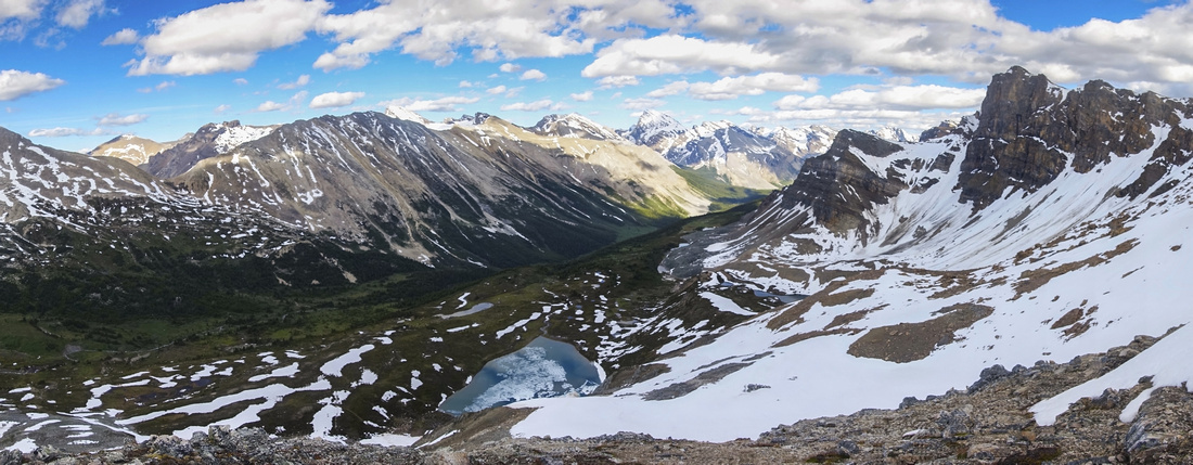 
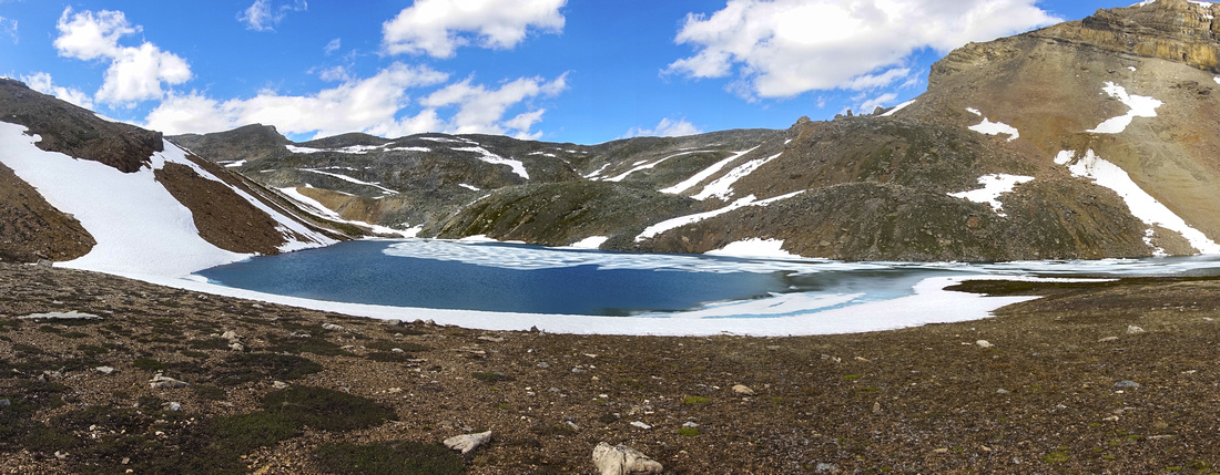
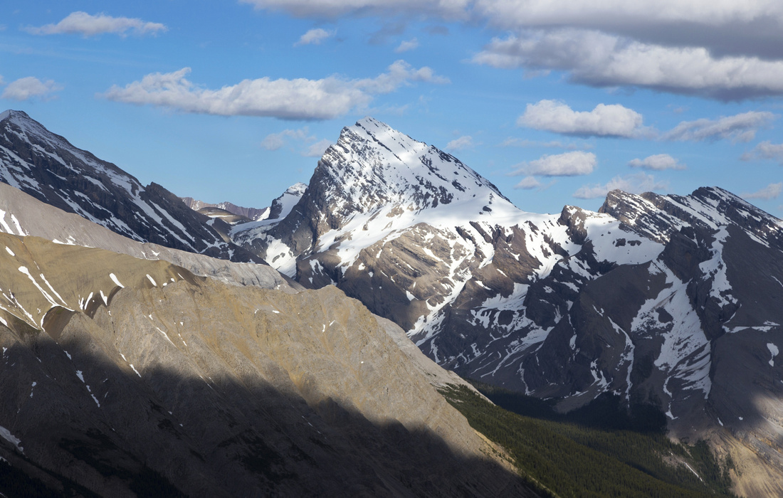
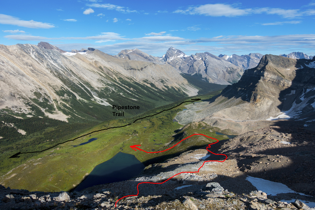
Panoramic View south from Mosquito Col into Pipestone Valley (Descent Line). Cataract Peak distance just right of center. Low point saddle center left is access route to rarely visited Deluc Alpine Basin |
|||
| Trip Summary | |||
Multiple Dates, last Aug 6, 2022Mosquito Col is one of three possible ways into Pipestone Valley that provides usual access into Siffleur wilderness area in eastern ranges of Banff National Park. (Other two being official but longer Parks Trail via Fish Lakes, and second most direct but dangerous route via Quartzite Col). It is also worthwhile day hike destination on its own as it passes through exception alpine area and views are nothing short of spectacular! No trail exists past meadows below North Molar Pass, but none is needed. Major scenic reward is secluded Bolt Lake in cirque below south ridge of Mosquito Peak; most hikers bound for Fish Lakes are totally unaware of it! Snow lingers till mid summer in this cirque and might present an obstacle if trying the trip too early. Several extensions are possible including scramble of Mosquito peak (longer, but more rewarding than described in Nugara guide). For backpacker bound for Siffleur Wildernsss time savings will not be substantial (~1hr estimate at most), but will make reaching Devon Lakes in a day more feasible. This route makes most sense when used for approach to rarely visited Deluc Peak alpine via easy col on Pipestone Valley east side.
Trailhead Parking is at Mosquito creek hostel and campground on west side of Icefields Parkway, some 20 minutes north from Lake Louise. (If you are leaving car overnight for several days, make sure your Park Pass is valid for entire time!). Trailhead is at other side of the road, past small bridge. Follow well defined and gentle trail for ~5km to official MO5 campground, passing Quartzite Col turnoff ~4km mark (last bridge before campground). Continue for another ~40min on more rooty and often muddy track to South Molar Pass / Fish Lakes junction, crossing Mosquito creek on a solid 2-log bridge along the way, ~1:45 - 2hr of brisk pace from trailhead; turn left. Trail climbs more steeply for 20-30 minutes and reaches beautiful Molar meadows; spectacular views open up! Cross Molar Tarn outlet (non-bridged and might be tricky without taking boots off early in season). Leave trail about here and head left (east) towards obvious low saddle below Mosquito Mountain -- see first gallery photo. No trail exists but none is necessary. Couple of creeks need to be crossed along the way, but none is difficult. These meadows are prime grizzly habitat and scan the environs frequently. Top up after ~45minutes of easy hiking to cirque containing Bolt Lake, as beautiful as unexpected. This is perfect spot for a break, and acceptable turnaround point if terrain is too snowy. "Mosquito Col" is right side high-point of ridge at far side of the Lake. Walk around on the left (north) side across talus, then angle up moderately angled talus/heather slopes and tramp up to low-point; ~30min from far side of the lake. This ridge is serious sensory overload; bird-eye view of Pipestone Valley with several tarns, Pipestone Pass leading into Siffleur Wilderness and several major peaks including Mt. Willingdon / Crown behind Devon Peak, while Cataract Peak is stunning eye catcher further east. Turn right and hike up to high-point where cairn awaits. This is day-hiker turnaround point. |
|
Gallery |
|||
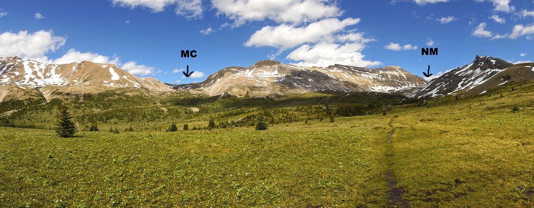 Molar Meadows as Fish Lakes trail reaches alpine after ~2.5 hrs of steady pace. "NM" - North Molar Pass, "MC" - Mosquito Col
 |
|||
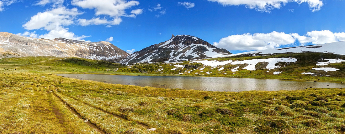 Molar Meadows Tarn with view of North Molar Pass (just left of center). Leave trail about here for Mosquito Col (left, out of view)
 |
|||
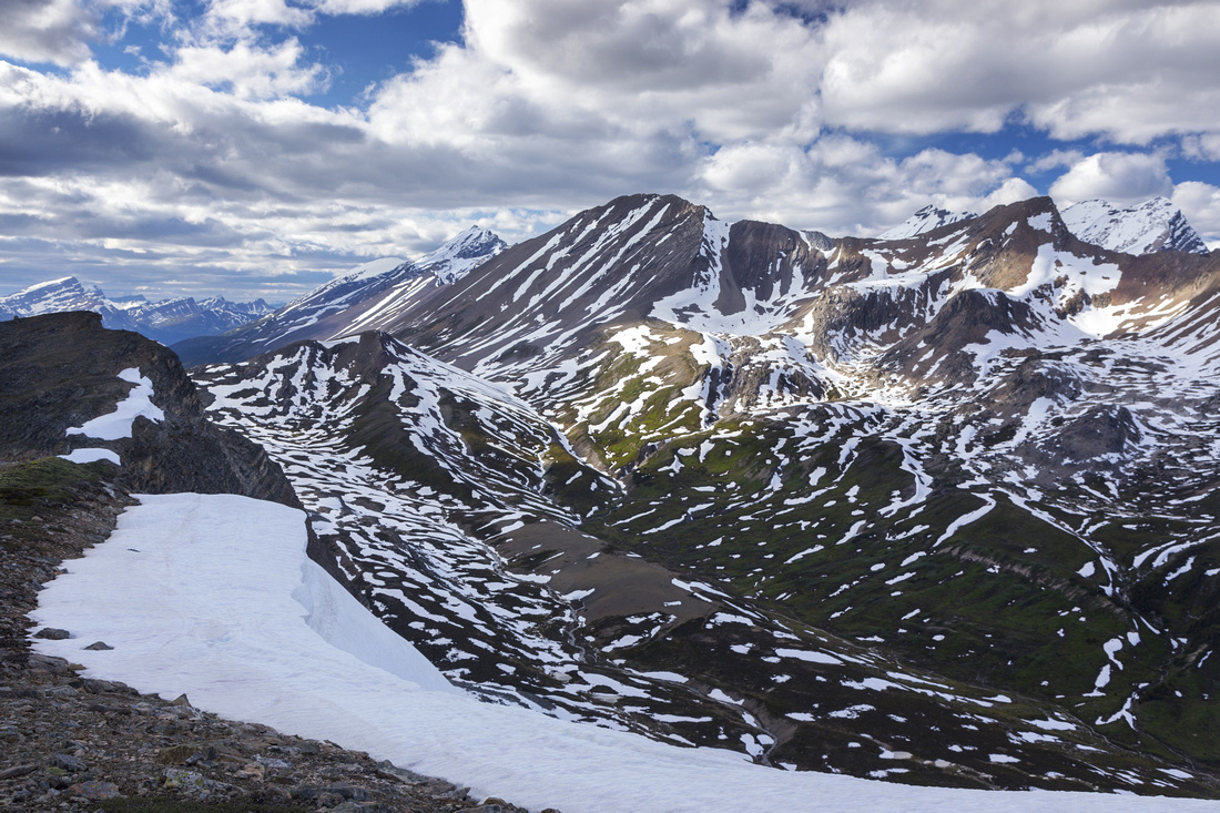
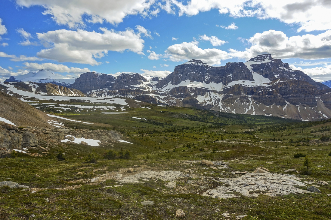 Fabulous Panorama back to Molar Meadows (note tarn) just below Bolt Lake cirque. Noseeum Peak upper right
 |
|||
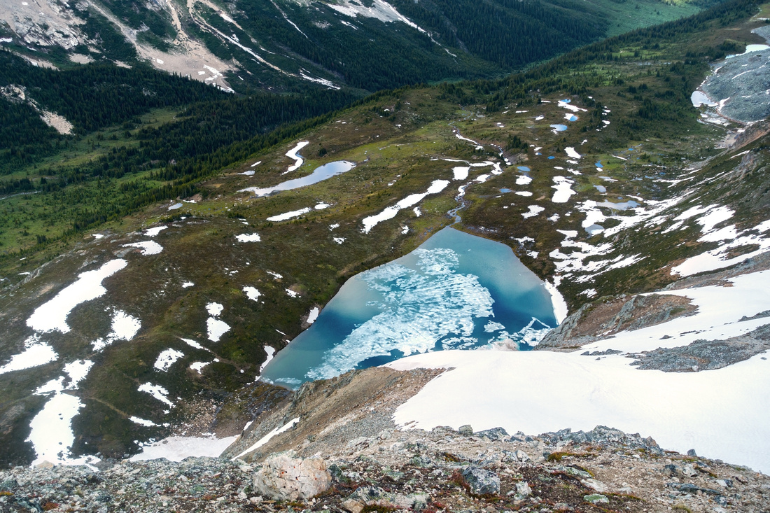
 Beautiful and unexpected Bolt Lake. "Mosquito Col" is at right high-point of ridge at far side of the lake
 |
|||
 View back from easy talus / snow slopes above Bolt Lake. Glaciated Mt. Hector distance center left
 |
|||
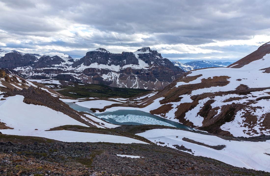
 Pipestone Valley and Pass from Mosquito Col. Devon Mtn. center, Clearwater Mtn distance left. Mt. Willingdon and Crown behind to the right
 |
|||
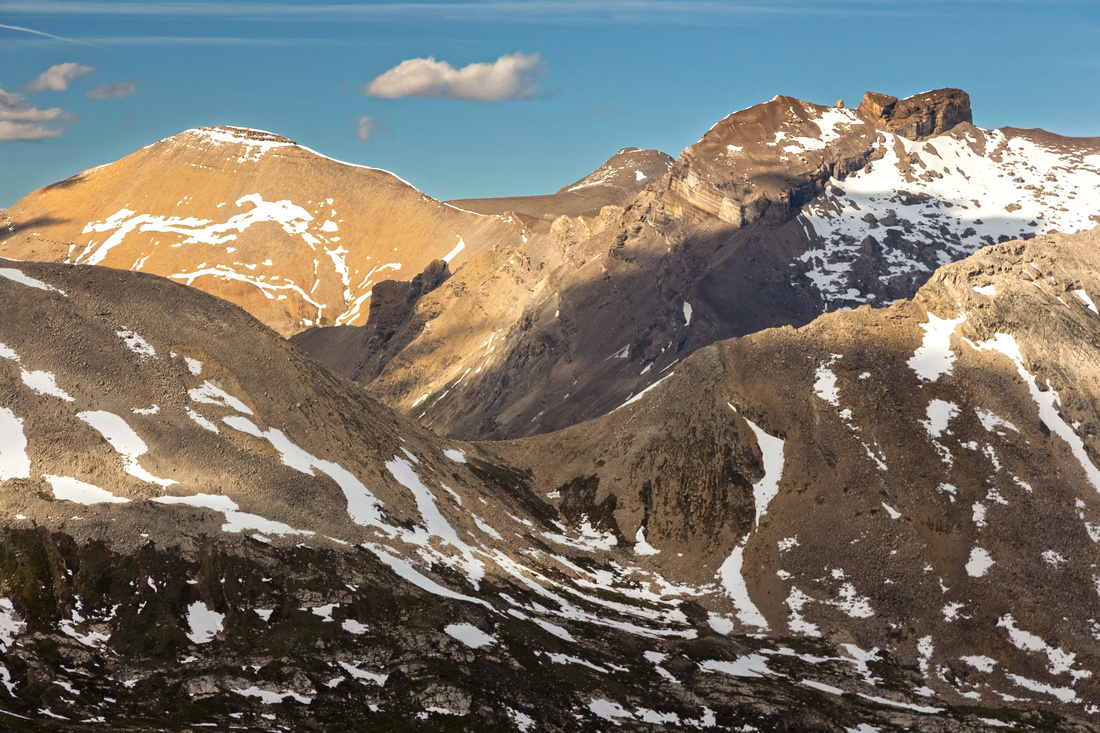
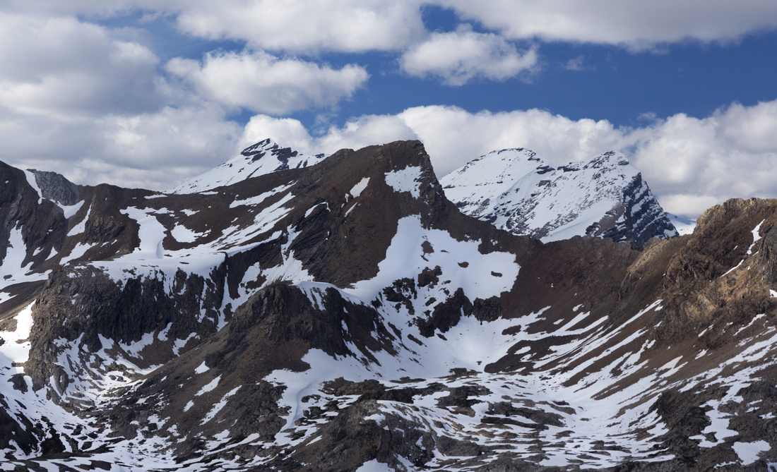 Closer look at snowy Willingdon (L) and Crown / Willingdon South (R) behind Devon Peak
 |
|||
 Cataract Peak (3340m) looking south from Mosquito Col. Difficult scramble in dry conditions, normally approached via Fish Lakes / Pipestone Valley
 |
|||
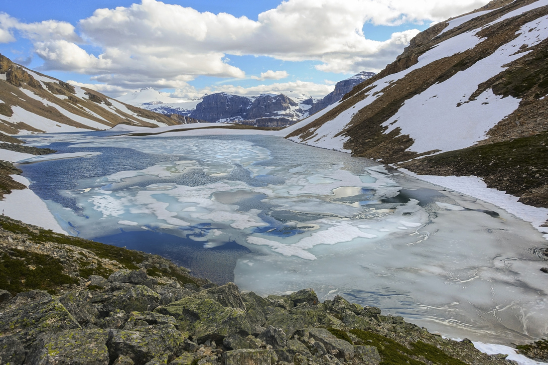
 Pipestone Valley descent slopes, mix of talus / snow early in season. Standard "Highline Trail" from Fish Lakes runs in meadows on far side of lake below
 |
|||
 Telephoto across Pipestone Valley to col providing access to rarely visited alpine below Deluc Peak. Near side is obviously easy, but far side descent is not as there are cliff bands directly below the saddle and one must scramble ~100m vertical left to reach easier terrain
 |
|||
 Bolt Lake and Noseeum Peak on return descent back from Mosquito Col
 |
Abstract
| Overall Difficulty | D4 | Off-trail hiking with minor route-finding. Non-bridged creek crossings. Possible snow covered lose slopes. | |||
| Snow Factor | S2 | Feasible as ski trip, although Mosquito creek approach is probably a bit long. Gentle slopes below Bolt won't present avalanche danger, but confined cirque above will. Much more suitable as summer trip | |||
| Scenery | Molar alpine meadows with lakes and summer wildflowers. Many well known peaks along Icefields corridor. Spectacular Bolt Lake below Mosquito col ridge. Far reaching panorama into Pipestone Valley and eastern regions of Banff National Park | ||||
| Trail/Marking | Good/None | Official Parks trail with signed junctions to Molar Meadows, none after | |||
| Suggested Time | 8 hr | Return time OnB to Mosquito Col, less if going just to Bolt Lake. Mosquito Peak extension will add ~2hr | |||
| Elevation | Start: 1850m Max: 2620m Total: ~950m | Round Trip: 26 km | |||
| Gear | Full hiking boots. Poles and gaiters essential | ||||
| Water | Mosquito Creek and several seasonal streams draining Bolt Lake. No need to carry more than 1L | ||||
| Dog Friendly | Yes | Standard back-country travel country precautions. Molar meadows are prime grizzly habitat! | |||
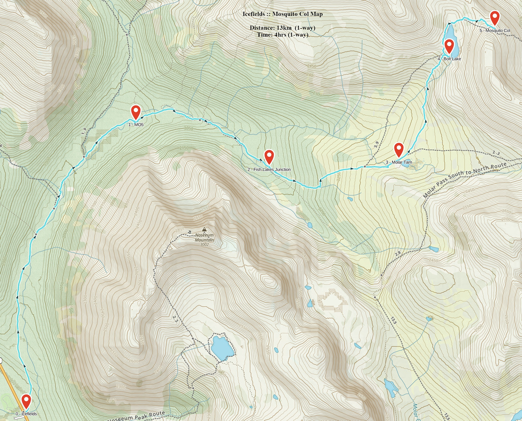 Mosquito Col GAIA Map
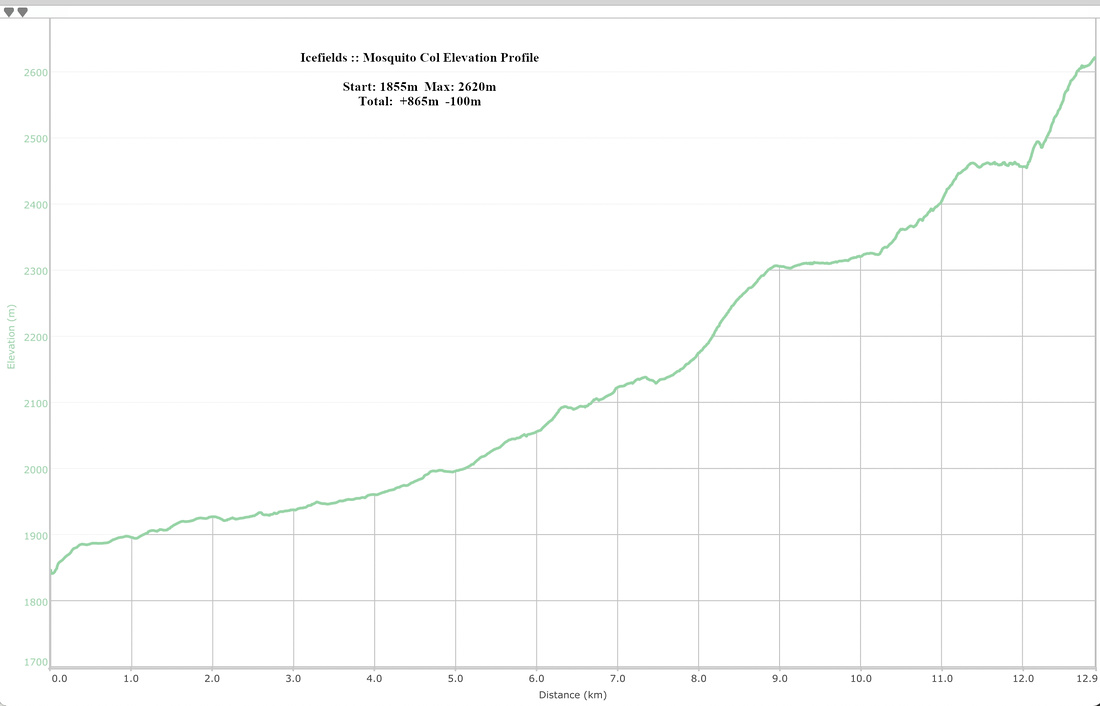 Mosquito Col Elevation Profile
Pipestone Descent
On my initial dayhike in July '20 looking from above I concluded descent would be straightforward when dry. I was wrong. I came back 1st part of Aug '22 and found it quite involved. This is the problem when looking from above; you just can't see everything. Parts are steep and lose, and one section could be quite dangerous with snow as slip would send you straight down the cliffs. Best line follows talus shelf diagonally till in line with far side of large lake below, then drops down steep grass. Do not angle left too soon as there are cliffs, not seen from above. It is also more time consuming than anticipated; with heavy overnight pack it will take 45-50min till you eventually intercept Pipestone Highline trail at far side of the lake.
This route makes most sense if heading over to Deluc alpine basin. When hiking out from Devon area, unless going over Quartzite Col, in my opinion it is better to follow long route via Fish Lakes - North Molar Pass; feasible as ~11hr day hike.
 Mosquito Col Descent
Approximate Descent line in red; most challenging part in shaded part lower down before turning left and down to the lake
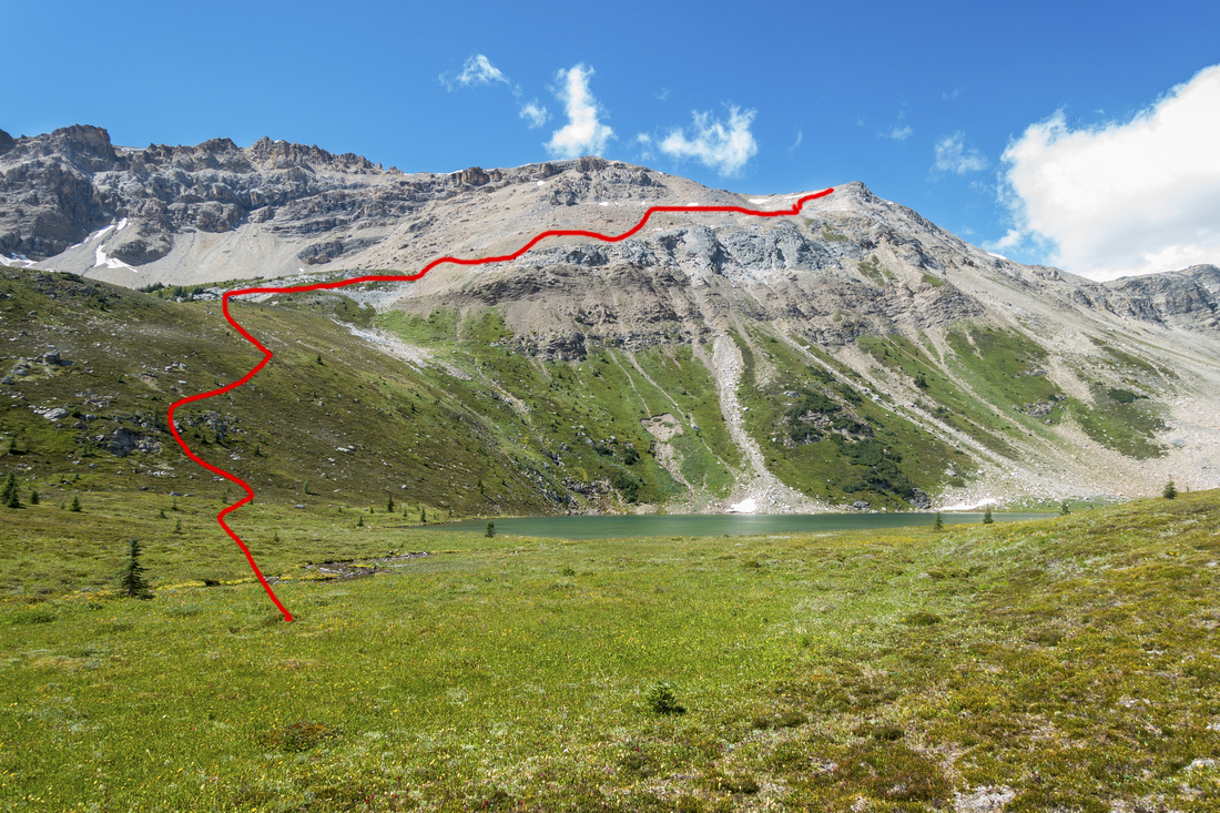 Mosquito Col Descent
Approximate Descent line from below; ascending this way with overnight pack would be quite strenuous
Mosquito Col Descent
Approximate Descent line from below; ascending this way with overnight pack would be quite strenuous