Google Map |
Rockies :: Kananaskis :: King Creek Ridge |
GPS Track |
|
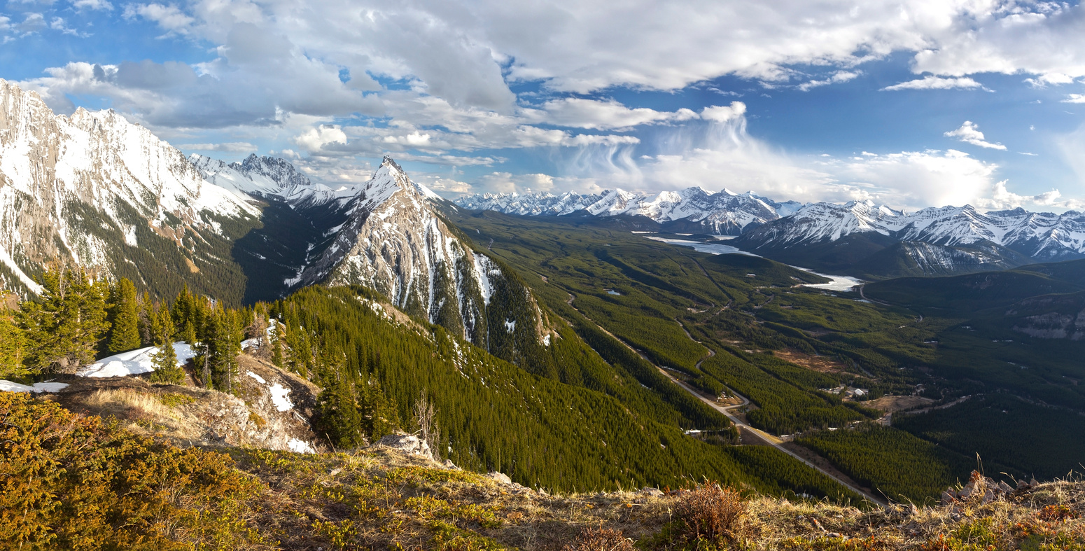
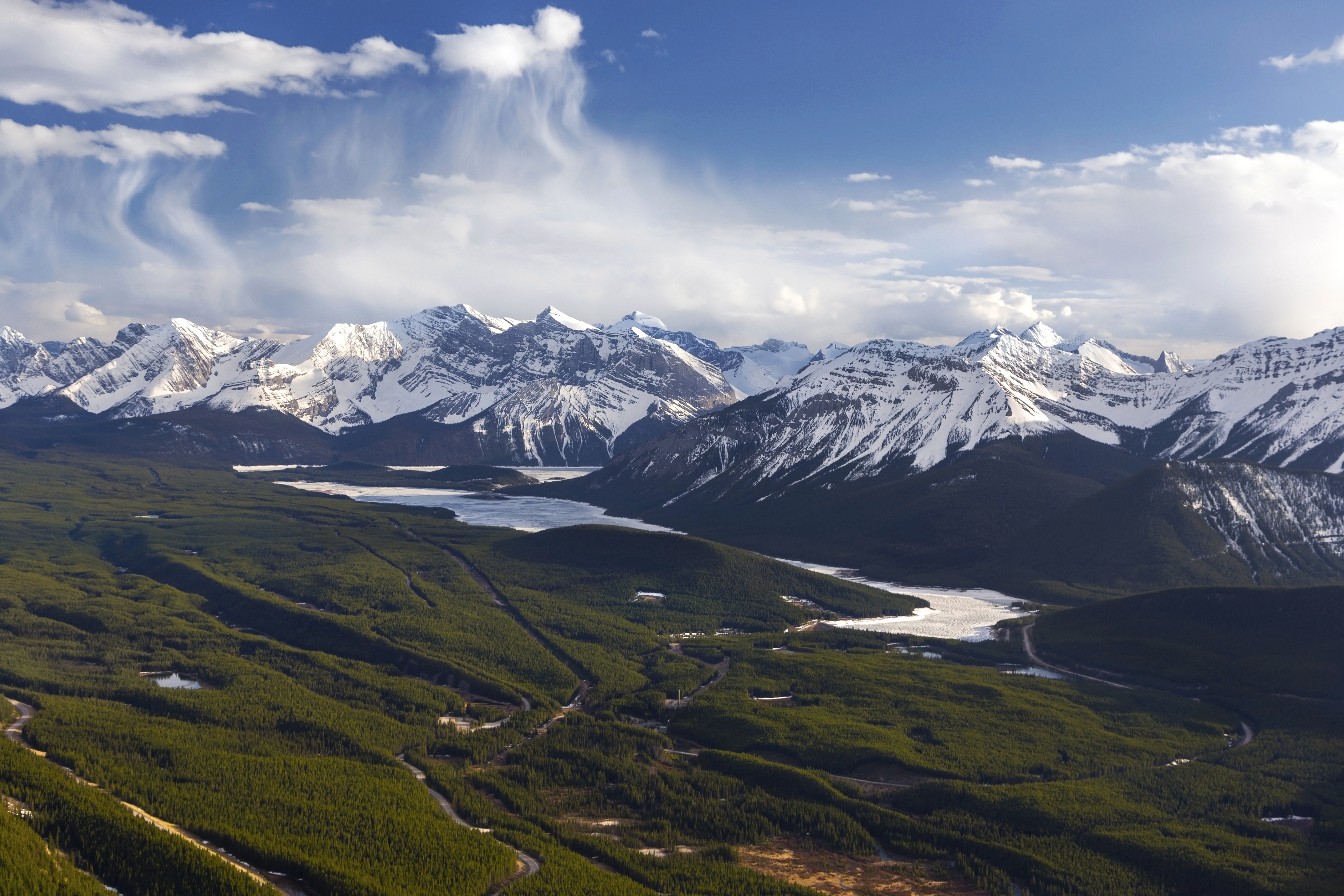
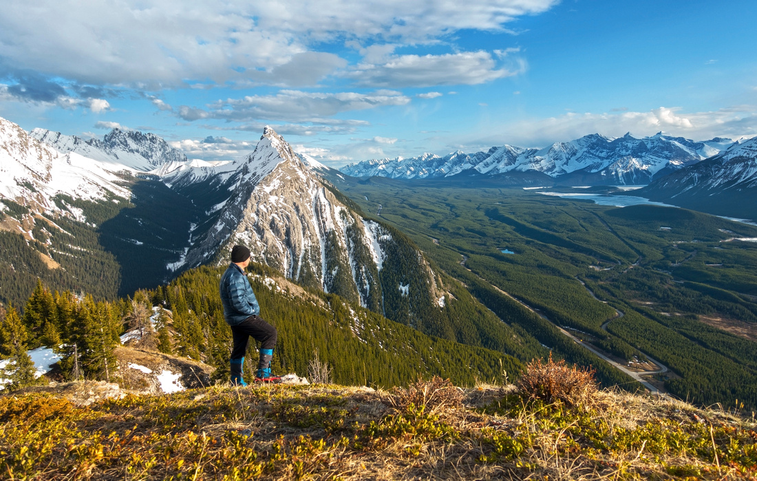
Panoramic View South to Kananaskis Lakes area from first highpoint of King Creek Ridge. Mount Wintour centre left |
|||
| Trip Summary | |||
May 14, 2021King Creek Ridge is grand ridgewalk in spectacular surroundings. Trip is feasible year round, but beware of avalanche prone west slopes when unstable snow conditions are present. When I first hiked this trail there was only faint footpath; nowdays there are several well-worn and eroded trails. Views are nothing short of fantastic - see gallery. When snow is gone in later part of summer loop - sort of - is possible by dropping east into King Creek canyon below Mt. Brock and Mt. Blane, then hike out following the creek. This loop return became quite involved after 2013 floods that obliterated the Creek and made travel quite difficult - return the same way is better option.
Park at shoulder of Hwy40 just before K-Lakes turnoff, or -when open- in King Creek picnic area on east side of the road. Trail starts at north side of the creek and is easy to follow. After dipping in forest, it parallels the road in north direction without gaining much elevation for 10-15min, then turns sharp right and makes no-nonsense beeline to low point of the ridge. There are some cairns and flags along the way but going is straightforward. In shoulder season upper parts can be very muddy - poles, and even micro-spikes are great help. After reaching ridge crest (1.5 hrs+ from parking) turn left and follow trail initially through forest then open grassy meadows across several highpoints. Final bit can be bit tricky if snow covered. "Summit" is wide and offers fantastic views; if calm/no wind it will be hard to peel off. Views of Opal Range are fantastic as well as imposing Mt. Wintour south, but main prize is sweeping panorama of Kananaskis Lakes area - see Gallery. Return will be faster if coming back the same way.
Note: After 2013 floods Kings Creek ridge became preferred approach for Mt. Hood scramble route. Loss of elevation is major hurdle, but apparently better compared to Kings Creek trash. I have not done Mt. Hood yet and will update this write-up if/when I do. |
|
Gallery |
|||
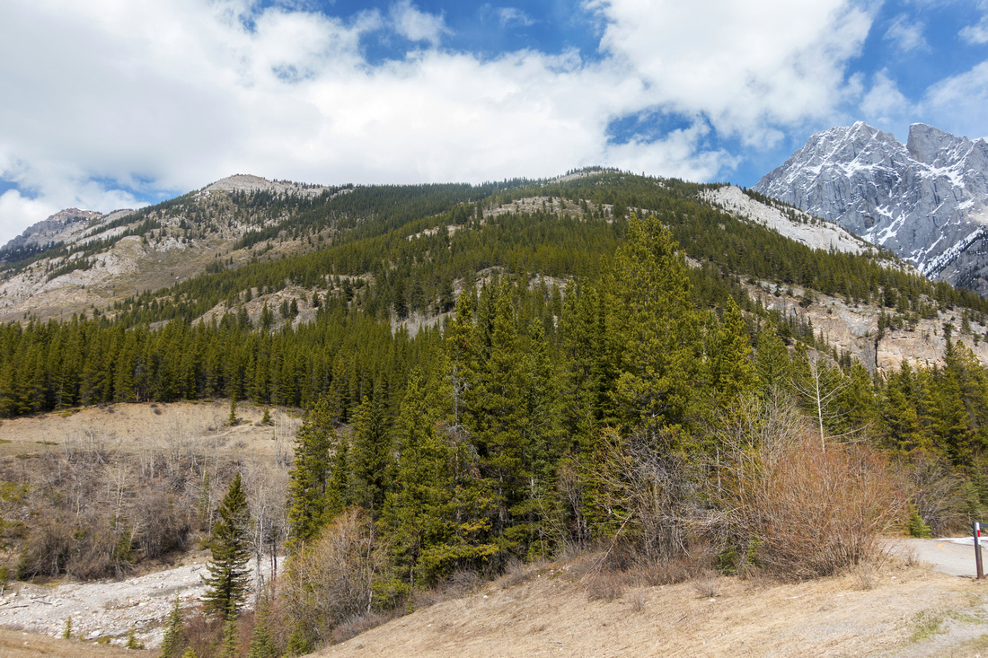 King Creek Trailhead King Creek Trailhead King Creek Picnic area (R) by K-Lakes turnoff. Ridge above, with both highpoints upper left. Mt. Blane upper right
 |
|||
 Ascent Slopes
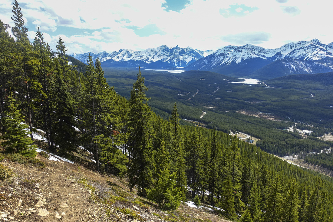
View back to K-lakes area at large clearing ~halfway up Ascent Slopes
View back to K-lakes area at large clearing ~halfway up |
|||
 Snowy Ridge Spine
Snowy Ridge looking back near first highpoint on less-than-ideal spring conditions Snowy Ridge Spine
Snowy Ridge looking back near first highpoint on less-than-ideal spring conditions |
|||
 King Creek Aerial View
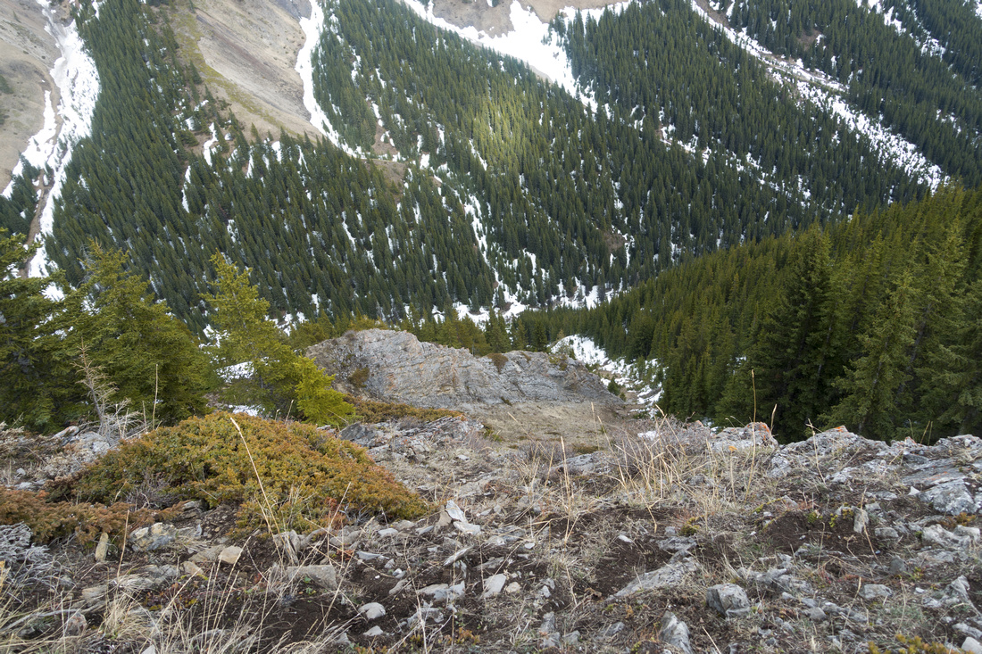
View down east side to King Creek; in late summer when snow has melted and conditions are dry, this is alternate - but not recommended - return. More importantly this is where one would head down if bound for Mt. Hood King Creek Aerial View
View down east side to King Creek; in late summer when snow has melted and conditions are dry, this is alternate - but not recommended - return. More importantly this is where one would head down if bound for Mt. Hood |
|||
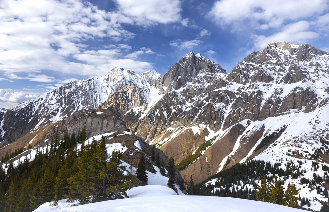 Opal Range
 rearing up with King Ridge end center left. This final bit can be awkward if covered with non-supportive spring snow. Mt. Hood upper right Opal Range
Opal Range rearing up with King Ridge end center left. This final bit can be awkward if covered with non-supportive spring snow. Mt. Hood upper right |
|||
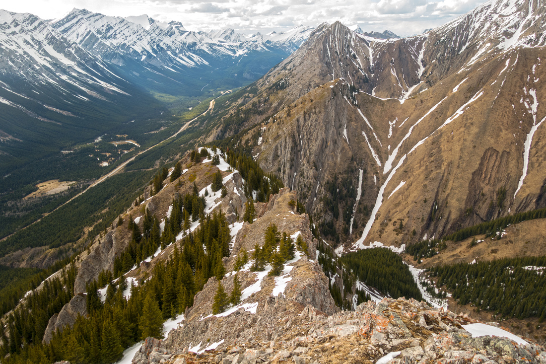 North End
King Ridge North end with views to normal Grizzly Peak scramble route (just right of upper center). Packenham Junior grassy hill in between North End
King Ridge North end with views to normal Grizzly Peak scramble route (just right of upper center). Packenham Junior grassy hill in between |
|||
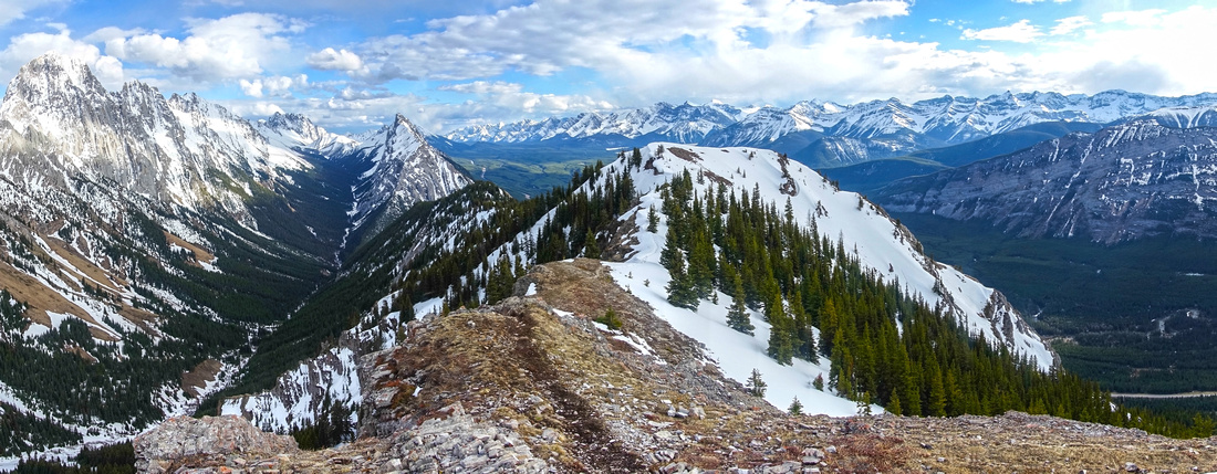 King Panorama
Panoramic View south from end of King Ridge, showing length of King Creek left King Panorama
Panoramic View south from end of King Ridge, showing length of King Creek left |
|||
|
|||
 Self-Indulgence
Enjoying fantastic afternoon light from dry grassy area at first highpoint on return Self-Indulgence
Enjoying fantastic afternoon light from dry grassy area at first highpoint on return |
Abstract
| Overall Difficulty | D4 | Steep ascent to ridge start with tight switchbacks. Ridgewalk has one or two mildly exposed parts with final bit to north end requiring brief use of hands | |||
| Snow Factor | S4 | West slopes are steep and with unstable snow will present serious avalanche danger. Ridge is usually snowbound till late spring with significant postholing | |||
| Scenery | Opal Range and sweeping views of Kananaskis Lakes area with several distant Northover area peaks | ||||
| Trail/Marking | Good | Well defined trail several branches and eroded sections below treeline | |||
| Suggested Time | 5hrs | Add ~1hr for optional return via King Creek | |||
| Elevation | Start: 1575m Max: 2430 m Total: ~900m | Distance: ~7.5km | |||
| Gear | Full hiking boots preferred to light hikers. Poles will help significantly on steep west slope. Micro-spikes in shoulder season essential (both for ice and mud!) | ||||
| Water | Except for seasonal snow melt only water source is King Creek right at the start. Carry 1-2L | ||||
| Dog Friendly | Yes | Standard back-country travel precautions. Grizzly bears frequent the area | |||
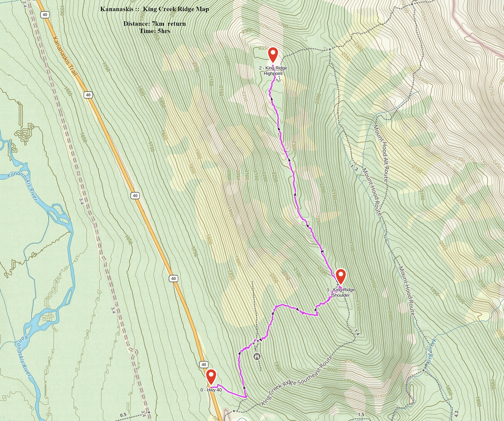 King Creek Ridge GAIA Map
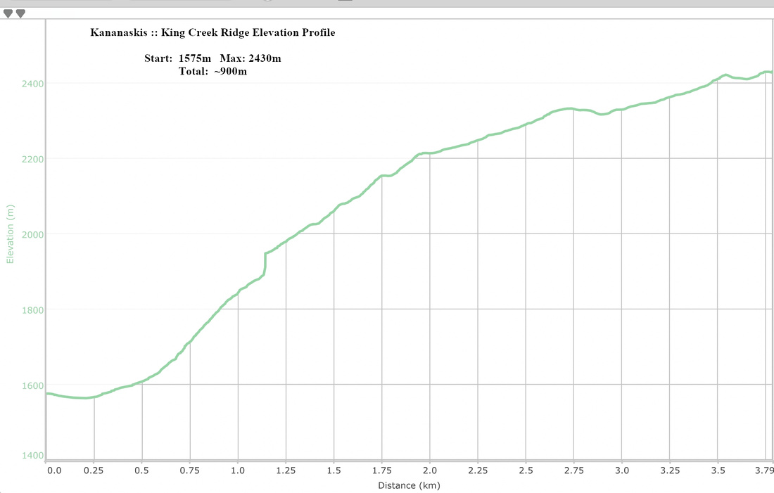 King Creek Ridge Elevation Profile