Google Map |
Rockies :: Kananaskis :: Packenham Junior |
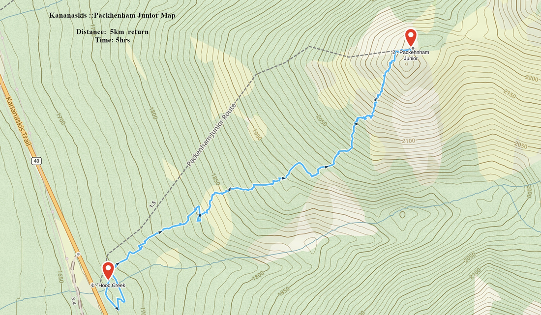
GPS Track |
|
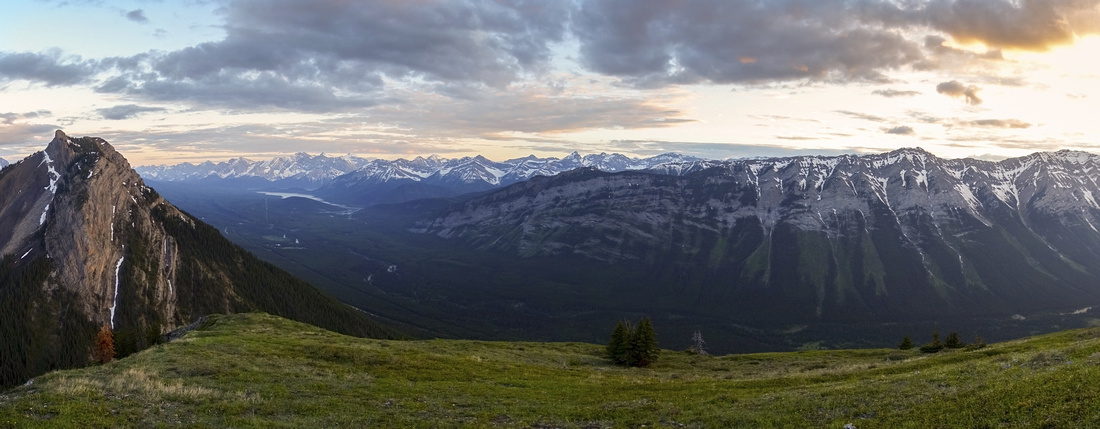
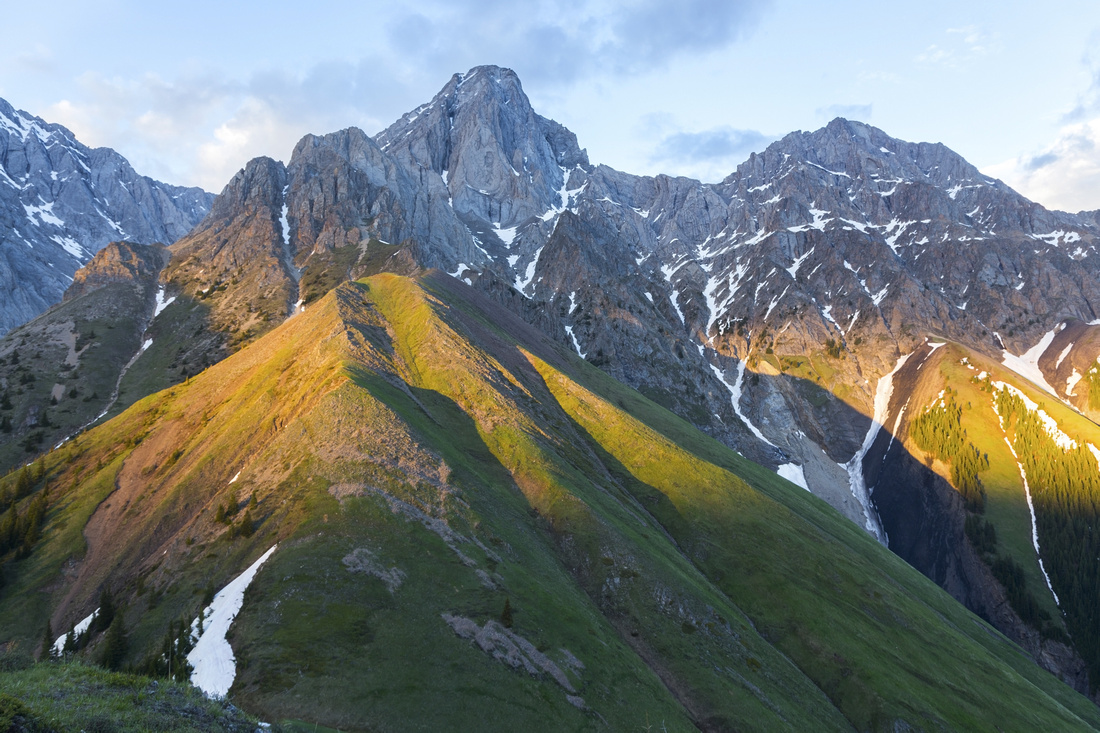
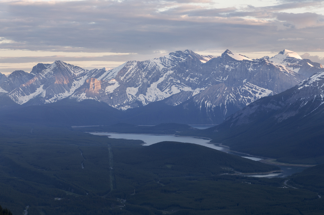
Panoramic View towards Kananaskis Lakes area from Packenham Junior. King Creek Ridge Highpoint extreme left, Little Lawson long ridge center right |
|||
| Trip Summary | |||
June 30, 2022Grassy Hill in Opal Range, sandwiched between Grizzly Peak to the North and King Creek Ridge to the South. The name is unofficial - it gained traction due to named Mt. Packenham in Opal range directly east. It is short but reasonably steep ascent couple of km north from Kananaskis Lakes junction. There is no parking area but convenient pullout behind some barricades just north of Hood Creek drainage can fit 7-8 vehicles. Rudimentary Trail exists on climber left of the drainage, but generally does not lead in optimal direction. On my ascent I took "beeline to treeline" shortly above the highway and there was no bushwhack to speak of, while direction was obvious. On descent I followed trail that stays near Hood Canyon Rim out of curiosity and it had some deadfall, unnecessary ups/downs and even couple of short cliff bands - make your pick. Just above treeline grade steepens up considerably and final part is on 40-45 degree angled grass slope. It is not a big deal, but if slippery/snowy it would be quite unpleasant, particularly on descent. I found zig-zag line aiming climber left towards north ridge least cumbersome. "Summit" is wide and has better views than expected. On sunny summer weekends when nearby King Creek Ridge and Grizzly peak will be swarming with Calgary weekend warriors, Packenham Junior will not be even half as crowded - yet. Recommended short, even after work trip. |
|
Gallery |
|||
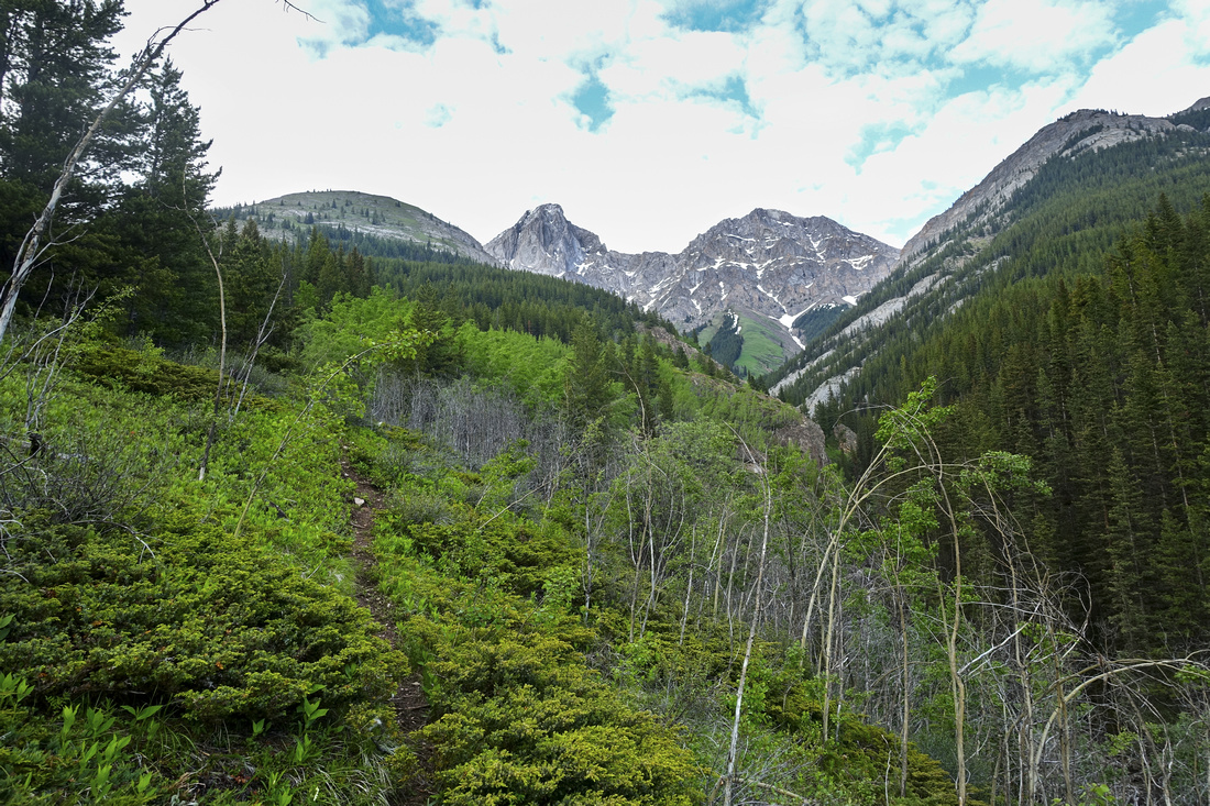 Hood Creek Hood Creek Starting up narrow, but fairly well defined trail at Hood creek left side. Objective, grassy hill upper center left, is further than it looks. For best line up leave trail about here and ascend semi-open forest to the left
 |
|||
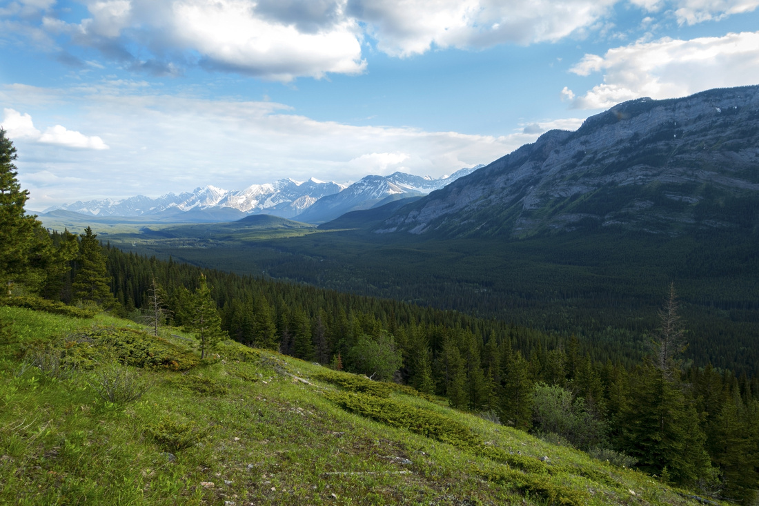 Lower Meadows
Crossing open meadows in lower part with nice view south towards K-Lakes area Lower Meadows
Crossing open meadows in lower part with nice view south towards K-Lakes area |
|||
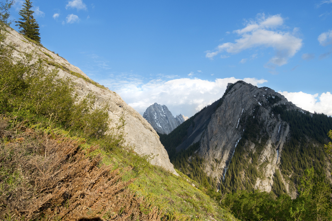
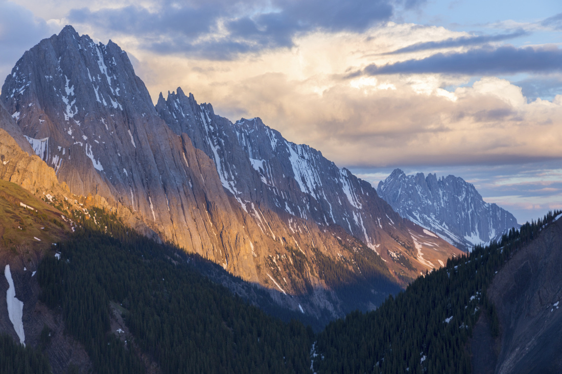
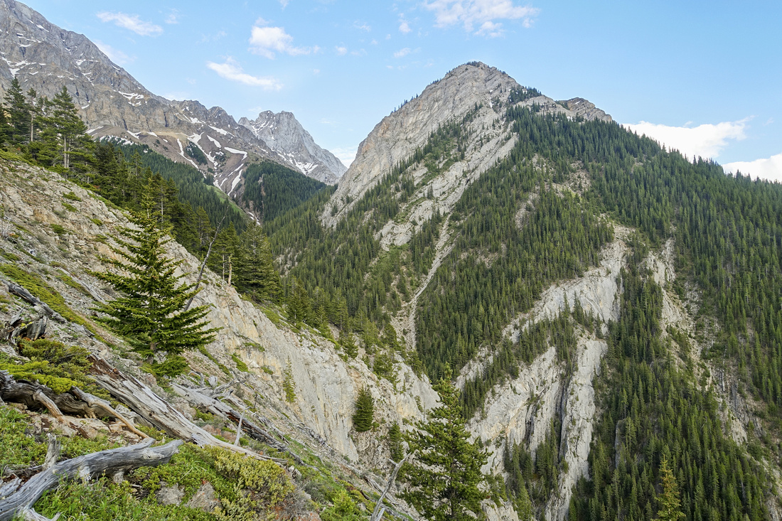 King Creek Ridge
Higher up bit of peeling rock bands that pose no problems. King Creek Ridge upper center right King Creek Ridge
Higher up bit of peeling rock bands that pose no problems. King Creek Ridge upper center right |
|||
 Upper Cliff
Just below steep part 2-3 meter high cliff that is easily bypassed climber left. If you followed trail, it will peter out about here Upper Cliff
Just below steep part 2-3 meter high cliff that is easily bypassed climber left. If you followed trail, it will peter out about here |
|||
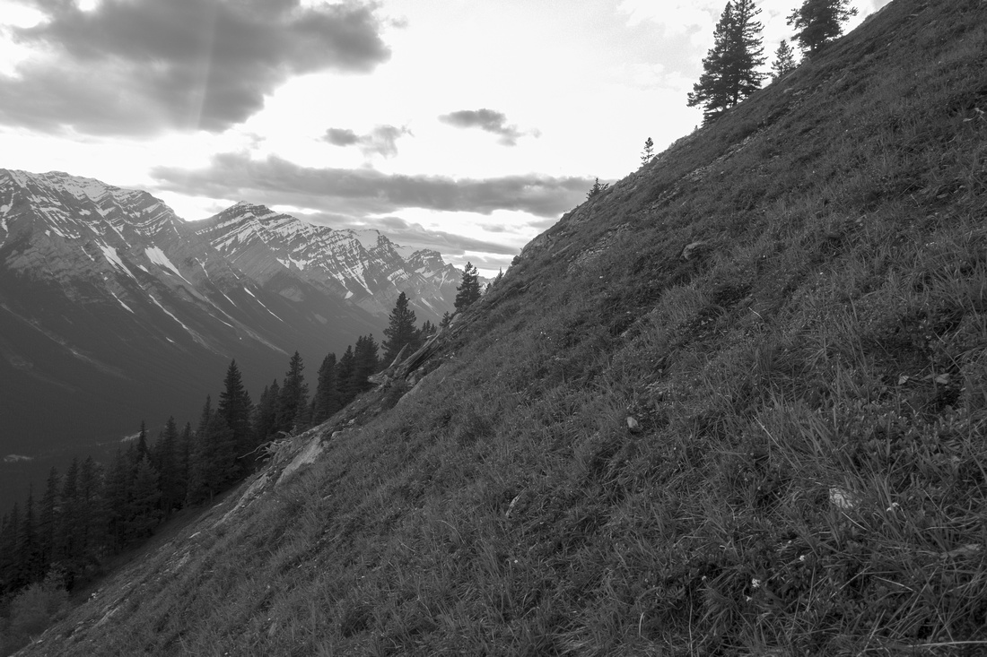 Steep Grade
Very steep final ascent on grass. Hiking poles are great asset on descent. With snow or wet/muddy after rain, this bit could be quite unpleasant Steep Grade
Very steep final ascent on grass. Hiking poles are great asset on descent. With snow or wet/muddy after rain, this bit could be quite unpleasant |
|||
 Grizzly Peak
Finishing up on north ridge with great views to Grizzly Peak showing standard ascent line Grizzly Peak
Finishing up on north ridge with great views to Grizzly Peak showing standard ascent line |
|||
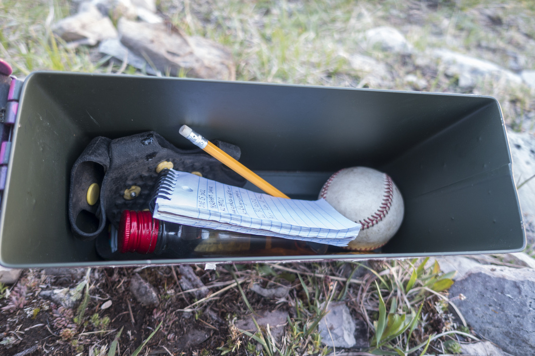 Pink Register
Contents of ever present pink summit register on Packenham Junior Pink Register
Contents of ever present pink summit register on Packenham Junior |
|||
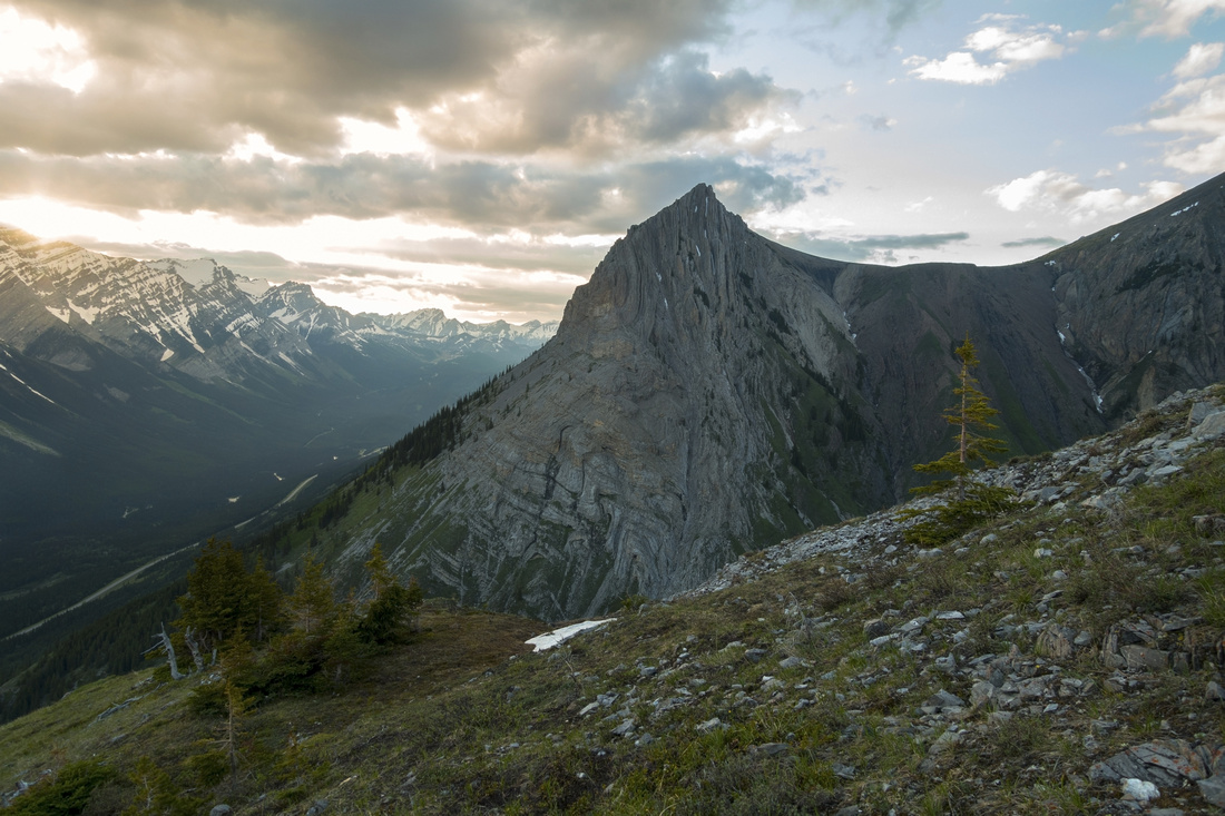
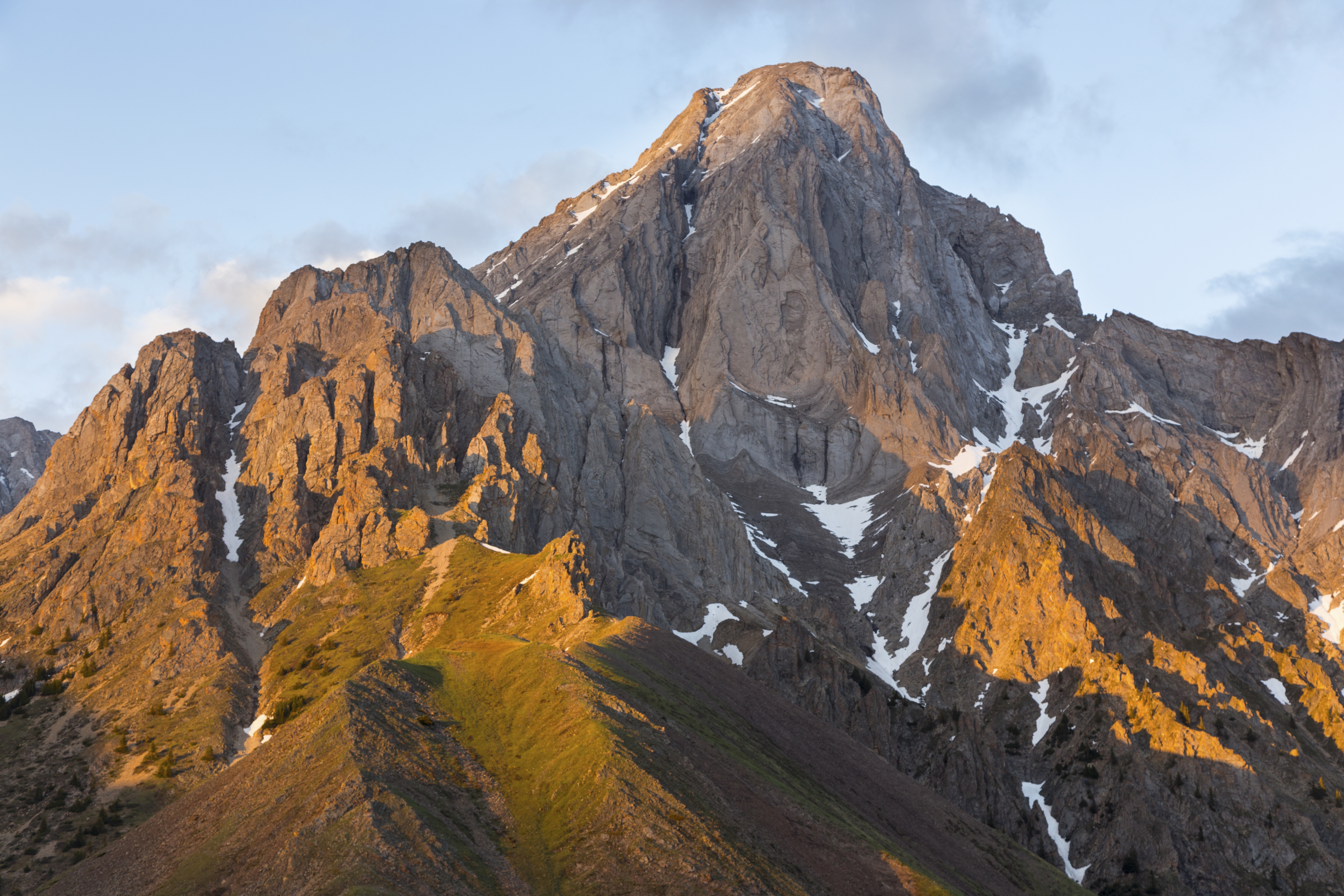
 Packenham Senior
Mount Packenham separated by grassy saddle on east side is technical ascent Packenham Senior
Mount Packenham separated by grassy saddle on east side is technical ascent |
|||
 |
|||
 Mt. Evan Thomas
 to the north east Mt. Evan Thomas
Mt. Evan Thomas to the north east |
|||
 King Creek Ridge
 Highpoint directly south, normally very busy on weekends King Creek Ridge
King Creek Ridge Highpoint directly south, normally very busy on weekends |
|||
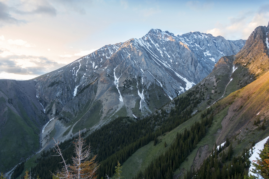
 Opal Range
Other members of Opal Range family - Hood, Brock, Blane Opal Range
Other members of Opal Range family - Hood, Brock, Blane |
|||
 Kananaskis Lakes
K-Kananaskis Lakes Telephoto. L-R: Mt. Fox, Turret, Mt. Sarrail and Mt. Joffre Kananaskis Lakes
K-Kananaskis Lakes Telephoto. L-R: Mt. Fox, Turret, Mt. Sarrail and Mt. Joffre |
Abstract
| Overall Difficulty | D3 | Steep upper part on grass. Couple of minor cliffs avoidable. | |||
| Snow Factor | S4 | Upper part is steep and exposed; with unstable snow conditions could be quite dangerous | |||
| Scenery | Opal Range directly east. Distant K-lakes with several well known area peaks | ||||
| Trail/Marking | None | Rudimentary trail partway up Hood Creek left (east) side, but has some deadfall, unnecessary ups/downs and generally does not lead in best direction. | |||
| Suggested Time | 3hrs | Return time allowing 20-30min summit break | |||
| Elevation | Start: 1600m Max: 2290 m Total: 695m | Distance: 5 km (return) | |||
| Gear | Full hiking boots mandatory. Poles extremely helpful for steep grass slope above treeline. Long pants/sleeves preferred because of minor bushwhack | ||||
| Water | Hood Creek at start, none after. 1L should be enough as it is short outing | ||||
| Dog Friendly | Yes | Standard back-country travel precautions. Grizzly bears frequent the area | |||
 Packhenham Junior GAIA Map
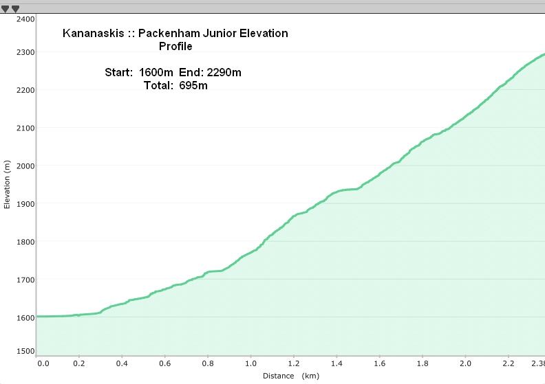 Packenham Junior Elevation Profile