Google Map |
Rockies :: Kananaskis :: Little Lawson |
GPS Track |
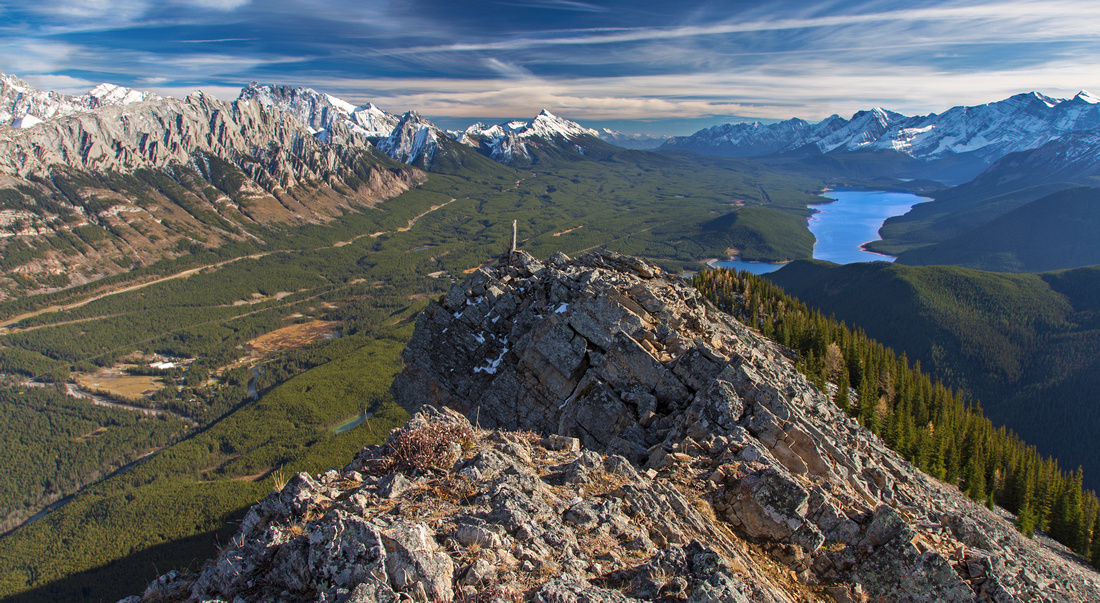 
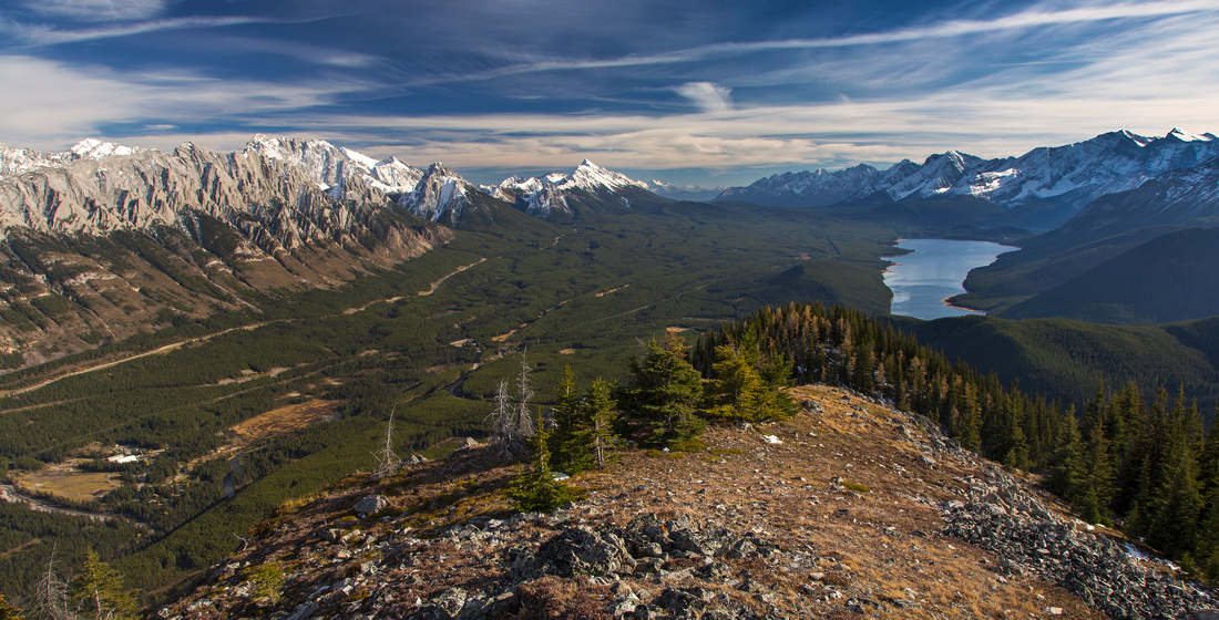
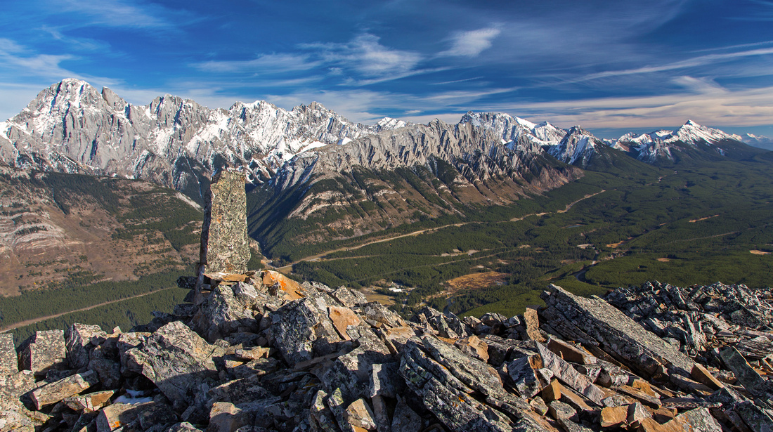
Final bit of slightly exposed ridge leading to highpoint with fabulous views to lower K-lake and Opal range |
|||
| Trip Summary | |||
October 5, 2015Such a huge reward for so little effort! While Mt. Lawson is well-known moderate Kane scramble, its south end (nick-named "Little Lawson") can be reached from Smith-Dorrien trail with little difficulty. Views are nothing short of outstanding, and personal favorite of Kananaskis Lakes basin. Most of ascent is under tree cover, but once above treeline panoramic 360 views are guaranteed to leave you breathless. Hike is described in K-country trail guide, 4th Edition Vol 1 and guaranteed to become more popular. Outing is short and good candidate for snowshoe winter ascent. Park at pull-out on right side of Smith-Dorrien, opposite Pocaterra day-use few kilometers past junction from K-lakes access road; it will be shortly past large 180 bend. Hike along Trans-Alta road past the gate, initially paralleling Smith-Dorrien, then turning left and away. Ascent ridge comes in view shortly. End of road is reached about 15-20 minutes from parking. Cross Kent creek before old dam by intake and find trail on the right side. Initially trail ascends steeply, then levels couple of times before final rise to treeline. It becomes faint couple of times, but flags always lead you in right direction; if in doubt, stay close to right (east) edge and you will pick it up again. Occasional openings in tree cover grant great views of King's Creek ridge on east side. Treeline is reached about 1 hour from old dam; trail transfers slightly left, and views open up so majestically you are guaranteed to reach for camera and have a breather. Further up couple of rises lead to semi-open false summit, followed by dip to saddle and final rise to highest point of the ridge. This bit is rugged with narrowest part being slightly exposed, but short. Ridge then widens again and leads within 5 minutes on grass towards summit cairn. It is possible to continue towards true summit of Mt. Lawson. Initial descent is rough, but manageable. Stretch through forest with no trail leads to meadows that can be studied from Little Lawson. However upper portion is cliffy and exposed and constitutes difficult scramble. |
|
Gallery |
|||
 Views from Trans-Alta road near the parking
 |
|||
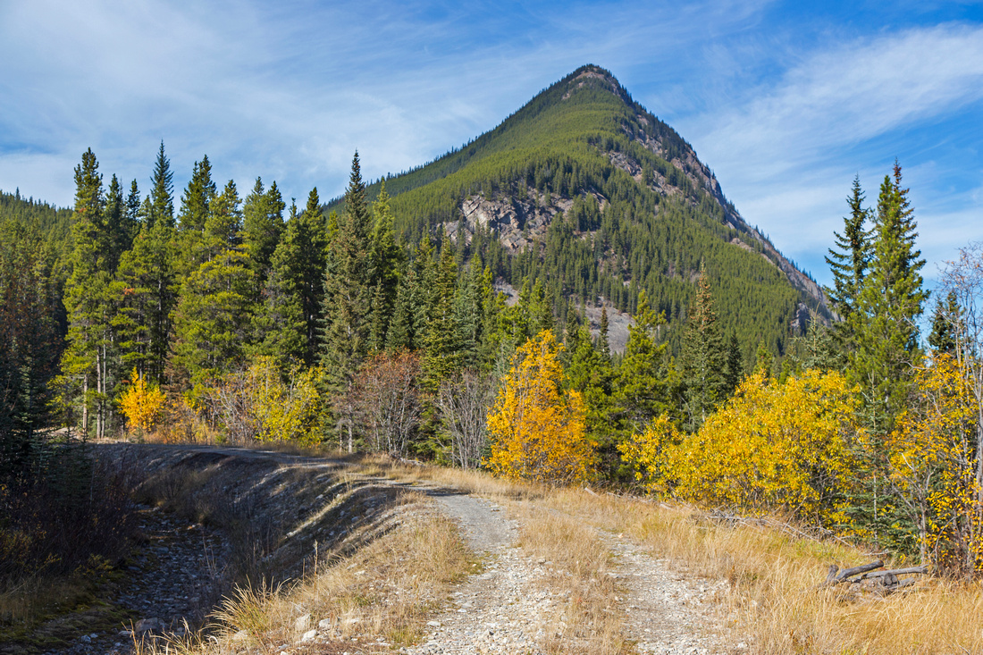 As road curls towards Kent creek ascent ridge comes into view
 |
|||
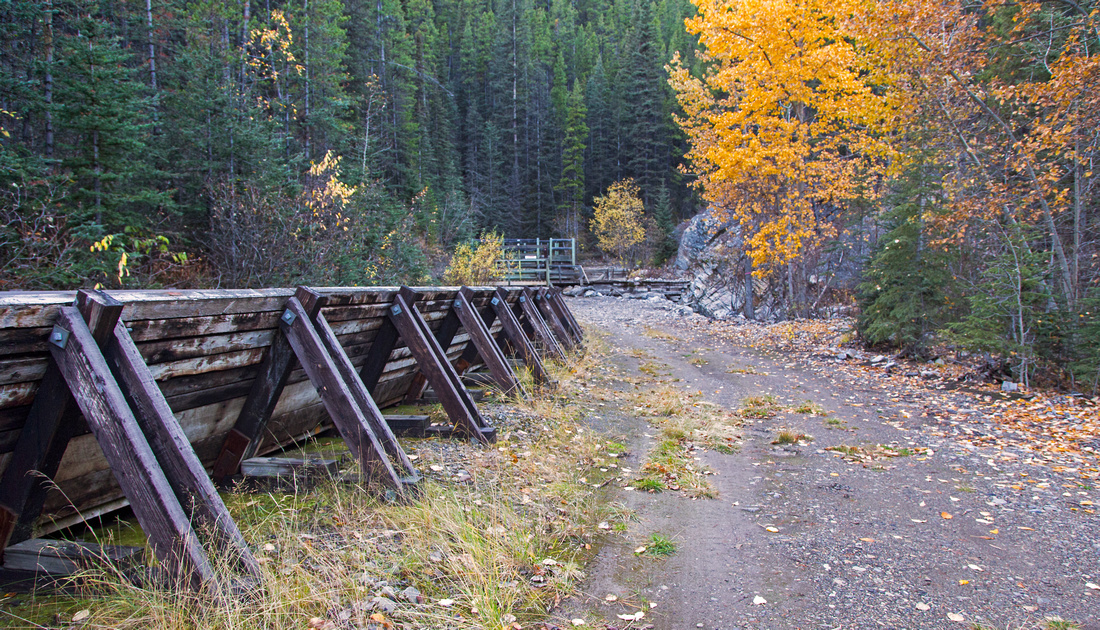 Old intake and end of Trans-Alta road; cross creek on the right side and pick-up trail
 |
|||
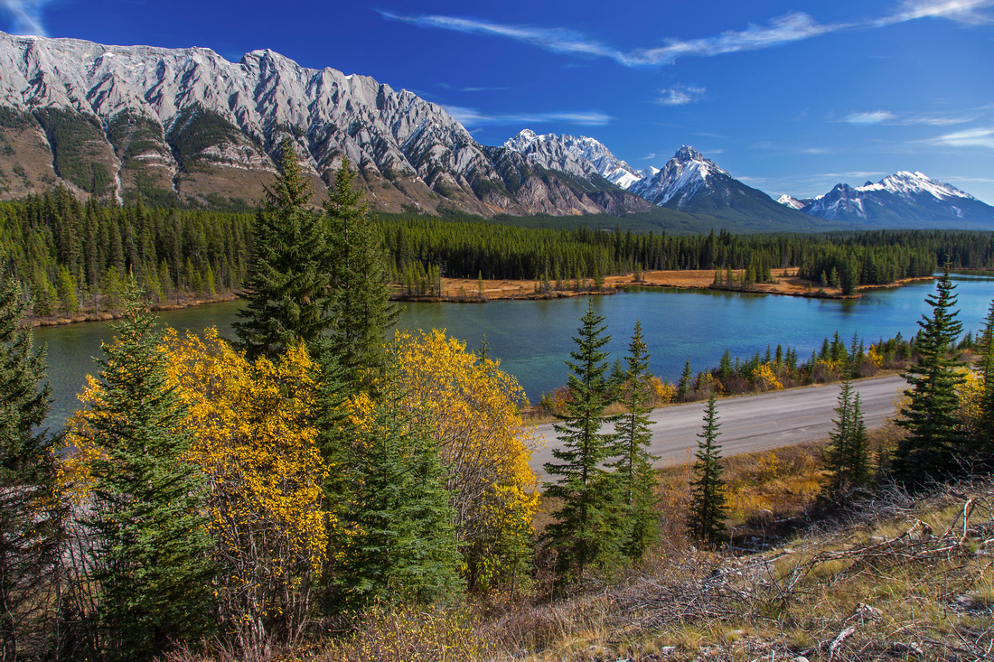
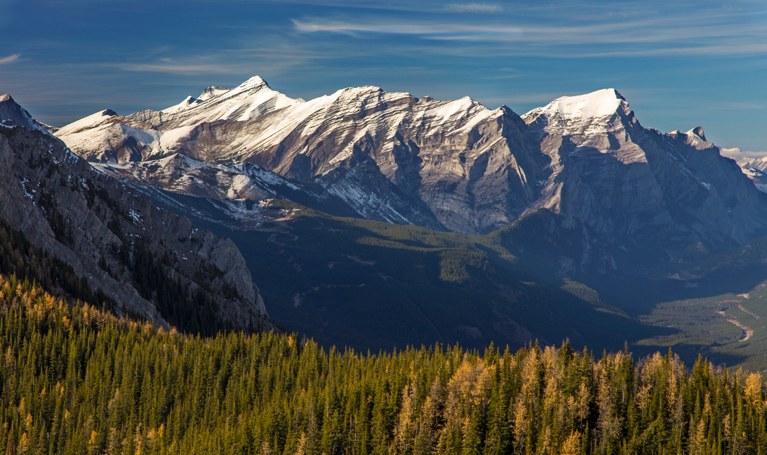
 Fantastic views of K-lakes basin at treeline
 |
|||
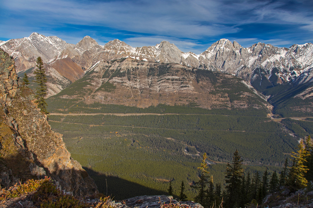 Kings Creek ridge on east side of Kananaskis Trail
 |
|||
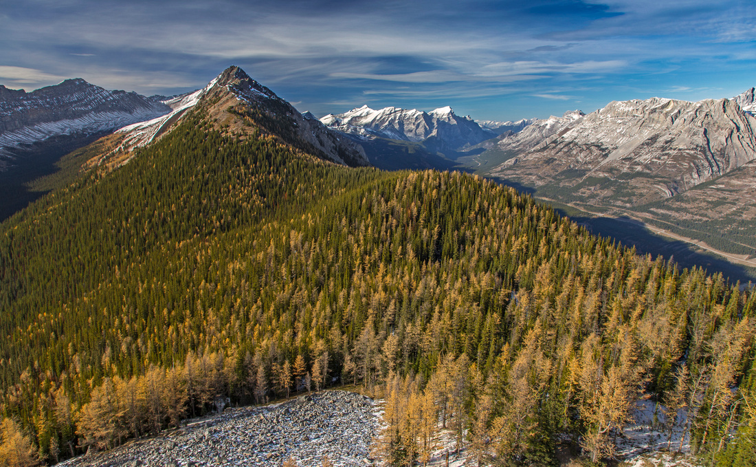
 Upper part of ridge leading to lower summit
 |
|||
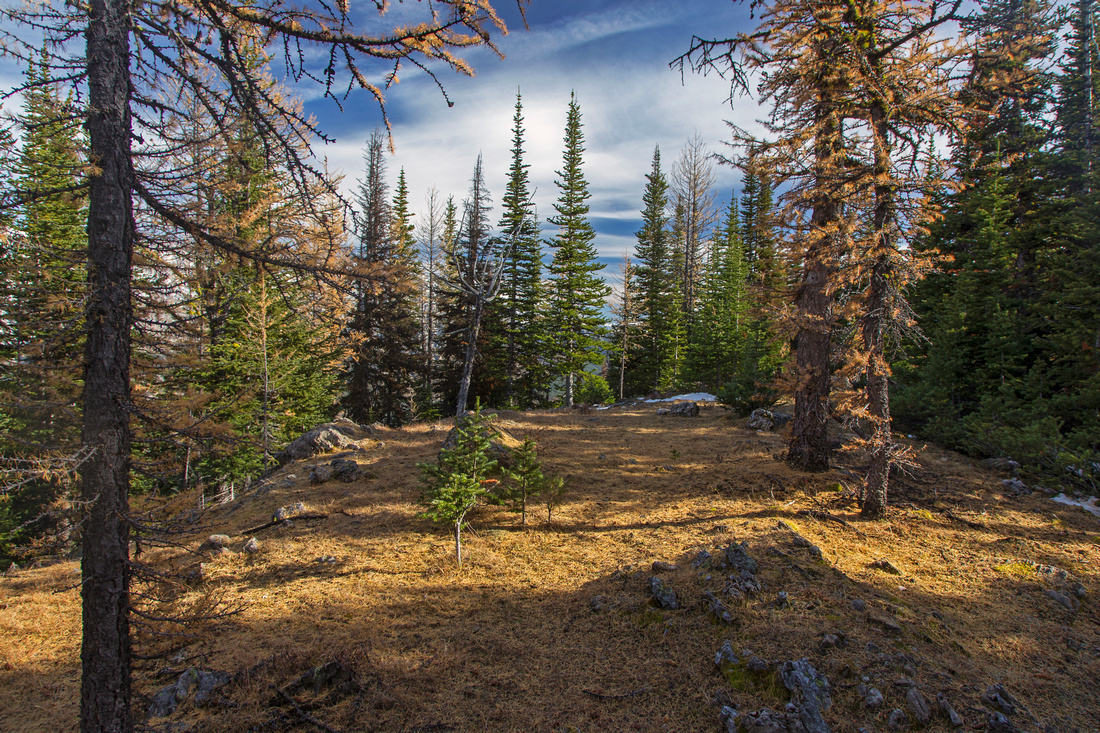 Carpet of gold larch needles just past lower summit
 |
|||
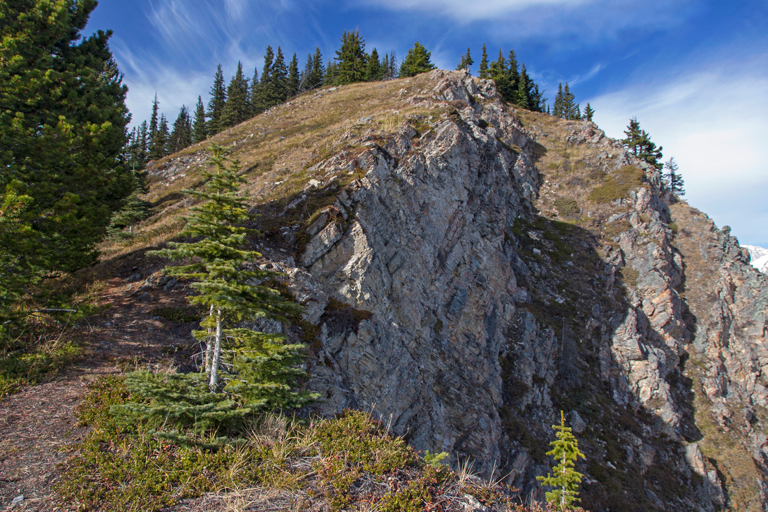
 Rock cutlass before narrow part of final ridge
 |
|||
 Mt. Lawson from highpoint of Little Lawson ridge
 |
|||
 Zoom on Mt. Kidd group. Fortress Ridge upper center-left
 |
|||
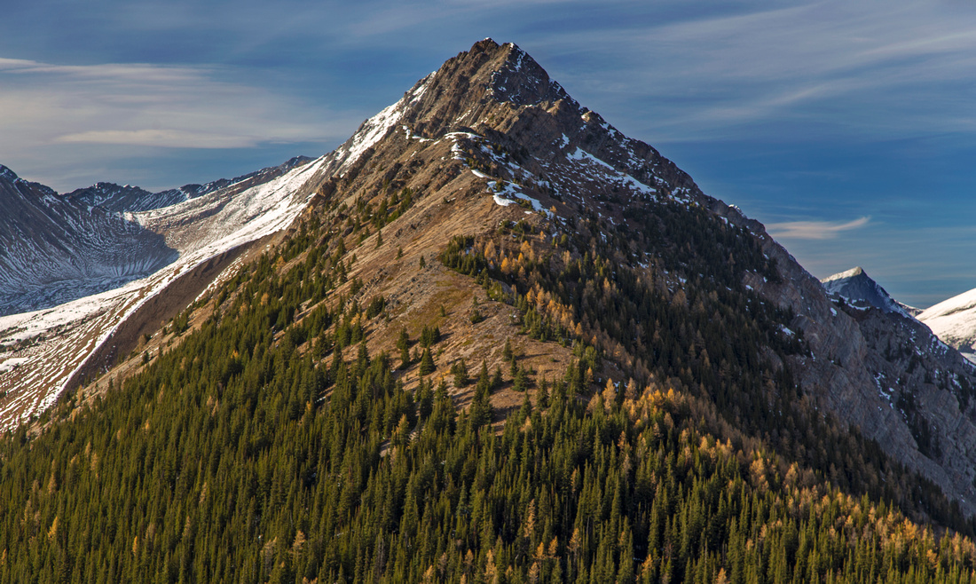
 Long ridge extending to Mt. Lawson
 |
|||
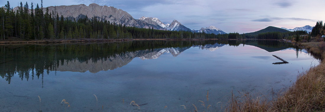 Twilight roadside shot near the parking
 |
Abstract
| Overall Difficulty | D4 | Unbridged creek crossing. Trail has some steep portions. Final bit of ridge is rugged and slightly exposed | |||
| Snow Factor | S2 | Excellent winter snowshoe with little avalanche danger. Upper ridge often windblown and snow free | |||
| Scenery | Outstanding panoramic views of Kananaskis Lakes basin, Opal range, King's Creek and Kent ridges | ||||
| Trail/Marking | Poor | Faint trail to treeline occasionally flagged, but way is obvious | |||
| Suggested Time | 4hr | Return time to highpoint. Possibility of further exploration towards Mt. Lawson true summit | |||
| Elevation | Start: 1700m Max: 2375m Total: ~750m | Round Trip: 8.5km | |||
| Gear | Day hikers or full hiking boots. Poles helpful for stability on steeper parts and final rugged bit before the summit | ||||
| Water | Dry hike past Kent creek; carry 1-2L | ||||
| Dog Friendly | Yes | Cougar tracks have been reported in upper ridge -- standard precautions | |||
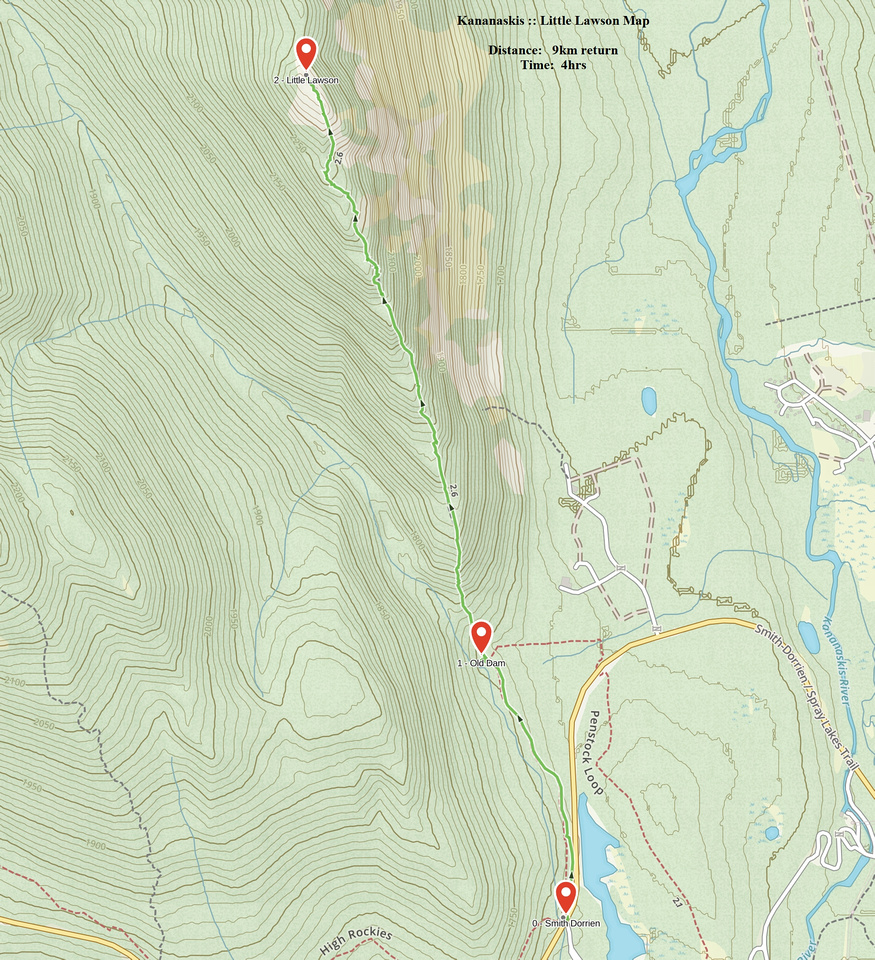 Little Lawson GAIA Map
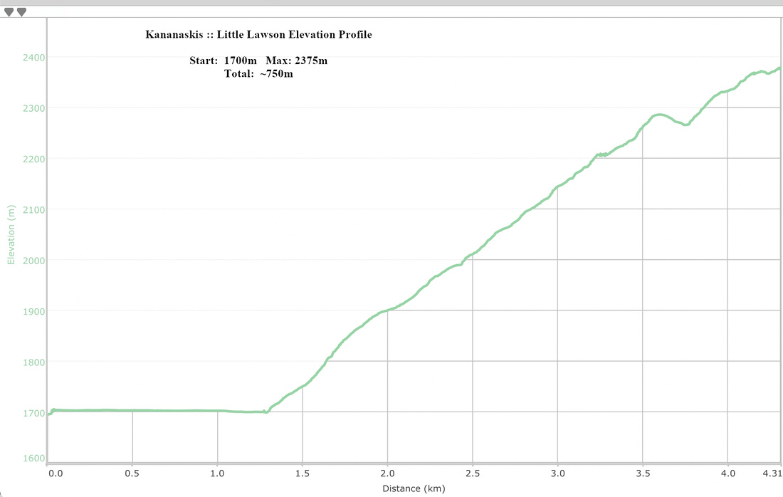 Little Lawson Elevation Profile