Google Map |
Rockies :: Kananaskis :: Fortress Ridge |
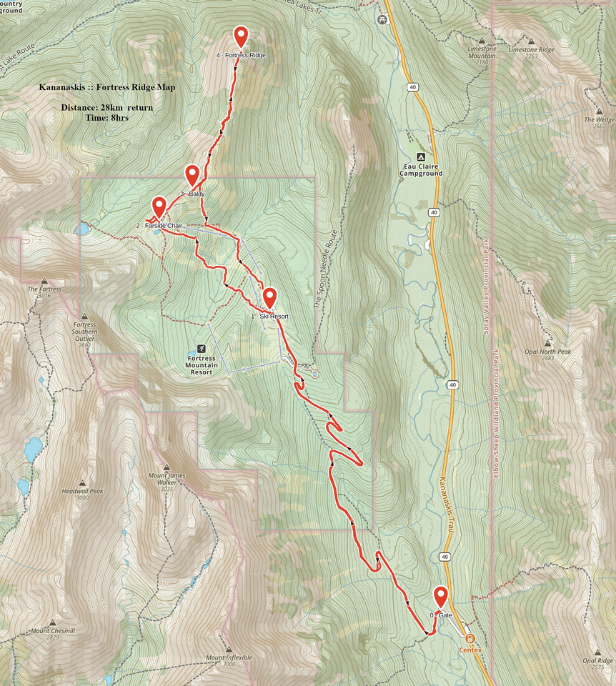
GPS Track |
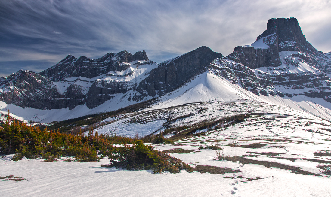 
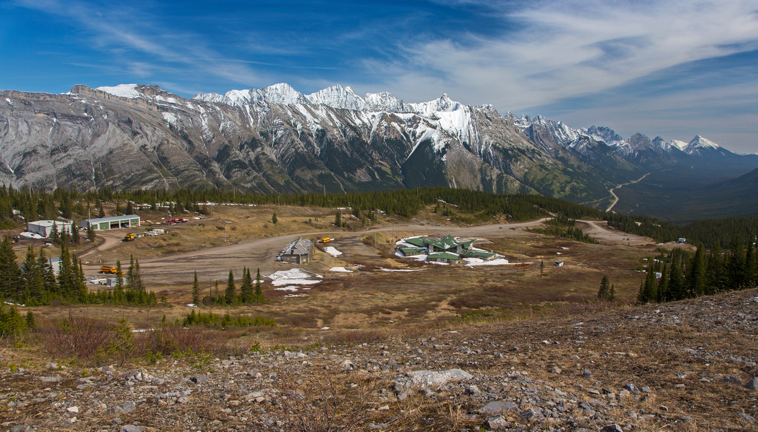
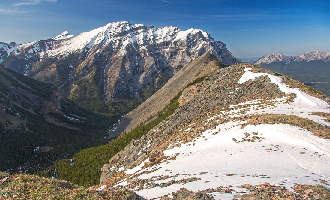
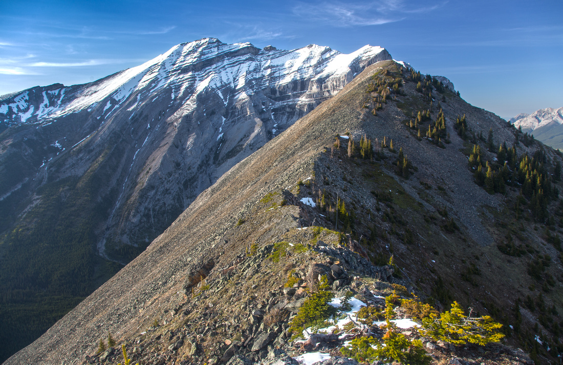
Start of the Ridge just below Baldy peak looking at top of Farside Chair and Fortress Mountain |
|||
| Trip Summary | |||
May 15, 2016An awesome bike and hike trip that is likely to provide solitude on sunny weekend when other popular destinations along Hwy40 are extremely busy. This trip is also described in Kananaskis Trail Guide, Vol 1 4th edition (blue). Views are outstanding. Fortress Mountain steals the show, but there are other scenic points as well including half a dozen of nearby Kane scrambles. Traversing entire ridge to its north end above Galatea creek involves several ups and downs. There is not much in terms of technical difficulty, but it is not simple hiking either. Beyond 2nd bump ridge drops steeply down blocky steps where care and good stability is required, so if you don't feel like going all the way this is an excellent turnaround point. If going further be ware that in early spring trips snow often lingers on steep slopes below 2nd bump requiring careful navigation and possible step kicking. Second crux is narrow part on low point between 3rd and 4th bump -- one tricky bit can be bypassed to the right (east), but is also great fun if downclimbed directly. Beware of bears; this entire area is hot spot.
First task is to get to Fortress ski area, where the hike starts. One used to be able to drive up, but since the closure road is gated thus posing significant logistic problems. Day trip entirely on foot is feasible, but if there was ever a case to be made for cycling the approach this is it! Road is about 8km long and you gain 500 vertical. Grade is low angle, but constant and will tire most casual cyclists. Real payback is on the way back -- 20 minutes of coasting for what likely took over an hour going up!
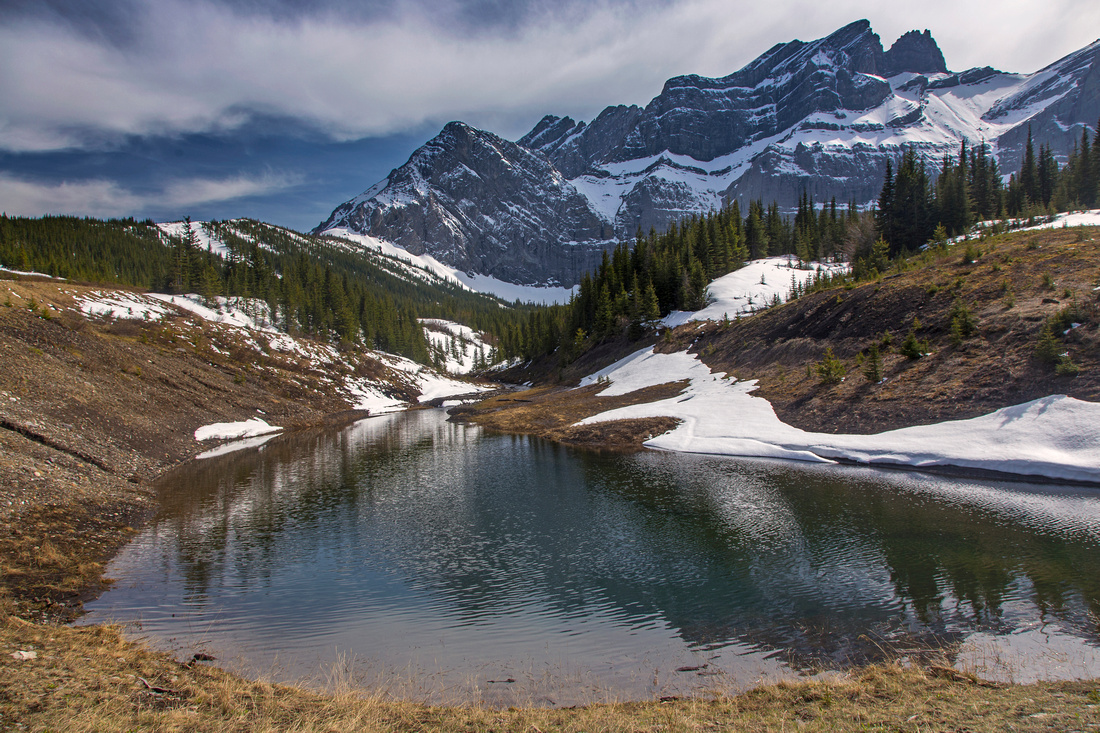
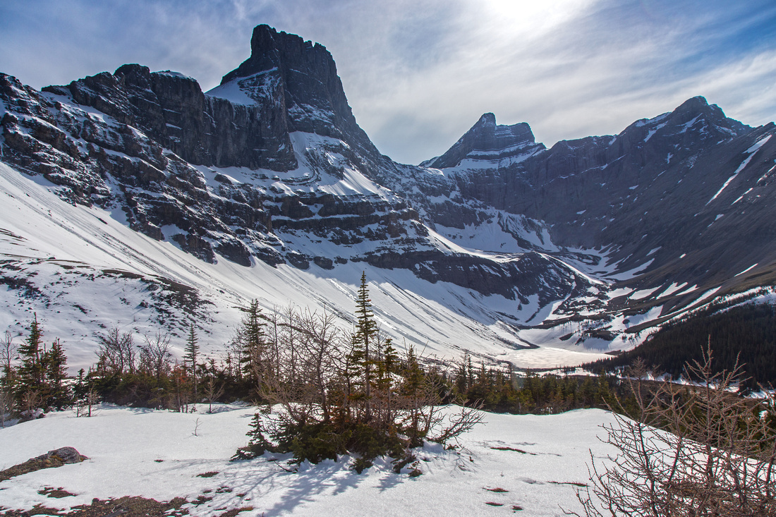
Drive Kananaskis Trail (Hwy 40) to Fortress Service station, then turn right and descend to bridge over Kananaskis River. The gate is here. Park and cycle the access road to ski resort. Final couple of kilometers are the steepest and if feeling tired you might have to push. Leave the bike and start up ski run directly to the left (west) heading to grassy Canadian ridge. From there rest of the journey is visible; Fortress ridge is long spine extending right from top of Farside chair across the intervening valley. There is over 100m vertical loss to descend to this valley, but scenic reward is pretty tarn/reservoir at head of Aussie creek. Continue up ski runs -- bits of trail -- and reach top of Farside chair, about 1 hour since you left the bike. This is an awesome place and well worth exploring a bit. Walk downhill towards Fortress mountain for very nice view of Fortress Lake; it will feel even more special if you enjoyed bird-eye view from top of Fortress Mtn (Kane scramble). Gusty Peak and Mt. Galatea appear formidable as well. After a break, start up the ridge. First bump (called "Baldy") is also the highest, so peakbaggers need not go any further. However it would be a shame not to continue at least to 2nd bump -- it is close, and travel is hands-in-your-pockets type with amazing 360 views.
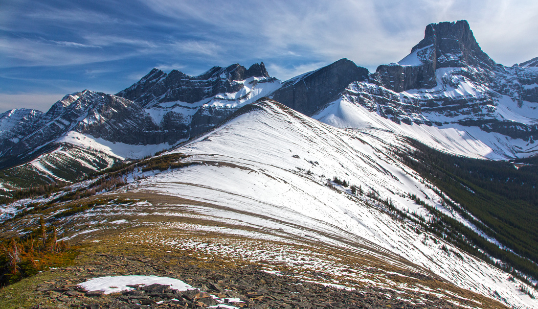
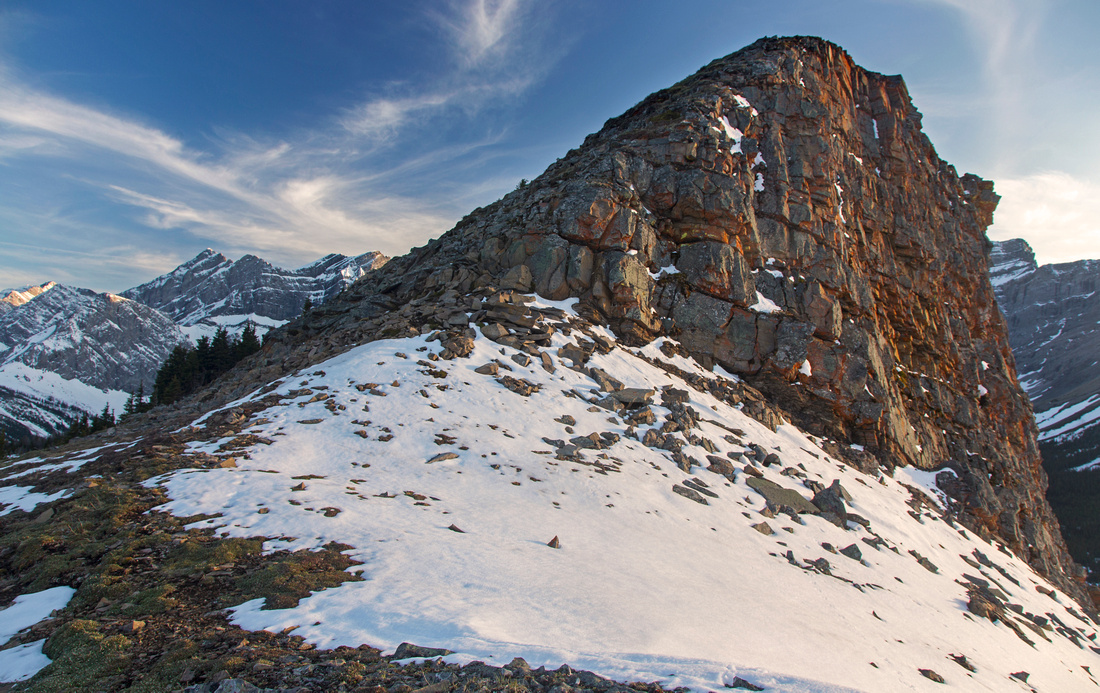
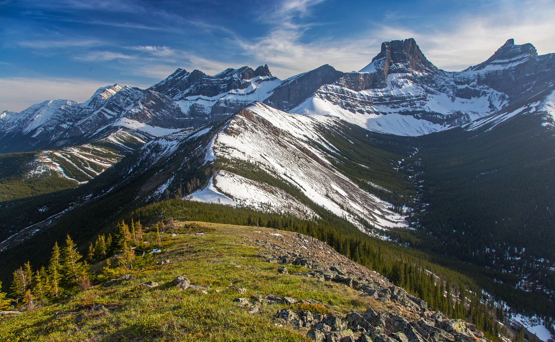
Past the 2nd bump hike becomes more technical and borders scrambling at couple of spots. This part of the ridge is also dotted with larches, thus making it an awesome fall hike! Finally reach 4th bump -- about 1 1/2 hours from top of Farside chair. Although not the highest, it has summit cairn. Views across to Mt. Kidd are formidable, while to the east long ridge unofficially called "Spoon Needle" appears far less dramatic than when seen from Hwy40. On return it is not necessary to backtrack all the way to Farside chair; circle on left (east) side of Baldy and descend adjacent ski run, then hike back to ski resort on roads. This is less scenic than the way in, but at this point you probably won't care. Final bit is the exhilarating ride down, but be on alert for bears coming down that speed.
Before setting on a trip, check latest conditions and/or security updates in Fortress Service station. It also appears possible to gain the ridge slogging up avalanche slopes from the valley between Fortress ridge and Spoon needle, but this would be very poor choice and entirely unnecessary. Bike option is much preferred and recommended. |
|
Gallery |
|||
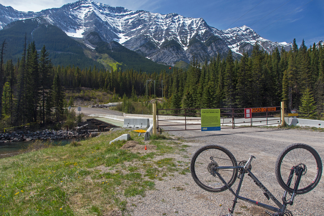 Fortress Junction Gate. 8km/500m of cycling ahead
 |
|||
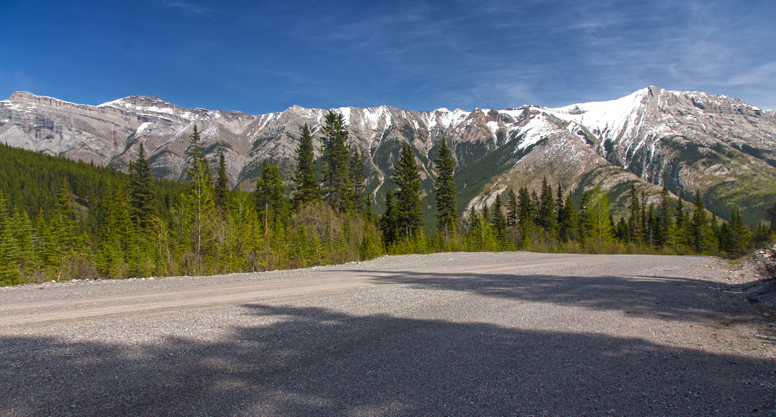 Views back to Opal range around 4km mark
 |
|||
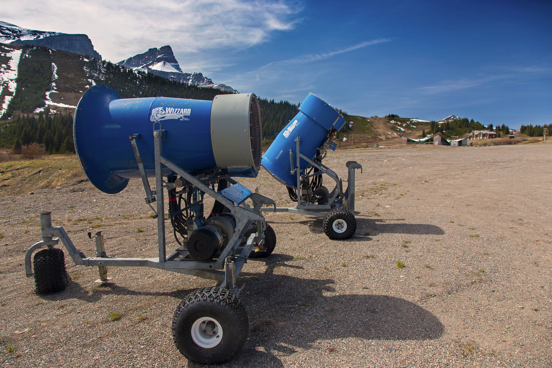 Abandoned snow canons nearing the ski lodge
 |
|||
 View of ski complex from top of Canadian ridge
 |
|||
 Fortress reservoir at head of Aussie Creek
 |
|||
 Fortress Lake from top of Farside Chair. Fortress mtn center left
 |
|||
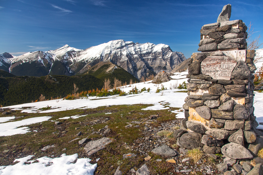 Memorial near top of Farside chair. Mt. Kidd massif in the distance
 |
|||
 Fortress ridge from low point between Baldy and 2nd bump
 |
|||
 Looking back to Baldy near top of 2nd bump. Fortress Mtn behind
 |
|||
 Ridge crux: steep-ish descent on rocky slope
 |
|||
 View back from grassy slopes below 3rd bump
 |
|||
 Final part of the ridge past 3rd bump. Narrow bit just ahead
 |
Abstract
| Overall Difficulty | D4 | Steep grass or talus slopes. Class 2 scramble descending 2nd bump. Narrow, but avoidable bit at low point between 3rd and 4th bump. Long day with considerable total distance and elevation gain, even with bike | |||
| Snow Factor | S3 | Logistics are not favorable for winter trip since cycling of closed access road would not be possible. Road not likely to be trackset for X-country ski access. Narrow bits of upper ridge could prove problematic if snow covered. | |||
| Scenery | Fabulous view of Fortress Mountain showing its rugged east aspect. Not-so-often seen Fortress lake. Great views of Mt. Kidd, Gusty Peak, Galatea, Wedge, Mt. Fisher and several other Kananaskis peaks. | ||||
| Trail/Marking | None | Hike/cycle on access road. No trails exist past ski complex, but way is obvious | |||
| Suggested Time | 8 hr | Return time given for approach with bicycle and hike to far end of the ridge. Considerably more if walking the access road | |||
| Elevation | Start: 1570m Max: 2370 m Total: ~1500 m | Round Trip: ~28 km | |||
| Gear | Bicycle is essential. Gaiters helpful for snowy bits between 2nd and 3rd ridge bumps. Hiking poles recommended for stability. | ||||
| Water | Drainages crossing access road in early spring. Aussie creek between Canadian Ridge and Farside chair. Ridge is dry. Carry 2-3 L | ||||
| Dog Friendly | Yes | Bears are often seen along the access road and in slopes above ski complex | |||
 Fortress Ridge GAIA Map
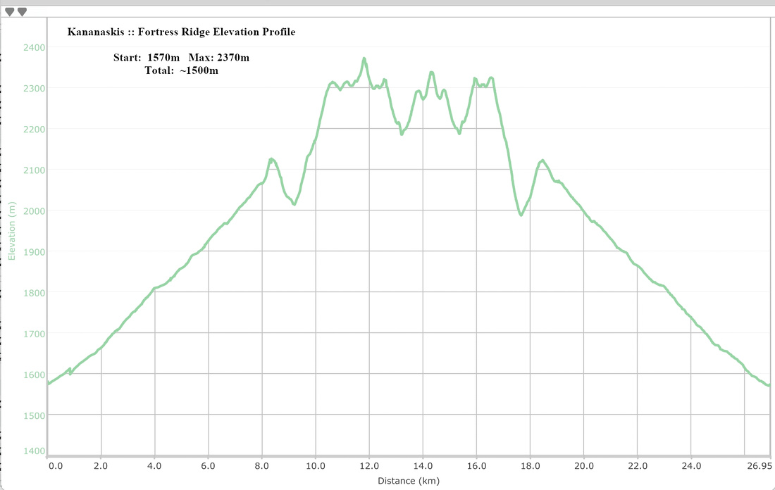 Fortress Ridge Elevation Profile