Google Map |
Rockies :: Kananaskis :: Northover Ridge |
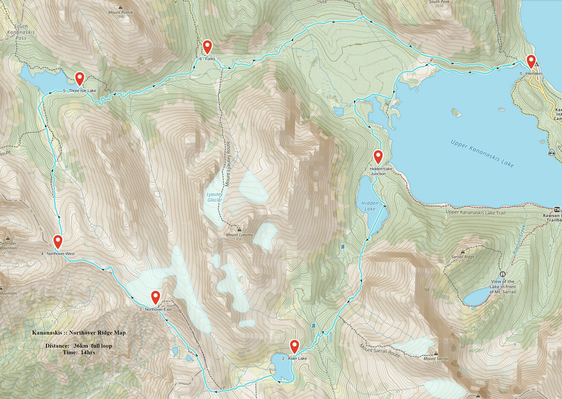
GPS Track |
|
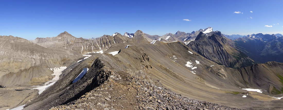
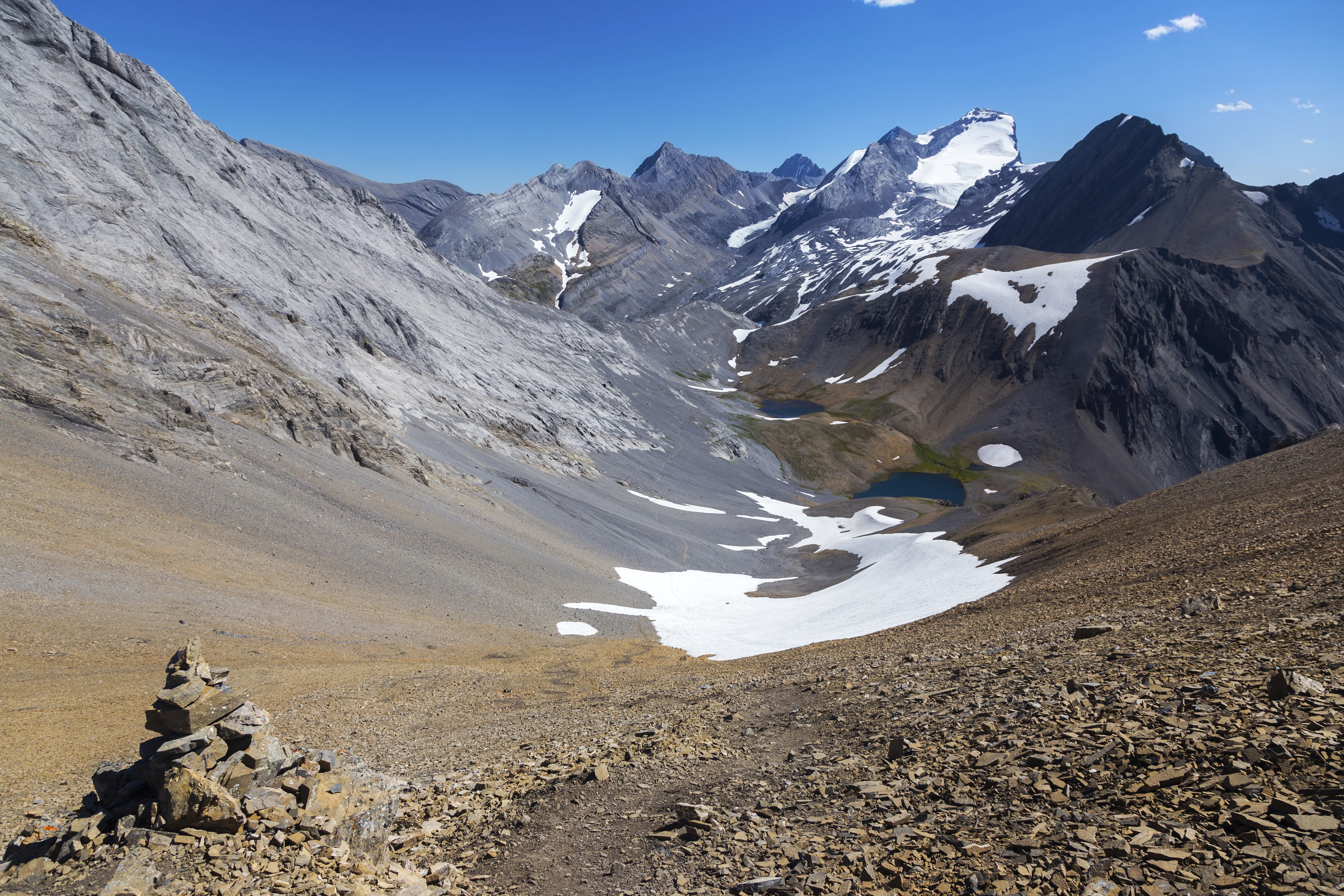
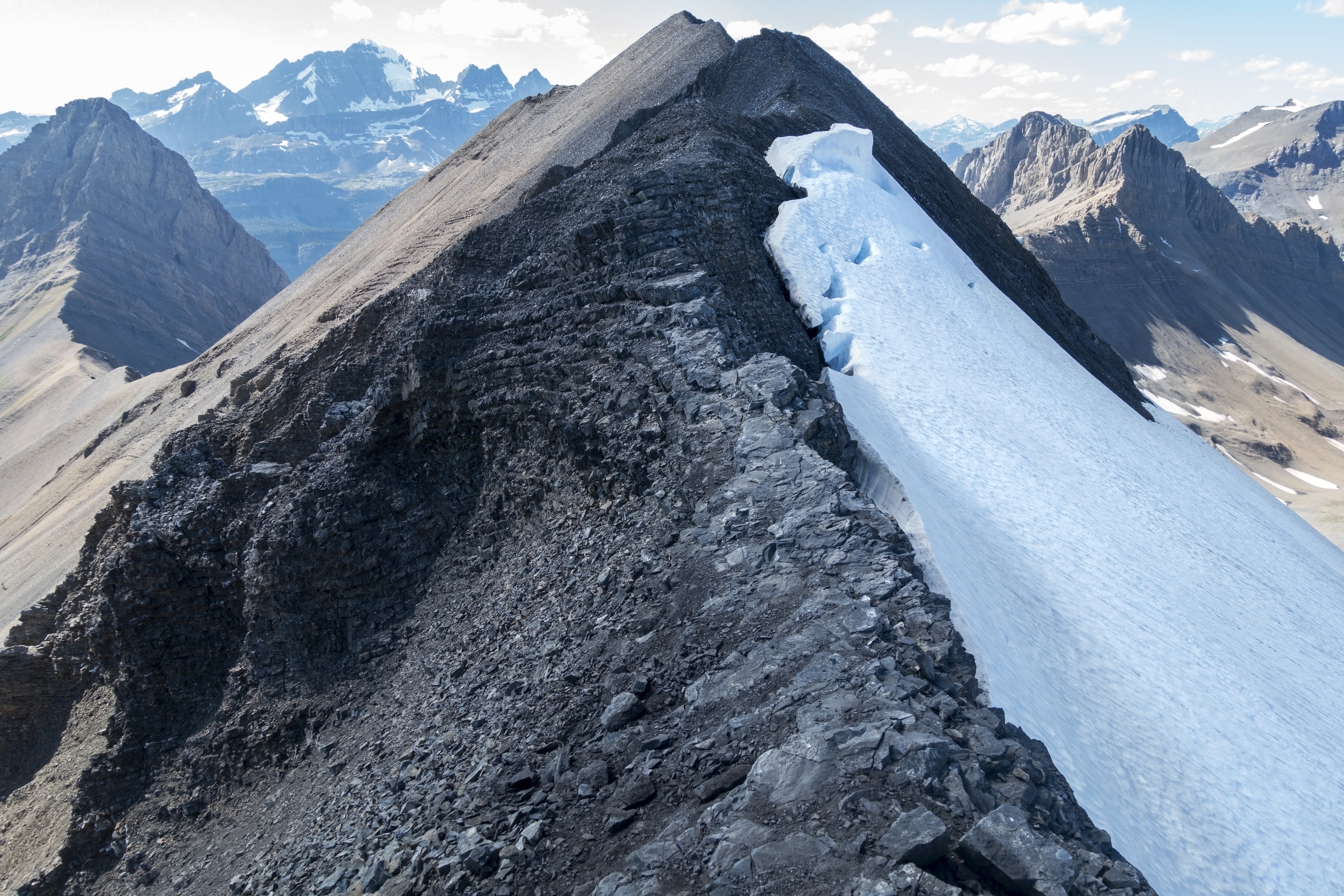
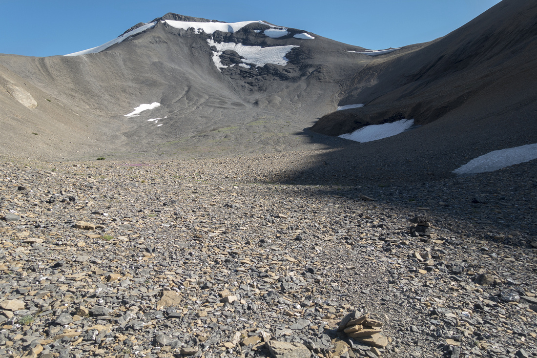
Central part of Northover Ridge looking east, just as easy part comes to an end. Mt. Northover dead center behind, white fang of Mt. Joffre to the right |
|||
| Trip Summary | |||
August 16, 2020Northover Ridge is probably best backpack in Kananaskis Country. It is commonly done as 3 days, 2 night trip with overnight camps at Aster and Three Isle lakes. It can be hiked either way, but suggested direction is Aster Lake first. Reasons: It is much easier to ascend than descend rough Aster Headwall (for more details see full Aster Lake trip report) as well as scenic advantage traversing ridge E - W direction. It is also worth noting 11 km Three Isle Lake trail is quite boring and hardly worth as backpack on its own (contrary to Aster Lake which is outstanding backpack by itself). Ridge can also be dayhiked in a very long day from North Interlakes -- both times I've been here I did it as dayhike. If you opt for this approach, you need above average stamina and early start; first part of August is optimal timing as days are still long, but snow has already melted. Stats in the Abstract are given for both ways: Aster to Three Isle (backpack) and full loop from North Interlakes (dayhike). Gallery photos are in suggested clockwise direction.
From Aster Lake walk along east side following faint trail; do not get your feet wet crossing outlet to west side as it is not necessary. Then at far end of the lake easily walk across outwash flats (wild bivi corals, against the rules) and pick up trail as it starts rising at Mt. Northover lower slopes towards Mt. Warrior. Trail rounds the corner and turns right ascending scree slopes to wide basin with sparkling Northover Tarns, already in Height of the Rockies BC Provincial Park. Note that wild bivi IS allowed here; BC Parks are much more flexible! Northover Ridge east end is low saddle on horizon and good talus trail can be followed most of the way, although it steepens considerably towards the top. Mt. Northover (Kane difficult) is to the right and it is hard to believe it is included as scramble; this ascent is dangerous and should not be done without rope, even "easier" west face, used typically for descent. With overnight packs it will take at least 2 hours from Aster Lake to here. Ridge itself is ~4km long and high scenic overload. First part is wide as it meanders effortlessly across several bumps with Northover Glacier on the right (north) side. Past mid-point going gets much stiffer and crux is narrow 5-6m that might feel awkward to non-scramblers, specially if hauling heavy overnight pack and strong wind is howling. It is also worth noting entire ridge is completely exposed to weather - should storm roll in, there is nowhere to hide; pick calm and sunny day! Past the crux there are still couple of rough sections until high-point (~2800m), from where now well defined but lose scree trail descends to low saddle and north end. Turn right and hike in just over an hour to Three Isle Lake, reached around mid-point. Trail is poorly defined in some parts here but direction is obvious.
Three Isle Lake trail, hiking back to North Interlakes, is quite rough initially till Forks -- switchbacks down steep headwall where even wooden stairs assist in lower part, followed by rooty and rocky sections. Past Forks trail mellows and is generally flat and wide allowing fast travel. Final part around upper K-Lake is old gravel road where cycling is allowed. Several openings provide great views, but by this time you'll likely be too tired to care, specially if dayhiking.
|
|
Gallery |
|||
 Aster Lake Panorama Aster Lake Panorama Panoramic view of Aster Lake from west end. Mt. Sarrail center right, Mt Foch extreme right
 |
|||
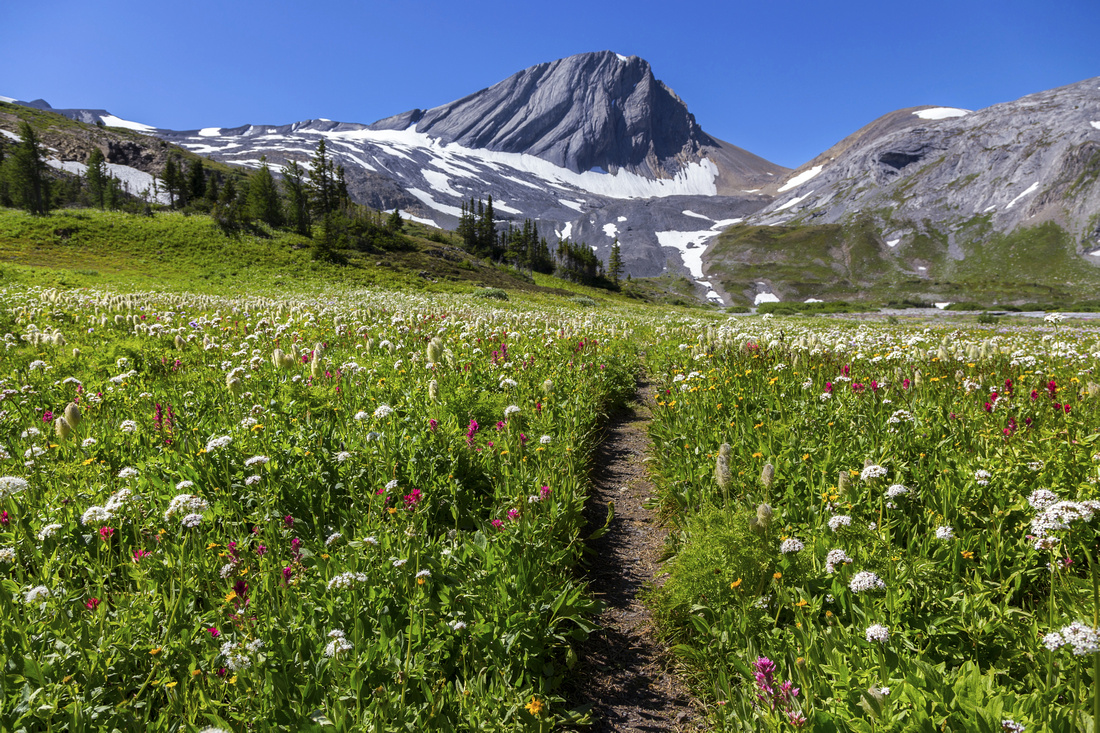 Aster Meadows
Flowery Meadows past Aster Lake. Trail ascends "V" gap to the right of Warrior Mtn (center) Aster Meadows
Flowery Meadows past Aster Lake. Trail ascends "V" gap to the right of Warrior Mtn (center) |
|||
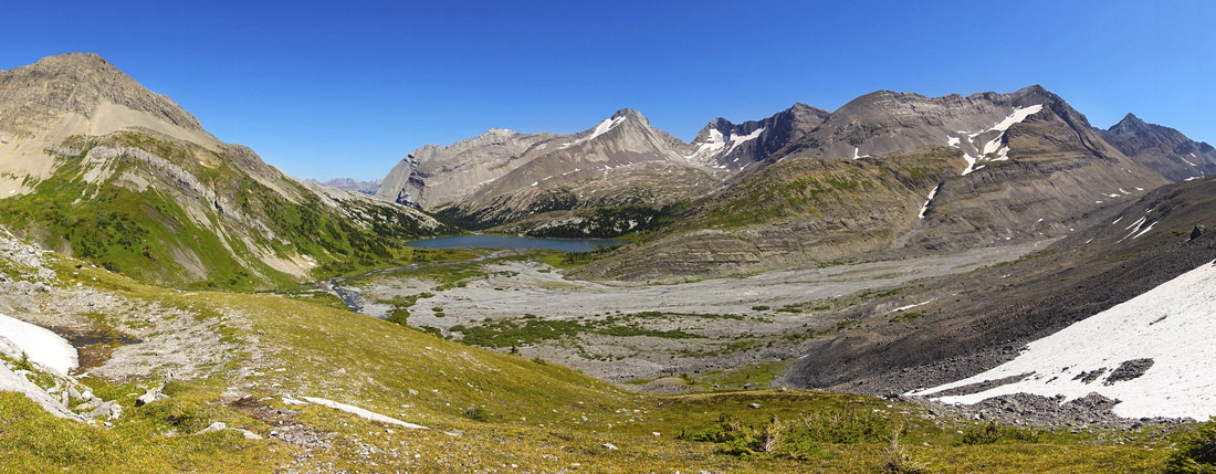 Aster Basin
Panoramic view of Aster Lake basin just before trail swings on west side of Mt. Northover Aster Basin
Panoramic view of Aster Lake basin just before trail swings on west side of Mt. Northover |
|||
 |
|||
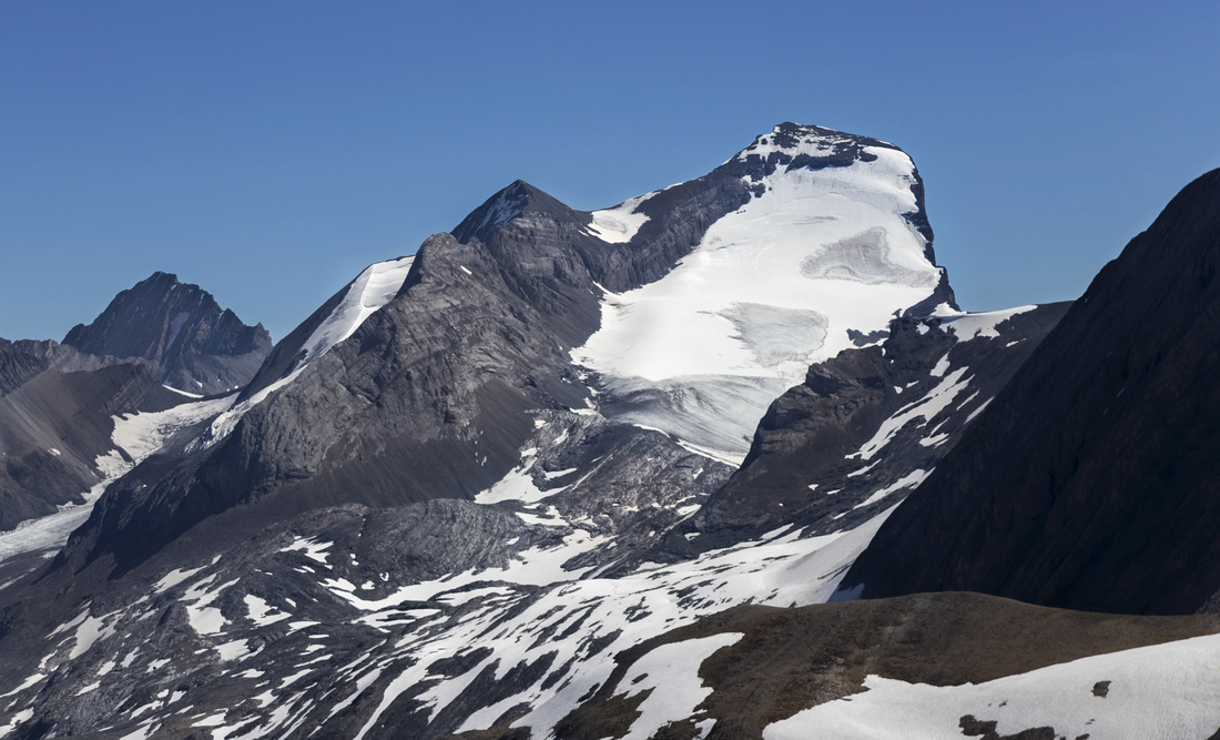 Mount Joffre
Mt. Joffre (3450m) Telephoto - strictly mountaineering, best done in early/mid summer as firm snow makes ascent much easier Mount Joffre
Mt. Joffre (3450m) Telephoto - strictly mountaineering, best done in early/mid summer as firm snow makes ascent much easier |
|||
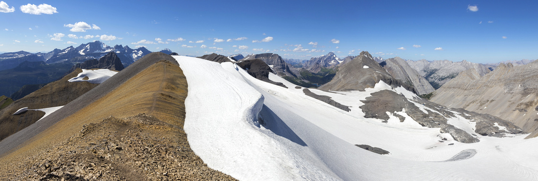 Northover Ridge Panorama
Northover Ridge East side is wide and serious scenic overload. Northover Glacier to the right, Three Isle Lake in the distance just right of center. Royal group, including Mt. King Edward upper left Northover Ridge Panorama
Northover Ridge East side is wide and serious scenic overload. Northover Glacier to the right, Three Isle Lake in the distance just right of center. Royal group, including Mt. King Edward upper left |
|||
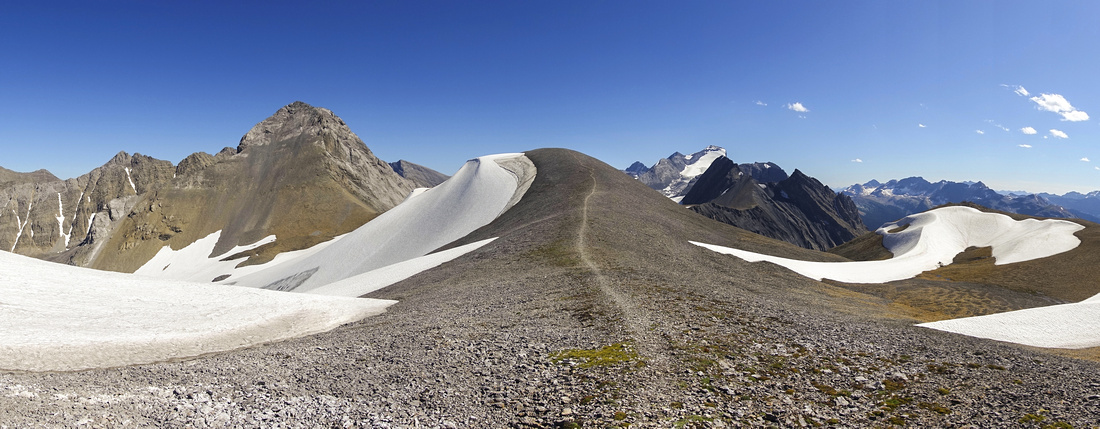 Northover Ridge Panorama
Looking back to Mt. Northover (center left) and distant Mt. Joffre (center right) while hiking rounded and wide east end of the ridge Northover Ridge Panorama
Looking back to Mt. Northover (center left) and distant Mt. Joffre (center right) while hiking rounded and wide east end of the ridge |
|||
 |
|||
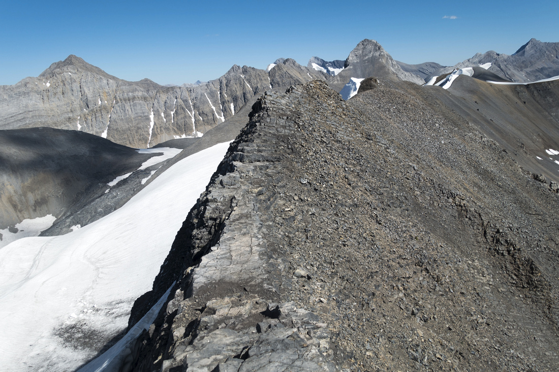 Crux Section
View back of the crux; same spot as in photo in Daffern K-Country Guidebook Crux Section
View back of the crux; same spot as in photo in Daffern K-Country Guidebook |
|||
 West End Saddle
Drop to the saddle at west end. Trail turns left at low point and descends talus towards Three Isle Lake valley West End Saddle
Drop to the saddle at west end. Trail turns left at low point and descends talus towards Three Isle Lake valley |
|||
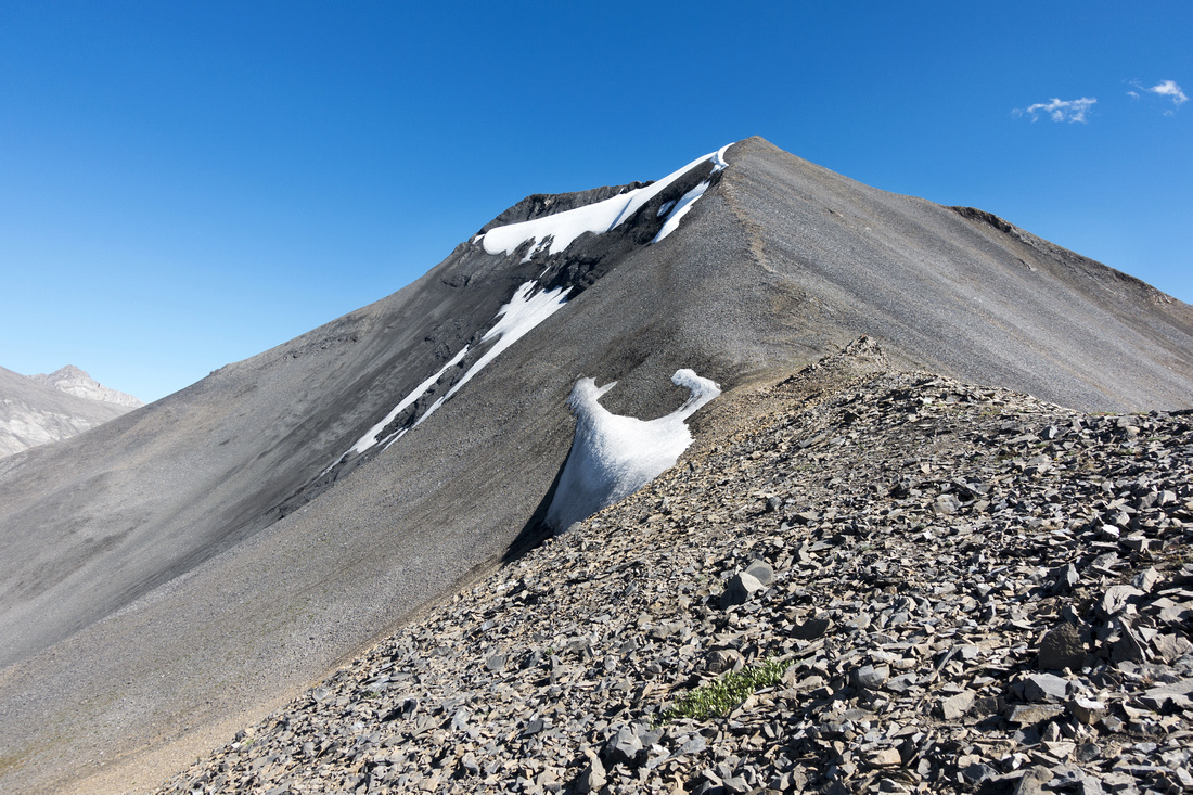 West End Saddle
Looking back from west end saddle just before dropping down. Rough part is upper center, above that snowpatch West End Saddle
Looking back from west end saddle just before dropping down. Rough part is upper center, above that snowpatch |
|||
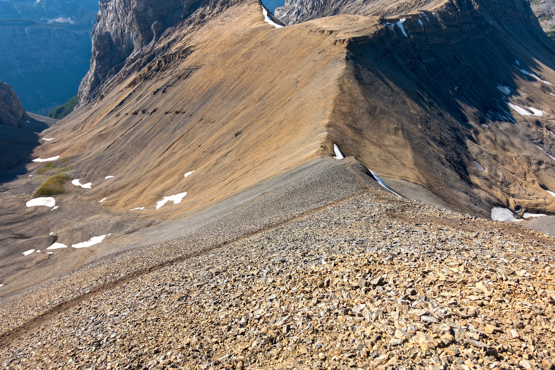
 West End Bowl
View back after descending steep Talus from West end saddle. Note trails in scree West End Bowl
View back after descending steep Talus from West end saddle. Note trails in scree |
|||
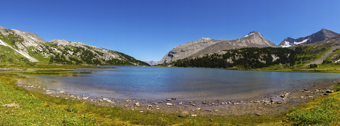
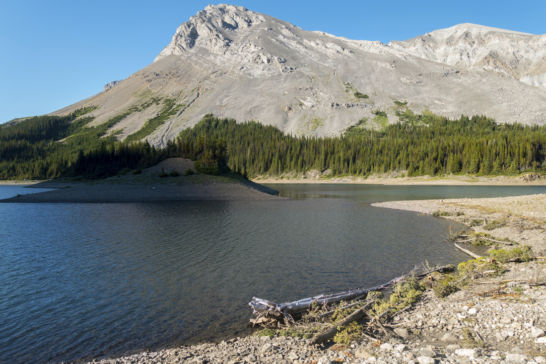 Three Isle Lake
, about an hour from Northover west end (coming down, longer if ascending this way!) Trail turns right here and reaches back-country campground in another 15 min or so at east side of the lake Three Isle Lake
Three Isle Lake, about an hour from Northover west end (coming down, longer if ascending this way!) Trail turns right here and reaches back-country campground in another 15 min or so at east side of the lake |
|||
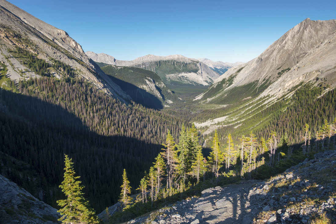 Three Isle Headwall
Long valley between North Interlakes and Three Isle lake -- 11.1 km according to AB Parks -- from top of Headwall Three Isle Headwall
Long valley between North Interlakes and Three Isle lake -- 11.1 km according to AB Parks -- from top of Headwall |
Abstract
| Overall Difficulty | D5/6 | Couple of narrow and exposed parts. Steep talus slopes. Extremely long day if day-hiking from North Interlakes. | |||
| Snow Factor | S5 | Not suitable for winter trip due to remoteness, length of approach and several steep slopes that might be avalanche prone. | |||
| Scenery | High aerial view of Royal Group, Height of the Rockies and many distant Kananaskis Peaks. Northover Tarns, Aster and Three Isle Lakes | ||||
| Trail/Marking | Poor/None | Entire section between Aster and Three Isle lakes is in the alpine with only occasional trails beaten in talus with cairns | |||
| Suggested Time | 6hrs (ridge only) | Aster Lake to Three Isle lake (or vice versa) only. 13-14 hrs if day-hiking full loop from North Interlakes | |||
| Elevation | Start: 2250m (Aster Lake) Max: 2800 m Min: 2165m (Three Isle) Total: ~700m (Aster to Three Isle), 1710m full loop | ~13km (Aster to Three Isle); ~36km full loop | |||
| Gear | Full hiking boots preferred for ankle protection on steep talus. Hiking poles essential for stability. Overnight gear if backpacking | ||||
| Water | No water between Aster Lake and Valley below West end -- carry 2L on a hot summer day | ||||
| Dog Friendly | Yes | Standard back-country travel precautions. If backpacking, consider leaving pets at home - Aster Lake is prime grizzly bear habitat | |||
 Northover Ridge GAIA Map
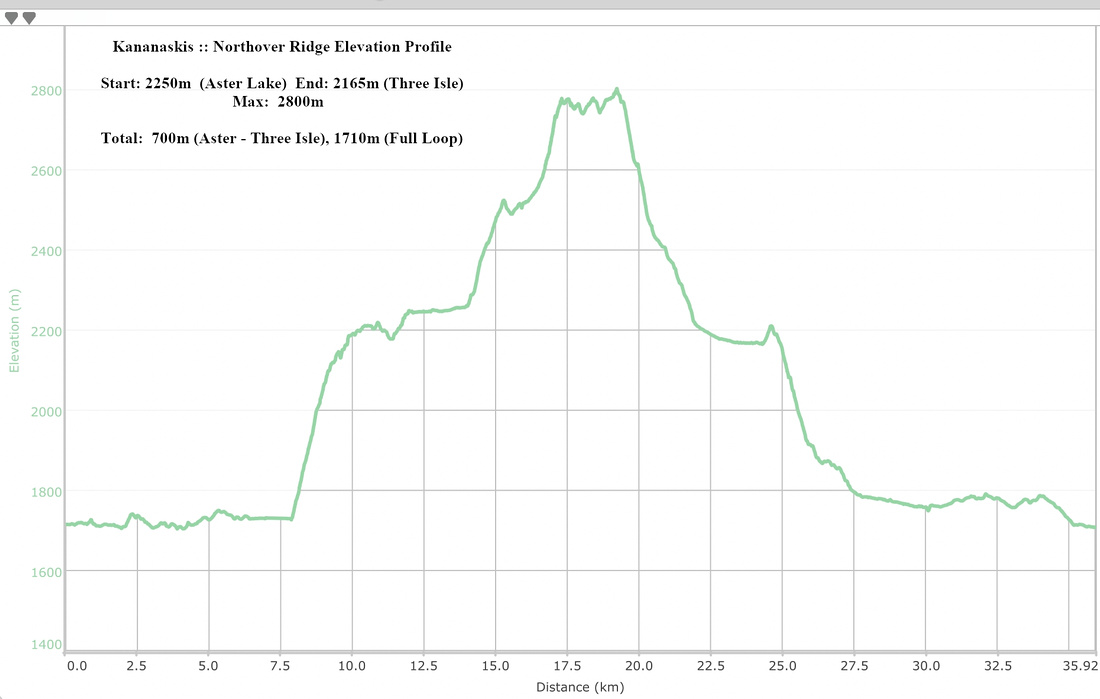 Northover Ridge Elevation Profile