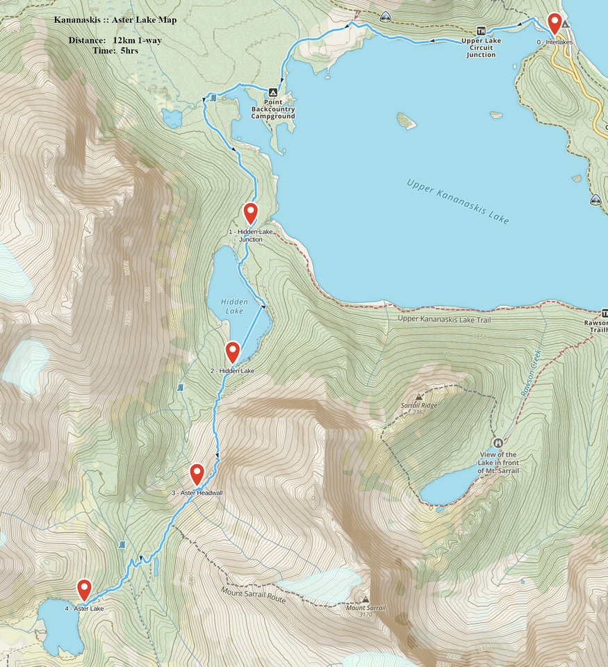
Google Map |
Rockies :: Kananaskis :: Aster Lake |
GPS Track |
|
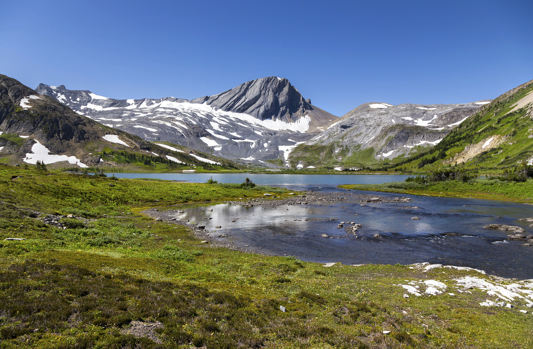
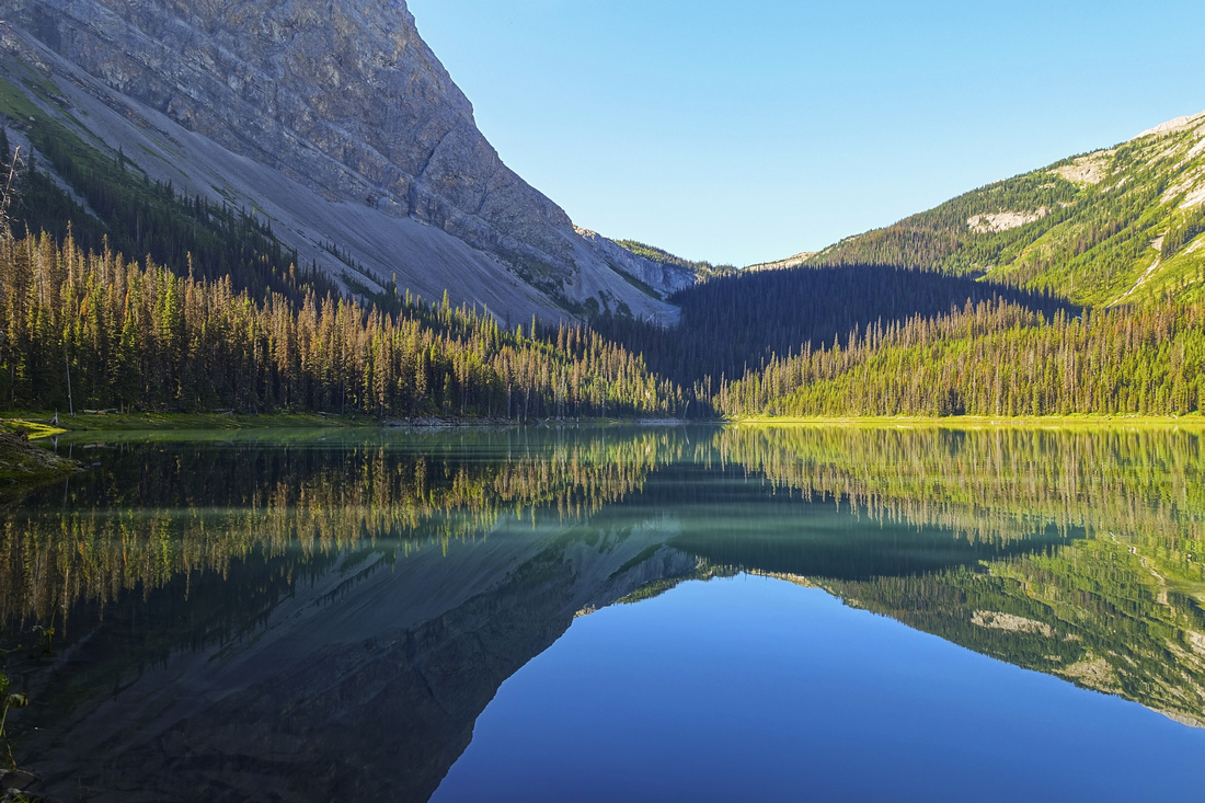
Classic view of Aster Lake near the outlet by backcountry campsite. Warrior Mtn in the background |
|||
| Trip Summary | |||
August 16, 2020Aster Lake is probably best destination radiating from upper Kananaskis Lake. Although feasible as day-hike, lake is more often visited as overnight trip benefiting from official Alberta Parks back-country campsite. Several peaks (Mt. Sarrail, Mt. Foch, Warrior / Cordonnier, Mt. Northover and Mt. Joffre) are often ascended from “Aster Lake basecamp”. Northover Ridge backpackers usually use campsite as one of two stops, the other one being Three Isle Lake. Despite all these options, Aster Lake is more than worthy destination on its own, either as day-hike or backpack. It is best to wait till second half of July till snow at awkward headwall below Mt. Sarrail is fully melted.
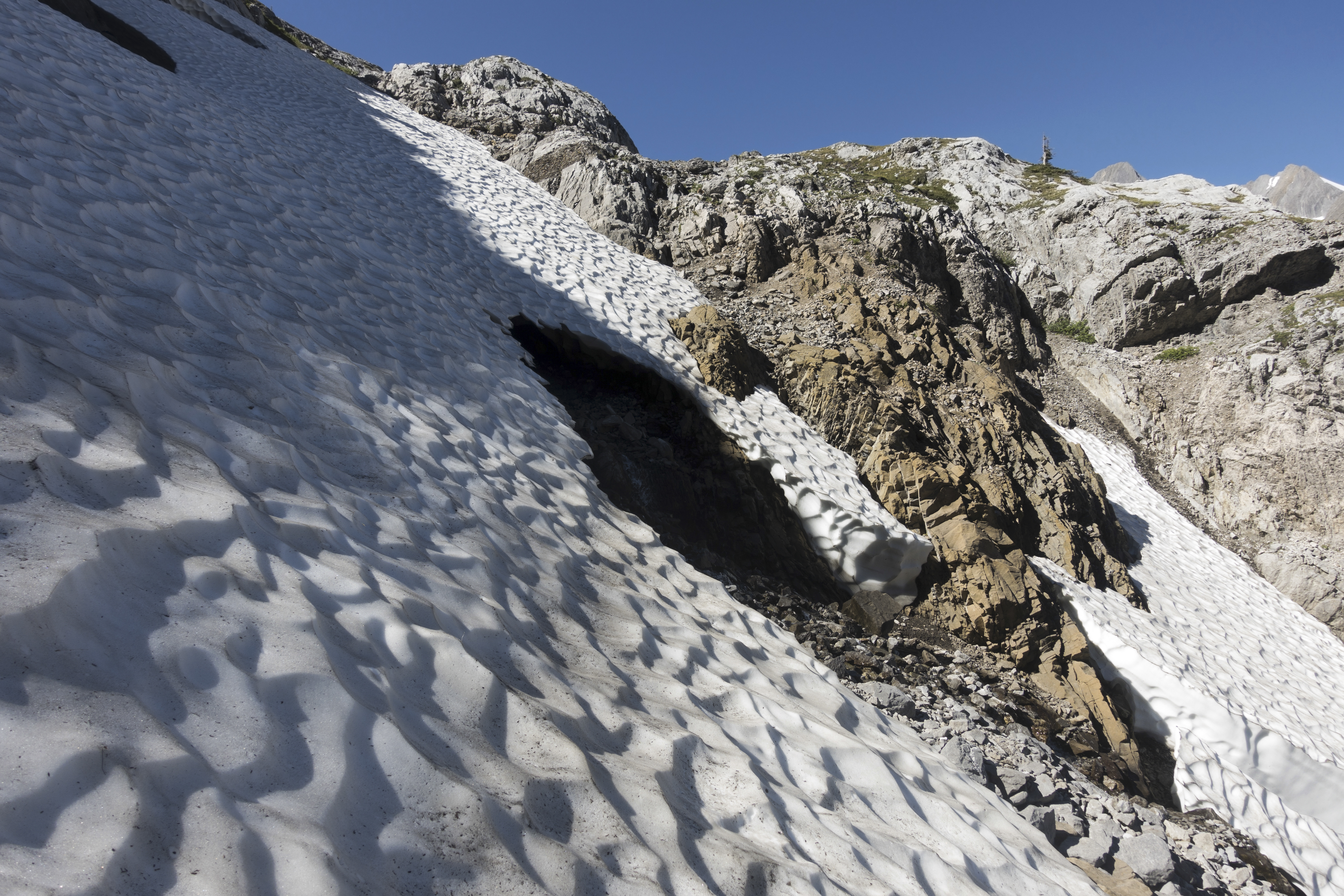
Start can be from Upper Kananaskis Lake parking (as for Rawson Lake and Ridge or The Turret), or North Interlakes. North Interlakes start is bit too longer, but probably more scenic -- see Upper Kanananskis Lake Circuit trip report for more details. Upon reaching Hidden Lake junction (1:15 to 1:30, depending on start) continue on less defined trail and hike to far end. Lakeshore walk is preferable due to fantastic scenery, but might not be possible with high water. Over the years forest trail on east side has been sufficiently cleared and is not as bad bushwhack as it used to be. Far end, reached around 2hr mark, is good spot for the break as ascent is about to begin. Climb steep forested slopes for 15-20 minutes, then continue on good trail beaten in talus ascending to Aster Headwall. Scenic Fossil Falls draining Aster Lake on the right side are sometimes visited on their own (you can not continue to Aster Lake from base of Falls). Crux is the headwall; when dry it is not huge problem but snow melts quite late and sometimes awkward snow caverns force scramble on right side (class 3). Above is another difficulty; rock chute with class 3 rock at top - climber left is easiest, there is some exposure but holds are firm. This spot can feel quite stiff if hauling heavy overnight backpack. Above the headwall going is easy and trail meanders through semi open forest crossing Foch Creek draining Marlborough Pond valley and finally tops by green outhouse just before back-country campsite.
If continuing to Northover Ridge or climbing peaks west of Aster lake, it is far better to follow trail on east side, as opposed to crossing outlet by campsite. |
|
Gallery |
|||
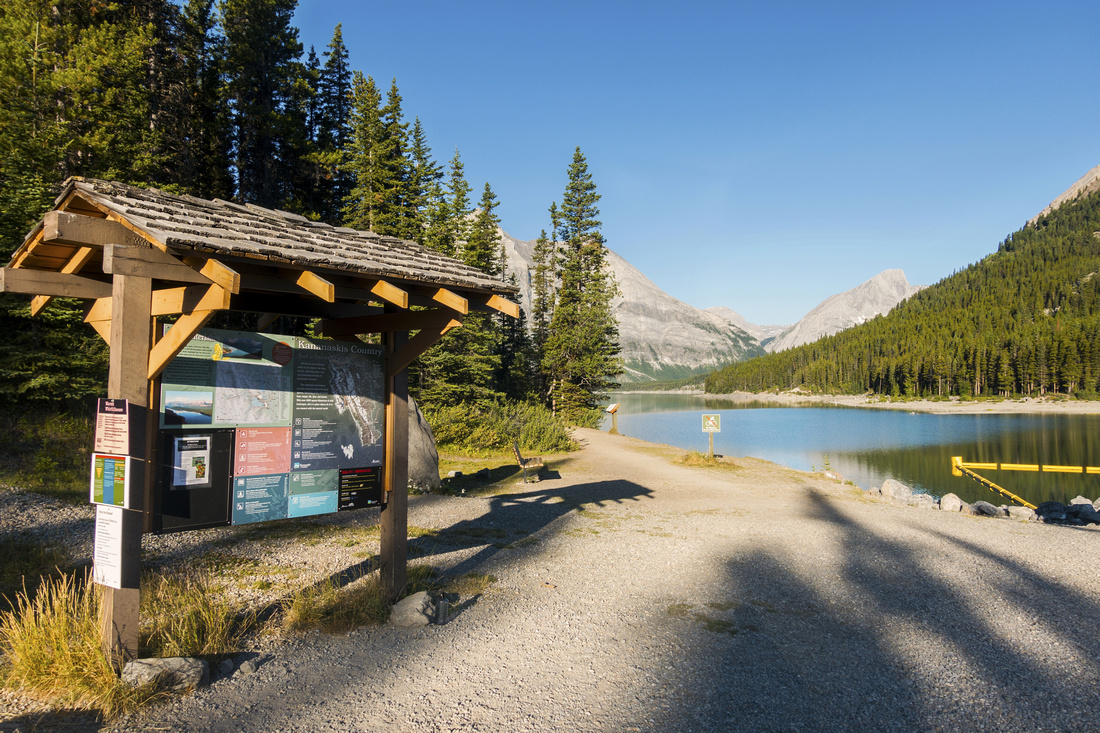 North Interlakes North Interlakes K-Country Kiosk at North Interlakes. Lakeshore trail crosses dam on the right side, out of picture
 |
|||
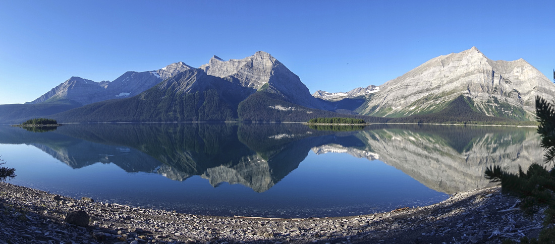 Upper Kananaskis Lake Panorama
Early morning reflections in still water of upper K-lake. Ascent slopes are just right of center at opposite side of the lake Upper Kananaskis Lake Panorama
Early morning reflections in still water of upper K-lake. Ascent slopes are just right of center at opposite side of the lake |
|||
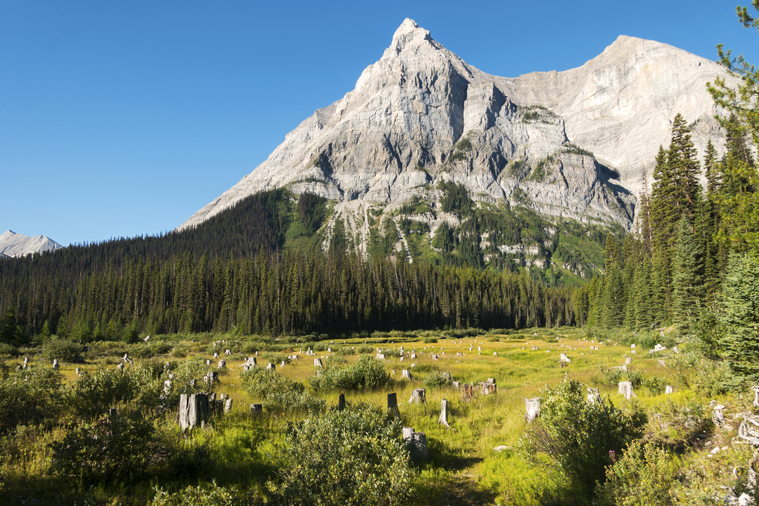 Mount Lyautey
Alpine meadow below Mt. Lyautey between Three Point campground and Kananaskis River Bridge Mount Lyautey
Alpine meadow below Mt. Lyautey between Three Point campground and Kananaskis River Bridge |
|||
 Hidden Lake
Hiking around Hidden Lake. If possible, it is much preferred to walk at lakeshore because of this kind of views! When water is too high, reasonably clear forest trail is on the left side. Scree Trail ascending Aster Headwall can be seen in distance Hidden Lake
Hiking around Hidden Lake. If possible, it is much preferred to walk at lakeshore because of this kind of views! When water is too high, reasonably clear forest trail is on the left side. Scree Trail ascending Aster Headwall can be seen in distance |
|||
 Hidden Lake
Gorgeous morning reflections of Mt. Lyautey (L) and Mt. Indefatiguable (R) in still water of Hidden lake, looking back from far end Hidden Lake
Gorgeous morning reflections of Mt. Lyautey (L) and Mt. Indefatiguable (R) in still water of Hidden lake, looking back from far end |
|||
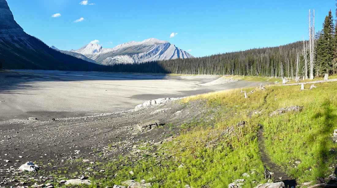 Hidden Lake
View of Hidden Lake in early September '23 after horrible summer wildfire season - no lake to speak off, just a small puddle of grey water at far end. Compare this to lush and beautiful photos above Hidden Lake
View of Hidden Lake in early September '23 after horrible summer wildfire season - no lake to speak off, just a small puddle of grey water at far end. Compare this to lush and beautiful photos above |
|||
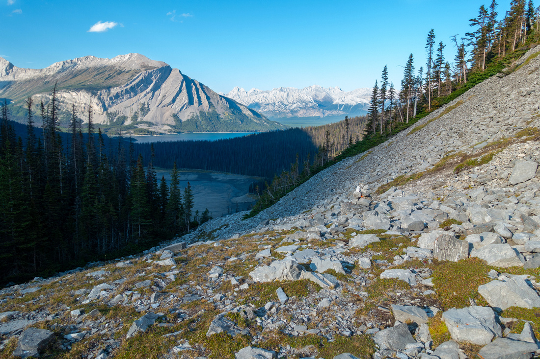
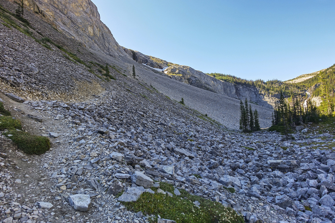 Aster Headwall
Trail ascending steep Talus slopes below Aster Headwall. Fossil Falls access branches right here Aster Headwall
Trail ascending steep Talus slopes below Aster Headwall. Fossil Falls access branches right here |
|||
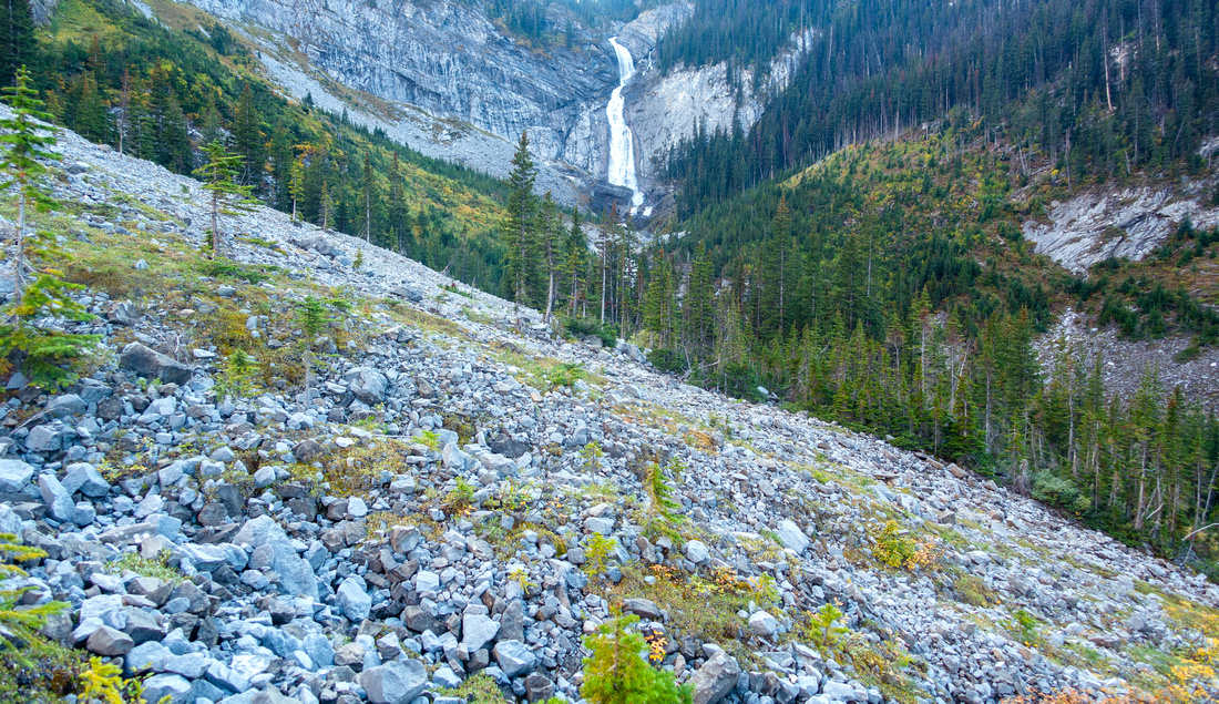
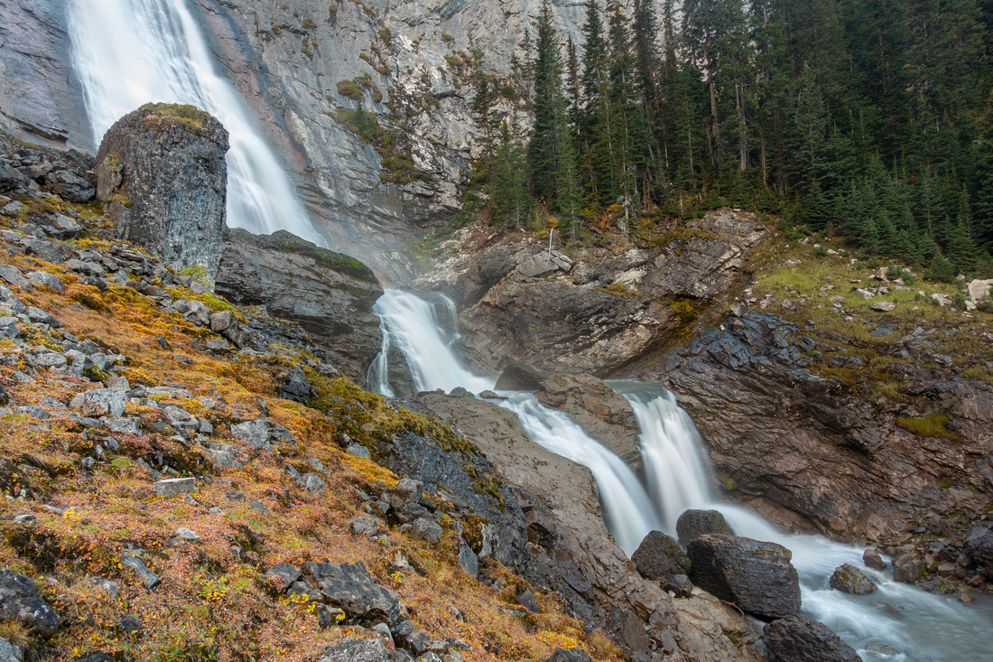
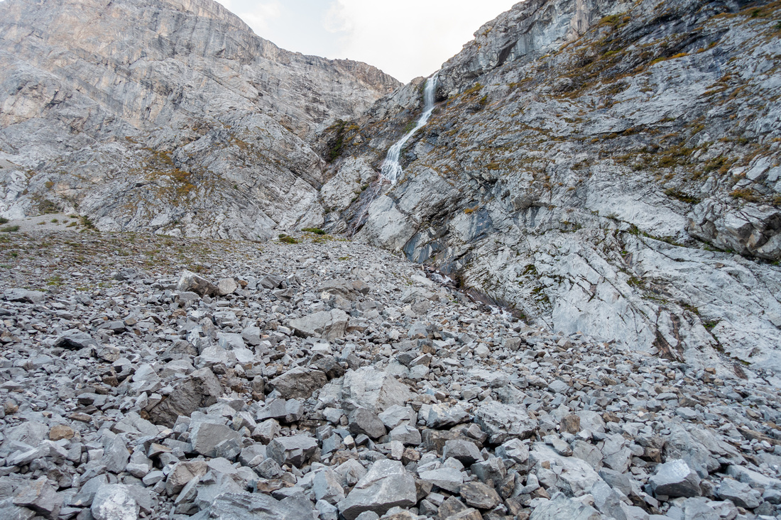
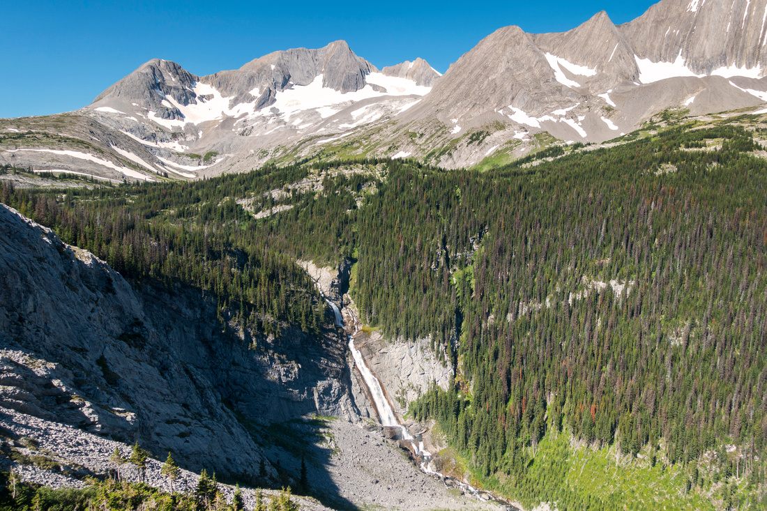 Fossil Falls
View of Fossil Falls just below Aster Headwall Fossil Falls
View of Fossil Falls just below Aster Headwall |
|||
 |
|||
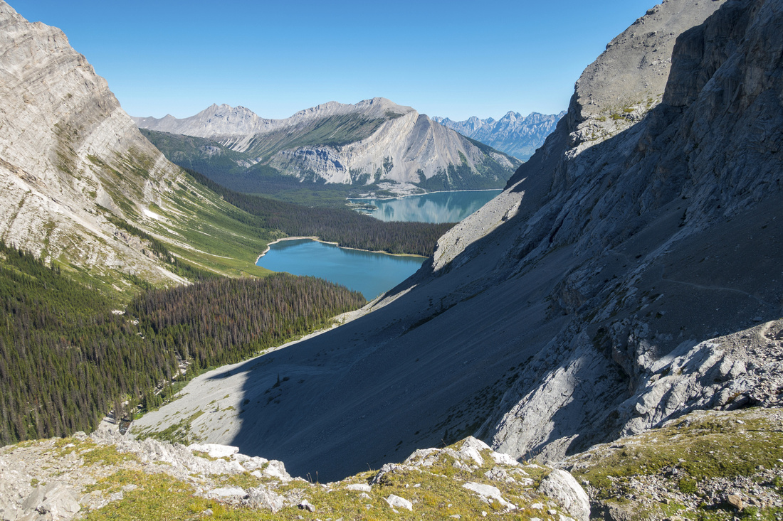 Above Aster Headwall
Classic view back to Hidden Lake and upper Kananaskis Lake from top of Aster Headwall, past all difficulties. Aster Lake is less than an hour from here Above Aster Headwall
Classic view back to Hidden Lake and upper Kananaskis Lake from top of Aster Headwall, past all difficulties. Aster Lake is less than an hour from here |
|||
 |
|||
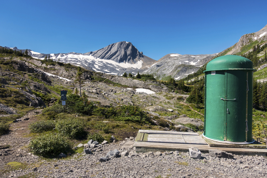 Campground Biffy
Aster Lake Backcountry Outhouse. Tent sites are just right of center Campground Biffy
Aster Lake Backcountry Outhouse. Tent sites are just right of center |
|||
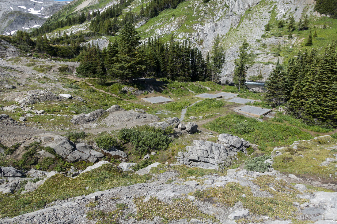 Aster Lake Campground
Tent Pads at Aster Lake backcountry campsite appear closely spaced and not offering enough privacy Aster Lake Campground
Tent Pads at Aster Lake backcountry campsite appear closely spaced and not offering enough privacy |
|||
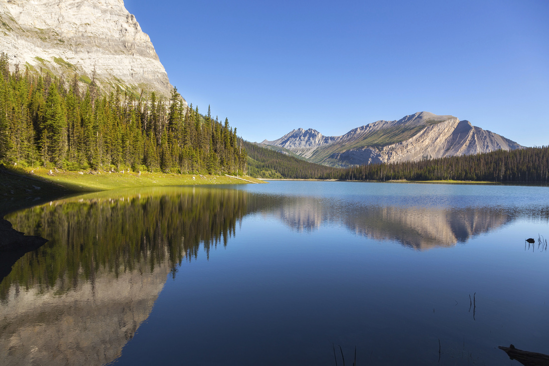
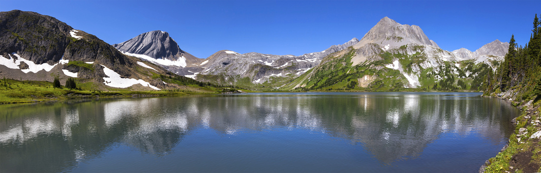 Aster Lake Panorama
Panoramic View from east shore of Aster Lake. Warrior Mtn. far left, entire Mt. Northover ascent ridge (not a scramble) can be seen slanting center right Aster Lake Panorama
Panoramic View from east shore of Aster Lake. Warrior Mtn. far left, entire Mt. Northover ascent ridge (not a scramble) can be seen slanting center right |
Abstract
| Overall Difficulty | D5 | Class 3 rock step on Aster Headwall. Steep talus slopes and possibility of bushwack around Hidden Lake | |||
| Snow Factor | S4 | Severe avalanche danger on Aster Headwall -- not suitable as winter trip. Possibility of awkward snow caverns in early/mid season. Some unbridged creek crossings (rock-hop) | |||
| Scenery | Upper K-Lake basin and surrounding peaks from different vantage points on approach. Beautiful mountain reflections in Hidden Lake. Spectacular Aster Lake alpine basin | ||||
| Trail/Marking | Good | Well defined trail around upper K-Lake. Hidden Lake junction might be unmarked -- use GPS track above. Rough but generally distinct trail around Hidden Lake and up Aster Headwall | |||
| Suggested Time | 5hrs | One way to Aster Lake, depending on starting point and day/overnight backpack. | |||
| Elevation | Start: 1720m Max: 2250 m Total: ~800m | One way to Aster Lake: ~12km | |||
| Gear | Full hiking boots preferred for ankle protection on steep talus. Hiking poles essential for stability. Overnight gear if backpacking | ||||
| Water | Hidden Lake outlet, dry later in season. Seasonal drainages on Aster Headwall. Foch creek in upper Alpine. Carry at least 1L | ||||
| Dog Friendly | Yes | Standard back-country travel precautions | |||
 Aster Lake GAIA Map
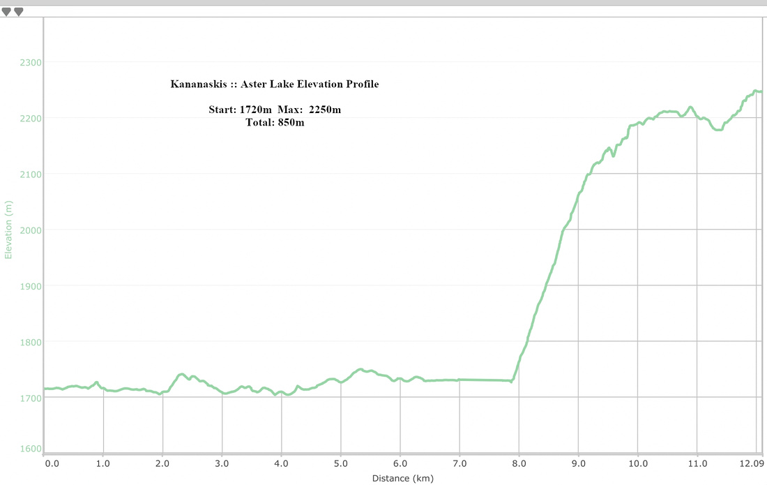 Aster Lake Elevation Profile
Fossil Falls
If out-and-back dayhiking to Aster Lake, Fossil Falls extension will require a long day; falls are best visited either as day trip on their own, or as side trip on Aster overnight backpack. Distance from Aster Trail is only ~1.5 km (1-way), but access is far from trivial. Junction is by the cairn as Aster trail clears first talus rise above Treeline, roughly 30min above Hidden Lake west end (see first photo below). There is no trail to speak off which is not a problem, but rather nasty and unavoidable bushwhack is. In Addition there is fair amount of side-slopping on shifting Talus. Variations are possible; on my trip I decided to drop all the way to Fossil creek and that was probably a mistake, as it led to more bushwhack than necessary. Easiest route is "highline" - circumvent first strip of forest higher left and up going in, then drop on talus to final - unavoidable - strip of Alder, that is sometimes so dense I felt stuck. Long sleeve jacket and gloves are a must. Final 10 minutes are pleasant hike across open meadow dotted with small rocks to base of the Falls.
Falls are best visited in first part of summer as water level will be high - although you might be forced to hike around Hidden Lake in the Forest. Total return distance from Upper Kananaskis Lake will be over 20km, 6-7 hour trip.
 Aster Junction
Looking back at Hidden Lake basin from Fossil Junction; note cairn just right of center
Aster Junction
Looking back at Hidden Lake basin from Fossil Junction; note cairn just right of center
 Talus Slope
One of more pleasant section sideslopping towards Fossil Falls base; it doesn't last long. Upon reaching edge of forest go left and up
Talus Slope
One of more pleasant section sideslopping towards Fossil Falls base; it doesn't last long. Upon reaching edge of forest go left and up
 Fossil Cascades
Cascades of Fossil Creek on more bushy low access
Fossil Cascades
Cascades of Fossil Creek on more bushy low access
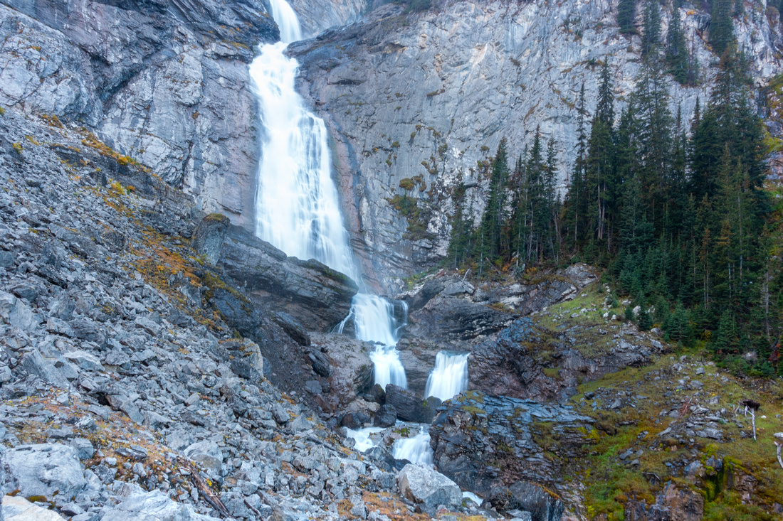 Fossil Falls
Base of Fossil Falls, almost an hour from Aster Junction despite only ~1.5km
Fossil Falls
Base of Fossil Falls, almost an hour from Aster Junction despite only ~1.5km
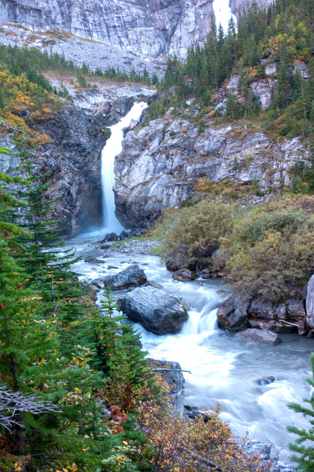
 Fossil Falls
Lower part of beautiful Fossil Falls
Fossil Falls
Lower part of beautiful Fossil Falls
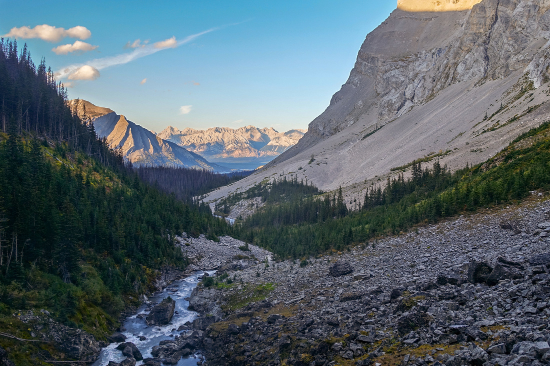 Fossil Creek Valley
Looking down access valley from Fossil Falls base; Aster Trail climbs talus slope just right of center. Unavoidable strip of bush is best crossed extreme right
Fossil Creek Valley
Looking down access valley from Fossil Falls base; Aster Trail climbs talus slope just right of center. Unavoidable strip of bush is best crossed extreme right
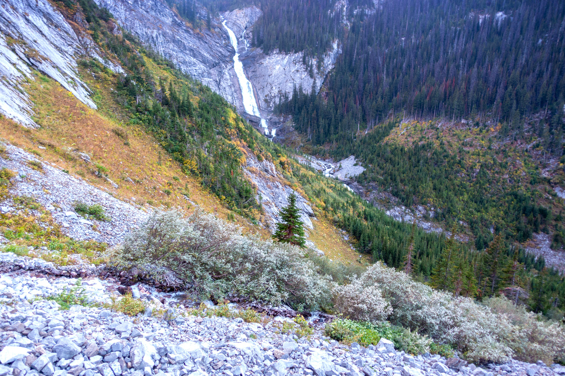 Highline Access
Looking down to Fossil Falls from "Highline" access route. Only bushy part is roughly center, only ~10 min long - but fairly dense
Highline Access
Looking down to Fossil Falls from "Highline" access route. Only bushy part is roughly center, only ~10 min long - but fairly dense
 Aster Headwall
Looking up Aster Headwall from Fossil "Highline" Access; it is possible (but not necessary) to scramble - or descend from - Aster trail from here
Aster Headwall
Looking up Aster Headwall from Fossil "Highline" Access; it is possible (but not necessary) to scramble - or descend from - Aster trail from here