Google Map |
Rockies :: Kananaskis :: Rawson Lake and Ridge |
GPS Track |
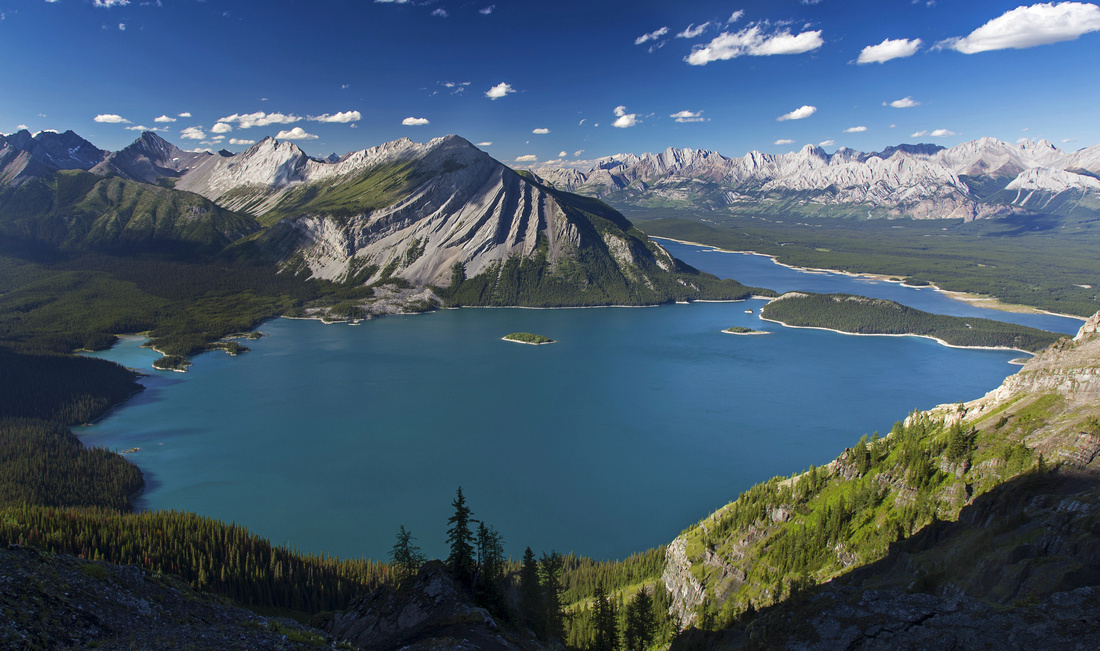 
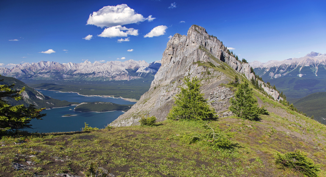
Panoramic view of upper Kananaskis Lake from Rawson Ridge. Mt. Indefatiguable directly across |
|||
| Trip Summary | |||
July 21, 2016Rawson Ridge offers probably the best viewpoint in Kananaskis country; view of upper K-lake is as breathtaking as it is sudden and once you have seen it in person you are likely to come back over and over again! Ascent is steep, but not overly demanding and well worth the effort. Along the way you pass rather pretty and fairly large lake situated in impressive cirque below sheer cliffs of Mt. Sarrail. Trail is popular, so solitude might be hard to find. Mid-afternoon is best time, as sun sets fairly early behind Mt. Sarrail. Note that while Rawson lake is frequently done in winter, ridge is much more serious undertaking in snowy conditions (avalanche danger).
Follow wide lakeshore trail starting at far end of upper K-lake parking lot for just above a kilometer to bridge over Sarrail creek. This bridge has been damaged in spring floods of 2013; new one has installed in 2016. Lovely falls are reason for photo-break. Note trail heading up on left side of the creek - if you have time, it is well worth following as it leads to several fantastic viewpoints of upper cascades. Rawson lake junction is just a minute past the bridge; turn left. It will take 30-40 minutes to the lake from here. Grade is moderate but not overly steep and there are several wide switchbacks. Just before the lake you enter boggy area - please stay on the planks in order to prevent further damage. North end of the lake has angler registration kiosk as well as outhouse. Trail continues around the east shore and you have good views of avalanche slopes on the other side you must ascend in order to reach the ridge. If hiking just to the lake, this is good turnaround point.
For the ridge hike around south end of the lake, then angle up obvious drainage. Fairly good trail can be found here but soon it branches in several directions. Note that grizzly bears frequent this area. On my trip in July 2016 I watched sow with cub moving on slopes adjacent to ascent drainage. Scan the surroundings and make noise. Dogs, specially unleashed, would be huge risk factor in these circumstances. Stay on trail closest to drainage center as it is least eroded. Halfway up is the tricky part as short eroded cliff bares the way. Scramble this obstacle on climber right side, then continue up bushy slopes dotted with wildflowers in mid-summer. You gain about 350m vertical from the lake to ridge low point. Fabulous panorama unfolds and you will be reaching for the camera instantly! Trail continues on the right side but best view of K-lakes is actually on the other side -- hike up grassy slopes to little nub below start of the cliffs (note neat little cave!). Ridge highpoint on the other side is difficult scramble through steep cliffs; it is doable, but exposed and fall would be serious. It is possible to drop down grassy slopes to the right; the further you go, the easiest it becomes! Unofficial winter route (that starts from outlet on north side of Rawson lake) joins here.
It is also possible to scramble low ridge on the other (east) side of the lake. This journey can not be recommended as views are rather mediocre and hardly justify the effort.
Update January '21: Well compacted and wide trail usually needs to snowshoes in winter. Continuing to ridge on normal route not recommended because of high avalanche danger |
|
Gallery |
|||
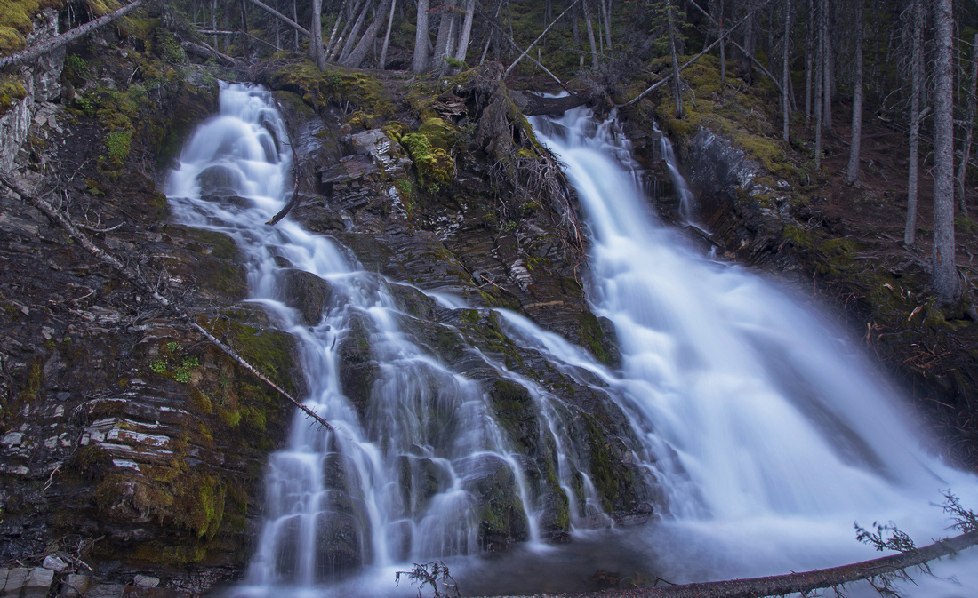 Sarrail Falls
 just over 1km from upper K-lake parking. Rawson lake junction is couple of minutes after the bridge Sarrail Falls
Sarrail Falls just over 1km from upper K-lake parking. Rawson lake junction is couple of minutes after the bridge |
|||
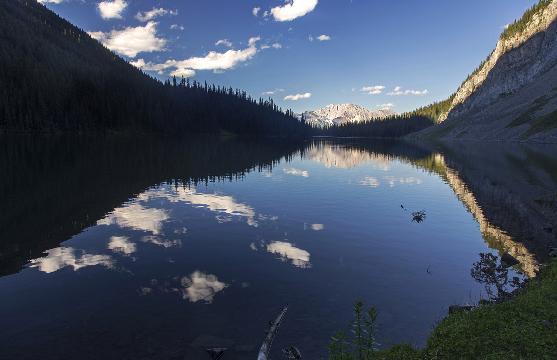
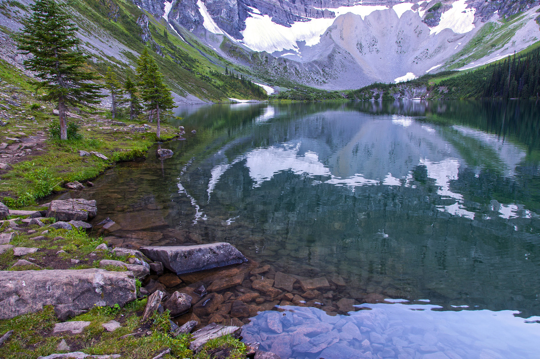 Rawson Lake
Hiking around east side of Rawson Lake Rawson Lake
Hiking around east side of Rawson Lake |
|||
 Ascent Slopes Ascent Slopes
Summer ascent avalanche slope (grizzly bear haven!) from far end of the lake |
|||
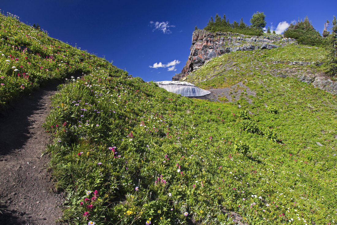 Rawson Ridge
Trail emerging at low point of Rawson Ridge among profusion of summer wildflowers Rawson Ridge
Trail emerging at low point of Rawson Ridge among profusion of summer wildflowers |
|||
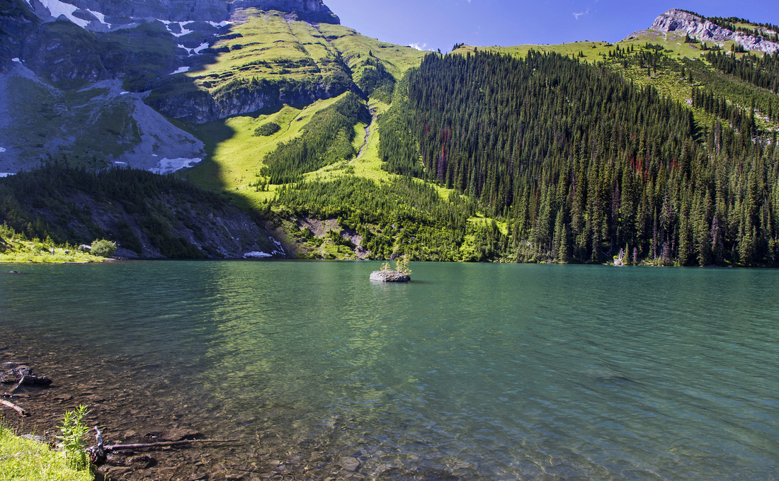
 Rawson Ridge
Hiking along wide and grassy ridge towards the highpoint Rawson Ridge
Hiking along wide and grassy ridge towards the highpoint |
|||
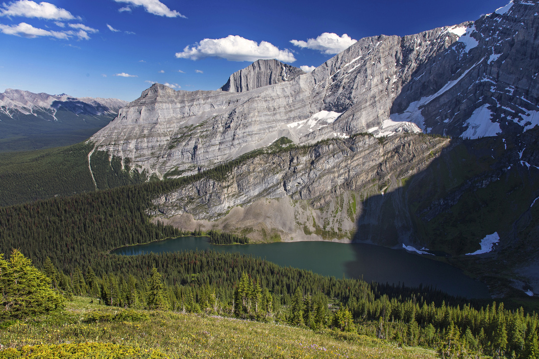 Rawson Lake Aerial View
Rawson Lake from the ridge. Turret and Mt. Fox behind Rawson Lake Aerial View
Rawson Lake from the ridge. Turret and Mt. Fox behind |
|||
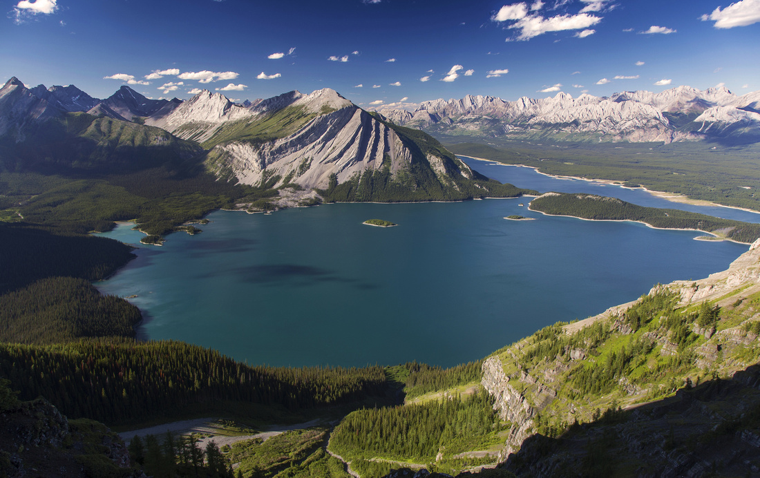 Million Dollar View
Main prize once again: Sweeping Panorama of Kananaskis lakes from Rawson Ridge Million Dollar View
Main prize once again: Sweeping Panorama of Kananaskis lakes from Rawson Ridge |
|||
 Rawson Twilight
Late afternoon shadows on hike back around Rawson Lake Rawson Twilight
Late afternoon shadows on hike back around Rawson Lake |
|||
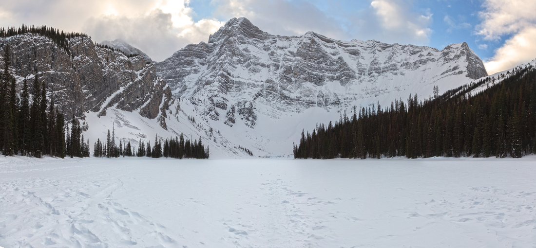 Rawson Lake in Winter
Frozen Rawson Lake in winter looking at imposing cliffs of Mt. Sarrail. Rawson ridge upper right Rawson Lake in Winter
Frozen Rawson Lake in winter looking at imposing cliffs of Mt. Sarrail. Rawson ridge upper right |
Abstract
| Overall Difficulty | D2/4 | Easy trail hiking with moderately steep parts to Rawson Lake (D2); steep avalanche gully with one awkward step to the ridge | |||
| Snow Factor | S2/4 | Easy showshoe, often on well compacted trail to the lake. Summer route to the ridge is avalanche trap that should be avoided; normal winter route from north end of Rawson lake is steep with lots of trail-breaking (S4) | |||
| Scenery | Several upper K-lake viewpoints on approach. Sarrail falls. Rawson lake below cliffs of Mt. Sarrail. Fantastic panoramic view of K-lakes from the Rawson Ridge | ||||
| Trail/Marking | Very Good | Wide well-defined trail to Rawson lake with signed junctions. Sporadic trail to the ridge, but way is obvious | |||
| Suggested Time | 5-6 hrs | Rawson lake only can comfortably done in 2 1/2 hours (return) | |||
| Elevation | Start: 1800m Max: 2370m Total: ~700m | Round Trip: 14km (return for the ridge; lake only is ~7km) | |||
| Gear | Day hikers if going just to the lake; full hikers suggested for the ridge for ankle support. Hiking Poles for stability on ridge ascent gully | ||||
| Water | Sarrail creek, outlet of Rawson lake and several streams at south side of the lake. Ridge is dry. 1L should be enough | ||||
| Dog Friendly | Yes | Rawson lake is very popular - please keep dog on leash. Avalanche slopes leading to the ridge are often frequented by grizzly bears. | |||
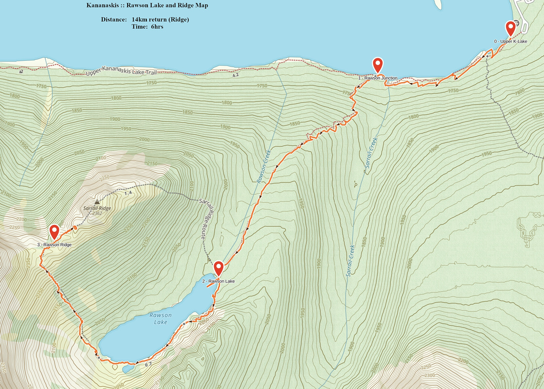 Rawson Lake and Ridge GAIA Map
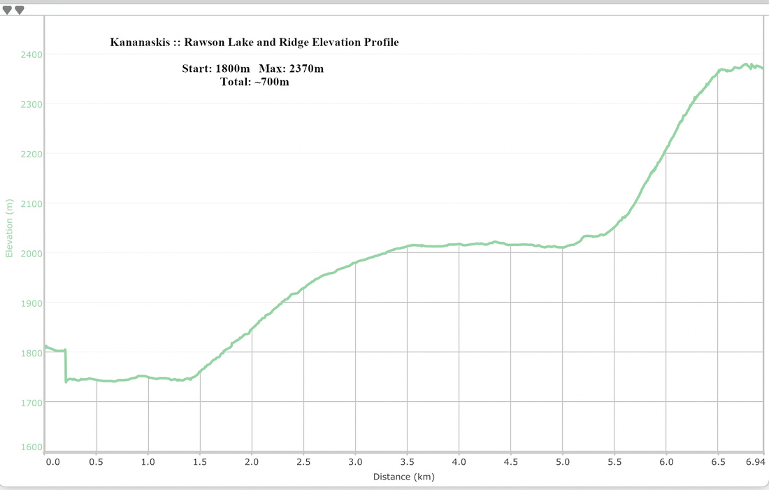 Rawson Lake and Ridge Elevation Profile