Google Map |
Rockies :: Canmore and Bow Valley ::Georgetown Loop |
GPS Track |
 
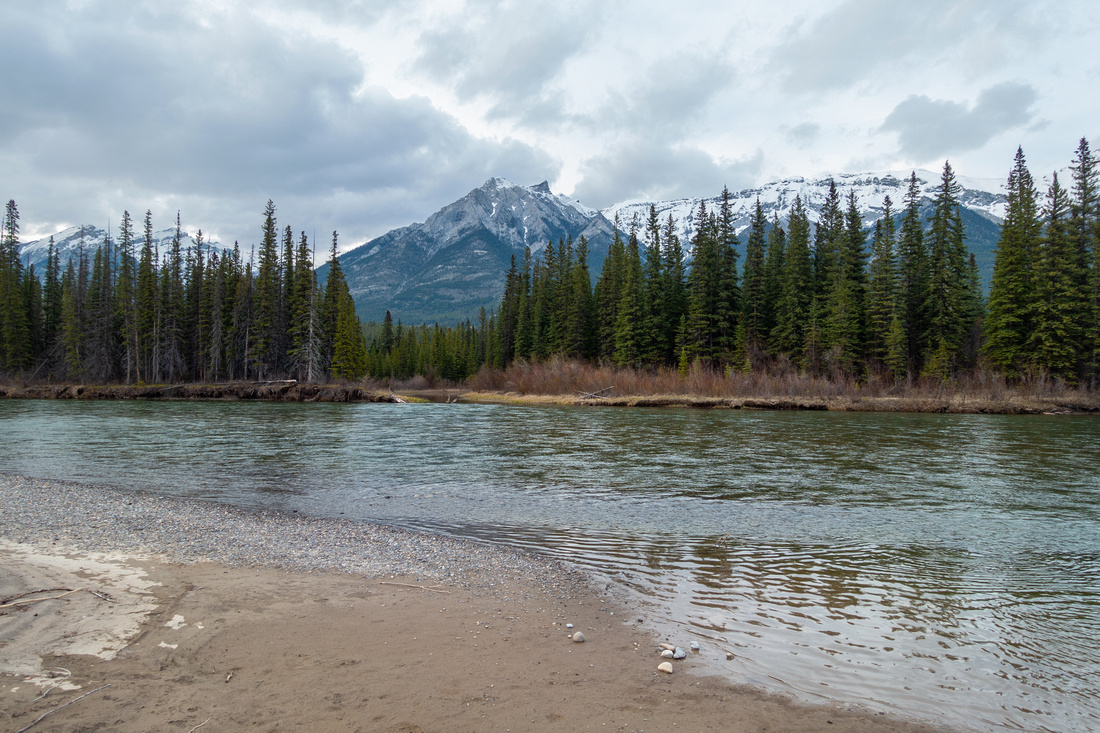
Bow River Flats ~2.5km below Georgetown Site with distant Three Sisters / Lawrence Grassi Group center right |
|||
| Trip Summary | |||
May 19, 2024
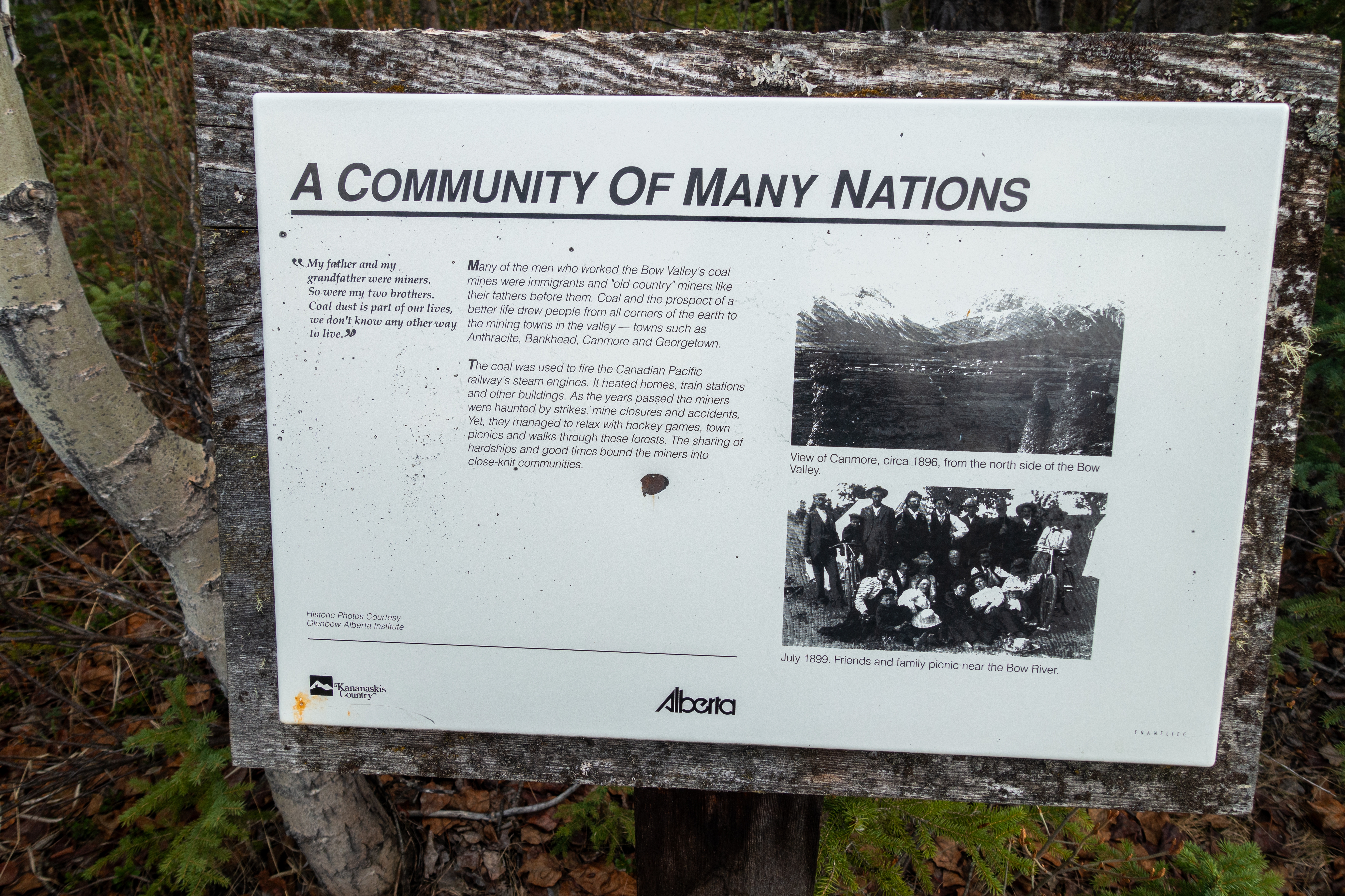
Georgetown was old mining community site in early 20th century at south side of Bow River. Nothing remains except old access road, now part of wide Nordic Centre network of MTB trails. It is signed as "Georgetown Interpretive Trail", but this is overstretch as only 2 Info tables remain at forest clearing near the End. Access is mainly forested and best done on mountain bike. From Georgetown Site I recommend continuing for ~2.5km to Bow River Flats where much of further exploring can be had. Variety of return options exist including loop via Nordic Centre; this is how Gallery is presented. Map and GPS Track (download Top of Page) start/end at Bow Bridge in Canmore for total loop distance of ~14km. Recommended MTB trip offering rich experience with bits of History and several nice viewpoints. |
|
Gallery |
|||
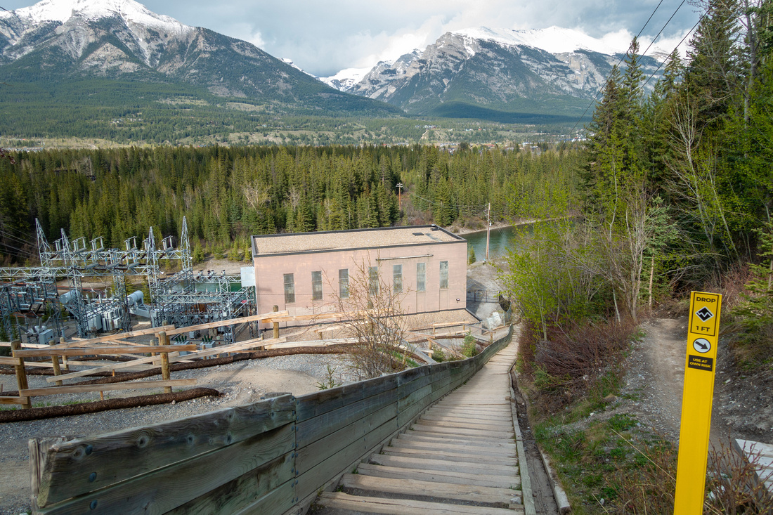 Rundle Stairs Rundle Stairs Wooden Staircase above Rundle Power Plant, ~10min walk from Bow Bridge. There are ~160 Stairs in Total and this is popular Spring training spot for Locals. Legacy Trail extension switchbacks left and presents first challenging part for Cyclists.
 |
|||
 Bluff Panorama Bluff Panorama Bow Valley Panorama from Bluff above Rundle Power Plant. On sunny Afternoon it is one of nicest Canmore area viewpoints
 |
|||
 Fairholme Range Fairholme Range Peaks at North side of Bow Valley from Bluff Viewpoint (different date). L-R: Peechee, Princess Margaret, Bald Eagle (The Tit), Charles Stewart and Lady McDonald
 |
|||
 Georgetown Trailhead Georgetown Trailhead Signed Junction of Georgetown and Canmore Trails. Continue right
 |
|||
|
|
|||
 Georgetown Site Georgetown Site Old Georgetown Site: All that remains are couple of Interpretive Tables. Sign points towards Georgetown Climb link to Nordic Centre
 |
|||
 |
|||
 Bow Flats Trail Bow Flats Trail Bow Flats extension is mostly easy cycling with some rocky parts and occasional deadfall
 |
|||
 Bow Flats Bow Flats Bow Flats ~2.5km below Georgetown Site. Trail diminishes here; make note of location to be able to pick it up on return
 |
|||
|
|
|||
 |
|||
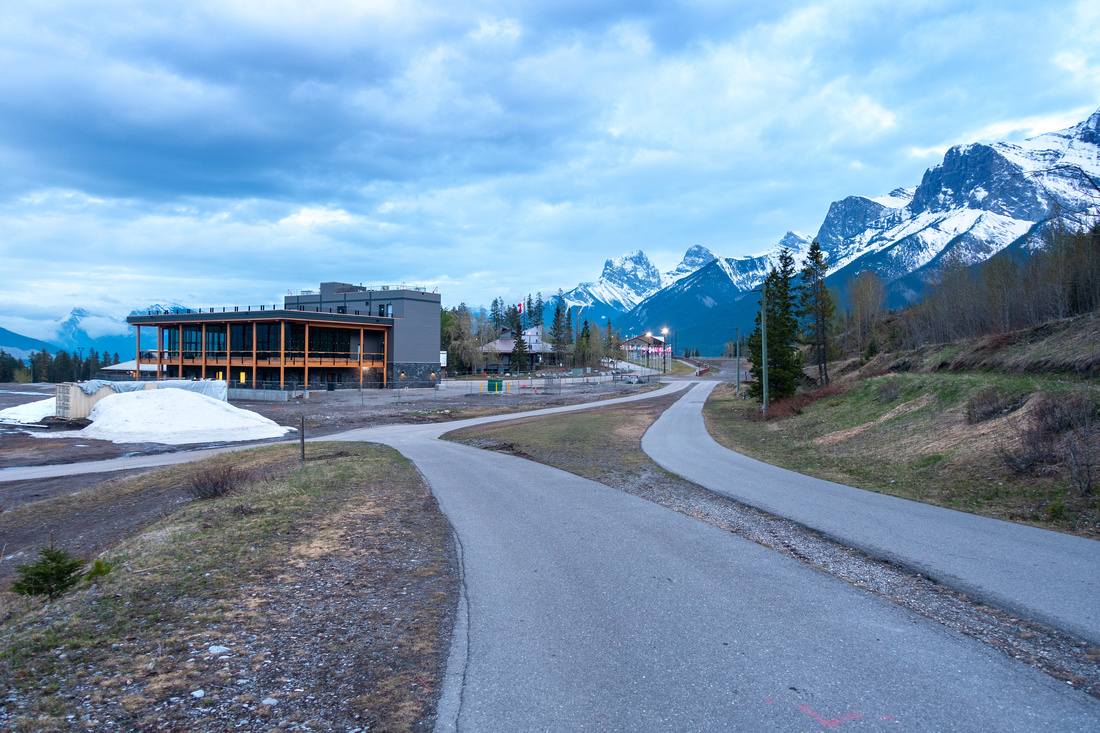 Nordic Centre Nordic Centre Canmore Nordic Centre; Legacy Trail behind new Biathlon Building (still in construction spring '24)
 |
|||
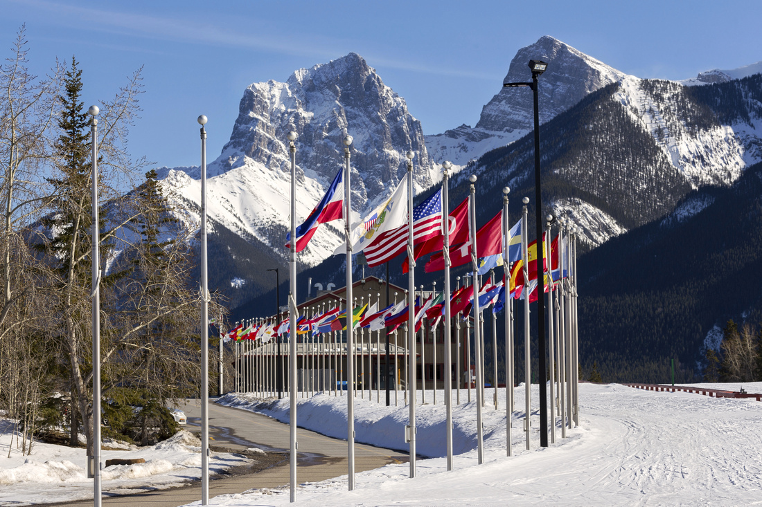 Nordic Flags Nordic Flags Alphabetically ordered Flags of Countries that hosted Winter Olympics (different date). Little Sister Behind
 |
|||
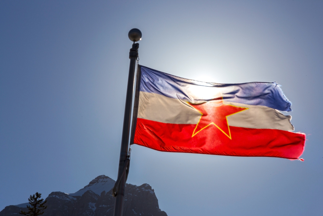 Yu Flag Yu Flag Winter Olympic 1984 Host; Beautiful country destroyed by Idiots in 1990s
 |
|||
 Canmore Nordic Centre Canmore Nordic Centre Nordic Centre Day Lodge. Bar / Lounge is on Main floor
 |
|||
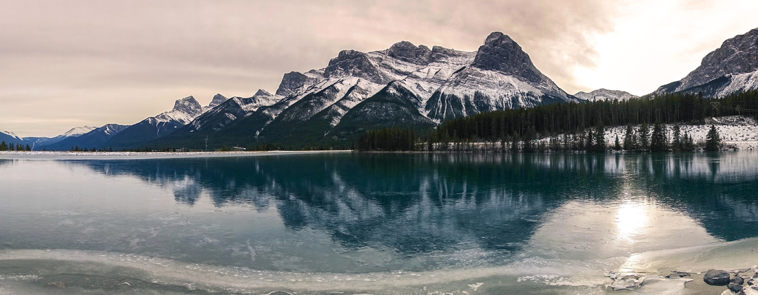 Rundle Forebay Rundle Forebay Rundle Forebay Viewpoint just below Nordic Centre. Ha Ling / Miners Peak just right of Center
 |
Abstract
| Overall Difficulty | D2 | Some steeper parts. Cyclists likely to push on Georgetown Climb | |||
| Snow Factor | S1 | Forested slopes with no avalanche danger. Likely feasible as XC-Ski Trip | |||
| Scenery | Bow River Flats below Georgetown. Fairholme Range Peaks at North Side. Rundle Forebay on Nordic centre loop return | ||||
| Trail/Marking | Excellent | Wide and well-defined Nordic Centre trail network with Trail Maps. Maze of Trails make some junctions confusing | |||
| Suggested Time | 3-4 hr | Leisurely pace if walking, at least 1hr less if cycling | |||
| Elevation | Start: 1320 m (Bow Bridge) Max: 1430m (Nordic Centre) Total: ~220 m | Round Trip: ~14 km | |||
| Gear | Light hikers or mountain bike | ||||
| Water | Seasonal Streams. Refill at Nordic Centre. Bring 0.5-1L, depending on season | ||||
| Dog Friendly | No | Dogs are officially allowed but I advise against due to heavy MTB usage. If you bring a dog, it must be on-leash | |||
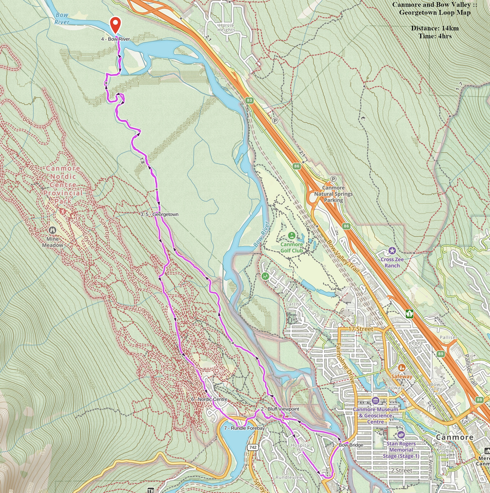 Georgetown Loop GAIA Map
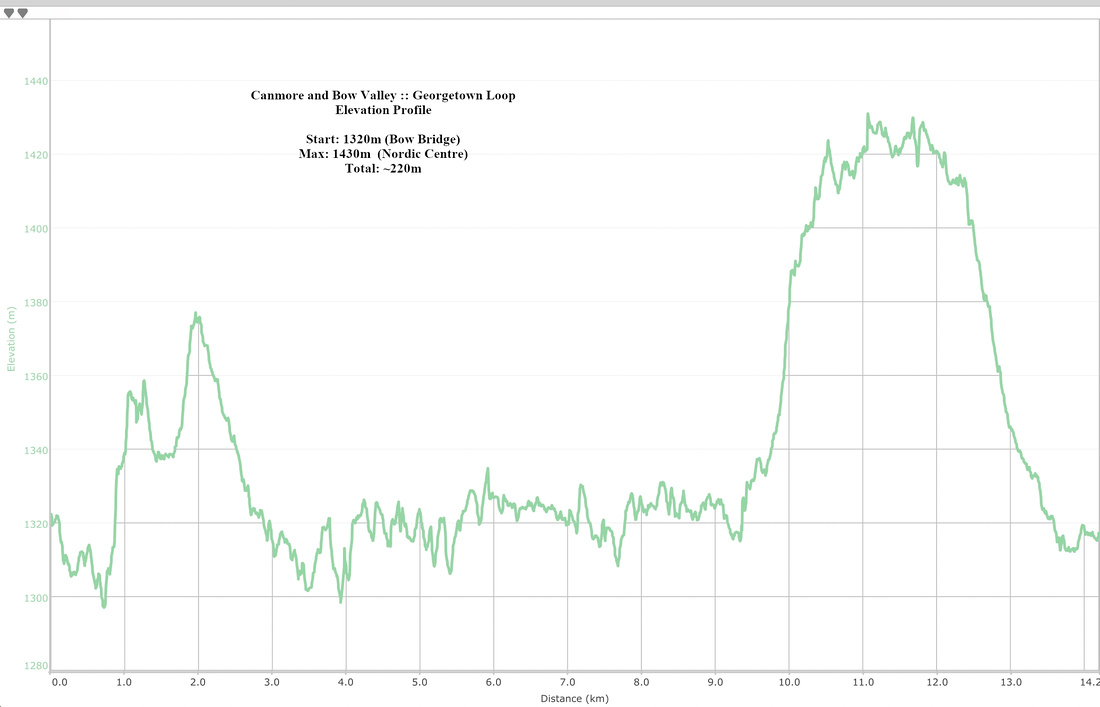 Georgetown Loop Elevation Profile

