Google Map |
USA :: Sedona :: Hiline / Cathedral Loop |
GPS Track |
|
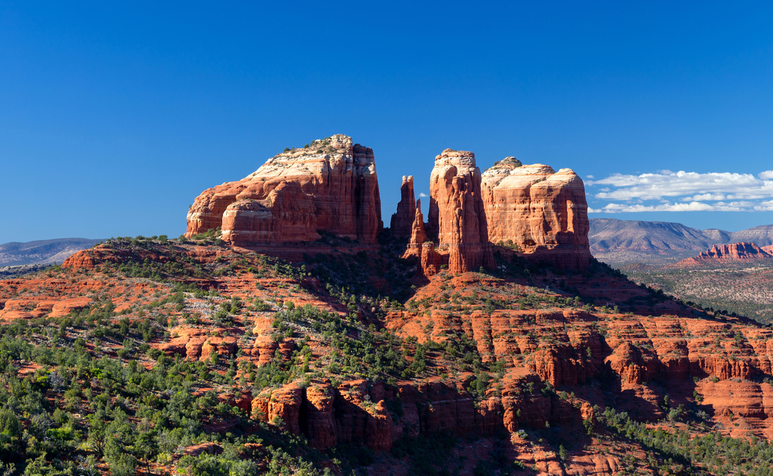
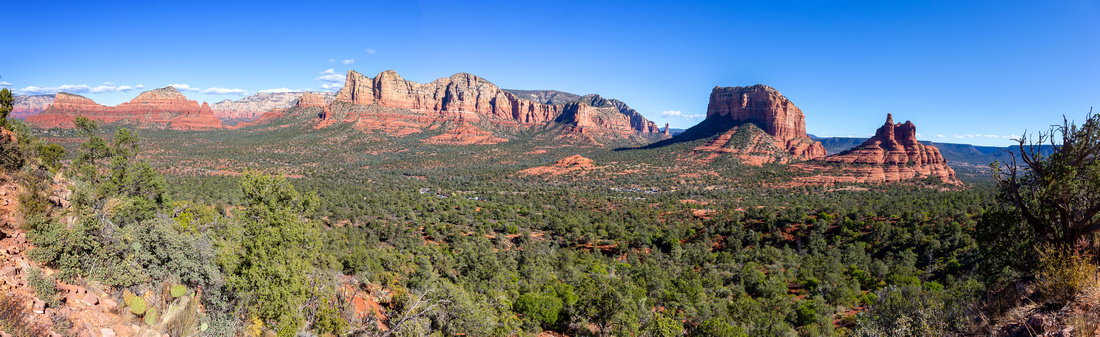
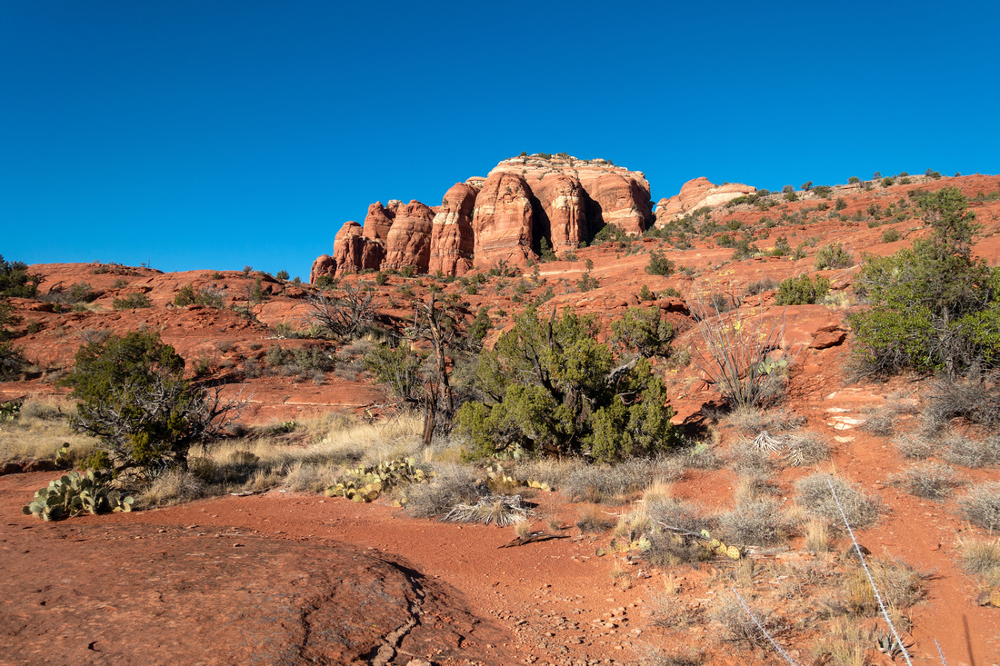
Cathedral Rock from Hiline Trail near Transept Junction |
|||
| Trip Summary | |||
Nov 25, 2023
Self designed loop utilizing segments of official trails, including full length of Hiline Trail, and Ultimate way to experience iconic Cathedral Rock. Starting from Yavapai Vista on Hwy 179 Loop can be done either way, but CW is more scenic because of extended in-your-face Cathedral Rock while rounding Seven Warriors Mesa on Hiline (lead photo). Not suitable for beginners as there are rough sections with some routefinding above Hiline / Baldwin junction. Overall one of best hikes I've done in Sedona, and likely a repeat - highly recommended!
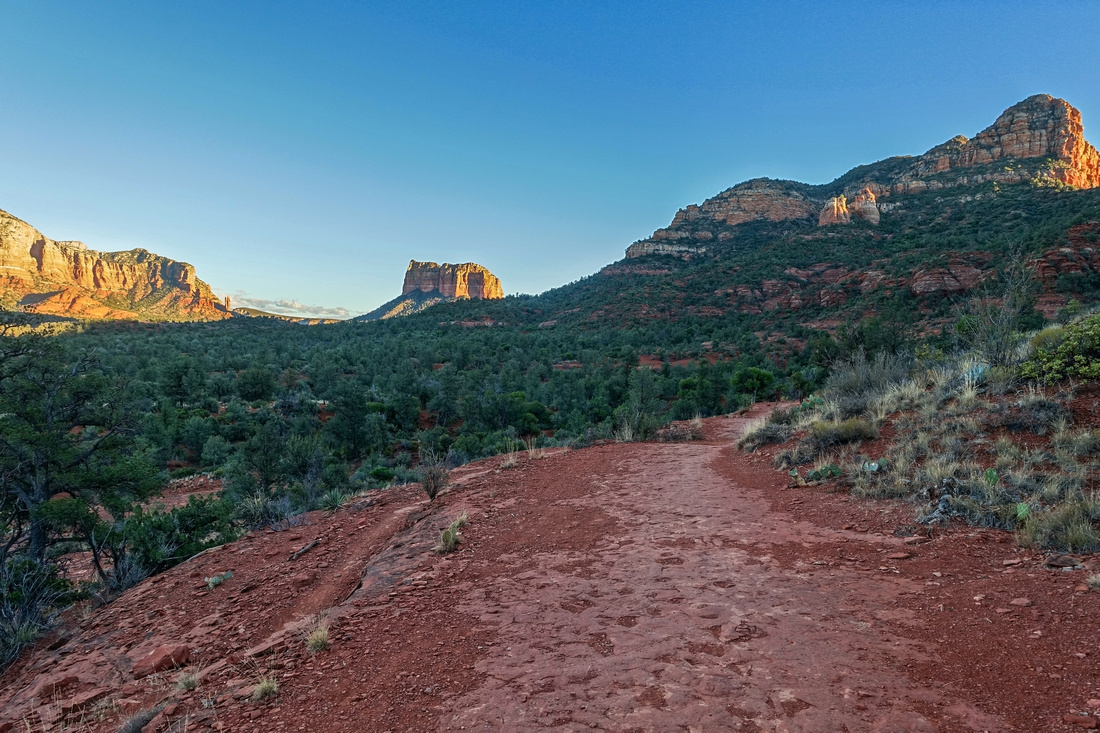
Find Hiline Trailhead above Yavapai Vista (Waypoint "1 - Hiline", GPS Download Top of Page). Slim Shady used for CW return ends here. Hiline rounds Seven Warriors Mesa and is one of most scenic Sedona Trails; I normally take hiking photos with little pocket Sony Rx100, but here kept Canon SLR around my neck. Past Transept junction Hiline descends towards Cathedral Rock (great spots for break on open Slickrock), then descends south side to Baldwin Trail junction. This is the most challenging part of the Day because of several rough parts that require occasional use of hands. There are also some route finding problems; look for customary Slickrock Paint blazes. After short section of descent on Baldwin turn right on Templeton through Oak Creek Canyon. This is one of strongest Sedona vortex areas, but also quite busy. Traffic increases as Templeton rounds north side with hordes of Social Media hikers pouring in from usual Back O Beyond Cathedral Rock approach. Things become more quiet again as Templeton traverses some Slickrock ledges getting away from Cathedral. Watch for Mountain Bikers here. Loop can be closed in one of several ways, but I simply followed Slim Shady back to Yavapai Vista.
If you don't feel like doing entire loop, shorter day can be had by hiking Hiline to Cathedral Rock OnB - including Cathedral Saddle Scramble (see Transept Trail), or even full Hiline - Transept loop with 2 cars. Slim Shady / Templeton to Cathedral Rock OnB (return leg of loop presented here) is also possible, but not as scenic as Hiline. |
|
Gallery |
|||
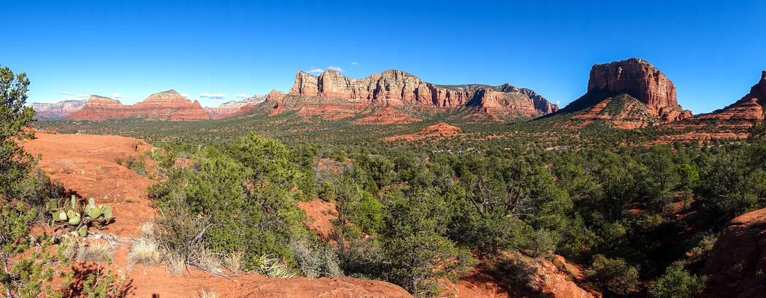 Yavapai Vista Yavapai Vista Yavapai Vista Panorama few minutes from Hwy 179 Parking. Courthouse Butte centre right.
 |
|||
 Slim Shady Junction
 behind Yavapai Vista; this is where loop ends if going all the way around Cathedral Rock Slim Shady Junction
Slim Shady Junction behind Yavapai Vista; this is where loop ends if going all the way around Cathedral Rock |
|||
 |
|||
 Hiline Climb
Initial part of Hiline Trail climbs towards Seven Warriors Mesa Hiline Climb
Initial part of Hiline Trail climbs towards Seven Warriors Mesa |
|||
 Courthouse Bell
Courthouse Butte (L) and Bell Rock (R) as Hiline trail contours around Seven Warriors Courthouse Bell
Courthouse Butte (L) and Bell Rock (R) as Hiline trail contours around Seven Warriors |
|||
 |
|||
 Red Rock Panorama
Terrific Panorama towards Munds Wilderness from Seven Warriors Shoulder Red Rock Panorama
Terrific Panorama towards Munds Wilderness from Seven Warriors Shoulder |
|||
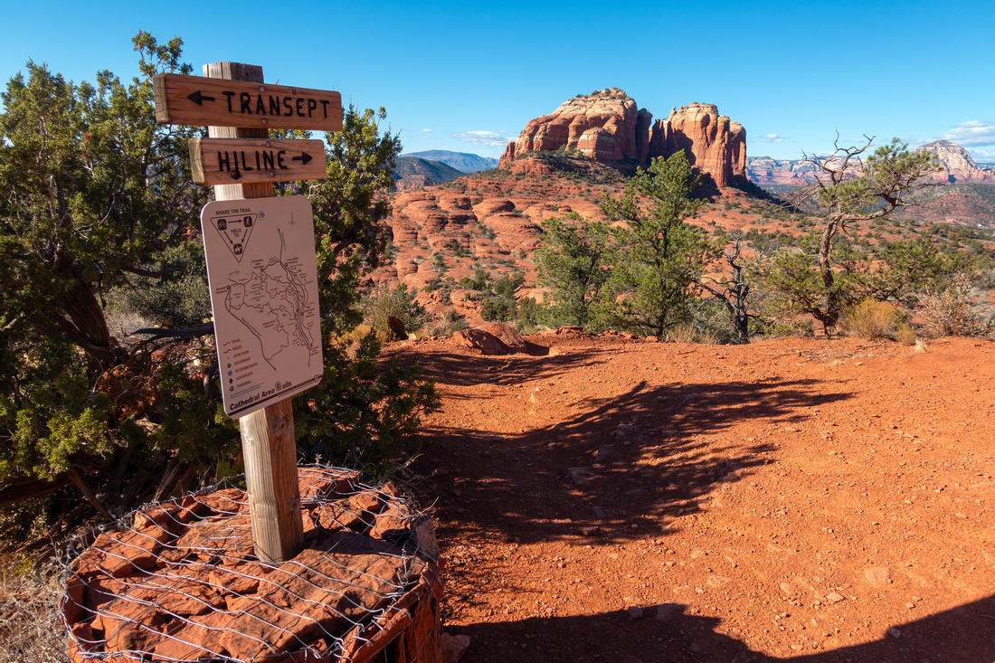 Transept Junction
Transept Trail junction at shoulder some 45-50min from Yavapai Vista. Transept Junction
Transept Trail junction at shoulder some 45-50min from Yavapai Vista. |
|||
 Hiline Trail
 gradually descends towards Cathedral Rock with Distinct Rock Spire between 2 main Buttes Hiline Trail
Hiline Trail gradually descends towards Cathedral Rock with Distinct Rock Spire between 2 main Buttes |
|||
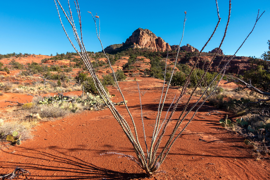 Desert Flora
Looking back towards Seven Warriors Mesa as Hiline Trail drifts across typical Red Rock Desert Landscape Desert Flora
Looking back towards Seven Warriors Mesa as Hiline Trail drifts across typical Red Rock Desert Landscape |
|||
 Hiline Descent
Hiline Trail becomes less defined as it drops below Cathedral Rock south side. Follow white paint blazes on Slickrock Hiline Descent
Hiline Trail becomes less defined as it drops below Cathedral Rock south side. Follow white paint blazes on Slickrock |
|||
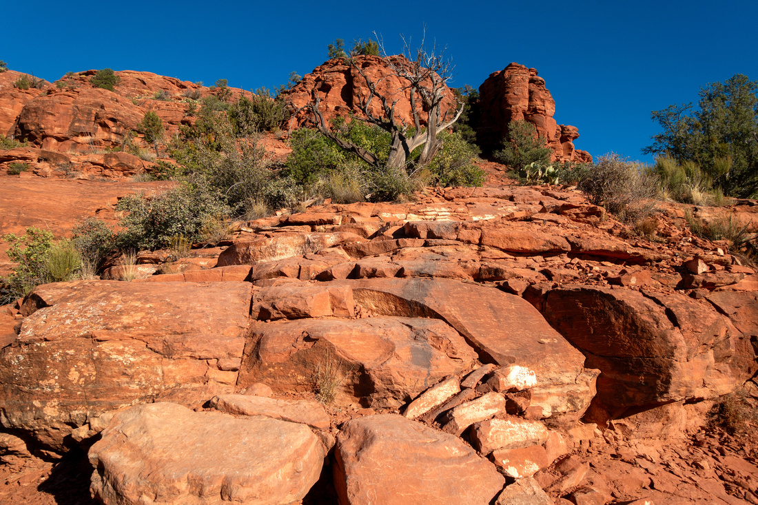 Rough Patch
Rough section with some easy scrambling. It is easy to take wrong turn - watch white paint blazes Rough Patch
Rough section with some easy scrambling. It is easy to take wrong turn - watch white paint blazes |
|||
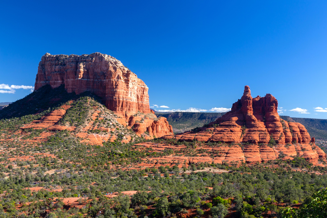
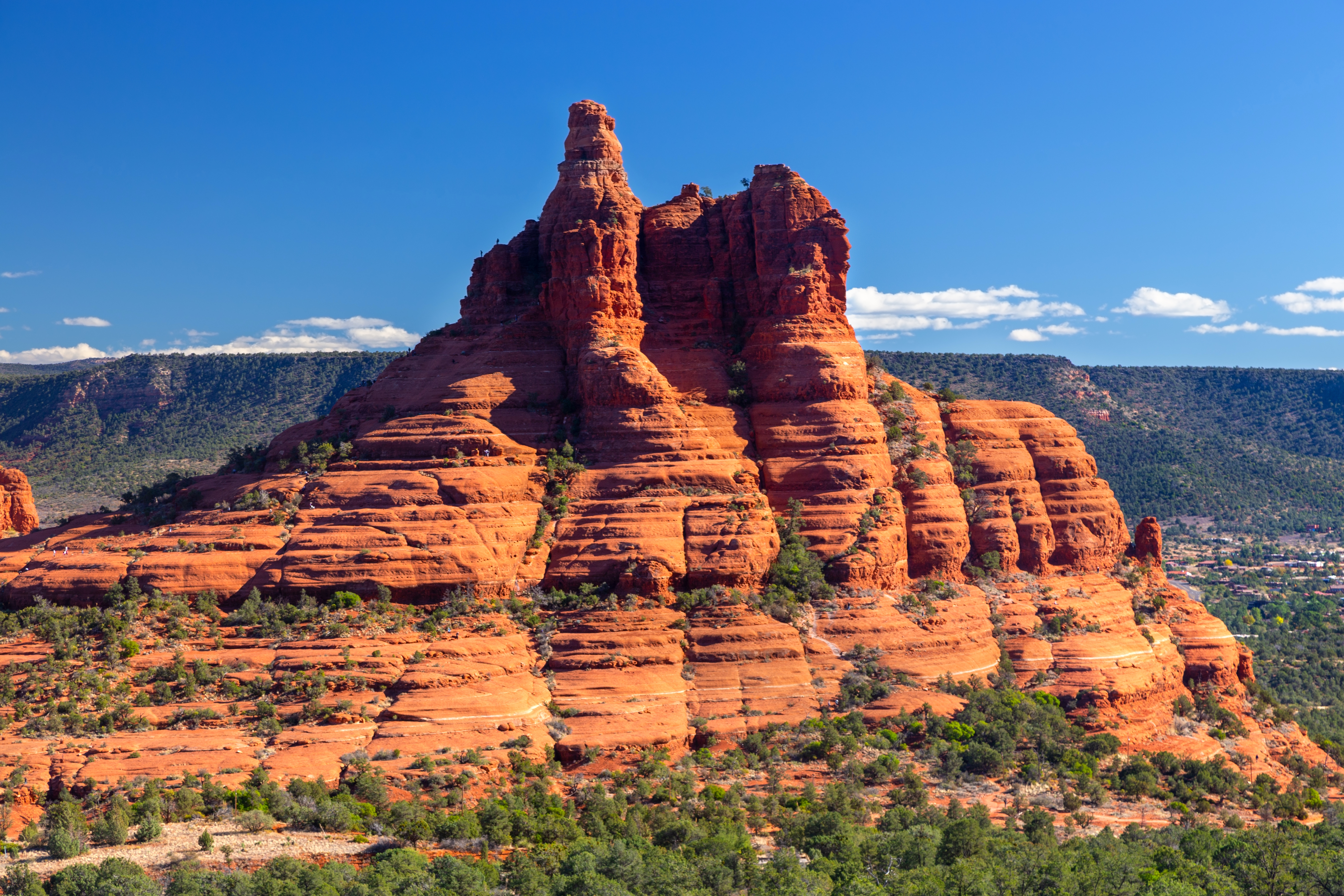
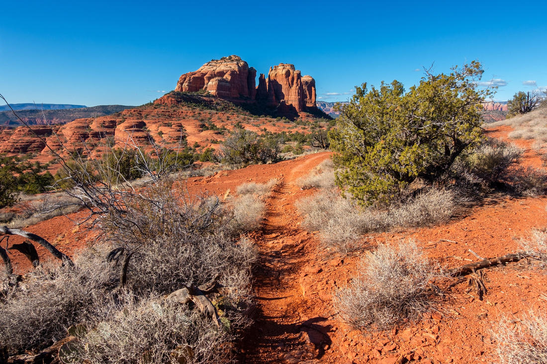
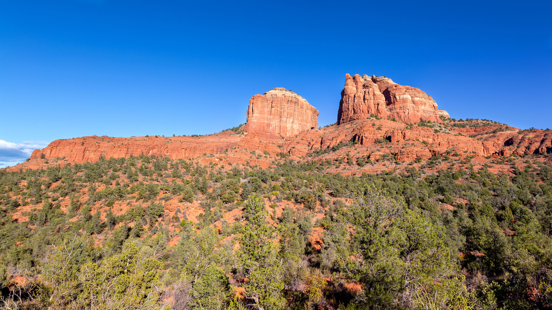 Cathedral Rock
View of Cathedral Rock just before Hiline Terminus / Baldwin Trail junction Cathedral Rock
View of Cathedral Rock just before Hiline Terminus / Baldwin Trail junction |
|||
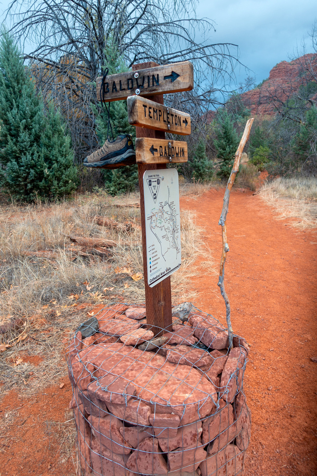 Templeton Junction
Baldwin trail reaching Oak Creek - continue on Templeton for loop around Cathedral Rock Templeton Junction
Baldwin trail reaching Oak Creek - continue on Templeton for loop around Cathedral Rock |
|||
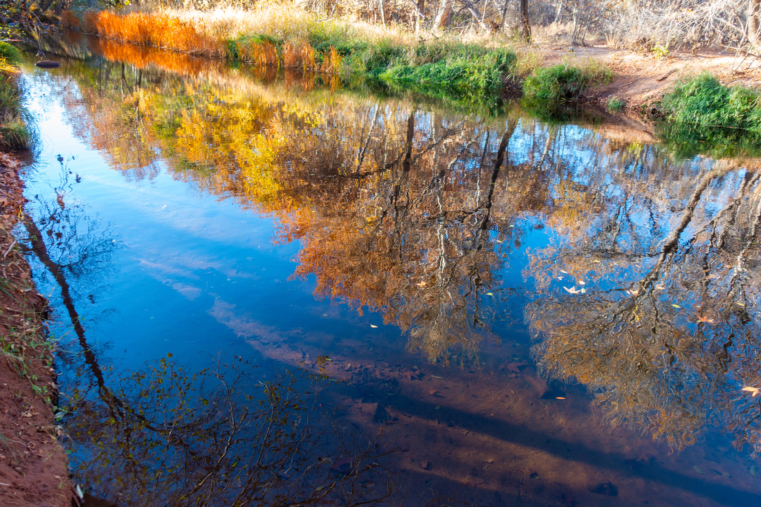 Oak Creek
 Autumn Colours; this spot is very Famous Sedona Vortex Oak Creek
Oak Creek Autumn Colours; this spot is very Famous Sedona Vortex |
|||
 Templeton Shoulder
Templeton Trail switchbacks up Cathedral Rock north side. This section is usually quite busy Templeton Shoulder
Templeton Trail switchbacks up Cathedral Rock north side. This section is usually quite busy |
|||
|
|
|||
 Templeton Slickrock
Seven Warriors Mesa and Bell Rock as Templeton Trail approaches Slim Shady Junction, about 30min from Yavapai Trailhead Templeton Slickrock
Seven Warriors Mesa and Bell Rock as Templeton Trail approaches Slim Shady Junction, about 30min from Yavapai Trailhead |
|||
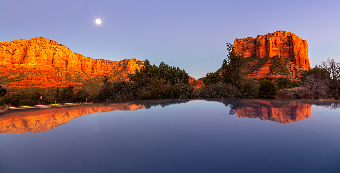 Courthouse Moonrise
Like a Calm Lake: Full moon reflected in Car Roof back at Yavapai Vista Parking Courthouse Moonrise
Like a Calm Lake: Full moon reflected in Car Roof back at Yavapai Vista Parking |

Abstract
| Overall Difficulty | D3/4 | Rough Hiline Descent at Cathedral Rock South Side. | |||
| Scenery | Most major Sedona Red Rock Landmarks. Different angles of iconic Cathedral Rock. Oak Creek below Cathedral Rock | ||||
| Trail/Marking | Very Good | Official Sedona Trails with marked junctions and Maps. Hiline hard to follow at Cathedral Rock South side | |||
| Suggested Time | 5 hrs | Full loop around Cathedral Rock. 2-3 hrs for OnB Hiline to Cathedral Rock | |||
| Elevation | Start: 1330m Max: 1450m Min: 1225m Total: ~400m | Round Trip: 12km | |||
| Gear | Light hikers or Full Boots. Poles will be helpful for rough Hiline Sections before Baldwin Junction | ||||
| Water | Oak Creek (must filter) Carry 2L, more in summer months | ||||
| Dog Friendly | Yes | Beware of Mountain Bikers and Rattlesnakes in summer months | |||
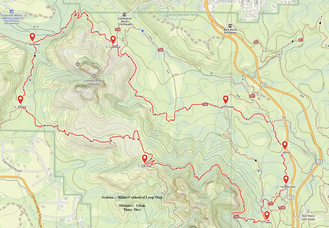 Hiline / Cathedral Loop GAIA Map
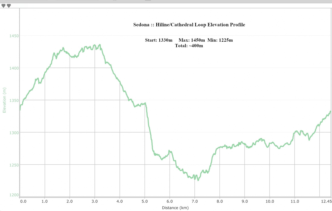 Hiline / Cathedral Loop Elevation Profile